The wreck of the Jack Abry II is a stark contrast to the spectacular Small Isles scenery and a sobering reminder that human error is one of the biggest risks we face when underway. According to the Marine Accident Investigation Branch (MAIB) report “the skipper, who had been alone on watch in the wheelhouse, fell asleep and failed to make a course alteration.” We came across the wreck while cruising the “Small Isles” of Rum, Eigg, Muck and Canna, en route to the Outer Hebrides from Loch Moidart on the Scottish mainland.
Trip highlights from Aug 22, 2017 follow. Click any image for a larger view, or click the position to view the location on a map. And a live map of our current route and most recent log entries always is available at http://mvdirona.com/maps
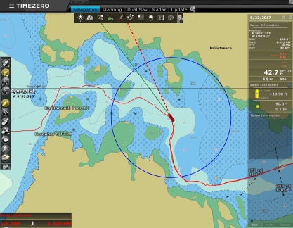 |
Leaving Loch Moidart
Position: -5 52.29, 56 47.09
Following our track back out of Loch Moidart. The tide is higher than when we entered, so many of the visual cues to our position are underwater.
|
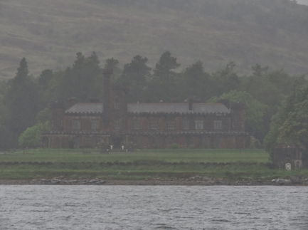 |
Kinloch Castle
Position: -6 16.16, 57 0.82
In a heavy downpour, we made a pass in Dirona through Loch Scresort to check out Kinloch Castle. The castle was built at the turn of the 19th century as a residence for Lancashire textile tycoon Sir George Bullough.
|
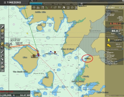 |
Mallaig
Position: -6 14.50, 57 1.06
We’re just west of Mallaig (circled in red), where we were at three weeks ago at the terminus of our West Highland Line train trip. This is the farthest north we’ve been in Scotland.
|
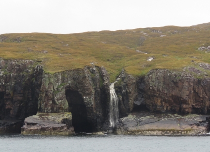 |
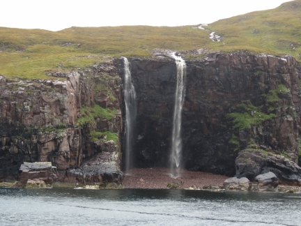
Waterfall
Position: -6 22.57, 57 3.22
The north coast of Rum Island has some great waterfalls, particularly after the heavy rain of the past few days.
|
 |
Double Waterfall
Position: -6 22.90, 57 3.00
A striking double waterfall along the north coast of Rum Island.
|
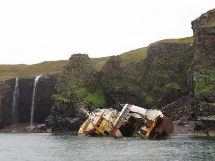 |
Jack Abry II
Position: -6 22.97, 57 2.96
The fishing vessel Jack Abry II aground off Rum Island. The ship went aground in 40-knot winds in January of 2011. According to the Marine Accident Investigation Branch (MAIB) report “the skipper, who had been alone on watch in the wheelhouse, fell asleep and failed to make a course alteration. The wheelhouse watch alarm was not used, nor was best use made of the available navigational aids and crew.” We’ve been longtime MAIB readers and stories like this encouraged us to install a wheelhouse watch alarm on Dirona. We consider it an important piece of safety equipment and rely on it heavily while on passage. We’ve since customized the original hardware.
|
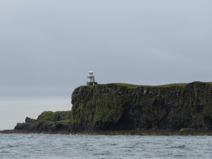 |
Light
Position: -6 27.57, 57 3.14
Light on the eastern headland of Sanday Island, connected by bridge to Canna Island, as we near Canna Harbour.
|
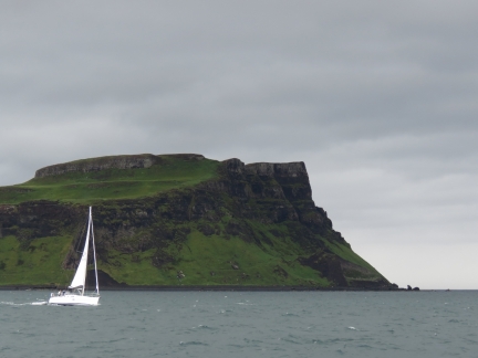 |
Compromise II
Position: -6 27.94, 57 3.22
Compromise II sailing out of Canna Harbour with the soaring cliffs at the eastern end of Canna Island in the background.
|
 |
St. Edward’s
Position: -6 29.41, 57 3.25
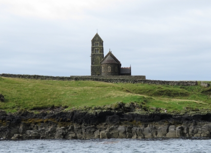
St. Edward’s Church on Canna Island was built in 1914. The church was converted to a Gaelic study center in 2001, but was never used.
|
 |
Canna Island
Position: -6 29.41, 57 3.25
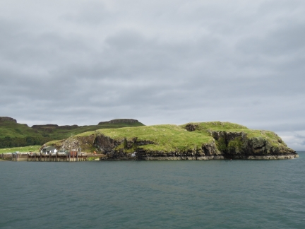
Looking north toward the pier with the hills of Canna Island as a backdrop.
|
 |
Impeller
Position: -6 29.42, 57 3.24
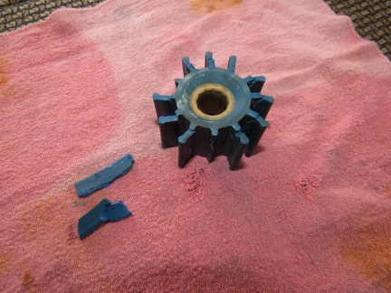
We received a Generator Fault email from our automation system: “Generator Fault (RPM=1744, Temp=>194F, Amps=41, Freq=58Hz, OilP=>57PSI, Volts=236V).” The high temperature indicated a possible cooling issue, so we inspected the impeller and found it had thrown two fins with several more ready to go.
|
 |
Rum Island
Position: -6 29.42, 57 3.24
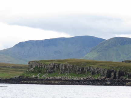
The view southeast from the anchorage over the cliffs on Sanday Island in the foreground to dramatic Rum Island in the background.
|
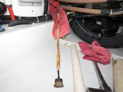 |
Water Heater Anode
Position: -6 29.41, 57 3.24
Steve Coleman reminded us to change the anode in our hot water heater anode, and a good thing he did. The old anode was in pretty rough shape.
|
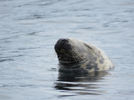 |
Sleeping Seal
Position: -6 29.42, 57 3.24
This seal was sleeping within touching distance right off our stern.
|
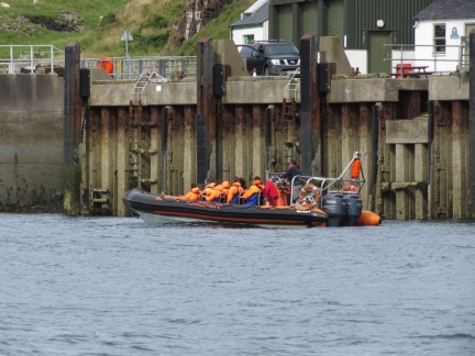 |
Tour Boat
Position: -6 29.42, 57 3.25
While we were anchored at Canna Harbour, several tour boats like this one arrived and dropped off their passengers for a short time before they all set off for the next destination.
|
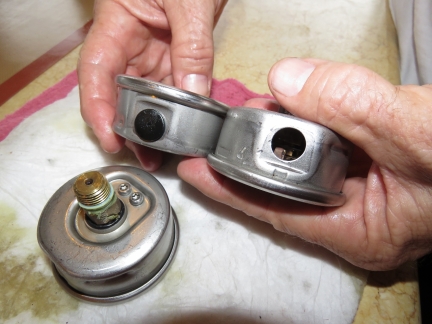 |
Gauges
Position: -6 29.42, 57 3.26
Ernie Romeo of American Bow Thruster (ABT), the manufacturer of the hydraulic and stabilization systems on Dirona, reminded us of a design change they have recently made at ABT. In the past and when our boat was built, they used to install gauges at all major components so you could check for correct system operation at a glance. Now they install gauge ports that allow a gauge to be quickly installed without spilling oil to check pressures. This approach gets all the gauges out of the system and avoids a failure mode where the gauge fails and the hydraulic system drops its oil load through the gauge.
Our gauges have served well for 9,300 hours but we decided we would rather have one less failure point than the data they provide. It’s probably a good thing we did. The beginning of the gauge failure has them eject the plug that retains the light oil that is used to dampen gauge movement and squirt oil out of the hole as hydraulic oil pressure leaks into the gauge. We had three gauges that blown off the oil retention cover and the one on the rear thrusters had sprayed out about a quarter of the oil. These appear close to being a service problem. We’re glad to have them gone. |

|
Click the travel log icon on the left to see these locations on a map, with the complete log of our cruise.
On the map page, clicking on a camera or text icon will display a picture and/or log entry for that location, and clicking on the smaller icons along the route will display latitude, longitude and other navigation data for that location. And a live map of our current route and most recent log entries always is available at http://mvdirona.com/maps. |

If your comment doesn't show up right away, send us email and we'll dredge it out of the spam filter.