For six months we had a goal to visit the lighthouse perched 630ft (192m) above the sea on Berneray Island, at the southernmost tip of the Outer Hebrides. Back in February, while we were in Daytona, Florida, we received our copy of the The Scottish Islands by Hamish Haswell-Smith. We immediately flipped to the Outer Hebrides section and the first island we read about was Berneray, which suffered from an exposed current-swept anchorage, but featured a path to the Barra Head lighthouse. We had been wanting to visit ever since.
Trip highlights from August 23rd, 2017 follow. Click any image for a larger view, or click the position to view the location on a map. And a live map of our current route and most recent log entries always is available at http://mvdirona.com/maps
 |
Hyskeir
Position: -6 41.28, 56 58.58
The lighthouse on Hyskeir Island was completed in 1904. The island is only 11m above sea level—before the light was automated, the keepers grew vegetables in a walled garden.
|
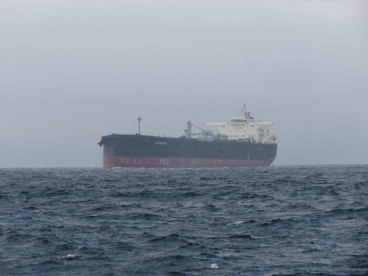 |
Alfa Baltica
Position: -6 58.95, 56 54.99
The 751-ft tanker Alfa Baltica underway from Port Leixoes, Portugal to the Port of Flotta oil terminal in the Orkney Islands.
|
 |
Traffic
Position: -7 0.16, 56 54.75
We’re seeing a fair bit of traffic as we cross the Sea of Hebrides. We’ve just passed the tanker Alfa Baltica; the ferry Isle of Lewis is underway route from Barra Island to Oban, north of the Crinan Canal on the mainland; and the bulker Aasnes is approaching from the south.
|
 |
Berneray Island
Position: -7 37.68, 56 47.27
Anchoring and landing at Berneray Island requires reasonably calm conditions. The lighthouse board reclassified the station as a “Rock Station” in the early 19th century after two small boats had swamped and been lost trying to land in huge swell. This change meant that landing by tender was no longer allowed, nor could the keepers have a dinghy ashore.
|
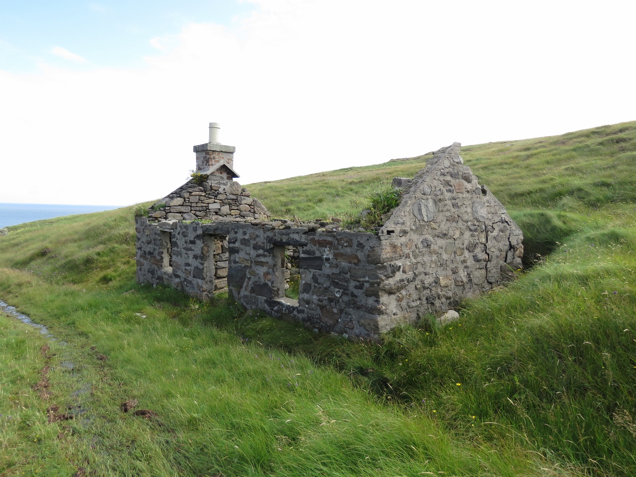 |
Ruins
Position: -7 37.71, 56 47.17
Berneray Island is uninhabited now, but in the late 1800s had 29 houses and a population of 142. From 1910 until the light was automated in 1970, the only residents were the three keepers and their families.
|
 |
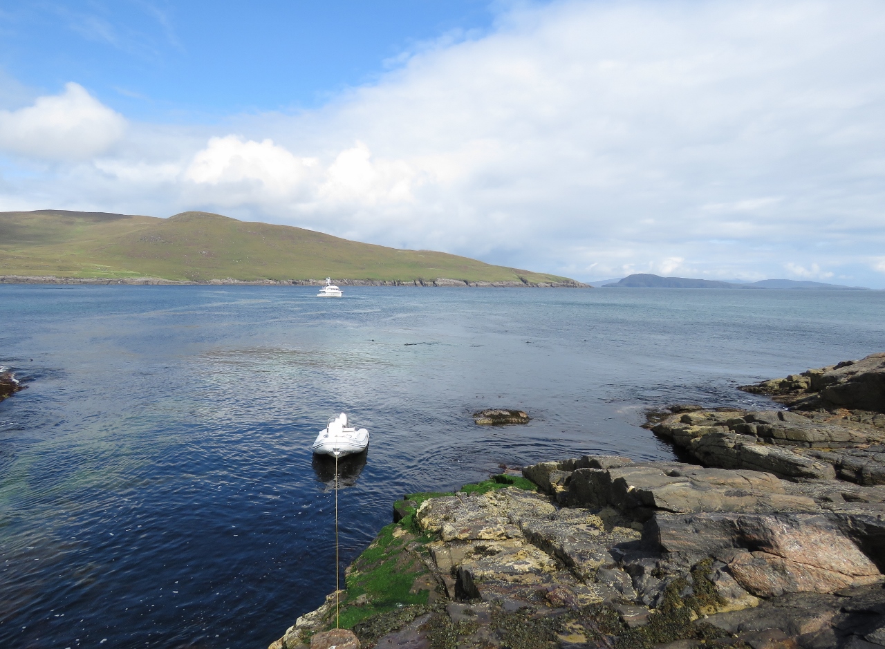
Service Landing
Position: -7 38.07, 56 47.18
A small helicopter pad at left and a small vehicle garage at right for servicing the lighthouse. Likely it’s just too windy to land at the lighthouse itself, so they drive at ATV up from here. We tied the tender off at the original vessel landing, no longer maintained, and walked up the old service road to the lighthouse.
|
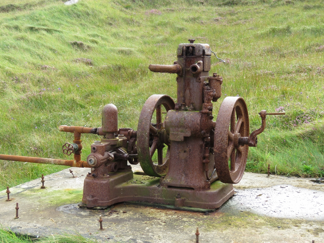 |
Water Pump
Position: -7 38.37, 56 47.11
The old pump that provided water to the lighthouse from a spring about halfway up the old service road.
|
 |
Entrance
Position: -7 38.98, 56 47.11
At the walled the entrance to the lighthouse property.
|
 |
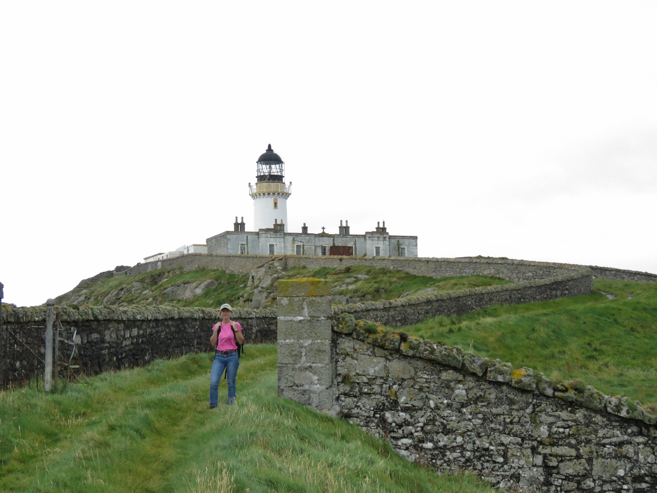
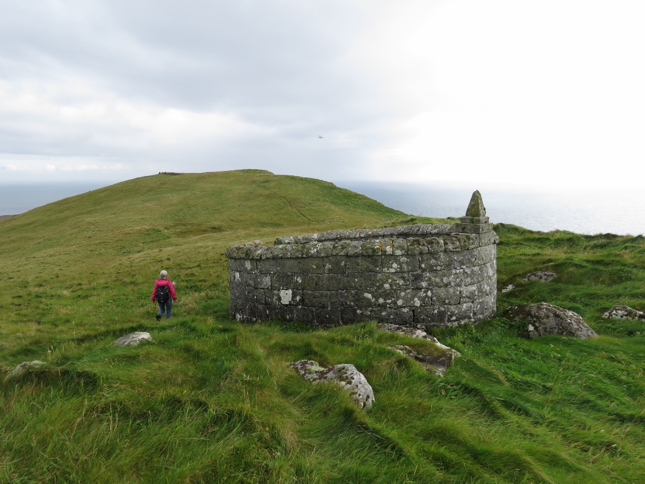
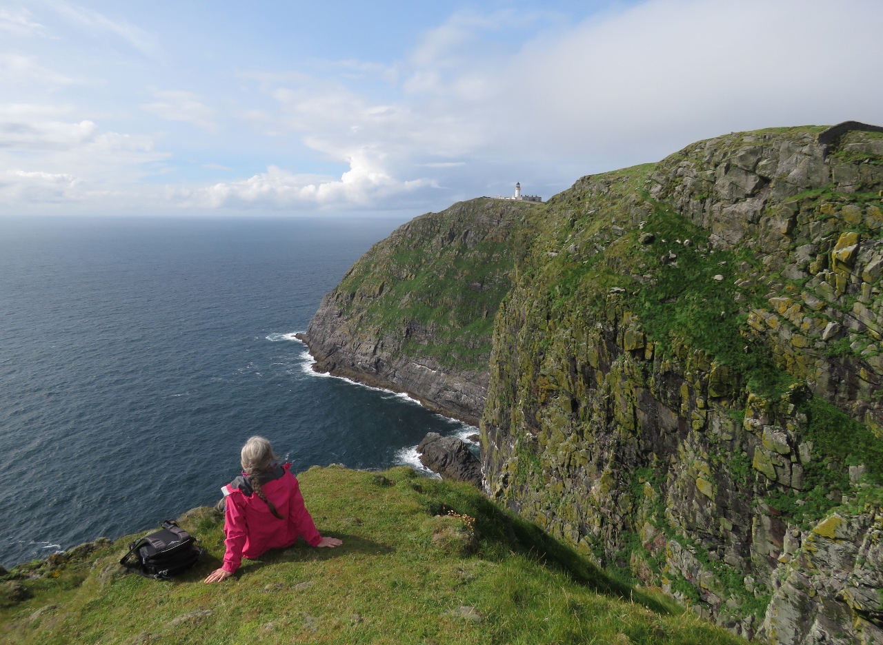
Viewpoint
Position: -7 39.12, 56 47.13
Jennifer looking down from a lookout just off the main lighthouse road. The lighthouse tower behind is only 58ft (18 m) high, but the light itself is the highest in the UK at 682ft (208m) above sea level and has a range of 18 miles.
|
 |
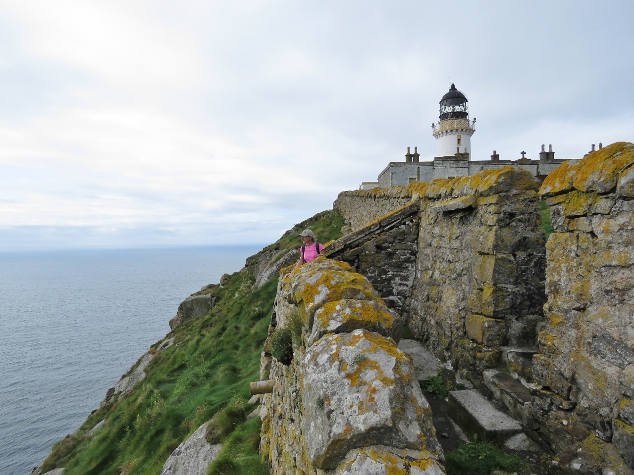
Bird Rock
Position: -7 39.14, 56 47.12
The view to Bird Rock at the base of the Sotan cliffs, from the lookout just below the lighthouse road.
|
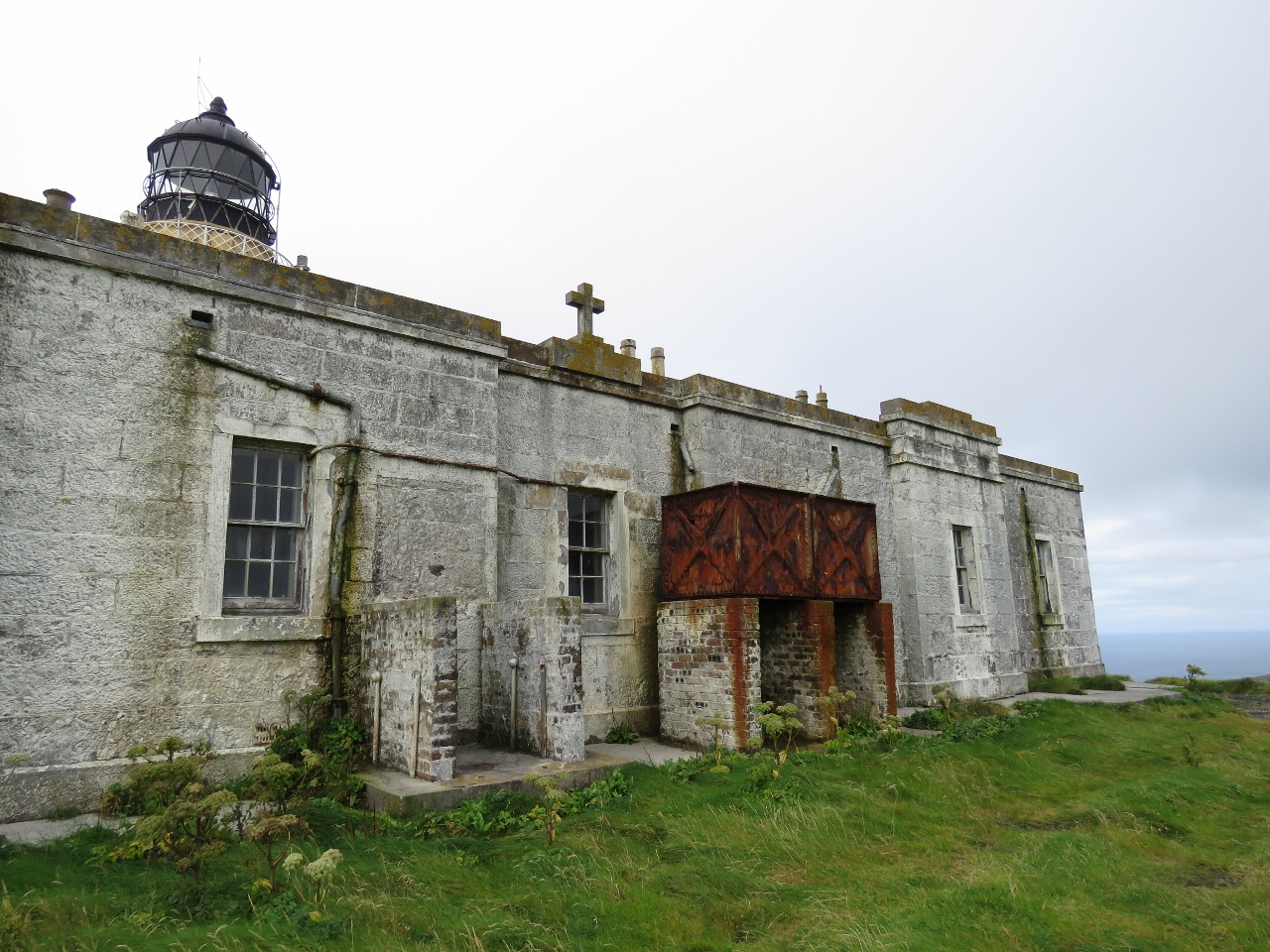 |
Lighthouse Building
Position: -7 39.15, 56 47.12
The lighthouse was built in 1833 from granite quarried on the island. The buildings themselves are no longer maintained, just the lighthouse.
|
 |
Courtyard
Position: -7 39.20, 56 47.13
Looking to the lighthouse from the courtyard between the buildings and the tower.
|
|
|
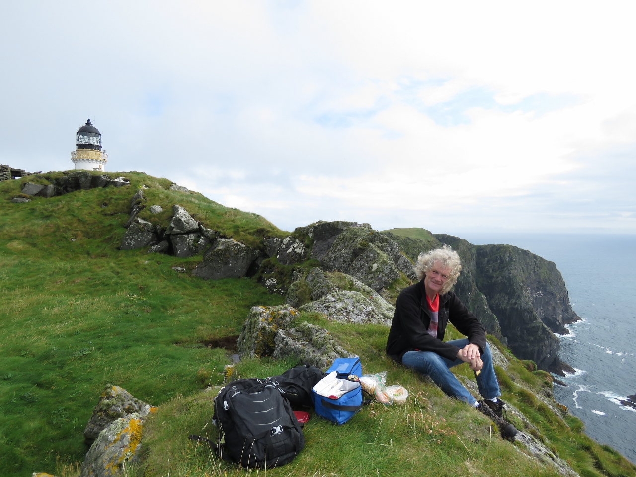
Lunch
Position: -7 39.28, 56 47.11
A great lunch spot perched on the cliffs west of the lighthouse. With no shallow water to impeded the seas, these cliffs take the full force of Atlantic storms and small fish are sometimes thrown into the grass here after a major storm.
|
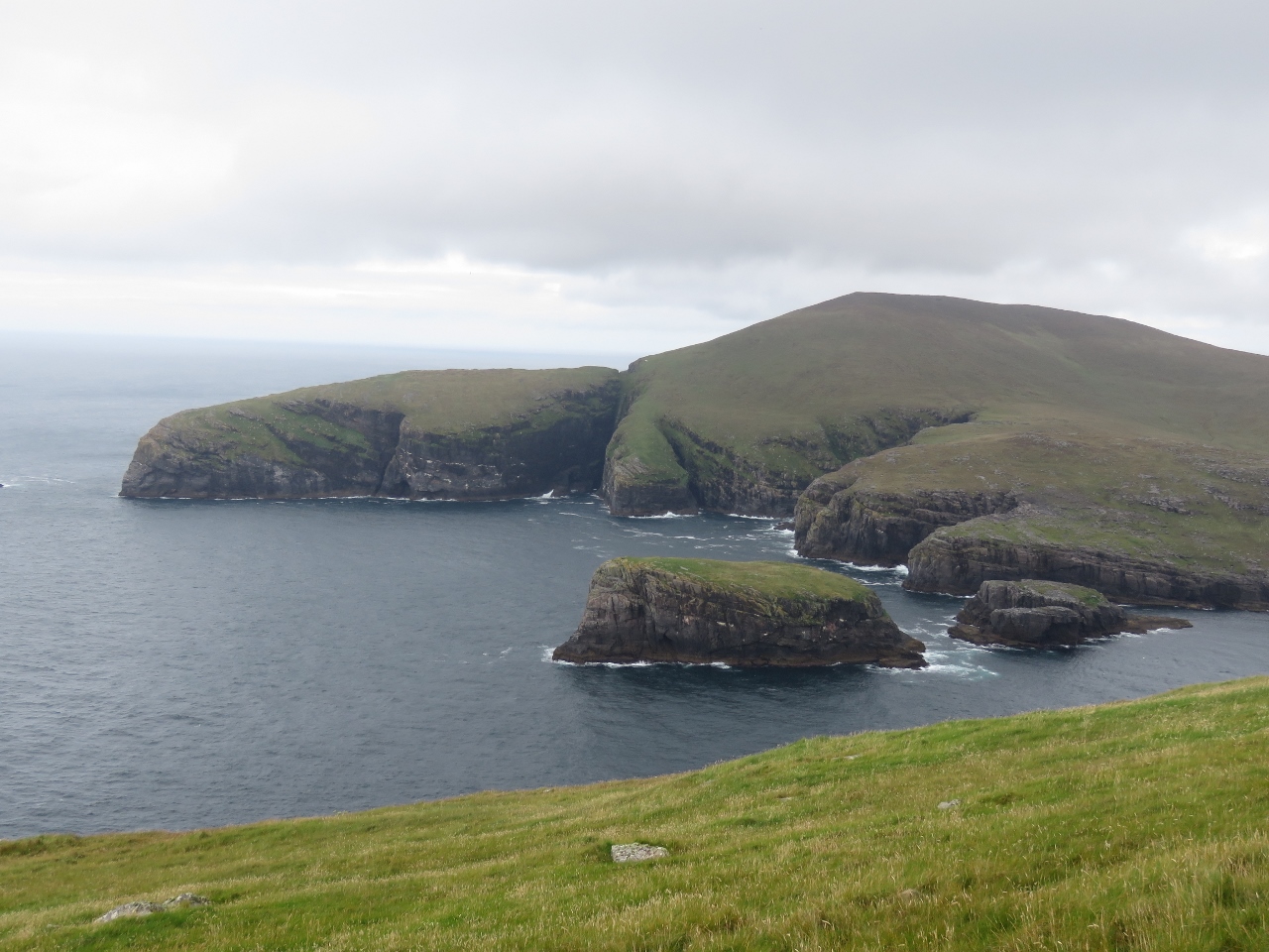 |
Mingulay
Position: -7 39.37, 56 47.14
View north across the Sound of Berneray to Geirum Mor (center) and Geirum Beag (right) off the southern tip of Mingulay island.
|
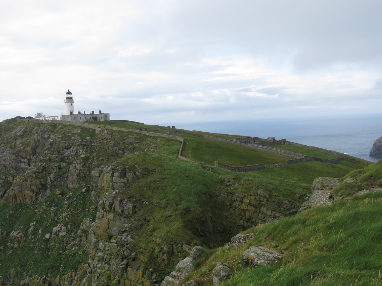 |
Full View
Position: -7 38.93, 56 47.07
A view to the full light station property as we walk east along the southern shore of Berneray.
|
 |
Cemetery
Position: -7 38.93, 56 47.06
The walled Keeper’s Cemetery along the south shore of Berneray. One of those buried here was two-year-old Alexander McIntosh, the son of the principal lighthouse keeper, who died in 1840 of the croup.
|
 |
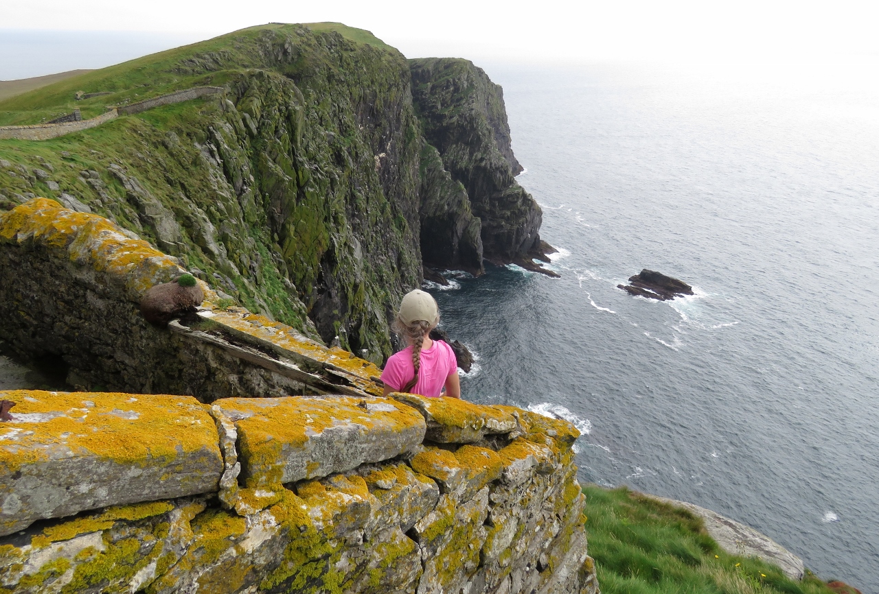
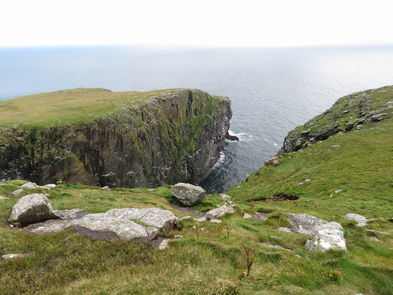
Sotan
Position: -7 38.66, 56 46.94
We stopped for a break to enjoy the view from Sotan, 633ft (193m) above sea level. Seabirds filled the cliffs beside us and were constantly swooping around us.
|
 |
Barra Head
Position: -7 38.51, 56 46.93
Looking south across Barra Head, the most southern top of the Outer Hebrides.
|
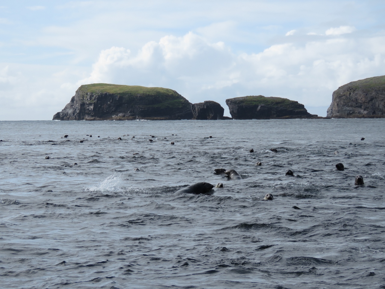 |
Seals
Position: -7 37.99, 56 47.41
Dozens of curious seals were watching the tender when we arrived and followed us as we toured by water. In the background are Geirum Mor (left) and Geirum Beag (right) off the southern tip of Mingulay island.
|
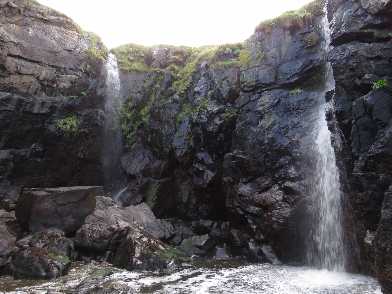 |
Waterfalls
Position: -7 38.40, 56 47.34
We worked the tender into a small cleft in the cliffs where two waterfalls tumbled down.
|
 |
North-west Peak
Position: -7 39.62, 56 47.25
Looking back to the North-west Peak of Berneray. We wanted to go all the way around to check out a ravine we could see from the lighthouse, but the swell felt too big to safely take the tender there.
|
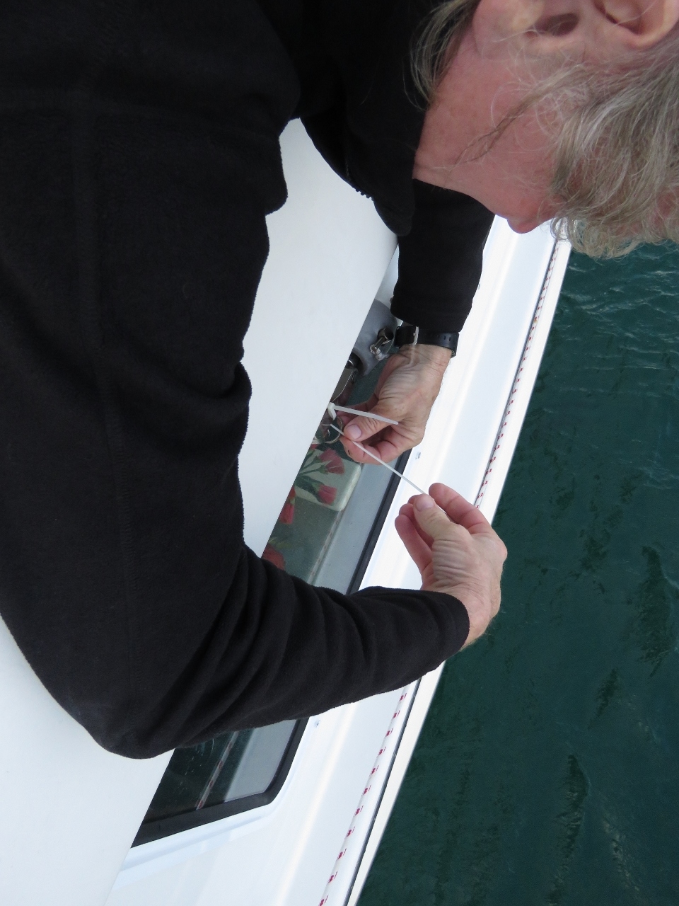 |
Near Disaster
Position: -7 37.72, 56 47.41
Conditions were calm, but a constant swell did reach the anchorage, so we had the flopper-stopper out to reduce boat roll. We happened to notice the pin holding the flopper-stopper pole to the boat had nearly worked out. Had the pin fallen out, the pole likely would have crashed through the salon window visible below.
The pin unfortunately is inserted from the bottom up, and only a spring detent pin holds it in place. When the flopper-stopper is working in heavier swells, the detent pin is slowly worked back and forth and apparently it can back out. We made a quick repair with cable ties and we later secured the detent pin more permanently with seizing wire. |

|
Click the travel log icon on the left to see these locations on a map, with the complete log of our cruise.
On the map page, clicking on a camera or text icon will display a picture and/or log entry for that location, and clicking on the smaller icons along the route will display latitude, longitude and other navigation data for that location. And a live map of our current route and most recent log entries always is available at http://mvdirona.com/maps. |
If your comment doesn't show up right away, send us email and we'll dredge it out of the spam filter.