The ruins of 14-century Castle Tioram, the rapids at River Shiel and a tender tour around the Isle of Shona make the slightly tricky entrance to Loch Moidart worth taking on. Several scenic anchorage choices are inside, most with great views to the castle. We reached Loch Moidart after a 40-mile run from the Sound of Iona. On the way we rounded Point Ardnamurchan, the most westerly point in mainland Britain with its dramatic lighthouse.
Trip highlights from Aug 21, 2017 follow. Click any image for a larger view, or click the position to view the location on a map. And a live map of our current route and most recent log entries always is available at http://mvdirona.com/maps
 |
The Carnburgs
Position: -6 21.62, 56 30.60
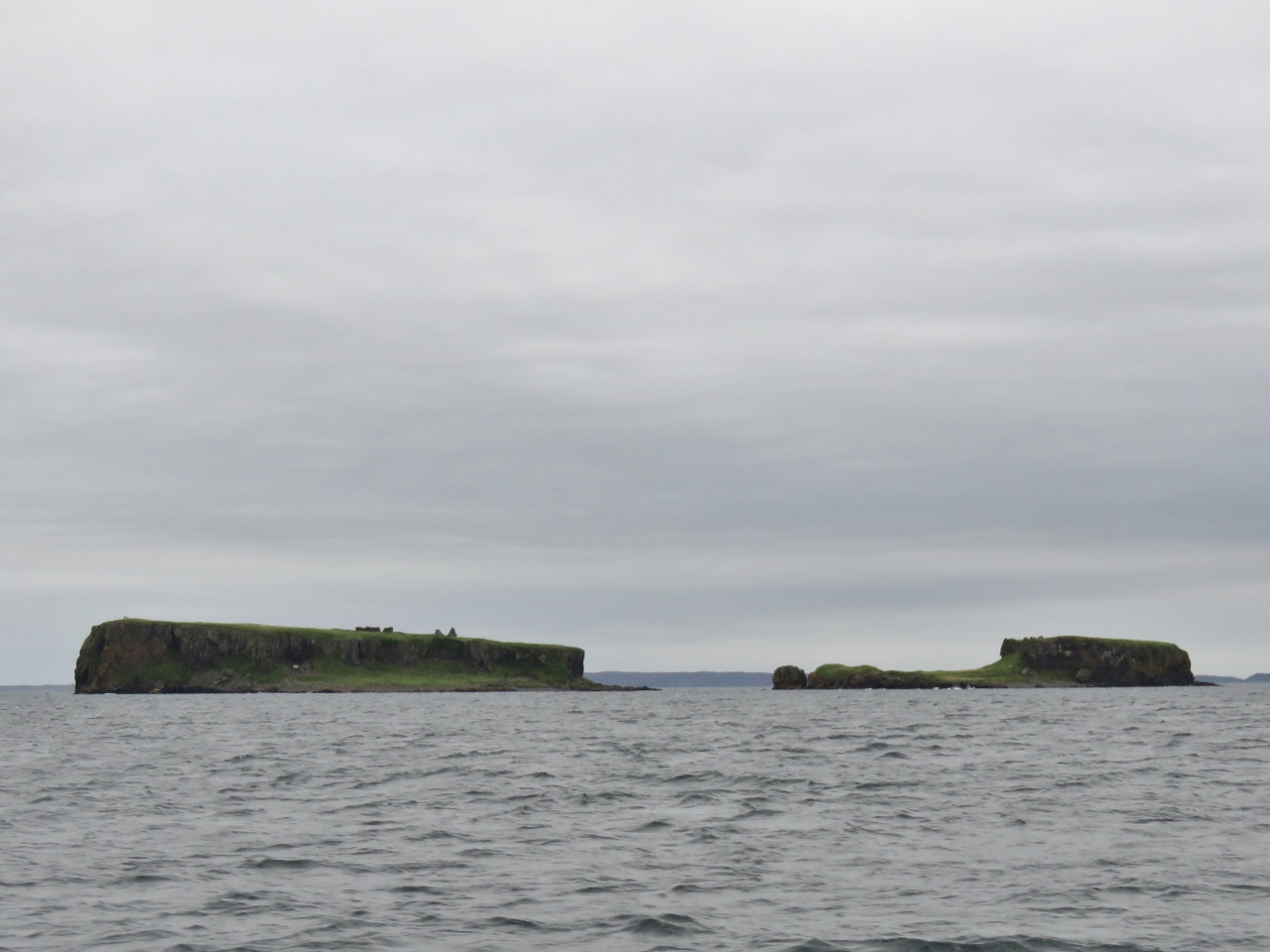
The islets of Carin na Burgh More and Cairn na Burdh Beag, nicknamed ‘the Carnburgs’, just north of Lunga Island in the Treshnish Isles. What looks like rocks on top of the islands are the ruins of Cairnburgh Castle that date from at least the 13th century. The castle is unusual because its defenses straddle both islands. The larger island, Carin na Burgh More on the left, contains a barrack block, chapel, courtyard and guard-house and Cairn na Burdh Beag on the right has another guard-house and a well.
|
 |
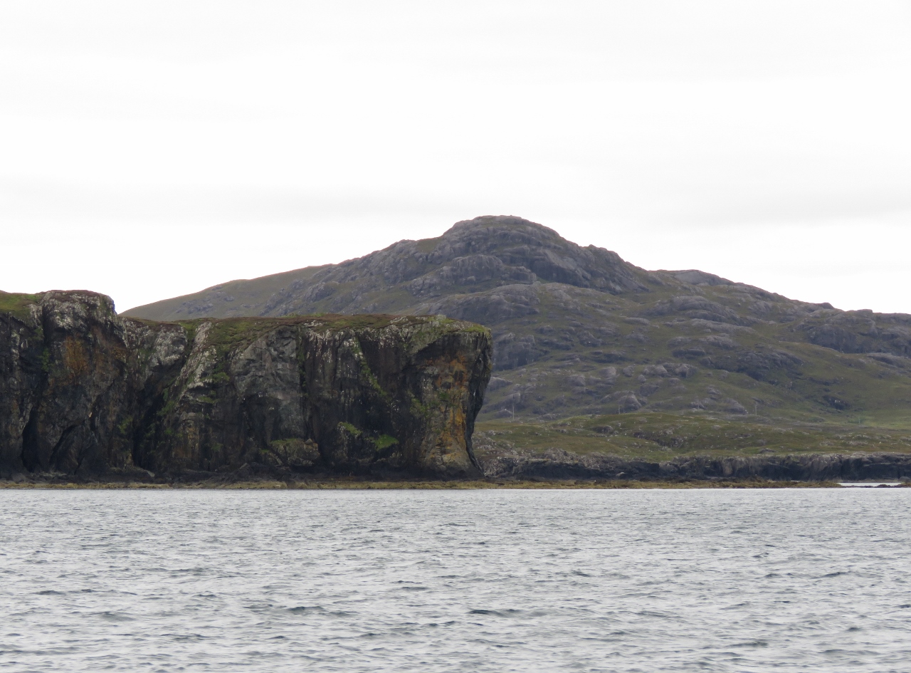
Lunga
Position: -6 21.61, 56 30.73
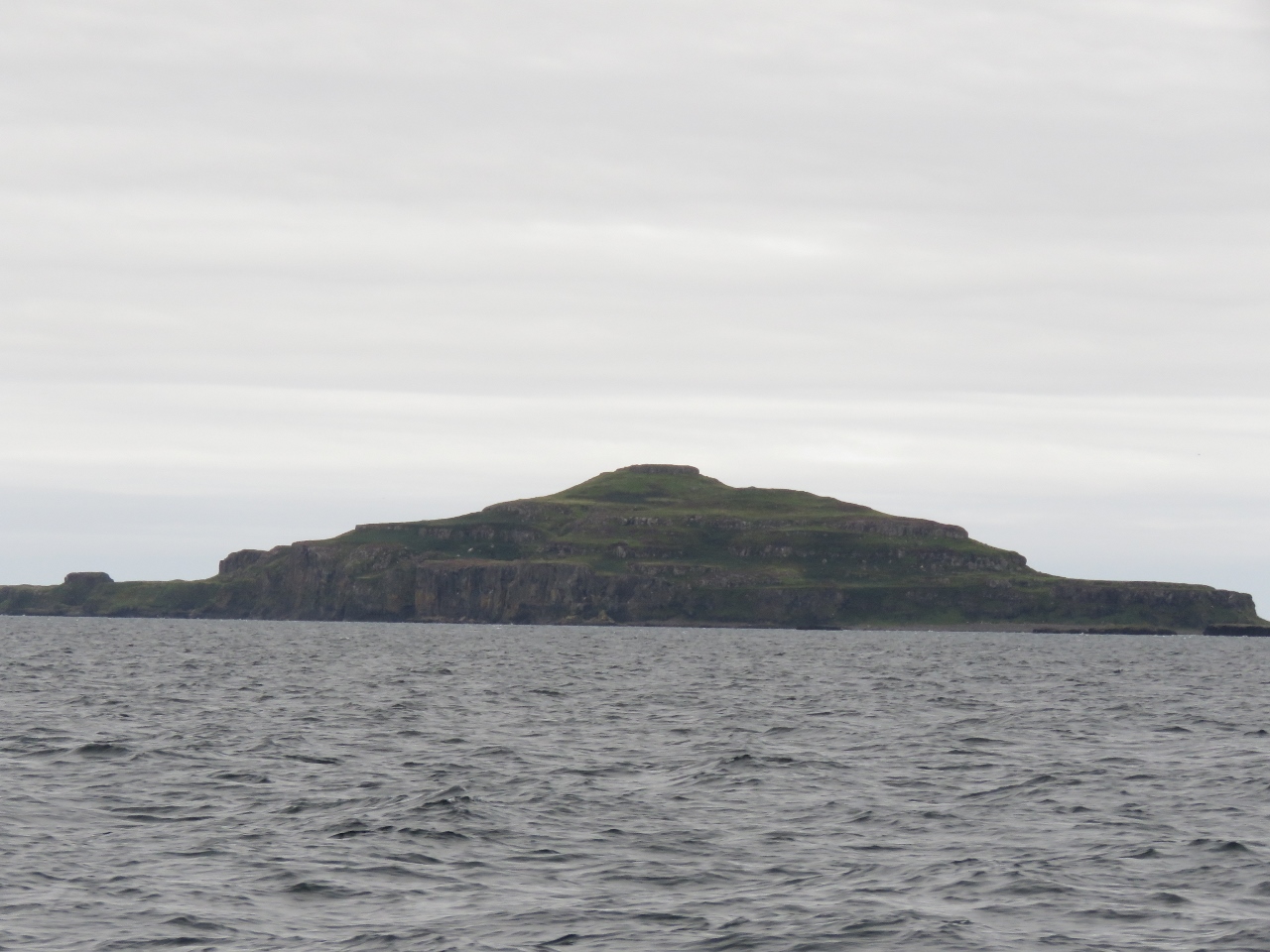
Looking south to 100m Cruichan on the Ilse of Lunga, the largest of the Treshnish Isles.
|
 |
Ardnamurchan Lighthouse
Position: -6 15.01, 56 43.80
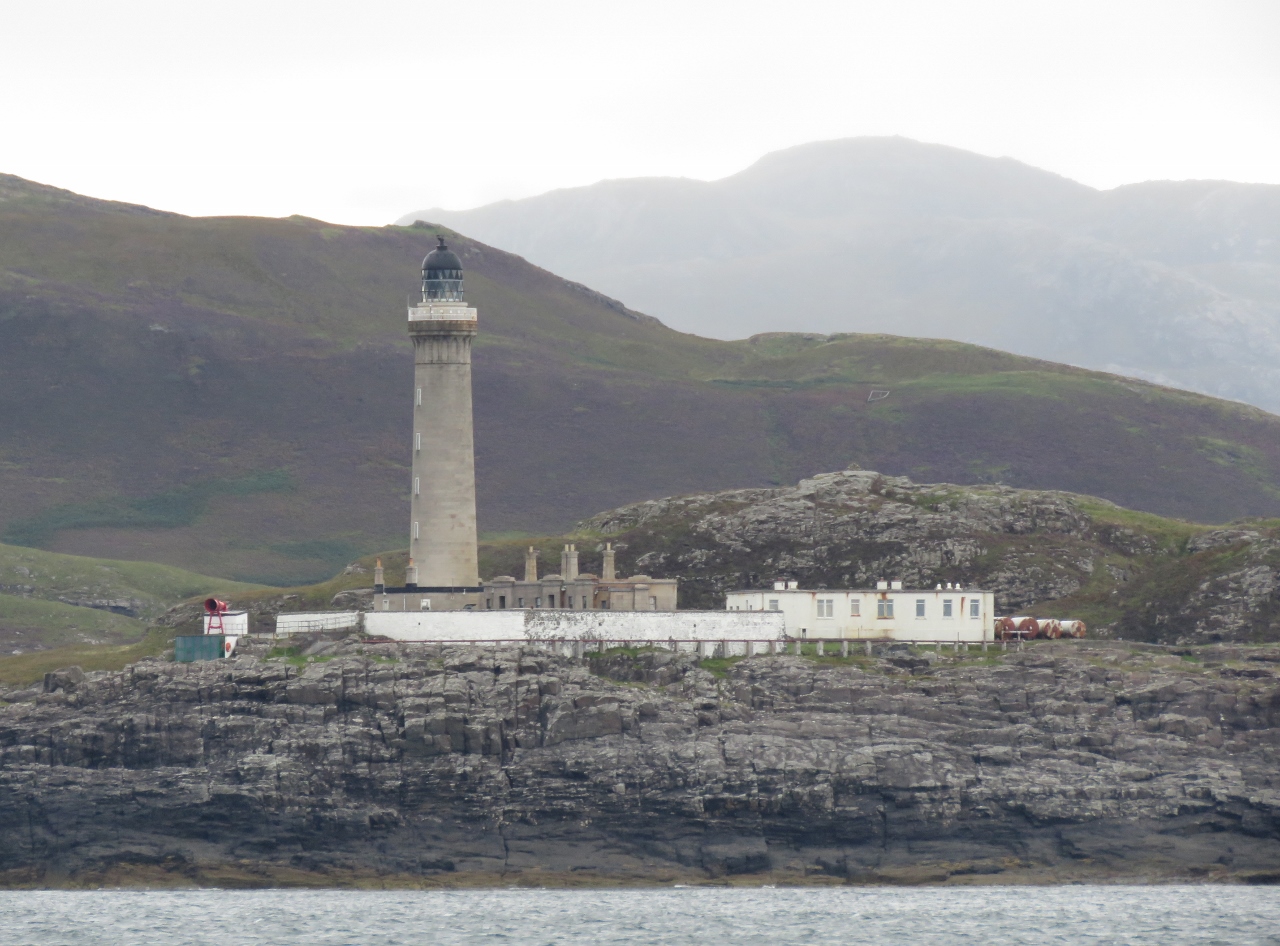
Rounding Point Ardnamurchan, the most westerly point in mainland Britain. Currents can run 1.5kts around the point and heavy seas develop a good couple of miles off when the tide opposes a strong wind. We rounded in calm conditions and could approach quite close. The 36-meter-tall Ardnamurchan Lighthouse stands 55 metres above sea level. The light was built in 1949 from a design by Alan Stevenson, uncle of author Robert Louis Stevenson, whose family designed most of Scotland’s lighthouses over a period of 150 years.
|
 |
Ardnamurchan Peninsula
Position: -6 8.90, 56 46.12
Looking south to Ardnamurchan Peninsula from northeast of Sanna Bay.
|
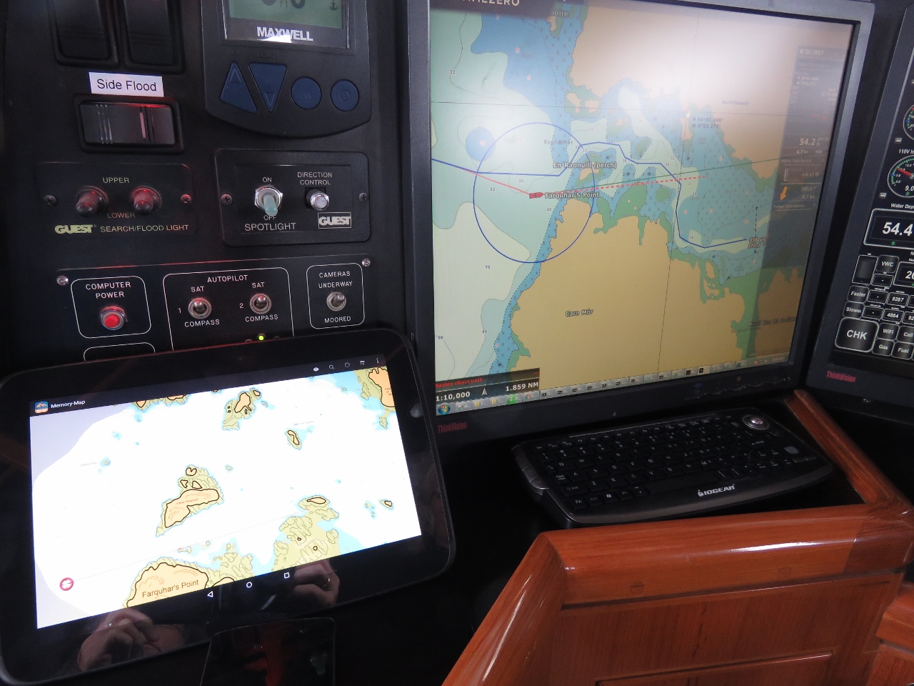 |
Antares Charts
Position: -5 53.37, 56 47.14
The charts don’t show good detail for many of the anchorages in Scotland, so we are augmenting them with Antares charts. These are unofficial, large-scale boating charts produced by boaters focusing on the West Coast of Scotland. The charts run on a variety of devices—we loaded them up on our tablet to display side-by-side with our Navionics charts.
|
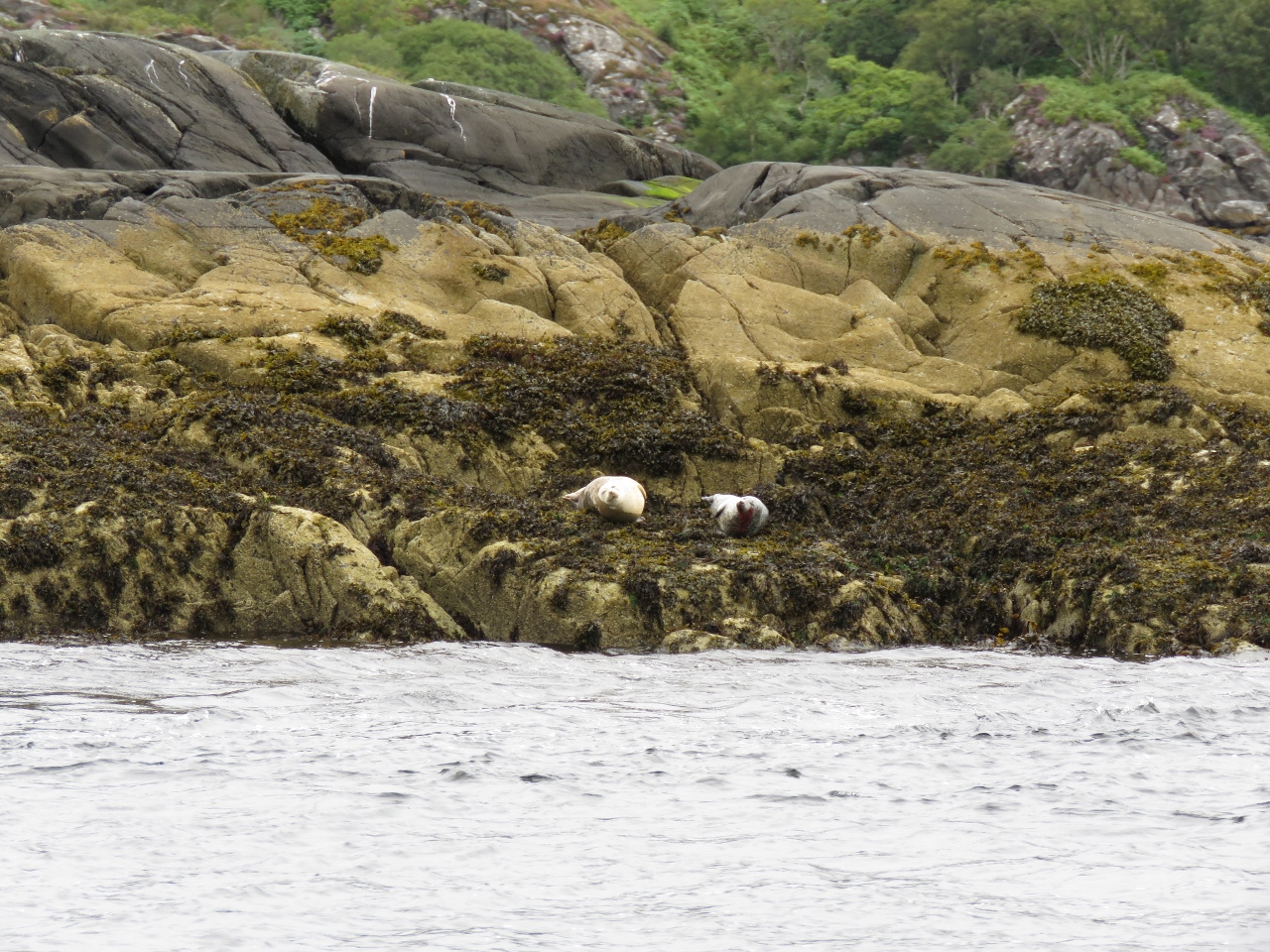 |
Seals
Position: -5 52.55, 56 47.27
Seals watching us enter Loch Moidart. Our initial plan was to head straight for the Outer Hebrides from Iona, but we were enjoying the scenery in the Inner Hebrides so much that we didn’t want to rush through. So we’ll spend a couple of more nights in the area.
|
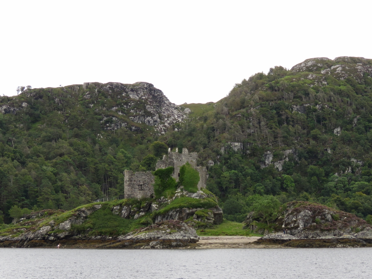 |
Castle Tioram
Position: -5 49.89, 56 47.14
The ruins of Castle Tioram in Loch Moidart. The castle dates from the 14th-century and is the traditional seat of Clan MacDonald of Clan Ranald, a branch of Clan Donald.
|
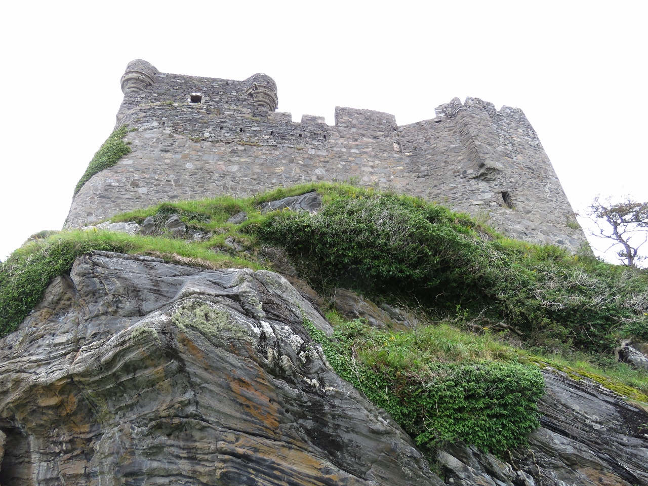 |
Impenetrable
Position: -5 49.75, 56 47.06
Looking up to Castle Tioram on a dinghy tour of the area. Castles are of course designed to be impenetrable and it certainly looked that way from this angle.
|
|
|
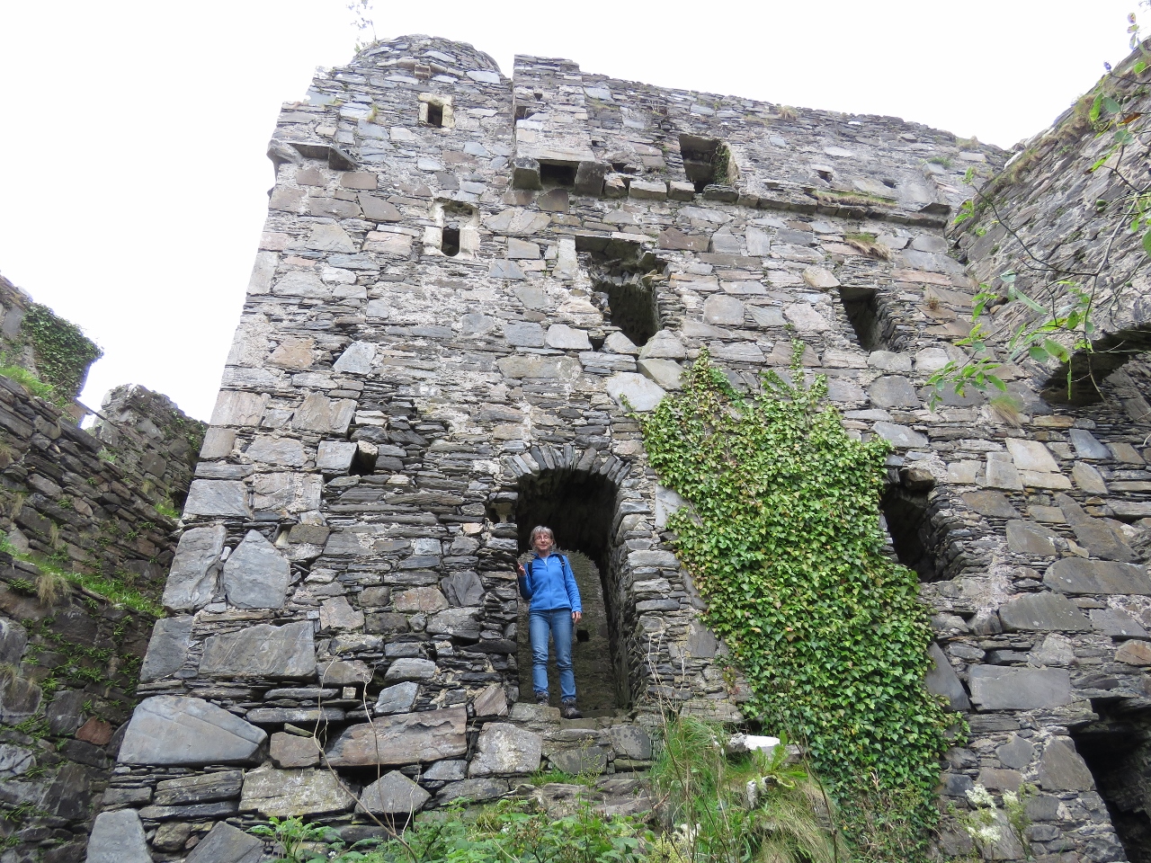
Inside
Position: -5 49.73, 56 47.08
Castle Tioram doesn’t look all this big from the outside, but is surprisingly large inside. The castle was torched during the 1715 Jacobite Uprising and has been unoccupied since.
|
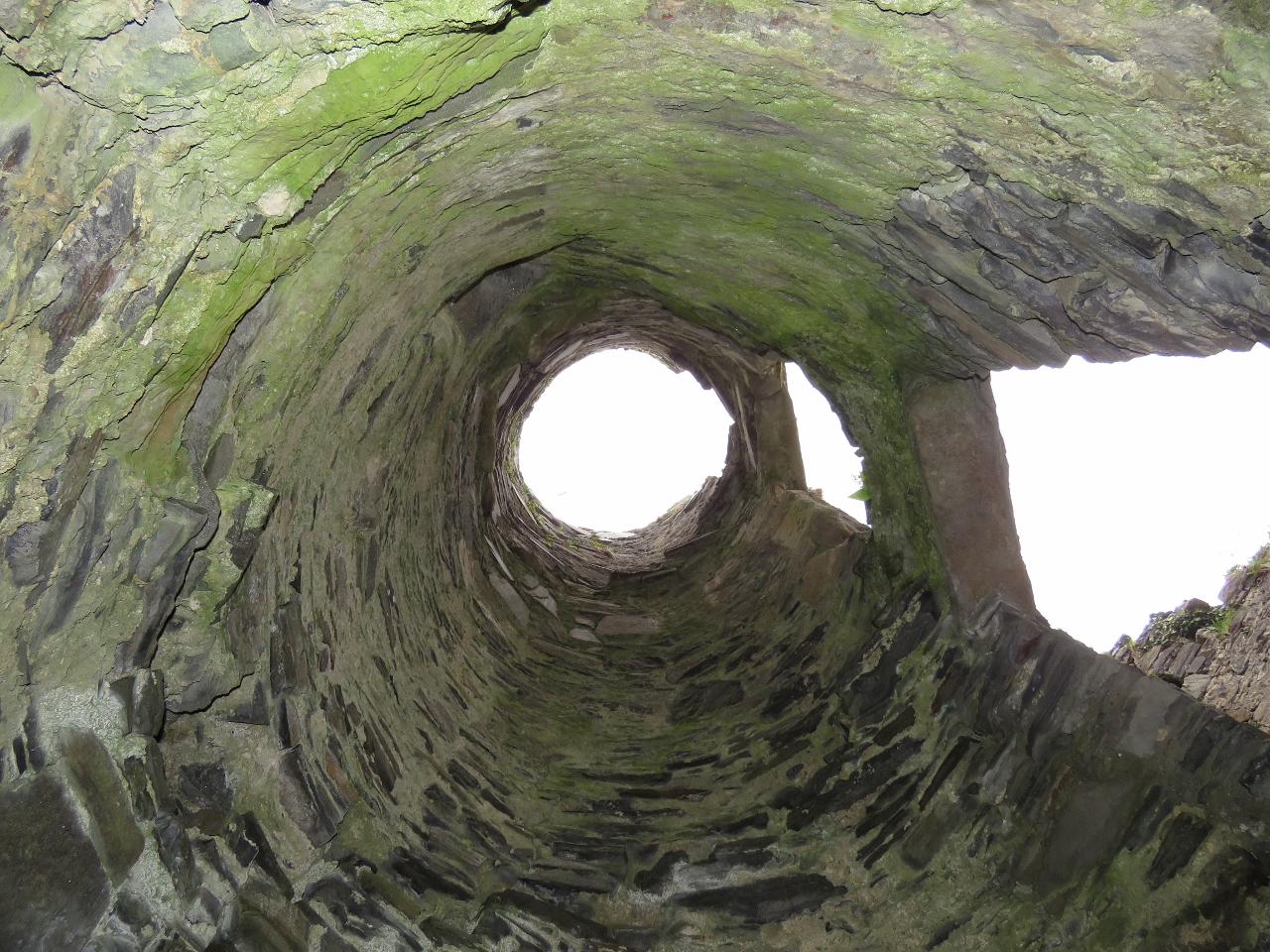 |
Stairway
Position: -5 49.73, 56 47.07
Looking up through a stairwell in Castle Tioram.
|
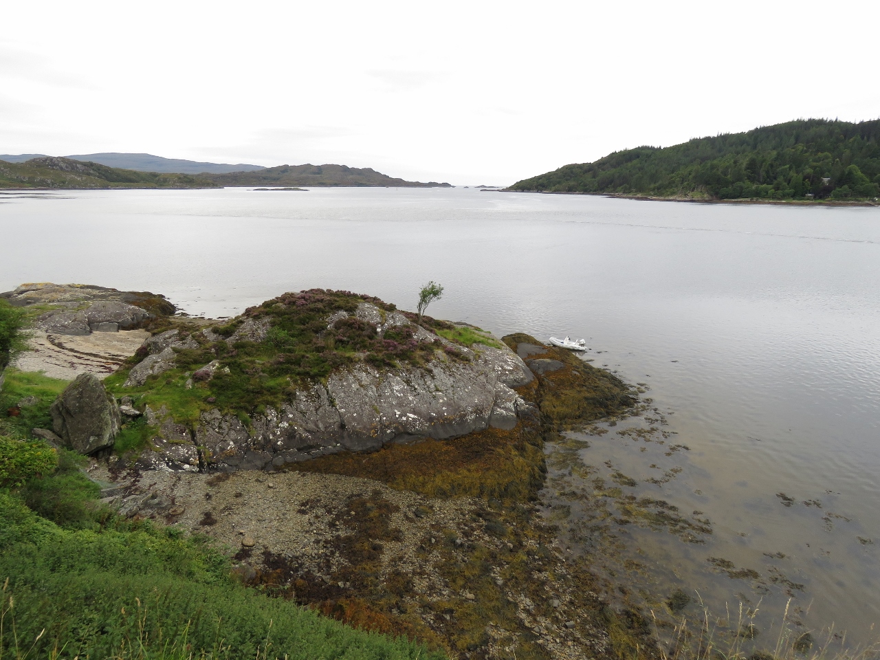 |
Loch Moidart
Position: -5 49.73, 56 47.09
The view west through the south channel of Loch Moidart from Castle Tioram. Dirona is anchored way in the distance and is almost too small to see.
|
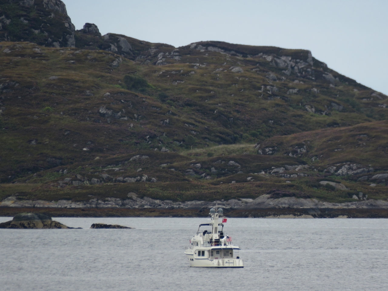 |
South Channel
Position: -5 49.71, 56 47.06
Dirona anchored in the south channel of Loch Moidart, viewed from Castle Tioram.
|
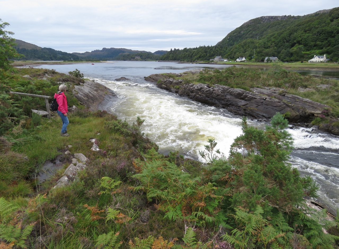 |
Rapids
Position: -5 49.91, 56 46.24
Rapids where the River Shiel drains 17.5-mile-long Loch Shiel into Loch Moidart. Just to Jennifer’s left is a small bridge that skirts the edge of the river.
|
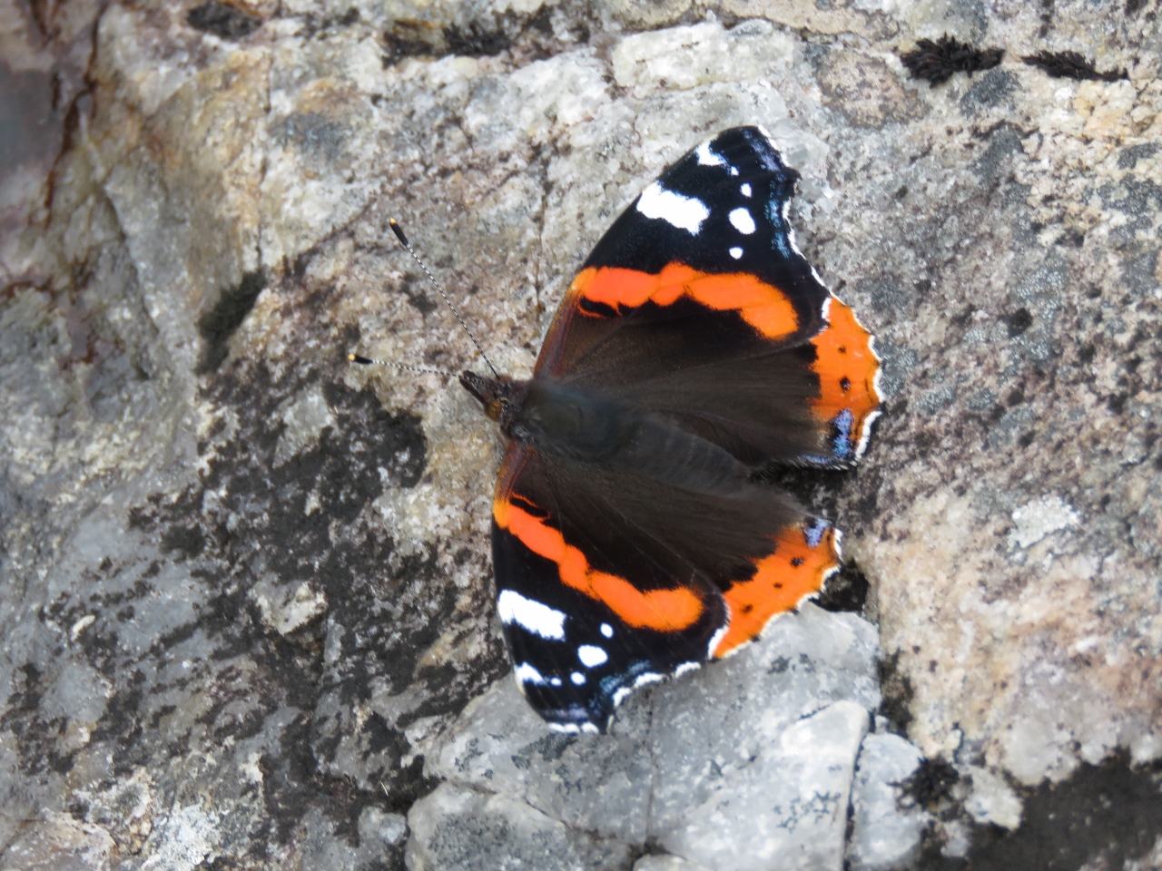 |
Red Admiral
Position: -5 49.94, 56 46.21
A striking orange-and-black Red Admiral butterfly perched near the River Shiel.
|
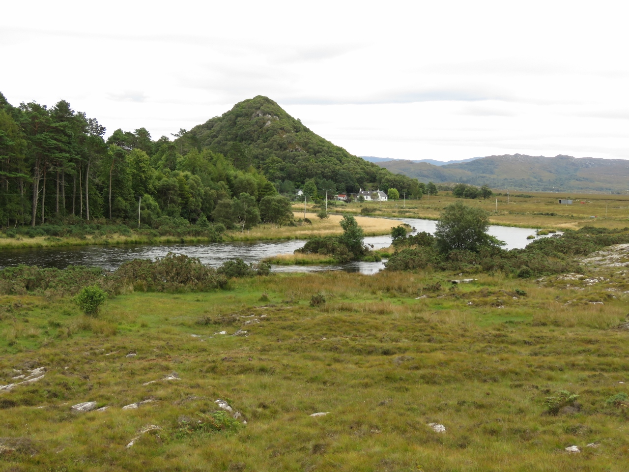 |
The Torr
Position: -5 49.95, 56 46.20
The Torr rising above the village of Shielfoot along the River Shiel. The hill is the site of an ancient and unusual vitrified fort, whose walls have been subject to glass transition through heat. This process actually weakens the structure, and arch believe it may have been done as a ritual to close the fort at end of life, or following enemy capture to prevent further use. Over 70 vitrified forts have been discovered in Scotland, with more in western and northern Europe.
|
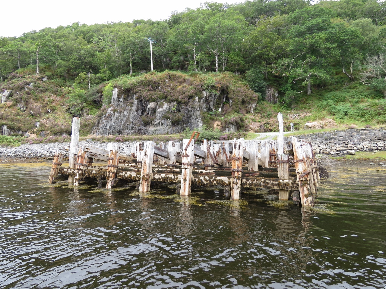 |
Dock
Position: -5 46.26, 56 47.35
Dock ruins at the head of Loch Moidart.
|
 |
Shona
Position: -5 51.44, 56 48.51
House tucked into the hills on Shona Island that splits Loch Moidart into two arms. J M Barrie leased the island in the 1920s for a secluded place to write the screenplay for Peter Pan.
|
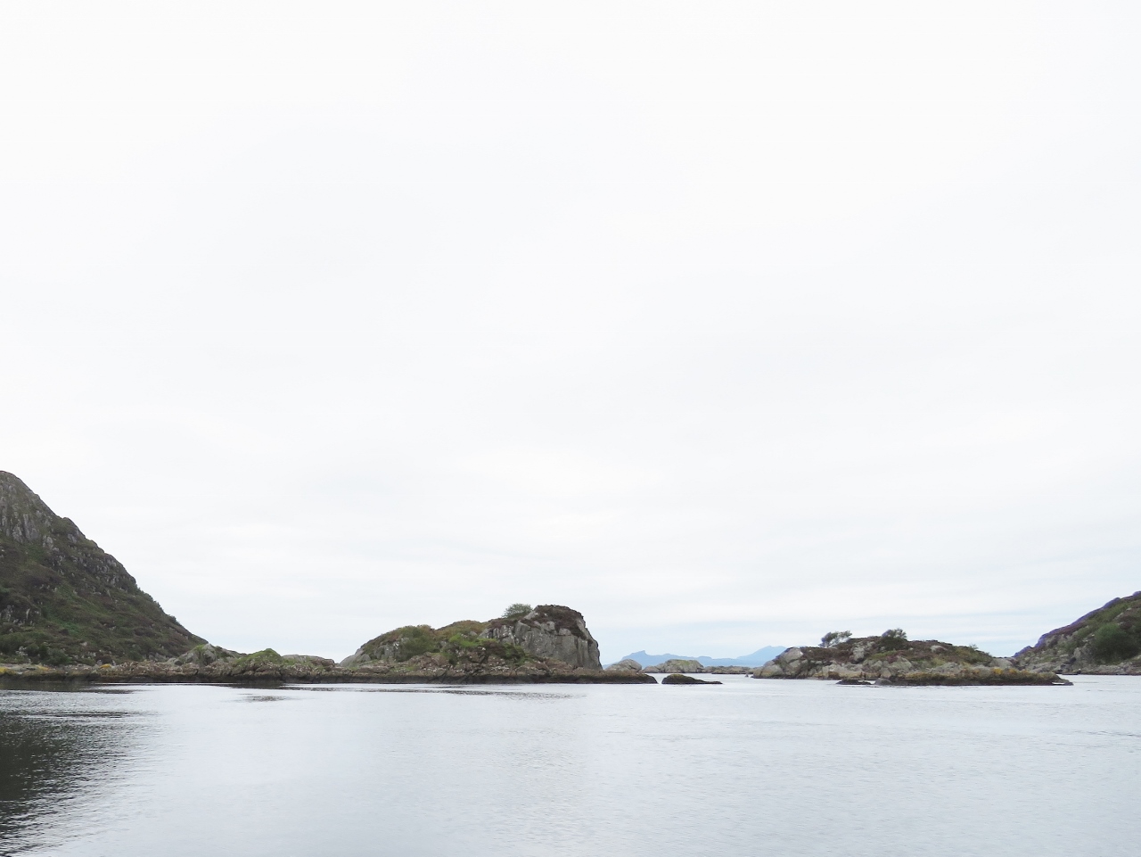 |
Islets
Position: -5 51.77, 56 48.42
Looking to sea from the North Channel of Lock Moidart.
|
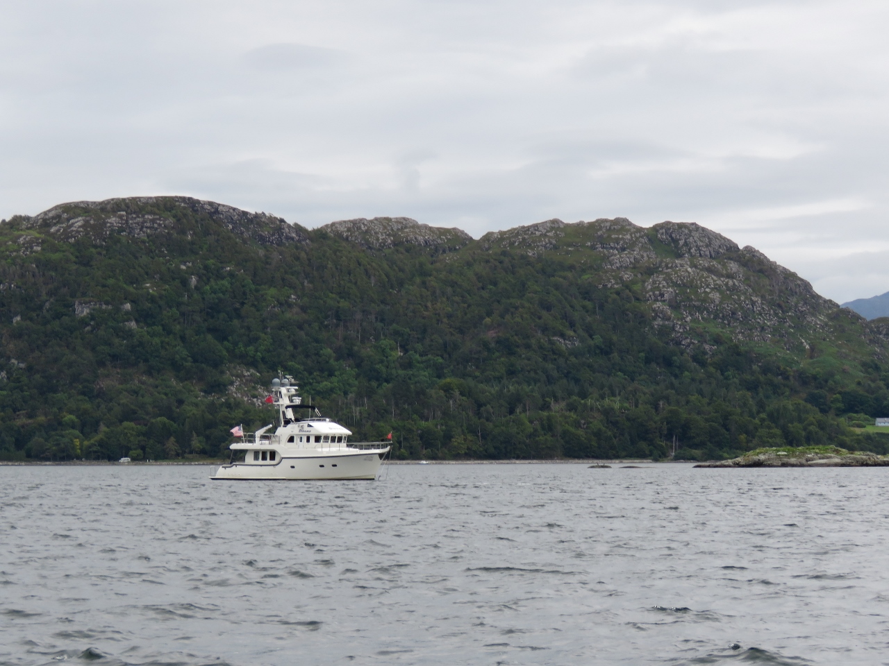 |
Back Home
Position: -5 51.36, 56 47.03
Back home at Dirona after a big tour by tender.
|

|
Click the travel log icon on the left to see these locations on a map, with the complete log of our cruise.
On the map page, clicking on a camera or text icon will display a picture and/or log entry for that location, and clicking on the smaller icons along the route will display latitude, longitude and other navigation data for that location. And a live map of our current route and most recent log entries always is available at http://mvdirona.com/maps. |
If your comment doesn't show up right away, send us email and we'll dredge it out of the spam filter.