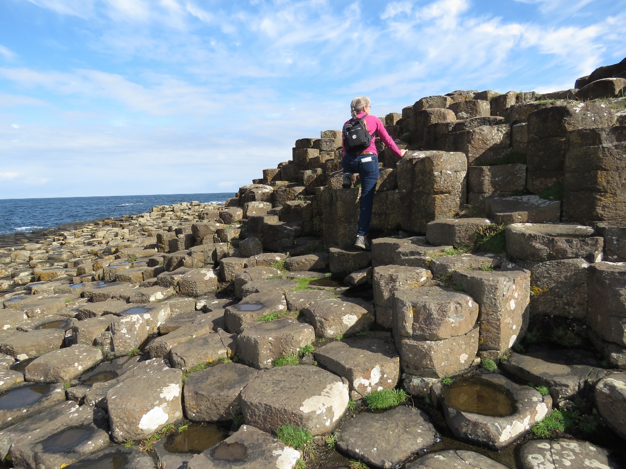
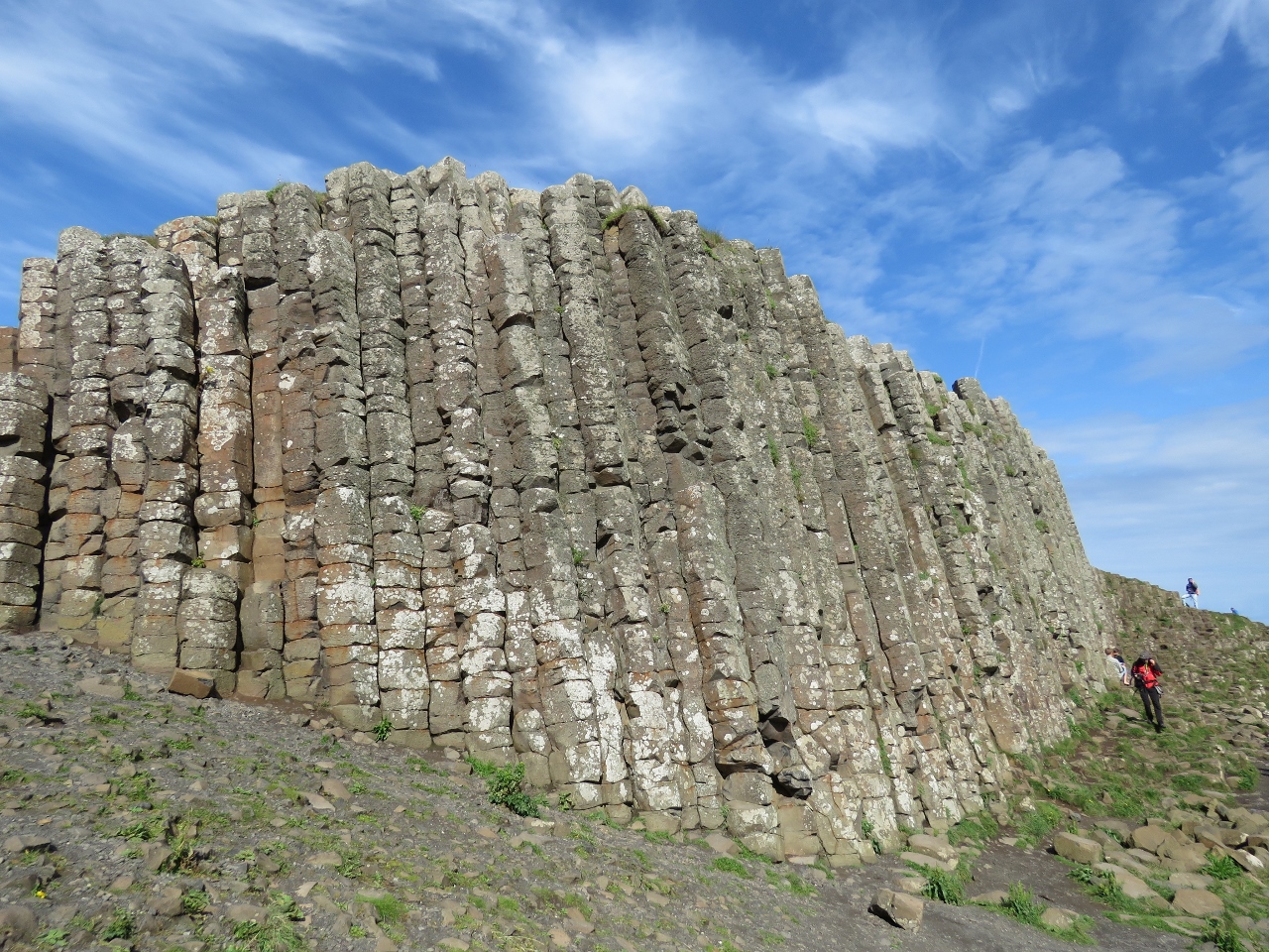
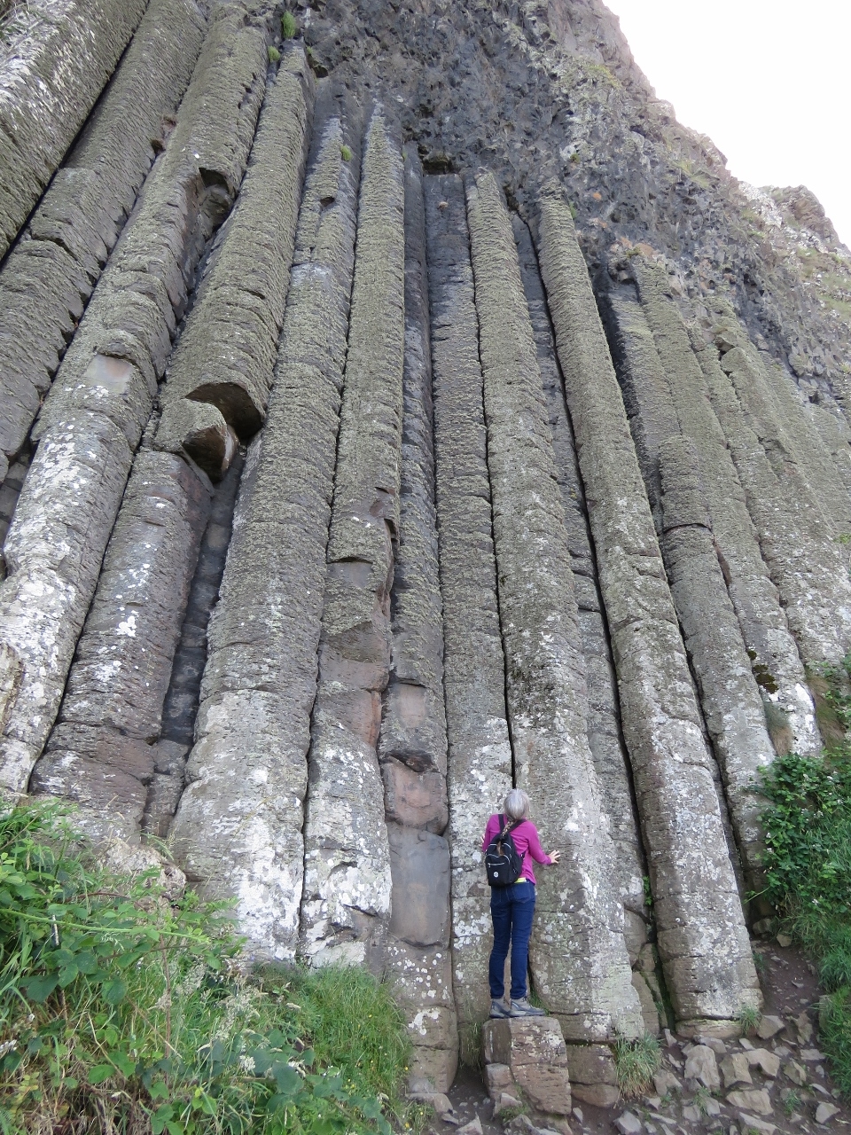
Giant’s Causeway in Northern Ireland consists of over 40,000 hexagonal basalt stones that lead from a cliff foot into the sea. The dramatic site inspired legends of giants building the causeway to reach Scotland across the sea. Led Zeppelin fans might recognize the above scene from the Houses of the Holy cover.
We had sorely wanted to visit Giant’s Causeway, and also Dunluce Castle and the Carrick-a-Rede Rope Bridge, but couldn’t find a convenient place in Northern Ireland to moor. We also were a little nervous about having the boat there near the July 12th termination of the Orange marching season. Lonely Planet recommends against being in the province then as “secretarian passions are usually inflamed”.
We found a solution at Loch Swilly Marina in the Republic of Ireland. For a reasonable price, Derry Blue Badge Guide picked us up at the marina and drove us across the border into the UK for the day. We felt completely safe, had a fabulous time, and made a bonus sidetrip to the Grianan of Aileach stone fort for sweeping views of Loch Swilly.
Trip highlights from July 7th through July 10th, 2017 follow. Click any image for a larger view, or click the position to view the location on a map. And a live map of our current route and most recent log entries always is available at http://mvdirona.com/maps
 |
Tory Island
Position: -8 11.32, 55 15.93
We weren’t planning a pass around Tory Island, but a distant view of the island’s dramatic seascape drew us in. The is looking south along from the northeast corner of the island.
|
 |
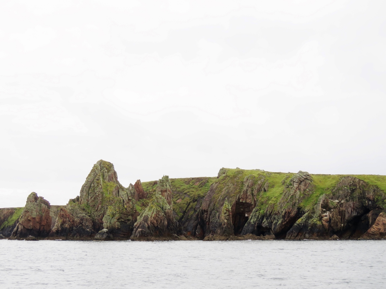
Tor Mor
Position: -8 11.69, 55 16.03
The view south along 262ft (80m) Tor Mor on the northeast tip of Tory Island. The spires visible over the cliff in the previous picture are slightly left of center in the background.
|
 |
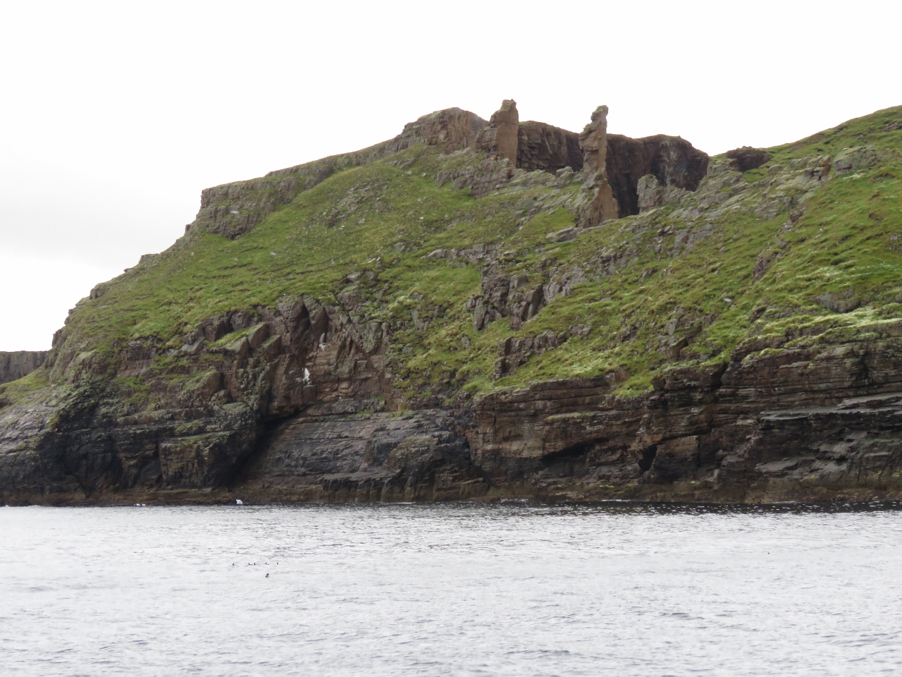
Tory Peak
Position: -8 12.50, 55 16.05
153ft (53m) Tory Peak at the left of the photo, with stacks, spires and caves along the north side of Tory Island. The scenery here is spectacular—we were very glad we made the detour.
|
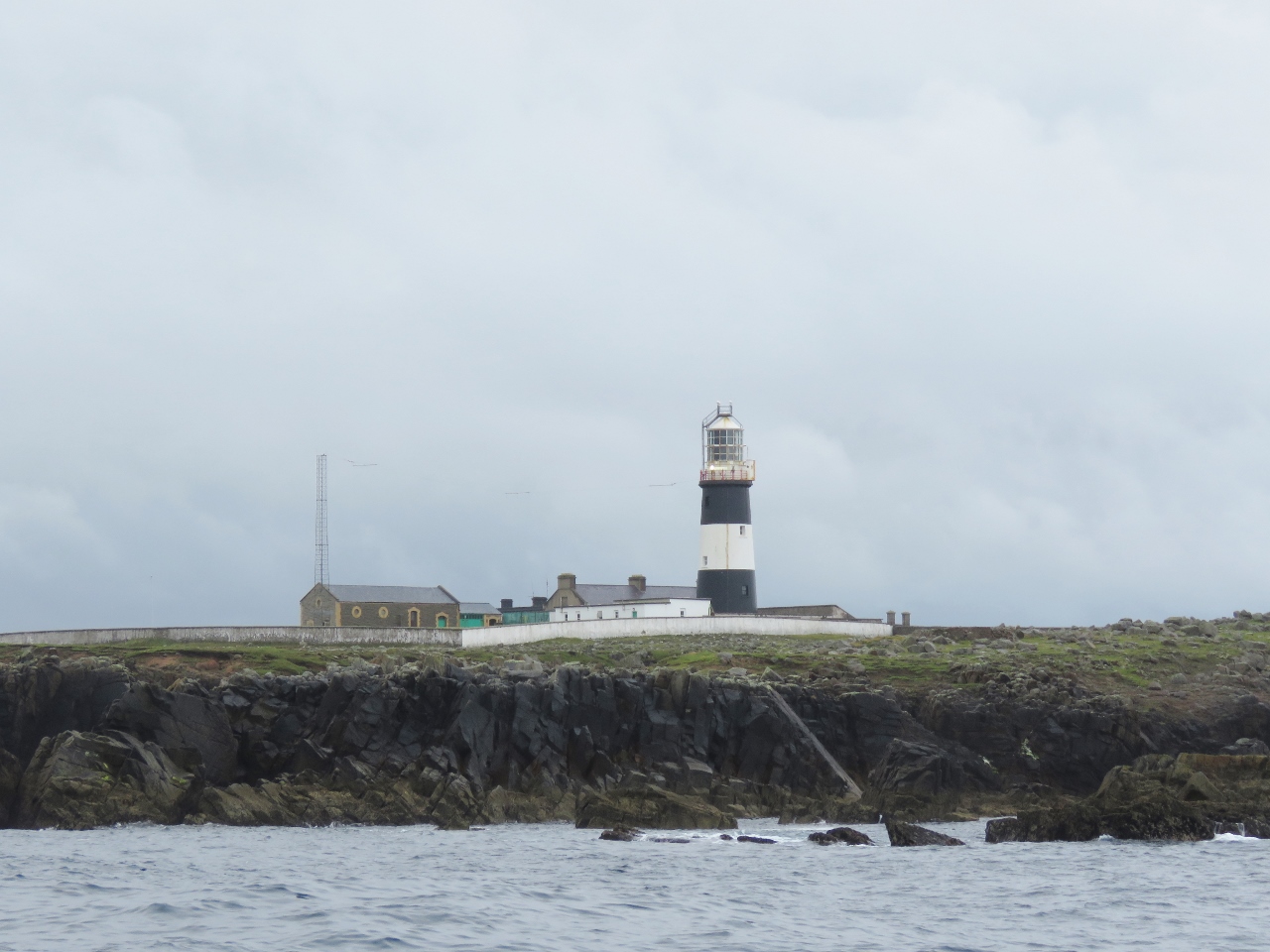 |
Tory Island Light
Position: -8 15.02, 55 16.73
The lighthouse on the northwest tip of Tory Island was established in 1832 and automated in 1990. The tower was originally all-black and a white band added in 1956.
|
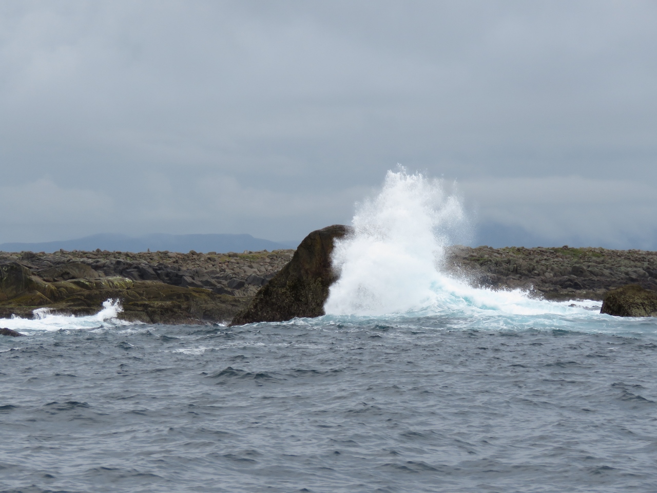 |
Wave
Position: -8 15.47, 55 16.35
Despite today’s calm conditions, waves were crashing into the rocks off the Tory Island lighthouse. Conditions must get pretty rough here when a storm comes up.
|
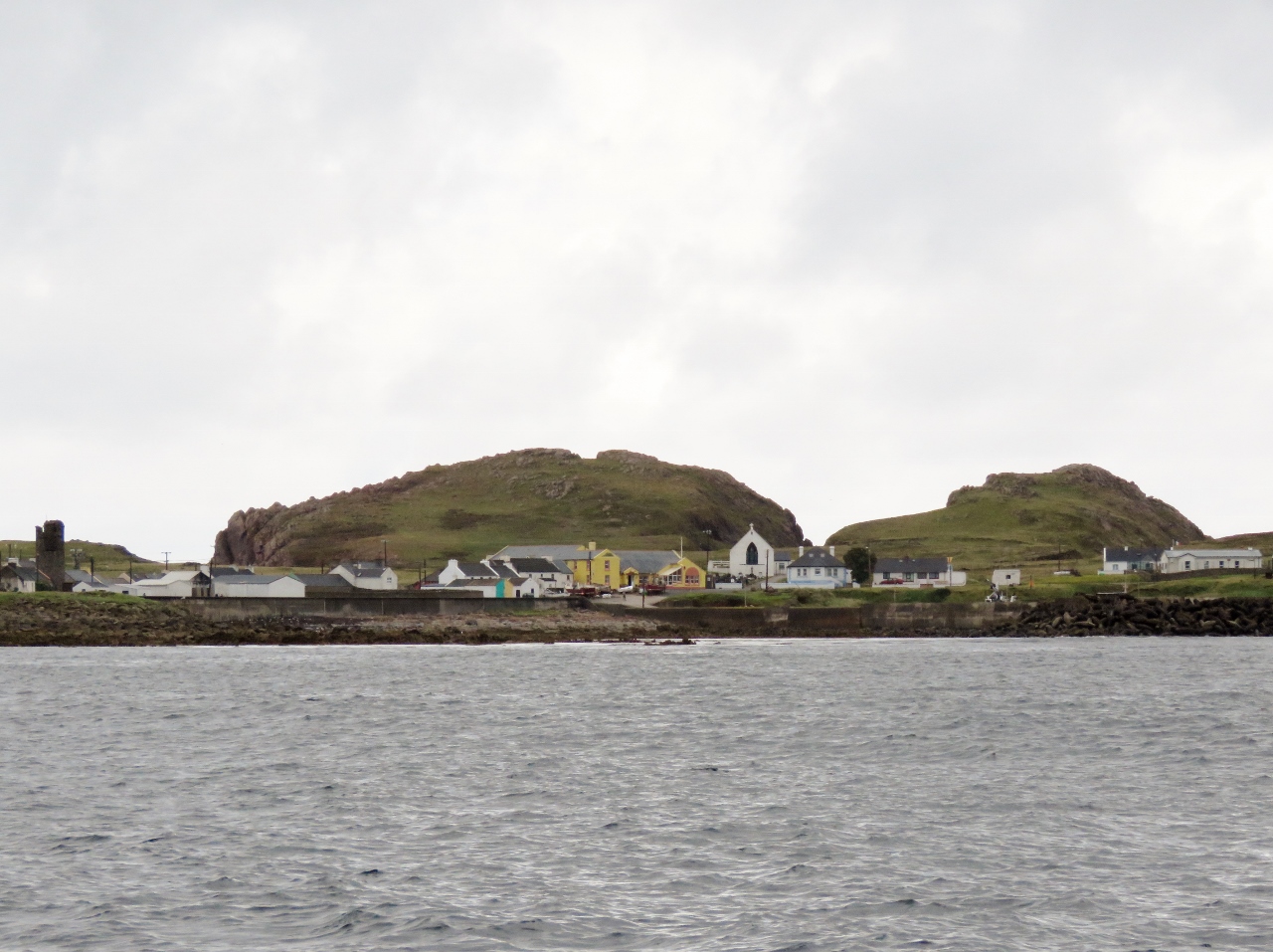 |
West Town
Position: -8 13.82, 55 15.38
West Town serves most of Tory Island’s 200 residents and is where the mainland ferry lands. The circular tower on the left was built in the 6th or 7th century.
|
 |
British Pounds
Position: -7 40.92, 55 17.21
While we are in Lough Swilly, we’ll be visiting Northern Island in the United Kingdom, so we got out our British Pounds leftover from our visit to St. Helena in the southern Atlantic.
|
 |
Fanad Head
Position: -7 37.78, 55 17.20
The lighthouse on Fanad Head was first lit in 1817 and could be seen for fourteen miles in clear weather. It was automated in 1983.
|
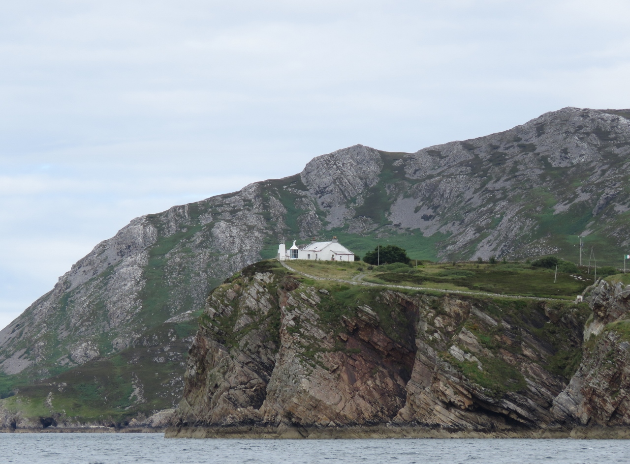 |
Dunree Head
Position: -7 33.50, 55 11.30
Partway into Lough Swilly, the Dunree Head was established in 1876. The light is 46m above the cliff and mounted in front of the keeper’s building at ground level to keep it below the fog.
|
 |
Lough Swilly Marina
Position: -7 28.76, 55 5.27
Moored for a few days at Lough Swilly Marina. We were expecting that crossing the Fahan Bar north of the marina would be the shallowest part of the approach, but saw no less than 8ft on a 2m rising tide. The marina entry channel was much more difficult. Despite assurances from the marina staff that we would be “fine” with our 2.1m draft so long as we didn’t enter at dead-low tide, we touched bottom numerous times on entry. We will need at least 3m tide to leave safely.
|
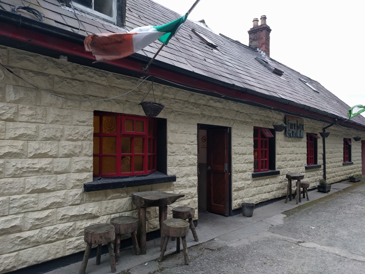 |
Firebox Grill
Position: -7 28.56, 55 5.29
We had an excellent meal at the Railway Tavern and Firebox Grill in the marina complex. We were expecting just a casual pub, but the Firebox Grill was much nicer and very popular.
|
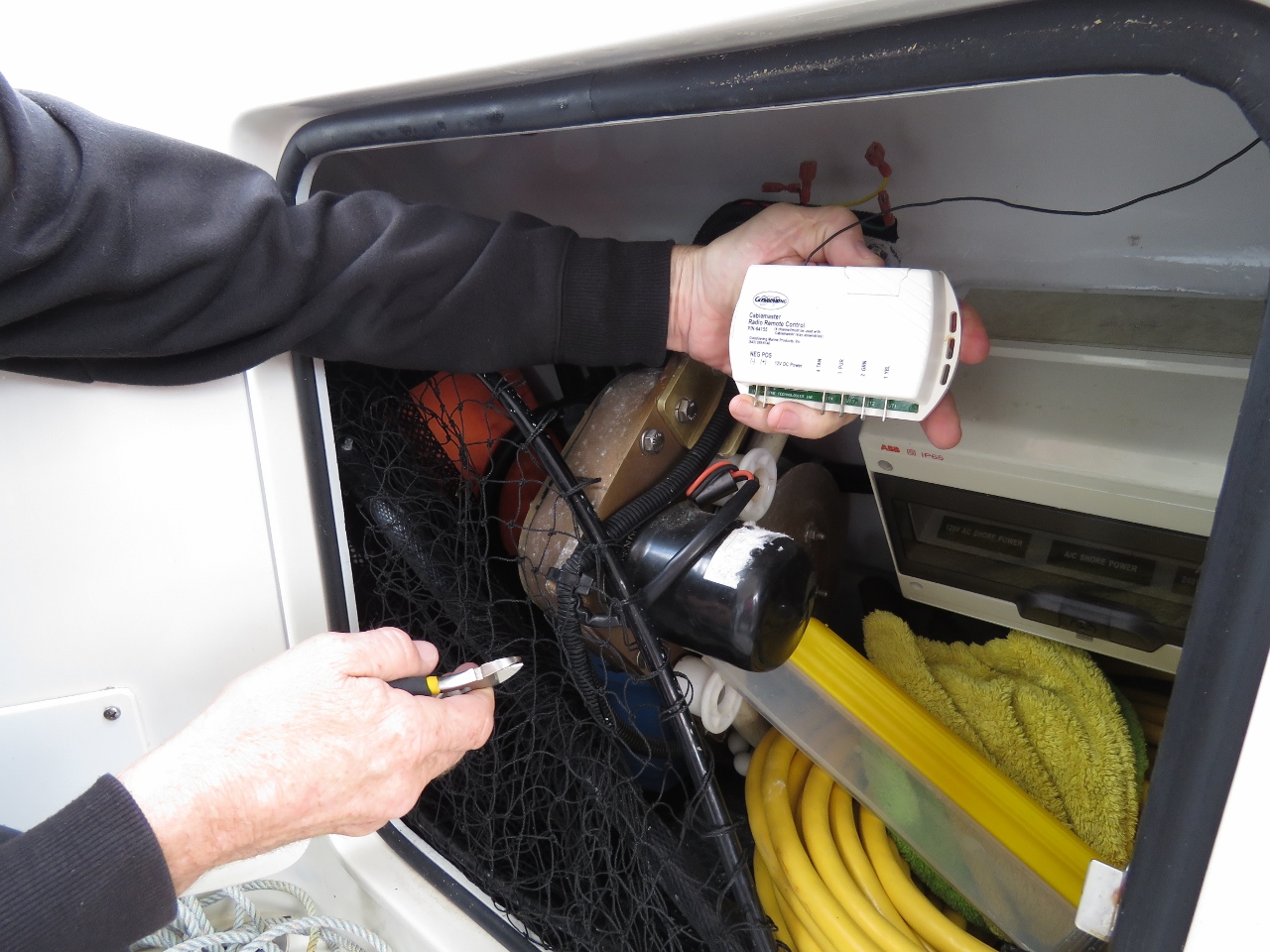 |
Glendinning
Position: -7 28.80, 55 5.26
Our Glendinning power cord retractor spontaneously started to reel in the cord and actually pulled the boat aftward up towards the dock, only releasing when the circuit breaker tripped. The switch circuit appears to have spontaneously closed, triggering the motor. Because it is intermittent and only triggers rarely, we disconnected both the remote control and the switch. We’re not positive it’s a switch problem and don’t have a spare to try. To keep things working, we installed a generic wireless remote to drive the cord retractor and disconnected the existing remote and switch. Having seen the power of the retractor, we’ll keep the circuit breaker off when not in use. It’s fully operational and we’ve ordered a new switch assembly to restore non-remote operation as well.
|
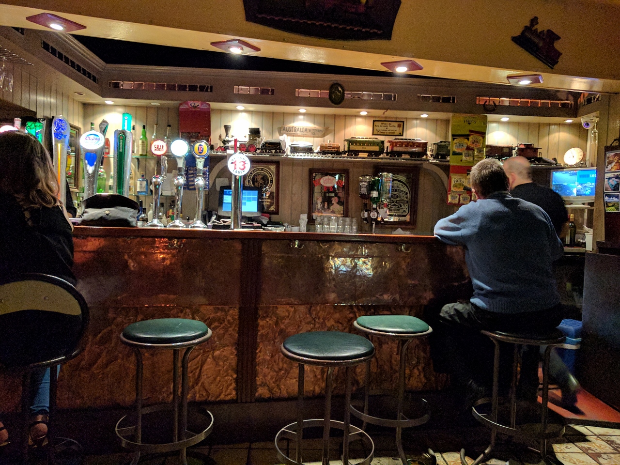 |
Railway Tavern
Position: -7 28.56, 55 5.30
We had another great meal at the Railway Tavern and Firebox Grill, but this time in the tavern section. Although we were sitting about three feet from where we were last night in the Firebox Grill, the Railway Tavern felt like a completely different restaurant, with more of a casual pub feel.
|
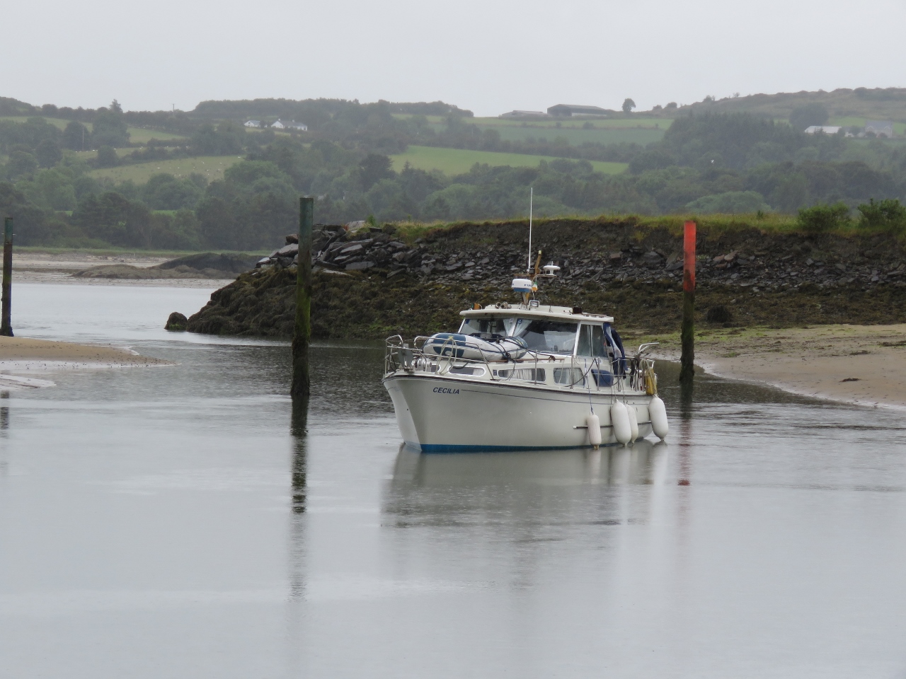 |
Cecilia
Position: -7 28.80, 55 5.26
Cecilia finding bottom on entering the Lough Swilly Marina with about 1m of tide. Besides being shallow, the entrance is narrow and has a couple of sharp turns, making entering that much more “interesting”.
|
 |
Causeway Coast
Position: -6 31.06, 55 13.99
One of the reasons we’re at Loch Swilly Marina is to do a tour of the Causeway Coast in Northern Ireland. For a reasonable price, Derry Blue Badge Guide picked us up at the marina and drove us across the border into the UK for the day. This is the view looking west from our first stop of the day at the Giant’s Causeway. Crossing the border was a real non-event. Our driver at one point said “We’ve just crossed the border” and we were in Northern Ireland without even a hint of a border crossing.
|
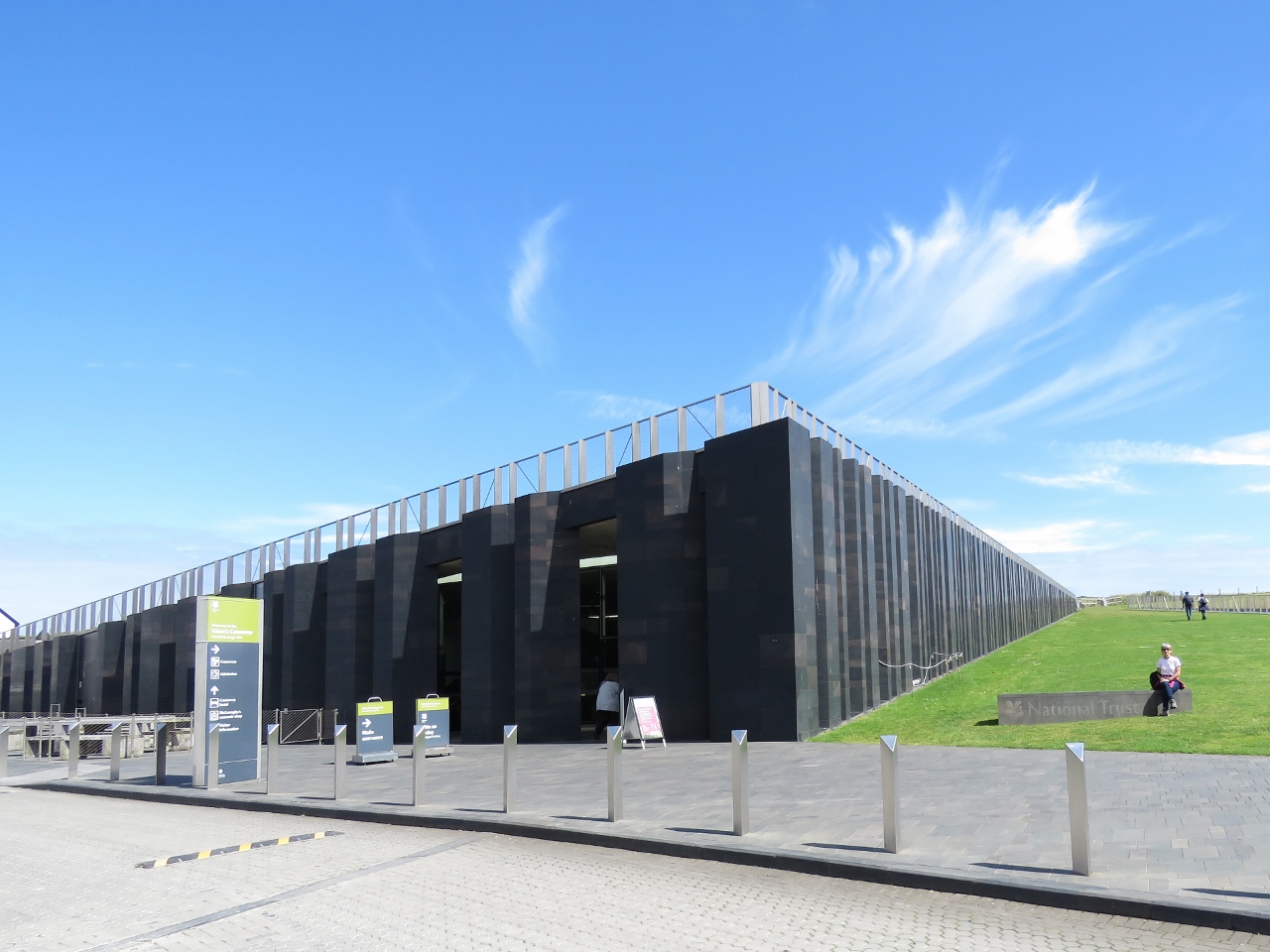 |
Visitors Center
Position: -6 31.07, 55 13.99
The striking Giant’s Causeway visitor center opened in 2012 and includes 186 basalt columns modelled after the site’s hexagonal basalt stones.
|
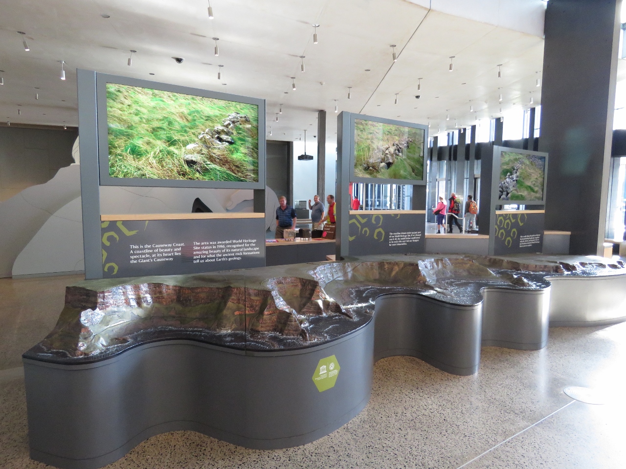 |
Displays
Position: -6 31.01, 55 13.99
Excellent displays in the visitor center model the causeway and describes its geology and formation through volcanic activity some 50 million years ago.
|
|
|
Giant’s Causeway
Position: -6 30.69, 55 14.46
Jennifer climbing the basalt stones that make the Giant’s Causeway famous. Led Zeppelin fans might recognize this scene from the cover art of Houses of the Holy. Giant’s Causeway was declared a UNESCO World Heritage site in 1986. The site consists of over 40,000 hexagonal basalt stones that lead from a cliff foot into the sea. The dramatic site inspired legends of giants building the causeway to reach Scotland across the sea.
|
 |
Columns
Position: -6 30.63, 55 14.40
Basalt columns farther inland that have not been eroded by the sea.
|
 |
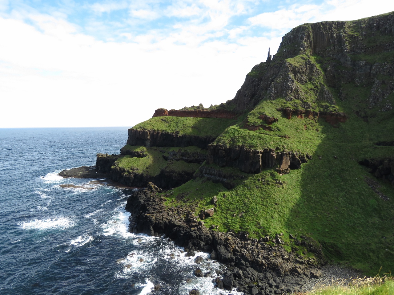
View
Position: -6 30.24, 55 14.55
Trails lead along the sea and the cliff tops for excellent views. This is looking back toward the Giant’s Causeway from partway up a trail to the Port Reostan.
|
 |
The Organ
Position: -6 30.25, 55 14.45
These basalt columns are known as “The Organ”.
|
 |
Chimney Tops
Position: -6 30.27, 55 14.64
Looking to the formations known as the Chimney Tops from the lookout at Port Reostan. The area to the right is known as the Amphitheatre.
|
 |
Cliff Path
Position: -6 30.23, 55 14.64
Partway back along the trail to Port Reostan, we took the steep Shepard’s Steps up to the Cliff Path for sweeping views of the area.
|
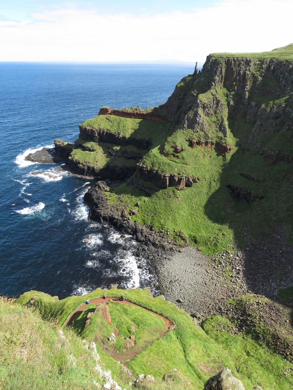 |
Amphitheatre
Position: -6 30.23, 55 14.63
Looking down into the Amphitheatre from the Cliff Path. The Port Reostan lookout we were at earlier is the circular path at the bottom of the photo.
|
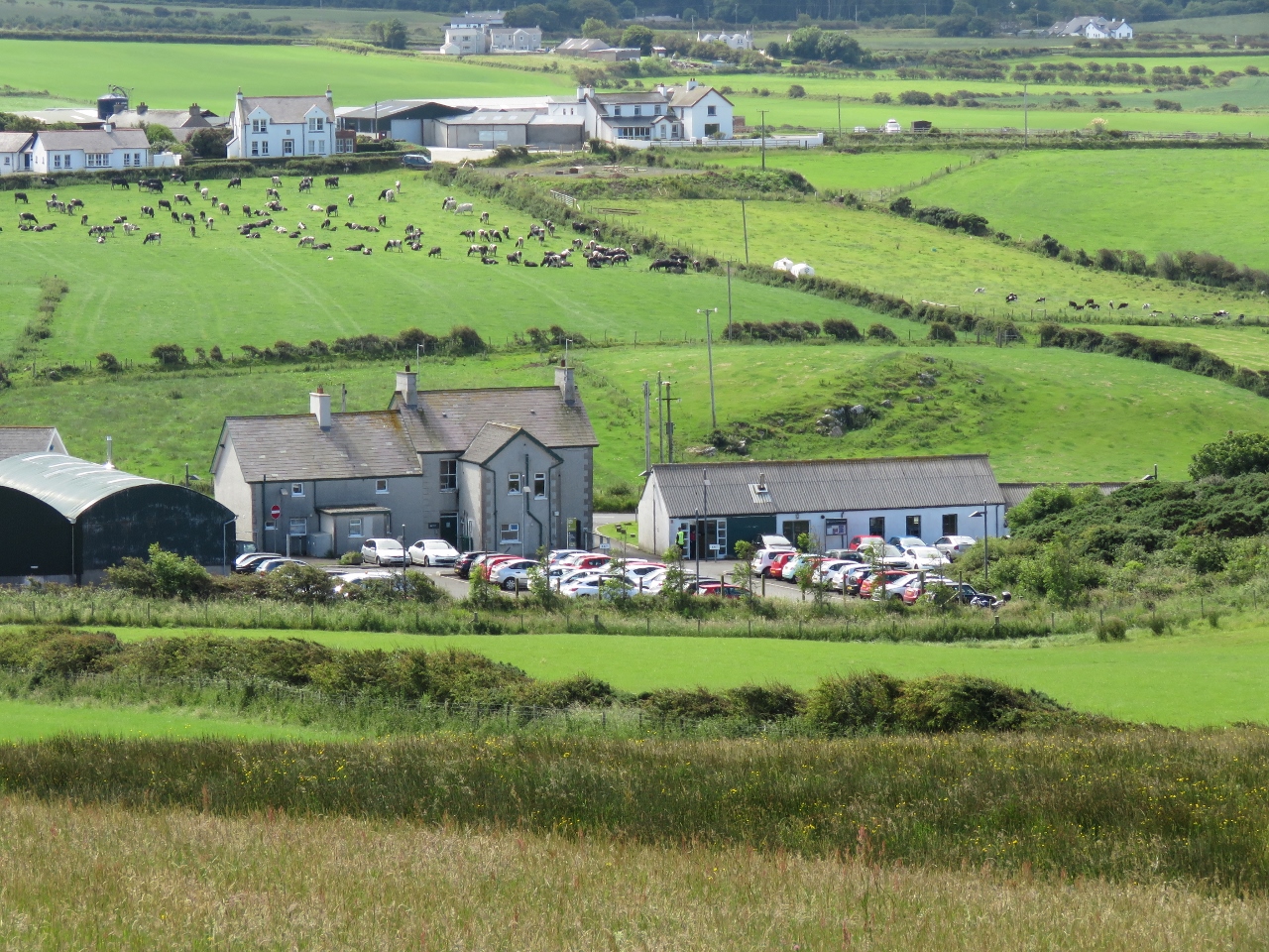 |
Parking
Position: -6 30.80, 55 14.22
We’d arrived relatively early on a weekday morning with plenty of parking. By the time we left two hours later, even the third overflow parking lot was filled and cars were parked a long way down the road. Apparently it gets a lot busier later in the day and on weekends. Hard to imagine.
|
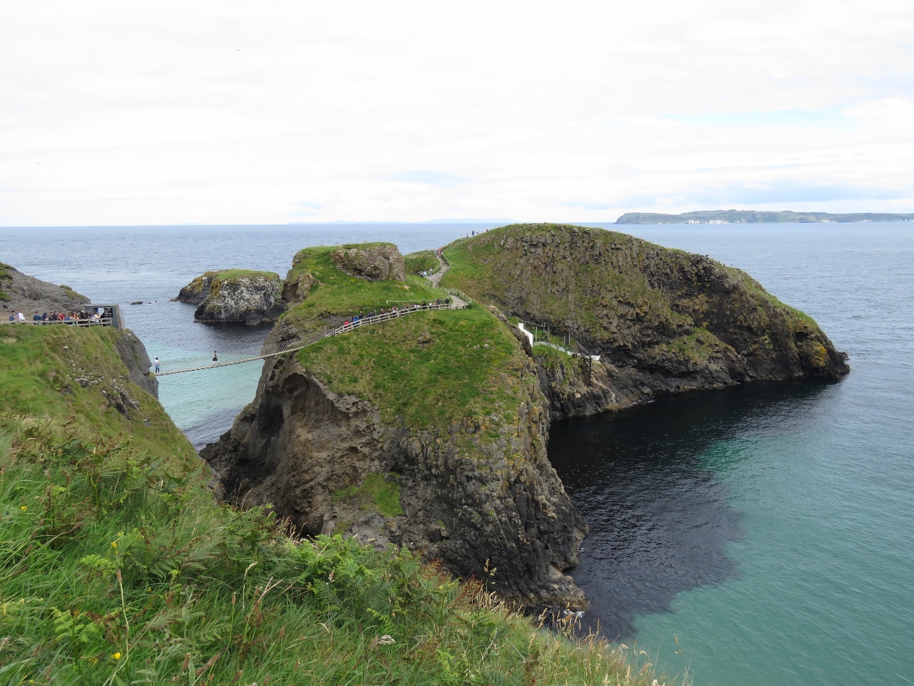 |
Carrick-a-Rede Rope Bridge
Position: -6 19.95, 55 14.32
Our next stop on the tour was the Carrick-a-Rede Rope Bridge strung across a 60ft chasm between the mainland and the island of Carrick-a-Rede. Fisherman erected the bridge so they could check on their salmon nets.
|
 |
Skiff
Position: -6 19.95, 55 14.32
Salmon fishermen set their nets from Carrick-a-Rede by boat, with one end attached to shore and the rest laid out in an arc to trap approaching salmon.
|
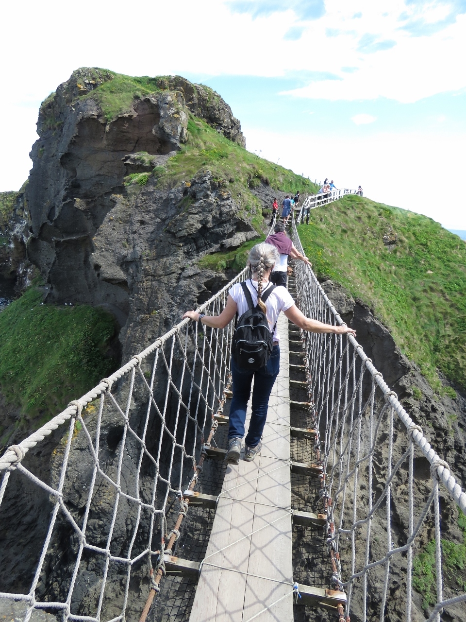 |
Crossing
Position: -6 19.92, 55 14.39
Jennifer crossing the bridge.
|
 |
Cliffs
Position: -6 20.04, 55 14.34
Mainland cliffs visible from Carrick-a-Rede Island. We’re not out of cliff country yet. The water here is a suprisingly clear and unusually turquiose in color.
|
 |
Carrick-a-Rede Island
Position: -6 19.86, 55 14.44
Looking west across wave-swept Carrick-a-Rede Island to Sheep Island in the distance.
|
 |
Seagull Chick
Position: -6 19.86, 55 14.43
This cute seagull chick was hiding in the grass at Carrick-a-Rede Island.
|
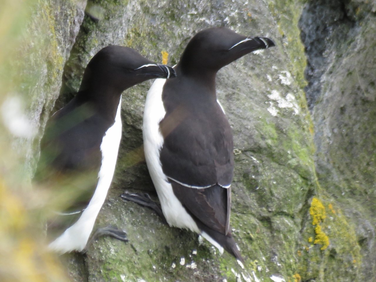 |
Razorbills
Position: -6 19.92, 55 14.38
Razorbills tucked along the cliff wall at Carrick-a-Rede Island.
|
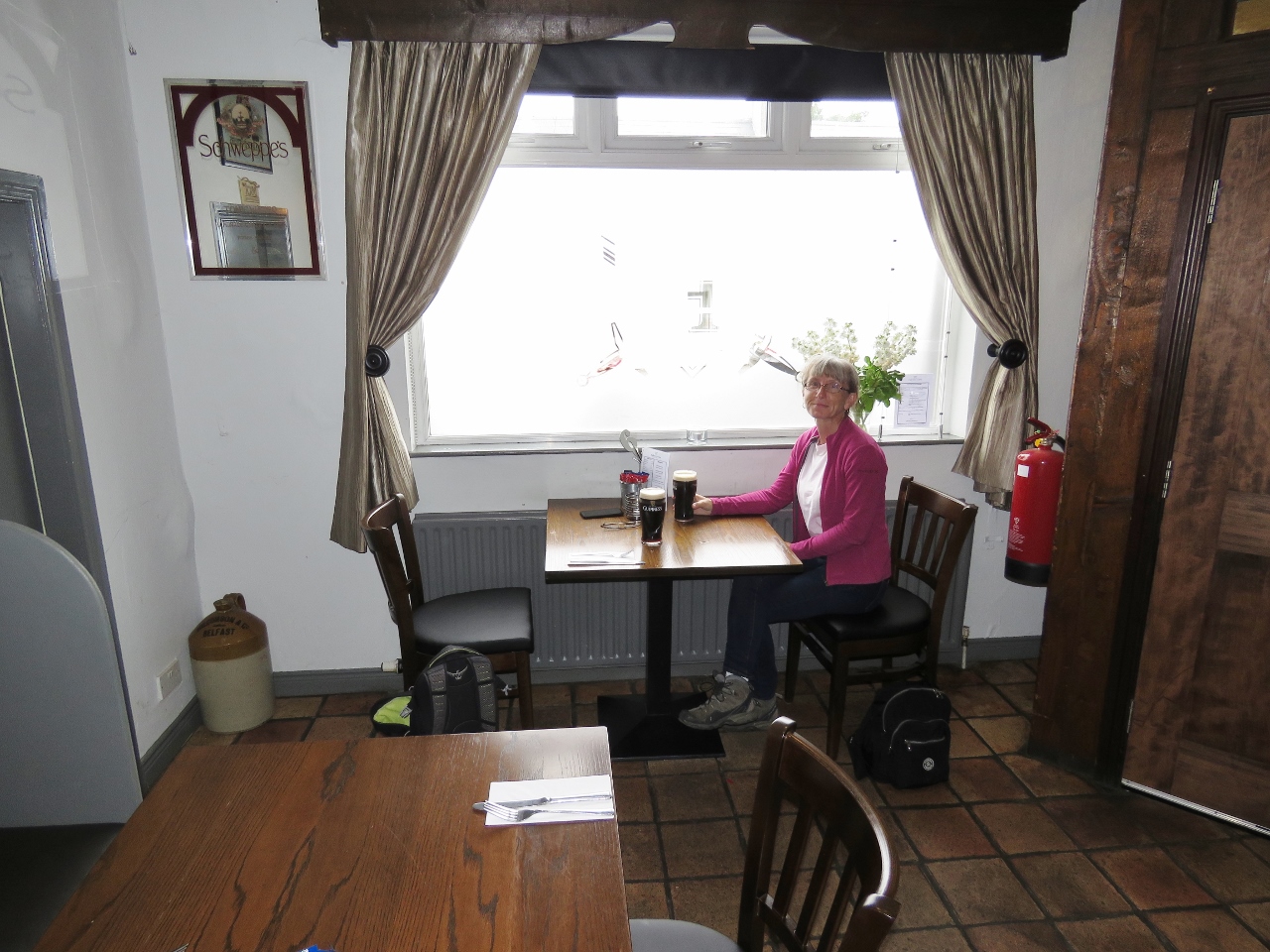 |
Fullterton Arms
Position: -6 21.46, 55 14.17
We stopped for a good lunch, and a Guinness, at The Fullerton Arms pub in Ballintoy.
|
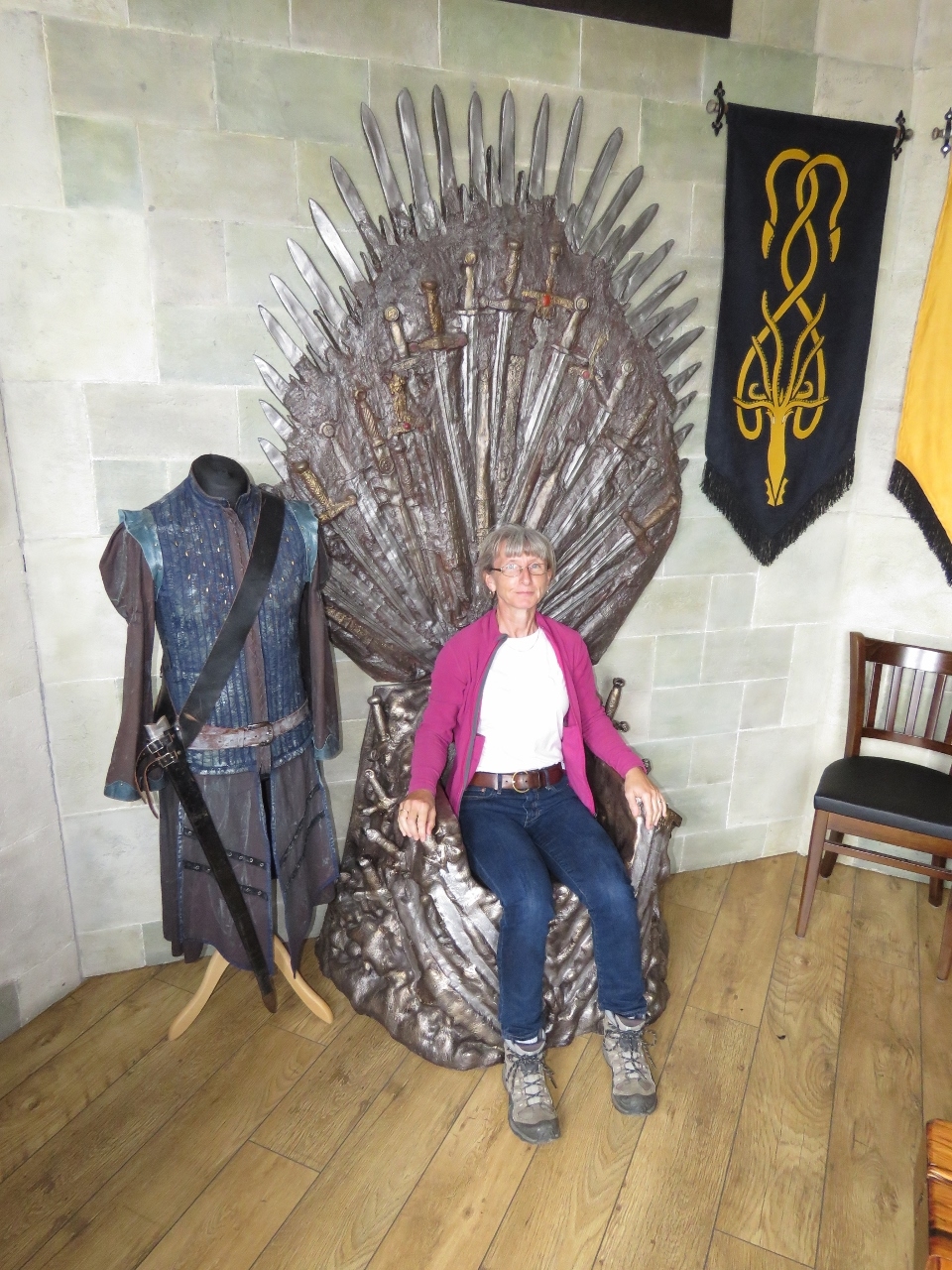 |
Game of Thrones
Position: -6 21.46, 55 14.18
Ballintoy was one of the Northern Ireland filming locations for the HBO series Game of Thrones. Ten doors representing an episode in Season 6 have been placed in pubs throughout near filming locations throughout Northern Ireland and the Fullerton Arms has Door Number 6. Throughout our lunch, a constant stream of visitors came in to take a picture of the door and sit in the throne.
|
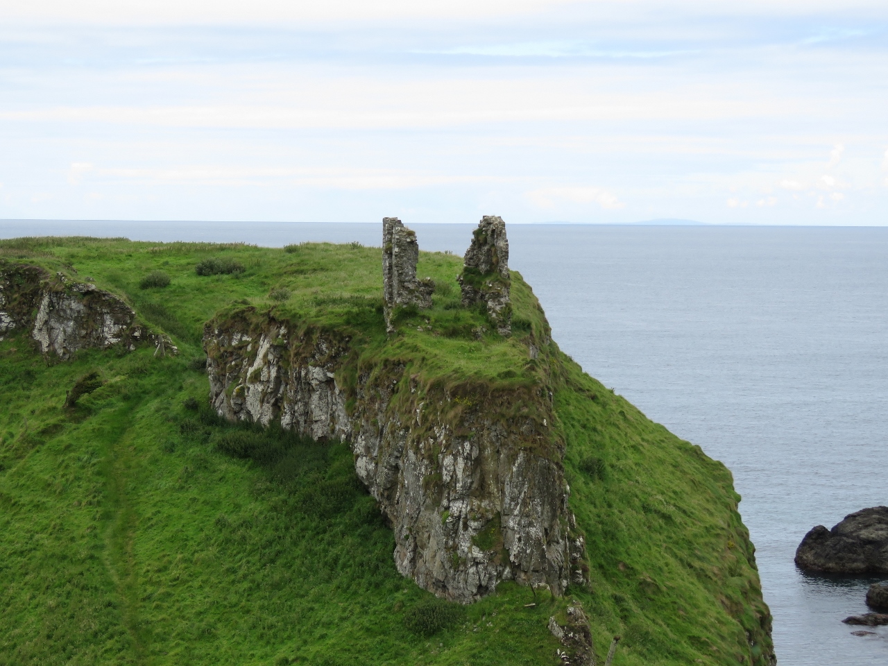 |
Castle
Position: -6 26.91, 55 14.24
Dunseverick Castle dates to at least the 5th century AD, when St. Patrick is said to have visited. The castle stood until the mid 1600s, when Oliver Cromwell’s troops captured and destroyed it.
|
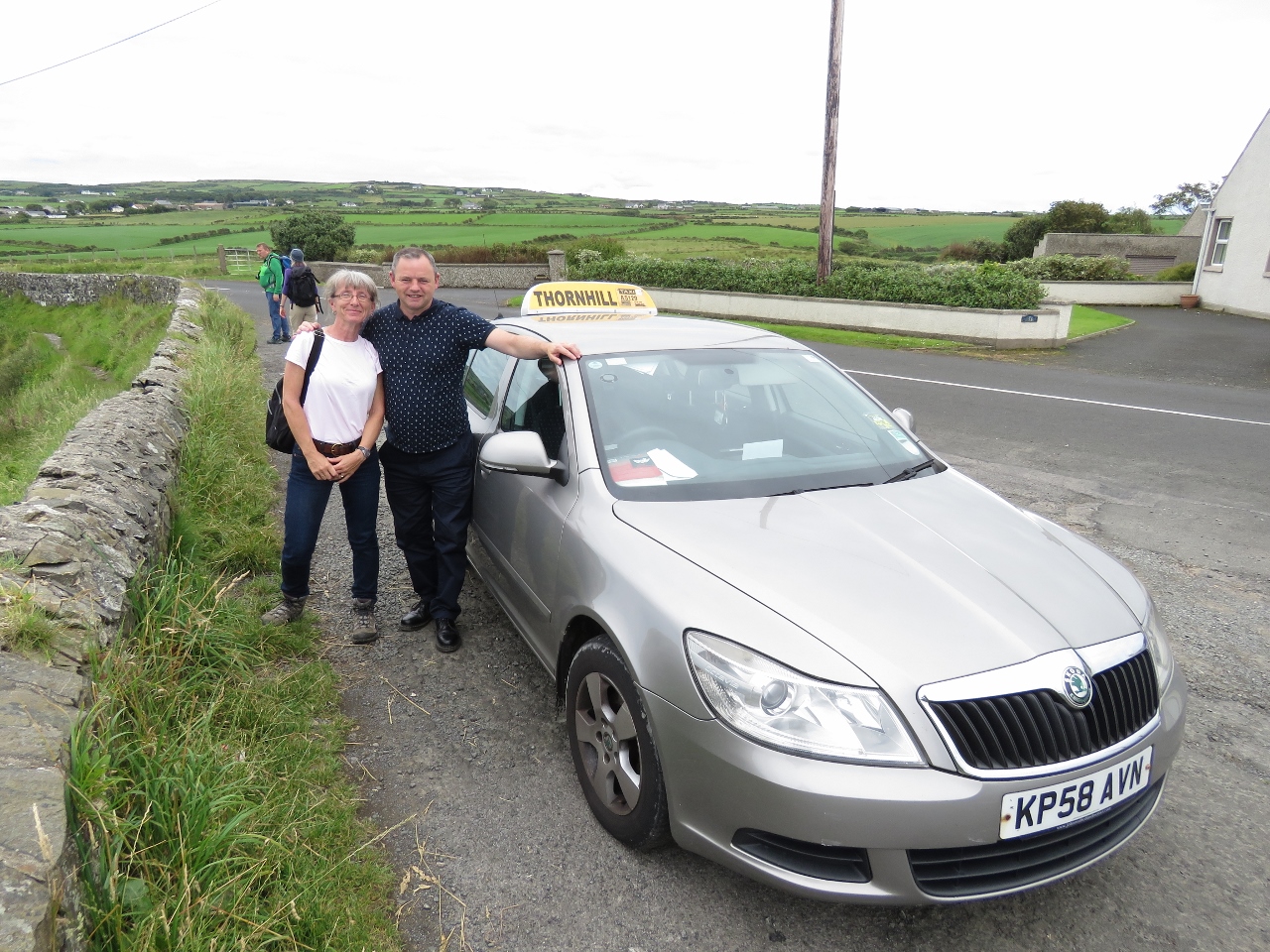 |
Derry Blue Badge Guide
Position: -6 26.91, 55 14.24
Our driver Neil McLaughlin of Derry Blue Badge Guide. We had a great day touring around with Neil and learned much about the history of Kerry and Northern Ireland in general.
|
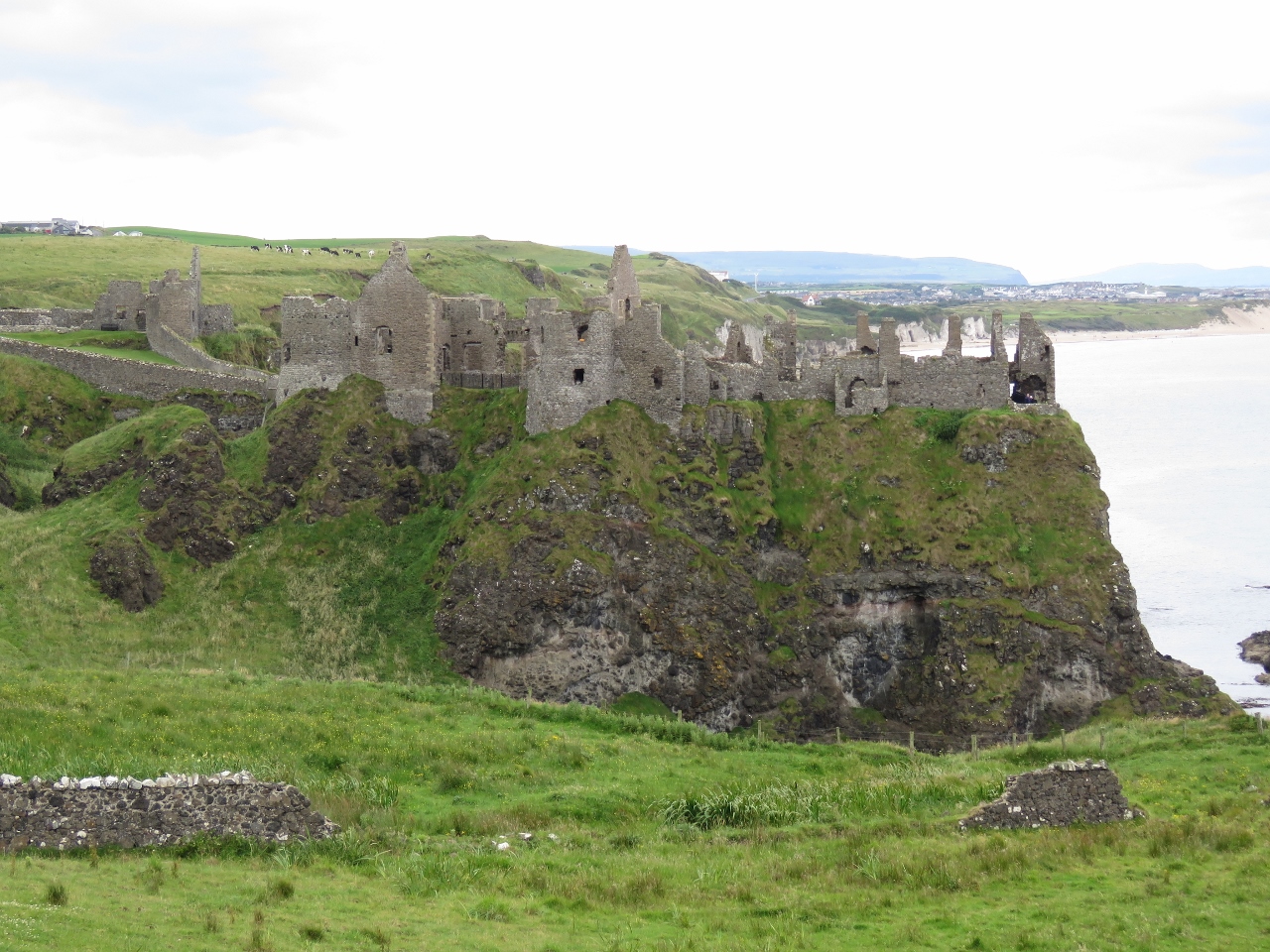 |
Dunluce Castle
Position: -6 34.47, 55 12.79
Dunluce Castle is a dramatic fortress perched on a cliff above the sea. A castle was first built here in the 13th century, and was expanded and modified over the years as it passed through different owners. The castle was the seat of the MacDonnell family in the 16th and 17th centuries, who abandoned it following their impoverishment in 1690 after the Battle of the Boyne.
|
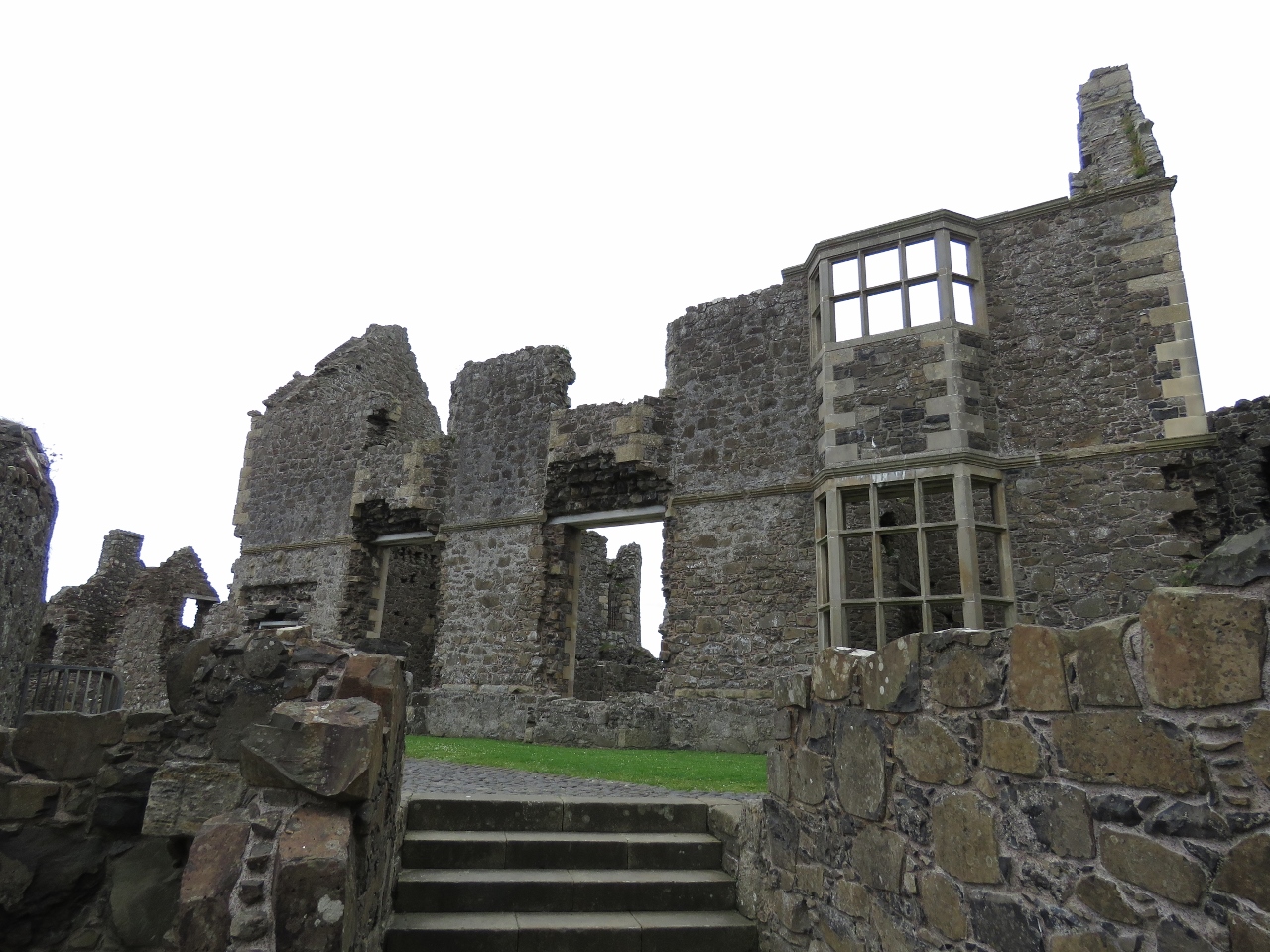 |
Manor House
Position: -6 34.76, 55 12.69
Although the castle has been abandoned for centuries, a surprising amount still stands. This is the outer wall of a Renaissance-style manor house that the MacDonnells built within the castle walls.
|
 |
Sea Arch
Position: -6 34.76, 55 12.69
Sea arch visible from Dunluce Castle.
|
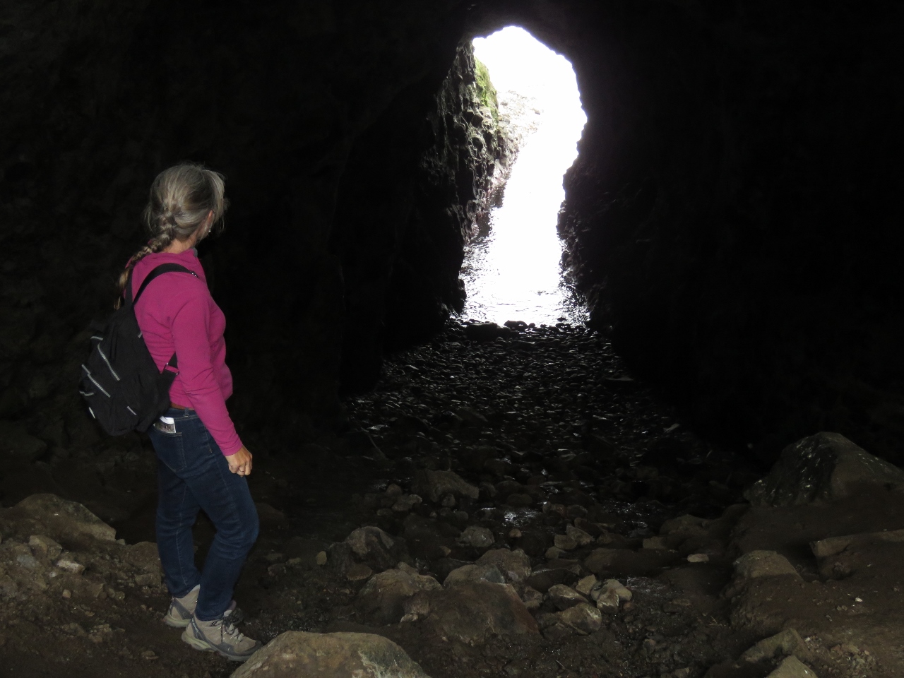 |
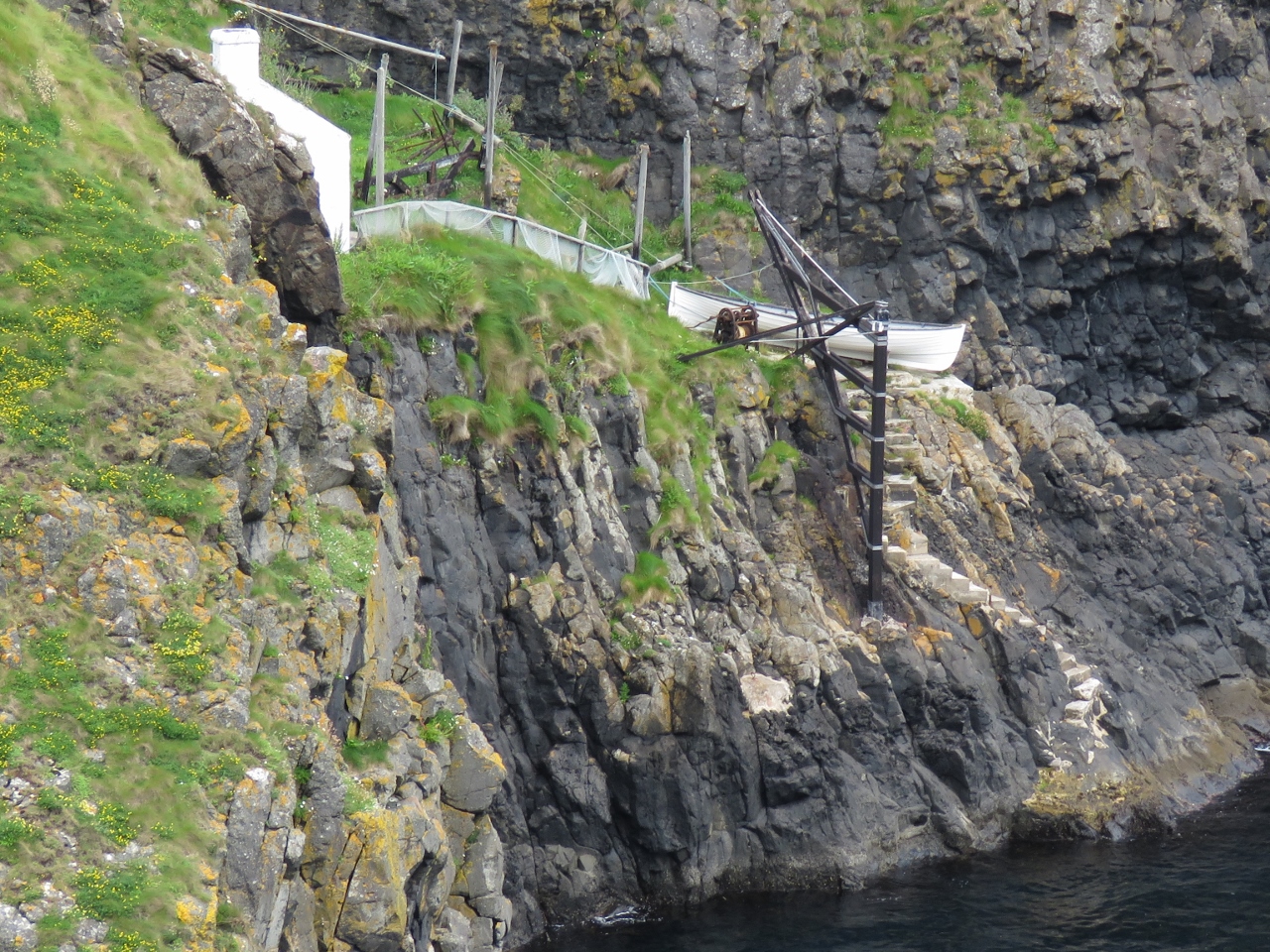
Mermaid’s Cave
Position: -6 34.75, 55 12.67
The only way to approach Dunluce Castle by water is under the castle through Mermaid’s Cave in a small boat at high tide.
|
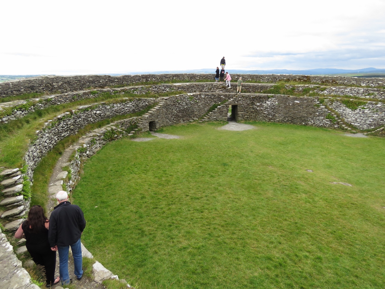 |
Grianan of Aileach
Position: -7 25.67, 55 1.44
Our final stop for the day was Grianan of Aileach, a restored ring fort high above Lough Swilly.
|
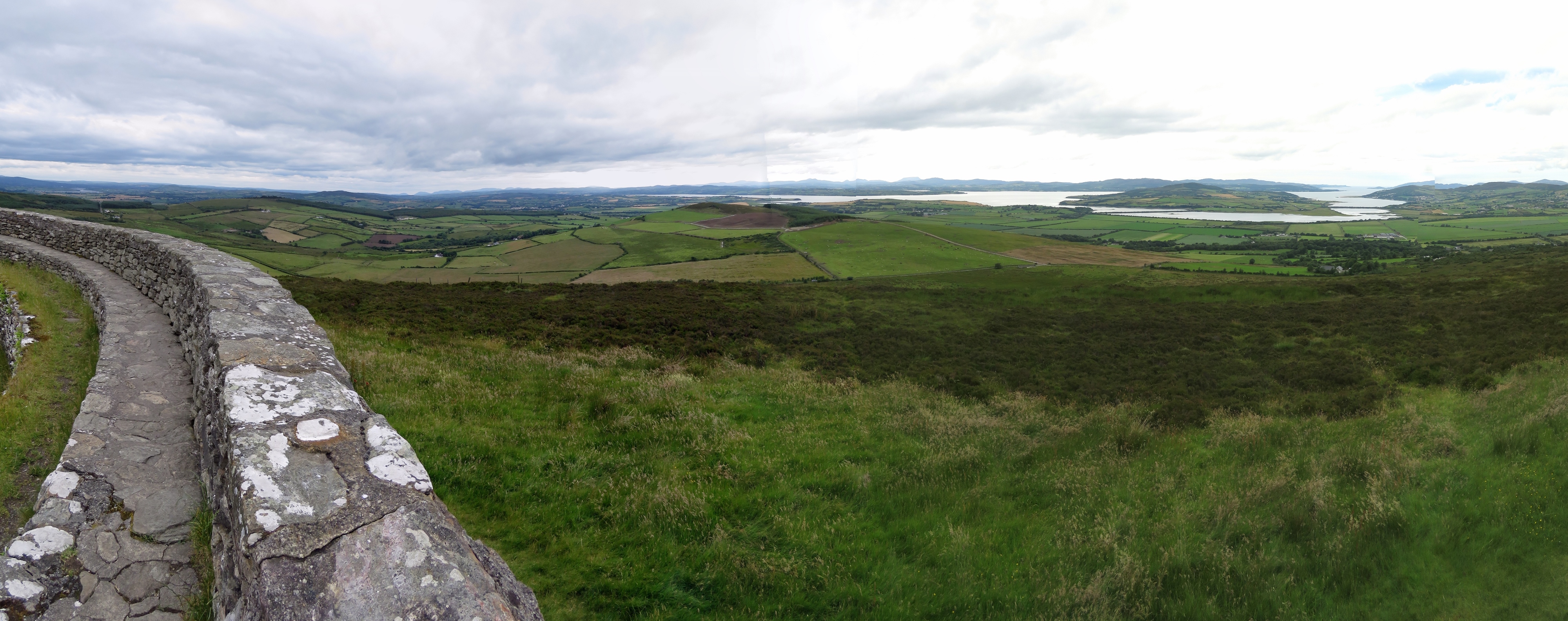 |
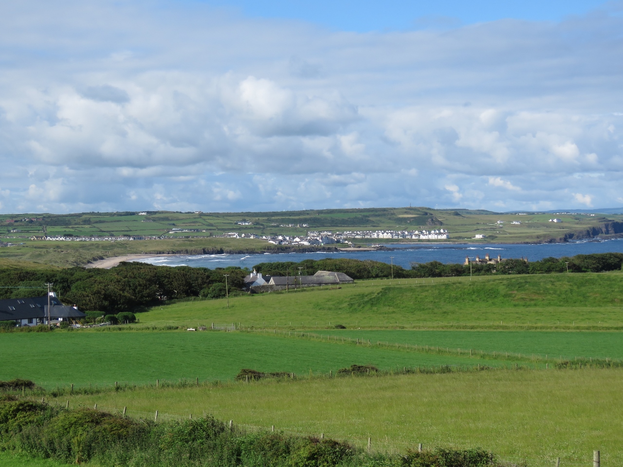
Lough Swilly
Position: -7 25.67, 55 1.44
Grianan of Aileach has a sweeping 360° view of the area. At the far right of the photo is the entrance to Lough Swilly from the Atlantic. The Lough Swilly Marina is closer in the right, just beyond a causeway connecting large Inch Island with the mainland. To the left of Inch Island, Lough Swilly continues to its head at the town of Letterkenny.
|
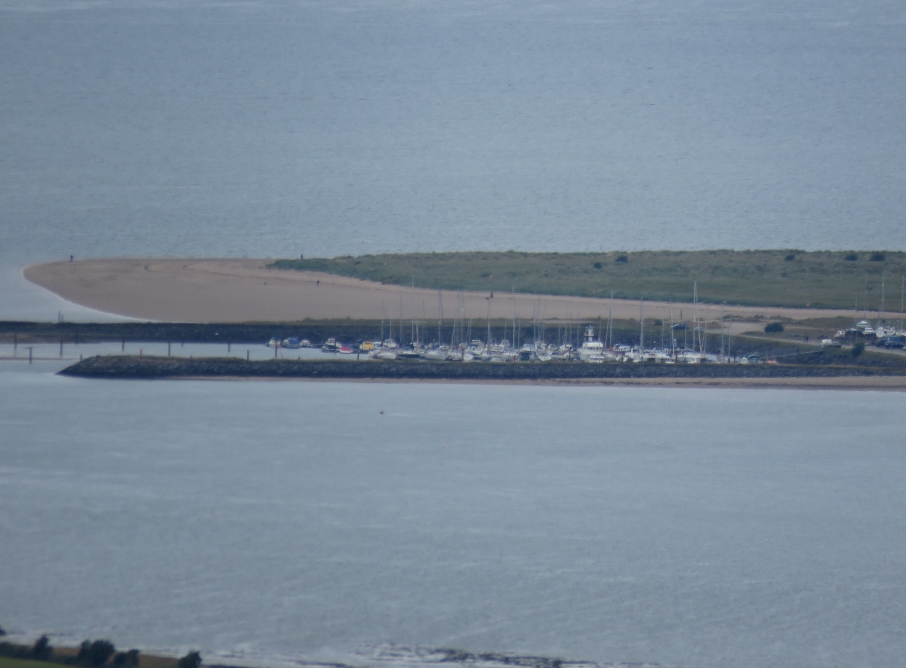 |
Lough Swilly Marina
Position: -7 25.66, 55 1.44
A close-up to the Lough Swilly Marina from Grianan of Aileach. Dirona is visible to the right of center.
|
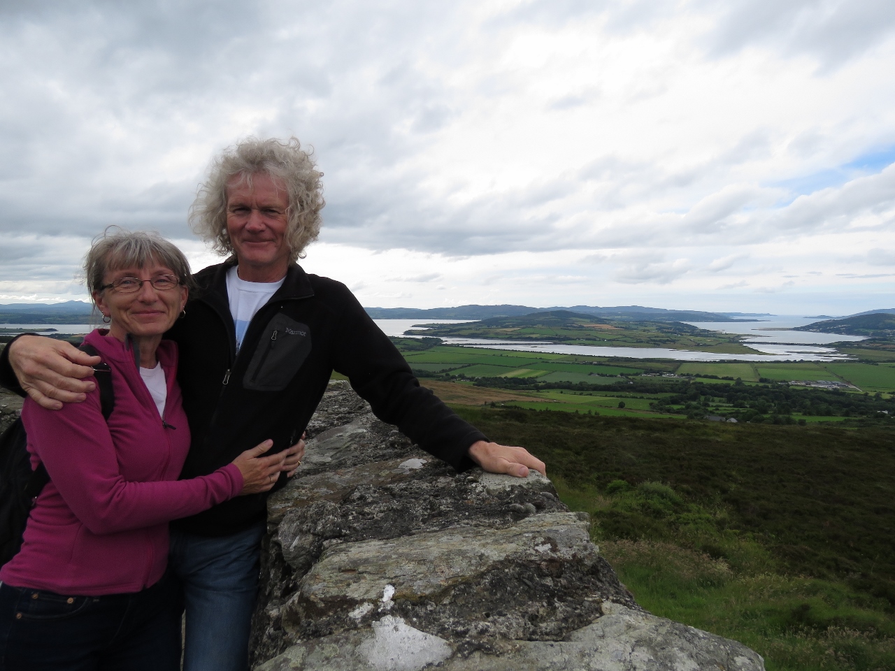 |
A Great Day
Position: -7 25.67, 55 1.43
We had a great tour of the Causeway Coast with Neil, who also suggested we visit Grianan of Aileach. We didn’t know about it and otherwise would have missed those amazing views. Several people at the marina that evening asked where we’d been and were especially pleased that we’d been to the fort.
|

|
Click the travel log icon on the left to see these locations on a map, with the complete log of our cruise.
On the map page, clicking on a camera or text icon will display a picture and/or log entry for that location, and clicking on the smaller icons along the route will display latitude, longitude and other navigation data for that location. And a live map of our current route and most recent log entries always is available at http://mvdirona.com/maps. |
If your comment doesn't show up right away, send us email and we'll dredge it out of the spam filter.