Rathlin Island is Northern Ireland’s only inhabited island and also is home to one of the largest seabird colonies in the UK. The West Light Seabird Centre is perched on a clifftop above the lighthouse at the western end of the island where visitors can take in the spectacular scenery, watch the thousands of seabirds covering the cliffs, and tour the lighthouse.
Rathlin Island was our first landfall in the UK after leaving the Republic of Ireland, and we cleared through by phone once we’d anchored. And after all that concern, we ended up being moored in Northern Ireland right on the July 12th termination of the Orange marching season. But we didn’t see even a hint of demonstration or conflict.
Trip highlights from July 11th through 13th, 2017 follow. Click any image for a larger view, or click the position to view the location on a map. And a live map of our current route and most recent log entries always is available at http://mvdirona.com/maps
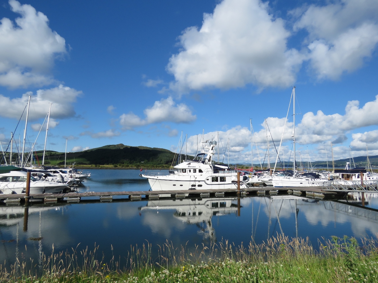 |
Morning Calm
Position: -7 28.77, 55 5.26
A beautiful calm morning at Loch Swilly Marina. We’ve moved from our original berth to a temporary spot near the walkway to take on fuel.
|
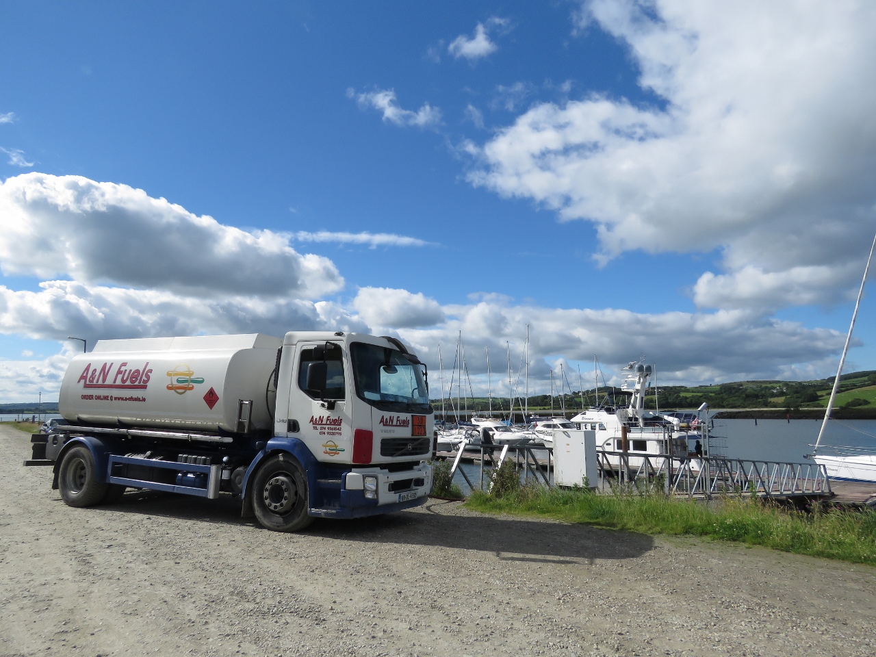 |
Fueling
Position: -7 28.77, 55 5.26
We weren’t low on fuel, but wanted to take advantage of the good prices in Ireland and top up since our last fill in Kinsale.
|
 |
Exit
Position: -7 28.85, 55 5.13
Looking back to the marina entrance as we leave. With the fueling we ended up cutting it a little closer than we wanted to on the tide, but still managed to escape without touching bottom.
|
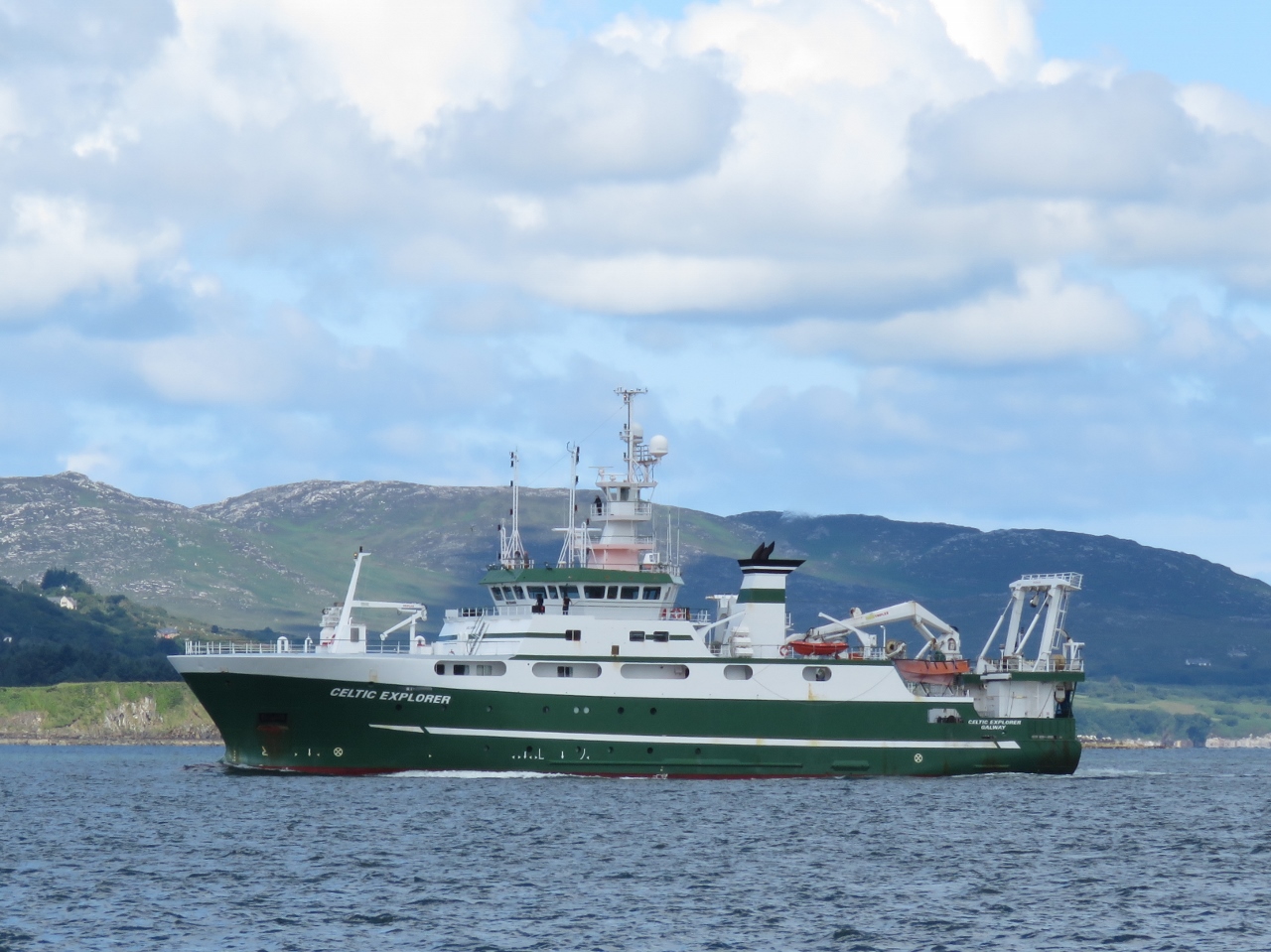 |
Celtic Explorer
Position: -7 29.29, 55 7.03
The fishing vessel Celtic Explorer entering Loch Swilly just after we crossed the Fahan Bar.
|
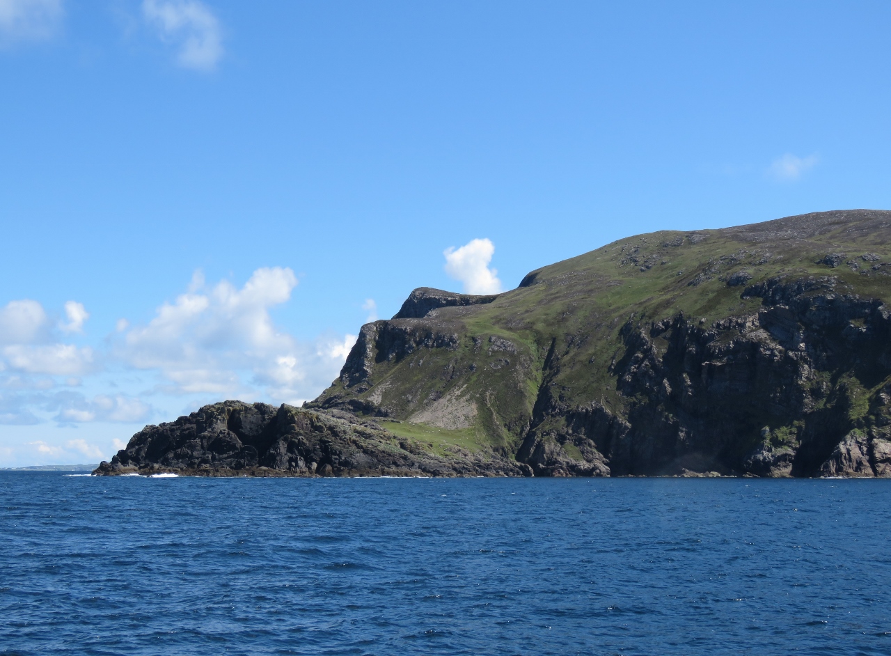 |
Dunaff Head
Position: -7 32.30, 55 16.83
Cliffs at Dunaff Head as we exit Lough Swilly.
|
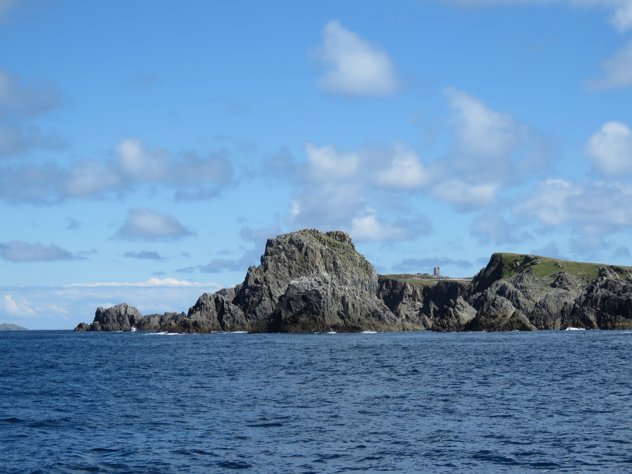 |
Malin Head
Position: -7 24.67, 55 22.47
Rounding Malin Head, the most northerly point in mainland Ireland. A Napoleanic Signal Tower is visible between the peaks.
|
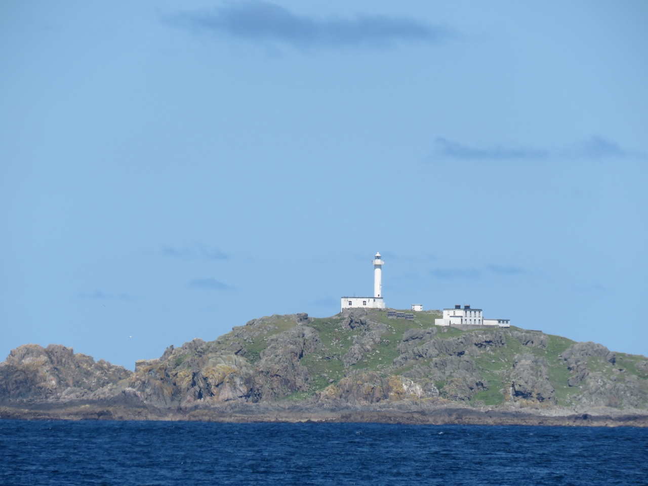 |
Inishtrahull Lighthouse
Position: -7 16.02, 55 23.56
The light on Inishtrahull Island is the most northern one in Ireland. Along with the light on Tory Island it forms one of the two main landfall lights for shipping from the Atlantic rounding the north coast of Ireland. A light on the east end of Inishtrahull Island was first installed in 1812, mainly because the British Navy was using Lough Foyle to the south. In 1952, the Commissioners of Irish Lights decided to modernize the light and replaced it by a new one on the west end of the island. The old one was demolished when it was found to obscure the new light.
|
 |
Ballast
Position: -7 12.31, 55 23.16
The forward enging room fluorescent light wouldn’t turn on. Changing bulbs didn’t help, so we changed the ballast and we’ll order a new spare ballast.
|
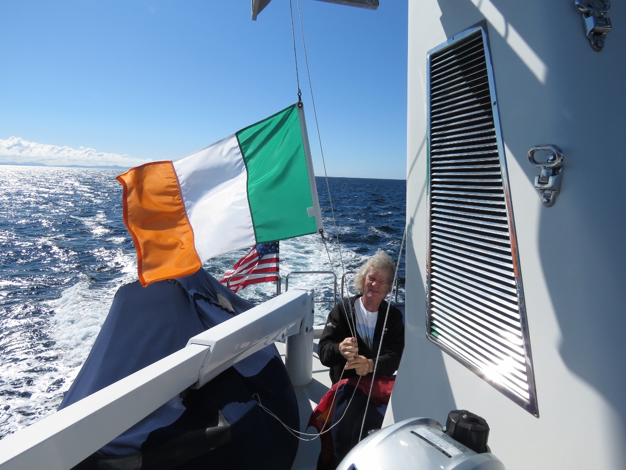 |
Leaving Ireland
Position: -6 45.96, 55 20.29
Taking down our Irish Tri-Color courtesy flag as we cross the border between the Republic of Ireland and the United Kingdom.
|
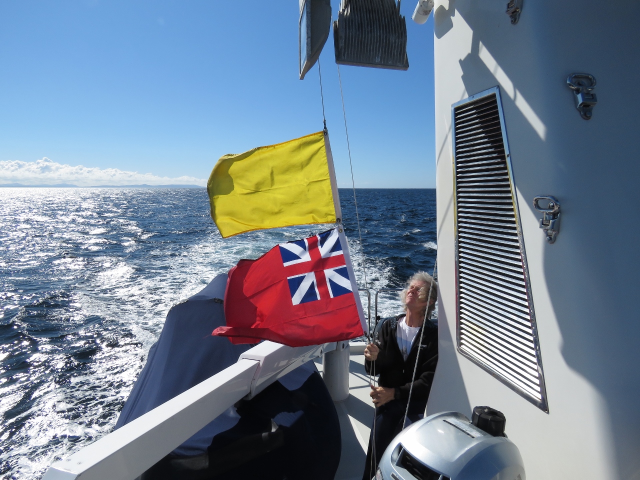 |
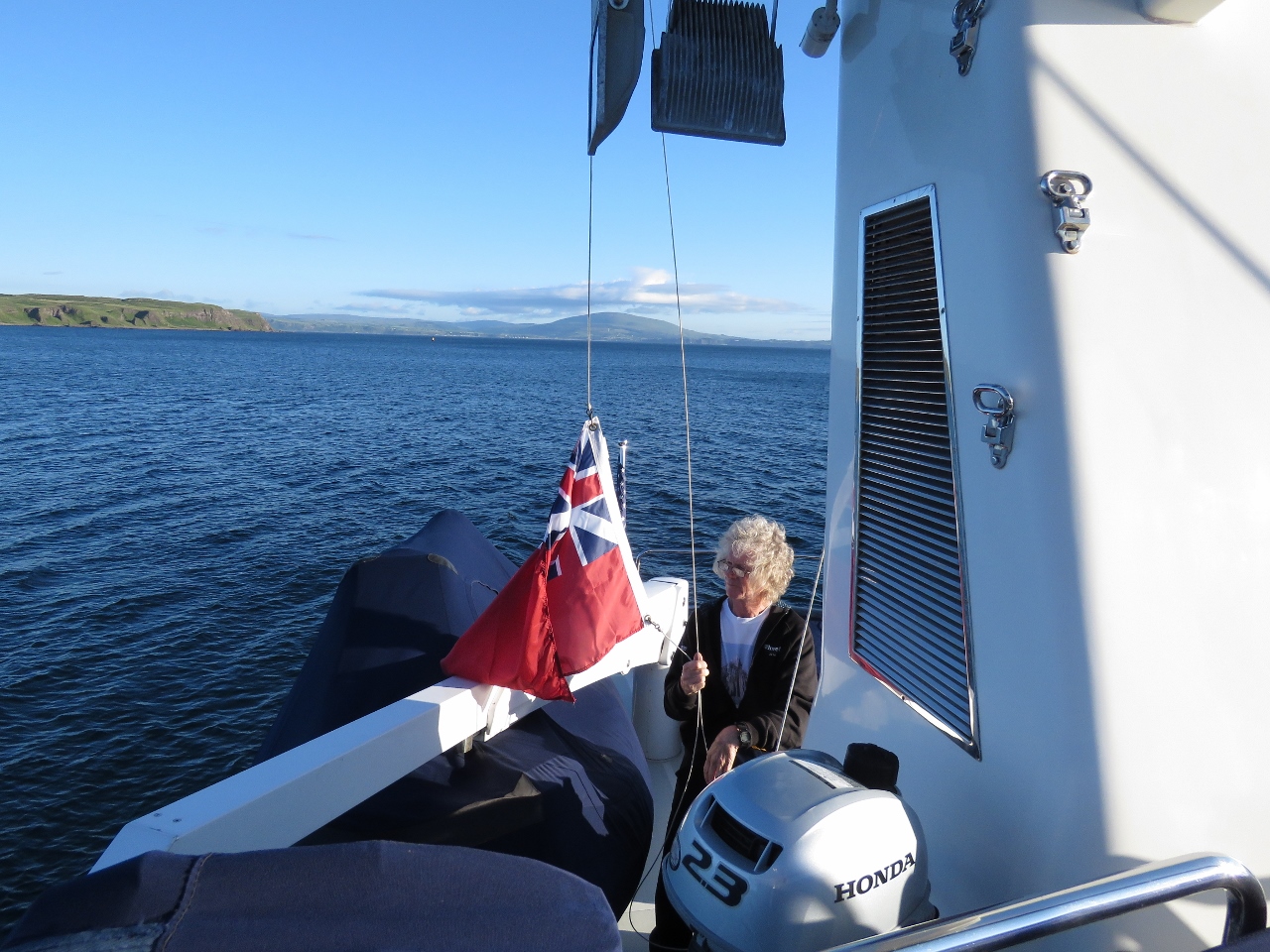
Entering UK
Position: -6 45.62, 55 20.24
Raising a quarantine flag and the UK Red Ensign as we enter Northern Ireland. Most countries use their national flag as a courtesy flag, but in the UK the national maritime flag, the Red Ensign, is used both as a courtesy flag and the ensign for UK-registered pleasure craft.
|
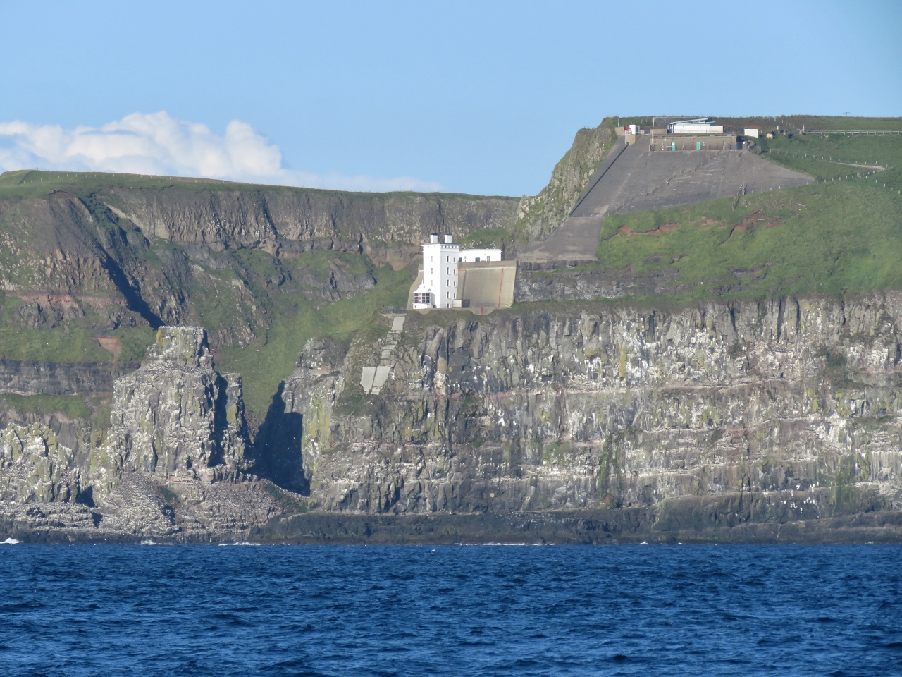 |
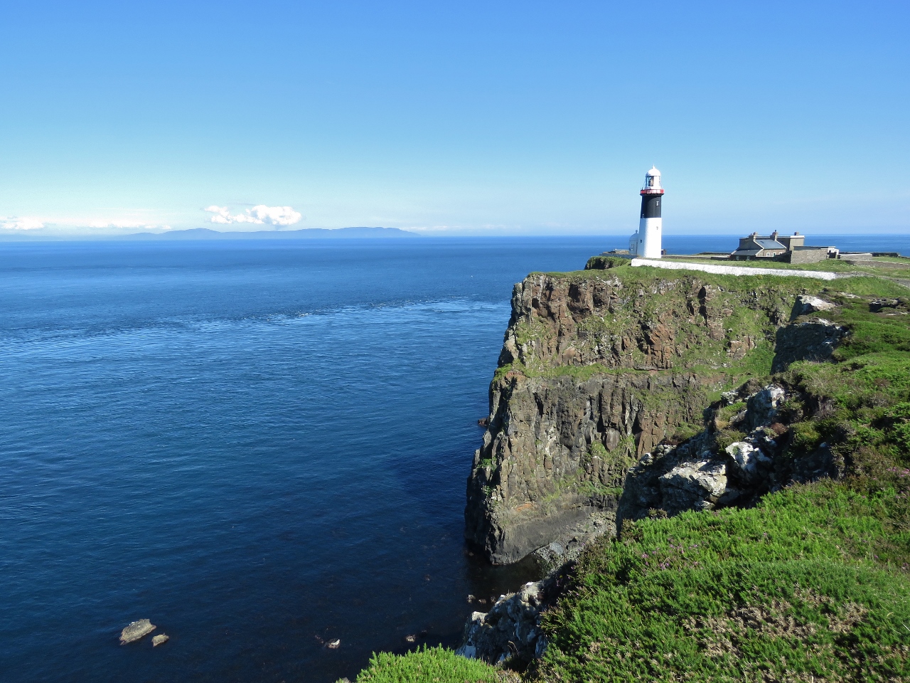
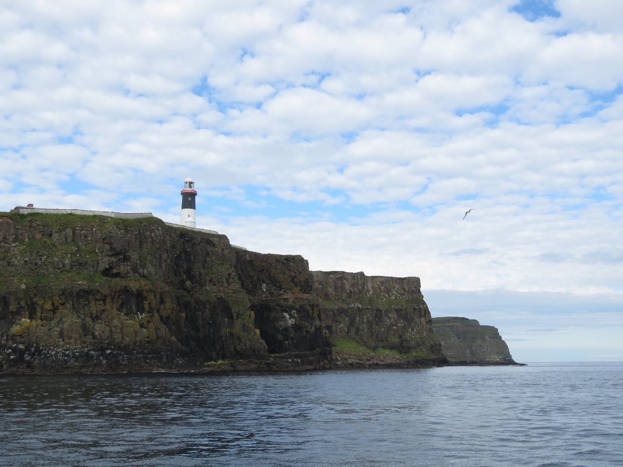
Upside-Down Lighthouse
Position: -6 19.14, 55 17.60
The lighthouse on the west end of Rathlin Island in Northern Ireland is called the “Upside-Down Lighthouse” because the light is below the tower to keep it below the fog line. The light is further unusual in that it is red, rather than white. The whole facility took over five years to build between 1910 and 1916. Little flat land was available and the cliffs were heavily reinforced with concrete to prevent rockfalls and eroson.
A diaphone compressed-air fog signal was established in 1925 that could be heard 20 miles away and was so loud it was known as the ‘Rathlin Bull’ and was once described as ‘a loud, droning sound, like a bull in agony’. The lighthouse was destaffed in 1983 and the foghorn was replaced by an electric version in 1982 and discontinued in 1995. The building at the top of the cliff is the West Light Seabird Centre. Rathlin Island is home to one of the largest seabird colonies in the UK. |
 |
Bull Point
Position: -6 17.42, 55 17.45
Spectacular seascape at Bull Point on the southwest tip of Rathlin Island, with the lighthouse just visible to the right of center.
|
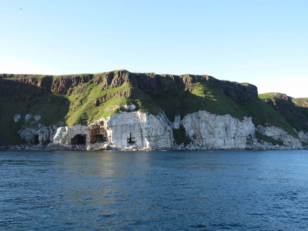 |
Cliffs
Position: -6 16.69, 55 17.37
Cliffs and caves along the south shore of Rathlin Island, just east of Bull Point.
|
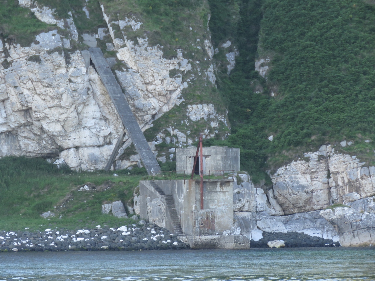 |
Jetty
Position: -6 16.20, 55 17.34
The old inclined railway and jetty built to land materials for the Rathlin West lighthouse.
|
 |
Cleared Through
Position: -6 12.41, 55 17.48
We quickly cleared into the UK by phone after landing at Rathlin Island and lowered our yellow quarantine flag. Even though we’re travelling within the EU between the Republic of Ireland and Northern Ireland, the UK requires pleasure craft operators to clear through for certain situations such as non-EU citizens on board.
|
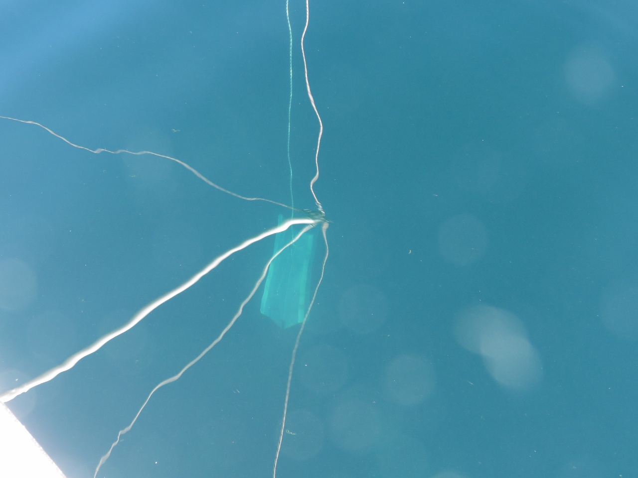 |
Flopper Stopper
Position: -6 12.42, 55 17.48
The anchorage at Rathlin Island is exposed to the south and west and even in these calm conditions a swell rolls through. The ‘flopper-stopper is a big help in reducing boat motion. The water is surprisingly clear here—the flopper-stopper plate is visible fifteen feet through the water.
|
 |
Bunkering
Position: -6 12.41, 55 17.50
Filling up the tender from one of the 29-gallon fuel tanks we keep on the boat deck.
|
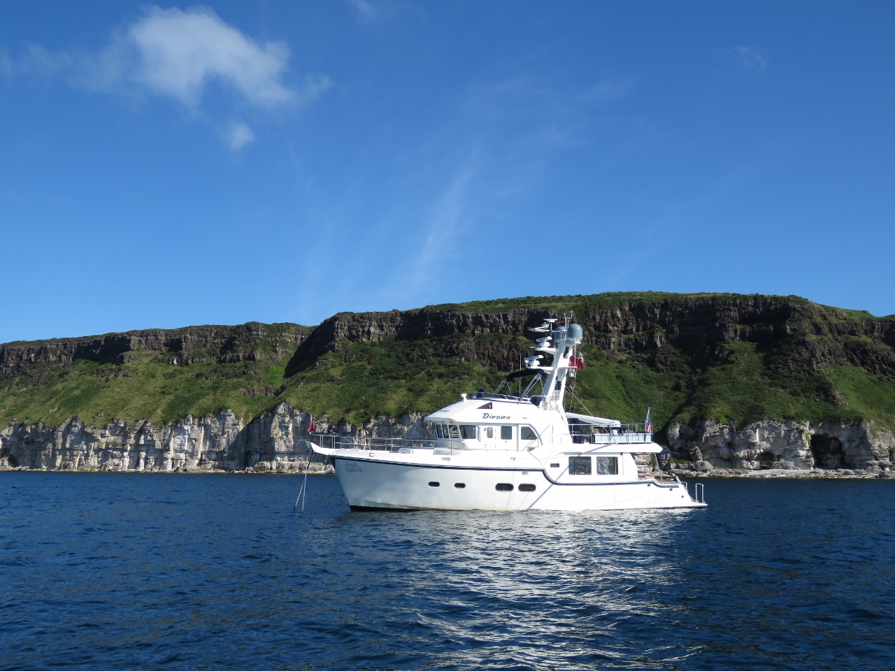 |
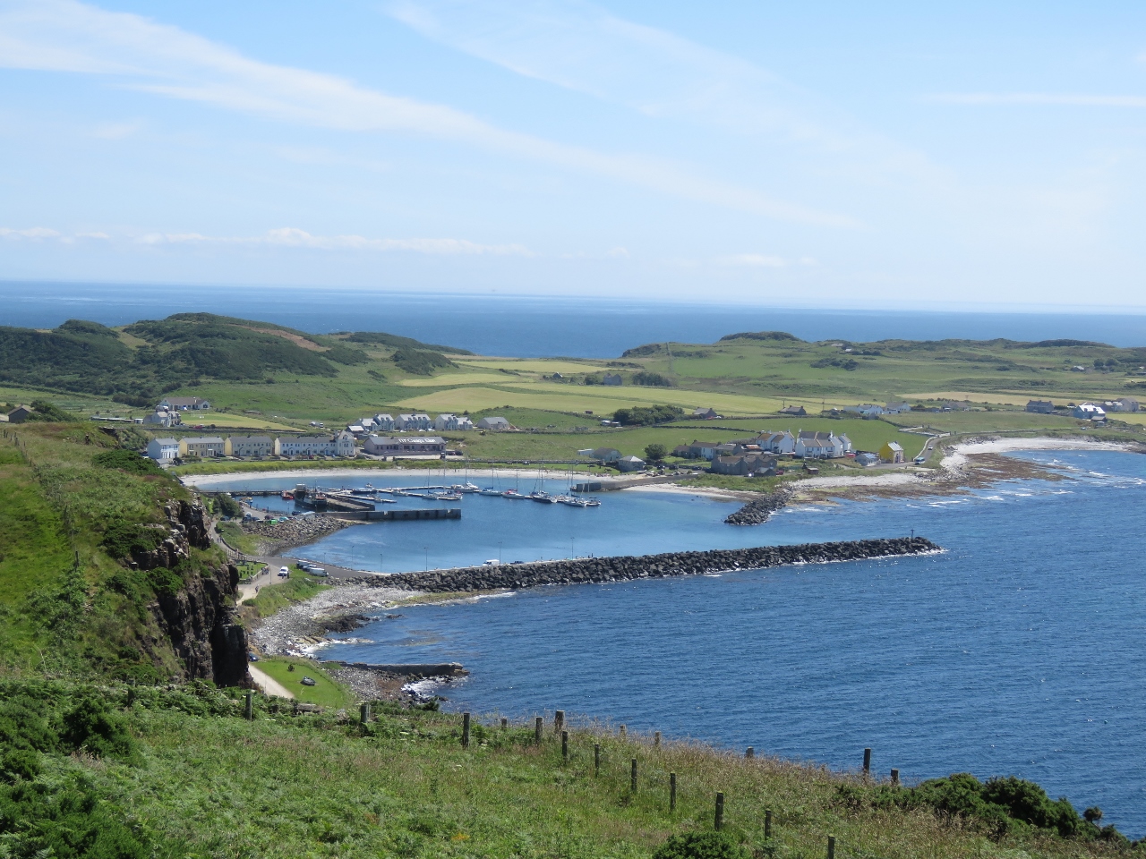
Dirona
Position: -6 12.24, 55 17.47
Dirona at anchor off the white cliffs of Rathlin Island. You’d not want to be here in rough weather, but with calm conditions this is a lovely anchorage.
|
 |
Knockans Viewpoint
Position: -6 12.41, 55 17.67
We landed the bikes ashore in the tender and set off on a bicycle tour of Rathlin Island. After a steep climb, the reward is this view from Knockans Viewpoint to the harbor where we moored the tender.
|
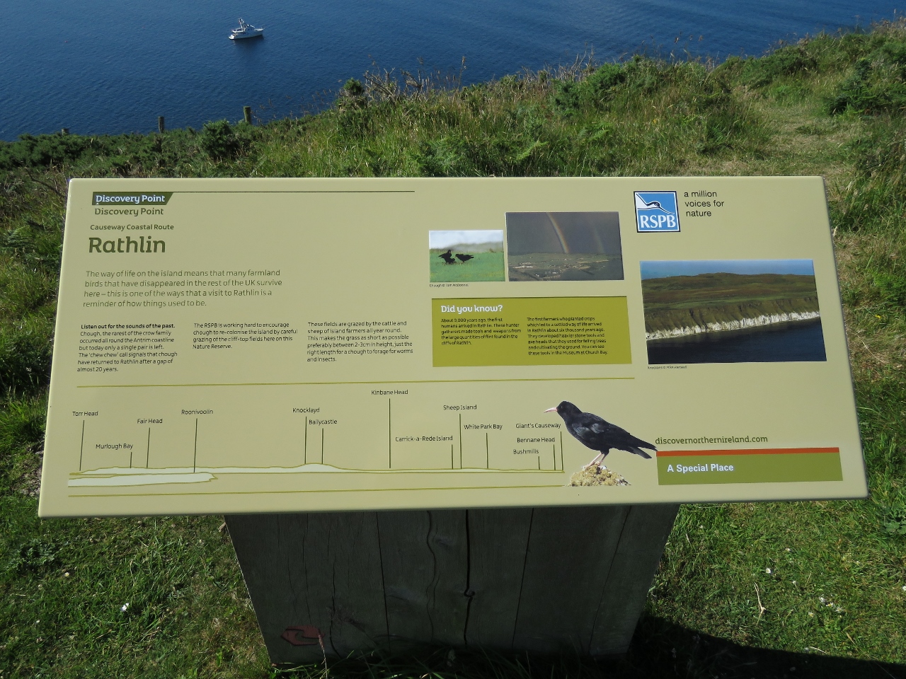 |
Causeway Coastal Route
Position: -6 12.41, 55 17.67
We’ve left the Wild Atlantic Way and now are on the Causeway Coastal Route. This interpretive sign at Knockans Viewpoint shows many mainland features on that route. Dirona is visible at anchor beyond the sign.
|
 |
Cows
Position: -6 16.23, 55 17.70
Biking through a herd of cows spread out across the road. The only reason they’re not right on the road likely is due to the occasional bus that passes through.
|
 |
Bull Point
Position: -6 16.77, 55 18.00
The fabulous seascape at Bull Point that we passed last night might be even more impressive viewed from the shore.
|
|
|
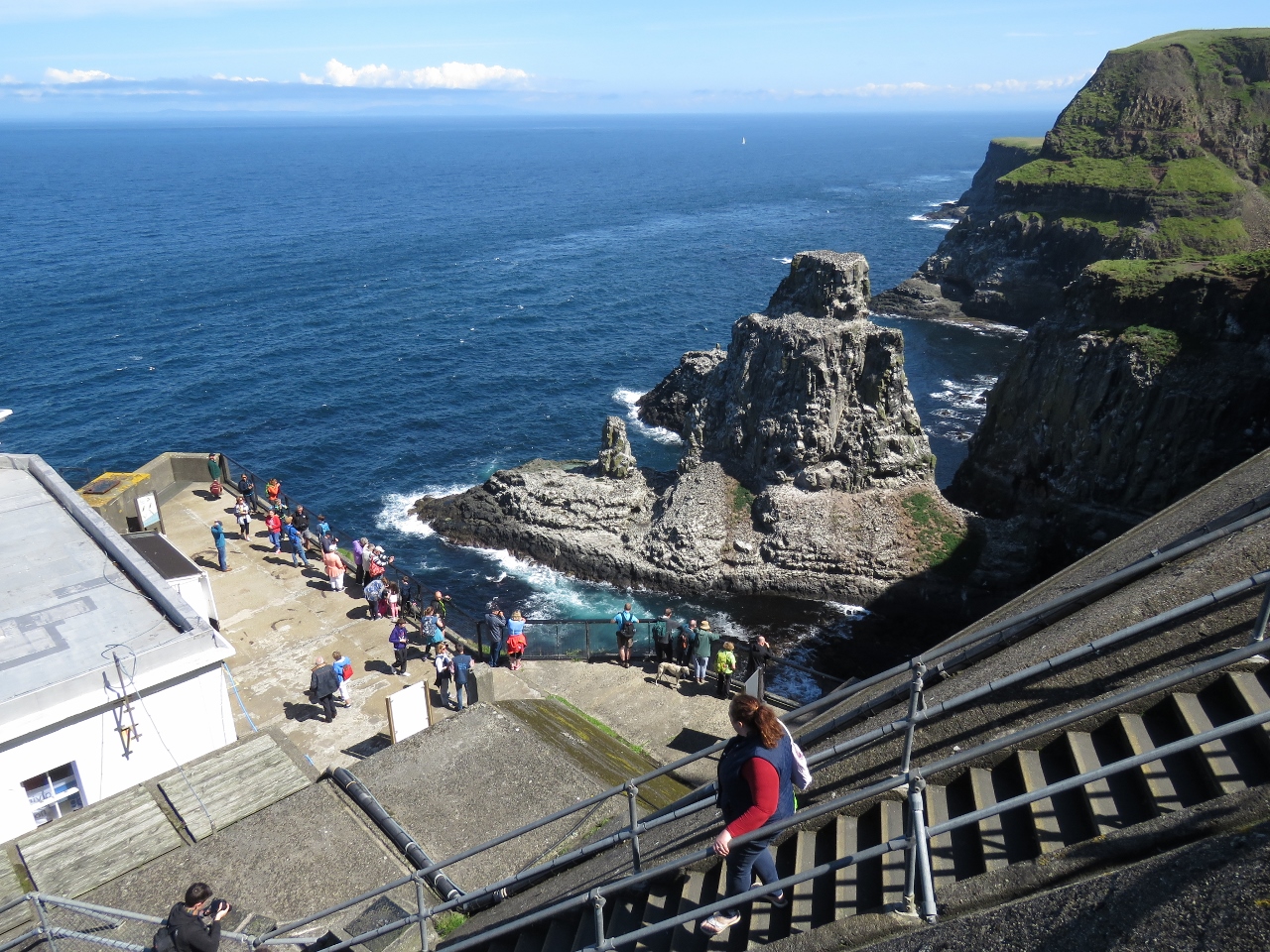
West Light Seabird Centre
Position: -6 16.80, 55 18.03
Descending the steps from the West Light Seabird Centre to the seabird viewing area. The steps are part of the original lighthouse construction, and the viewing center is adjacent to the top floor of the keeper’s tower on the left. Even without the seabirds, the seascape here astonishing and well worth the visit.
|
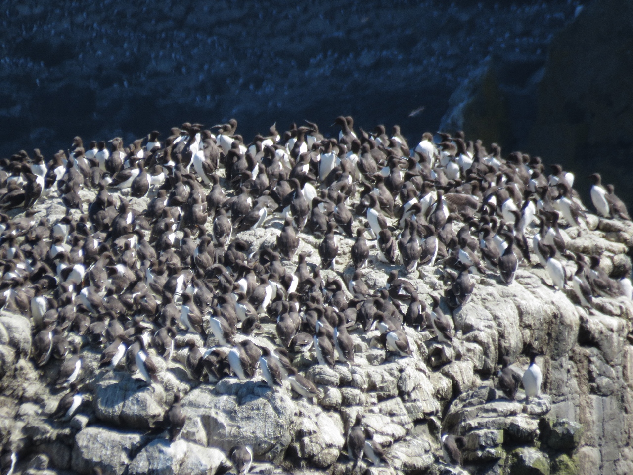 |
Birds
Position: -6 16.81, 55 18.05
Rathlin Island is home to one of the largest seabird colonies in the UK, including Guillemots, Razorbills, Kittiwakes, Fulmars and Puffins. Seabirds packed the stacks and cliffs and the air was filled with swooping birds and their calls. What an amazing place.
|
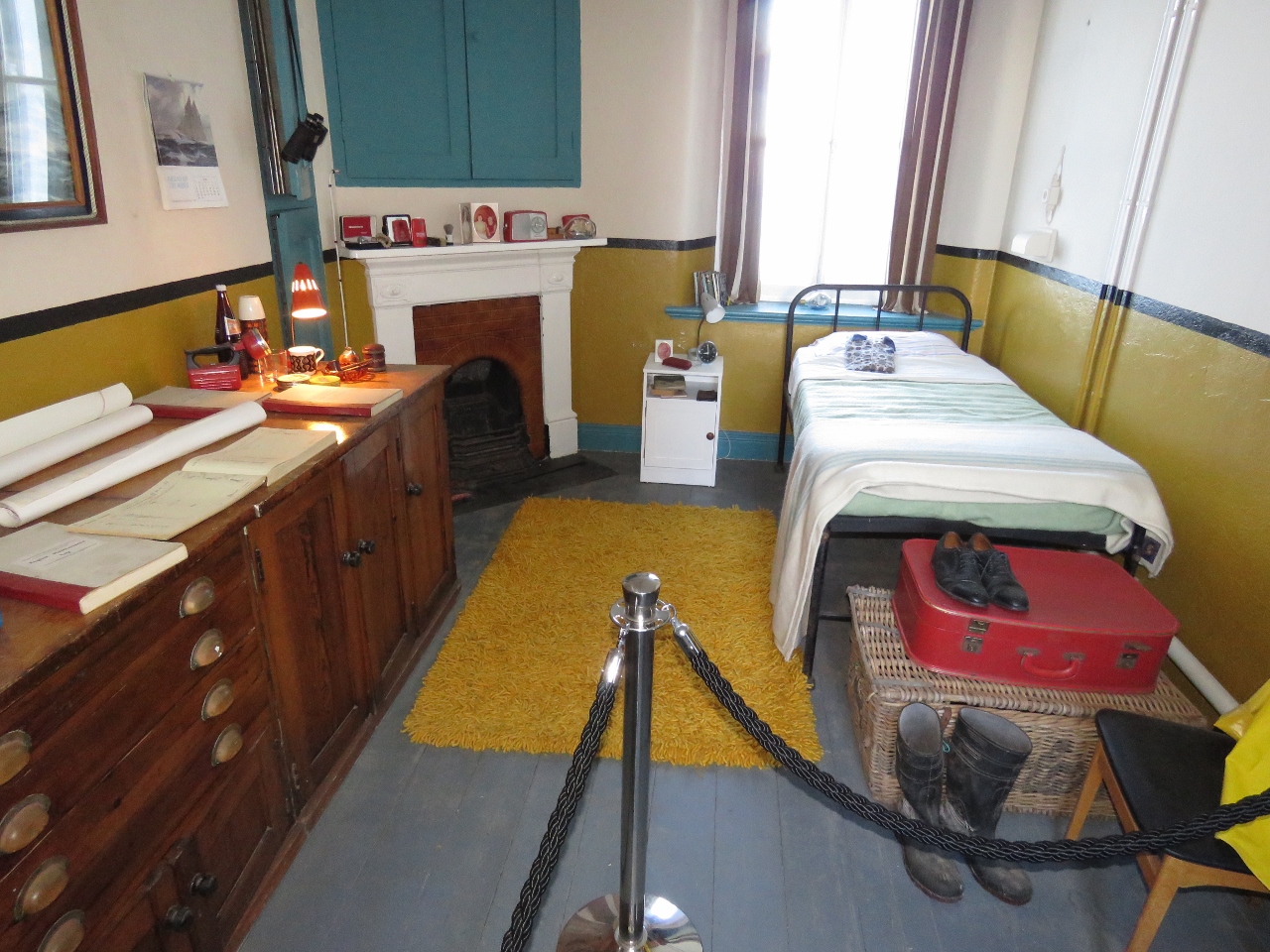 |
Museum
Position: -6 16.81, 55 18.05
The lighthouse tower itself was only opened to the public last year, so we were lucky to have a chance to visit. Inside the tower are several good displays detailing construction of the lighthouse, the keeper’s lives and information about the wildlife in the area.
|
 |
Fresnel Lens
Position: -6 16.82, 55 18.05
A view up to the huge First Order Fresnel Lens used to focus the distinctive red light. It’s the same size as the Sambro Lighthouse lens we saw in Halifax, Canada.
|
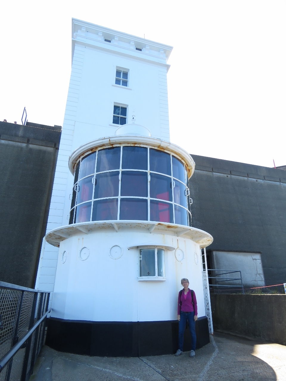 |
Upside-Down Lighthouse
Position: -6 16.82, 55 18.05
The lighthouse here is called the “Upside-Down Lighthouse” because the light is below the tower to keep the light under the fog line.
|
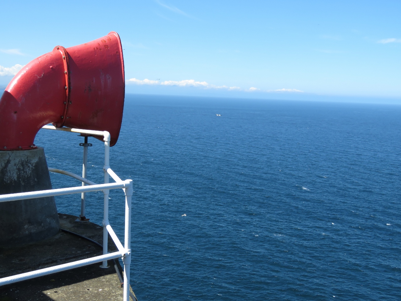 |
Fog Horn
Position: -6 16.78, 55 18.02
The old fog horn from the lighthouse was so loud it was known as the ‘Rathlin Bull’ and was once described as ‘a loud, droning sound, like a bull in agony’. The foghorn was replaced by an electric version in 1982 and discontinued in 1995.
|
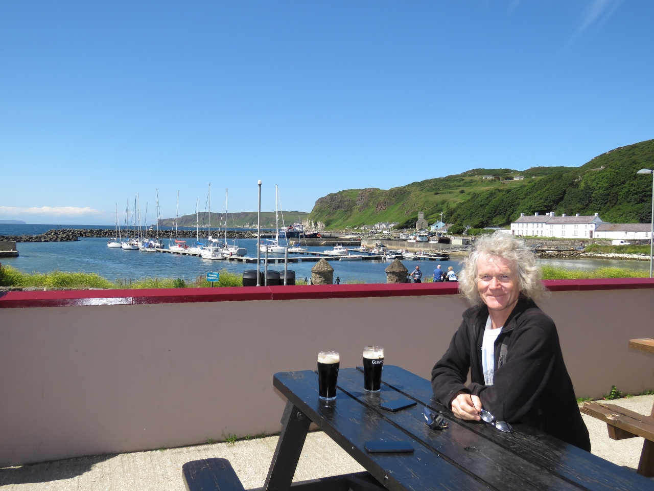 |
McCuaig’s Bar
Position: -6 11.50, 55 17.51
We stopped for lunch on the patio at McCuaig’s Bar before continuing our tour of the island. We had a great meal with an excellent view to the harbour.
|
 |
Seals
Position: -6 11.30, 55 17.10
Seals sunning just south of the harbor.
|
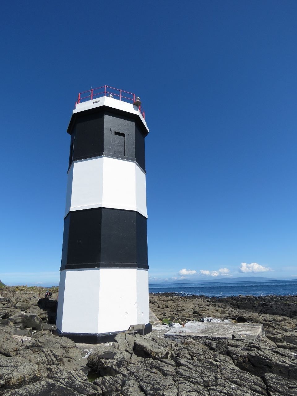 |
Rue Point Lighthouse
Position: -6 11.48, 55 15.52
The Rue Point lighthouse was established as a temporary structure in 1915 with two double-flashing lights. The current tower was later built in 1921.
|
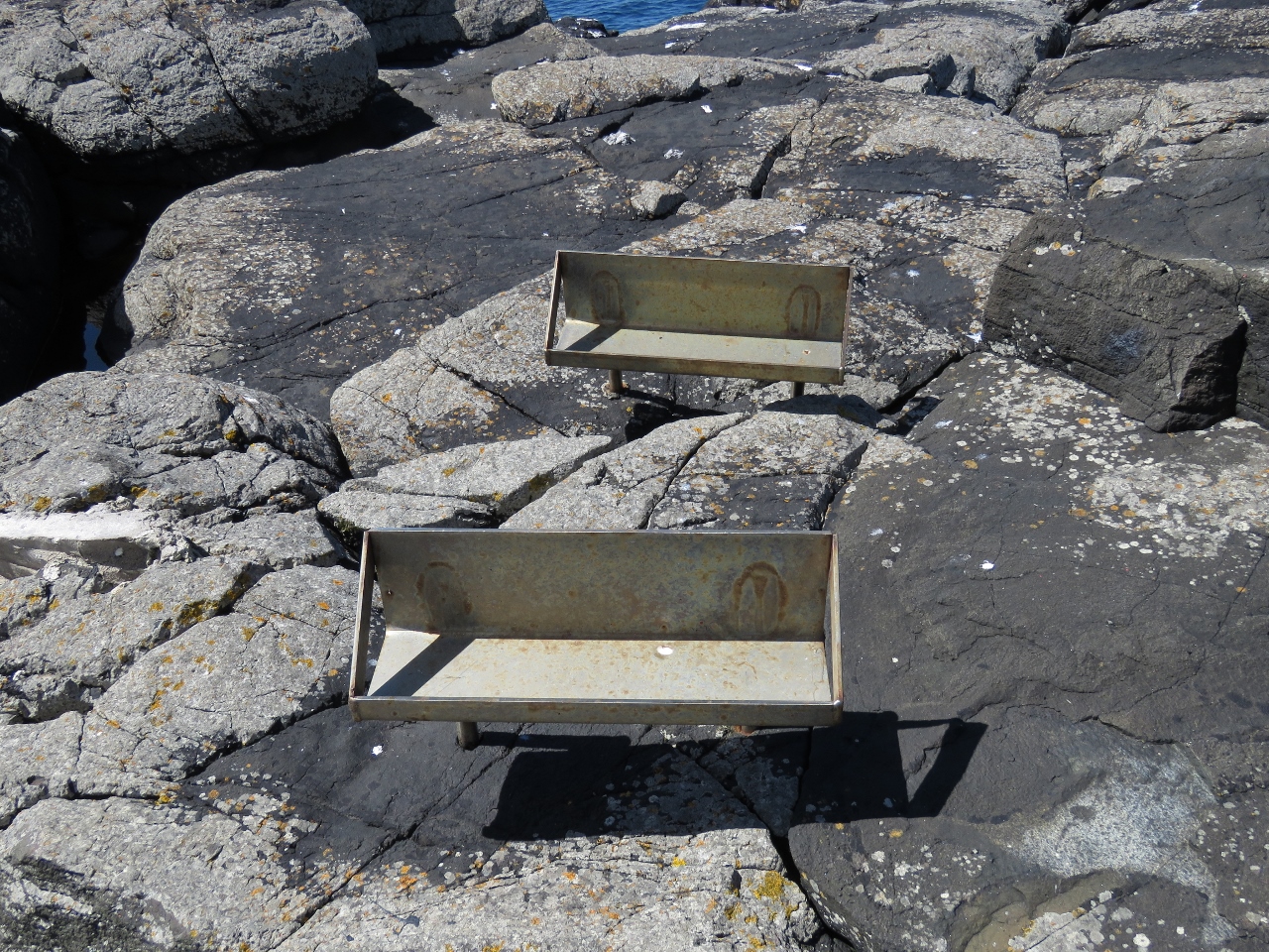 |
Shelves
Position: -6 11.45, 55 15.53
We couldn’t guess the purpose of these shelf-like structures mounted around the base of the Rue Point lighthouse. No power or other wires connected to them. Some had ledges on the front like these, but others didn’t. And some were paired, but many were single. Since they face the lighthouse and are all the way around it, we guessed it might have been to light the outside of the lighthouse.
|
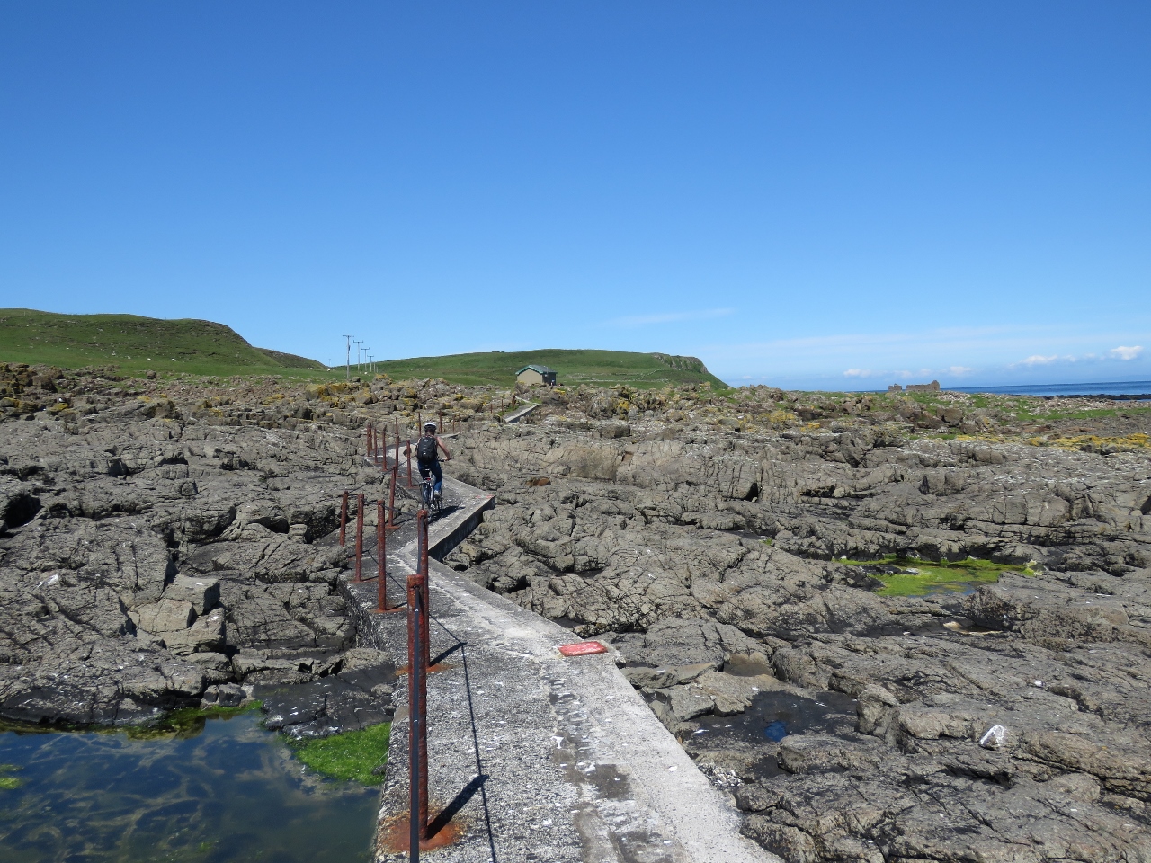 |
Path
Position: -6 11.44, 55 15.55
Jennifer biking back along the path across the rocks to Rue Point lighthouse.
|
 |
Ruins
Position: -6 11.19, 55 15.71
These ruins along the east shore of Rathlin Island might have been the lighthouse keeper’s houses.
|
 |
East Lighthouse
Position: -6 10.44, 55 18.13
The Rathlin Island East Lighthouse was established in 1856 with a lower fixed light and an upper flashing light to distinguish it from other lights in the North Channel. Fifty years later, on July 6th 1898, Guglielmo Marconi successfully transmitted the first commercial radio signals across water from the lighthouse to Ballycastle on the Northern Irish mainland. The light was converted to electric in 1981, automated in 1995, and in 2003 an experimental Automatic Identification System (AIS) was established there.
|
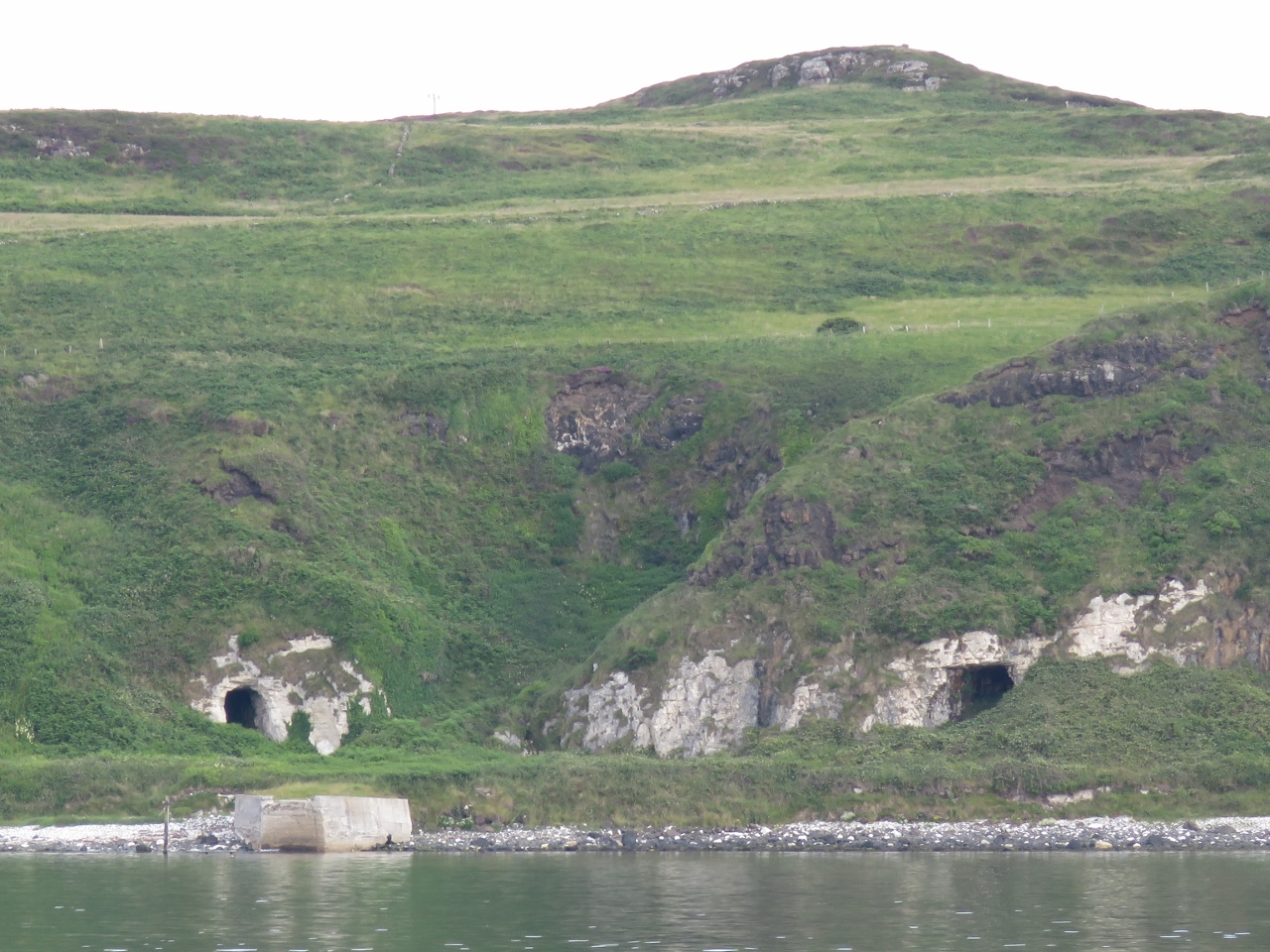 |
Tunnels
Position: -6 13.39, 55 17.40
We couldn’t find anything about these man-made tunnels on the south shore of Rathlin Island west of the lighthouse landing. Possibly it was a quarry used in the lighthouse construction.
|
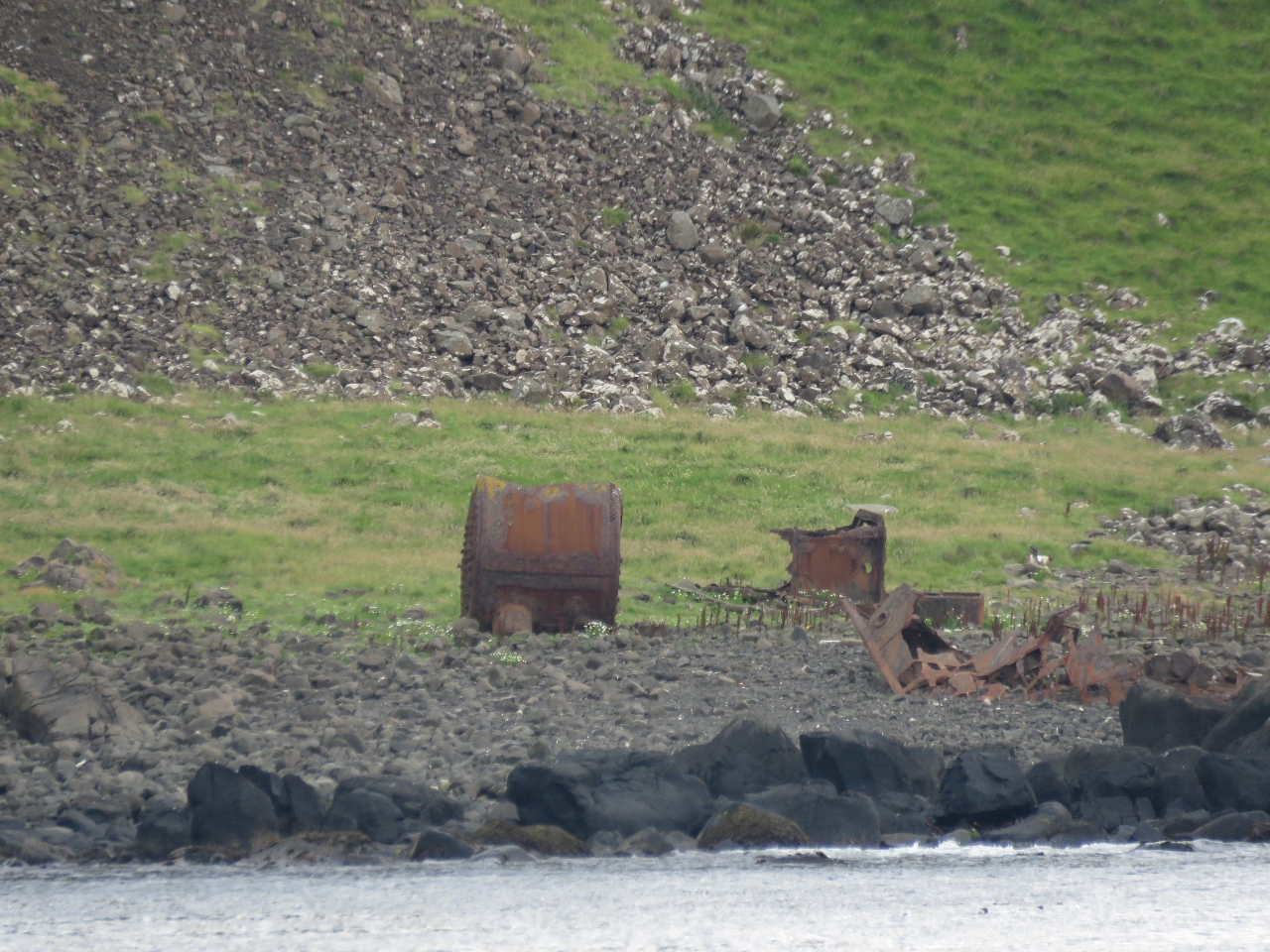 |
Boiler
Position: -6 17.28, 55 18.01
Ruins of a steam boiler at Bull Point on Rathlin Island. Likely it was used for kelp production (kelp was burned to obtain soda) prevalent on the island in the 19th century.
|
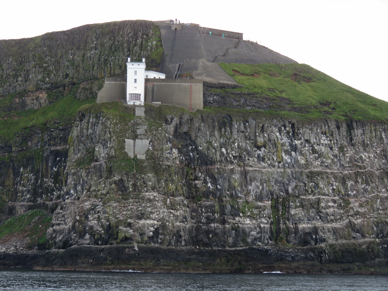 |
West Lighthouse
Position: -6 17.16, 55 18.11
Looking up to the West Lighthouse from below with a good view to all the reinforcement done along the cliffs to prevent erosion and rockfalls.
|
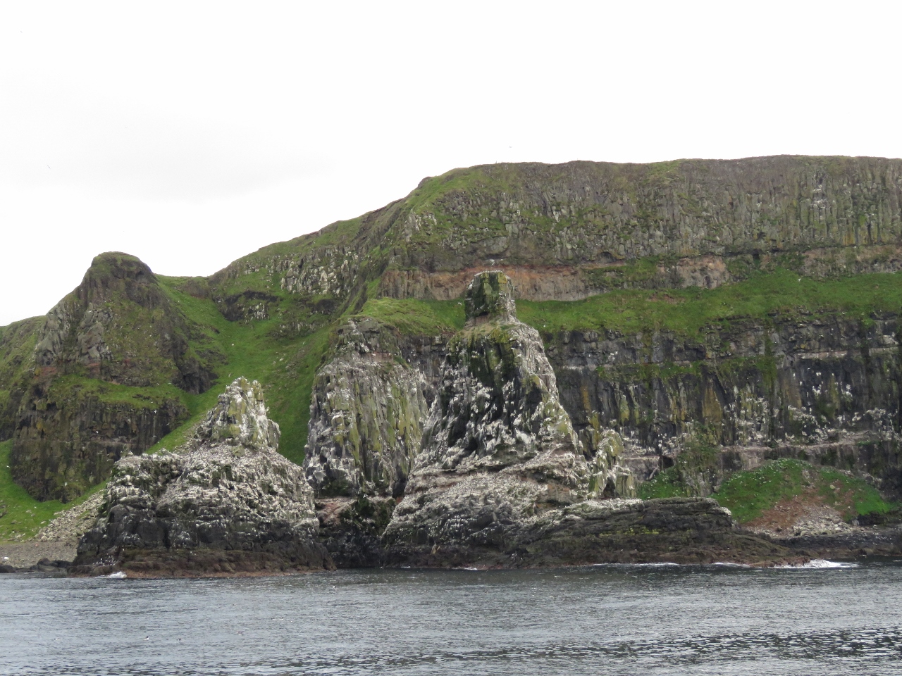 |
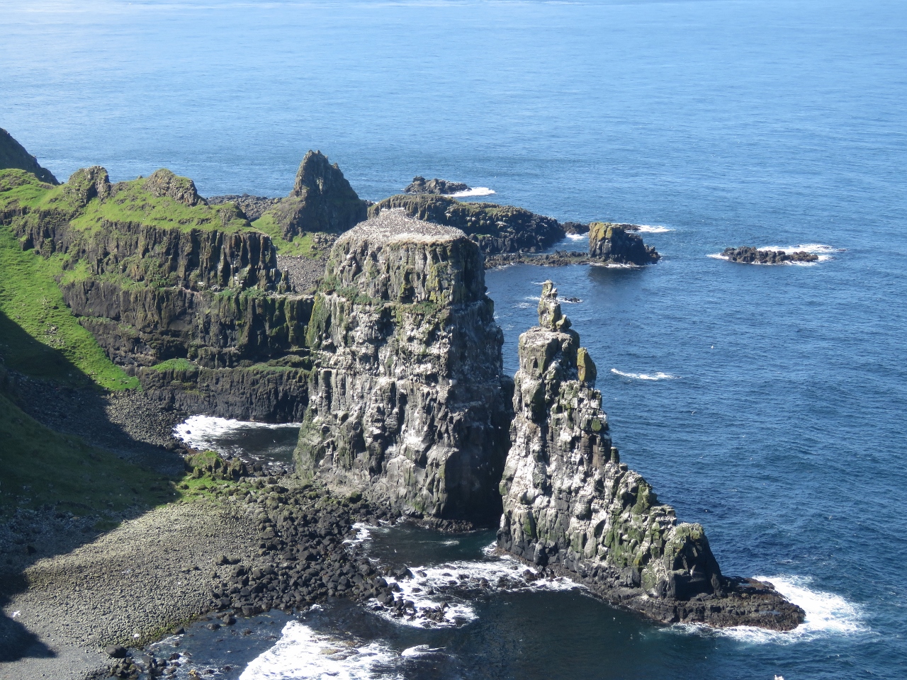
Sea Stacks
Position: -6 16.83, 55 18.26
The bird-filled sea stacks we saw yesterday from the West Light Seabird Centre.
|
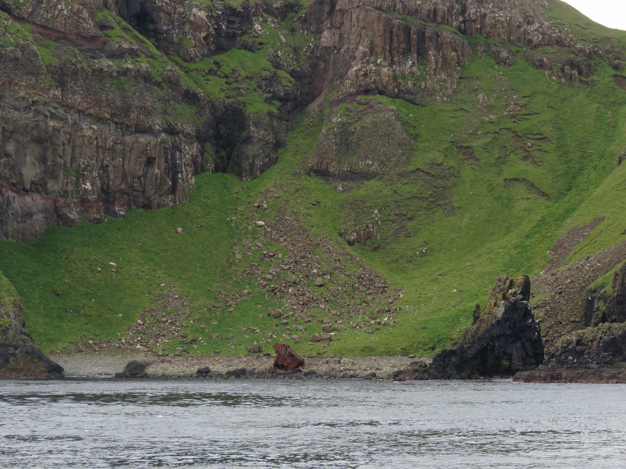 |
Shipwreck
Position: -6 15.31, 55 18.80
One of the at least forty shipwrecks around Rathlin Island. A combination of strong currents and violent storms resulted in many wrecked and sunk vessels on and around the island.
|
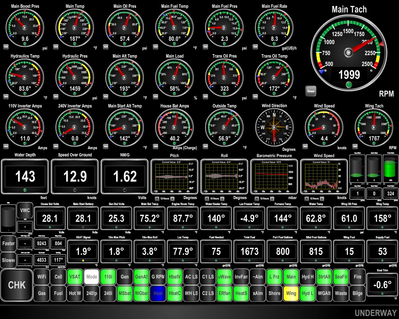 |
12.9 knots
Position: -6 13.05, 55 18.82
We’d timed our North Channel crossing with a flood tide to carry us across. Currents are particularly strong around Rathlin Island‐we were doing 12.6 knots at 2,000 RPM. We’d normally do about 8.4 knots at that RPM.
|
 |
East Lighthouse
Position: -6 10.07, 55 18.20
Looking up to the Rathlin Island East Lighthouse. Robert the Bruce is said to have hid out in a cave below the lighthouse following his defeat by the English at Perth in 1306 during his struggle for the Scottish crown.
|

|
Click the travel log icon on the left to see these locations on a map, with the complete log of our cruise.
On the map page, clicking on a camera or text icon will display a picture and/or log entry for that location, and clicking on the smaller icons along the route will display latitude, longitude and other navigation data for that location. And a live map of our current route and most recent log entries always is available at http://mvdirona.com/maps. |
If your comment doesn't show up right away, send us email and we'll dredge it out of the spam filter.