Leaving Sherkin Island, we checked out the tiny harbour on Cape Clear Island, then did two laps around Fastnet Rock before stopping for the night in beautiful Crookhaven Harbour, home of Ireland’s most southerly pint. En route we saw another castle and two ancient watchtowers, plus plenty of dramatic scenery.
Trip highlights from June 16, 2017 follow. Click any image for a larger view, or click the position to view the location on a map. And a live map of our current route and most recent log entries always is available at http://mvdirona.com/maps
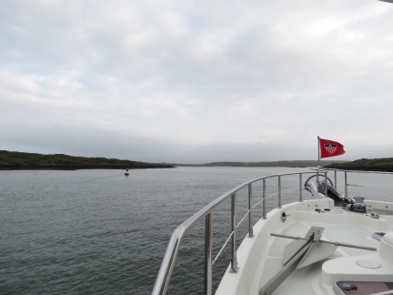 |
North Channel
Position: -9 23.76, 51 29.32
We exited Baltimore Harbour through North Channel. It looked a little difficult on the chart, and our cruising guide gave a lengthy and complex description on how to transit, but it turned out to be pretty straightforward with plenty of width and depth.
|
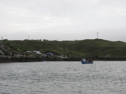 |
Graiguefrehane
Position: -9 24.40, 51 29.76
A few fishing boats were moored off the wharf at Graiguefrehane.
|
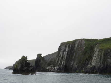 |
Cape Clear Island
Position: -9 30.21, 51 26.54
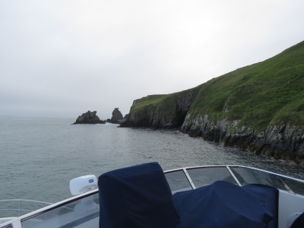
Looking northeast along the dramatic coast off Cape Clear Island near North Harbour.
|
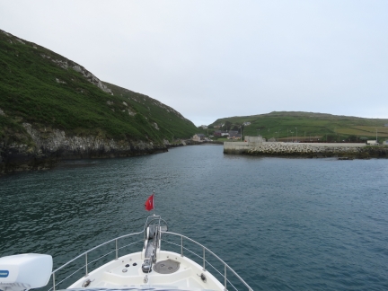 |
North Harbour
Position: -9 30.21, 51 26.54
We nosed in to checkout tiny North Harbour on Cape Clear Island, but didn’t get very far in before the charted depth was lower than we were comfortable in. You can see how small and tight the harbour is in the satellite imagery. A ferry runs here from Baltimore.
|
 |
Tight
Position: -9 30.22, 51 26.49
We were right up against the cliffs entering and leaving North Harbour. The ferry ride in and out of the harbour must be exciting in big seas.
|
 |
Dun An Oir Castle
Position: -9 30.86, 51 26.55
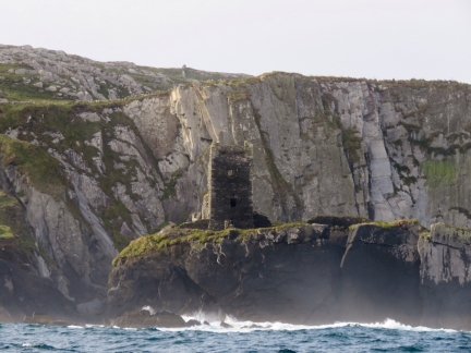
14th-century Dun An Oir Castle, perched on a cliff just south of North Harbor, was another O’Driscoll holding. The castle took heavy cannon fire in the 16th century.
|
 |
Fastnet-to-Fastnet
Position: -9 34.08, 51 24.81
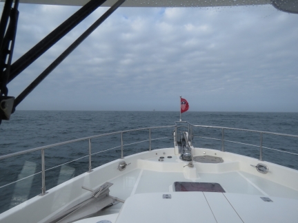
Fastnet Light, clearly visible about two miles ahead. It was dark when we passed a few miles south of the light on our 2,800nm Fastnet-to-Fastnet North Atlantic crossing from Newport, RI to Kinsale, Ireland. We were thrilled to see the light’s bright flash illuminating the sky every five seconds, and really wanted to see the light up close in daylight.
|
 |
Fastnet Rock
Position: -9 36.21, 51 23.44
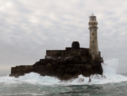
Fastnet Rock is the most southern point in Ireland and the light on it is known world-wide, partly because it is the turn-around point of the classic ocean sailing race of the same name. Read more …
|
 |
Streek Head
Position: -9 41.45, 51 28.45
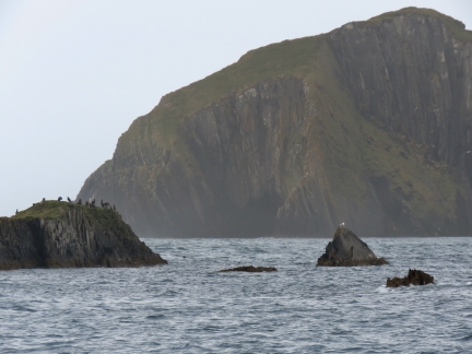
The soaring cliffs of Streek Head on the south side of the entrance to Crookhaven Harbour.
|
 |
Crookhaven Lighthouse
Position: -9 42.22, 51 28.45
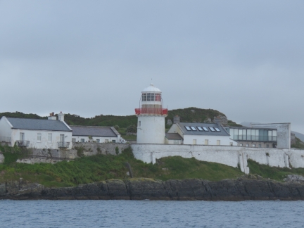
The Crookhaven Lighthouse dates to 1843 and has been converted to guest accommodations. At the far right is a dramatic modern cottage with floor-to-ceiling glass walls and sweeping views. Not a bad place to stay.
|
 |
Watchtower
Position: -9 42.22, 51 28.45
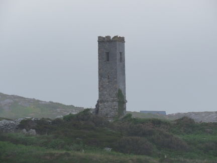
An old watchtower overlooking the harbour entrance.
|
 |
Crookhaven
Position: -9 43.29, 51 28.34
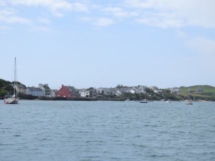
Much of the Crookhaven Harbour is filled with moorings, but there was plenty of room to anchor at the east end. This is the view to Crookhaven village from our anchorage.
|
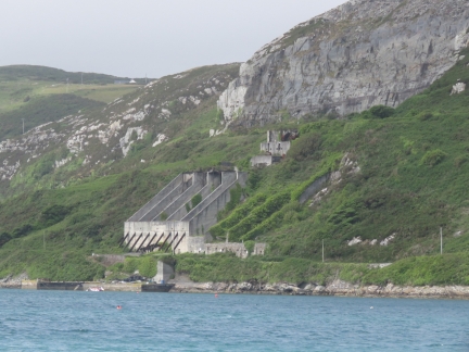 |
Quarry
Position: -9 43.29, 51 28.34
The Roadstone Quarry along the north shore of Crookhaven Harbour supplied gravel for Welsh roads until the the 1930s.
|
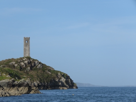 |
Second Watchtower
Position: -9 43.29, 51 28.35
A second watchtower visible from the anchorage.
|

|
Click the travel log icon on the left to see these locations on a map, with the complete log of our cruise.
On the map page, clicking on a camera or text icon will display a picture and/or log entry for that location, and clicking on the smaller icons along the route will display latitude, longitude and other navigation data for that location. And a live map of our current route and most recent log entries always is available at http://mvdirona.com/maps. |

If your comment doesn't show up right away, send us email and we'll dredge it out of the spam filter.