During the Napoleonic-era, a signal tower was built at Brow Head near Crookhaven, Ireland. A century later, the Marconi Wireless Telegraph company installed telegraphic equipment on Fastnet Rock and a station on Brow Head. Passing ships signaled the Fastnet Lighthouse and the keepers relayed the message wirelessly to Brow Head for transmission to the final recipient. And a century after that, Brow Head was one of the filming locations for Star Wars Episode VIII. The old signal tower can be seen for miles, and ruins of Marconi’s station are visible at the head, including the four square blocks that make up the radio tower base. We couldn’t find any evidence of the Star Wars set though.
Trip highlights from June 18th, 2017 at Brow Head, Ireland follow. Click any image for a larger view, or click the position to view the location on a map. And a live map of our current route and most recent log entries always is available at http://mvdirona.com/maps
 |
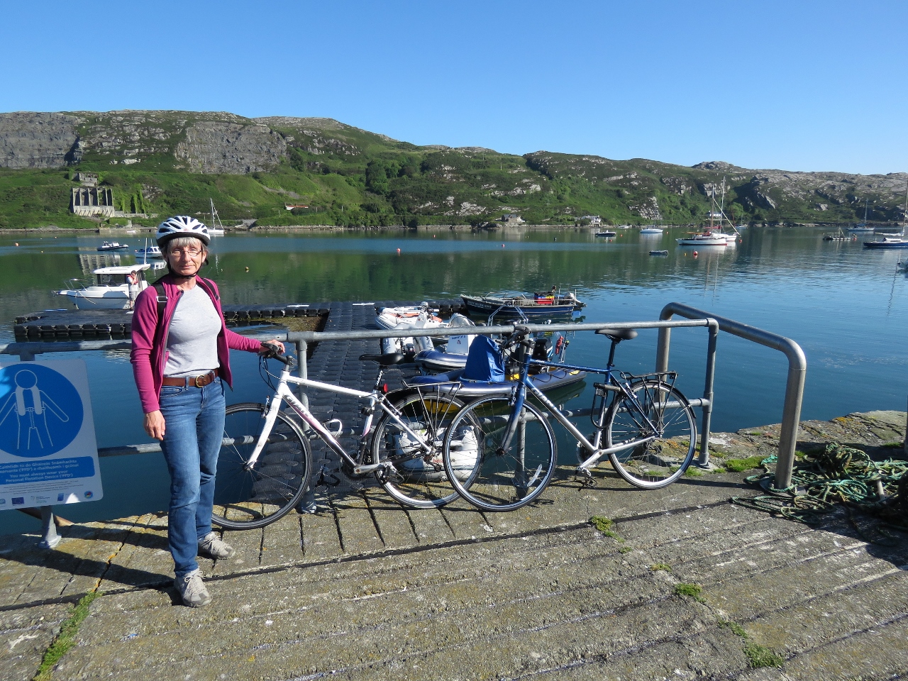
Bicycles
Position: -9 43.32, 51 28.34
We stow our bicycles under a custom canvas cover on the flybridge. To bring them ashore from an anchorage, we secure the bikes in the tender on the boat deck and launch them all together. The whole process of getting the bikes ready to go and in the tender, and everything ready for shore launch, takes less than ten minutes.
|
 |
Landed
Position: -9 43.56, 51 28.16
Crookhaven has a convenient floating dinghy pontoon with stairs at the head. We dropped the bikes off near the head to carry up the stairs, and secured the tender farther out (you can just see it above the top guardrail).
|
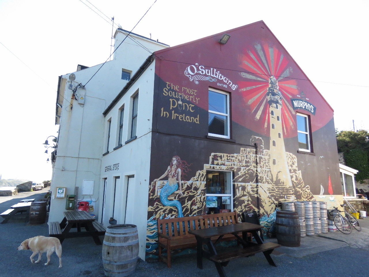 |
O’Sullivans
Position: -9 43.56, 51 28.15
It’s too early in the day to enjoy “the most southerly pint in Ireland” at O’Sullivans, but we’ll definitely be back.
|
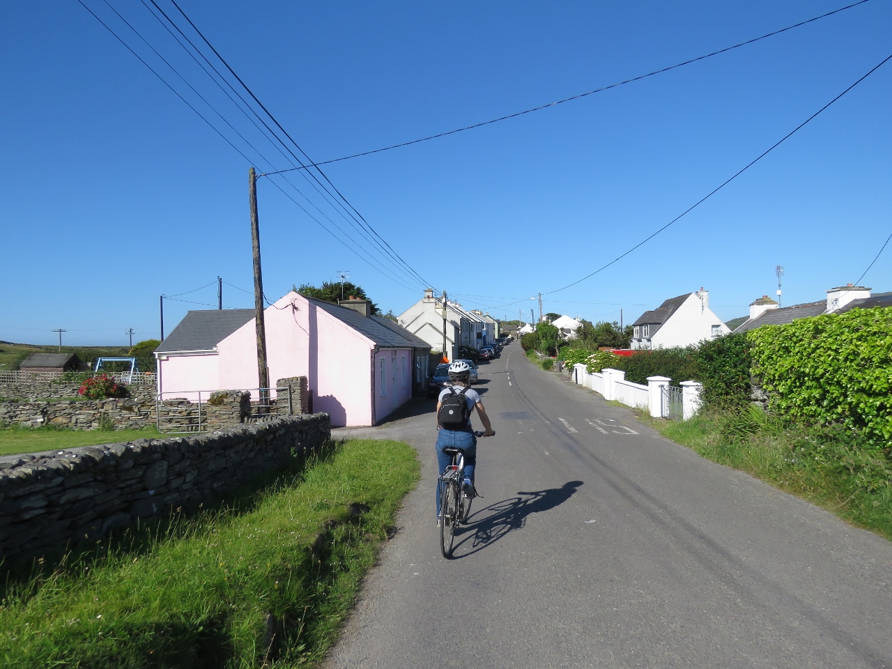 |
En Route
Position: -9 43.49, 51 28.16
Setting off on the bikes through the village of Crookhaven.
|
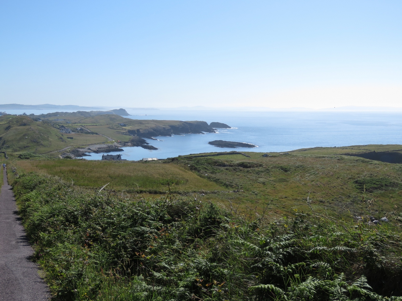 |
Galley Cove from East
Position: -9 45.13, 51 27.54
Our first stop on today’s bicycle tour is Brow Head. The road climbs quickly to 354ft above sea level, making for a tiring climb. But the reward is some fabulous views, particularly on this clear and sunny day.
|
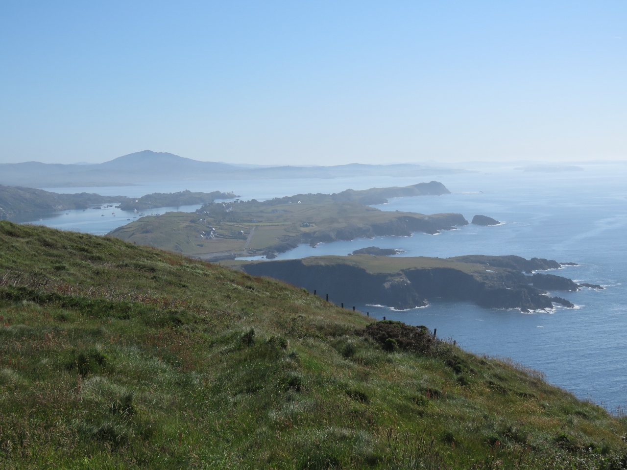 |
Summit View
Position: -9 45.55, 51 27.28
We can see for miles from the summit of Brow Head on this clear day. This is looking slightly northeast—we couldn’t determine the mountain visible in the distance.
|
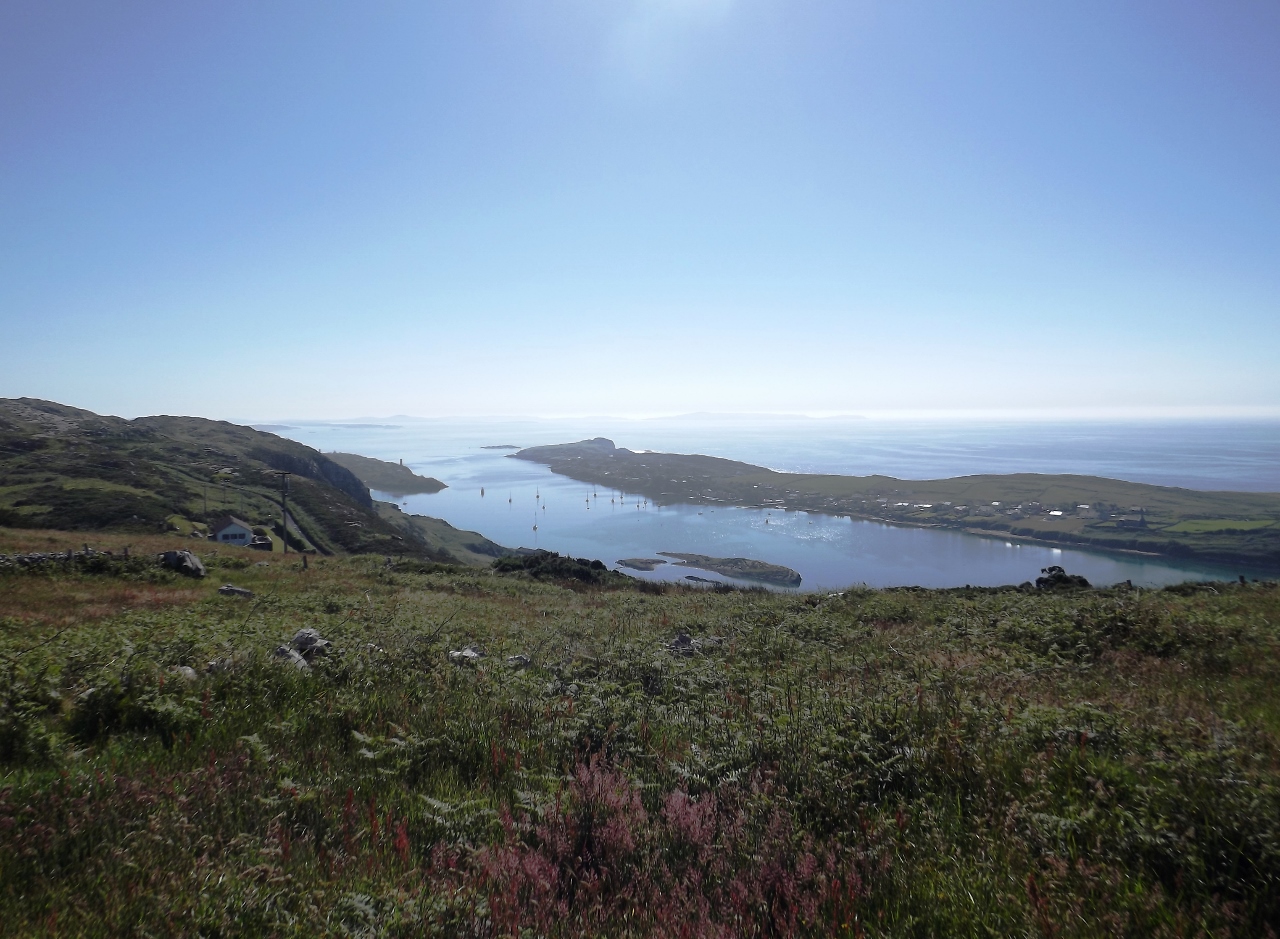 |
Crookhaven Harbour
Position: -9 45.56, 51 27.27
Looking down to Crookhaven Harbour from Brow Head.
|
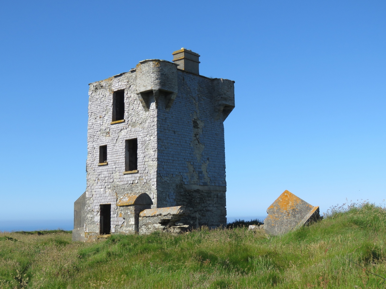 |
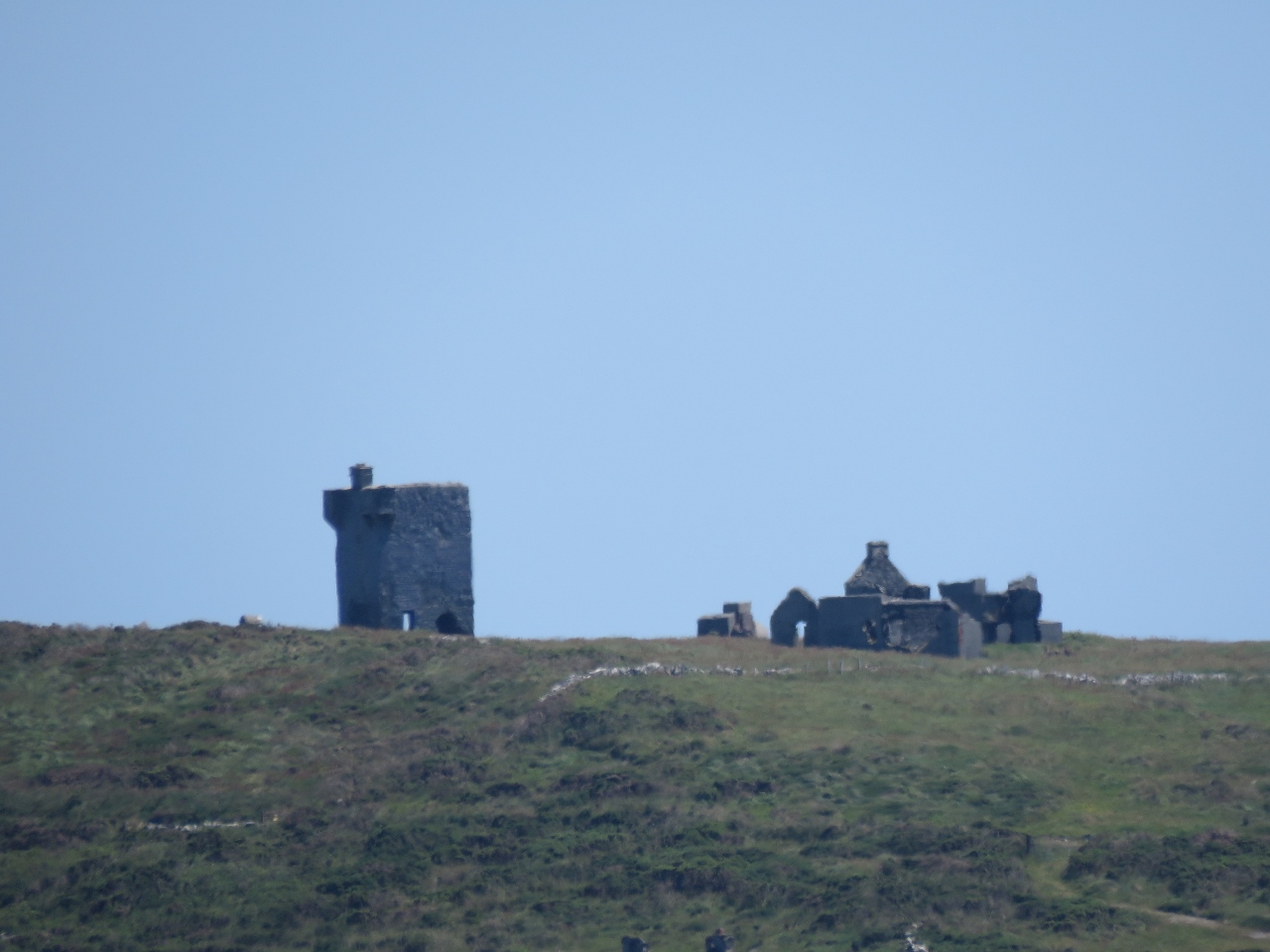
Signal Tower
Position: -9 45.52, 51 27.33
The signal tower on Brow Head was one of the 81 signal towers built along the Irish coast during the Napoleonic era to give early warning of a French invasion.
|
|
|
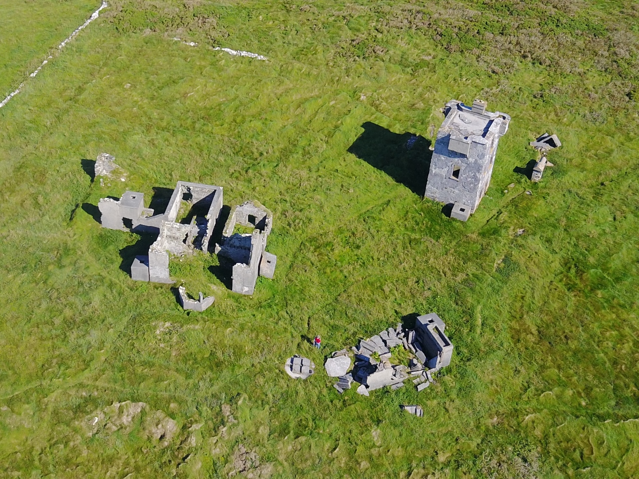
Brow Head
Position: -9 45.57, 51 27.25
A century after the Napoleonic-era signal tower was built, The Marconi Wireless Telegraph company installed telegraphic equipment on Fastnet Rock and a station on Brow Head. Passing ships signaled the Fastnet Lighthouse and the keepers relayed the message wirelessly to Brow Head for transmission to the final recipient. And a century after that, Brow Head was one of the filming locations for Star Wars Episode VIII.
The old signal tower can be seen for miles, and ruins of Marconi’s station are visible at the head, including the four square blocks that make up the radio tower base near where we are standing. We couldn’t find any evidence of the Star Wars set though. The video Brow Head: From Napoleon to Marconi to Skywalker was shot from the air above Brow Head looking down on the dramatic stone structures on the cliff edge. |
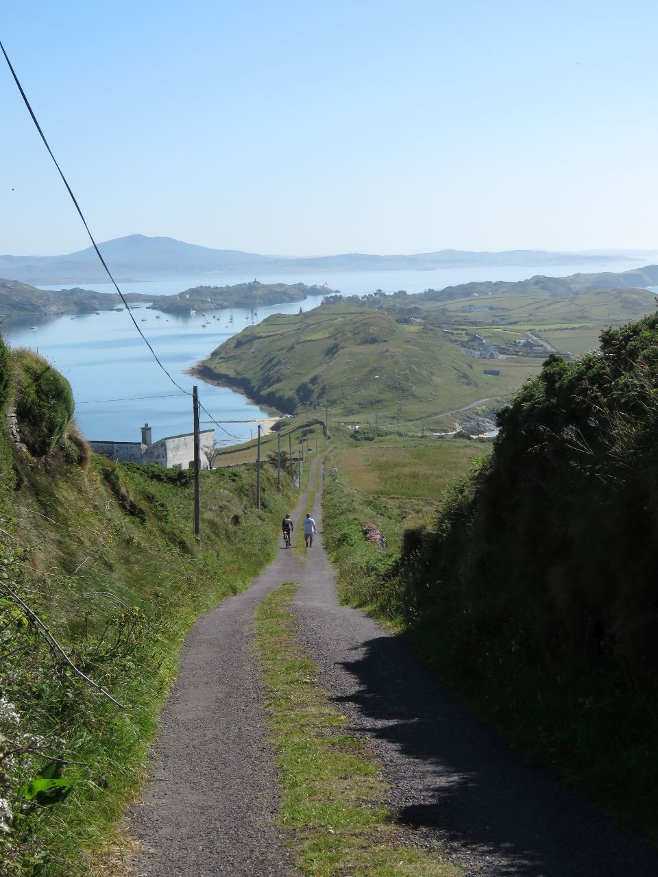 |
Road
Position: -9 45.32, 51 27.44
Looking down the road leading back to sea level from Brow Head. The road was suprisingly busy for early in the morning—we passed three people on the way up and another two on the way down.
|
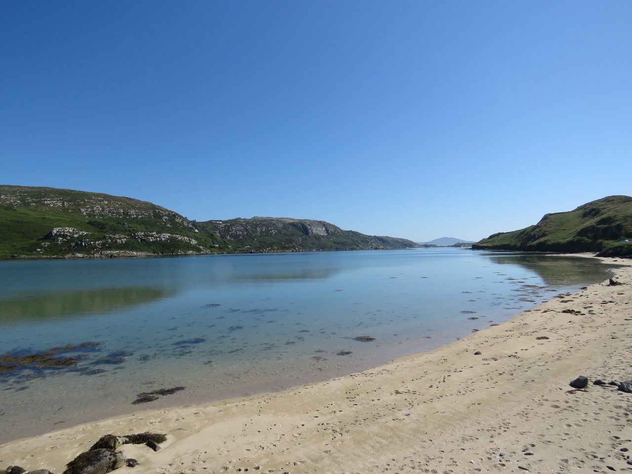 |
Crookhaven Head
Position: -9 44.86, 51 27.64
From Brow Head, we continued around Crookhaven Harbour toward Mizen Head. This is looking northeast across the sandy beach at the head of Crookhaven Harbour.
|
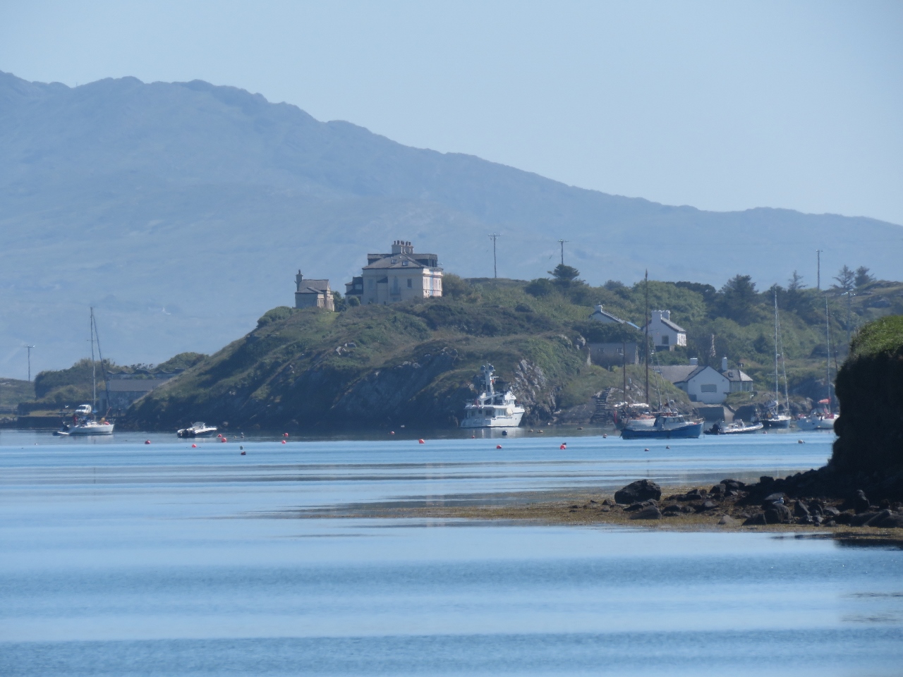 |
Dirona
Position: -9 44.86, 51 27.64
The view to our anchorage from the head of Crookhaven Harbour.
|
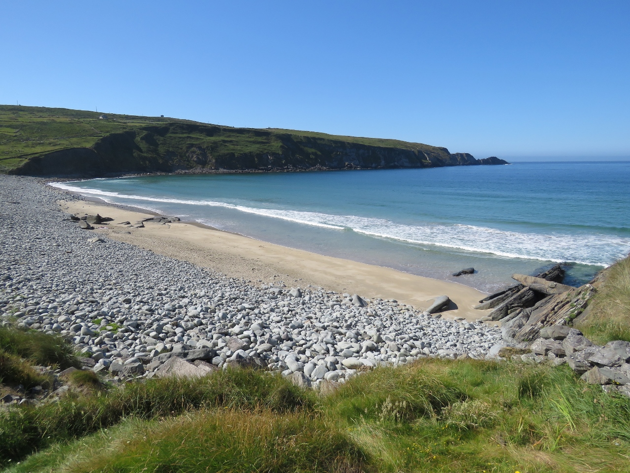 |
Beach
Position: -9 45.45, 51 27.87
People were just starting to arrive at this beach along Barleycove on the Atlantic side.
|
 |
Barleycove
Position: -9 46.89, 51 28.02
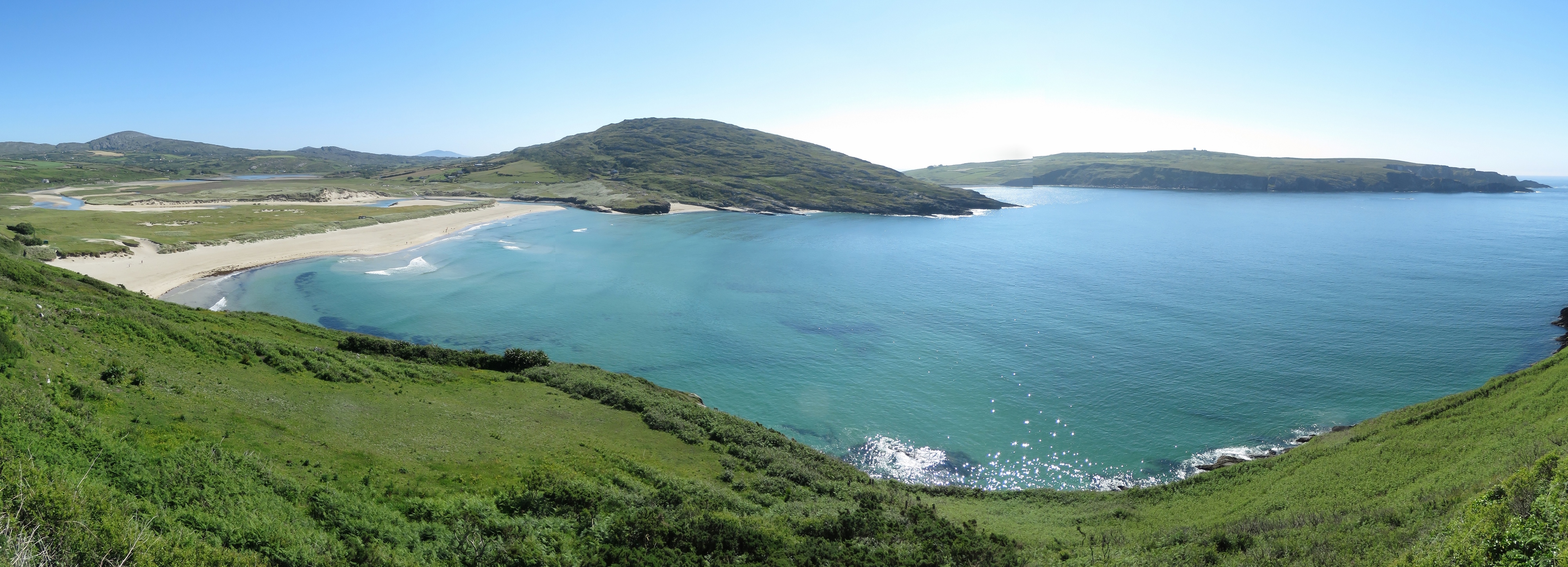
We cycled around Barleycove and up above on the other side for a sweeping view back. The sand dunes behind Barleycove Beach are visible on the left and the Brow Head signal tower is visible on the right.
|
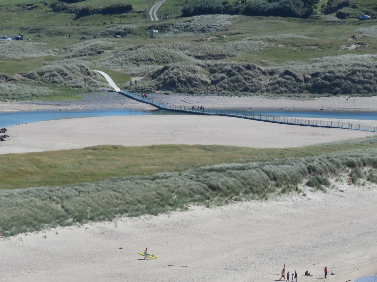 |
Boardwalk
Position: -9 46.88, 51 27.99
A boardwalk leads from the parking lot across sand dunes and a stream to popular Barleycove Beach. We’ve never associated Ireland with beaches, but we’ve seen several nice ones today.
|
 |
View to Brow Head
Position: -9 47.82, 51 27.40
Looking southeast from above Barleycove to the signal tower on Brow Head.
|

|
Click the travel log icon on the left to see these locations on a map, with the complete log of our cruise.
On the map page, clicking on a camera or text icon will display a picture and/or log entry for that location, and clicking on the smaller icons along the route will display latitude, longitude and other navigation data for that location. And a live map of our current route and most recent log entries always is available at http://mvdirona.com/maps. |