We completed our Fastnet-to-Fastnet run and arrived into Kinsale, Ireland after a 17-day, 2,801 nm crossing of the North Atlantic. And we shared our first pint at an Irish pub—we’d been looking forward to that from almost the moment we left Newport.
This was by far our most difficult passage we have done, with three gales and two separate mechanical issues to deal with. On most of our passages thus far, we’ve generally seen good weather with winds usually less than twenty kts and only rarely above thirty. But most of these have been equatorial and timed for the statistically best time of year when storms are least common. Higher-latitude crossings are just more likely to encounter storms, even at the best time of year, and we were crossing a month or two earlier to have more time to cruise the west coasts of Ireland and Scotland this year.
In this final four days of the passage to Ireland, we travelled 521 nm at an average speed of 6.7 kts, and burned 407 gallons of diesel for a fuel economy of 1.28 nm/gallon. Fortunately we had no more mechanical issues, but did pass through the third, and worst, of the three gales we encountered on this passage. We were rolling consistently past 20 degrees, frequently past 25 degrees, and once to 38 degrees. The storm was intense, but fast-moving and passed quickly. Conditions were exceptionally calm our final night, and we had a nice, easy run past Fastnet Light and along the south coast of Ireland to finally reach Kinsale.
Over the entire 2,801nm, 17-day trip our average speed was 6.86 kts, and we consumed 2,386 gallons of diesel for an average fuel economy of 1.18 nm/gallon. We arrived with 346 gallons of diesel, 46 gallons above our 300-gallon reserve because we’d slowed down near the end to approach Kinsale in daylight, and a flooding tide carried us in.
Trip highlights from May 21st through 24th, 2017 follow. Click any image for a larger view, or click the position to view the location on a map. And a live map of our current route and most recent log entries always is available at http://mvdirona.com/maps
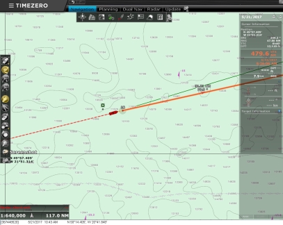 |
Below 500
Position: -20 42.49, 50 14.29
We’ve crossed 500 miles left, only 479 to go. It looks like we’ll arrive into Kinsale on the 24th.
|
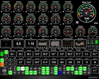 |
38 Degrees
Position: -20 17.43, 50 17.96
The seas picked up overnight to 11-12ft on 8 seconds and as expected, conditions were at their worst this afternoon. Seas were 14-20 ft seas on 7 seconds and winds steady in the high 30s with gusts to 46. The winds have peaked and are starting to settle now, but the seas aren’t. We just took the biggest roll of the trip: 38 degrees. The boat is handling the conditions well and everything is 100% operational, but we have to be super careful moving around and ensure that any loose items are secured.
|
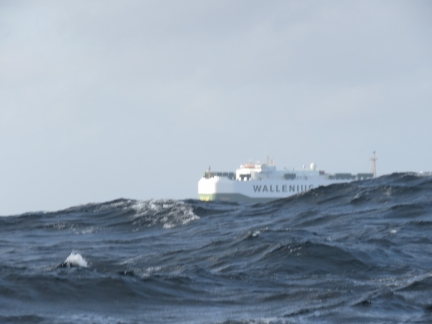 |
Tosca
Position: -19 6.22, 50 28.02
The 642ft(199m) RO/RO Tosca is almost disappearing in the swell. Conditions are starting to settle down, but we’re still in 10-11 ft waves on the stern.
|
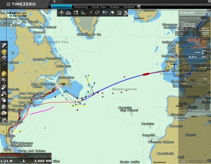 |
400 To Go
Position: -18 41.15, 50 31.56
We’re flying through the miles–only 400 to go.
|
 |
Conditions
Position: -18 9.33, 50 35.88
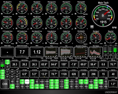
Conditions have settled down considerably since yesterday. The winds have dropped from steady in the high 30s to the low 20s and roll is much reduced from consistently over 20 degrees to a maximum of 13.3 in the past 15 minutes. And the barometer is starting to rise as the low pressure system passes away. It wasn’t a very long storm, but it was quite intense.
|
 |
Valve
Position: -15 34.88, 50 53.90
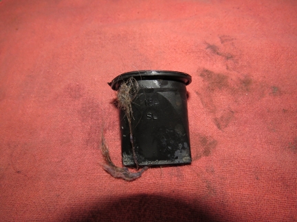
Our grey water pump wasn’t pumping very well. The valve had failed, so we replaced it with a spare.
|
 |
Debris
Position: -15 29.34, 50 54.45
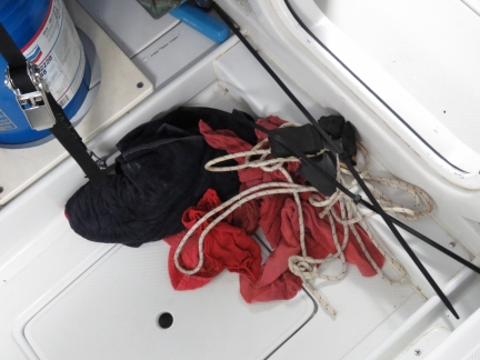
As part of cleaning up the boat in preparation for arrival, James removed the material he’d used to plug the leak. This is what came out.
|
 |
Spitfire
Position: -15 17.80, 50 55.58
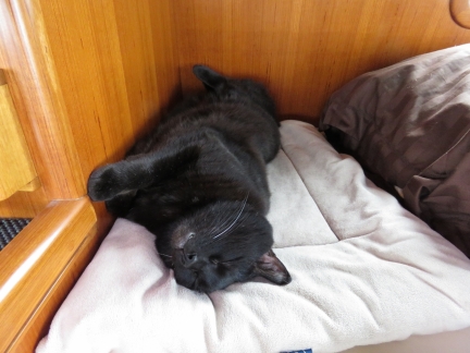
Spitfire loves sleeping on his fleece blanket, but won’t when the boat is moving too much because he will slide around. He’s happily back on the fleece now that conditions have settled substantially.
|
 |
Deadline
Position: -14 6.88, 51 2.58
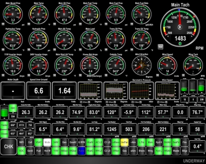
We’ve changed our “drive the lights” (bottom left) to a deadline mode instead of fuel-economy mode. Instead of indicating that we should speed up or slow down to ensure we have 300 gallons of reserve when we arrive into Kinsale, we’re now want to adjust speed for a 10am arrival. As a consequence, we’ve slowed down considerably as our fuel-economy speed would have us arriving in the middle of the night.
|
 |
Continental Shelf
Position: -13 26.54, 51 6.27
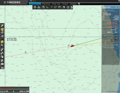
We’ve just crossed the Continental Shelf. Depths have dropped from 14,000 ft to 2,000 ft with less than 200 miles to go.
|
 |
Bourbon Tern
Position: -12 7.41, 51 12.49
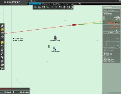
We’re starting to see a lot more vessel traffic as we near Ireland. Supply vessel Bourbon Tern and research/survey vessel Geo Caspian appeared to be travelling together. Bourbon Tern listed an AIS destination of “G. Caspian Guard V/L” and Geo Caspian‘s AIS indicated it was towing with a 5nm cable.
|
 |
Ditch Bag
Position: -11 47.15, 51 14.07
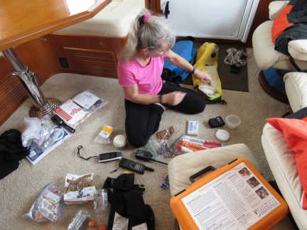
Jennifer tearing down our offshore ditch bags now that we’re approaching Ireland. We stow our ditch gear in two large drybags with lifejackets attached for flotation.
|
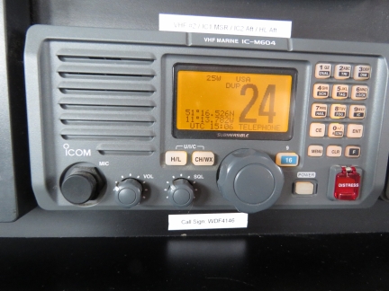 |
CG Radio
Position: -11 14.42, 51 16.50
Our first reception of Ireland weather radio. We’re getting close now.
|
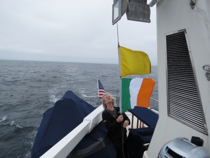 |
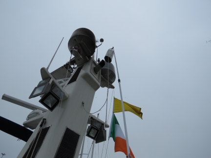
Q Flag
Position: -11 9.09, 51 16.76
For most countries we’ve visited so far, we’ve flown only the yellow ‘Q’ flag to indicate we require clearance. Ireland customs specifically requested we fly the Irish tri-color as well. Once we clear in, the ‘Q’ flag will come down and the Irish tri-color takes over the top spot.
|
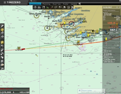 |
100 To Go
Position: -10 50.91, 51 17.65
Only 100 miles left to reach Kinsale
|
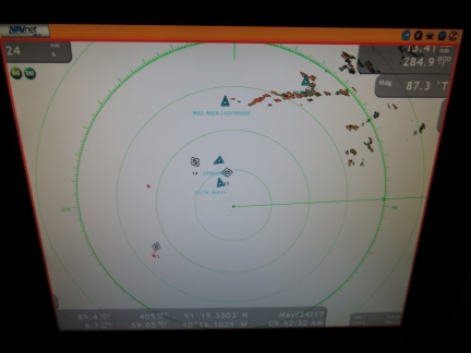 |
Land Ho!
Position: -10 16.76, 51 19.35
The west coast of Ireland is showing up clearly on the radar about 16 miles away. It’s been a long time since we’ve seen anything other than ships on radar.
|
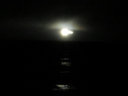 |
Fastnet Light
Position: -9 38.16, 51 21.25
With Fastnet Light a mile to port, we’ve nearly completed our Fastnet-to-Fastnet run. Only 50 more miles to Kinsale.
|
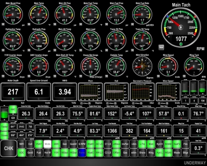 |
Conditions
Position: -9 17.07, 51 24.95
Conditions are wonderfully calm for our last night at sea as we pass along the south coast of Ireland. With a push from the flooding tide, we’re running at 1,077 RPM to run slow enough to meet our 10am arrival time into Kinsale. Dirona is just purring along effortlessly.
|
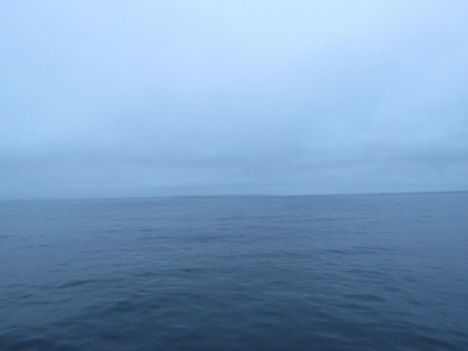 |
First View of Ireland
Position: -9 1.41, 51 28.06
As the day brightens we can actually see land now. Our first view to Ireland!
|
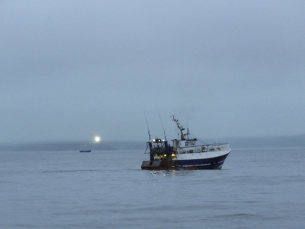 |
Fish Boats
Position: -8 59.55, 51 28.44
We were expecting heavy fishing activity, and possibly lots of floats, as we passed along the south coast of Ireland last night. But conditions were incredibly smooth and easy—we didn’t see a single float or other vessel from Fastnet Light until morning. As we just pass daybreak, we’re seeing lots of fishing vessels off the coast.
|
 |
Galley Head
Position: -8 57.08, 51 28.92
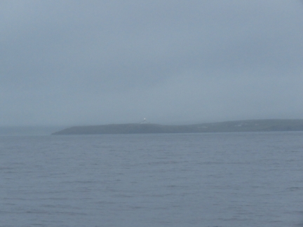
The lighthouse on Galley Head shining through the overcast morning.
|
 |
First Smell of Ireland
Position: -8 45.98, 51 31.12
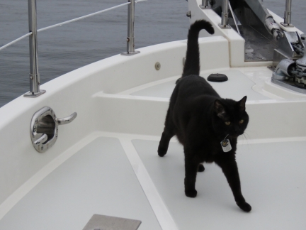
Spitfire hasn’t wanted outside for most of the run from Newport. But he always wants out as we approach a coast and is on the bow getting his first smell of Ireland.
|
 |
Old Head of Kinsale
Position: -8 30.36, 51 35.48
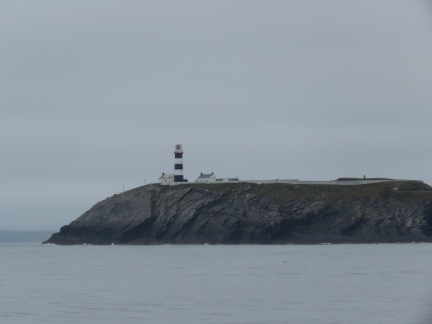
The first light on the Old Head of Kinsale was established in the 17th century. The headland is known for being the closest point of land to where a German submarine sank the RMS Lusitania in 1915.
|
 |
Countryside
Position: -8 30.16, 51 39.68
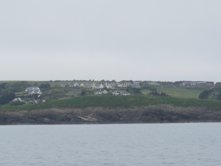
The verdant hills of Ireland. It’s so amazing to actually be here!
|
 |
Fenders
Position: -8 30.14, 51 39.88
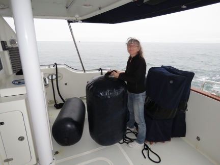
Jennifer getting the inflatable fenders ready to deploy. They don’t look so big when in use, but they sure look huge in the cockpit. Jennifer is “height-challenged” though, so most things look big next to her.
|
 |
Welcome to Ireland
Position: -8 30.11, 51 40.42
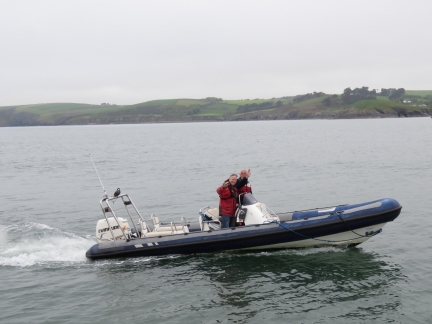
Paul Murphy (closest), manager of the Kinsale Yacht Club, and Richard came out to greet us as we entered Kinsale Harbour.
|
 |
Charles Fort
Position: -8 29.95, 51 41.35
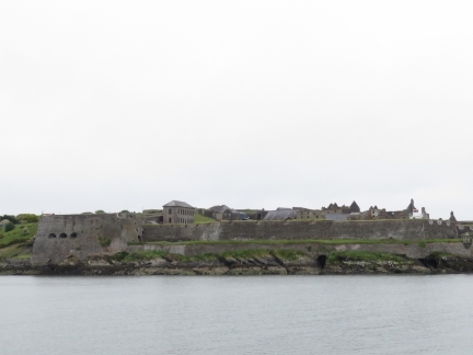
Charles Fort was completed in 1682 and is one of the largest military installations in Ireland. The fort is open to the public and receives over 85,000 visitors a year.
|
 |
Kinsale
Position: -8 30.05, 51 41.43
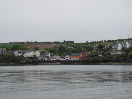
Our first view to the town of Kinsale.
|
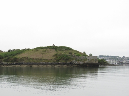 |
James Fort
Position: -8 30.19, 51 41.60
James Fort, also known as the “Old Fort” (Charles Fort is the “new fort”) was completed in 1607.
|
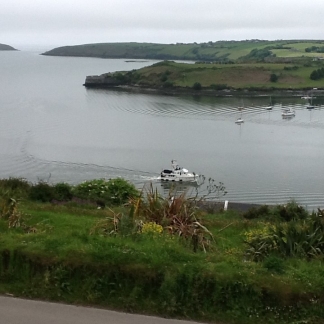 |
Nearly There
Position: -8 30.29, 51 41.92
Bill Skelton, former owner of Nordhavn 47 Nexus, sent us this picture taken from his home above Kinsale Harbor.
|
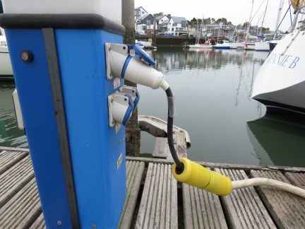 |
Power
Position: -8 31.04, 51 42.13
Amazingly, that pigtail we built in Papeete in 2013 still is working for us. We had power within minutes of arriving. The adapter has worked in every country we’ve plugged into in the southern hemisphere except Australia.
|
 |
Exhaust Cover
Position: -8 31.04, 51 42.13
We drop a cutoff fender over the exhaust to prevent rainwater from getting in. This reduces the amount of soot ejected from the stack when we start up after sitting for a while. We also ran a while at wide-open-throttle to clear out the soot from the long, low-load ocean crossing.
|
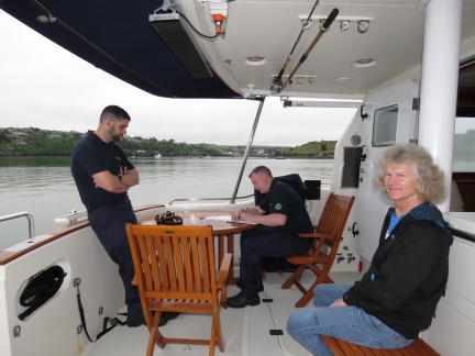 |
Customs
Position: -8 31.04, 51 42.13
We’d notified Customs of our ETA and they arrived shortly after we did. The clearance process was among the smoothest we’d been through in any country. We presented our passports and ship’s papers, and no other paperwork was required. And we got an excellent lunch recommendation.
|
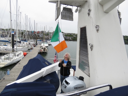 |
Cleared Through
Position: -8 31.04, 51 42.13
We’ve cleared through so can remove our ‘Q’ flag and fly just the Irish tri-color.
|
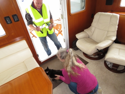 |
Agriculture
Position: -8 31.04, 51 42.13
Jim Hegarty of the Department of Agriculture arrived shortly after Customs to check Spitfire in. When Customs was here, Spit was outside checking them out, but as soon as a vet showed up, he ditched. Somehow he knew. But the whole process was as low-key as the Customs check-in. That huge wand Jim is carrying scanned Spitfire’s microchip instantly from nearly a foot away and Spit became an EU kitty before he even knew what had happened. The handheld scanners most vets use require more precision and need to be a lot closer.
|
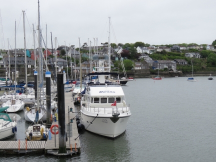 |
Kinsale Yacht Club
Position: -8 31.04, 51 42.13
Our home for the next couple of weeks at the Kinsale Yacht Club. It’s hard to believe we’re actually here. Now to find a pub.
|
 |
Kitty O Se’s
Position: -8 31.41, 51 42.38
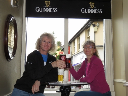
After a bit of a walk around town, we decided on Kitty O Se’s for a celebratory landfall lunch. We had an excellent meal over a pint of Smithwicks. We’d been looking forward sharing a pint in an Irish pub from almost the moment we left Newport.
|

|
Click the travel log icon on the left to see these locations on a map, with the complete log of our cruise.
On the map page, clicking on a camera or text icon will display a picture and/or log entry for that location, and clicking on the smaller icons along the route will display latitude, longitude and other navigation data for that location. And a live map of our current route and most recent log entries always is available at http://mvdirona.com/maps. |

James & Jennifer –
We are relieved to see you safe and sound in Ireland. Needless to say you had many following along with you on this harrowing trip and your Atlantic updates kept many of us on the edge of our seats.
I remember during one of your worst nights, my wife woke up and starting Praying for your safe passage.
Please have a pint for us! We are looking forward to your fantastic future posts as you explore this summer.
Best…………….Rob
That’s very kind of you both Rob. We pledge to make all future trips considerably less “interesting.” We are indeed enjoying Ireland.
Congratulations on your passage…we read with such interest!!
We made a similar passage in 2013 from St.John, Newfoundland to Crookhaven, Ireland. We left in early July and were fortunate to enjoy a wonderful 9-day passage enjoying a high pressure system all the way to Ireland. Kinsale is lovely. Looking forward to reading more about your travels…ENJOY!
Best, Tina & Braun Jones
N6406 ‘Ocean Pearl’
You chose a much better time of the year and we’re jealous about being able to do it in 9 days. That we can’t do at any time of the year :-).
It’s great to be here and we’re already really enjoying our visit.