
We departed Southwest Harbor for Belfast in a fog so thick we could barely see 100 yards in front of us. We ran at six knots with our big floodlights lit all around and the fog horn sounding. Dodging the moored boats and lobster traps in the thick fog was difficult, but the lobster boats were a real challenge. We could see them on radar, making frequent course changes and often running at over ten knots, but couldn’t see them. The fog eventually lifted so we finally could see all those lobster boats we’d been avoiding, and the rest of the run into Belfast, Maine was much more relaxing and enjoyable.
Trip highlights from October 8th, 2016 en route between Southwest Harbor and Belfast Maine follow. Click any image for a larger view, or click the position to view the location on a map. And a live map of our current route and most recent log entries always is available at http://mvdirona.com/maps
 |
Fog
Position: -68 19.24, 44 16.44
Thick fog as we depart Southwest Harbor.
|
|
|
Silver Fox
Position: -68 17.21, 44 13.58
We ended up much closer than we liked to Silver Fox, seen here passing behind us. We could see it on radar crossing our bow at over ten knots, fairly close. It then turned 190° and went back straight towards us. We sounded three blasts of the horn and stopped, and they passed just astern. We caught the image on our newly installed aft-view camera. The timestamp on the picture should read 07:34—we hadn’t put the camera in the correct time zone yet.
|
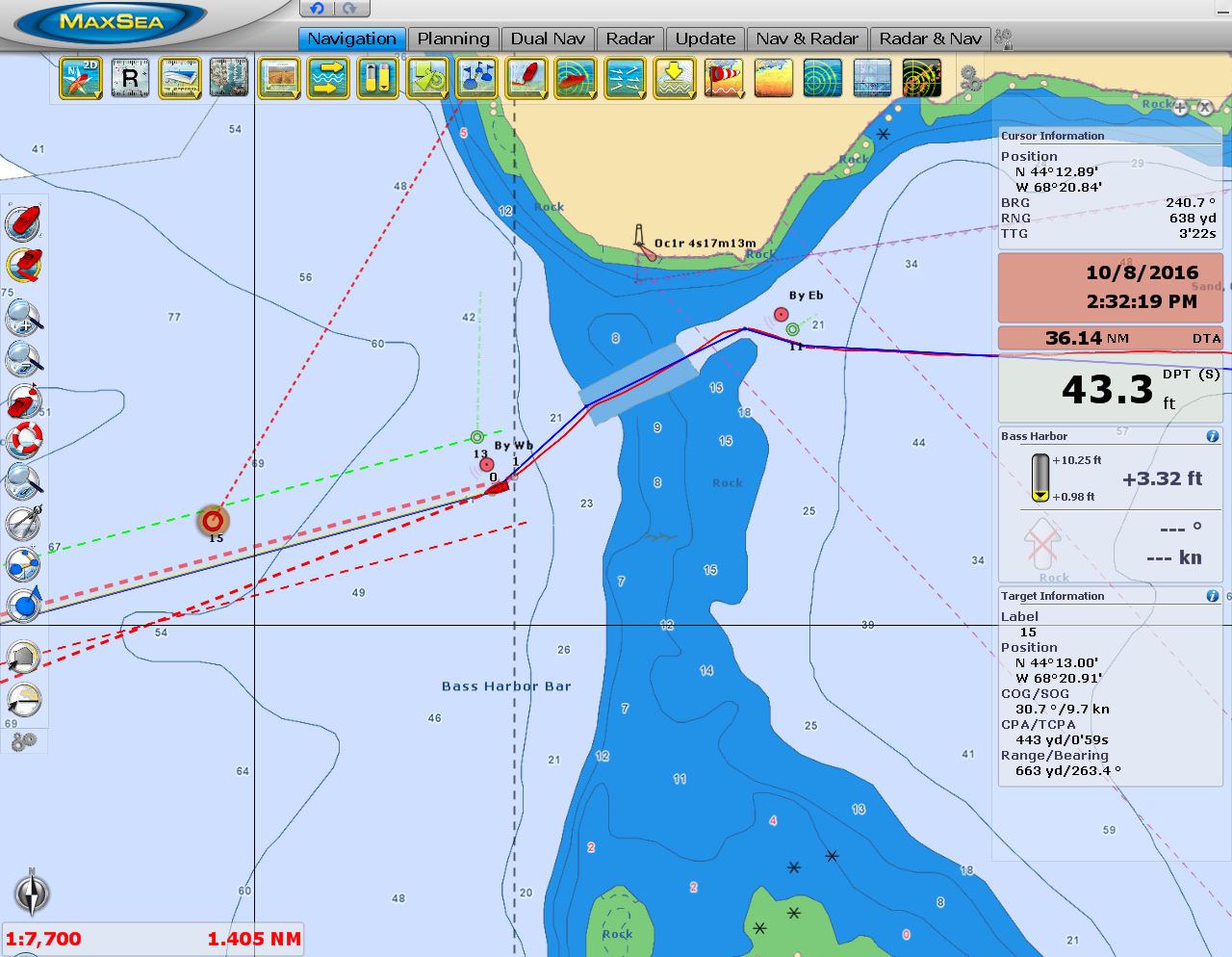 |
Bass Harbor Bar
Position: -68 20.67, 44 13.00
We passed through Bass Harbor Bar with 18ft on a near-zero tide at Bass Harbor. You can see another lobster boat running at 9.7 knots in heavy fog just ahead and north of our route. Those lobster boats really move.
|
 |
Lobster Boat
Position: -68 34.95, 44 14.35
The fog cleared and we finally could see all those lobster boats we’d been dodging.
|
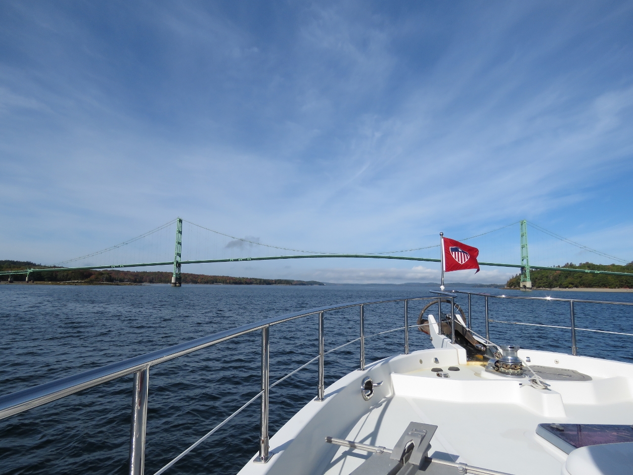 |
Deer Isle Bridge
Position: -68 41.27, 44 17.61
Passing under the Deer Isle Bridge with a main span of 1,088ft (329m). The bridge was completed in 1939 and suffered wind stability issues similar to the Tacoma Narrows Bridge, aka “Galloping Gertie”, that collapsed shortly after opening in 1940. The Deer Isle Bridge was subsequently reinforced with modification that included cable stays between the cables, tower and road deck.
|
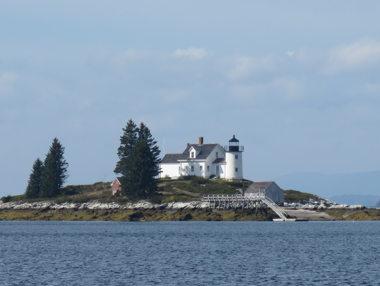 |
Pumpkin Island
Position: -68 43.97, 44 18.88
The light station at Pumpkin Island was built in 1854, discontinued in 1955 and now is privately owned.
|
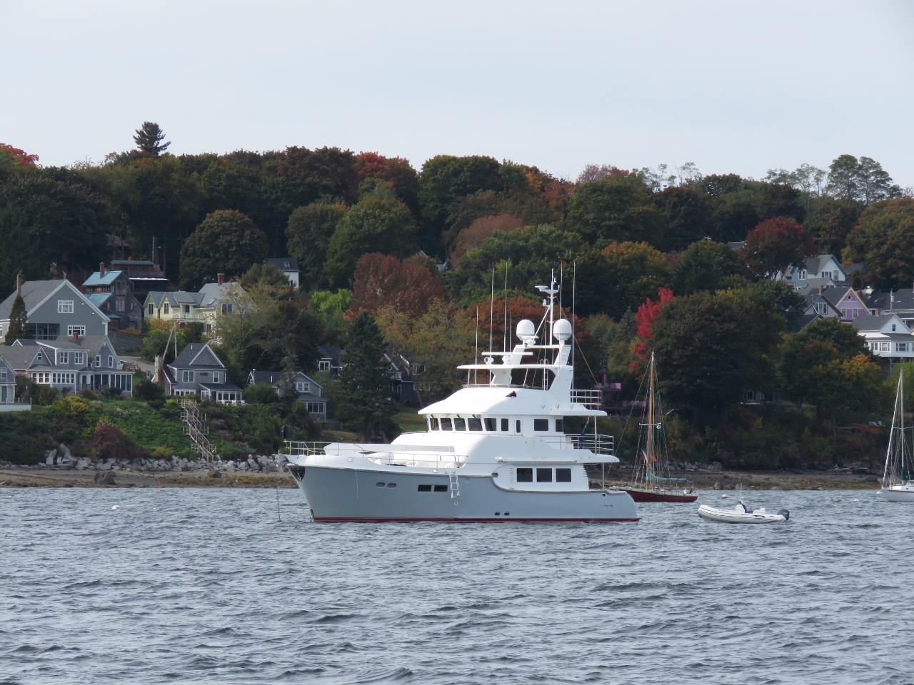 |
Grace of Tides
Position: -68 59.42, 44 25.44
Nordhavn 68 Grace of Tides anchored off Belfast as we arrived.
|
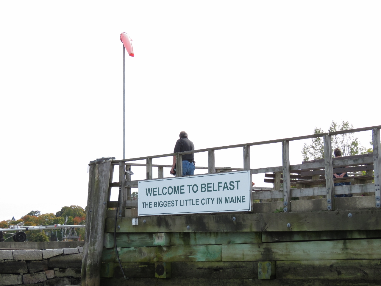 |
Belfast
Position: -69 0.24, 44 25.75
Belfast dubs itself the “Biggest Little City in Maine”. It also has one of the friendliest harbor staff we’ve met—they took excellent care of us during our visit.
|
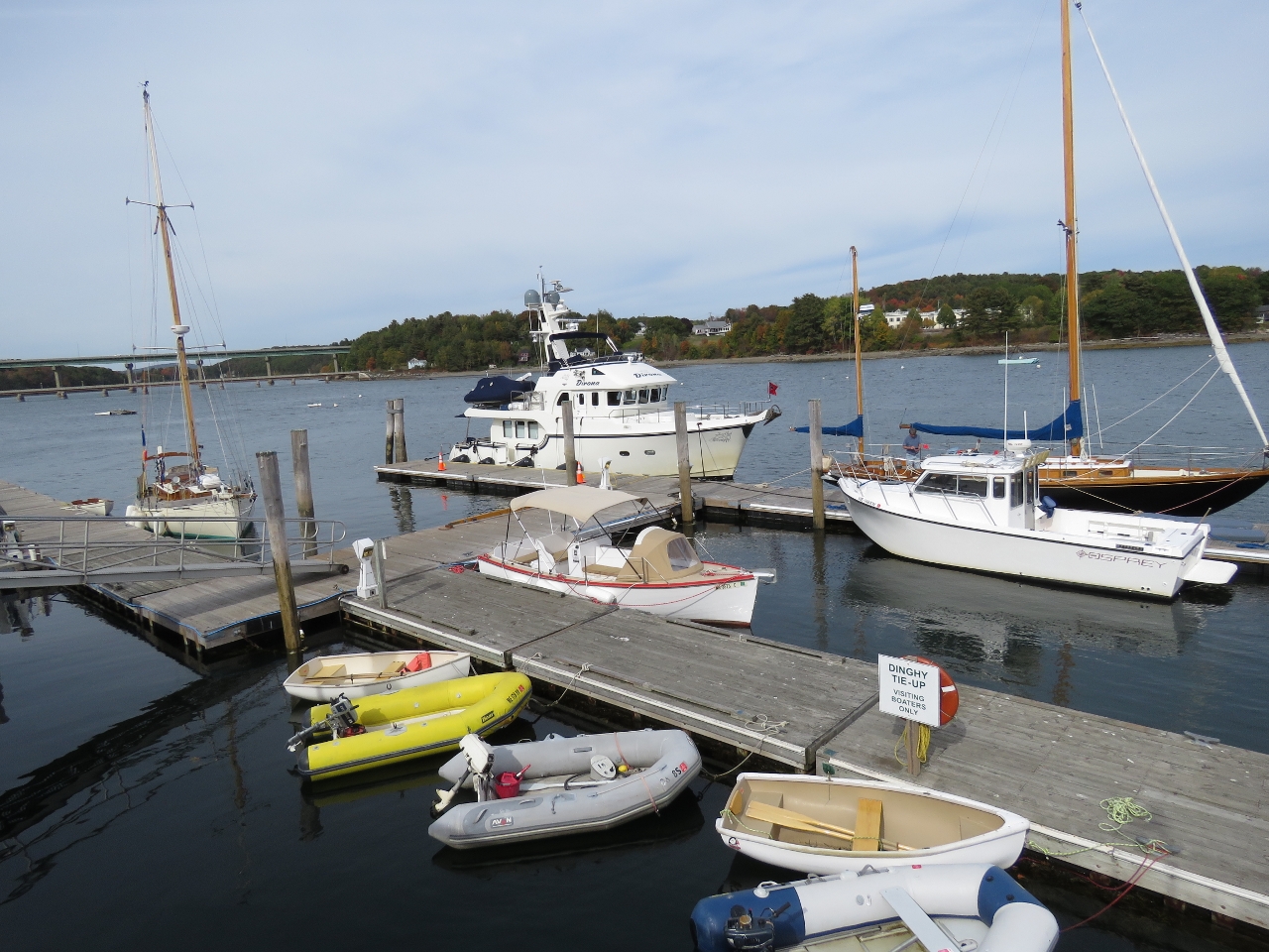 |
Moored
Position: -69 0.24, 44 25.75
Moored at the Belfast City Landing in downtown Belfast. We loved this spot, with a view all along the waterway and into town.
|

|
Click the travel log icon on the left to see these locations on a map, with the complete log of our cruise.
On the map page, clicking on a camera or text icon will display a picture and/or log entry for that location, and clicking on the smaller icons along the route will display latitude, longitude and other navigation data for that location. And a live map of our current route and most recent log entries always is available at http://mvdirona.com/maps. |
If your comment doesn't show up right away, send us email and we'll dredge it out of the spam filter.