Portland, Maine was recently ranked the top craft beer city in the world, and it shows. The city is full of craft breweries and pubs. We of course visited several during our stay, but also explored historic Fort Gorges and did a four-lighthouse and Fore River dinghy tour.
Trip highlights from October 17th through 20th, 2016 follow. Click any image for a larger view, or click the position to view the location on a map. And a live map of our current route and most recent log entries always is available at http://mvdirona.com/maps
 |
Cuckolds Light
Position: -69 38.86, 43 46.57
En route to Portland from Boothbay Harbor we passed the Cuckolds Lighthouse that went into operation in 1892 and was automated in 1974. The Coast Guard deemed the lighthouse excess in 2004 it was at risk of being demolished. In 2006 a group of local citizens purchase the light and it has since become the Inn at Cuckolds light station where a lucky few can spend a night or a few on the island in the restored buildings.
|
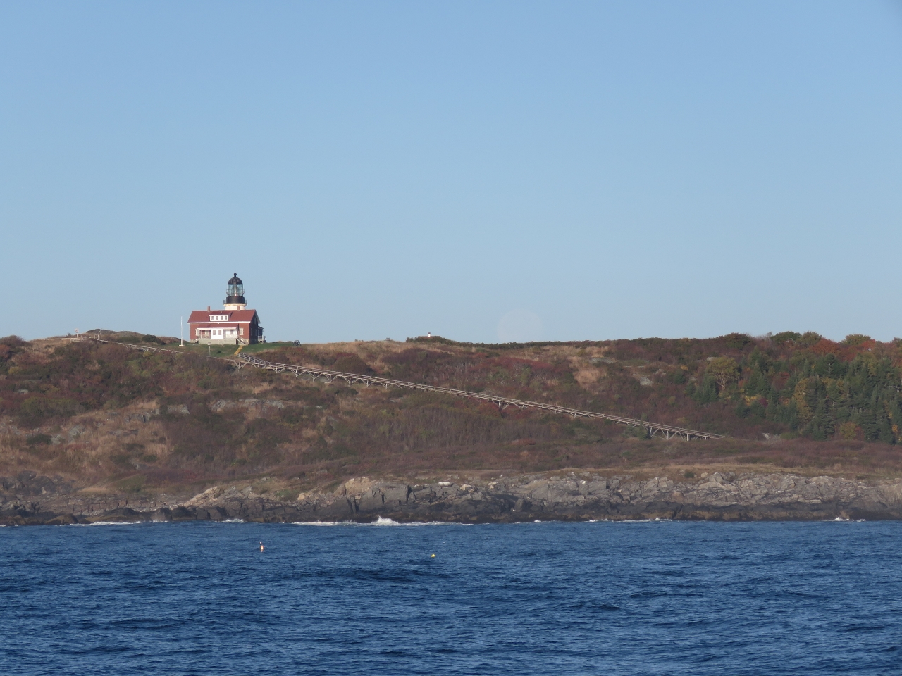 |
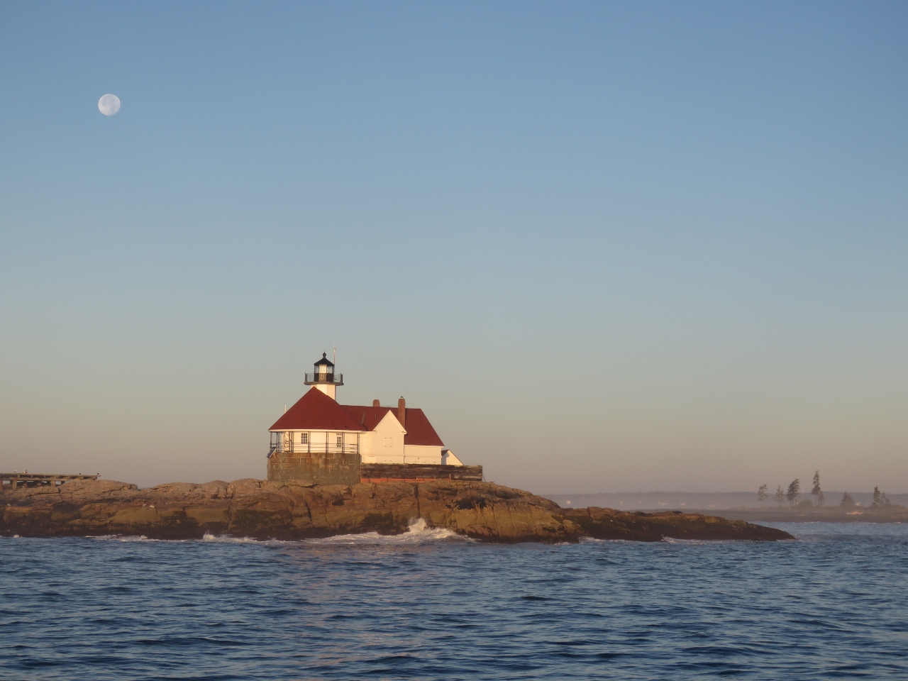
Seguin Island Light
Position: -69 44.84, 43 42.21
The light station perched atop Sequin Island went into service in 1796. Goods were transported between the boathouse at sea level and the station via a long tramway.
|
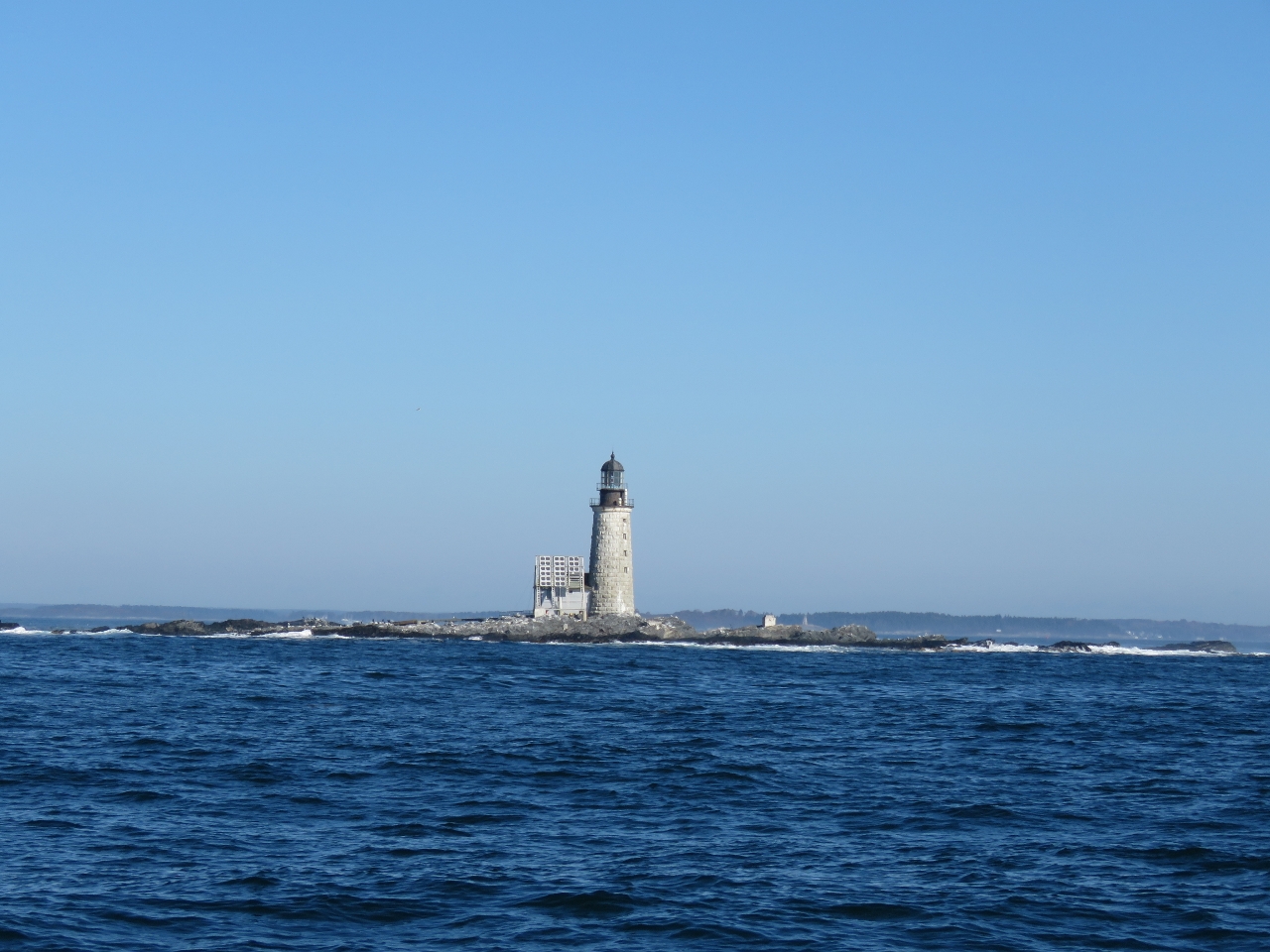 |
Halfway Rock Light
Position: -70 2.44, 43 38.99
Halfway Rock is in the middle of Casco Bay, roughly midway between Cape Elizabeth and Cape Small. It isn’t far from the light on Sequin Island, but locals began petitioning for a lighthouse here after several tragic shipwrecks on the rock. Nothing happened even in 1861 when the British bark Boadicea crashed into Halfway Rock and all aboard drowned. Funds finally were approved eight years later. A light on Halfway Rock went into operation in 1871 with a third-order Fresnel lens and the light was automated in 1874. The lighthouse and the ex-boathouse are all that remain as the rest of the structures have been carried away in storms, such as the Perfect Storm of 1991 documented in Sebastian Junger’s book of the same name.
|
 |
Fort Levett
Position: -70 11.45, 43 38.89
Lookout from Fort Levett high on the cliff at Cushing Island to our south as we approach Portland. Fort Levett was built in 1898 and went through several modernizations, including adding 16-inch gun batteries during World War II. The fort was decommissioned after the war and the property later sold to local residents.
|
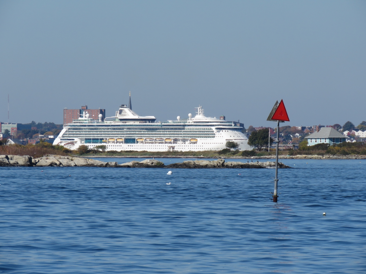 |
Serenade of the Seas
Position: -70 11.65, 43 38.86
The 962 ft cruise ship Serenade of the Seas visible through Whitehead Passage.
|
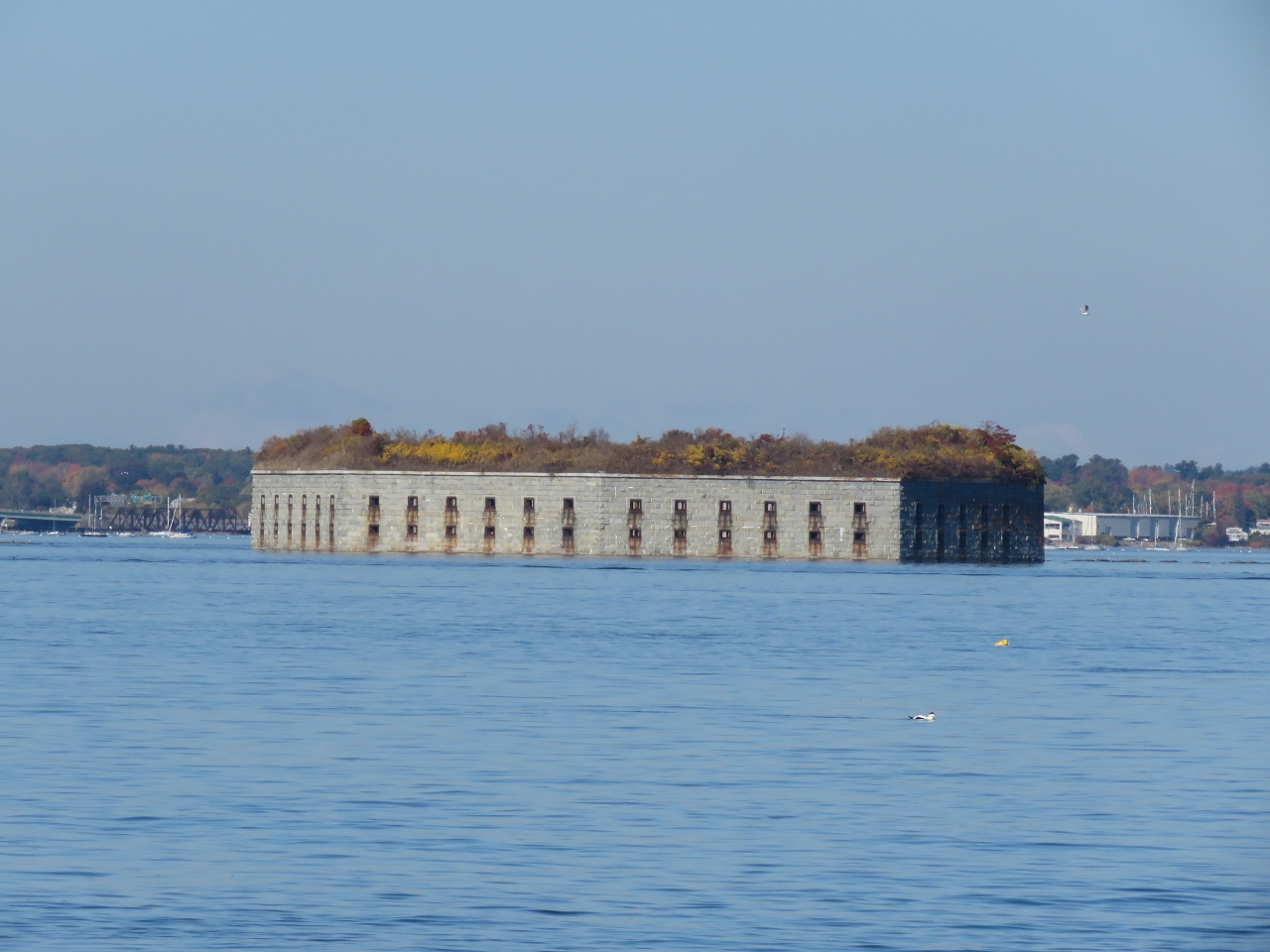 |
Fort Gorges
Position: -70 12.23, 43 39.46
Fort Gorges to our west is built on Hog Island Ledge, but appears to be floating at high tide.
|
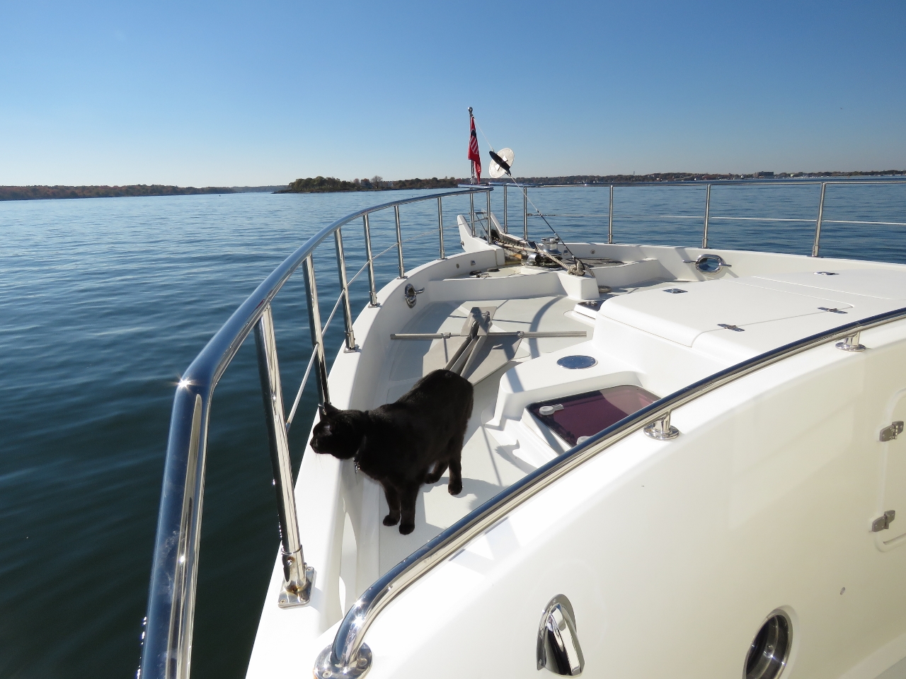 |
Spitfire
Position: -70 12.26, 43 39.70
Spitfire getting his first smell of Portland, Maine from our anchorage at the south end of Diamond Island Pass.
|
 |
At Anchor
Position: -70 12.19, 43 39.67
Looking across our anchorage in Diamond Island Pass to the cruise ship Serenade of the Seas. This was an excellent anchorage—we loved the views to the city and of the commercial traffic entering and leaving the harbor.
|
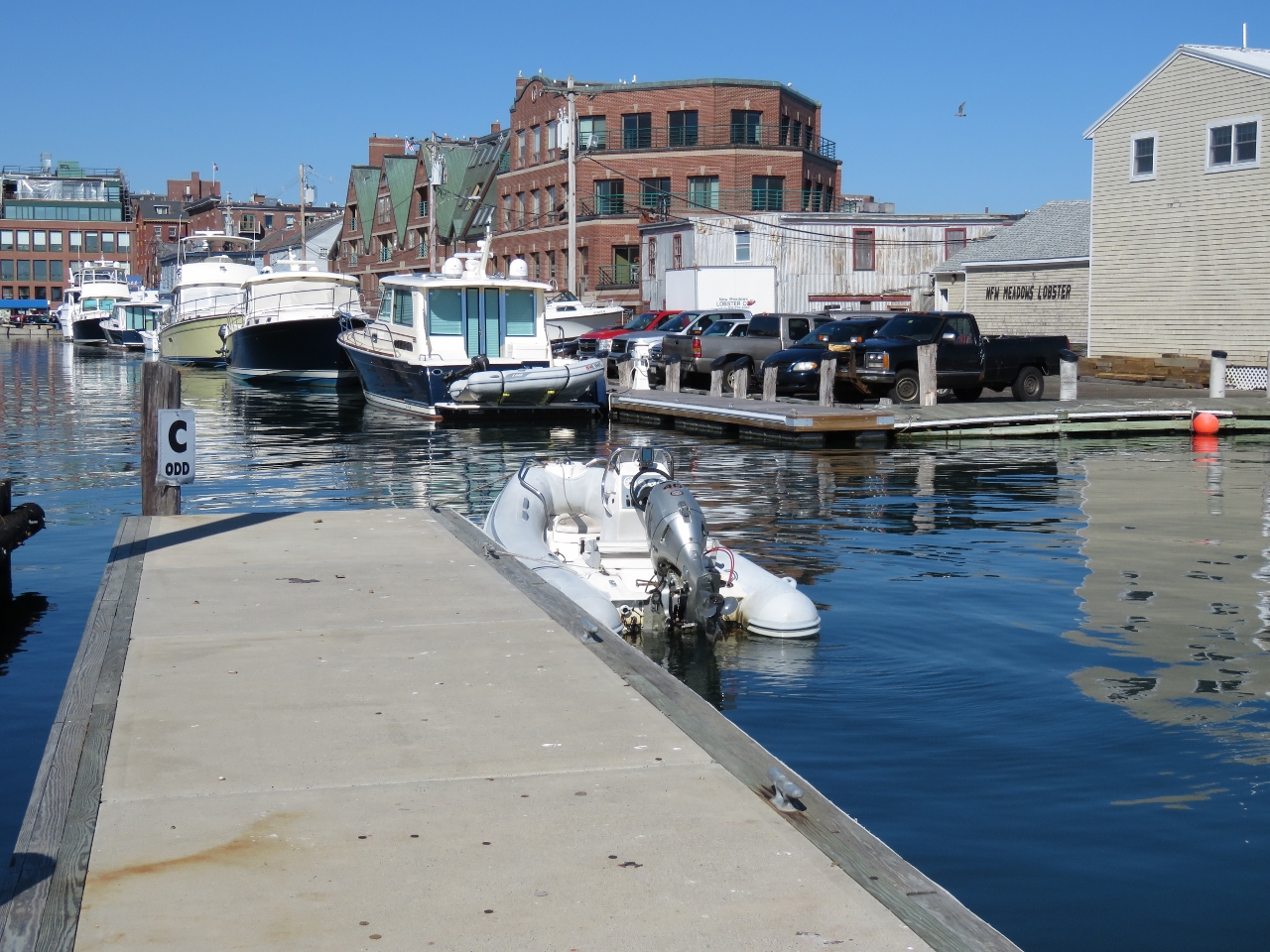 |
DiMilo’s
Position: -70 15.02, 43 39.25
We asked at the DiMilo’s Marina fuel dock if there was a spot we could leave the tender for a few hours. They directed us here and said we could get the gate code from the marina office. The office, however, wanted $20 for 3 hours. We intended to be ashore a little bit longer, so we asked how long for 5 hours and they said $40. That seemed absolutely unreasonable for a day stop in a 12ft tender so we declined and left to find a more reasonable alternative than DiMilo’s Marina.
|
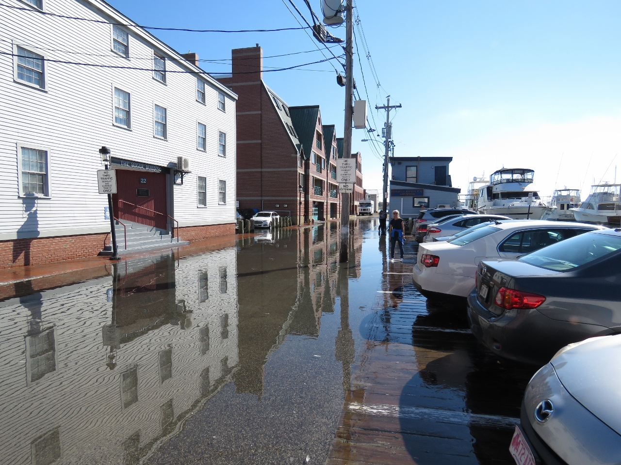 |
King Tide
Position: -70 15.07, 43 39.39
We found another spot to leave the tender and set off to explore Portland. Today and tomorrow the full moon is bringing astronomically high tides, or “King Tides”, that bring the water levels two inches above flood level. Jennifer is working past the cars along the flooded street near where we left the tender.
|
 |
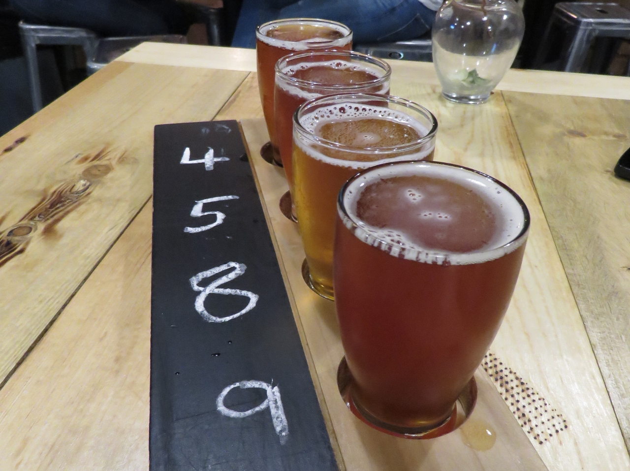
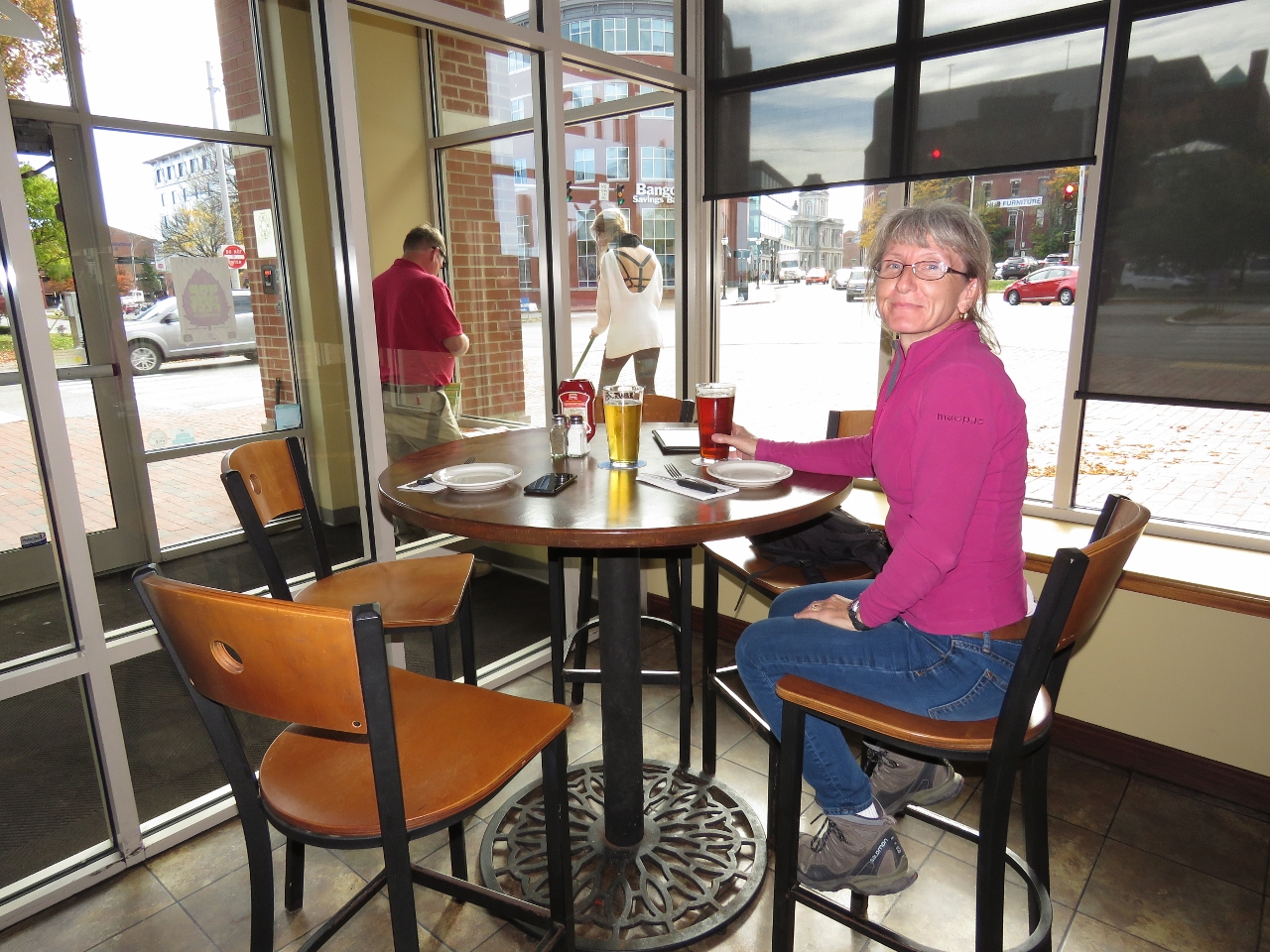
Ri Ra Irish Pub
Position: -70 14.98, 43 39.43
Lunch with local craft beer at Ri Ra Irish Pub overlooking the water.
|
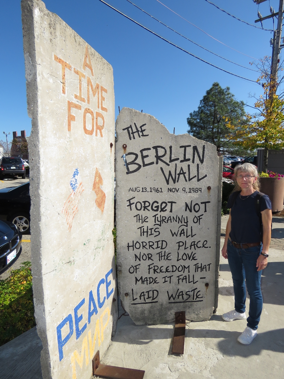 |
Berlin Wall
Position: -70 15.17, 43 39.34
We recently saw a piece of the Berlin Wall in Lunenburg, Nova Scotia. And here’s another in Portland.
|
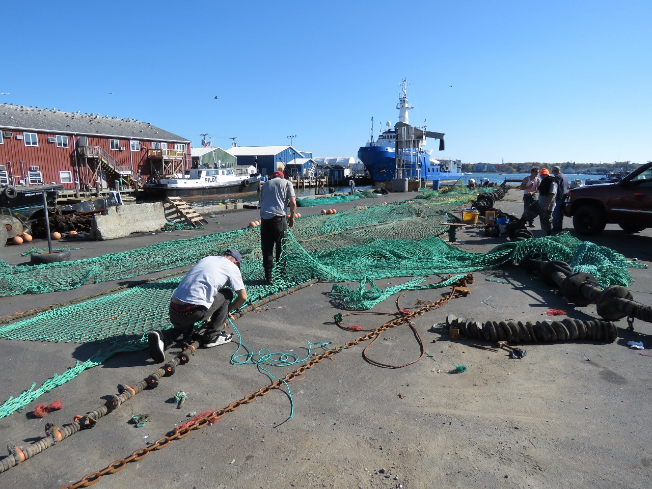 |
Nets
Position: -70 15.21, 43 39.19
We spent some time watching fisherman repairing their nets on the docks.
|
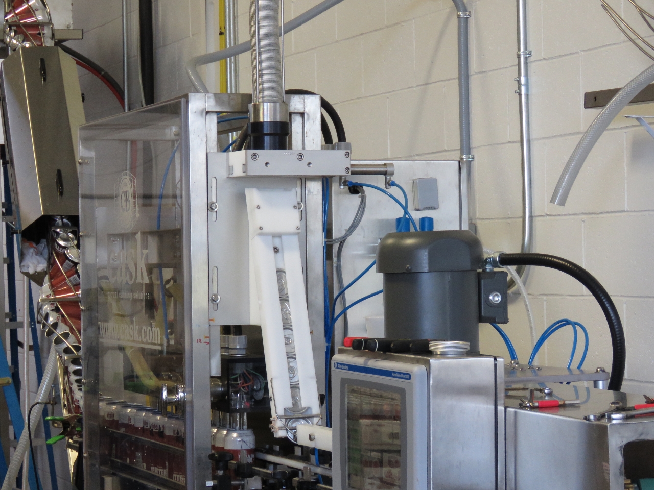 |
Canning Machine
Position: -70 15.42, 43 39.93
Portland has lots of microbreweries. This is the impressive automatic canning machine at the Rising Tide Brewing Company. Flats of lidless cans are fed into an elevator not visible in the picture, then are brought down and filled, lids applied and the cans sprayed clean. Hundreds of cans were filled in the brief time we were there.
|
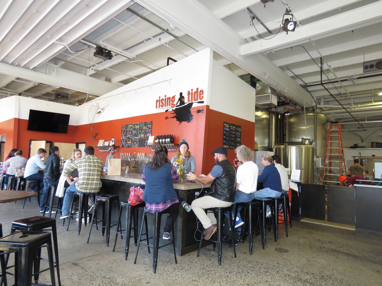 |
Rising Tide
Position: -70 15.44, 43 39.93
After an entertaining tour of the Rising Tide brewery, we tasted some of their excellent beer. The man seated on James’ right was on our tour and coincidentally also is from the Seattle area.
|
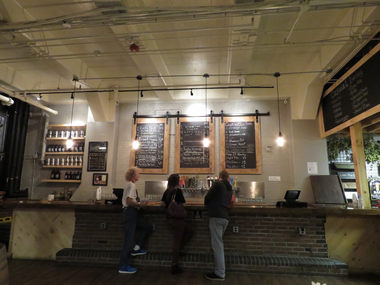 |
Shipyard
Position: -70 14.95, 43 39.68
On our way back to town, we stopped at the Shipyard Brewing Company tasting room to sample their craft beer.
|
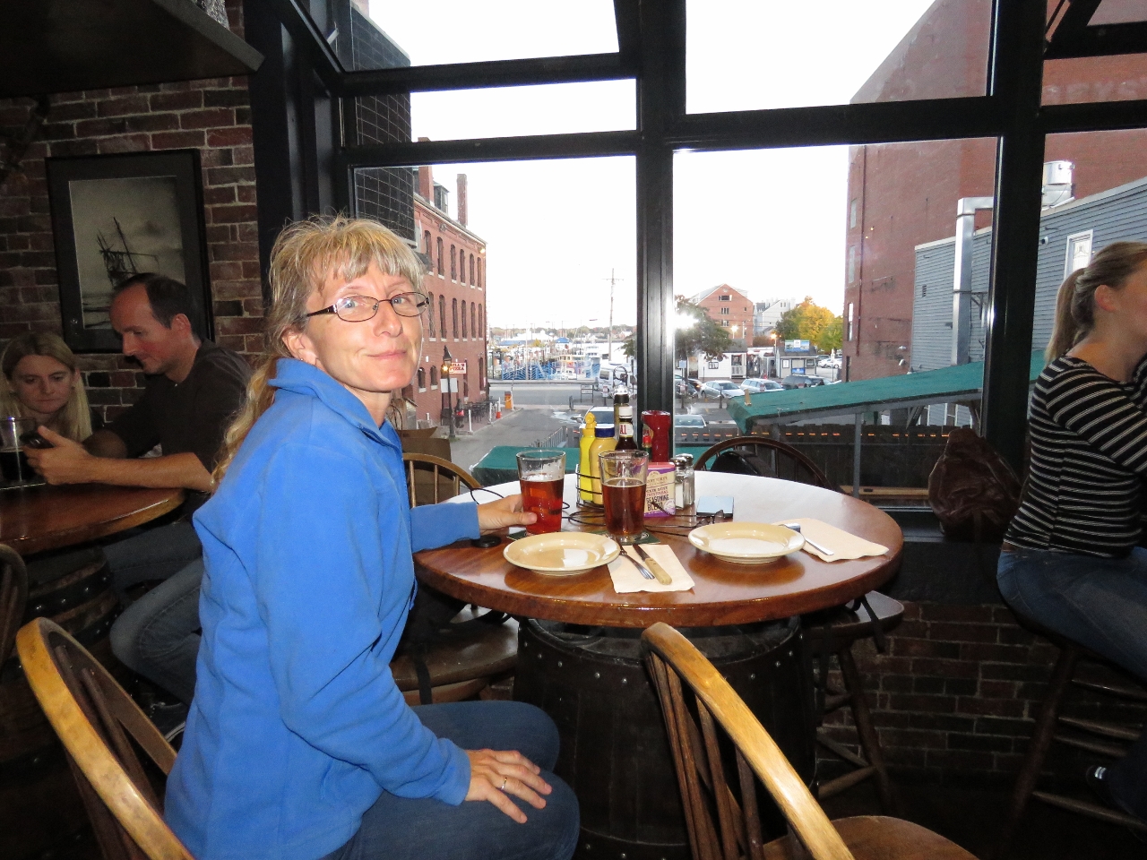 |
Gritty McDuff’s
Position: -70 15.20, 43 39.36
Dinner at Gritty McDuff’s Brew Pub overlooking downtown and the water. Gritty McDuff’s was established in 1988 and bills themselves as “Maine’s Original Brew Pub.”
|
 |
Low Tide
Position: -70 15.05, 43 39.34
The other effect of the King Tide is an extreme low tide of -1.8ft. With a total tide drop of nearly 13ft, our tender was barely afloat. The dock that is now resting on the bottom was above the fixed dock height visible at the top of the frame.
|
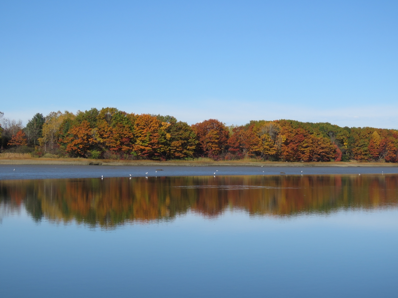 |
Fore River
Position: -70 18.00, 43 39.07
The fall colors reflected in the still waters of the Fore River west of downtown Portland.
|
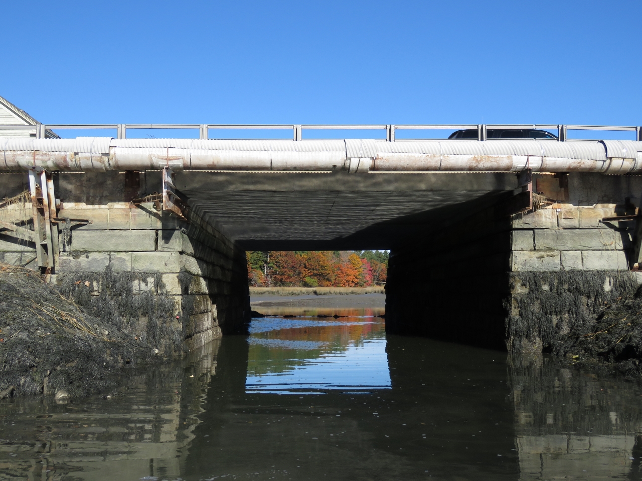 |
Out of Water
Position: -70 18.65, 43 39.50
The tide was on the rise from a -1.l-ft low and we had trouble finding enough water in places. But we knew we couldn’t get under this bridge at higher tides, so we were hoping to have enough to get through at low tide. Unfortunately a mid-tide seems to be the magic tide level to have enough water to pass through but not so much that the air draft restricts us.
|
 |
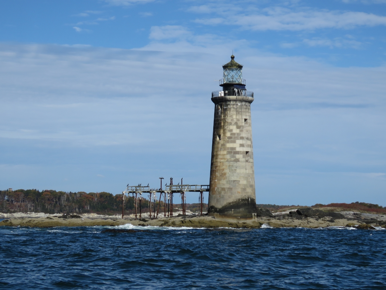
Bug Light
Position: -70 13.99, 43 39.28
Bug Light at the end of the Portland Breakwater was built in 1875. Six decorative Corinthian columns hide seams joining the curved cast-iron plates that form the structure. The light was decommissioned in 1943, restored in 1989, and reactivated as a private beacon in 2002.
|
 |
Liberty Ship Memorial
Position: -70 13.58, 43 39.32
This Liberty Ship Memorial in South Portland is the replica of a bow section of a World War II Liberty Ship. The memorial honors those who built Liberty ships nearby at the New England Shipbuilding Corporation.
|
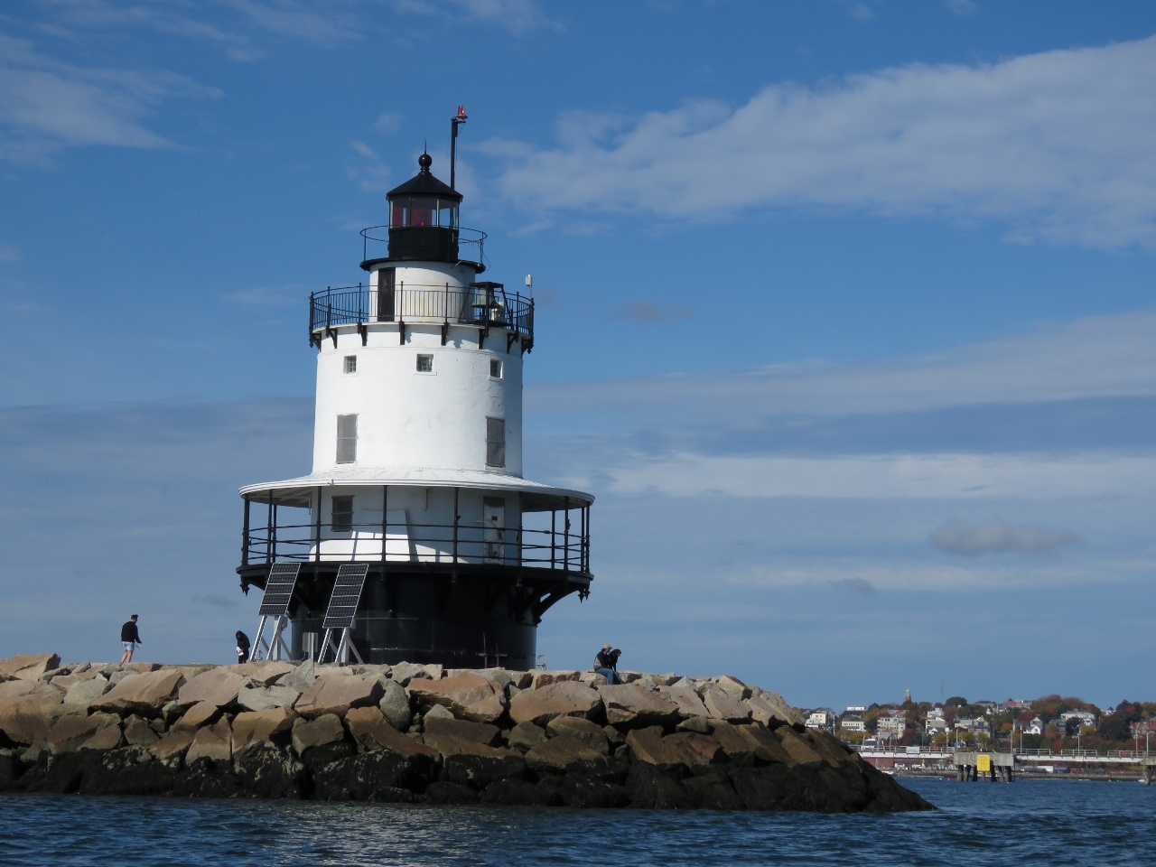 |
Spring Point Ledge Light
Position: -70 13.42, 43 38.97
Spring Point Ledge Lighthouse was constructed in 1897 and is the only caisson-style light station in the United States that visitor can walk to.
|
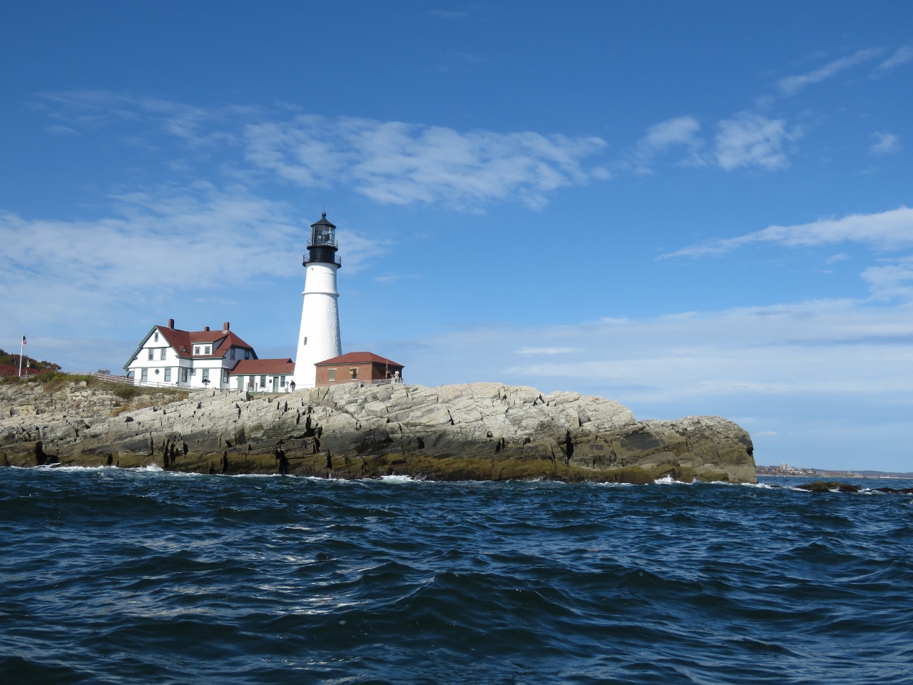 |
Portland Head Light
Position: -70 12.36, 43 37.34
In 1787 George Washington directed the construction of the Portland Head Light that was completed in 1791. The light originally was lit with whale oil lamps. In 1855, a fourth-order Fresnel lens was installed that was later upgraded to a second-order. During the civil war the tower was raised twenty feet. After the Halfway Rock light was built, the Portland Head light was considered less important and in 1883 the much-deteriorated twenty-foot extension was removed and a new lantern and fourth-order Fresnel lens installed. The height and the second-order lens were restored in 1885 when mariners complained. The light is still an operating aid to navigation, lit with a 400-watt halogen bulb visible for 24 miles.
|
 |
Ram Island Ledge Light
Position: -70 11.31, 43 37.81
The Ram Island Ledge light was built in 1905 and automated in 1959. To the left of the tower are the ruins of the iron landing pier built to facilitate the transfer of goods and people in rough weather.
|
 |
Fort Gorges
Position: -70 13.30, 43 39.78
Fort Gorges was built on Hog Island Ledge between 1858 and 1864 and at high tide appears to float. No troops were ever stationed there and no battle fought—advancing military technology made the fort obsolete before it could be used. The fort is open to the public, but accessible only by private boat. We’d tried to land earlier in the day, but couldn’t easily get close enough in the extreme low tide.
|
 |
Sebago
Position: -70 15.05, 43 39.54
We had an excellent lunch at the Sebago Portland brewpub.
|
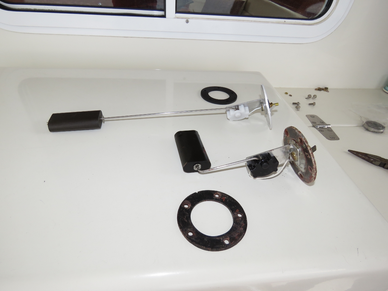 |
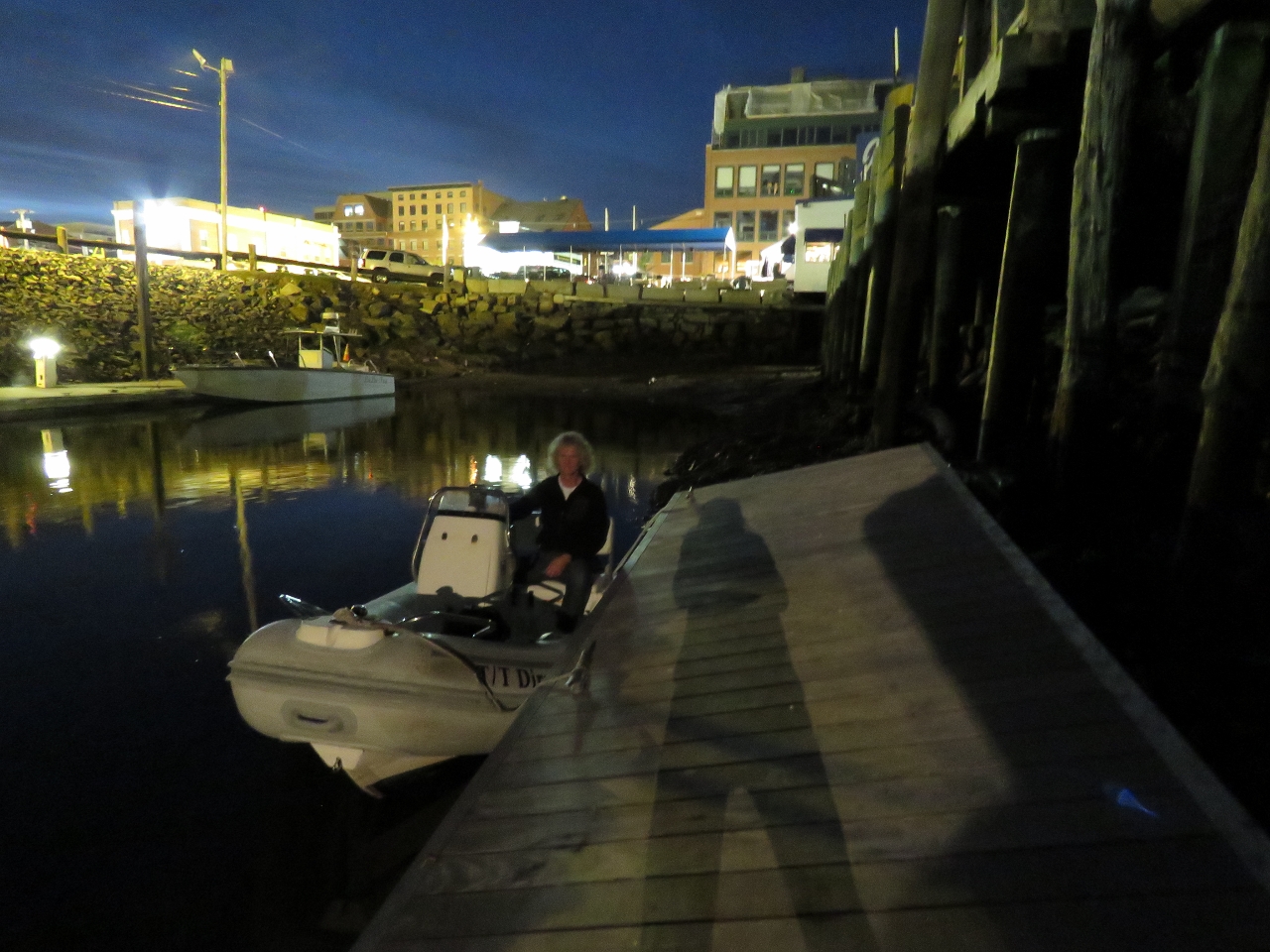
Fuel Gauge
Position: -70 12.27, 43 39.67
The fuel gauge in our tender failed while we were in Bras d’Or Lake, Nova Scotia earlier this year. We’d received a replacement while in Southwest Harbor and James set about installing it today. The original float in the lower part of the picture isn’t really available as a part. What you need to do is buy the new part above and bend it to suit the tank.
|
 |
New Float
Position: -70 12.27, 43 39.67
The new fuel level float bent to match the original.
|
 |
New Fuel Gauge
Position: -70 12.27, 43 39.68
The new fuel gauge installed and working. It’s great to have an accurate fuel reading again.
|

|
Click the travel log icon on the left to see these locations on a map, with the complete log of our cruise.
On the map page, clicking on a camera or text icon will display a picture and/or log entry for that location, and clicking on the smaller icons along the route will display latitude, longitude and other navigation data for that location. And a live map of our current route and most recent log entries always is available at http://mvdirona.com/maps. |
Bummer that I just caught this entry now as I would have loved to show you all some other great craft beer locations in Portland.
Hey Mark. Sorry we missed that on this trip through. You can always see our current location on //mvdirona.com/maps — feel free to contact us if our coordinates overlap.