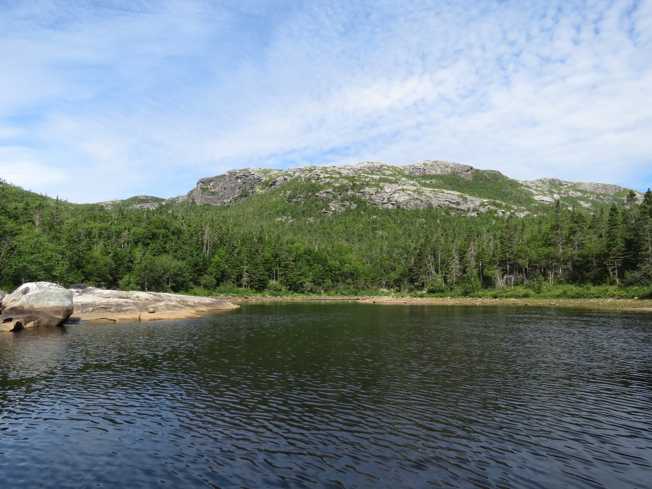
Northern Arm extends as two long inlets roughly eleven miles into the Newfoundland Coast from the western edge of Bay d’Espoir. The scenery there, particularly along seven-mile North Bay, is spectacular. We spent four nights in Northern Arm where we saw seals, whales and eagles, made five climbs, and completely ran out of superlatives to describe the amazing setting.
Trip highlights from August 13 through 16th follow. Click any image for a larger view, or click the position to view the location on a map. And a live map of our current route and most recent log entries always is available at http://mvdirona.com/maps
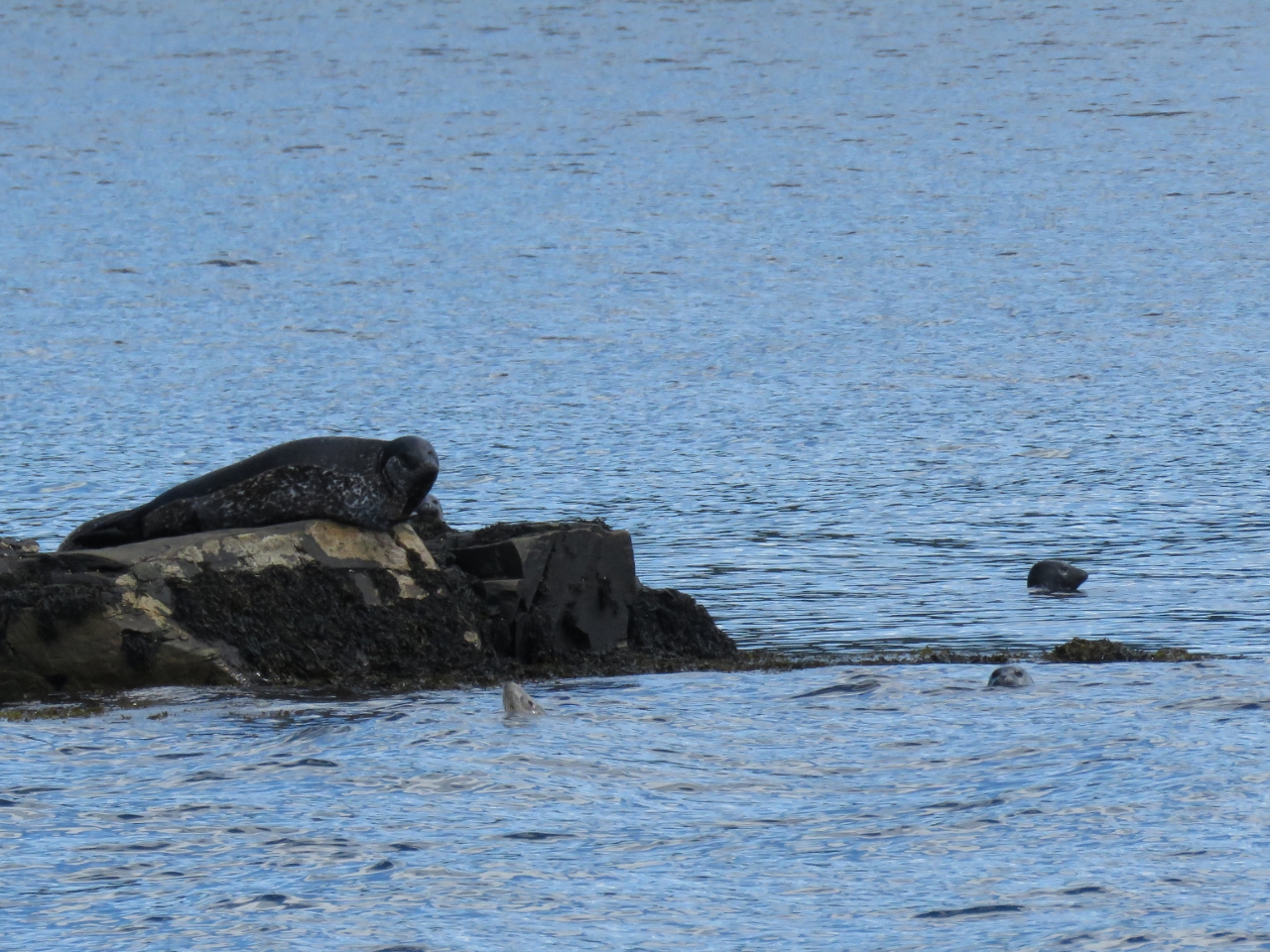 |
Seals
Position: -56 6.48, 47 42.61
Seals apparently aren’t very common in Newfoundland, so we felt lucky to see some on the rocks outside Middle Goblin Bay. The ones in the water looked quite small and likely were juveniles.
|
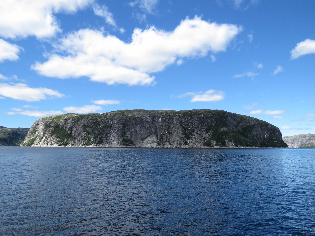 |
North Bay Head
Position: -56 8.13, 47 44.12
Imposing North Bay Head at the mouth of North Bay. The scenery here is incredible.
|
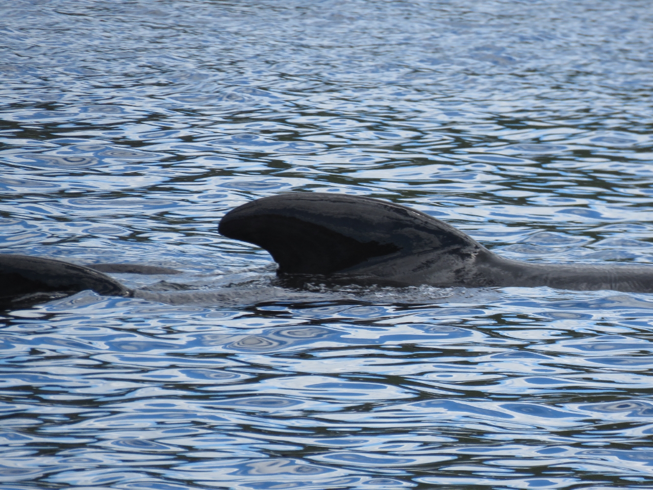 |
Pilot Whales
Position: -56 7.97, 47 44.51
Near North Bay Head, we saw a pod of cetaceans of a variety we’ve not seen before. They acted like whales feeding, but were about the size of a large dolphin. We believe they are Long-finned pilot whales, common in Newfoundland and the northern Atlantic.
|
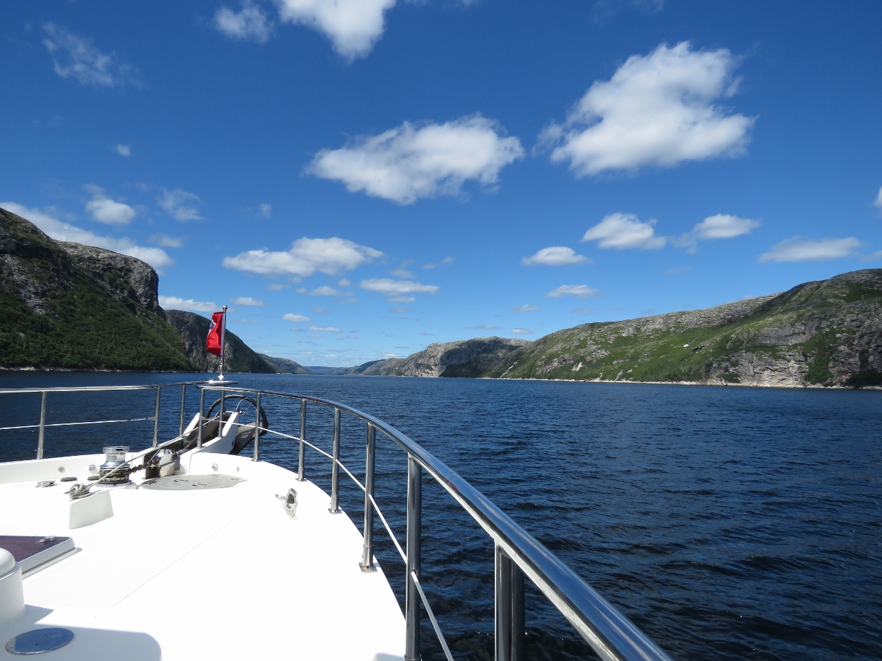 |
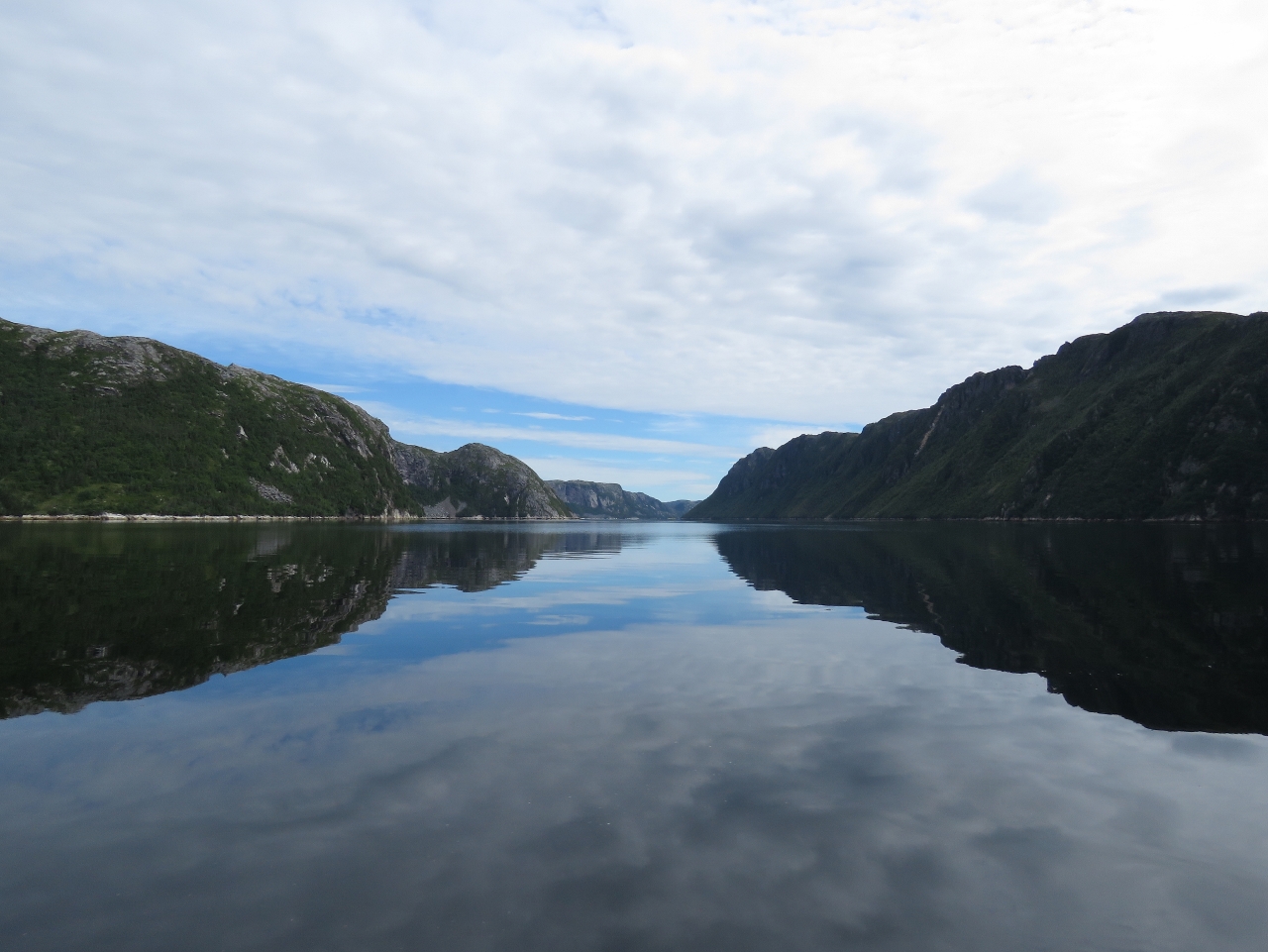
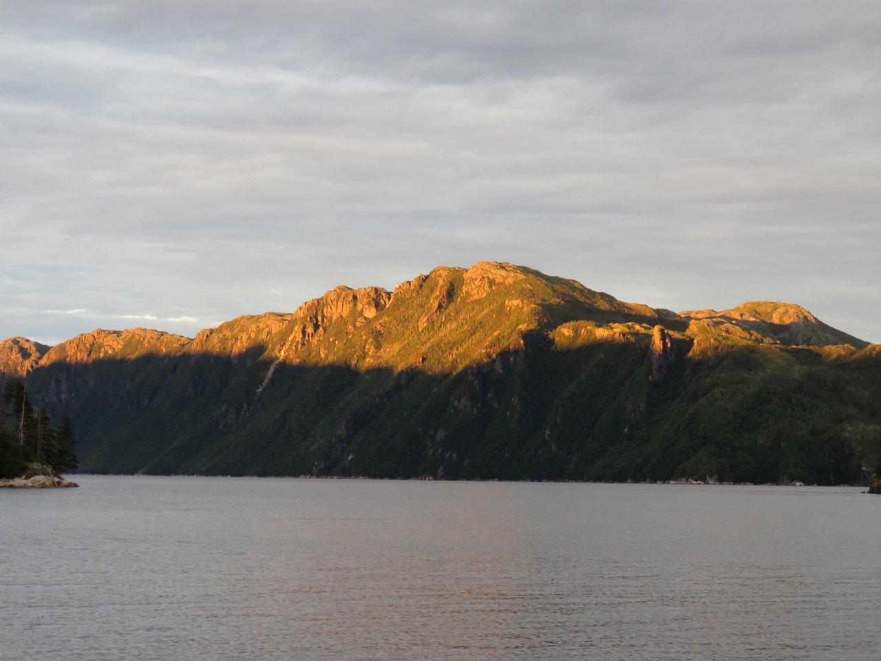
North Bay
Position: -56 7.70, 47 45.17
The amazing scenery looking up North Bay.
|
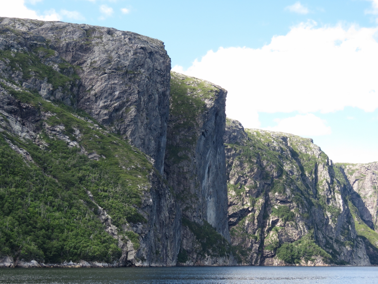 |
Cliffs
Position: -56 7.74, 47 45.55
Twin shear-faced cliffs soaring straight up from the water along the west shore of North Bay.
|
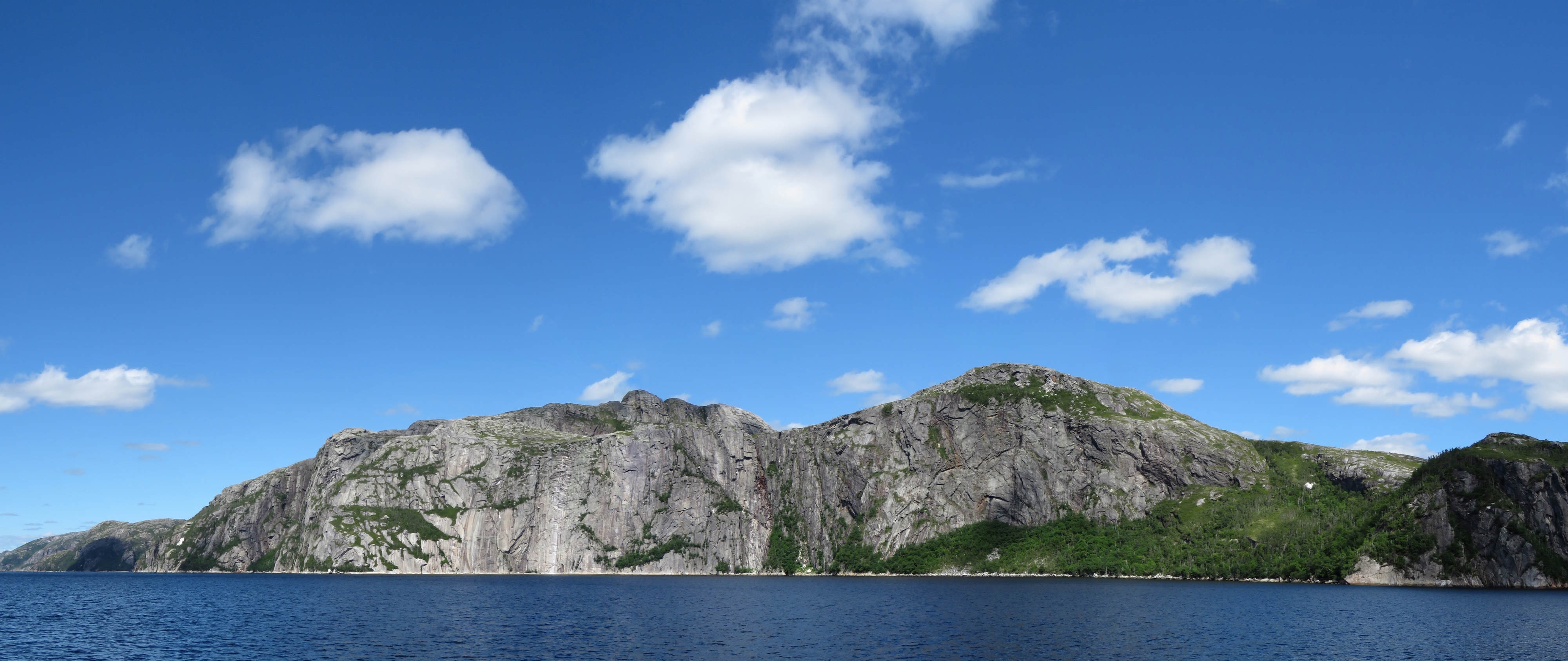 |
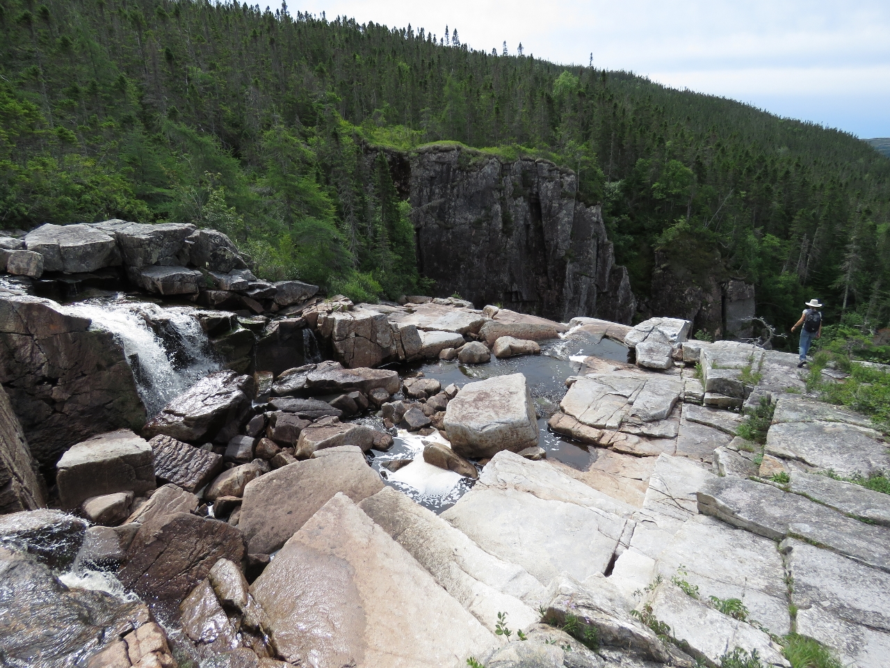
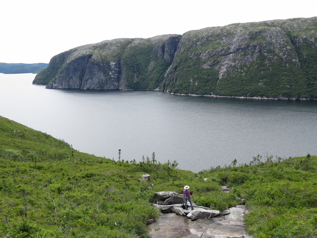
Scenery
Position: -56 8.05, 47 46.50
The scenery is on such a large scale it’s hard to capture in a single photograph. This is a panorama of the cliffs along the eastern shore of North Bay.
|
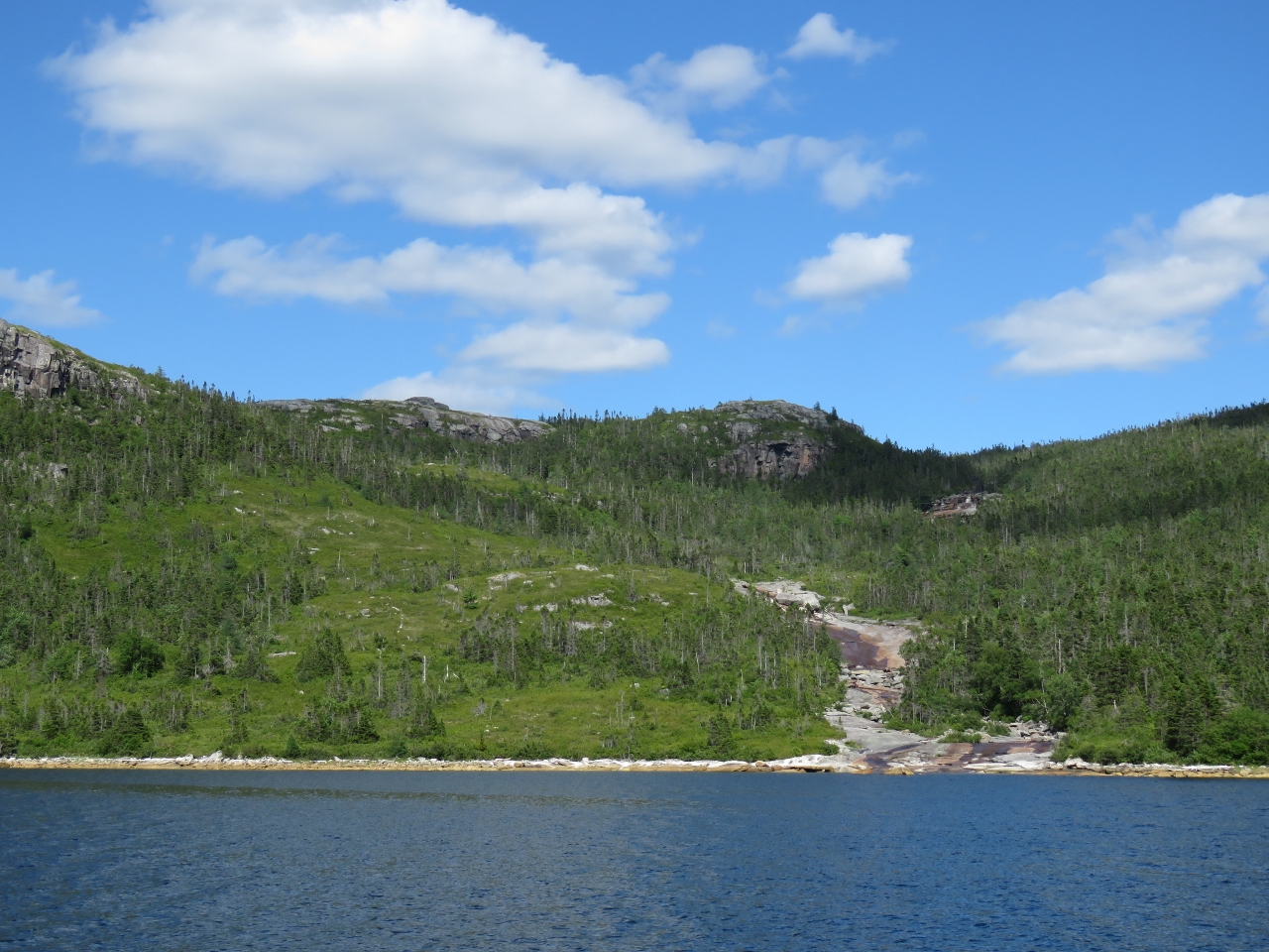 |
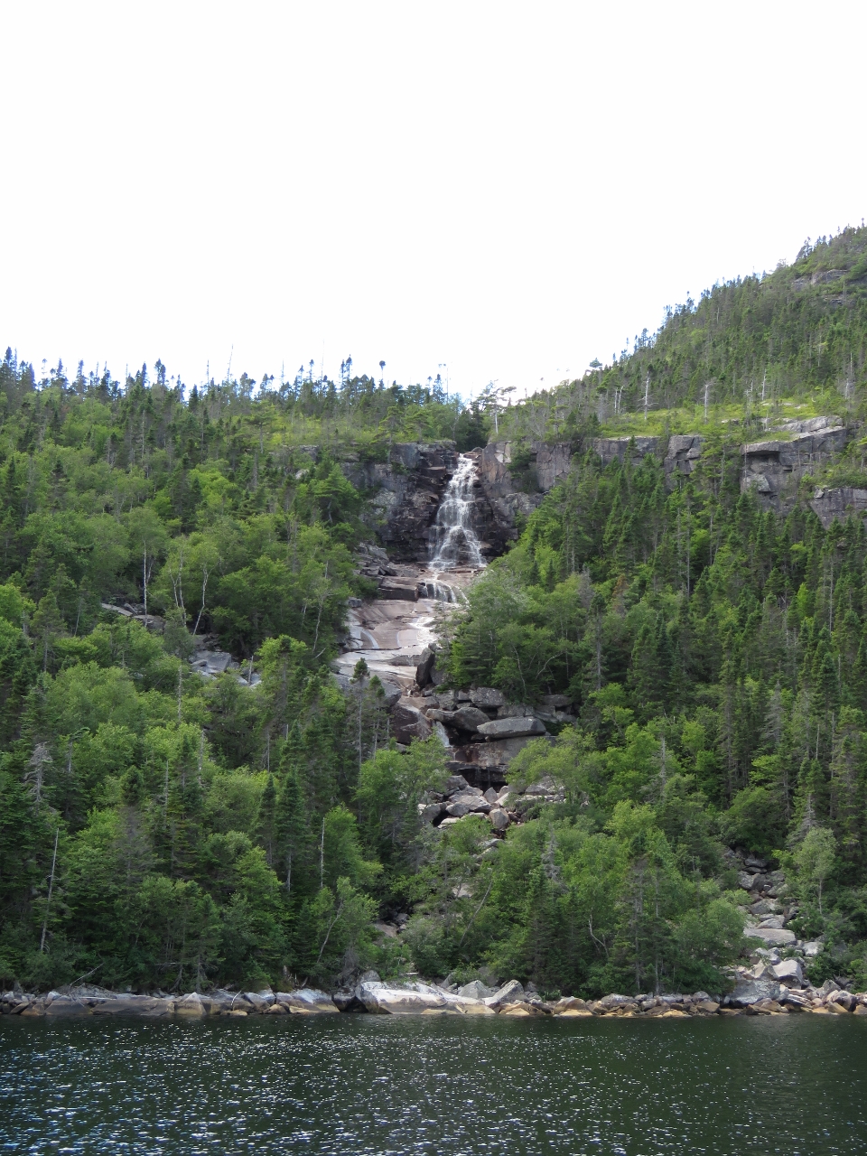
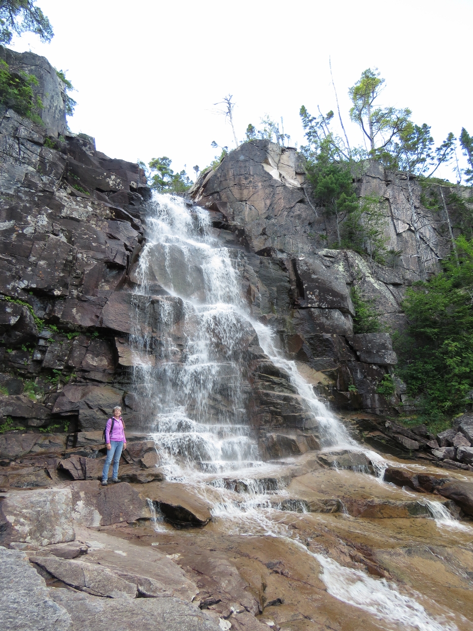
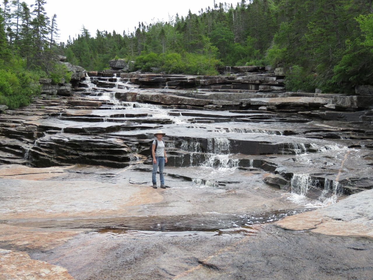
Waterfall I
Position: -56 9.47, 47 50.56
This waterfall spills over smooth rocks into the east shore north of Hughes Point near the head of North Bay. It looks like an easy climb.
|
 |
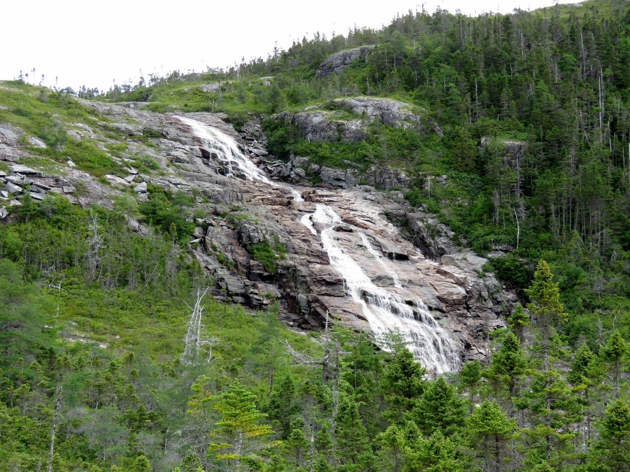
Waterfall II
Position: -56 10.10, 47 51.07
A second, more dramatic waterfall, empties into the west shore near the head of North Bay. This one also looked climbable, although a little more difficult than the first.
|
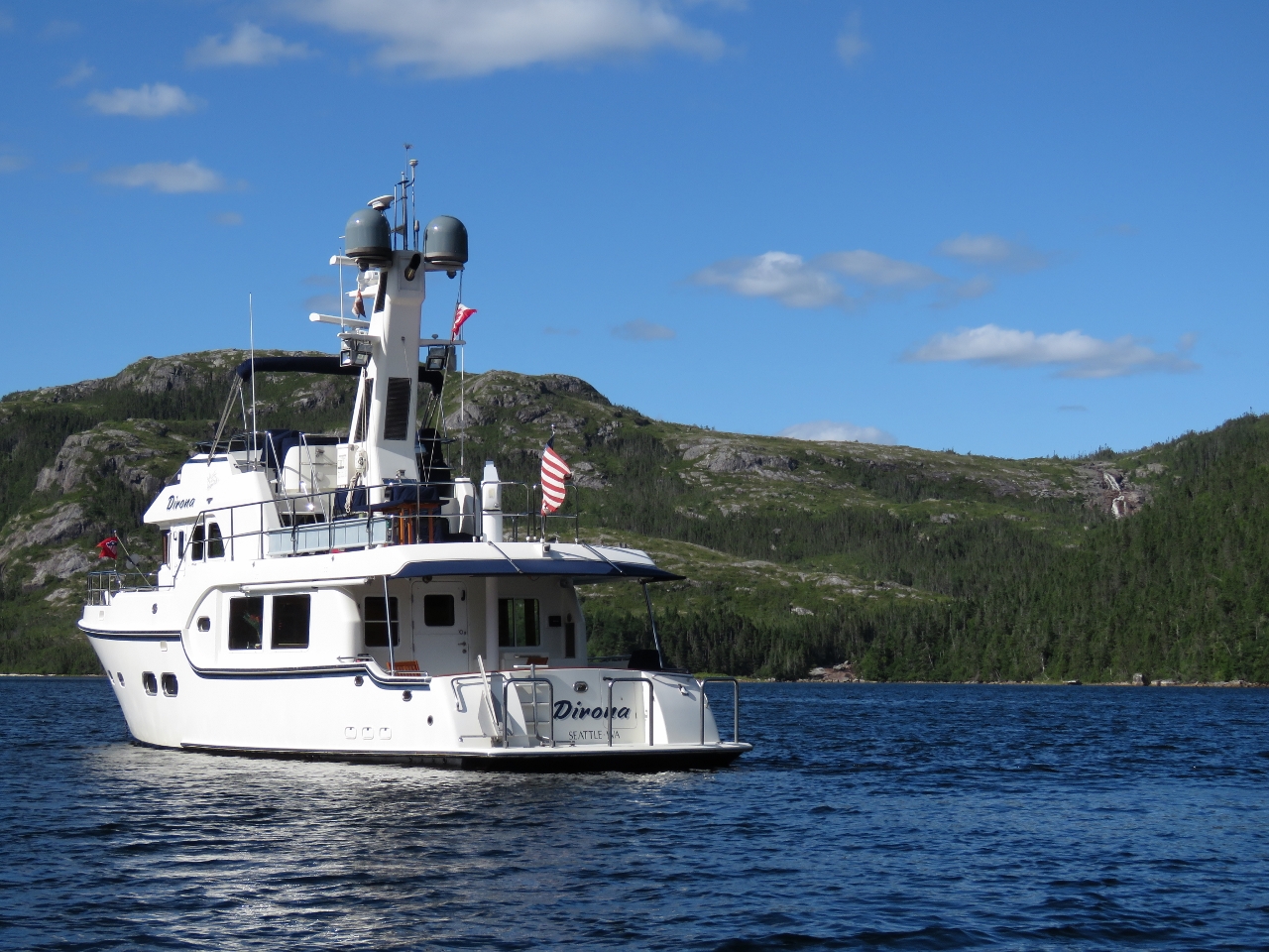 |
Anchor
Position: -56 9.90, 47 51.84
At anchor behind Indian Point at the head of North Bay. Near the top of the hills at the right side of the photograph is a third waterfall.
|
 |
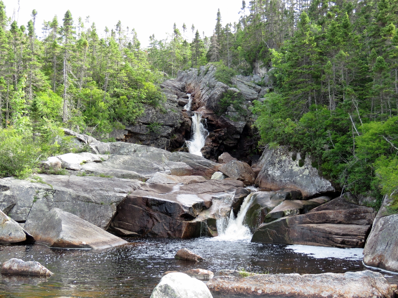
Waterfall III
Position: -56 9.76, 47 52.27
Looking up from the bottom of the third waterfall that we could see the top of from the anchorage.
|
 |
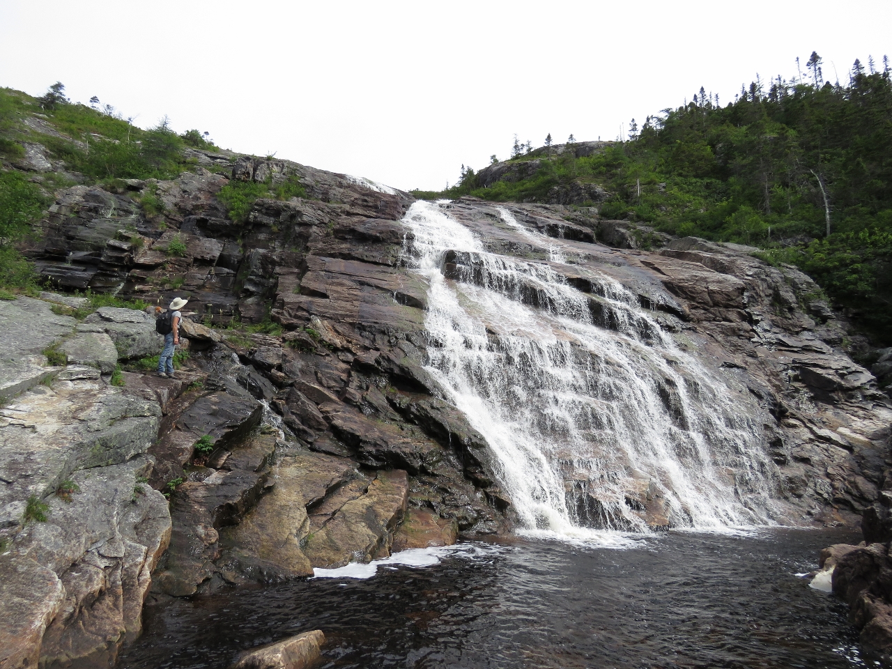
Climbing
Position: -56 10.24, 47 51.14
We’d arrived late in the afternoon and didn’t have time for a long shore trip, so decided to make a short climb up the second waterfall.
|
 |
Mid-level falls
Position: -56 10.28, 47 51.13
Partway up, the falls gushed out through an opening in the rocks and spilled over the ledge James is standing on. Beautiful!
|
 |
Top
Position: -56 10.32, 47 51.13
The topmost section of the falls were the most impressive of all.
|
 |
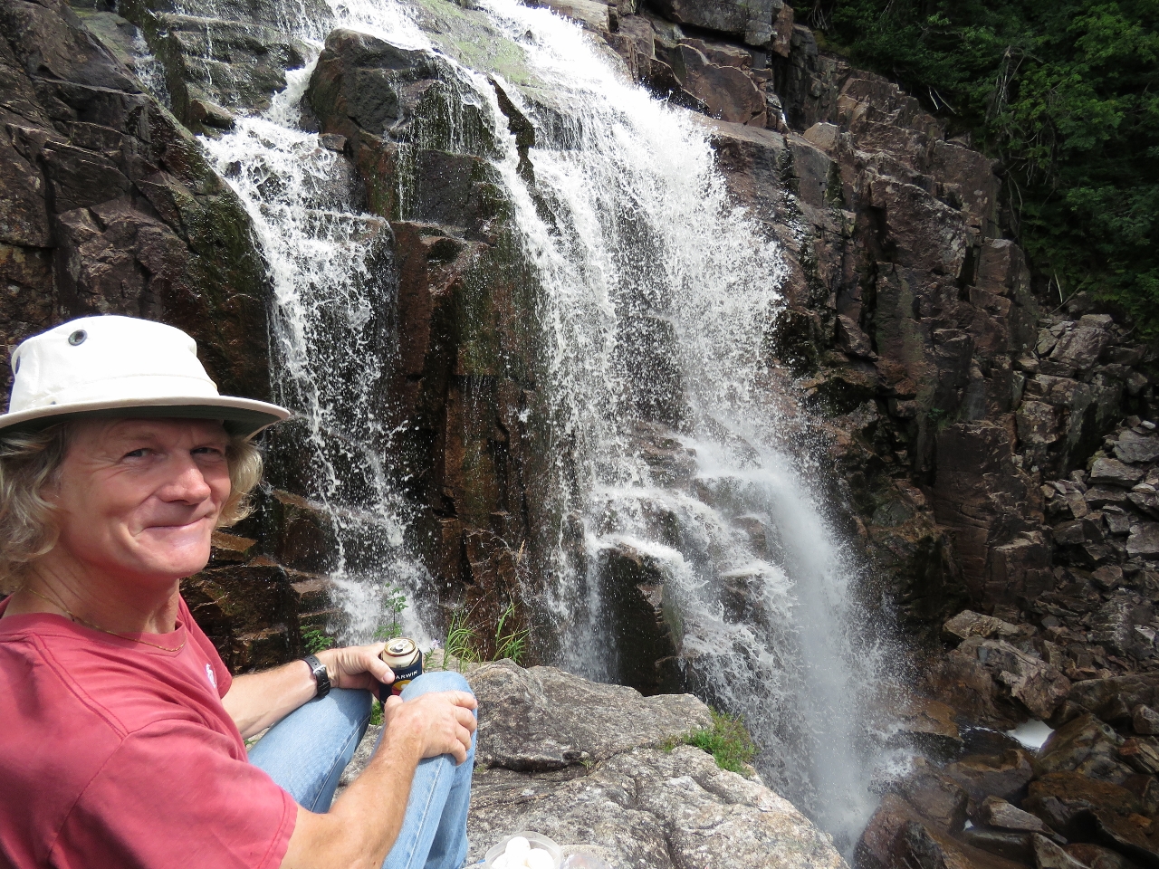
Break
Position: -56 10.33, 47 51.13
Taking a break to enjoy the falls. The view the other way is pretty spectacular as well.
|
 |
Morning
Position: -56 9.91, 47 51.85
A beautiful calm morning at the head of North Bay.
|
 |
Cabin
Position: -56 9.90, 47 52.06
A nice location for a cabin at Thomey Cove at the head of North Bay.
|
 |
Waterfall III
Position: -56 9.76, 47 52.31
We landed the tender in Thomey Cove and began walking up to reach the top of the falls we could see from the anchorage. For the first half or so the going generally pretty easy over gently sloping rocks.
|
 |
Cascades
Position: -56 9.72, 47 52.35
Multiple cascades about a quarter of the way up.
|
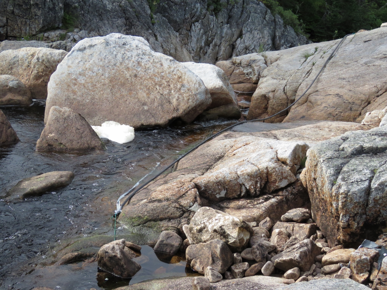 |
Water Supply
Position: -56 9.69, 47 52.41
About a third of the way up we found the top of the water supply hose for the cabin at Thomey Cove. The hose was secured to rocks, but wasn’t actually in the flow, so presumably the water levels are quite low right now.
|
 |
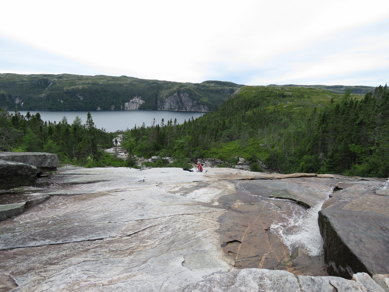
Goal
Position: -56 9.59, 47 52.55
We’d mostly been following the falls, but diverted into the woods to work around a cliff about two-thirds of the way up. We’re getting closer to our goal though.
|
|
|
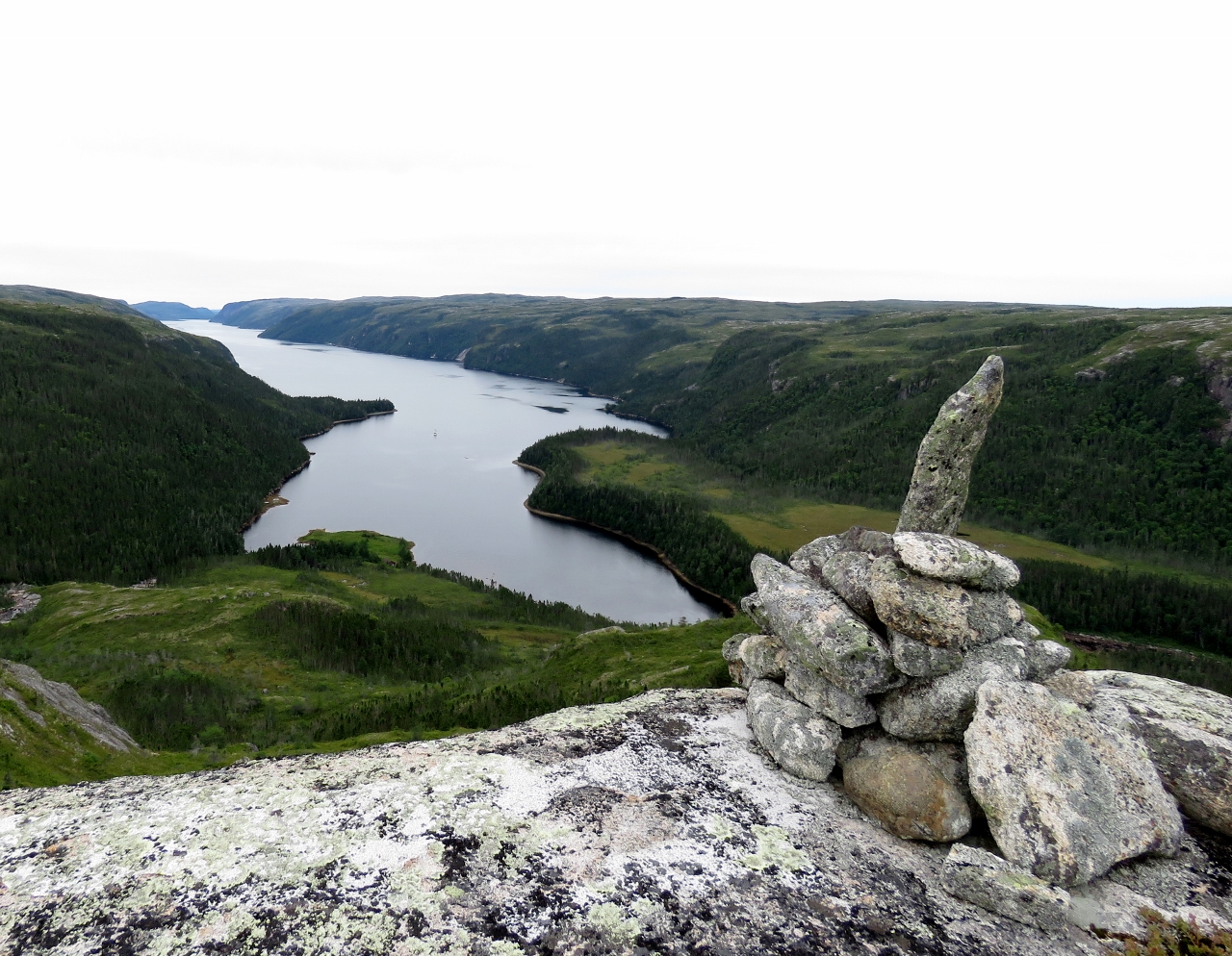
Summit
Position: -56 9.84, 47 52.71
We cleared the woods relatively quickly, and decided to keep climbing northwest across mostly open ground to reach the peak above the anchorage. This is the view from 665ft up where someone had built a cairn. Dirona is visible as a small speck midway between the point that juts out from the left, and the right shore.
|
 |
Tundra
Position: -56 9.92, 47 53.01
We spent some time exploring the tundra around the summit. Not many trees grown up here–mostly undergrowth and small bushes. The terrain reminded us very much of Stewart Island in southern New Zealand, particularly the glacial erratics (glacial-carried rocks and boulders) littered across the landscape.
|
 |
Top of the Falls
Position: -56 9.53, 47 52.63
After exploring the tundra, we worked our way back down to the top of the falls.
|
 |
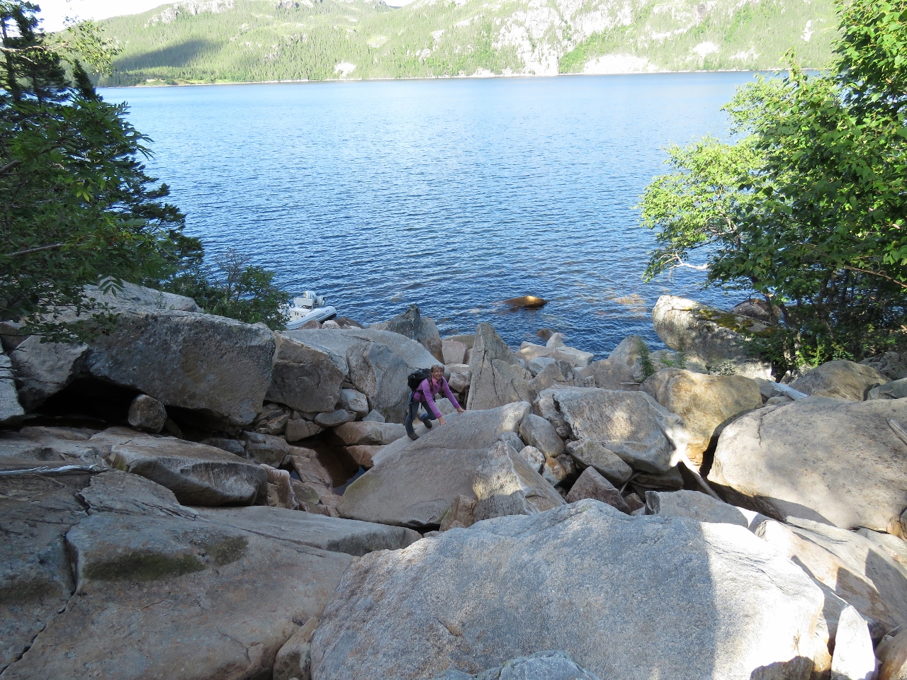
Heading Down
Position: -56 9.56, 47 52.57
We were able to work our way all the way back down to the base of the falls mostly following the rocks along the west side of the falls, with a few diversions into the woods. Here Jennifer is just about to disappear over the edge at a steeper, but still manageable section.
|
 |
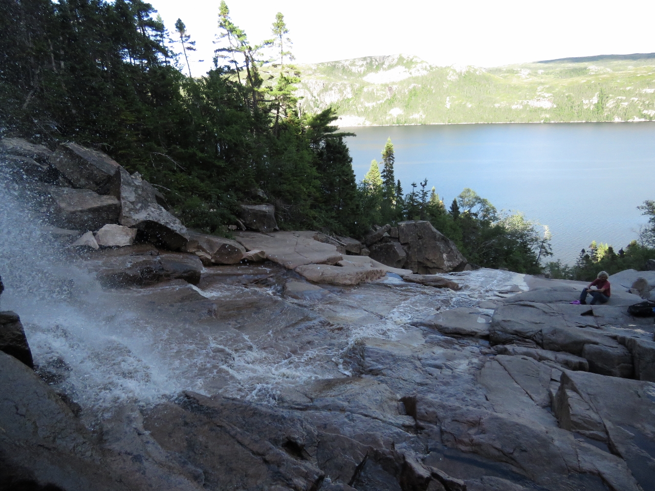
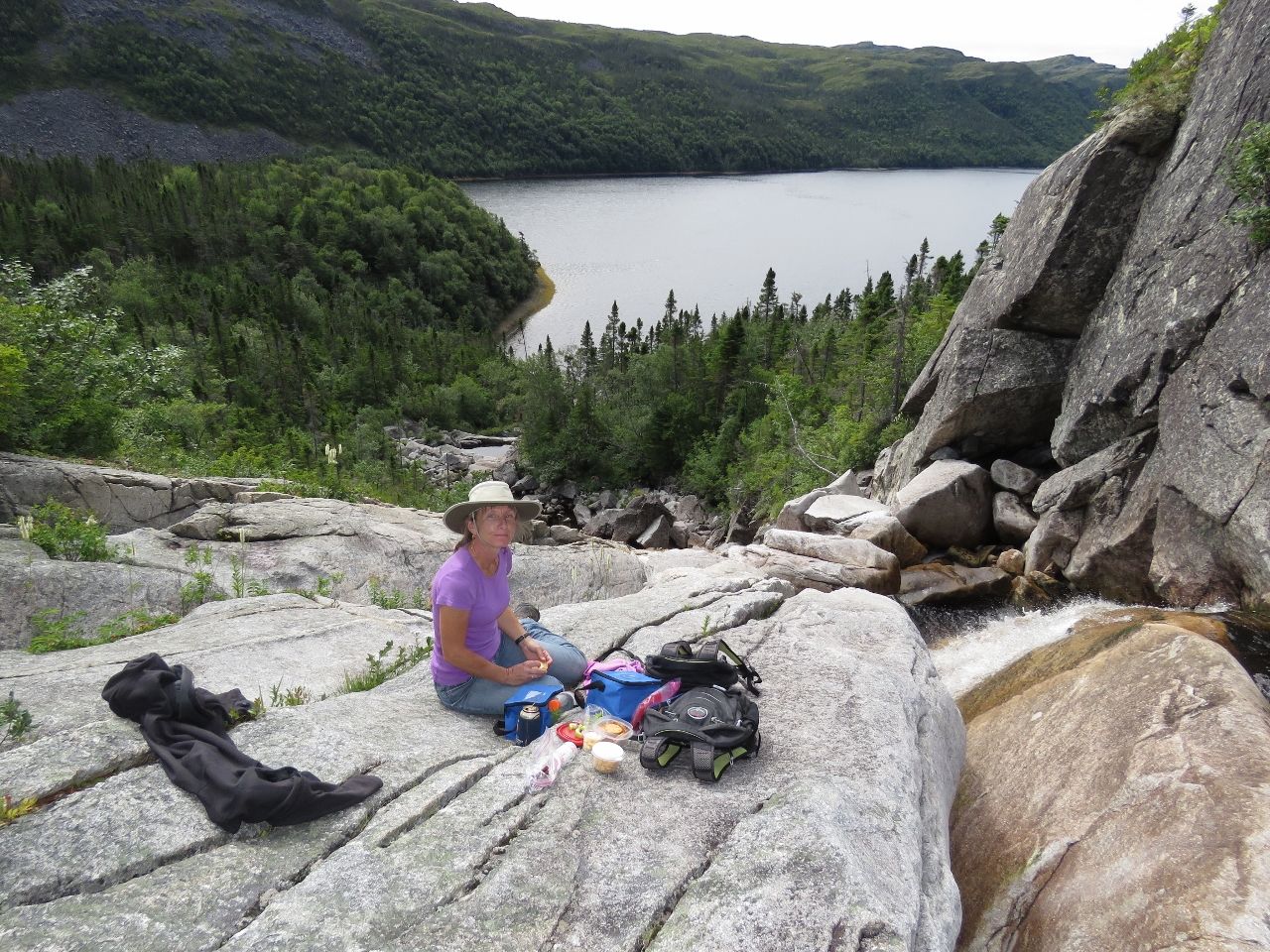
Lunch
Position: -56 9.54, 47 52.52
On our climb up we’d moved away the falls so missed this section where the water plunges over one hundred feet into a pool below. We couldn’t imagine a better view for a picnic, so found a perch above the falls and enjoyed the show.
|
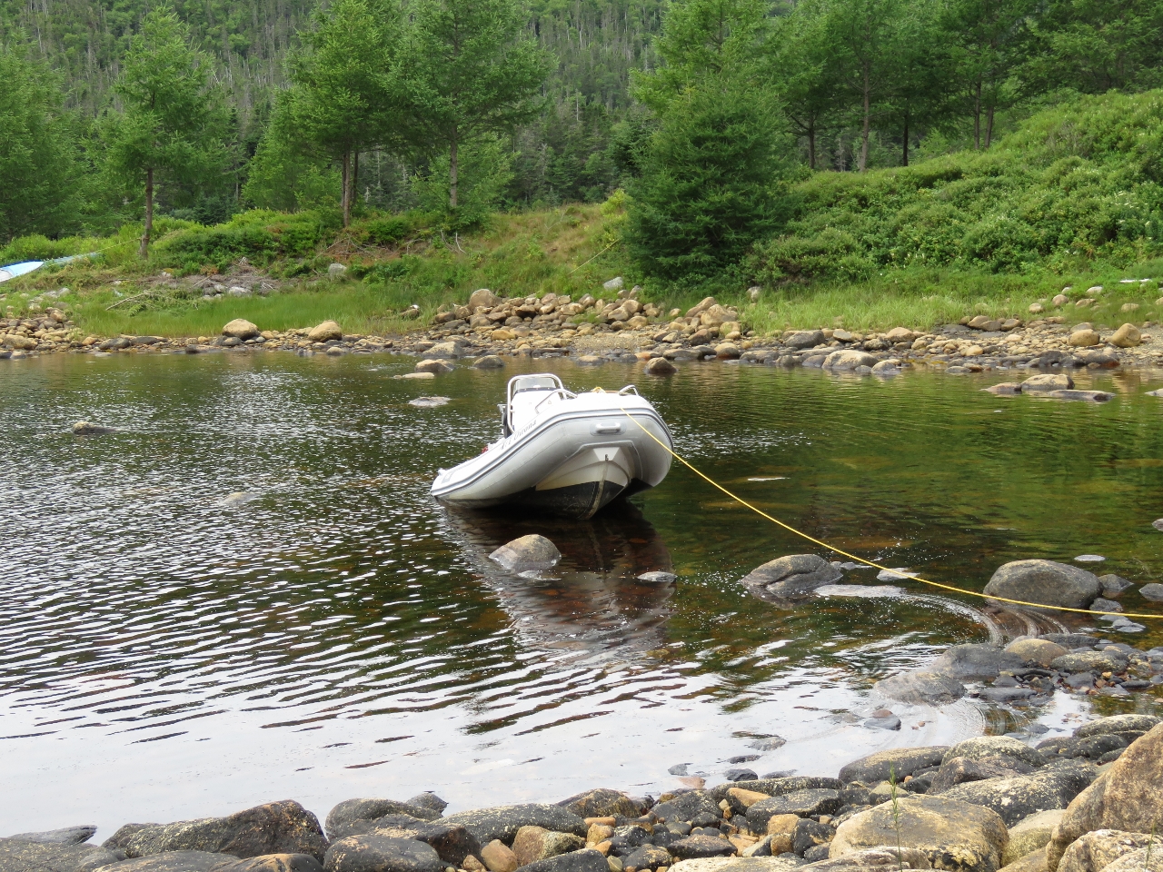 |
The Boat Who Wouldn’t Float
Position: -56 9.77, 47 52.32
We arrived back from our hike to find the tender top-centered on a couple of rocks due to a little more tidal range at the end of the inlet than we’d expected. The Boat Who Wouldn’t Float was penned by Bestselling Canadian author Farley Mowat while he lived about 75 miles to our west in Burgeo, Newfoundland. The book was an account of Mowat’s misadventures aboard his sailboat The Happy Adventure that had all manner of equipment failures and sank regularly. While in Burgeo he also wrote the controversial A Whale for the Killing, about a fin whale that became trapped in a cove near the town and died from wounds inflicted by some locals.
|
 |
Afloat
Position: -56 9.78, 47 52.31
We got lucky and James was just barely strong enough to wrestle the tender off the rocks.
|
 |
Waterfall I
Position: -56 9.28, 47 50.66
It was just past noon when we returned from our hike, and it looked like an easy walk up the first waterfall we saw coming in yesterday, so we ran the tender over to check it out.
|
 |
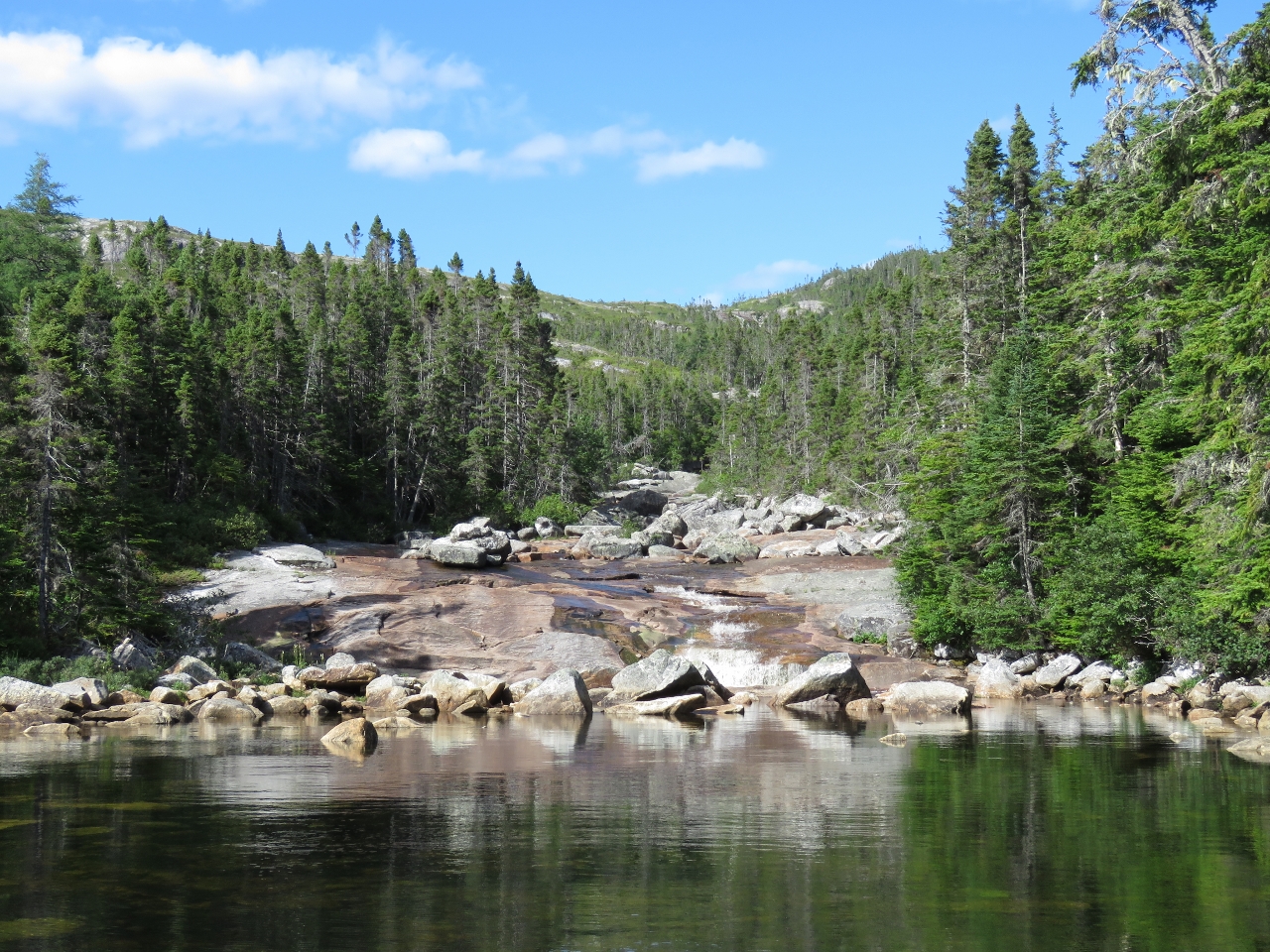
Shelves
Position: -56 8.97, 47 50.82
The hike up Waterfall I was quite easy over a generally smooth and gradually sloping rock surface. Partway up the even surface gave way to a series of small shelves with water spilling over each.
|
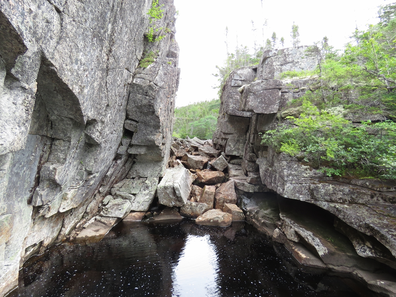 |
Top
Position: -56 8.80, 47 50.87
The easy going ended at this gorge, presumably before the lake that feeds the falls. We didn’t climb further to investigate.
|
 |
Second lunch
Position: -56 8.82, 47 50.86
In the spirit of the Hobbit’s “Second Breakfast”, we had “Second Lunch” at the top of the falls with a great view over the inlet.
|
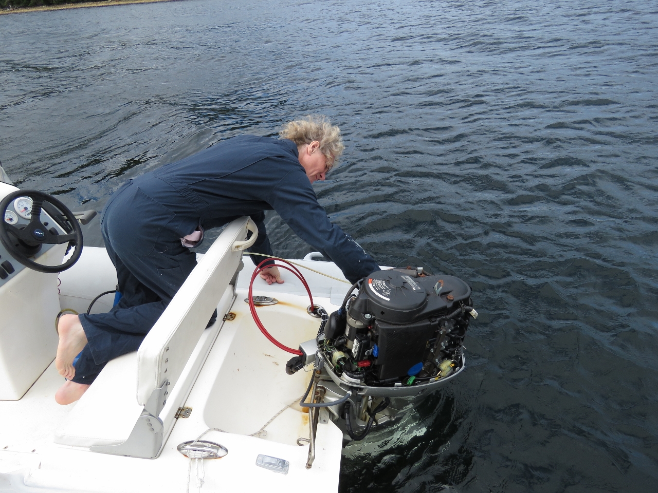 |
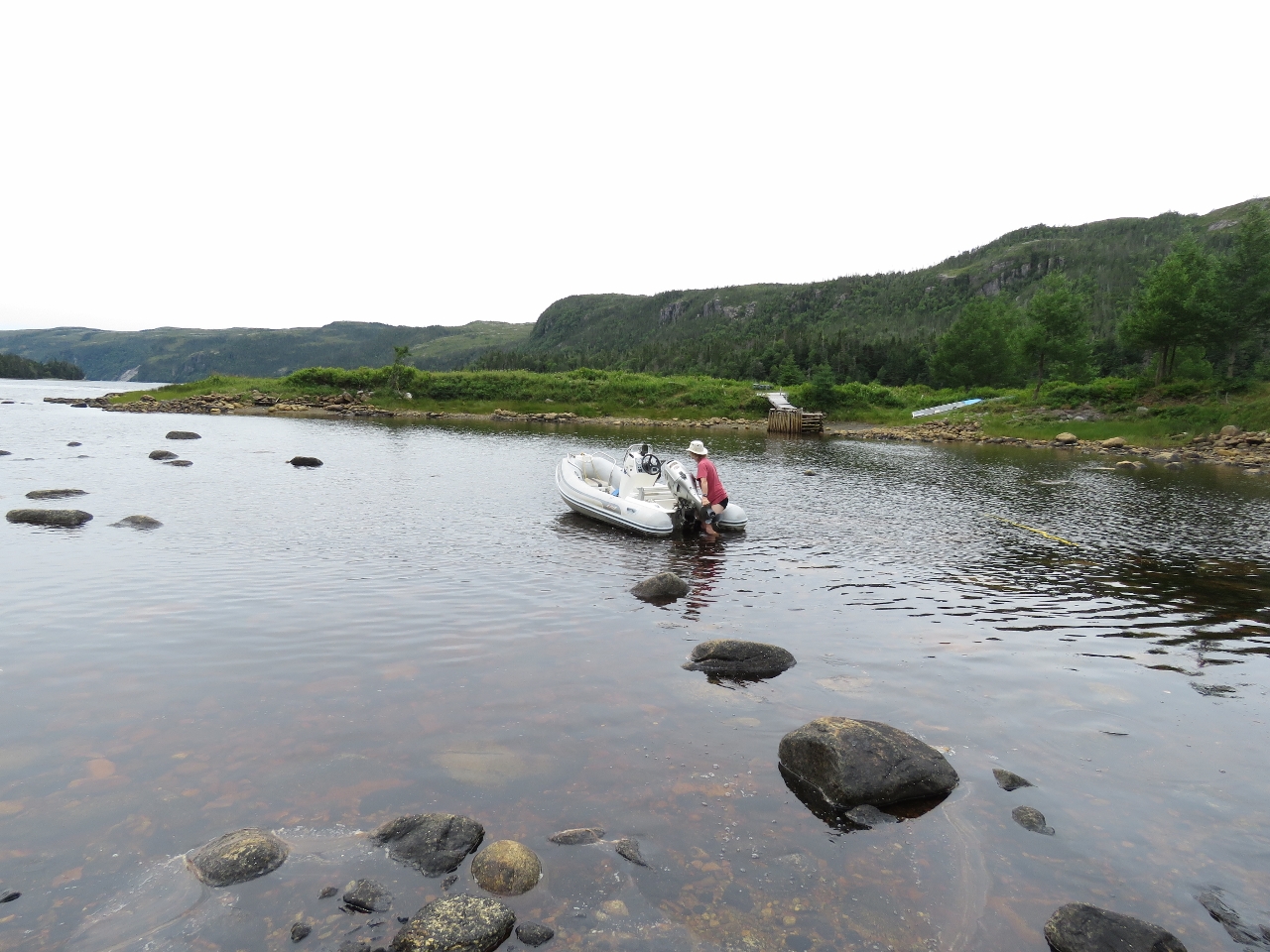
Oil change
Position: -56 9.92, 47 51.89
The 40HP Honda on our main tender is due for it’s annual oil and filter change.
|
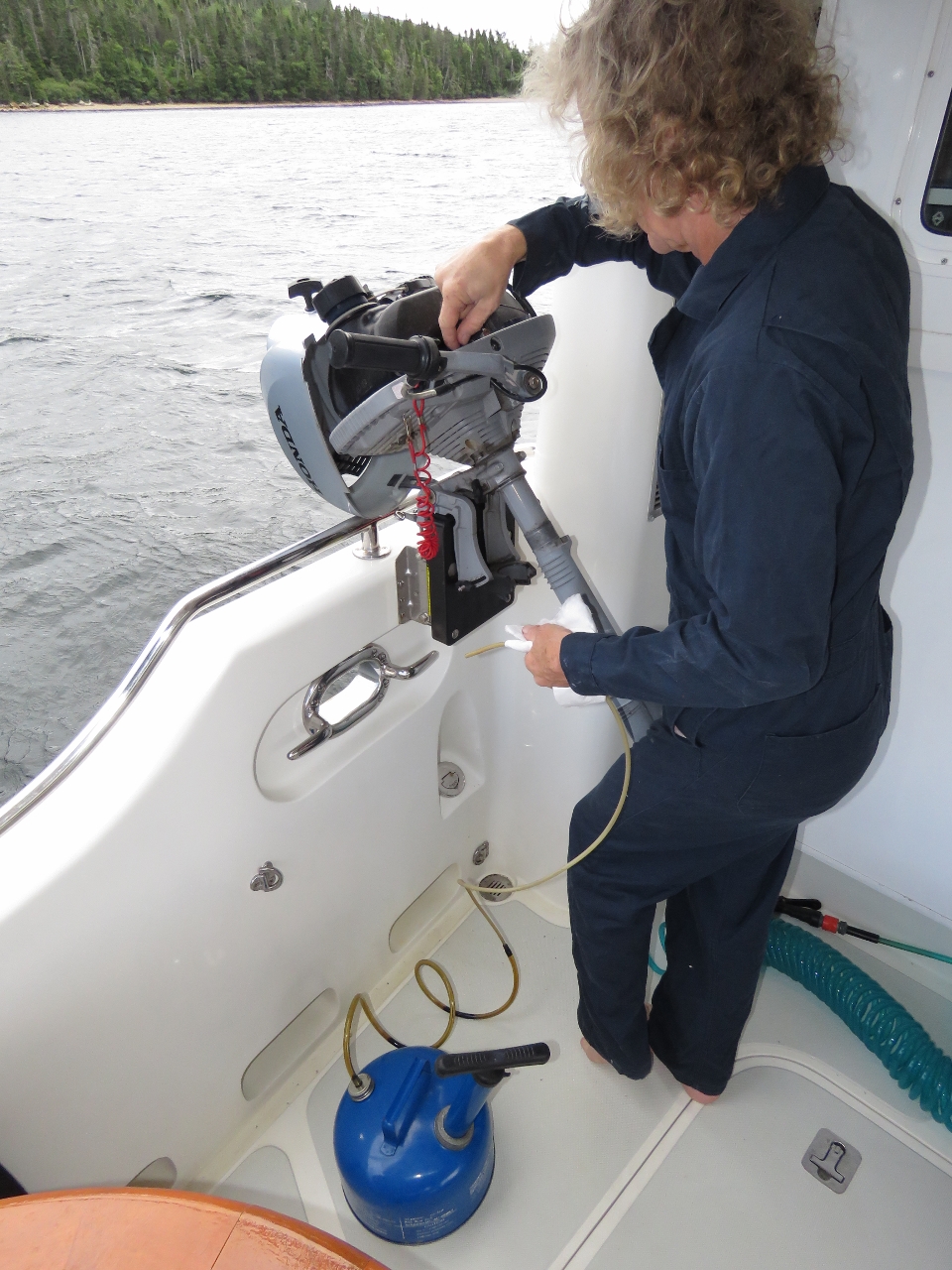 |
Oil change II
Position: -56 9.91, 47 51.89
James also changed the oil in the 3.2HP micro-tender Honda, using the mount we’d installed in Florida. And he greased the fittings in both outboards.
|
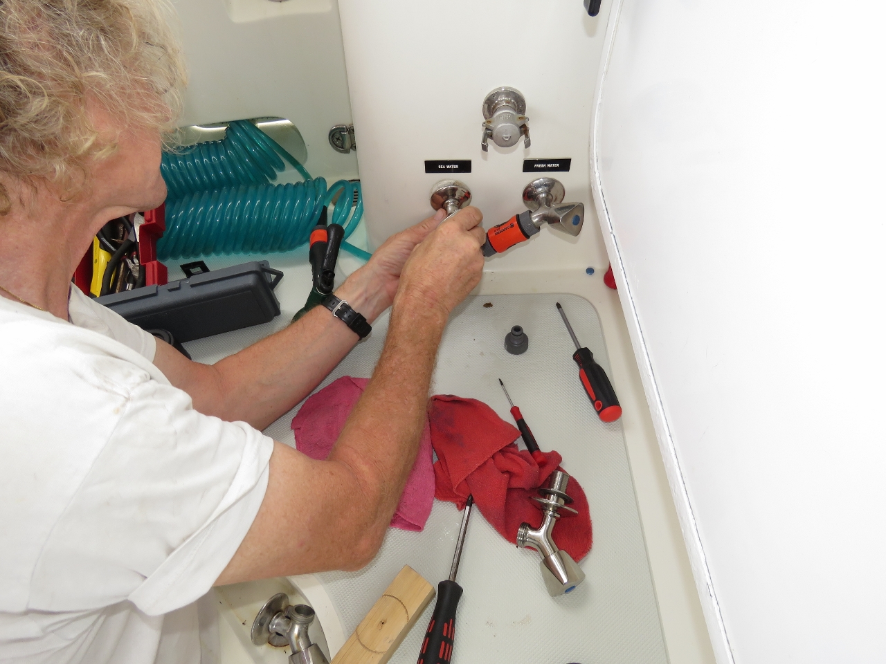 |
Faucet
Position: -56 6.99, 47 44.34
Our raw water wash-down pump was cycling frequently. We chased it down to a leaking faucet in the cockpit bulkhead and replaced it with a spare.
|
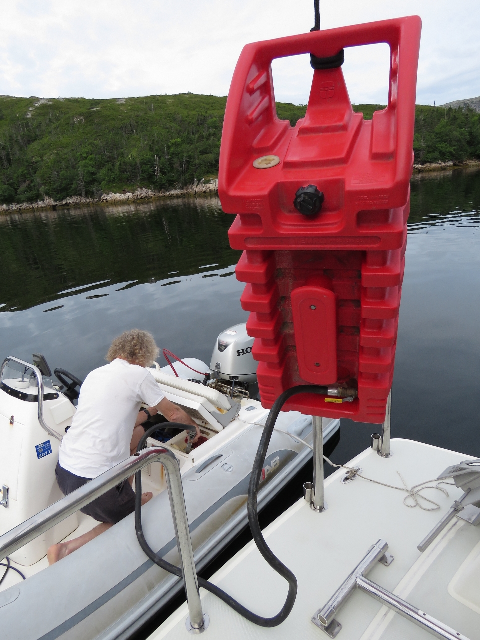 |
Bunkering
Position: -56 6.99, 47 44.34
Filling up the tender from one of the 29-gallon fuel tanks we keep on the boat deck. We’re glad we filled both in Boston—we’re going through a lot of gasoline on this trip.
|
 |
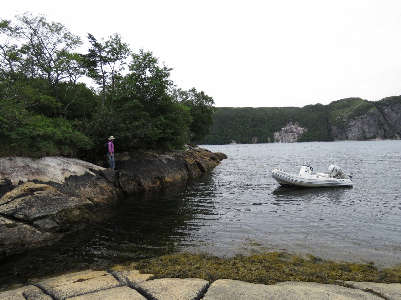
Raymond Islands
Position: -56 6.99, 47 44.30
The anchorage in the Raymond Islands caught our attention as we passed on the way up North Bay and we came directly here on the return trip. This is looking north toward the bluffs on the east side of the mouth of North Bay.
|
 |
East Bay
Position: -56 5.99, 47 44.87
Heading up East Bay in the tender. The channel was quite scenic, with steep hills on either side.
|
 |
Bow Watch
Position: -56 0.09, 47 48.88
Looking for rocks as we get into shallow water in the Salmon River.
|
 |
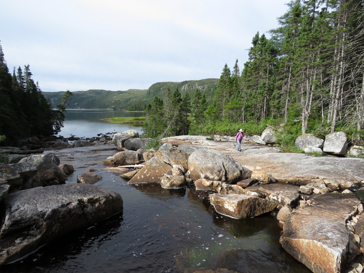
End of the Road
Position: -56 0.04, 47 49.21
We got about a mile up the Salmon River before running out of water. We didn’t see any salmon though.
|
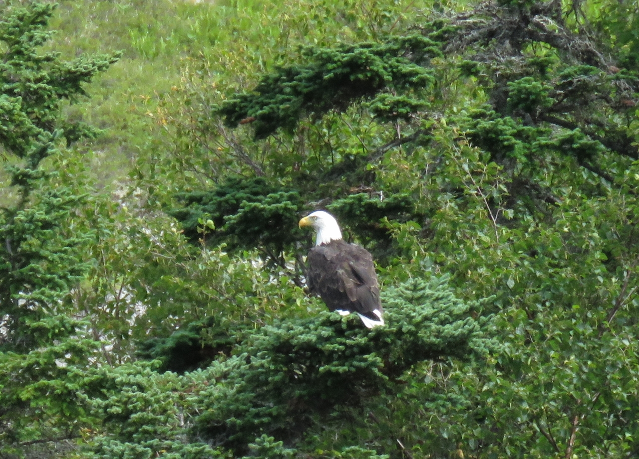 |
Eagle
Position: -56 1.05, 47 48.12
We’ve seen only a few eagles while in Newfoundland. They look just as big as their Pacific counterparts.
|
 |
Lunch
Position: -56 1.14, 47 48.36
We climbed up a small smooth-rock falls just south of the Salmon River mouth and had lunch beside the falls with a view to East Bay.
|
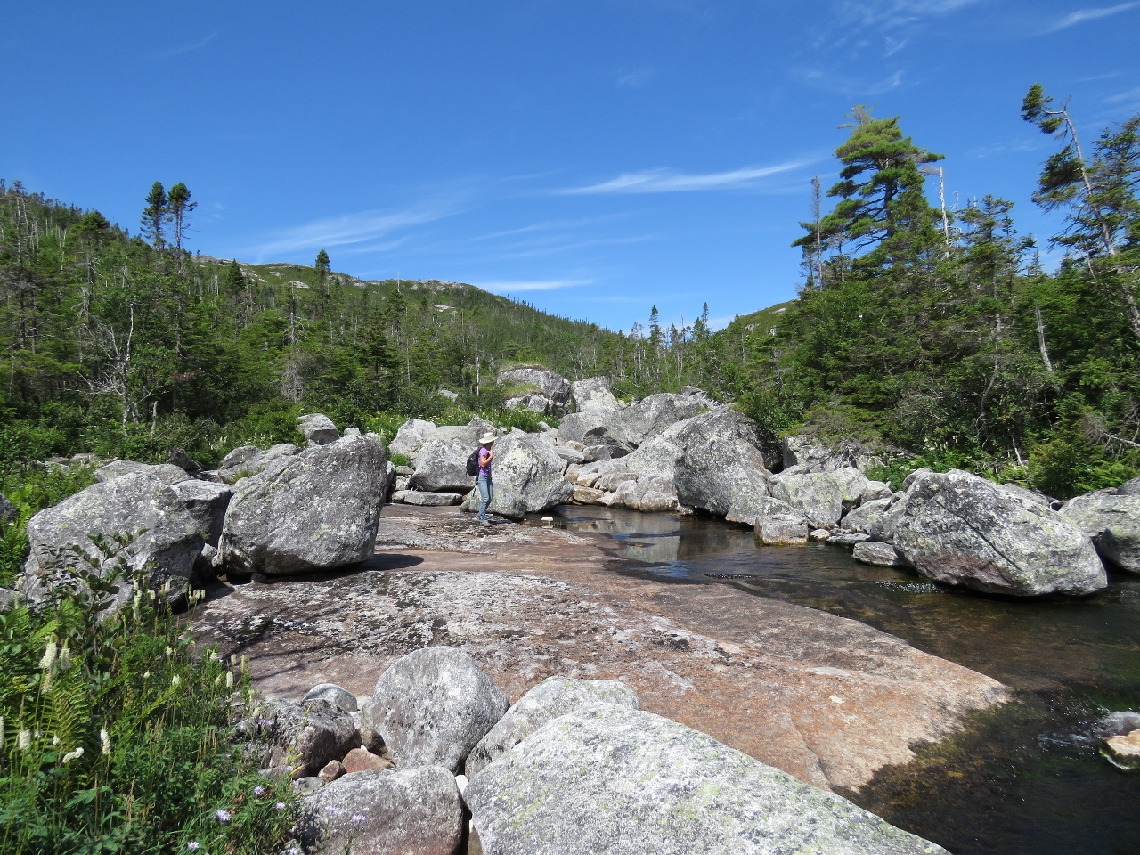 |
Boulders
Position: -56 1.15, 47 48.49
Above our lunch spot, the sloped, smooth rock face gave way to large boulders along relatively level ground.
|
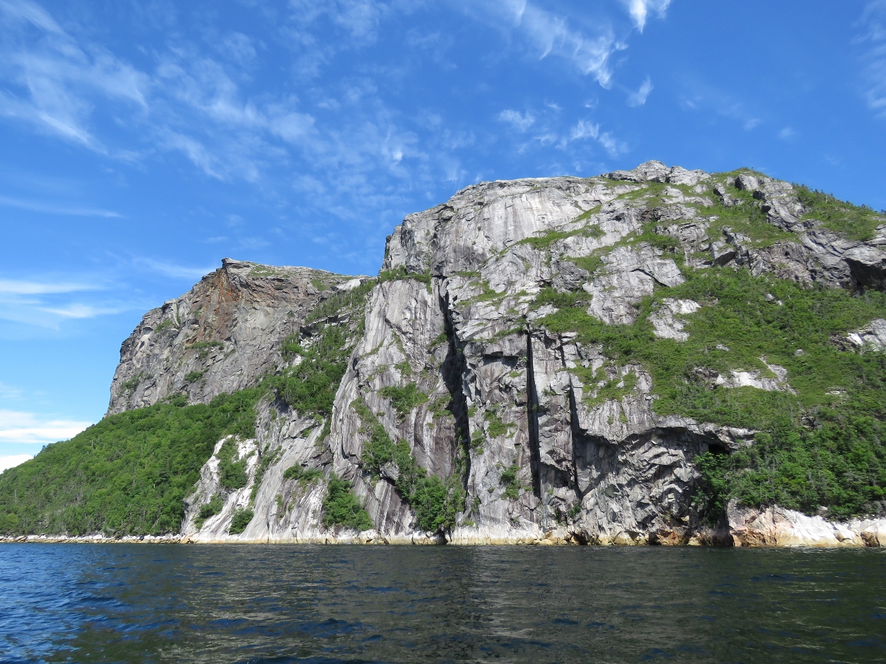 |
Cliffs
Position: -56 3.51, 47 47.01
Newfoundland has no shortage of spectacular cliffs. These are outside Northwest Cove in East Bay.
|
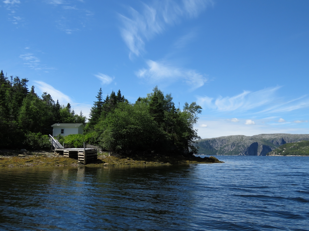 |
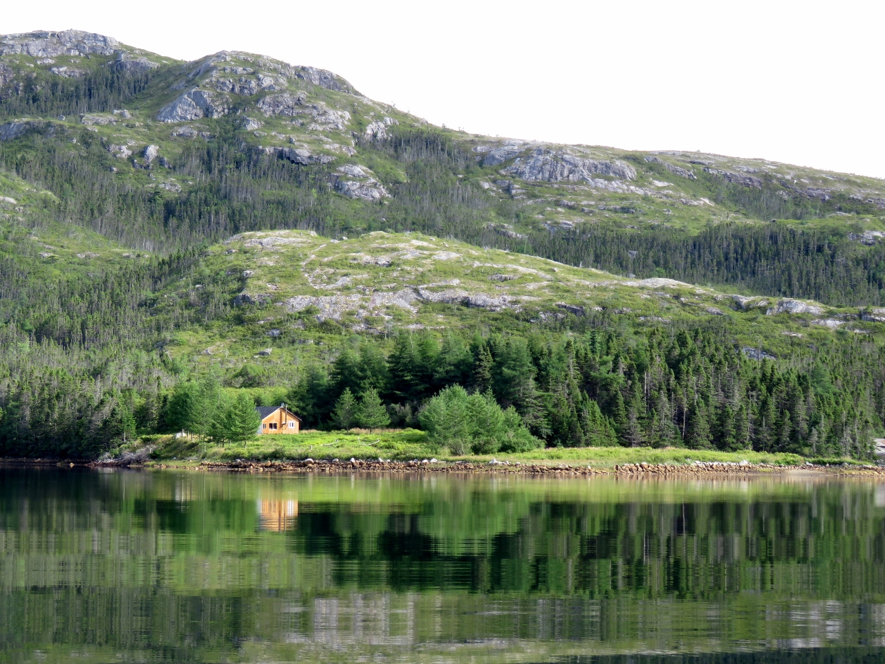
Long Reach
Position: -56 5.24, 47 44.68
Cabin and dock in Long Reach along the south shore of East Bay. Most of the cabins we’ve seen here look well-built and maintained.
|
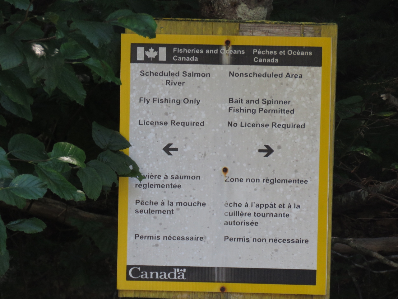 |
Fishing
Position: -56 5.07, 47 44.68
We’ve seen a few signs like this in Newfoundland indicating that only licensed fly fishing is allowed upstream.
|
 |
Climb
Position: -56 7.28, 47 45.81
We very much wanted to climb up for a view near the mouth of North Bay, but most places looked prohibitively steep. We found a reasonably place at a waterfall along the east shore and made a steep climb. The watereway was mostly open until about 350ft up, where this picture was taken. There the waterway was thick with trees, so we doubled back to work across the scrub to find a way up higher.
|
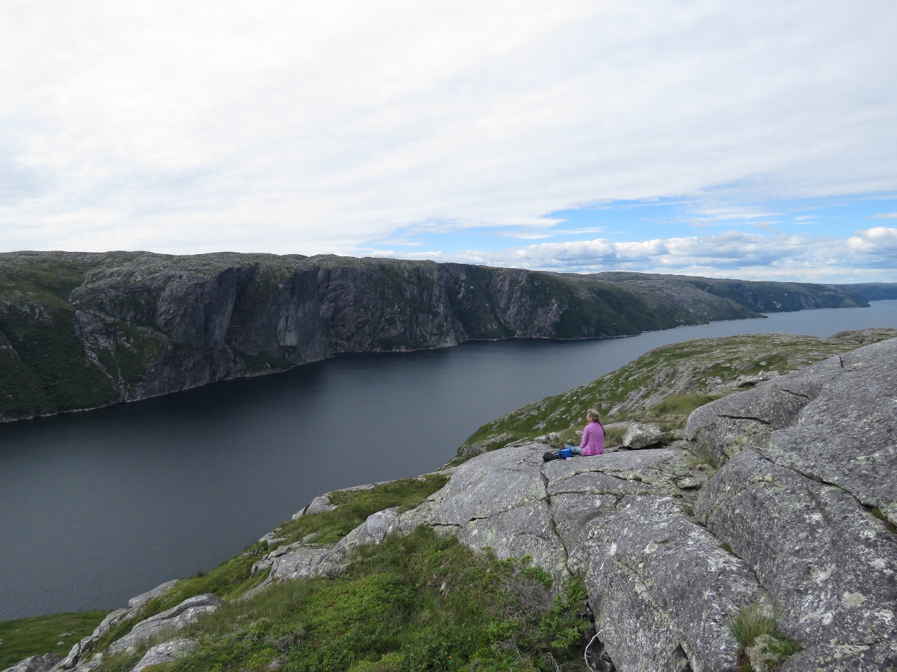 |
View
Position: -56 7.17, 47 45.71
We had to push through a couple of small clumps of trees, but made it to the bluffs and walked along open ground to a great view point 650ft above North Bay. We were pretty tired though–the climb was steep pretty much the entire way.
|
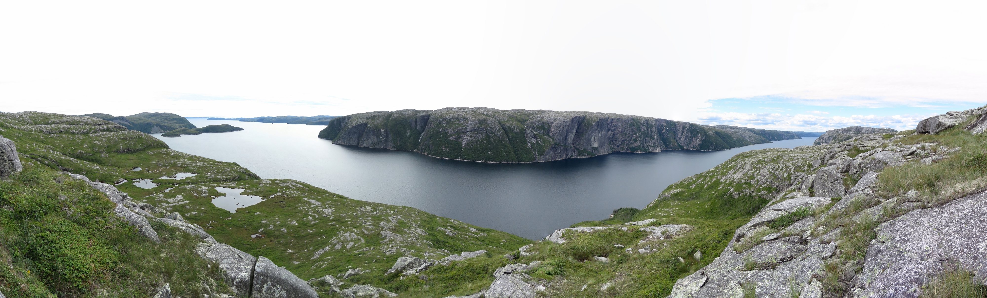 |
Panorama
Position: -56 7.17, 47 45.71
The sweeping view from our spot on the bluffs above North Bay. Dirona is barely visible as a small speck in the Raymond islands at the left, in the center is North Bay Head along the west side of the mouth of North Bay, and on the right is North Bay. The twin cliffs we photographed heading up North Bay are slightly right of center.
|
 |
Sunset
Position: -56 6.96, 47 44.36
Sunset lighting up the hills above East Bay, viewed from our anchorage in the Raymond islands.
|
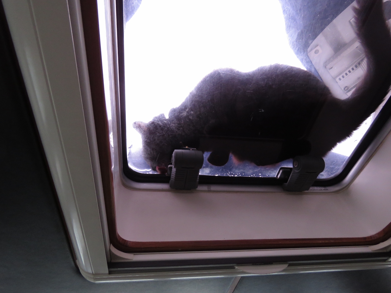 |
Fresh Water
Position: -56 6.97, 47 44.34
After a rainfall, Spitfire loves to drink freshwater from on deck. Here he is drinking from the pilot house overhead hatch.
|
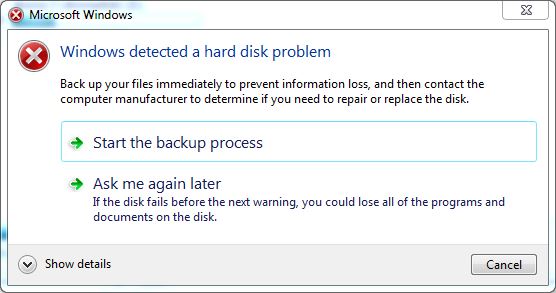 |
Disk Failure
Position: -56 6.98, 47 44.35
The navigation computer displayed a warning this morning indicating that our hard disk was failing. The disk might still be OK, but it’s been in the computer since 2012 and seen a lot of vibration and sea air, so we’ll take the message seriously. The drive in question is not the operating system drive, just a data drive. We have a spare drive, so all we need to do is copy the data to the spare and swap drives. That should take about a day and we’ll be up and running on the new drive—a little time-consuming and a bit of a hassle, but far from a show-stopper. We backup the system nightly to our Synology RAID file server, so data loss isn’t a major concern.
|
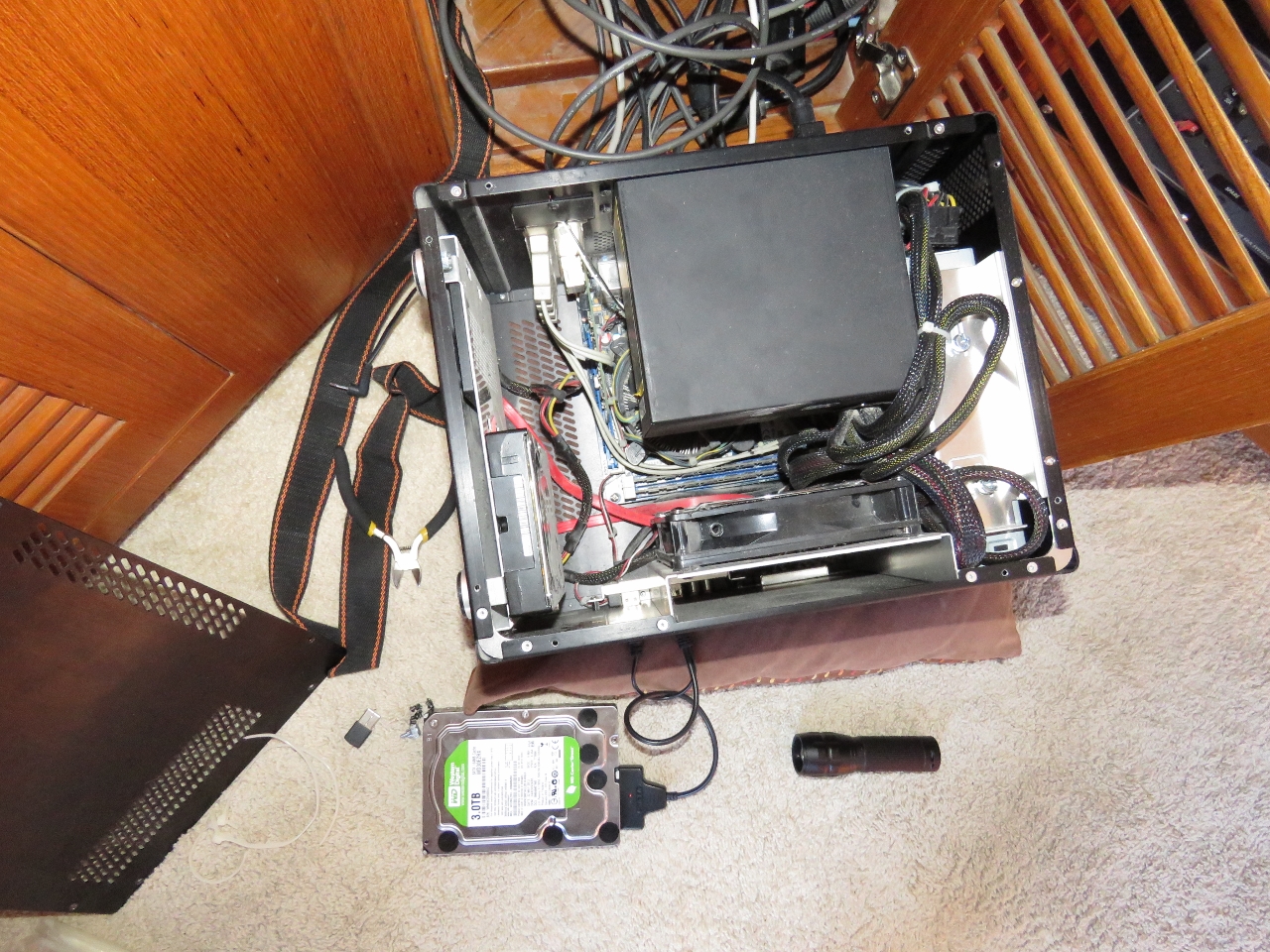 |
Disk Copying
Position: -56 6.97, 47 44.34
To copy the data off the failing disk, we temporarily installed the spare as a fourth drive in the system and copied between them.
|
 |
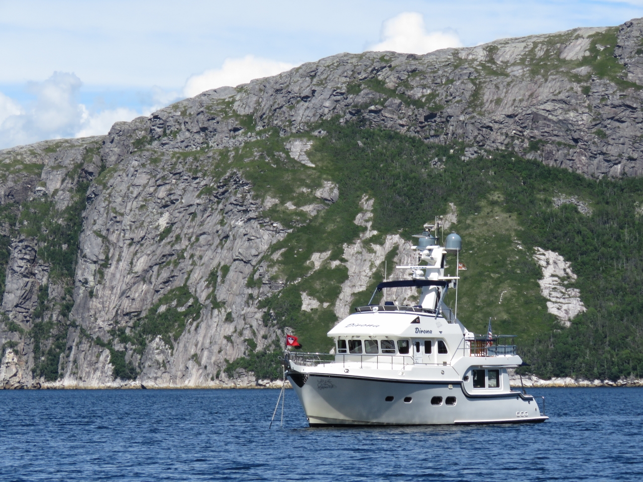
Raymond Islands
Position: -56 6.96, 47 44.34
The fabulous view from our anchorage in the Raymond islands. On the left is the mouth of North Bay, with the mouth of East Bay right of center. Yesterday afternoon we hiked into the hills just to the left of center.
|

|
Click the travel log icon on the left to see these locations on a map, with the complete log of our cruise.
On the map page, clicking on a camera or text icon will display a picture and/or log entry for that location, and clicking on the smaller icons along the route will display latitude, longitude and other navigation data for that location. And a live map of our current route and most recent log entries always is available at http://mvdirona.com/maps. |
If your comment doesn't show up right away, send us email and we'll dredge it out of the spam filter.