From Palm Beach we made a six-night offshore run to reach Boston, stopping for three nights at Cape Lookout to wait for a weather system to pass through the Boston area and one night at Plymouth so that we could enter Boston Harbor in the morning rather than at night.
We got a good push from the Gulf Stream on the first leg, reaching speeds of over 13 knots briefly while testing the new keel cooler at wide open throttle. Using NOAA models, we tried to stay in the strongest of the current until around the Chesapeake area and then ran straight to Rhode Island Sound.
We’d heard stories about the high concentration of fishing bouys along the east coast, so were a little anxious about what we might encounter. We saw a few floats as we neared Cape Lookout, but otherwise didn’t see much of anything in the water until the last night at sea as we approached Rhode Island Sound. Out in 500′ of water we ran for several hours at dusk and into the night through a mine feild of large floats with metal RADAR reflectors. The good news is they weren’t as close together as the inshore fields but they are large enough to damage a boats topsides if struck. We could pick them out on RADAR, but this required constant vigilance at the helm. We eventually passed through after several fairly tiring hours and the rest of the night wasn’t much of a problem. In daylight closer to shore we found dense fields of smaller floats as expected, but they weren’t hard to avoid. We’re told that north of here in Maine, the float fields get so dense they are close to impossible to avoid. Even at the density found in the inshore Rhode Island and Boston area, it’s preferable to only approach shore in daylight.
Trip highlights from June 8th through 17th follow. Click any image for a larger view, or click the position to view the location on a map. And a live map of our current route and most recent log entries always is available at http://mvdirona.com/maps
 |
Leaving Palm Beach
Position: -80 2.45, 26 46.29
We left Riviera Beach Marina about 5:30 this morning, roughly one hour before low water slack at the Port of West Palm Beach. The current in the marina was negligible, but we did feel it once we got out into the main channel. Only one other boat was underway as we exited the channel, but traffic picked up once the sun rose.
|
 |
Boston
Position: -79 52.88, 27 11.39
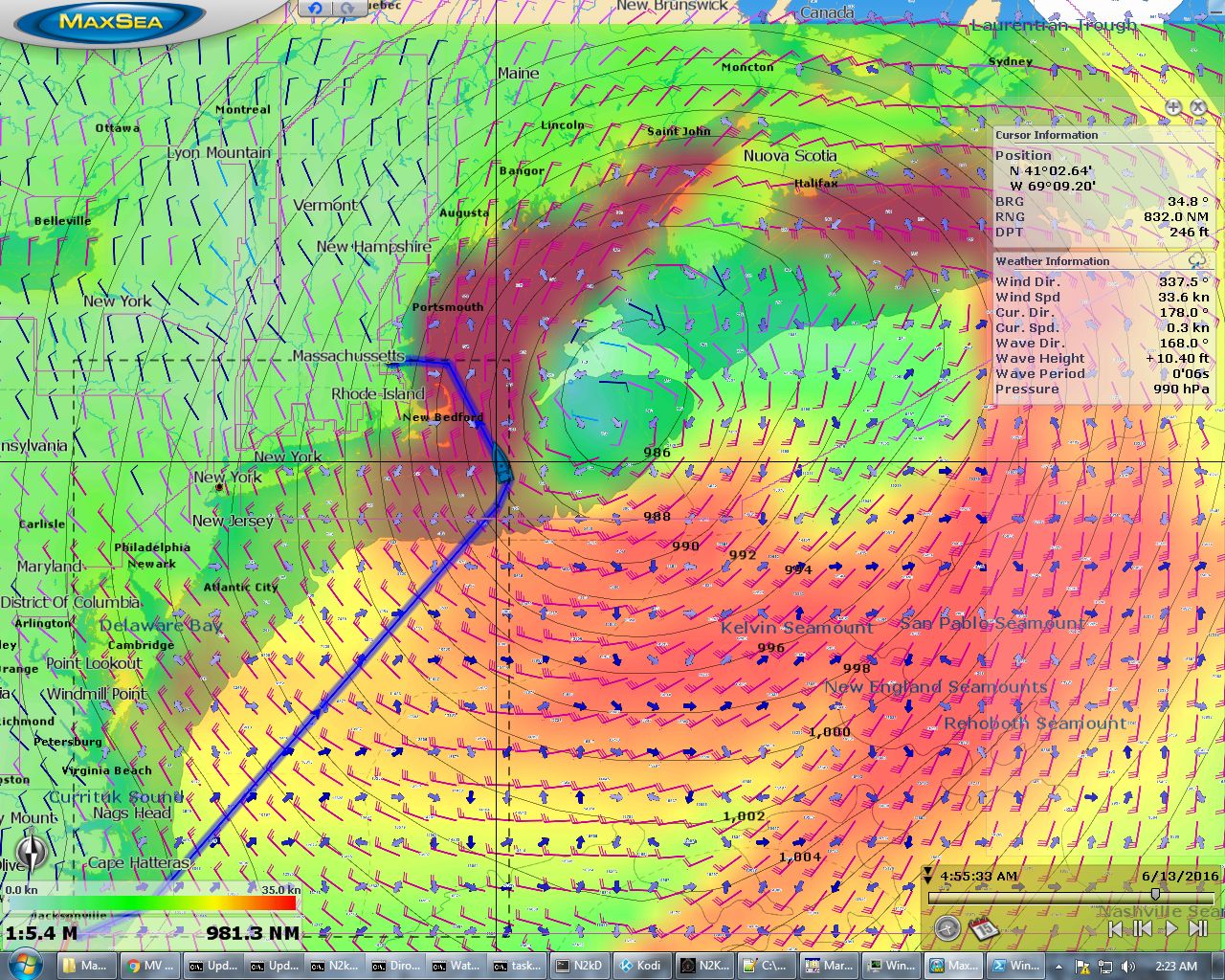
Our ultimate destination is Boston. We plan to spend 6-8 weeks in there, enjoy the 4th of July fireworks, then continue north to explore Maine in August. We would like to head directly to Boston from West Palm Beach, but this is the weather model for June 13th when we’d be nearing Massachusetts. The blue boat icon is where we’d be, with 35-knot winds and 11-ft seas on 6 seconds. No thanks. We’ll instead spend a couple of nights on the hook at Cape Lookout to wait for the system to pass, and then continue north. It’s been WAY too long since we enjoyed a sunset on the anchor so we’re looking forward to a couple of relaxing days on the hook.
|
 |
Wide Open Throttle
Position: -79 56.43, 26 58.42
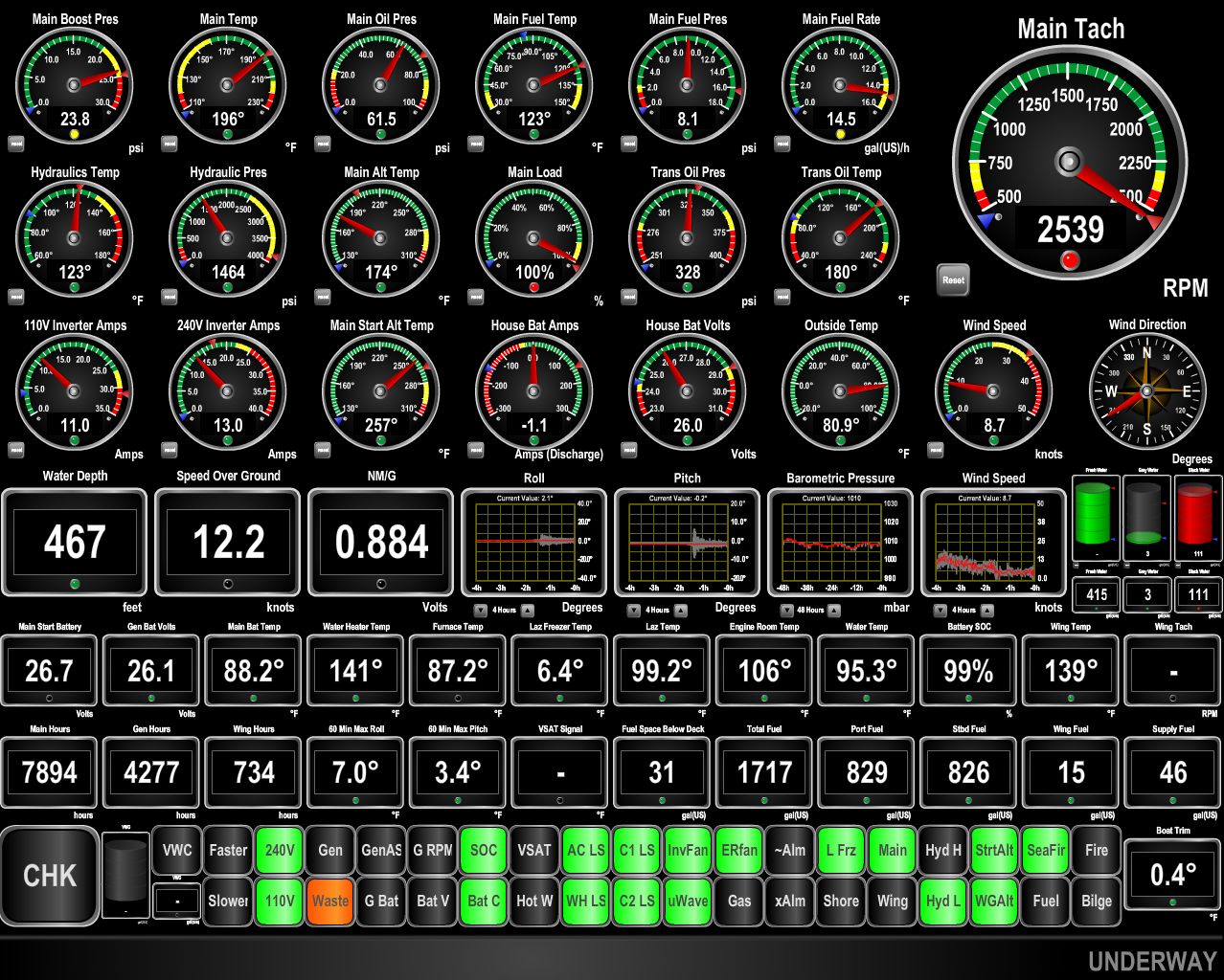
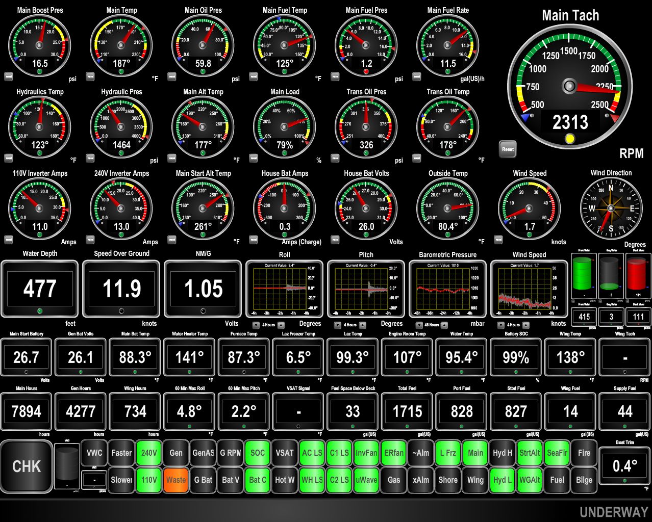
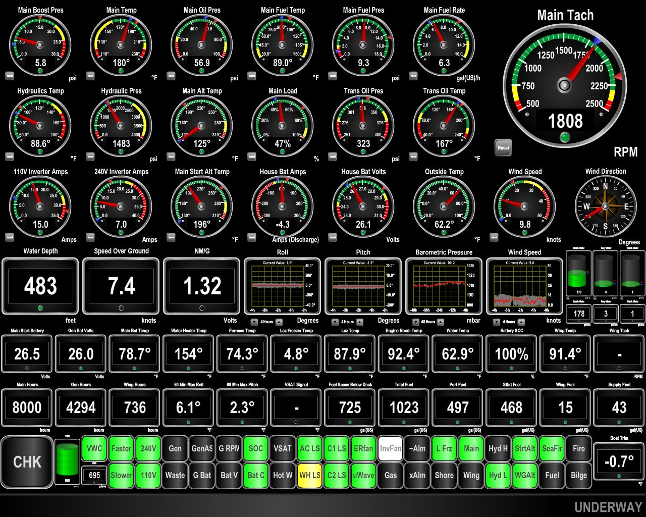
Man, this one is a fun one to see. We are currently operating in 84.6F sea water and we’ve been running for 10 min at wide open throttle and the coolant temperature is rock stable at 196F. In the past, the temps would be escalating well above 200F and would just keep going up. In warm water, there wasn’t sufficient heat rejection to run flat out. Arguably it doesn’t matter in that we never run harder continuously than the maximum continuous duty rating on the engine which is 231hp @ 2300 RPM. However, even this output level would barely work with the engine running right around 210F at this output level. Deere specifies a maximum continuous permissive coolant temperature of 212F so 210 is way to close to the limit. And, if the keel cooler is not super clean, even this output level can’t be run. We’ve been limited as low as 2150RPM in the past. With the new keel cooler, we can run at the engines max continuous rating indefinitely and the coolant temperature never exceeds 187F. The engine thermostat is not even fully open until 190F so we now have massive amounts of reserve cooling. Even a dirty keel cooler won’t slow us down. Just the way we like it.
|
 |
Max Continuous Output
Position: -79 56.13, 26 59.38
Here we are smoking along at 11.9 kts running steadily at the mximum continuous rating output of our Deere 6068AFM75 of 231 hp. Admittedly, some of this speed is the Gulf Steam. When testing at wide open throttle we were doing 13.1 kts in the open ocean. Seemed just crazy. We are operating at 231 hp and a steady 2,300 RPM and the thermostat isn’t even fully open at only 187F. We just love having greater engineering margins.
|
 |
Anti-chafe
Position: -79 55.23, 27 2.28
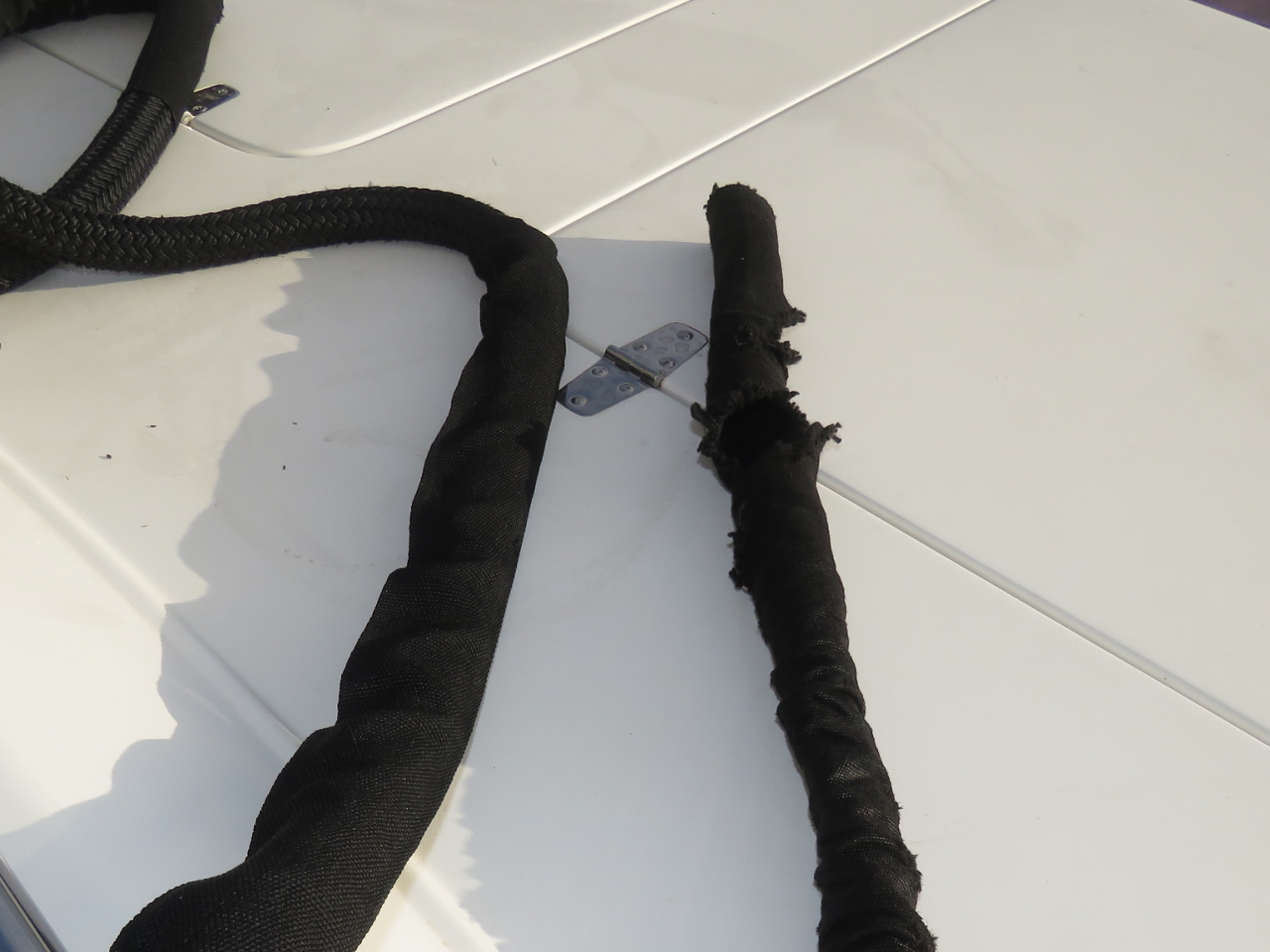
The anti-chafe on one of our lines was heavily worn from our stay at Barbados, so we replaced it today. We’ve gone through a lot of anti-chafe on this trip. Before we left, Adam Block, previous owner of Nordhavn 47 Eden recommended we bring lots of anti-chafe. We did, and ended up getting even more partway through the trip.
|
 |
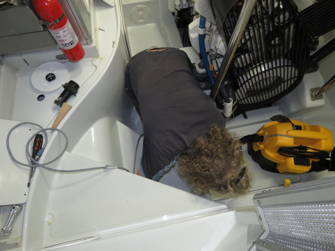
Hydraulic pump
Position: -79 52.73, 27 15.69
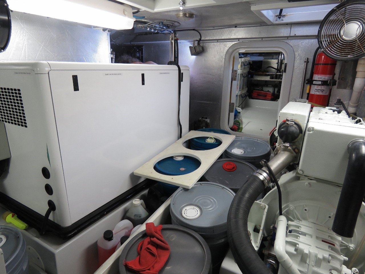
During an engine-room check, James noticed that the hydraulic raw water cooling pump had stopped flowing. Unfortunately the pump is in the starboard engine room alcove, and accessing it requires removing all our stored oil. You can just barely see the top of James’s back on the other side of the generator. In order to change the impeller the hydraulic system must be depowered or the hydraulic pump hydraulic flow needs to be shut off. The latter is more hassle so we just shut down the main engine and ran on the wing. The reason the main engine has to be shutdown to depower the hydraulic system is the main engine drives a “live pump” which means that pump turns whenever the main engine is running. The reason the wing engine is able to run is the wing engine hydraulic pump has an electric clutch that can be disengaged to shut down the hydraulic system. This configuration allows us to proceed on the wing with full stabilizers, thrusters, etc. Or, as in this case, we can run on the wing but briefly shut down the hydraulic system for service and then turn the stabilizers back on.
|
 |
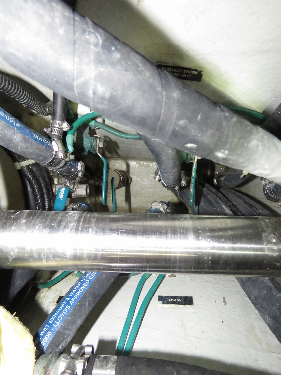
Impeller
Position: -79 52.32, 27 18.46
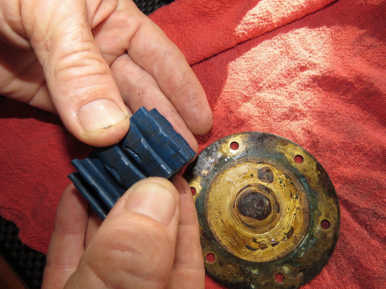
Unsurprisingly the cause of the lack of hydraulic coolant flow was the hydraulic raw water pump. Most of the industry recommend that these impellers get changed every year. For years, we did this but we noticed that sometimes they last a week, sometimes, 6 months, and sometimes 3 years. Changing them annually seems to have just about exactly the same number of unexpected changes and just waiting until they fail. And the outcome of failure seems no worse when they run a long time. Old impellers don’t seem to show a higher propensity to throw fins off which forces the downstream heat exchange to be opened up to get the broken impeller parts. This hydraulic impeller is a perfect example: it went 2 3/4 years and 4,350 hours. And it’s still 100% intact so just needs a quick change and no need to chase down parts. Amazing.
|
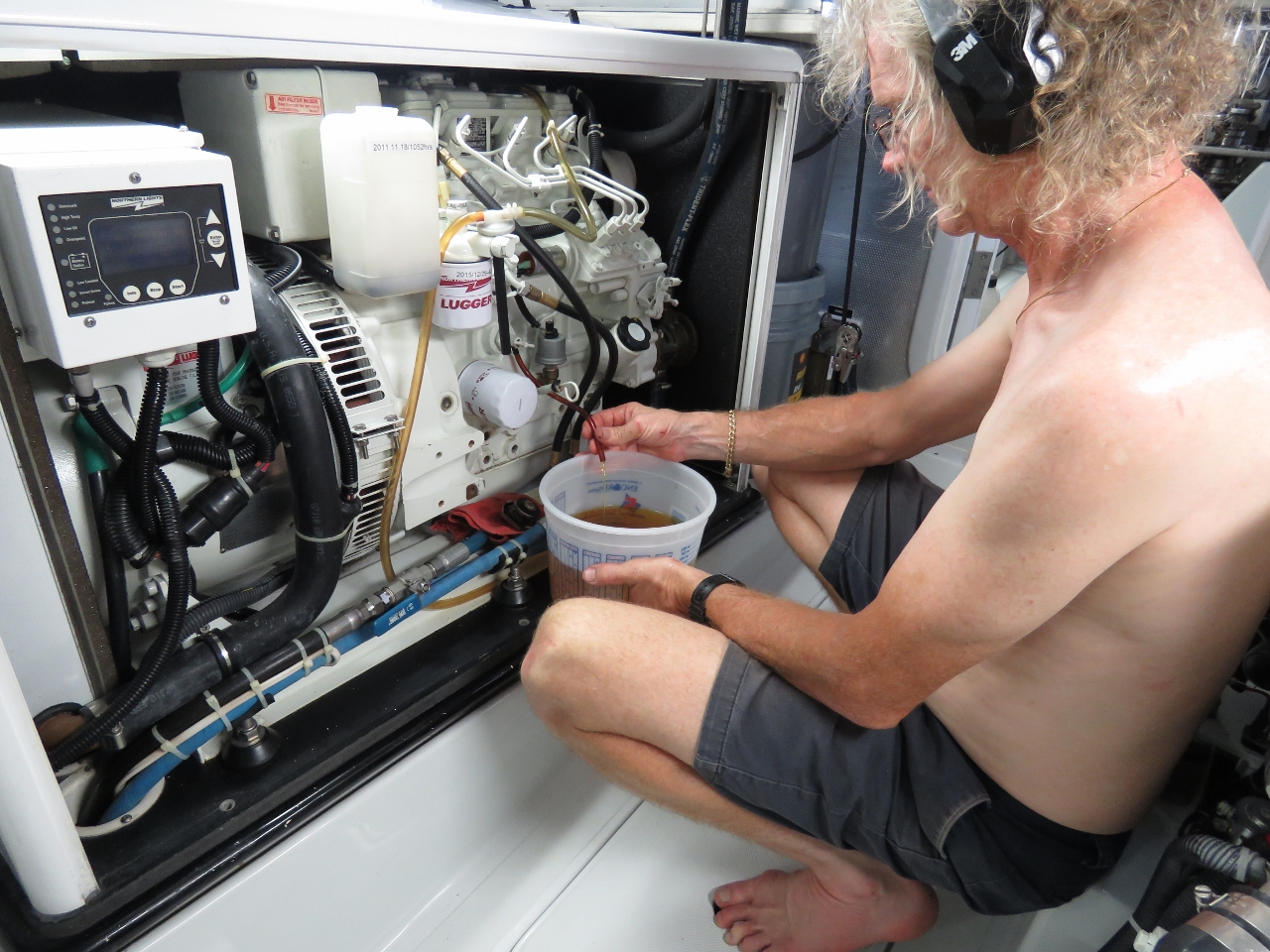 |
Antifreeze
Position: -79 51.60, 27 30.00
ames changed the wing and generator antifreeze today to get all the engines on Fleetguard ES Compleat. The last change on the wing was 109 hrs/19 months ago and on the gen was 1634 hrs/34 months ago.
|
 |
7900 hours
Position: -79 45.37, 28 7.72
We just crossed 7900 hours on the main engine.
|
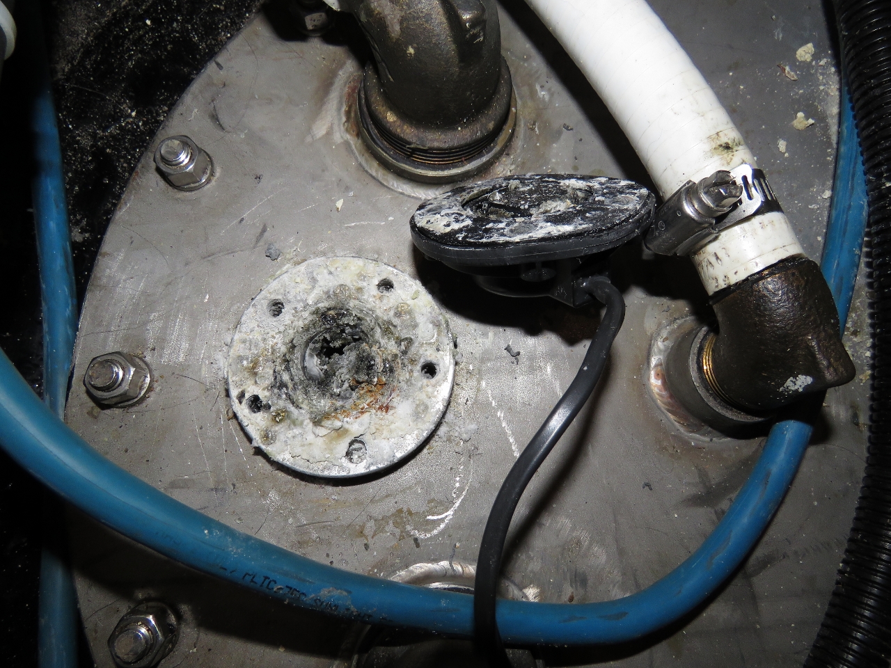 |
Corrision
Position: -79 44.14, 28 18.78
The black water tank sensor wasn’t reading. Deeper investigation shows the optional aluminum focus tube had completely corroded away and the corrosion filled the gap where the sensor reads. I cleaned out all the aluminum corrosion and the sensor is now reading correctly again.
|
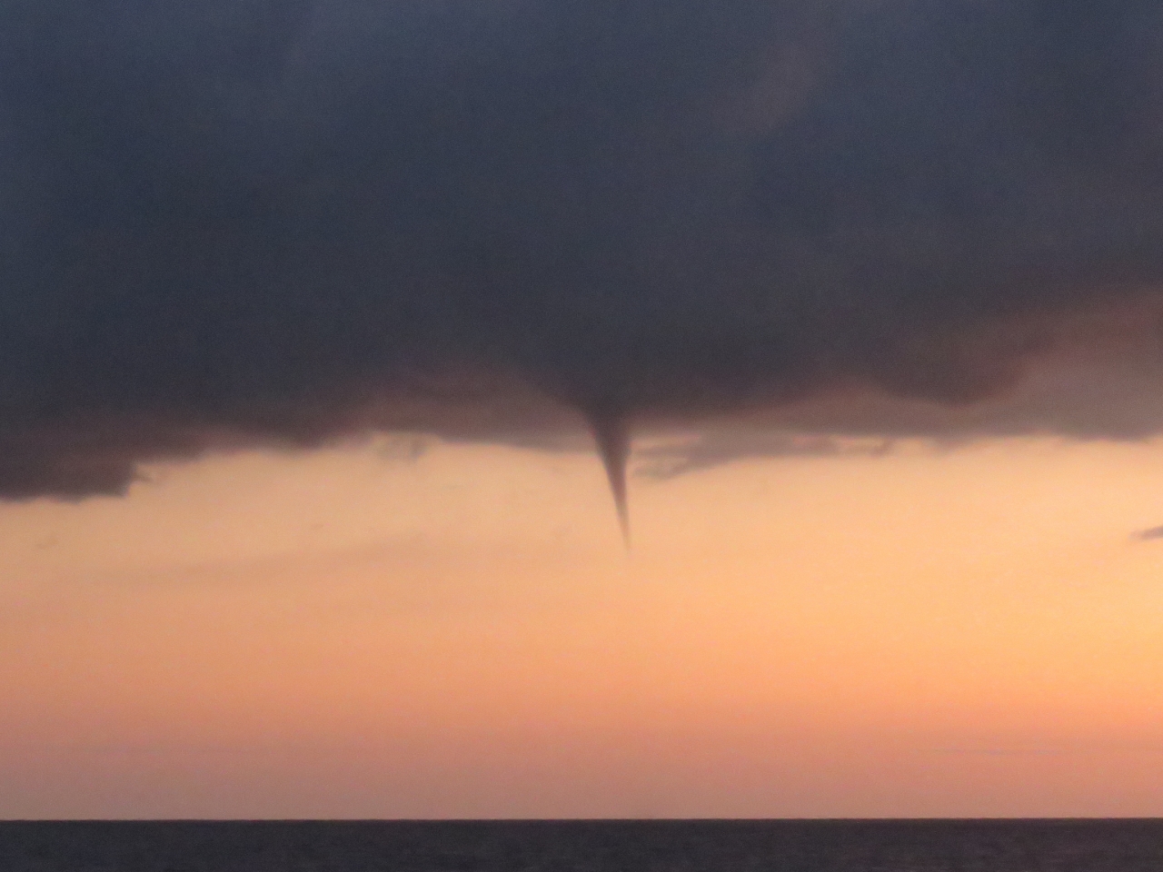 |
Funnel cloud
Position: -79 34.77, 30 35.35
A funnel cloud extending below towering cumulus clouds.
|
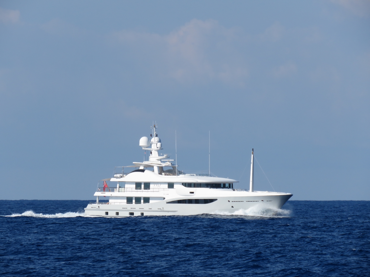 |
Were Dreams
Position: -79 23.77, 31 3.53
The 171ft superyacht Were Dreams heading north at speed. We haven’t seen much traffic on this run so far.
|
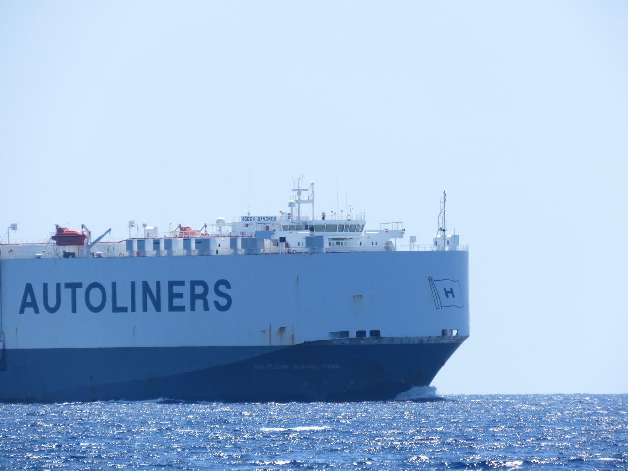 |
Hoegh Bangkok
Position: -79 6.23, 31 20.78
The 652-ft Hoegh Bangkok heading south to Jacksonville Florida with a load of cars.
|
 |
Sea Water Temp Sensor
Position: -78 56.10, 31 30.66
Our sea water temperature sensor was reading incorrectly again, so James replaced the depth sounder transducer, located underneath the steps from the master stateroom to the engine room. The 1.5″ hole in the hull 4.5″ down below the water line brings in prodigous quantities of water even when switching transducers quickly. It’s a reminder of how fast a boat can go down and the importance of super high capacity bilge pumps. We do have a wooden plug ready, at left next to the old transducer, in case we have any issues re-installing the transducer.
It looks like the current temp sensor just failed. Looking at it closely there is no sign of mistreatment from the recent boat yard visit. It appears to have just stopped working. That’s the second failure in six years so arguably a bit high but not completely outside of the bounds of reasonableness. |
 |
Dry bilge
Position: -78 35.55, 31 50.95
Looking down into the bottom of the now dry engine-room bilge behind the main engine. Our current working theory on the leak is when the boat was in the yard for ten days it was stored at an angle different from the angle it floats on, and water from cleaning up the keel cooler change ended up accumulating where it wouldn’t normally. We still would like to get the area to drain fast in the future but we have to find it first.
|
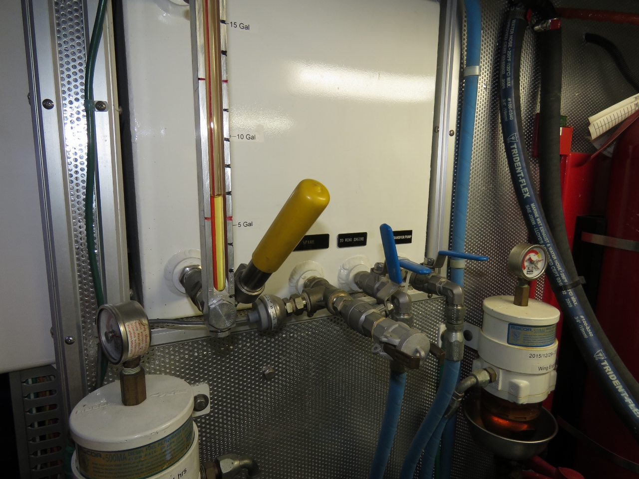 |
Wing fuel
Position: -78 30.13, 31 56.25
We don’t like to leave fuel sitting for too long in the wing engine tank. Every 6-9 months, once we’re sure we have a good load of new fuel on board, we drain the wing tank into the supply tank and refill it.
|
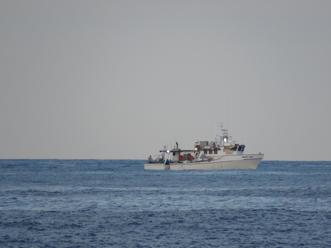 |
Shady Lady
Position: -78 8.33, 32 17.47
The fishing vessel Shady Lady working traps about 100nm east of Charleston.
|
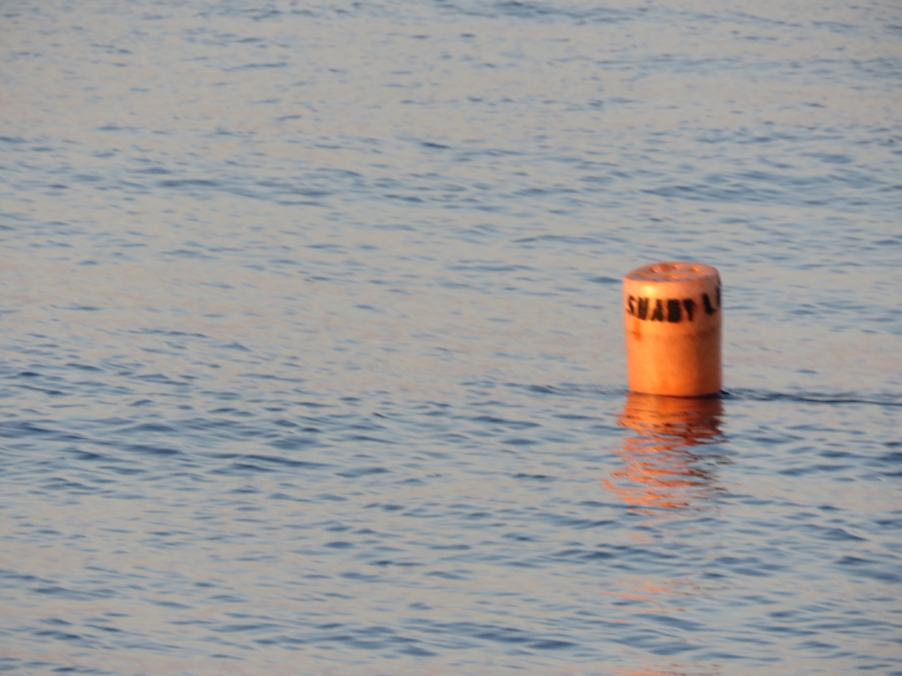 |
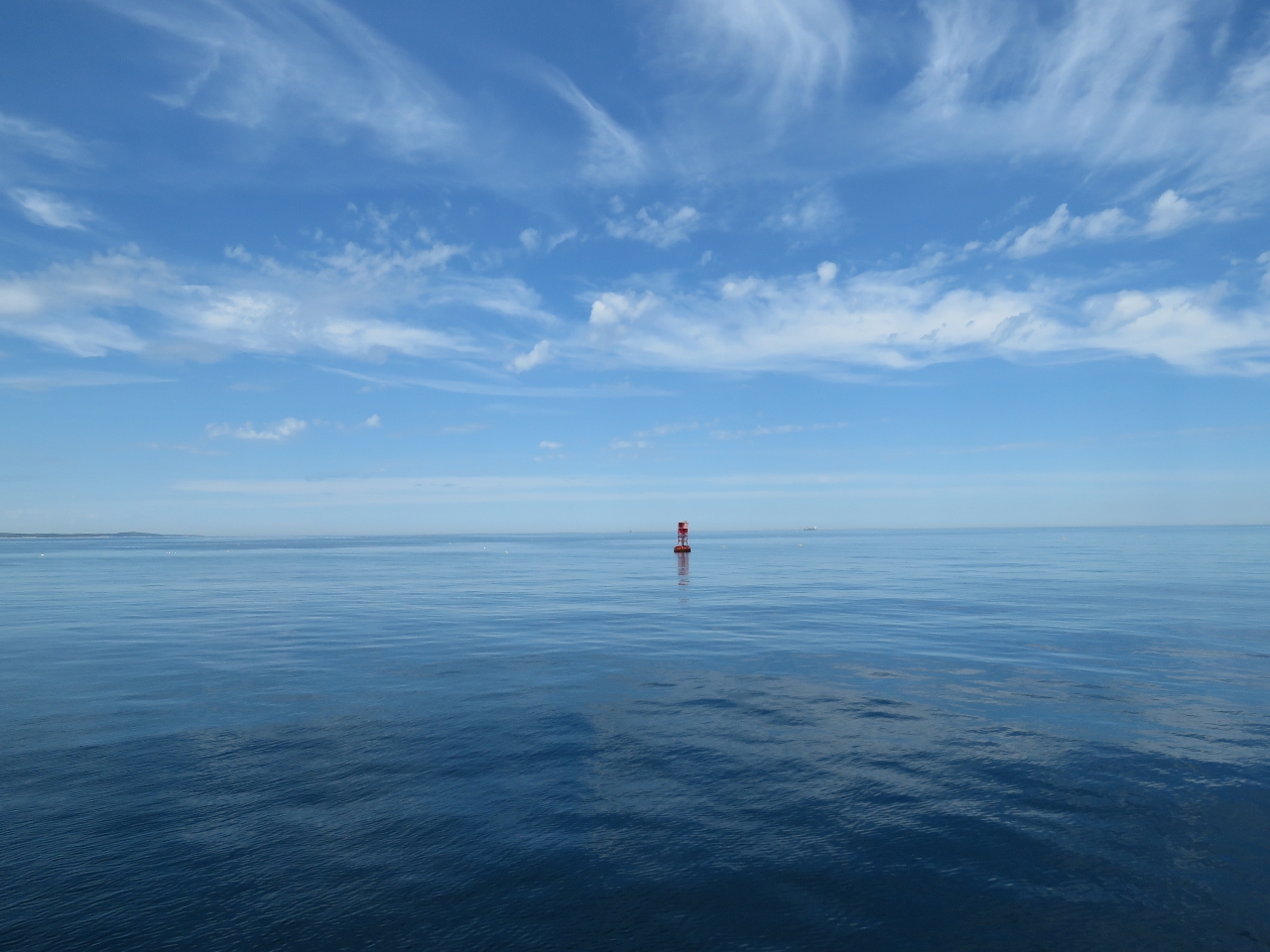
Float
Position: -78 5.94, 32 19.79
The US east coast, especially up toward Maine, is famous for a veritable mine fields of floats from traps. So far we’ve only seen the one set here from Shady Lady. This float is pretty obvious during the day, but we’re sure many aren’t this well-marked. And even this one likely wouldn’t show up on radar. We do have spurcutters behind our propeller to hopefully cut any line that might become tangled there, but avoidance is the best strategy.
|
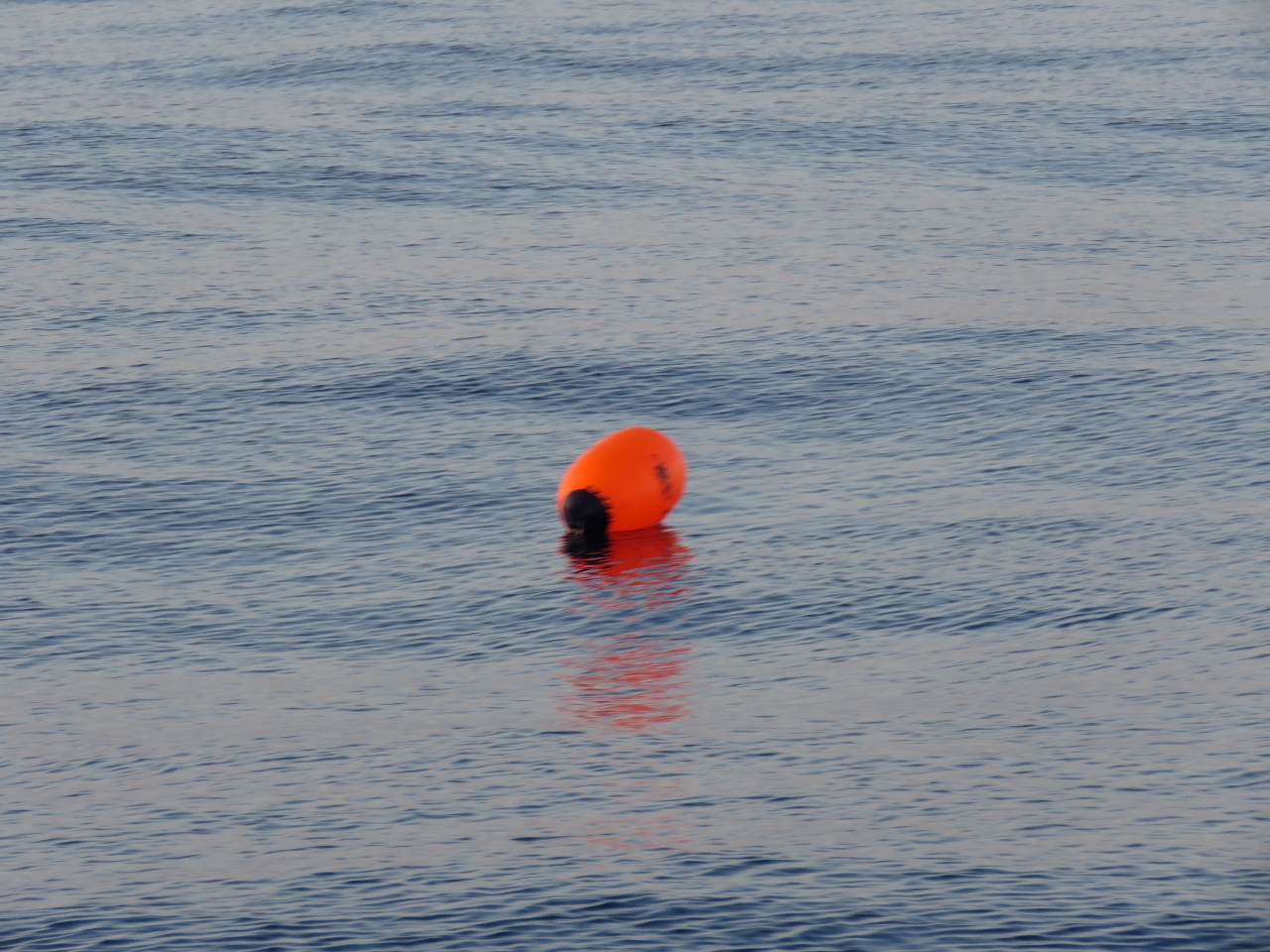 |
Second float
Position: -78 5.92, 32 19.91
This second style of float that Shady Lady is using isn’t quite as visible as the first, but still quite large and obvious during the day at least.
|
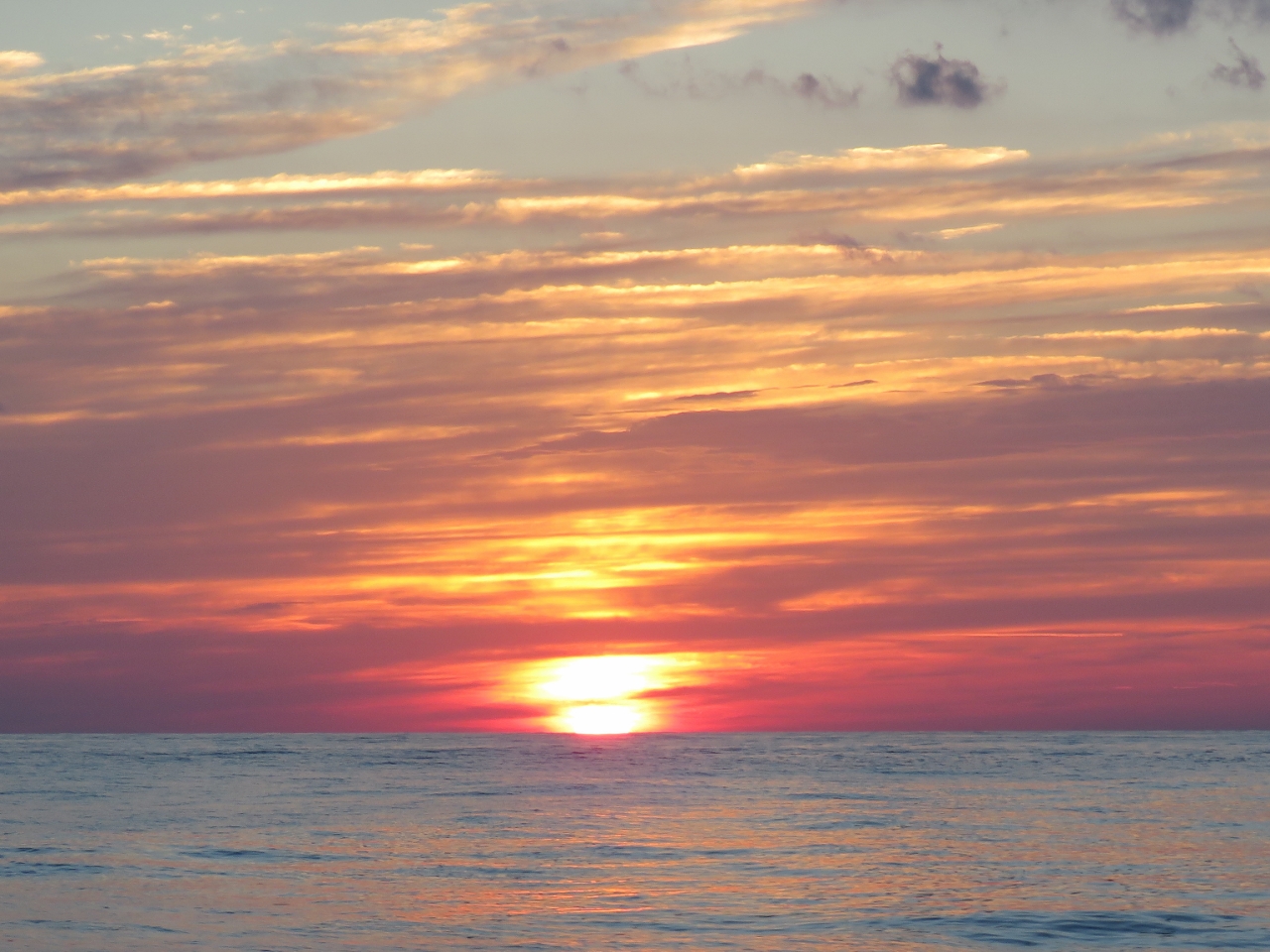 |
Sunset
Position: -78 3.67, 32 22.00
.
|
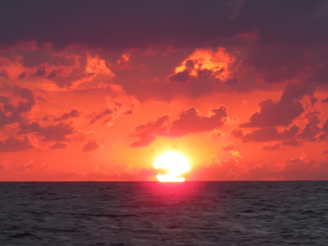 |
Sunrise
Position: -77 10.88, 33 23.25
.
|
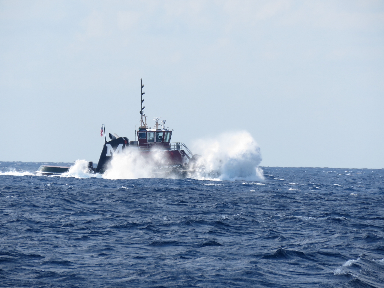 |
Payton Grace Moran
Position: -77 1.34, 33 45.12
The nearly 100-ft Payton Grace Moran pounding into the seas. We’re heading in the opposite direction, and getting a better ride.
|
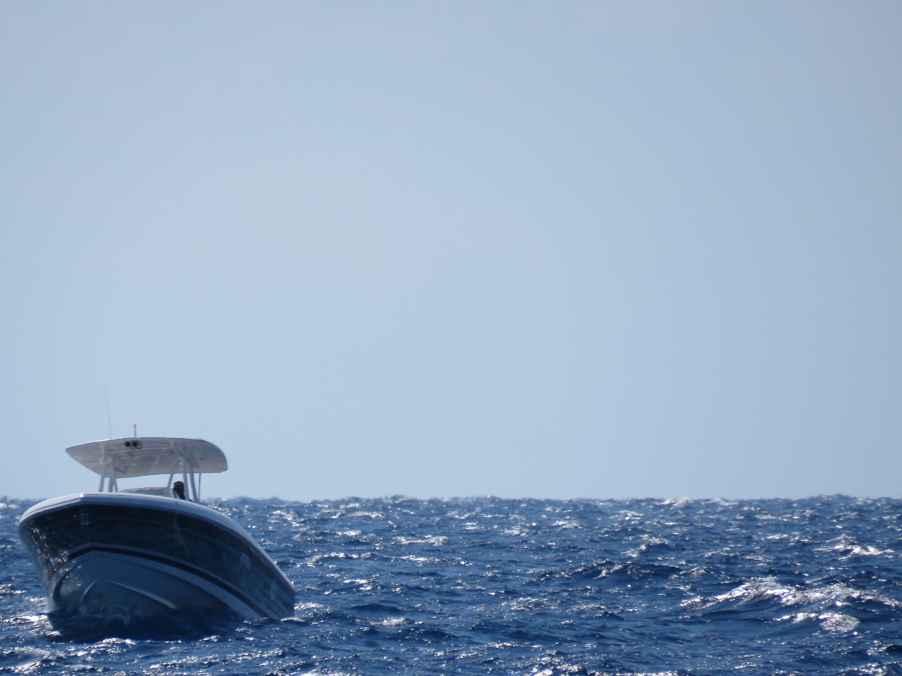 |
Bobbing
Position: -76 58.08, 33 51.38
Having just seen a 100ft tug pounding through the seas, a few minutes later we saw a center-console out getting tossed around in the same seas, fishing happily, but perhaps wearing seat belts.
|
 |
Traffic
Position: -76 41.29, 34 23.85
An incredible amount of vessel traffic as we approach the Beaufort Inlet entrance.
|
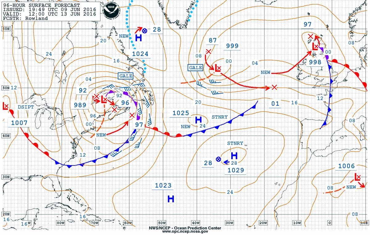 |
Boston-area gale
Position: -76 39.72, 34 26.88
We might have stopped at Cape Lookout anyway, but the storm in the Boston area makes delaying heading further north worth doing. The 96-hour surface analysis shows that Boston-area storm that we’re avoiding is now a 989mb low with gale-force winds.
|
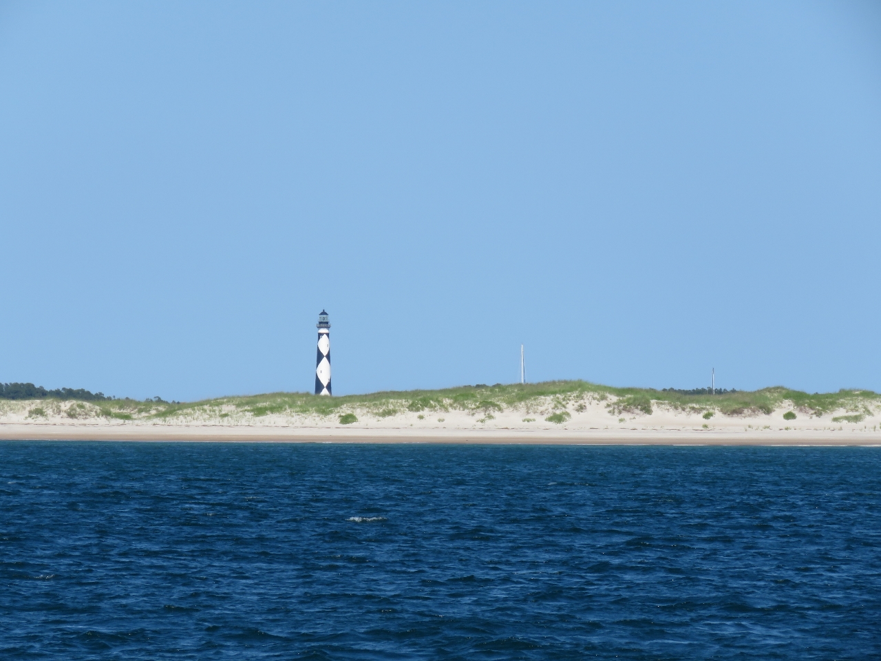 |
Cape Lookout
Position: -76 34.02, 34 37.29
The distinctive light at Cape Lookout is prominent in the background as we approach the anchorage. This was an excellent stop. We toured the Cape Lookout National Seashore, climbed the light house there, and generally enjoyed being out on anchor again. Amazingly, our anchor hadn’t been down for over six months. Read more …
|
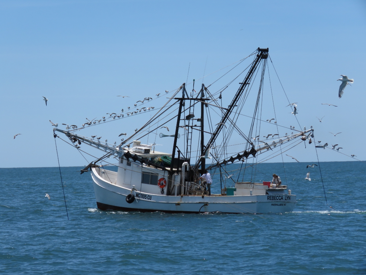 |
Rebecca Lyn
Position: -76 33.71, 34 36.26
The fishing vessel Rebecca Lyn of Mashallberg, that small harbour we visited the other day by tender, fishing off Cape Lookout Shoals. The winds over the past couple of days were up to 30 knots and several fishboats like this had taken shelter in our anchorage. They all left today and many were out fishing in the area.
|
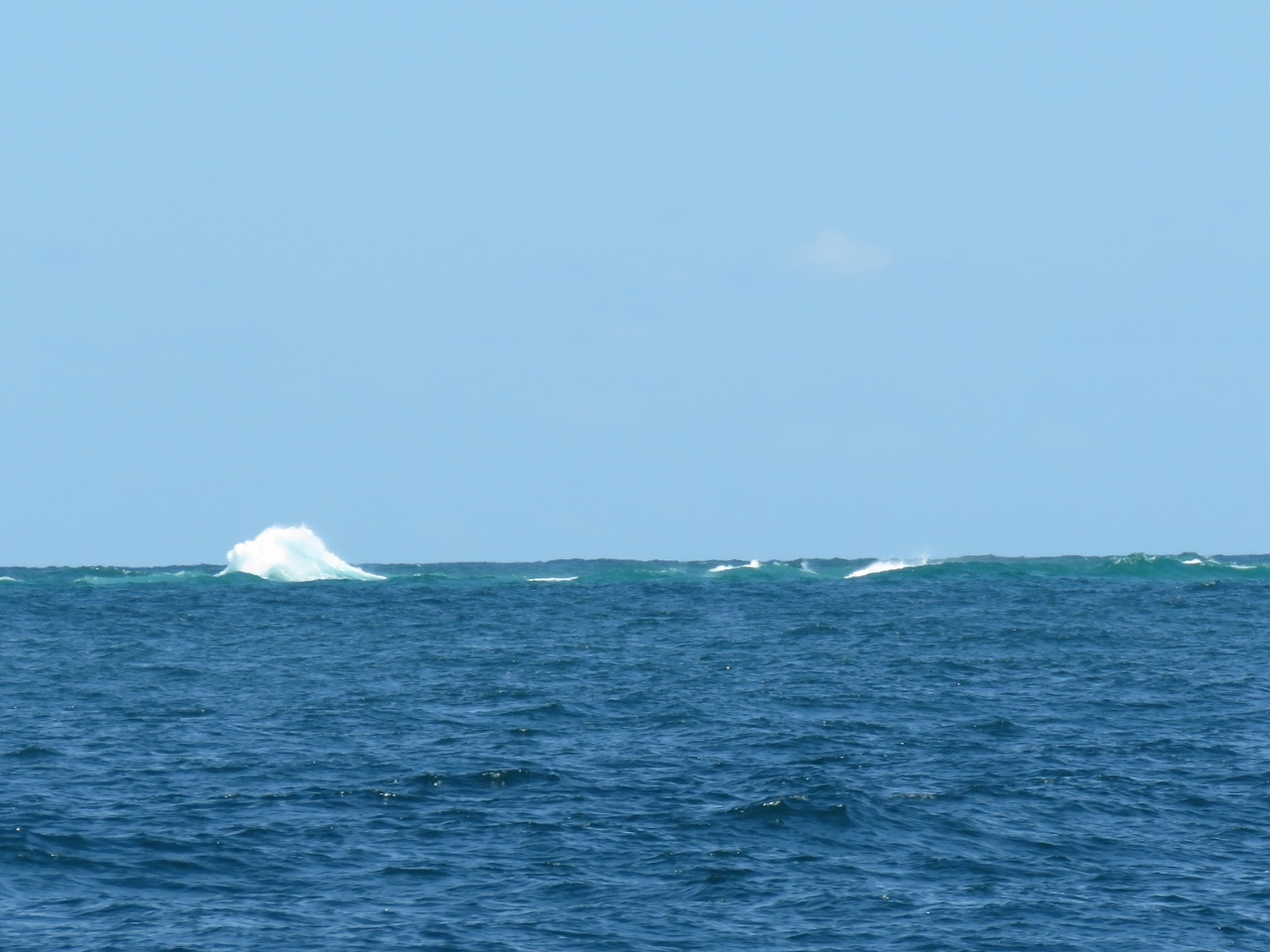 |
Breakers
Position: -76 30.79, 34 29.34
Cape Lookout Shoal extends several miles south of Cape Lookout, with breakers down much of its length. Finding a shortcut across. although technically feasible, did not look appealing.
|
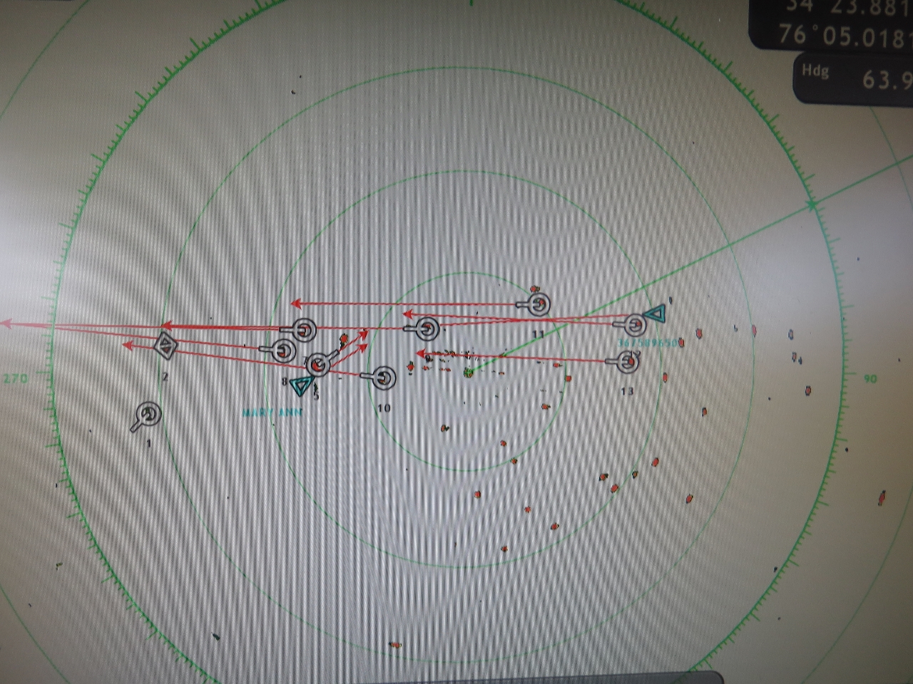 |
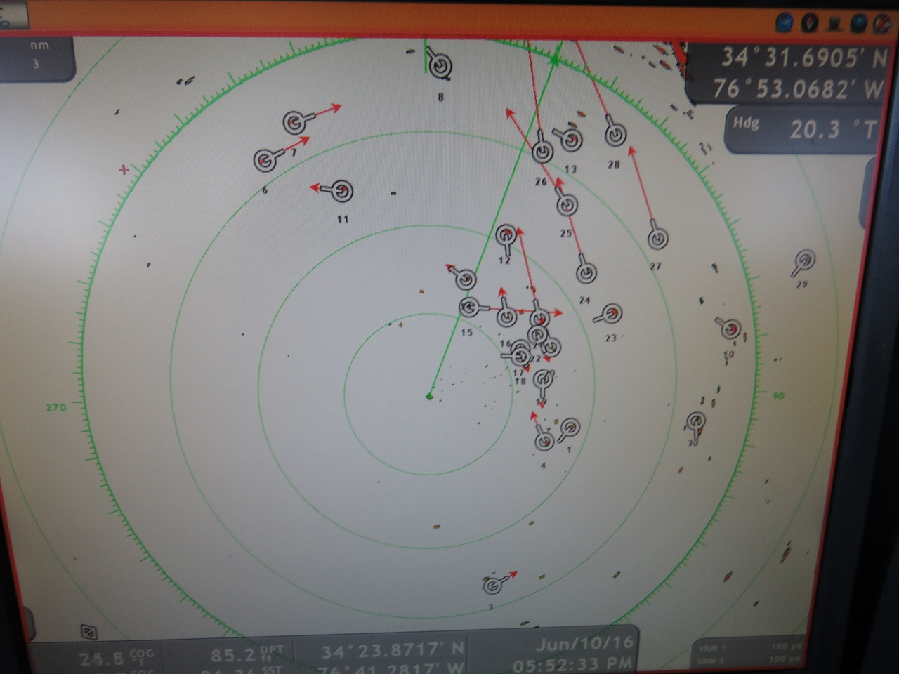
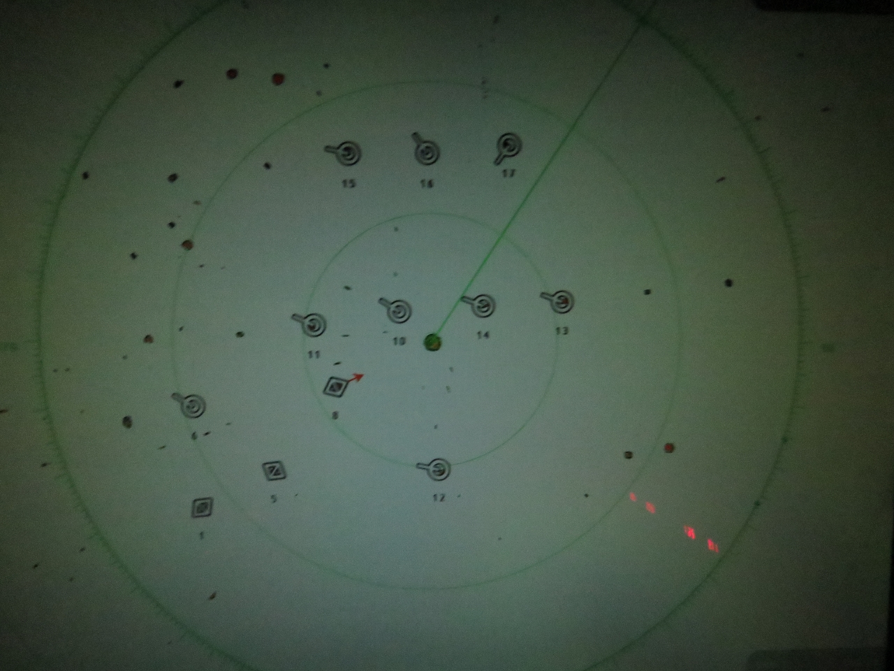
Tournament
Position: -76 18.26, 34 30.75
We heard something on the radio about a fishing tournament and suddently found ourselves swimming very much upstream against a flow of at least fifty high-speed sportsfishing boats. All those little red dots on the radar are boats, some we’ve selected as ARPA targets.
|
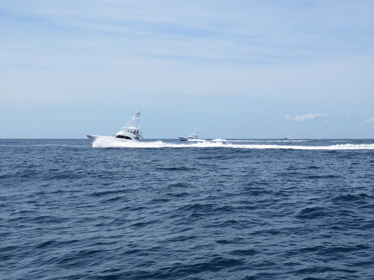 |
Sportsfishers
Position: -76 18.41, 34 30.68
Several of the group of 50+ sportsfishers in the tournament group passing us heading west. The slowest boat was running at 25 knots, most were over 30 and one was running 38.
|
 |
BGAN
Position: -76 4.48, 34 36.72
Our mini-VSAT satellite system failed, so we’re on BGAN until we get the issue resolved. The means we’ll only be updating the route periodically when we connect (usually twice a day).
|
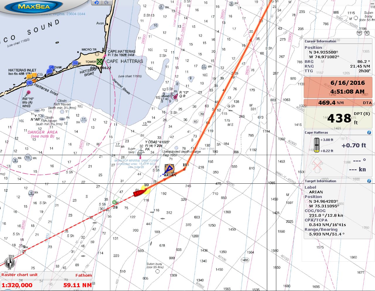 |
Cape Hatteras
Position: -75 24.46, 34 54.08
Rounding Cape Hatteras near midnight with the cargo ship Arian heading the opposite direction. The Cape Hatteras lighthouse light was quite obvious 20 miles to our north.
|
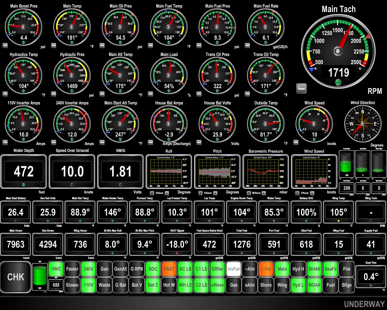 |
10 knots
Position: -75 1.94, 35 14.49
We’re making excellent speed in the Gulf Stream and doing over 10 knots at 1700 RPM with a fuel economy of 1.81 nm/gallon. At this RPM, in flat water without current, we would normally run about 8 knots.
|
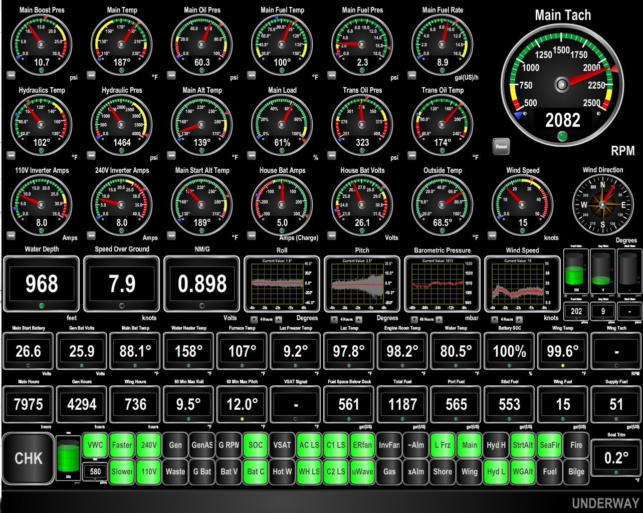 |
Pitch
Position: -74 1.05, 36 42.84
The winds have switched to 15-20 from the north-northwest. This is generating a chop that is producing steady pitching of 12 degrees and occasionally up to 15. The pitch graph near the center of the gauge display shows it increase over the past couple of hours. This shouldn’t last more than a few hours until the wind switches back to the southwest. As expected, we’re out of the Gulf Stream current now, and need to run at 2000RPM to make 8 knots.
|
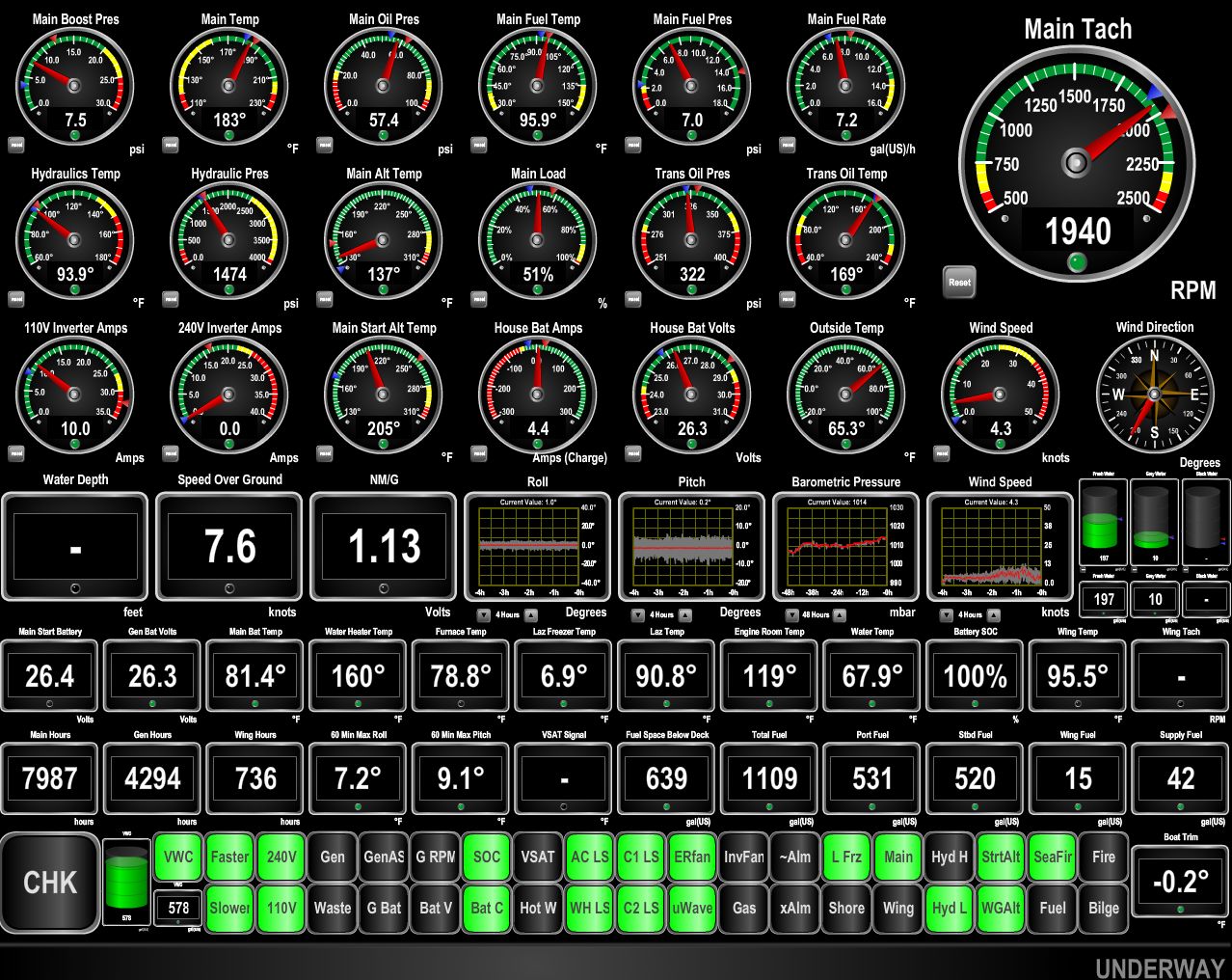 |
Calmer
Position: -73 8.72, 38 5.64
The winds have switched around to the southwest now, so we’re seeing much reduced pitching motion.
|
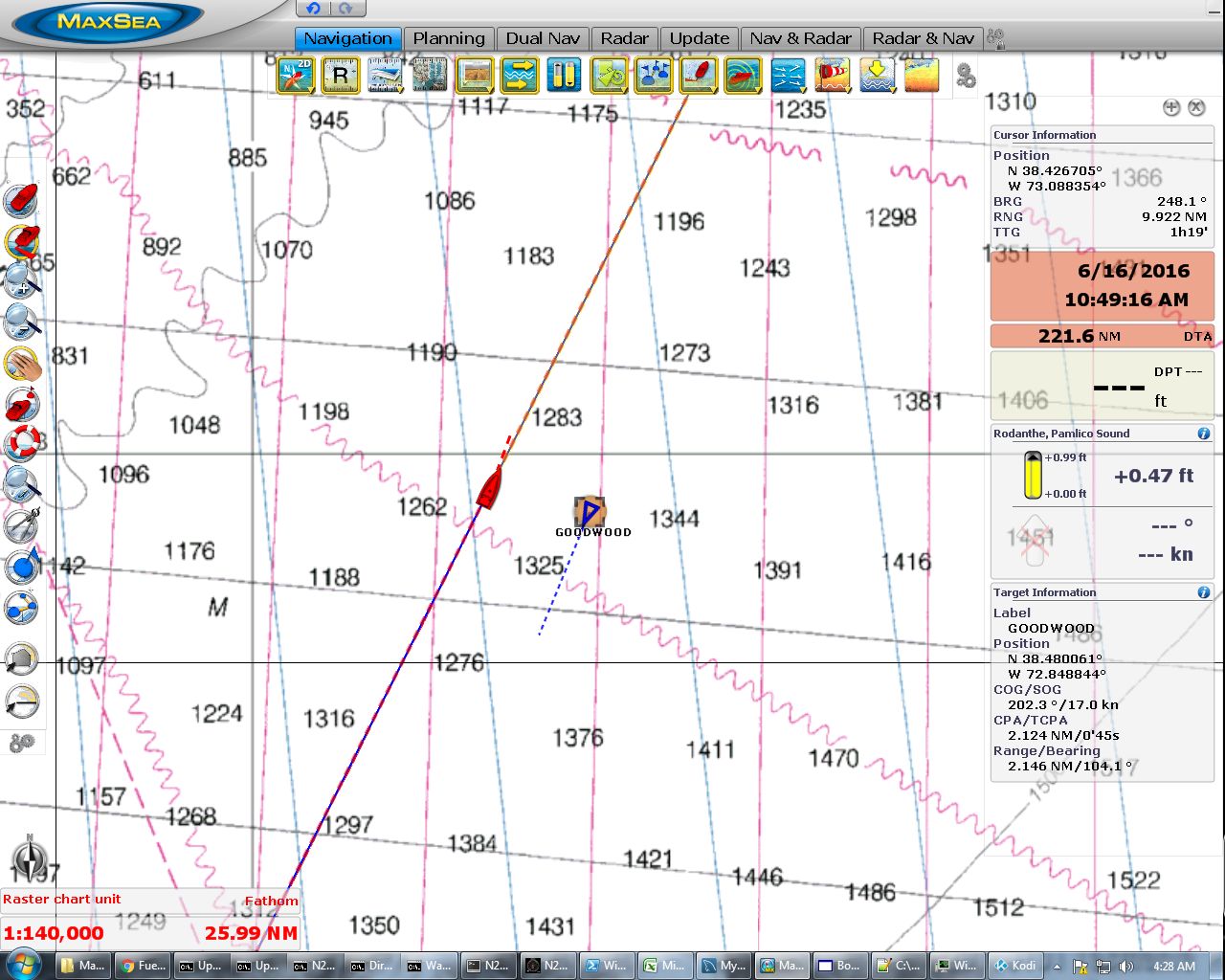 |
Maersk Goodwood
Position: -72 53.62, 38 29.28
Passing the 653ft cargo ship Maersk Goodwood en route to Jacksonville. Vessel traffic has been pretty light so far.
|
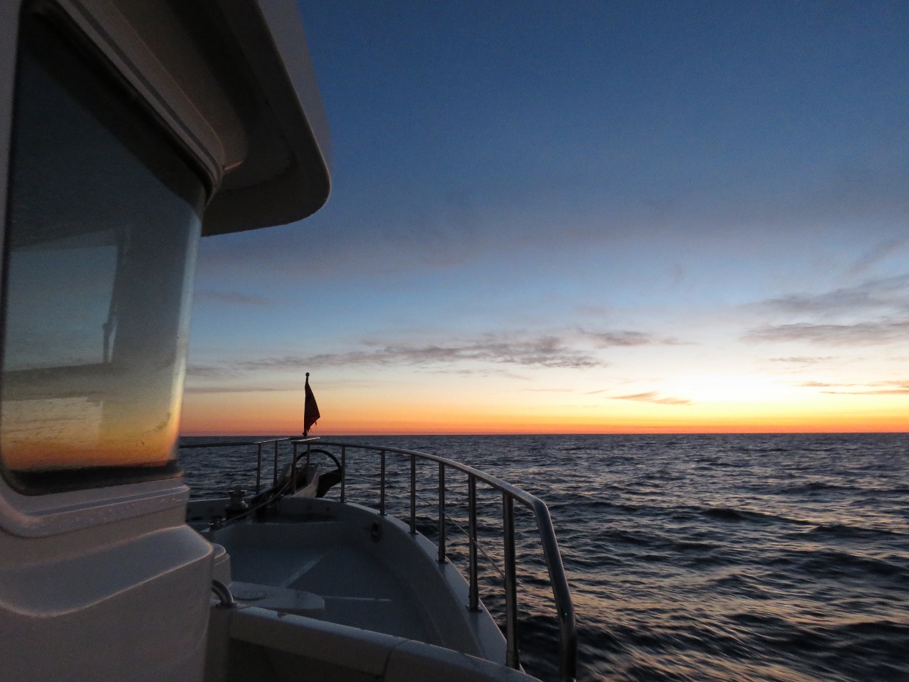 |
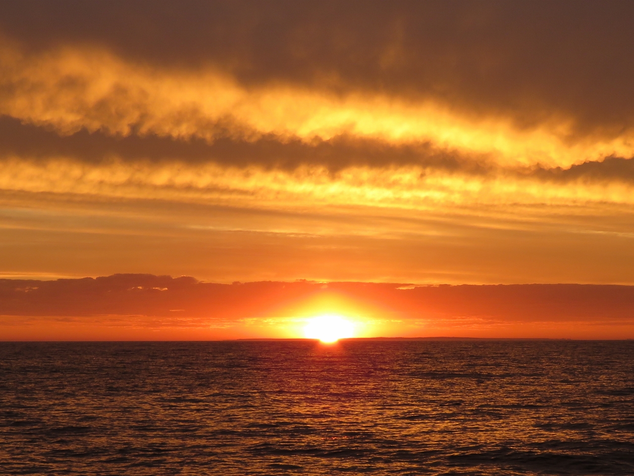
Sunrise
Position: -72 51.66, 38 32.31
Conditions have remained excellent since last night’s wind switch to the southwest. Seas are calm and the winds are below ten knots. We expect this to last into Boston.
|
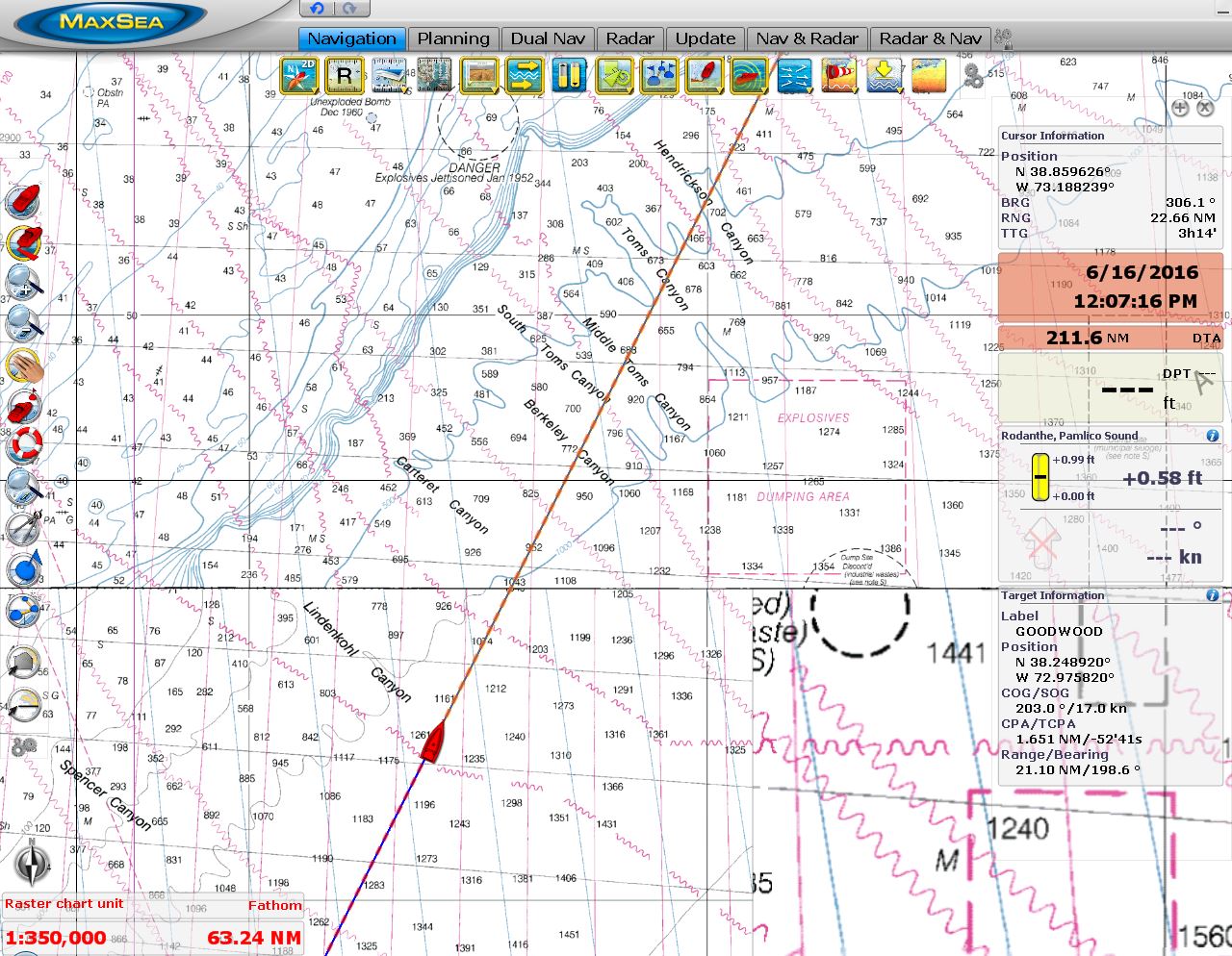 |
Canyons
Position: -72 47.97, 38 38.05
We’re passing by a series of submarine canyons where depths plummet from 300ft to thousands in only a few miles, home to a wide diversity of underwater life.
|
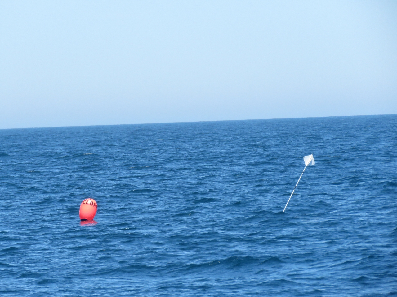 |
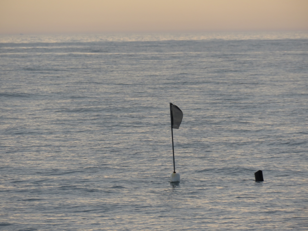
Floats
Position: -72 17.32, 39 25.52
Other than the floats we saw nearing Cape Lookout we’ve not seen much of anything in the water so far. That changed today. We just passed through a large field of floats like this one, with a large buoy and a radar reflector on a stick. They’re pretty easy to see during the day, and do show up on RADAR. Hopefully we won’t see a lot at night though.
|
 |
8,000 hours
Position: -72 13.44, 39 31.47
We just crossed 8,000 hours on the main engine. That John Deere has never once failed to start and has run reliably for all those hours.
|
 |
Floats at night
Position: -71 37.32, 40 26.61
Shortly after dark, we found ourselves in a seemingly endless field of floats like the one we’d seen earlier, spaced about a third of a mile apart. We could pick them out on RADAR, but this required constant vigilance at the helm. If the seas were choppy or we were in storm clouds, they’d be very difficult to spot though. We eventually passed through after several fairly tiring hours.
|
 |
Sunrise
Position: -71 7.36, 41 11.83
After we got through the floats, we started seeing a lot of fishing vessel traffic off Rhode Island Sound. They’re much easier to see and avoid at night than the floats, but we were still pretty happy to see that sun come up.
|
 |
Small float
Position: -71 0.05, 41 22.72
The large floats we’d seen earlier gave way to these smaller ones. They were widely spaced and easy to avoid.
|
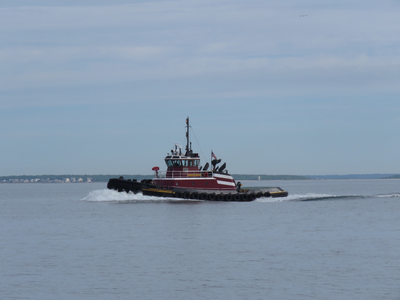 |
Andrew McAllister
Position: -70 49.27, 41 32.07
The beautiful tug Andrew McAllister, designed by Jensen Maritime Consultants of Seattle, Washington, is powered by two EMD 12-710-G7B diesel engines with a rated 6,000 horsepower.
|
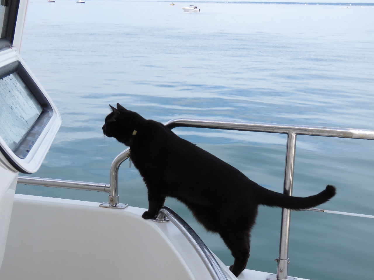 |
Where are we?
Position: -70 40.07, 41 40.46
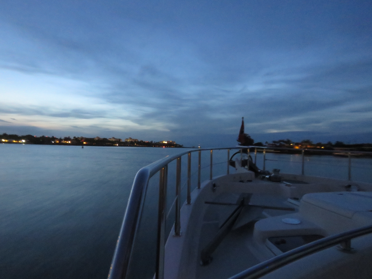
Spitfire getting his first smell of Massachusetts while we wait at anchor for a favourable tide to transit Cape Cod Canal. The tidal range at Buzzards Bay is 4 ft and at Cape Cod Bay is 9ft, which generates 3.5knot flooding currents and 4-6-knot ebbing currents in the Cape Cod Canal that connects the two bodies of water. At the earliest we’ll transit on the end of the ebb current shortly before it turns to flood.
|
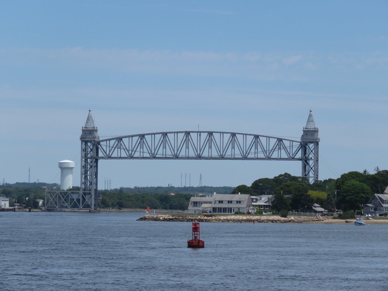 |
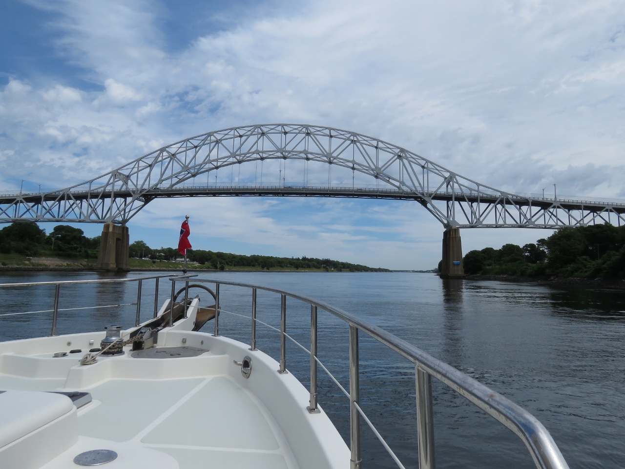
Railroad Bridge
Position: -70 37.79, 41 43.95
The ConRail Railroad Bridge is the first of three bridges we will pass under as we transit the Cape Cod Canal, and the only one that opens. It’s normally in the open position, but when closed has a vertical clearance of only 7ft. So we really need it open.
|
 |
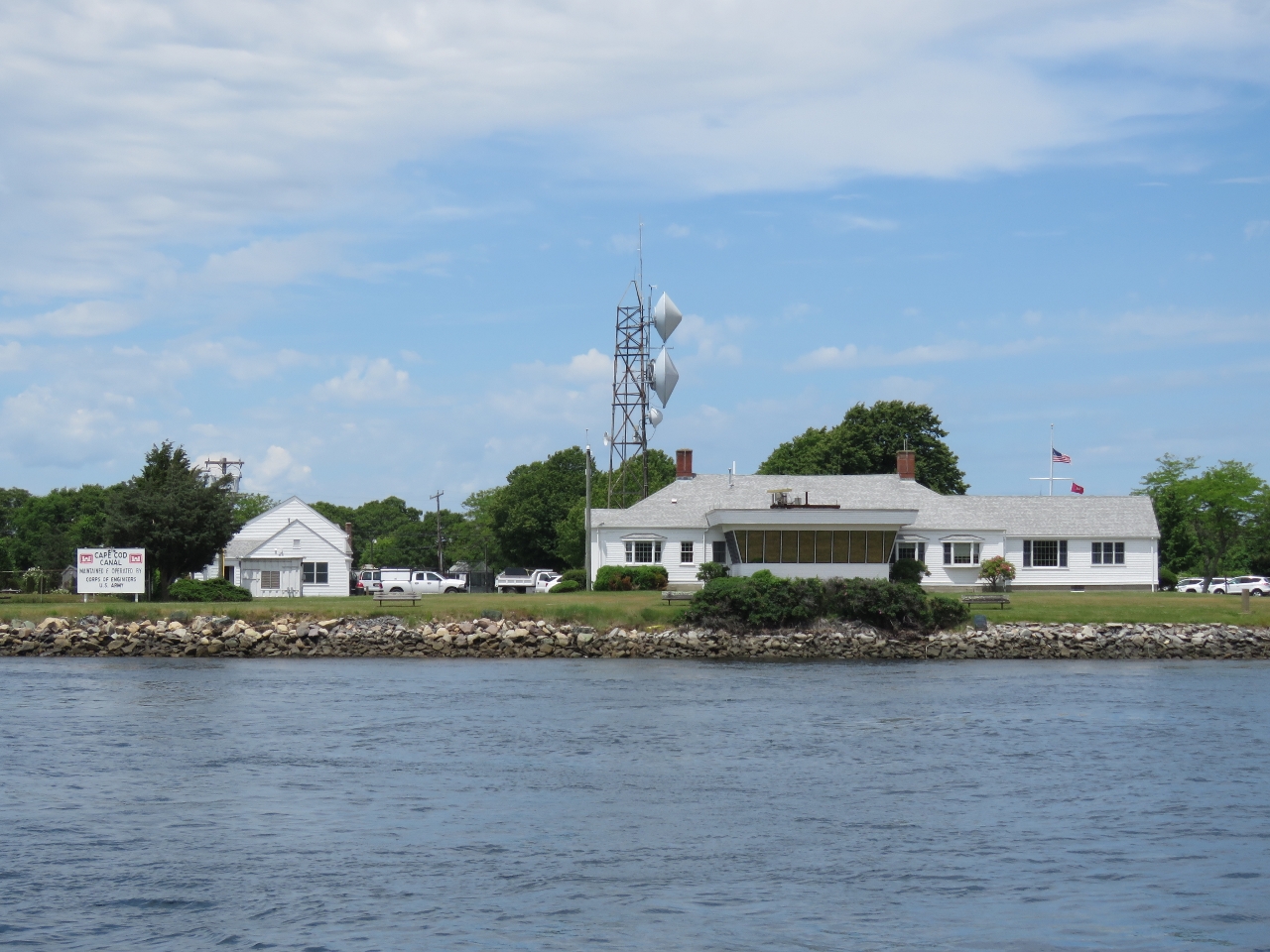
USTS Kennedy
Position: -70 37.46, 41 44.19
The Massachusetts Maritime Academy is at the west entrance to the canal. Moored out front is their training ship, the 540ft USTS Kennedy. The academy was founded in 1891 and has a huge campus that encompasses all of Taylor Point.
|
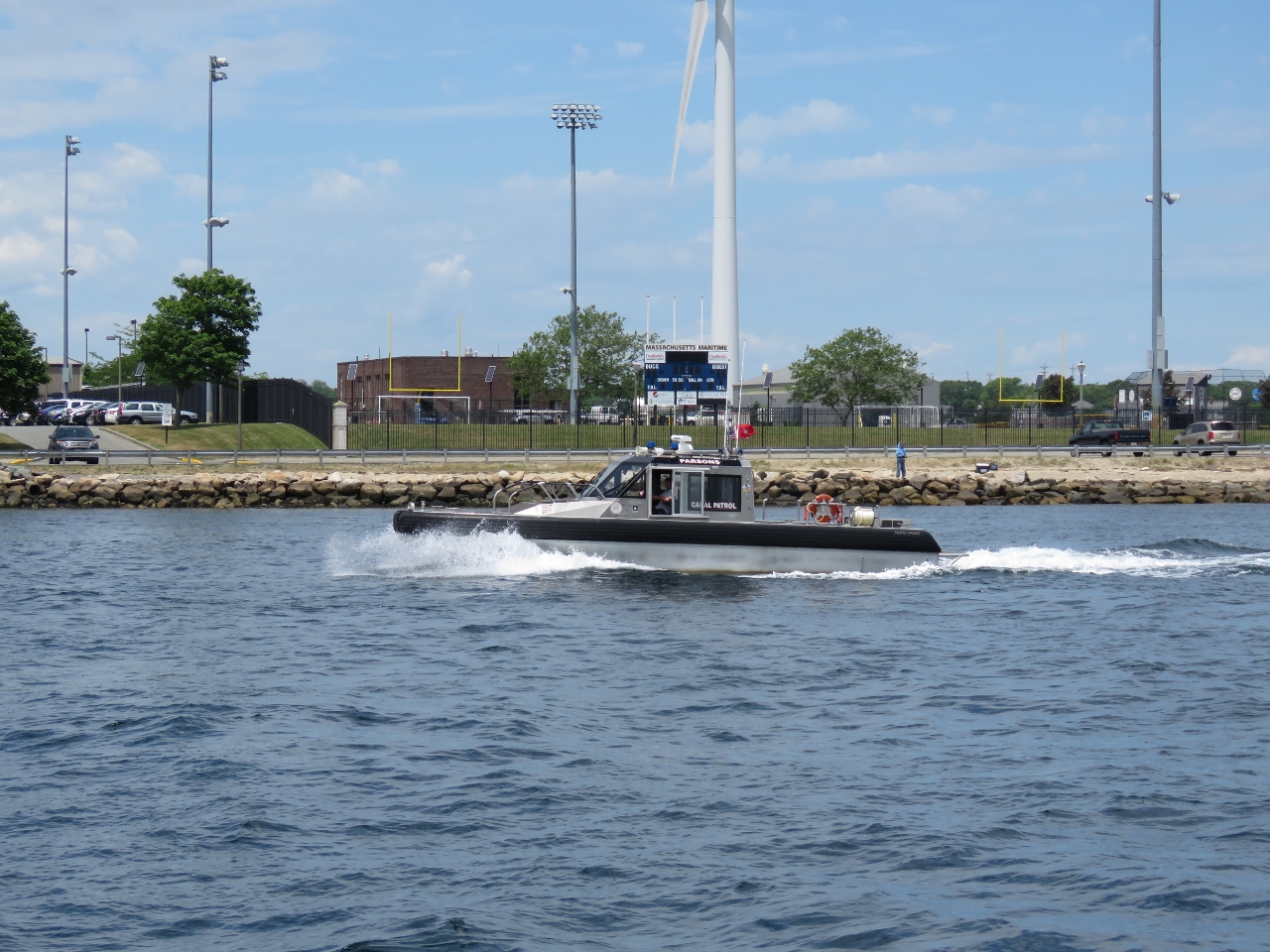 |
Canal patrol
Position: -70 37.18, 41 44.33
The Cape Cod Canal has a number of rules for transit, including a maximum speed limit of 10mph and also minimum and maximum transit times. Boats must be able to make it through the canal in 2.5 hours or hire a tug assist. Any boat passing through must be under power with no wake. Stopping, turning around or fishing are not permitted.
|
 |
Corp of Engineers
Position: -70 36.92, 41 44.46
The Army Corps of Engineers manages the canal. This is their control center.
|
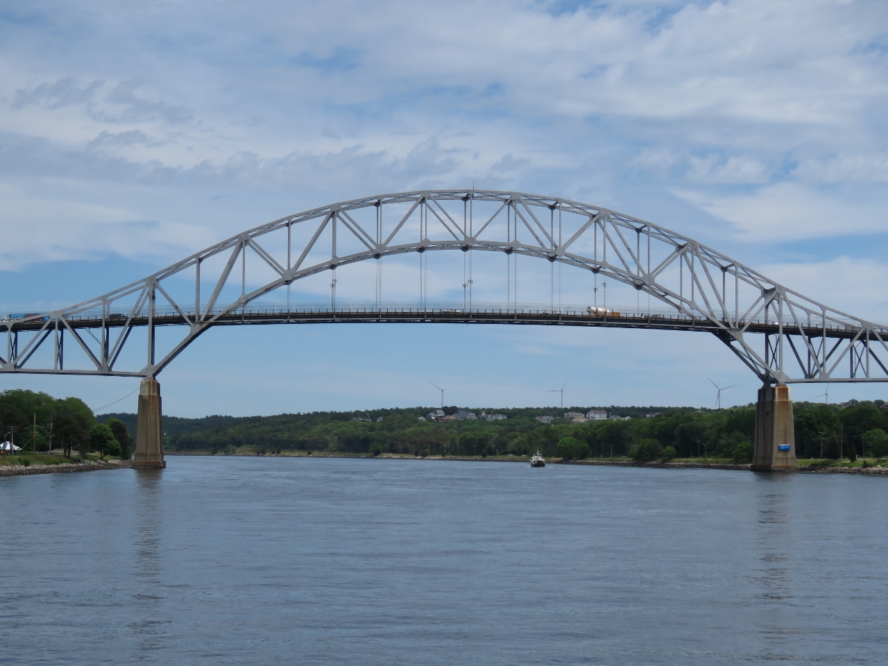 |
Bourne Bridge
Position: -70 35.74, 41 44.77
Approaching the Bourne Bridge, with a 135ft vertical clearance.
|
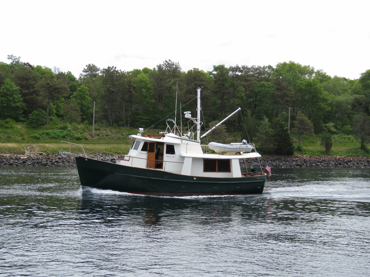 |
Guinness
Position: -70 34.26, 41 45.63
We saw only one other boat in the canal, the Kady Krogen 42 Guinness. But on AIS we could see a pusher tug ahead of us, with a tug assist, and another larger commercial ship behind.
|
 |
Sagamore Bridge
Position: -70 32.78, 41 46.55
Approaching the third and final bridge, the Sagamore Bridge, has the same 135ft clearance as it’s sibling, the Bourne Bridge.
|
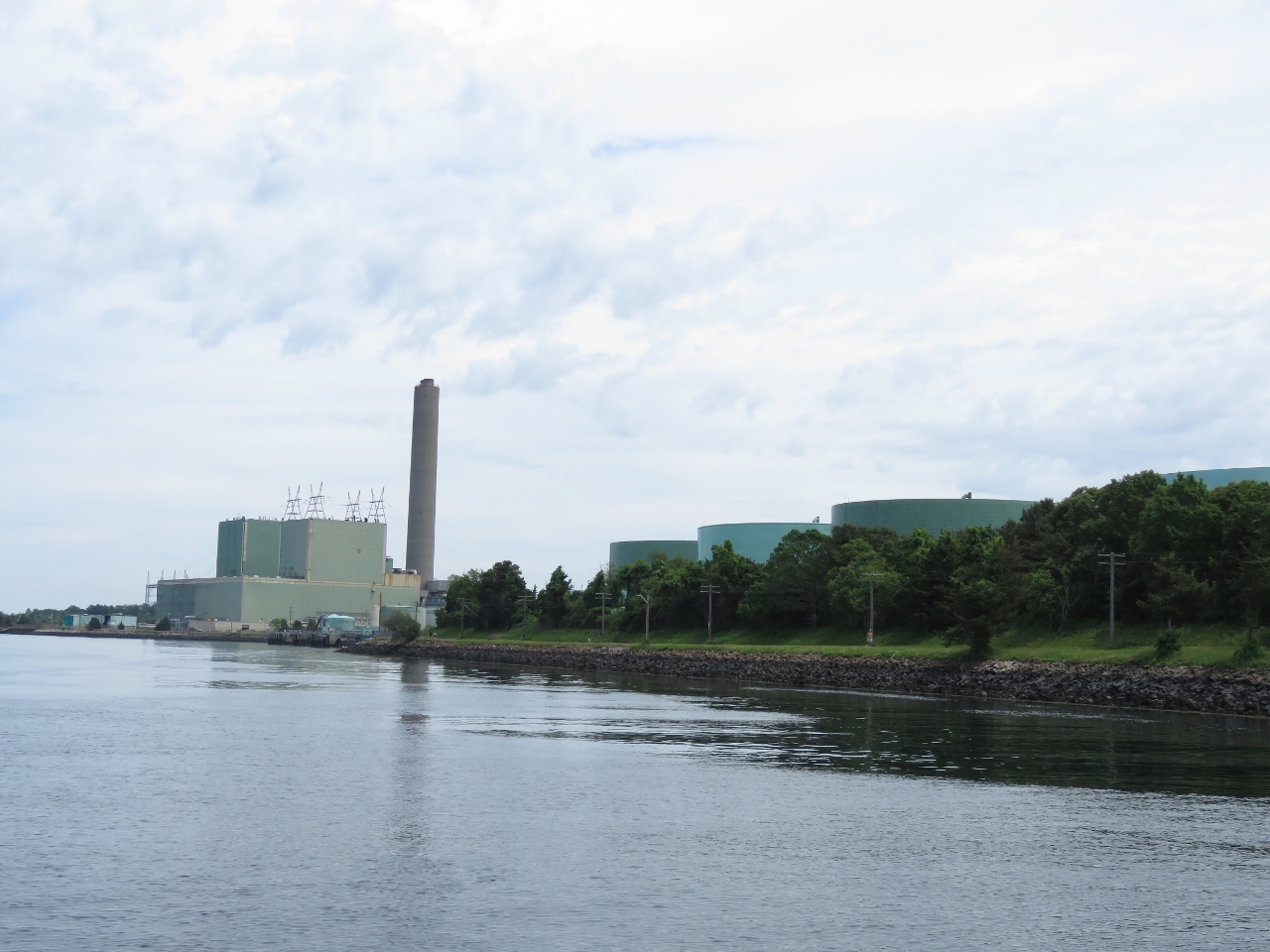 |
Canal Generating Plant
Position: -70 31.18, 41 46.39
The Canal Generating Plant,a petroleum and natural gas electrical power station, at the east end of the canal. It opened in 1968 and once generated the majority of the power for Cape Cod, but now only handles peak loads.
|
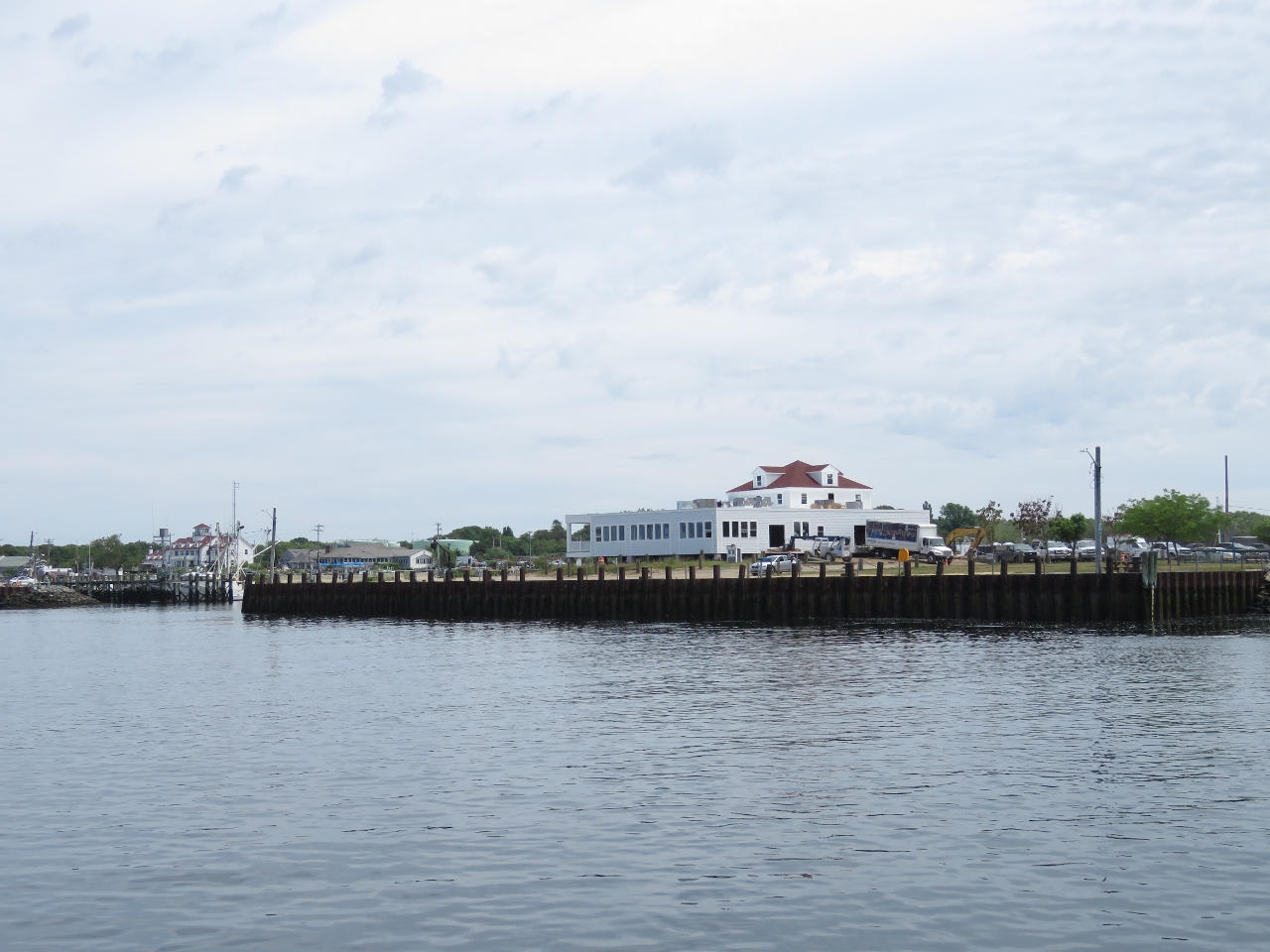 |
Sandwich
Position: -70 30.24, 41 46.40
Sandwich, incorporated in 1639, is the oldest town on Cape Cod. The Canal Visitor Center is here, along with a popular boardwalk along the canal.
|
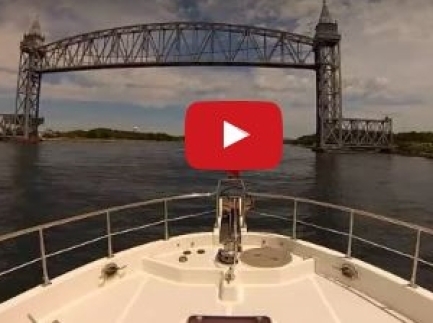 |
Canal Transit
Position: -70 29.74, 41 46.63
A 1:36 video of our transit through the Cape Cod Canal.
|
 |
Cape Cod Bay
Position: -70 29.19, 41 46.79
We entered Cape Cod Bay on a wonderfully sunny and calm day.
|
 |
Warren Cove
Position: -70 37.02, 41 56.80
At anchor in Warren Cove off Plymouth Bay with Plymouth Beach stretching out to our west. As with Cape Lookout, we chose Plymouth mainly because it was a convenient and easy place to anchor without taking us too far off our route. But also like Cape Lookout, this was an excellent stop in the city where the Pilgrims settled in the New World in 1620. Read more …
|
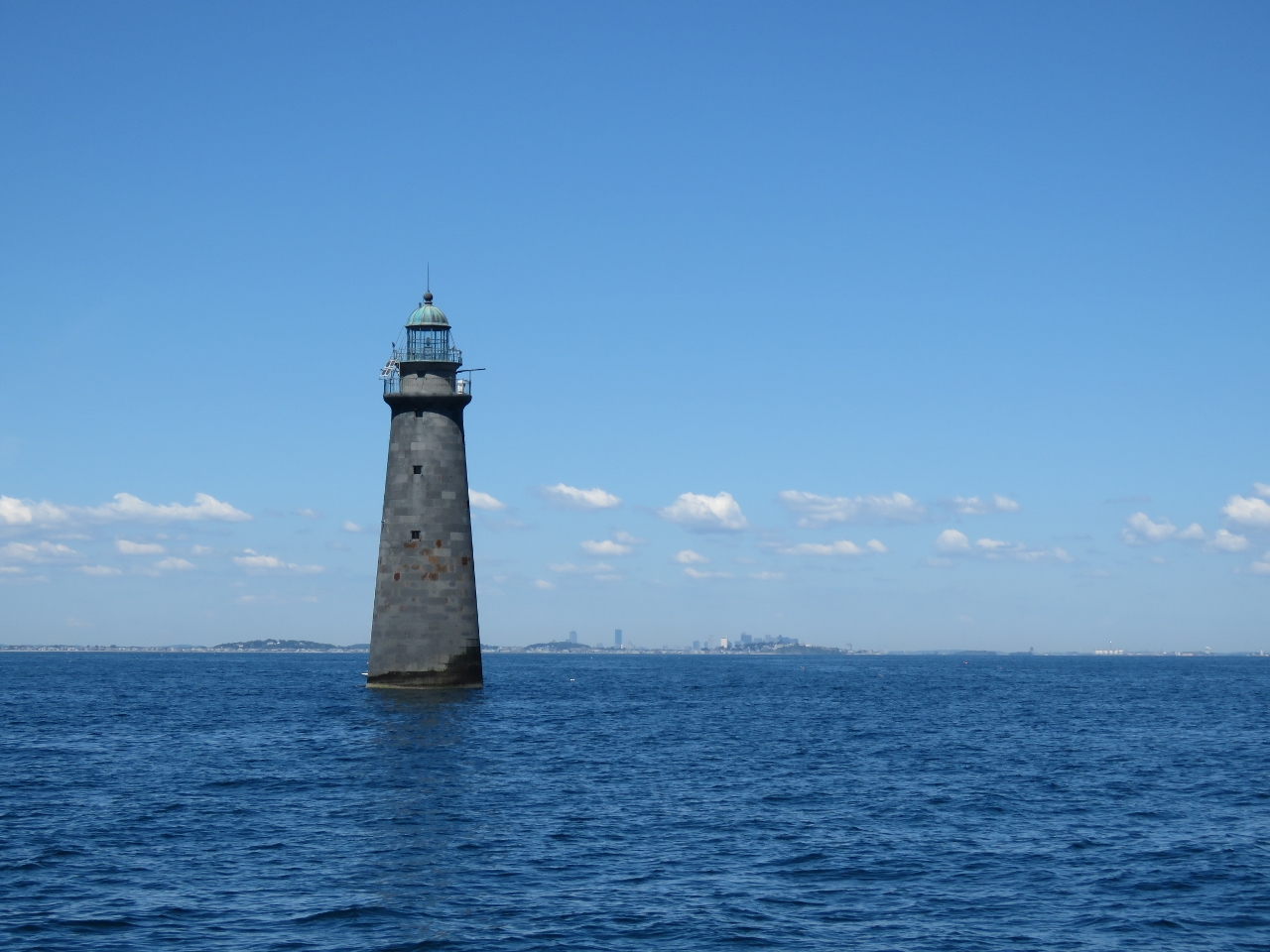 |
Minots Ledge Light
Position: -70 45.40, 42 16.20
Minots Ledge Light, a few miles outside Boston Harbor, was completed in 1850 following the loss of over 40 vessels on Minots Ledge in the 1830s. Barely a year later, a major storm swept the entire structure away, killing the two keepers. The current 87ft lighthouse was completed in 1860 at a cost of $300,000, the most expensive lighthouse ever constructed in the US.
|
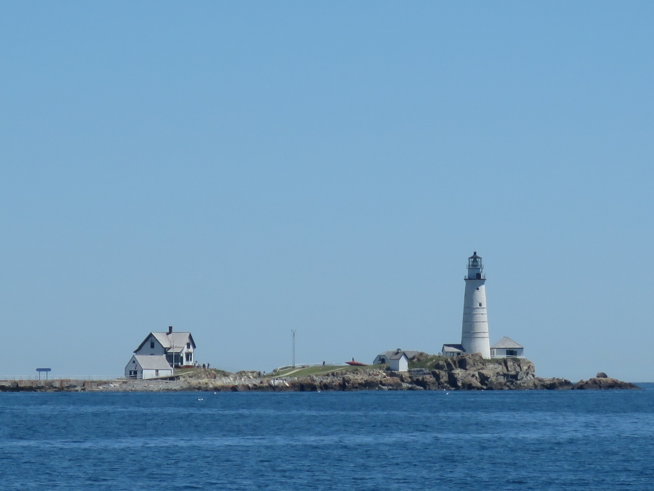 |
Boston Light
Position: -70 54.24, 42 19.15
Boston Light on Little Brewster Island, first lit in 1716, is the oldest continually used light station in the US. There sure is a lot of history in this area. Settlement of Victoria, Canada, where we originally hail from, didn’t even start until the mid-1800s with the contruction of Fort Victoria in 1843. And the first lighthouse on Canada’s west coast, Fisgard Light, wasn’t completed until 1860.
|
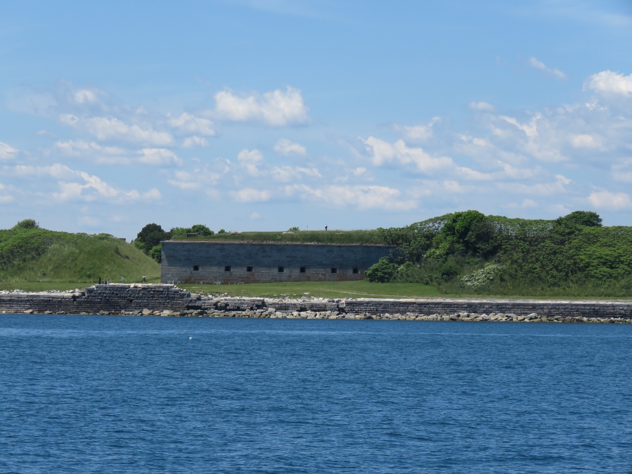 |
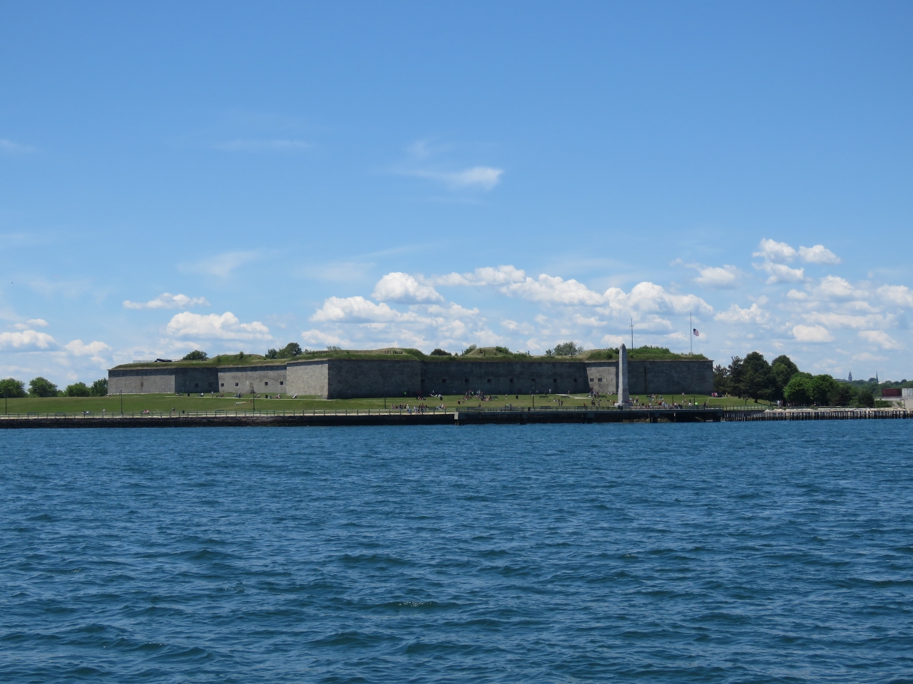
Fort Warren
Position: -70 55.12, 42 19.29
Fort Warren on Georges Island was completed in 1860, shortly after the start of the American Civil War. The fort was permanently decommissioned in 1947 and now is a popular tourist destination.
|
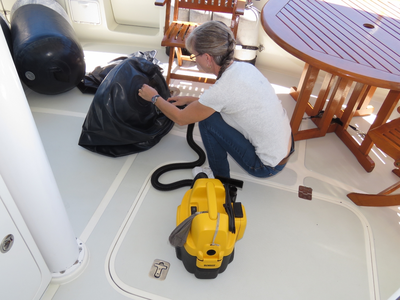 |
Fenders
Position: -70 55.30, 42 19.35
Jennifer inflating the fenders in preparation for our arrival into Charlestown Marina. We’re getting them ready early so we can enjoy the trip through the inner harbor.
|
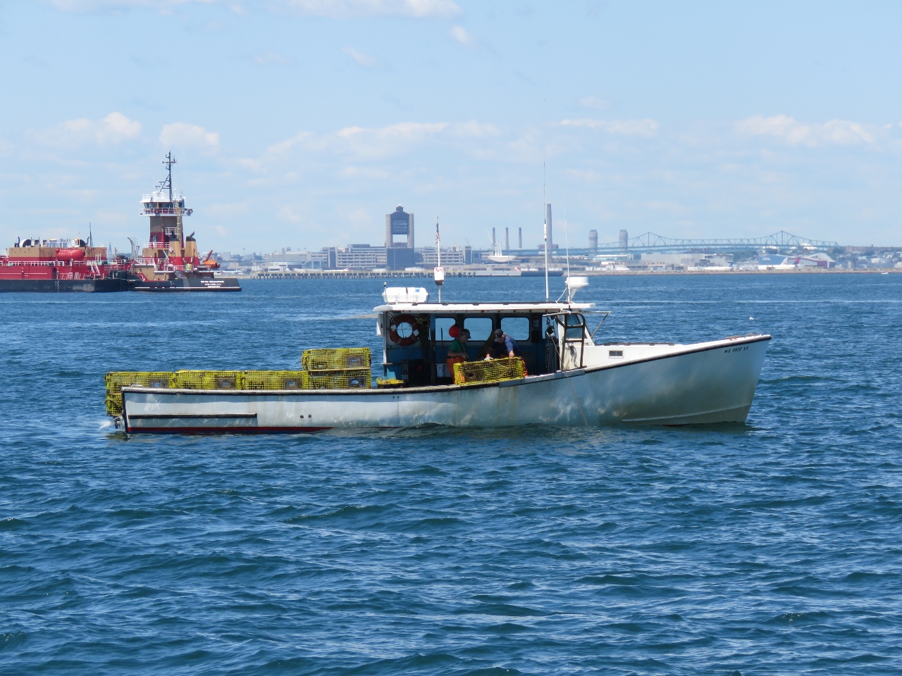 |
Lobster boat
Position: -70 57.20, 42 20.15
A lobster boat working traps in the harbour. While we did see a lot of traps both coming into and leaving Plymouth, they all were widely spaced and easy to avoid.
|
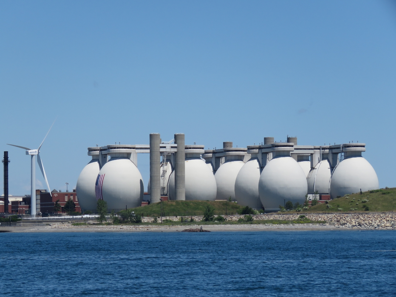 |
Deer Island
Position: -70 57.57, 42 20.18
“Egg” digesters in the Deer Island Sewage Treatment Plant. The plant is the second largest in US, with a capacity of 1.2 billion gallons per day.
|
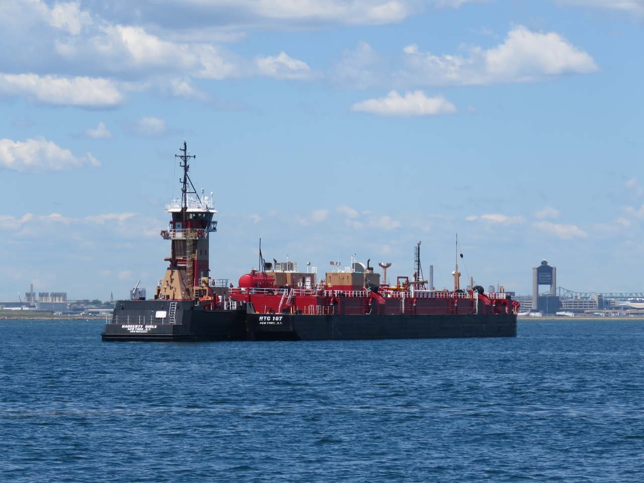 |
Haggerty Girls
Position: -70 58.19, 42 20.19
The articulated tug barge Haggerty Girls, likely heading to the bulk petroleum storage facility along the Chelsea River.
|
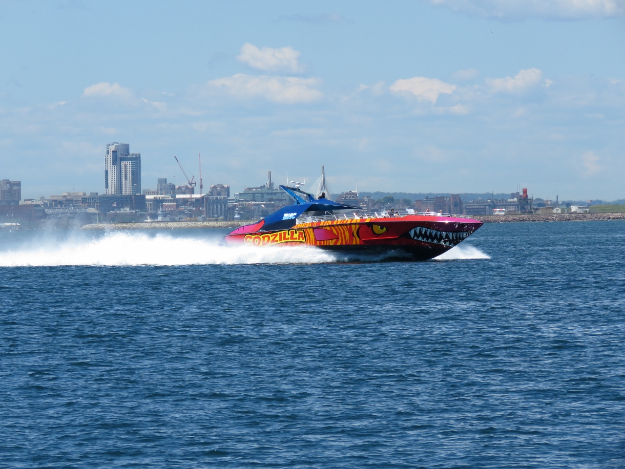 |
Codzilla
Position: -70 58.79, 42 20.22
The 70ft tourist boat Codzilla has 2,800 horsepower and can easily do 40 knots.
|
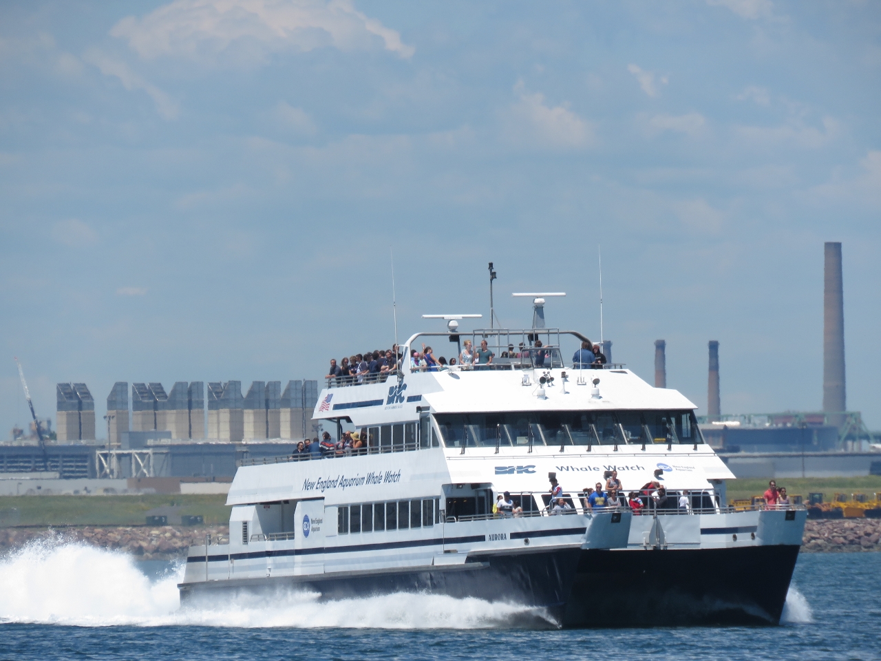 |
Whale Watch
Position: -70 59.18, 42 20.21
A New England Aquarium whale-watching tour heading out.
|
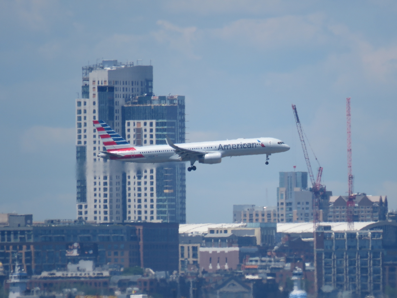 |
Planes
Position: -70 59.56, 42 20.26
Traffic is heavy in Boston Harbor, and it’s not all in the water. Jets are constantly flying overhead bound for Logan International Airport to our north.
|
 |
Fort Independence
Position: -71 0.32, 42 20.44
Fort Independence on Castle Island was commissioned in 1851. Castle Island has had a military presence from 1634 through World War II and is the oldest continuously fortified site in British North America.
|
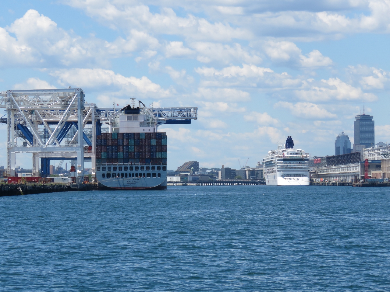 |
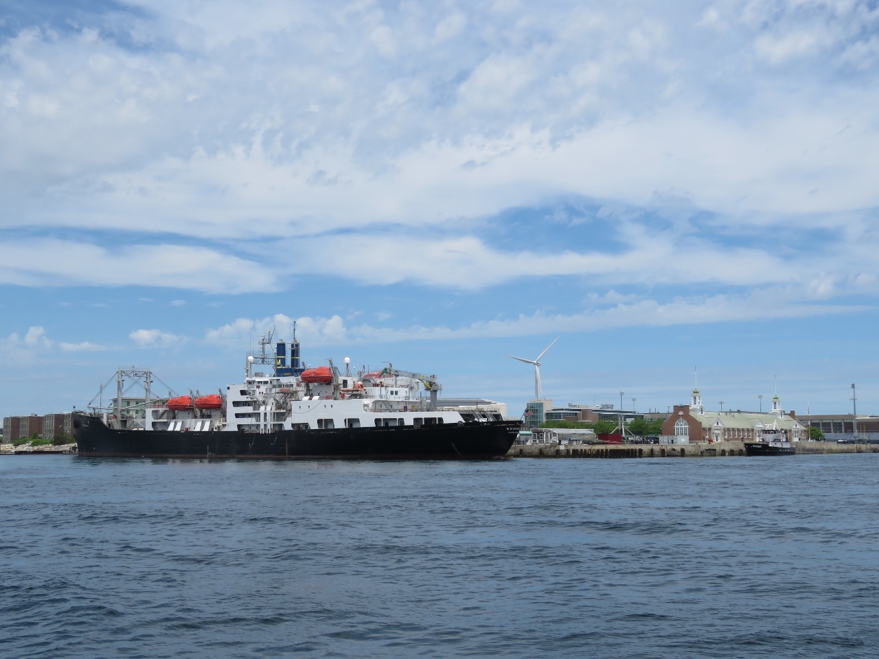
Port of Boston
Position: -71 0.65, 42 20.60
The container ship Cosco Genoa and the cruise ship Norwegian Dawn in the Port of Boston.
|
|
|
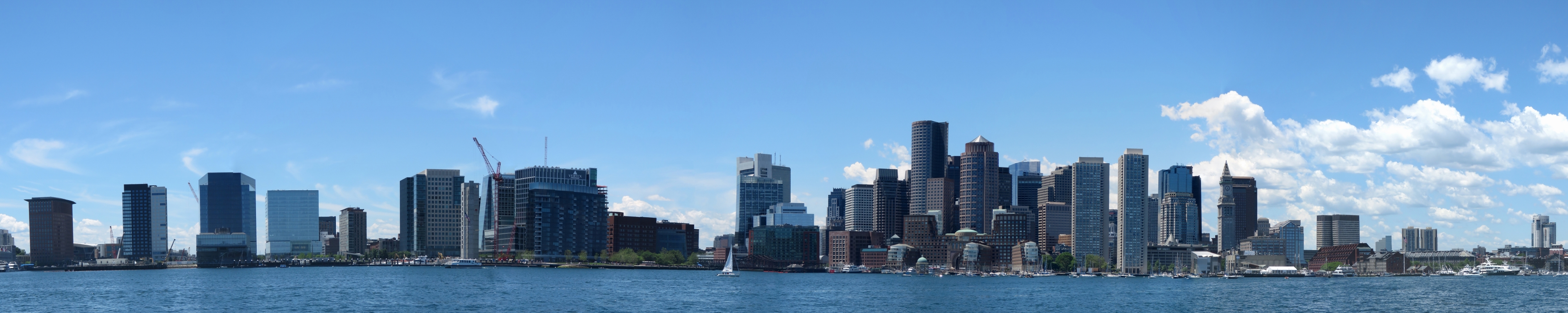
Boston Skyline
Position: -71 2.39, 42 21.58
We were pretty excited to see the Boston skyline stretching out before us.
|
 |
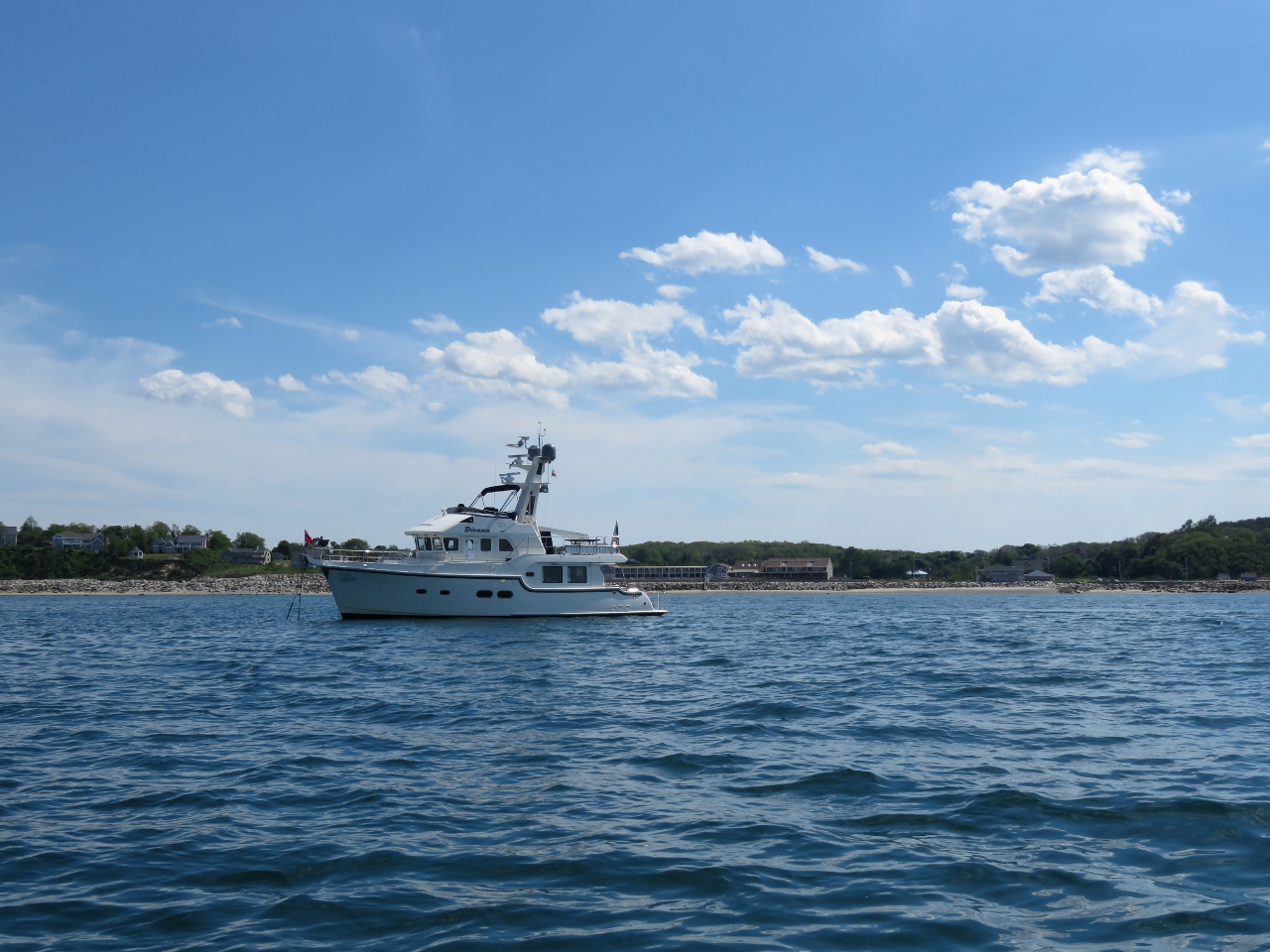
Nordhavn 60
Position: -71 2.49, 42 21.70
A Nordhavn 60 moored at Boston Yacht Harbor. We couldn’t quite read the name behind a radio antenna, it looks like Chapiu.
|
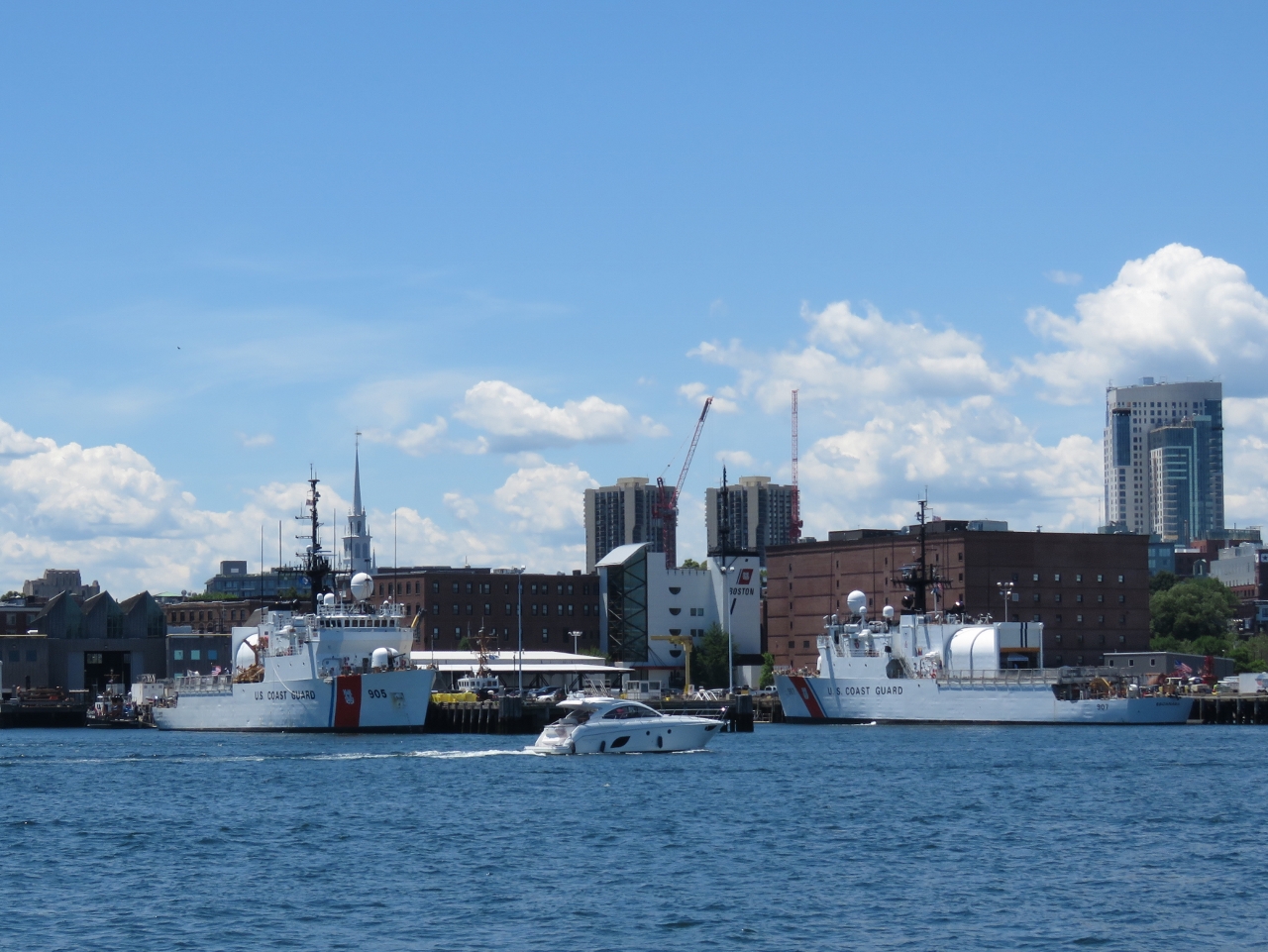 |
USCG
Position: -71 2.80, 42 22.22
United States Coast Guard (USCG) Base Boston just north of downtown.
|
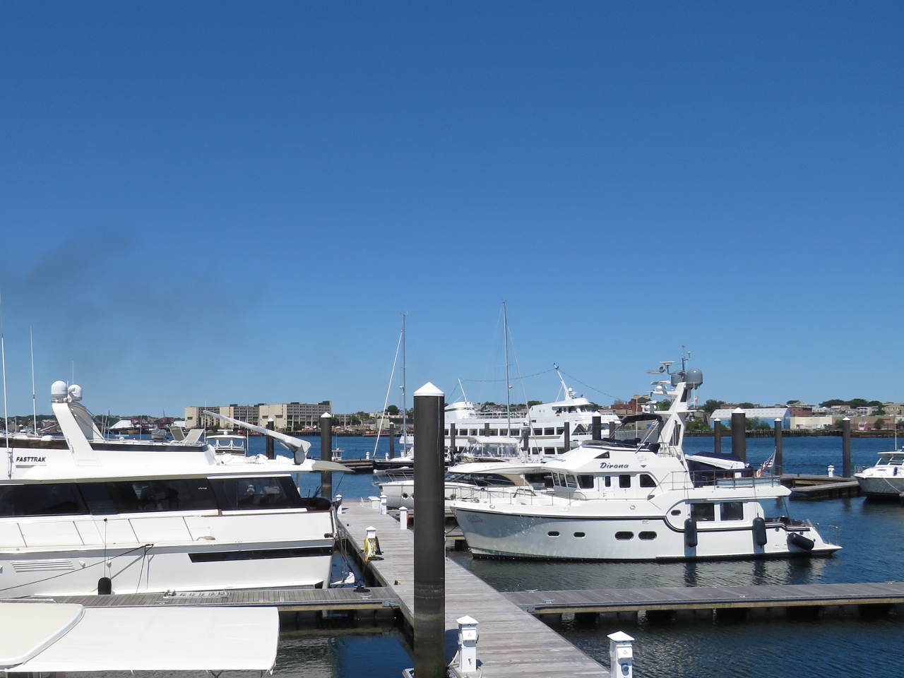 |
Charlestown Marina
Position: -71 2.90, 42 22.52
Moored in our temporary home for the next 6-8 weeks at Charlestown Marina.
|

|
Click the travel log icon on the left to see these locations on a map, with the complete log of our cruise.
On the map page, clicking on a camera or text icon will display a picture and/or log entry for that location, and clicking on the smaller icons along the route will display latitude, longitude and other navigation data for that location. And a live map of our current route and most recent log entries always is available at http://mvdirona.com/maps. |
If your comment doesn't show up right away, send us email and we'll dredge it out of the spam filter.
This is in regards to the Maretron system….I have been doing a lot of research on this and wanted some of your insight if possible. I see there are 3 levels of sophistication with that product but it is something that you can have monitor what you want or it is a pre-packaged deal per those levels?
I know you 2 get pretty in depth with gathering data but do not think I will be to that extent at least. I have looked at other monitoring systems but have had no experience with anything like them before. I do like the layouts and what Maretron offers but do I need all it has to offer or is there another product that is similar?
I have a pretty good idea(actually have it mapped) of what I will be monitoring and it is a lot so both of your opinions on this will help me a lot.
Thanks in advance for your thoughts. :)
Maretron has many advantages but key amongst them are you can start as small as you want, it’s easy to expand, and very cost effective. Most competitive systems I looked at were much more expensive and required a professional installer
With Maretron you can start as small as a single sensor: by getting n2kview for PC (or using the free version on Android — we do both), some cabling, a power adapter, and a single sensor. We started with 4 or 5 sensors including depth, fuel level, water level, and weather and, as you know, the system has been through several expansions since then. Overall, great value, easy to use, and easy to expand as your monitoring needs change.
Your reply just sold me on it then as when researching other systems, they just did not seem to have the options Maretron has. Let’s say someone was going to build a new boat. Would it be better to rig the system in during the build or better to wait till the commissioning stage?
It’s always easier to pull wires during a build rather than later but, other than wire pulling time, it’s not notably more complex to install Maretron or any other NMEA 2000 gear after build.
My aproach has been to do most of the install post-build and keep the system running adding one componnet at a time. Just making small changes to a known good system makes it much easier to chase down install issues whereas if you install everything at once and it doesn’t work, it’s hard to know where to start to chase dow the problem
That is a good point taken and that would actually help in teaching a person exactly how that system works which makes troubleshooting a whole lot easier when problems arise.