We arrived into Barbados 25 days and 3,689 nm after leaving St. Helena. We’re told this is the longest non-stop run in a Nordhavn under 100ft. Including the 11-day, 1,711 nm trip from Cape Town to St. Helena, we’d been at sea six weeks to the day between Cape Town and Barbados, and covered exactly 5,400 nm, stopping only for four nights in St. Helena.
The long run from St. Helena to Barbados was of course our biggest concern, as prior to this our longest passage was 3,023 nm across the Indian Ocean from Australia to Rodrigues. We left St. Helena carrying 2,691 gallons of fuel and needed to make 1.6 nm/gallon targeting a 400-gallon fuel reserve. We normally use a 200-gallon reserve, since we know the fuel levels fairly accurately. But on longer runs, with more potential for issue, we often at least start with greater reserves. And for planning purposes, we assumed an average speed of 5.5 knots, which would be 28 days at sea.
Sea conditions generally were good most of the run, with a few days of negative current, and we had no trouble meeting our fuel economy goal. We ended up averaging nearly 6 knots, and so spent three days less at sea than we’d planned on. The summary data from this trip are:
- Fuel consumed: 2,384 gallons
- Fuel left on arrival: 307 gallons
- Total actual distance: 3,689 nm
- Overall fuel economy: 1.55 nm/g
- Overall speed: 5.98 kts
- Total trip hours: 616.5 (25 days, 16.5 hours)
- Gallons per hour: 3.87
- Average RPM: 1458
We’ve been asked to each comment on whether we’d do that length of passage again and the highs and lows of the journey:
Jennifer: I’d gladly do a run like that again–it really didn’t feel like a big ordeal. I was happy to reach Barbados of course, but I wasn’t dying to get off the boat or anything. Overall, the entire trip went remarkably well: the boat ran smoothly and sea conditions generally were good. We were comfortable at sea, slept well, had great meals, and enjoyed many relaxing hours together in the pilot house or up on the flybridge. For me the only real low points of the journey were when we hit a few days of counter-current that had a real negative impact on our fuel economy and also about 3-4 days of rougher water. Conditions were perfectly safe, but it’s just less enjoyable and more tiring when boat motion increases to the point that you need to be careful moving around.
James: It was a long trip for sure but it really wasn’t that difficult. Having done it, we now have really long distance runs as another tool we can use with comfort. Some people find longer times at sea boring, but for me it’s almost a relief to be able to catch up on work and boat service that needs to be done. As long as the weather isn’t difficult or dangerous, long trips really aren’t bad at all. We do have to admit that we are ready to slow down for a bit :-). We have covered a lot of water since Australia.
Spitfire: I’m happy so long as the kibbles keep coming and I can get in a good 20 hours of sleep a day. I like the longer trips because one of Jennifer or James is always at the helm, so I can get attention (or kibbles!) whenever I want, 24 hours a day. The main thing I don’t like about being at sea is sliding around when I’m sleeping, so I just adjust my sleeping position to wedge myself in more securely. At rest or in calm conditions at sea, I’ll sleep pretty much anywhere, often upside-down. In light seas, I’ll brace my paws against a wall. As conditions get rougher I’ll wedge into the pilothouse corner shelf above the master stateroom steps. And in extreme conditions, I curl up into the master stateroom sink and don’t shift an inch.
Trip highlights from February 1st through 3rd follow. Click any image for a larger view, or click the position to view the location on a map. And a live map of our current route and most recent log entries always is available at http://mvdirona.com/maps
 |
Chartplotter
Position: -55 42.45, 10 49.50
At 257 miles out, we’re close enough to show an outline of Barbados and our boat at the same time on the chartplotter.
|
 |
Marine growth
Position: -56 1.17, 10 59.63
We passed quite a bit of near-shore marine growth over the past few hours, so we must be getting close to shore.
|
 |
Rinse
Position: -56 3.21, 11 0.73
We’ll give the boat a good scrub when we get in, but for now James gave it a quick rinse with the powerwasher so we can move about and not get covered with salt. We also wanted to get some of the fish scales off before they became permanent.
|
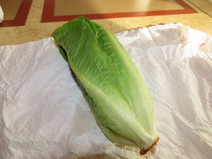 |
Lettuce
Position: -56 34.44, 11 17.61
We still have fresh lettuce purchased from Cape Town six weeks ago. That Sub-Zero fridge really is impressive.
|
 |
Chembulk Houston
Position: -56 34.99, 11 17.91
The 443ft tanker Chembulk Houston passed about a mile and half to our north en route to Rio de Janeiro.
|
 |
Deadline
Position: -56 44.23, 11 22.91
Our “driving the lights” program has two modes: one to meet a fuel economy goal and the second to meet a time-based deadline. At our current speed, we’ll arrive just after sunset tomorrow. We’d rather not arrive in the dark and it will be difficult to speed up enough to ensure that we don’t, so we’ve switched to deadline mode and slowed down to arrive first thing in the morning on the following day.
|
 |
Conditions
Position: -57 38.27, 11 53.12
The winds have dropped to around 10 knots from the ENE and the seas have settled to a gentle swell on the stern quarter. The maximum roll and pitch for the past hour was 7.3° and 4.1° respectively. It’s nice to be able to glide into our destination with such calm conditions.
|
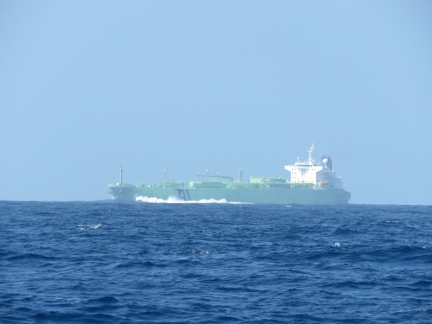 |
BW Austria
Position: -58 6.00, 12 8.62
We passed another tanker today, the 741ft BW Austria, en route to Suape, Brazil. We seem to be on the oil tanker route to Brazil.
|
 |
Fuel economy
Position: -58 22.09, 12 17.62
We’re “driving the lights” to arrive tomorrow morning. We are currently burning 2.2 gallons/hour for an astonishing 3.2nm/gallons at 5.8kts. Conditions remain wonderfully calm.
|
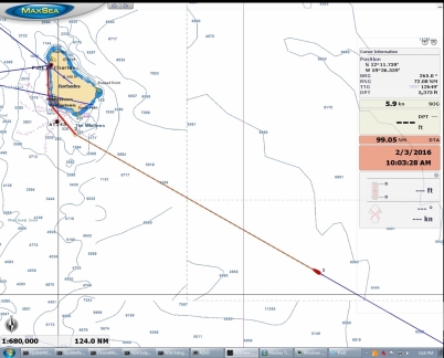 |
Below 100
Position: -58 18.21, 12 15.46
3,551 miles down, 99 to go. We’re within 100 miles of landfall now.
|
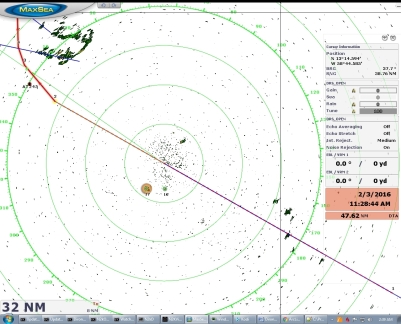 |
Land ho!
Position: -59 8.91, 12 43.74
Barbados now is visible on radar 30 miles away.
|
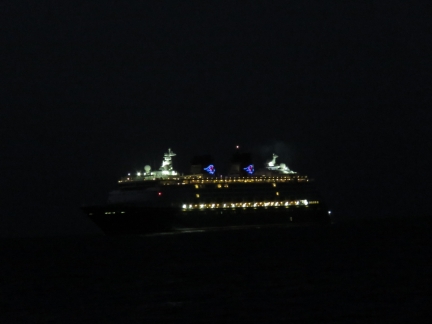 |
Disney Wonder
Position: -59 39.27, 13 6.53
The cruise ship Disney Wonder was arriving into Barbados about the same time as we were. It reminded us a bit of the early-morning cruise ship arrivals we would see in our home port at Bell Harbor, Seattle.
|
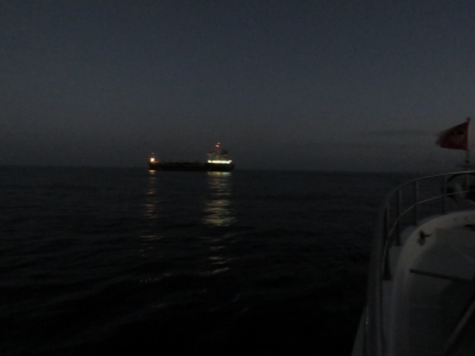 |
Chassiron
Position: -59 39.24, 13 6.66
We changed course to give way to the small freighter Chassiron room to pass as it departed Bridgetown harbor.
|
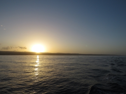 |
Sunrise
Position: -59 39.52, 13 12.59
Our first ever Caribbean sunrise.
|
 |
Oil change
Position: -59 38.67, 13 15.80
Customs wouldn’t be ready to clear is through for about an hour, so we changed the engine oil while we were waiting. This is our third oil change this calendar year and it’s only February 3rd.
|
 |
Clearing through
Position: -59 38.67, 13 15.82
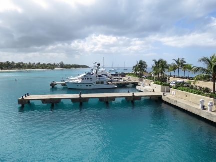
All the clearance officials were in a small building right on the docks. When they were ready for us, we just walked up there to handle the entrance formalities. This is the view from the immigration office to Dirona moored at Port St. Charles, Barbados.
|
 |
Courtesy flag
Position: -59 38.67, 13 15.80
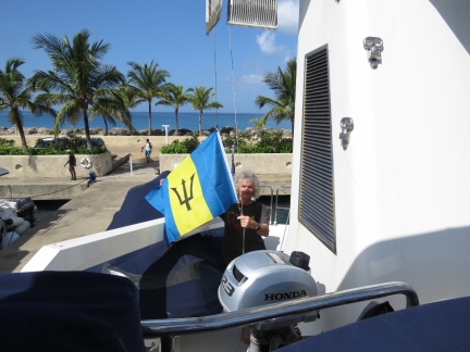
We got ourselves, the boat, and Spitfire all cleared through with Health, Immigration and Customs in about 15 minutes. We can now swap our yellow Q flag for a Barbados courtesy flag.
|
 |
Click the travel log icon on the left to see these locations on a map, with the complete log of our cruise.On the map page, clicking on a camera or text icon will display a picture and/or log entry for that location, and clicking on the smaller icons along the route will display latitude, longitude and other navigation data for that location. And a live map of our current route and most recent log entries always is available at http://mvdirona.com/maps. |

Congratulations guys. What a voyage. I adore Barbados so i hope you have a great time. What is the reason for the resistance to run the generators? is it load or fuel use?
We love our Northern Lights generator and it has provided 4,200 hours of excellent service. When at anchor, the generator runs 3 times a day (we consume a lot of power).
We don’t use the generator when plugged into shore because shore power is cheaper and our boat is set up to run well on just about any shore power source. We don’t use the generator under way for a variety of reasons: 1) if you run 24×7, you need to change the oil every 10 or 11 days, 2) when running only a single A/C unit or at most two, the load on the generator is very low so you get all the disadvantage of 24×7 maintenance while at the same time running the generator at very inefficient power levels, and 3) the main engine on long passage is also running at light load so adding load to it is better than running two engines at light load.
We use shore power at shore, main engine power underway, and love the generator and use it heavily when on hook.
We follow you from Spain, congratullations ! We use to do coastal cruising in our country, we appreciatte very much the way you prepare your long run cruises and your technical expertise…..30 days at sea…this is not easy, enjoy Barbados, take care, hasta pronto
Thanks for the comment Francisco. I’ll bet coastal cruising in Spain is incredibly picturesque. We will likely eventually find our way there ourselves. 30 days at sea sounds tough but, in moderate conditions, it’s not bad at all. It only gets hard when the weather kicks up or if mechanical problems set in. We had a great crossing.
Congratulations on your passage. That’s quite a haul!
Thanks Wyatt. We had good weather so it was a fairly easy run.
Curious about your water usage in the 25 days. How much water did you make? How much water did you consume? Do you drink the on board water or only bottled?
I have been a follower of your blog since before the Nordhavn. Keep up the good work & stay safe.
Up until a couple of years ago, we could only make water by starting the generator and we generally never run the generator on long passage. There were a few exceptions when it was jus too hot but we hate running the gen 24×7 at light load. Our passages where generally sufficiently short that we were fine with the 415 gallons we carry.
More recently we got tired of the salt film in the boat when the doors are all open in even fairly moderate seas. And, its so much easier to sleep with the AC on. Since the AC will run fine off the power produced by the main engine, we now just run the AC 24×7 when it’s warm. And, rather than treating a passage like a rare event, we not try to operate as usual so we do laundry and other water consuming jobs just as we would do them normally. Consequently we use 200 to 300 gallons a week now where it used to be down around 150 gallons a week before. Since we can run the water maker off the main engine as well, we just make water when needed.
I’m not sure exactly how much water we used in the month at sea but I’m guessing it was around 600 gallons. On that estimate, we will have made arout 500 gallons of fresh water.
We used to drink bottled water but it’s a hassle to get it to the boat in very large quantity and the Reverse Osmosis water filtration system produced fairly high quality water so we just consume what we make directly on this boat.
What a wonderful journey you two have just completed. I have been following and reading every post, and I must say….I have complete envy of your life. hahaha
You two have a beautiful life, and are making memories that will last a lifetime.
Thank you for sharing them with the rest of us here on land.
I cant wait to see what is next for you.
Enjoy the time on land, and each other.
Thanks Bobby. We’re having a ball and, as long as we stay safe and be careful, we should be able to keep doing this for a while yet.
I can see why you spend so much time at sea…You have a talking cat and that could be a major crowd gathering oddity. ;)
I hope you do slow down and enjoy those islands a bit. You have a knack for going off the beaten path and provide some great photography for us following along.
The Carribean is certainly more busy than most places we have been but, yes, you are right on us liking off the beaten path locations. We will look to find some on this trip north towards Florida.
Congratulations on completing such a long trip with such success. I recall, from reading several of the late Eric C Hiscock’s books, how important voyage planning is. He was a passionate ocean sailor and paid great attention to the prevailing trade winds, ocean currents and seasons in his planning – for example in his Voyaging Under Sail.
Of your recent voyages which would you deem the riskier, the shorter Australia to Rodrigues leg or this latest from Sr Helena to Barbados? Did the relative proximity of the South American coast offer you any comfort as a potential bail out option if things turned bad?
We were thinking hard and careful with both trips mostly because each pushed or previous distance by a sizable margin. The Saint Helena run pushes the distance by a larger margin and so it arguably carryies more risk. But, your point is an important one. On this run to Barbados there were fall back plans and diversions available whereas the run to Rodrigques had none. There are no diversions available anywhere remotely close to the intended distination so the trip passes the “commit” point very early.
Generally my read of the two situations is longer distances introduce more risk and force more time in sea which increases risk as well. On that logic, the more recent run probably carries a bit more risk or might require a bit more care.