Among Reunion’s many natural wonders is Piton de la Fournaise, an active and accessible volcano at the south end of the island known locally as simply le volcan (the volcano). We were lucky to be there during a period of active eruptions, and spent hours watching as lava constantly boiled, bubbled, and spewed out.
Trip highlights from October 7th follow. Click any image for a larger view, or click the position to view the location on a map. And a live map of our current route and most recent log entries always is available at http://mvdirona.com/maps
 |
Belvedere du Nez-de-Boeuf
Position: 55 36.96, -21 12.53
We left the marina at 5:30 this morning on the 2-hour drive to le Volcan, Piton de la Fournaise, at the south end of the island. As with all the mountain roads we’ve driven, the elevation brough some spectacular viewpoints. This is looking south through the Riviere des Remparts river valley from Belvedere du Nez-de-Boeuf.
|
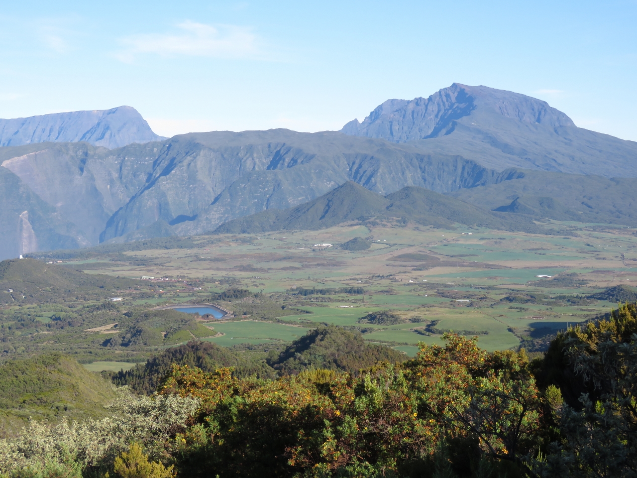 |
La Plaine des Cafres
Position: 55 37.01, -21 12.42
The La Plaine des Cafres viewed from the road to Le Volcan. The large mountain on the right is 10,068ft (3,069m) Piton des Neiges, the highest point on the island. It’s a popular multi-day climb with an amazing 360-degree view from the summit. On the left is 9,500ft (2,896m) Le Grand Benare—we’d walked partway along the track to the viewpoint there when we visited Le Maido.
|
 |
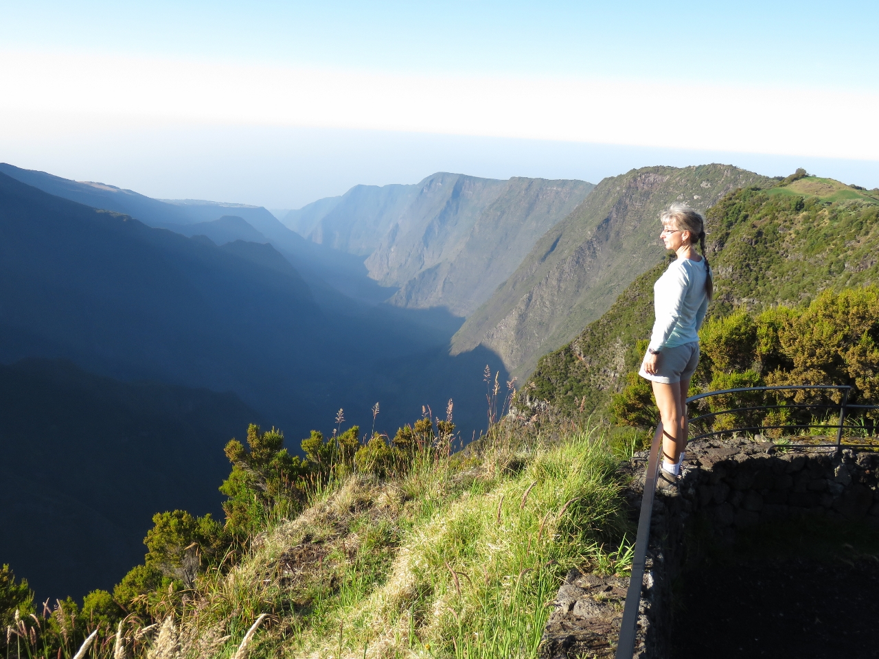
Plaine des Sables
Position: 55 39.03, -21 13.85
As we popped over the rim at 7,742ft (2,360m) Pas de Sables, the view across the volcanic ash Plaine des Sables was surreal. We felt as if we’d landed on another planet.
|
 |
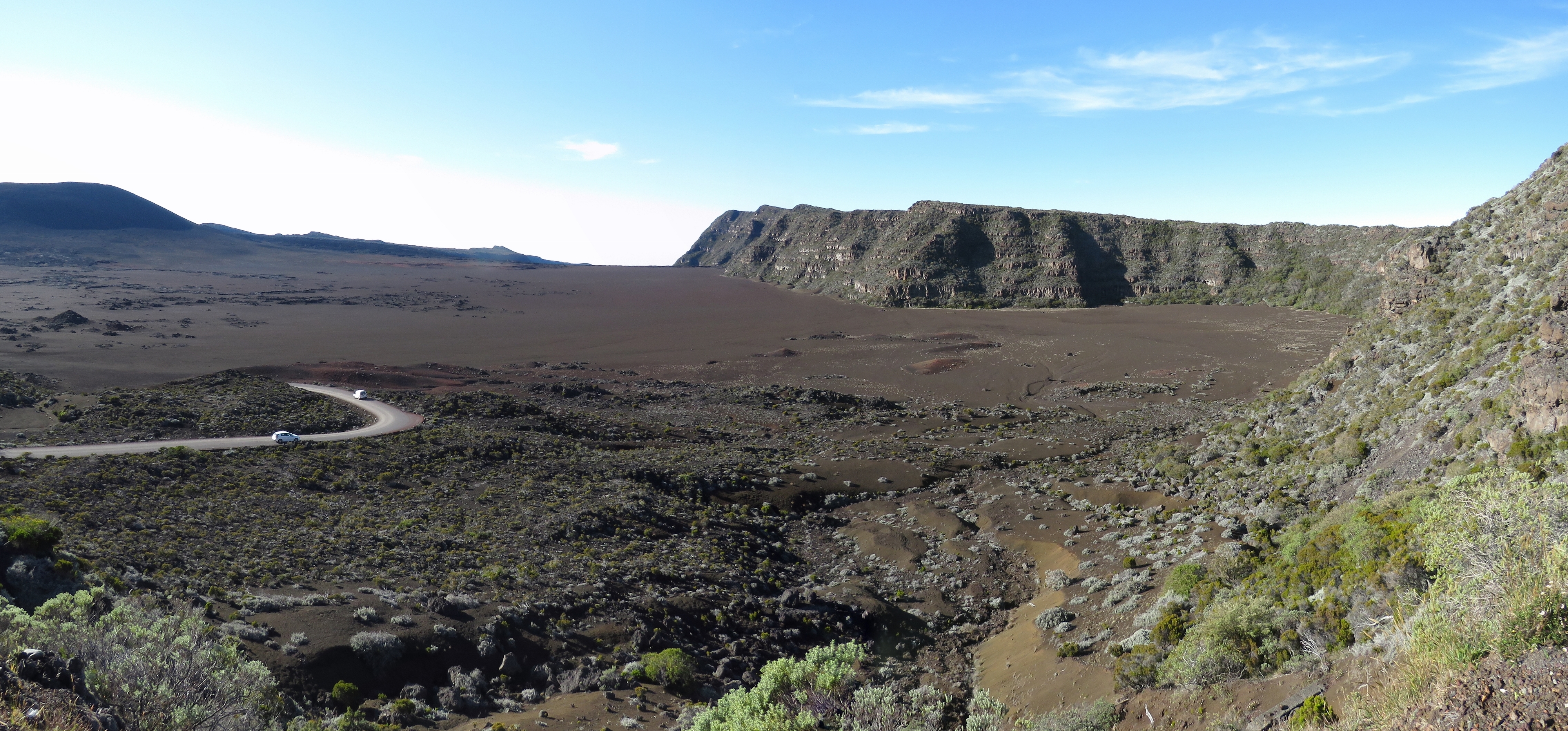
Pas de Bellecombe
Position: 55 41.19, -21 13.45
The sweeping view from 7,582ft (2,311m) Pas de Bellecombe to Piton de la Fournaise across it’s outer crater, Enclos Fouque.
|
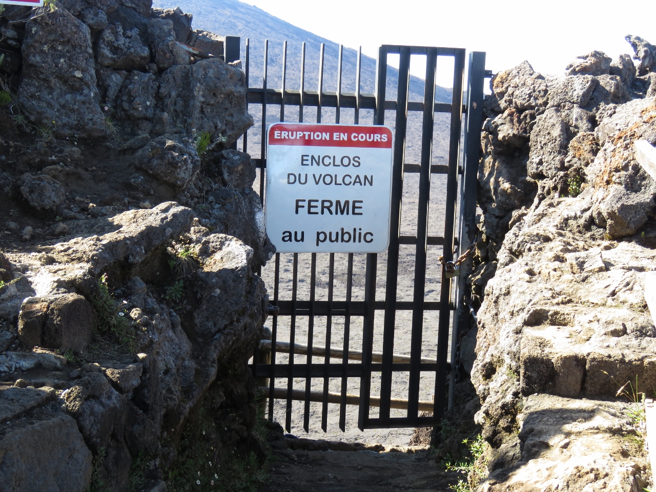 |
Ferme
Position: 55 41.35, -21 13.34
We were planning to hike the track across Enclos Fouque and up to Balcon du Dolomieu for views down into Dolomieu Crater. Unfortunately the track was closed due to high levels of volcanic activity. Several people did climb over the locked gate anyway, and we were sorely tempted to follow. But getting arrested in a foreign country held little appeal, and the track might actually be closed for good reason. Customs mentioned that a tourist was killed during a recent eruption.
|
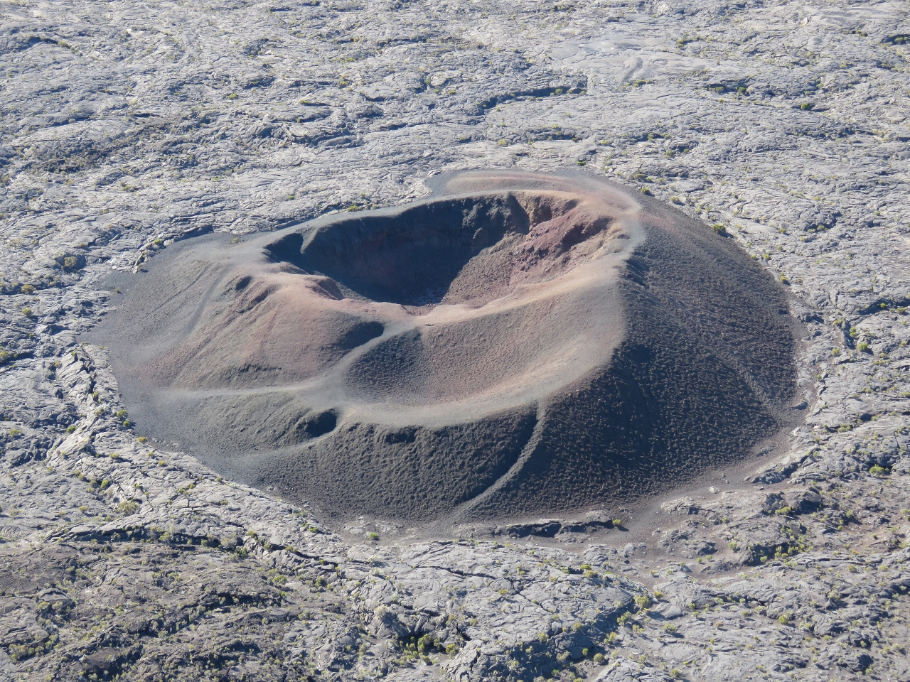 |
Formica Leo
Position: 55 41.39, -21 13.33
The small crater Formica Leo in Enclos Fouque far below us along the track to Balcon du Dolomieu. It was so named due to its resemblance to the pitfall traps built by antlions, an insect that preys on ants and other small crawling creatures.
|
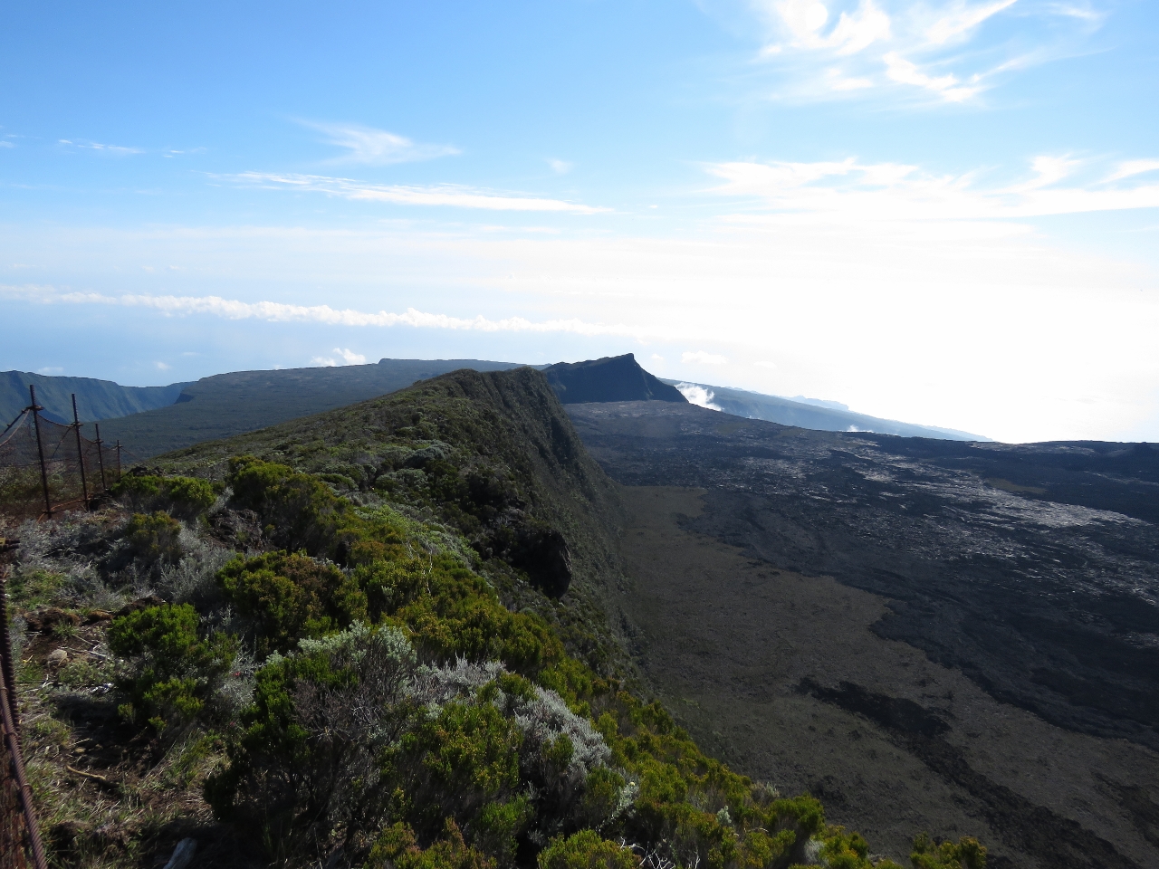 |
Plaine des Osmondes
Position: 55 42.21, -21 13.14
We followed a track from the locked Balcon du Dolomieu gate north along the crater rim. After about 20 minutes we reached a clearing with views across Plaine des Osmondes at the north end of Enclose Fouque to the ocean in the distance.
|
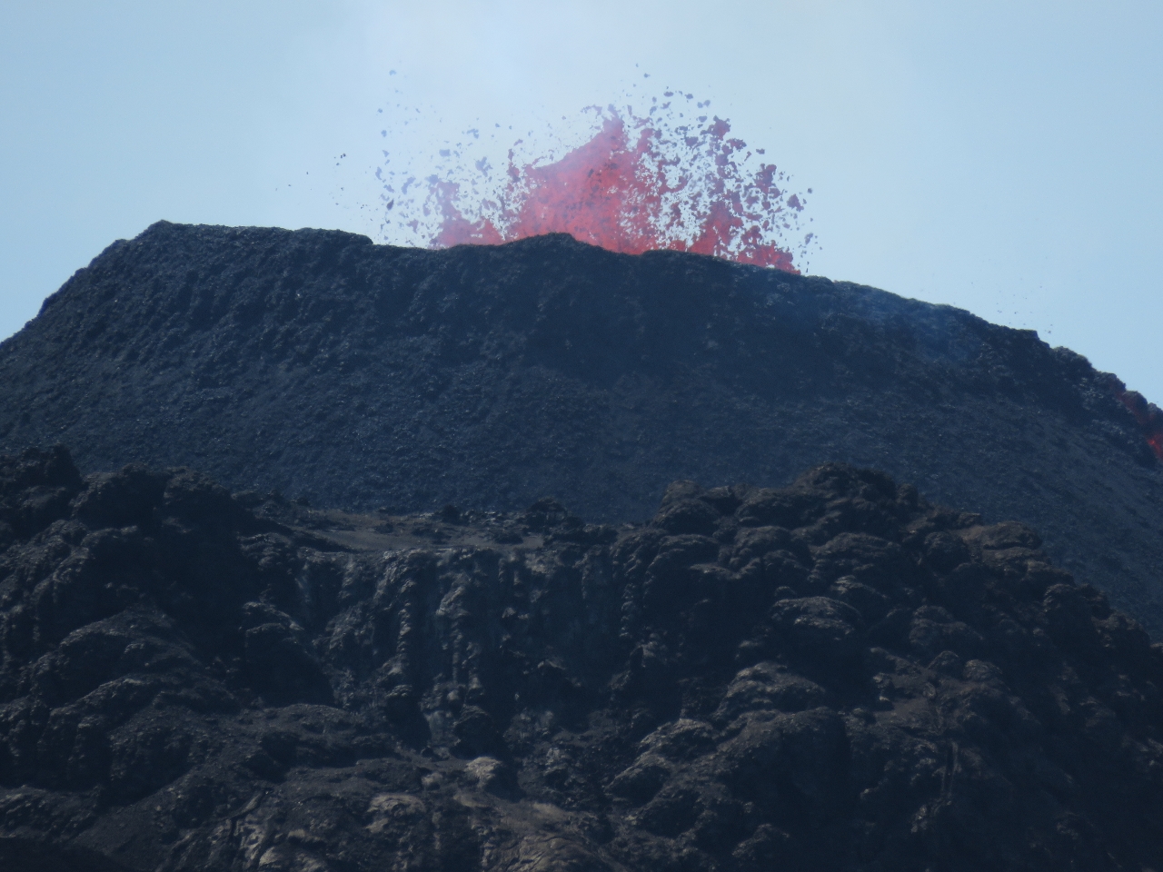 |
Le Volcan
Position: 55 40.73, -21 14.97
Shortly before Pas de Bellecombe, we’d passed a jam-packed car park and our map showed a trail leading from there around the eastern edge of Enclos Fouque with a viewpoint towards the volcano. We decided to try it, hoping for a good view. About twenty minutes in we were stopped in our tracks and amazed to see lava spewing from the volcano. At this point, we were no longer disappointed that the track to Balcon du Dolomieu was closed. Rather, we felt lucky to be able to view a live eruption and could see the advantage of not being within spitting distance of it.
|
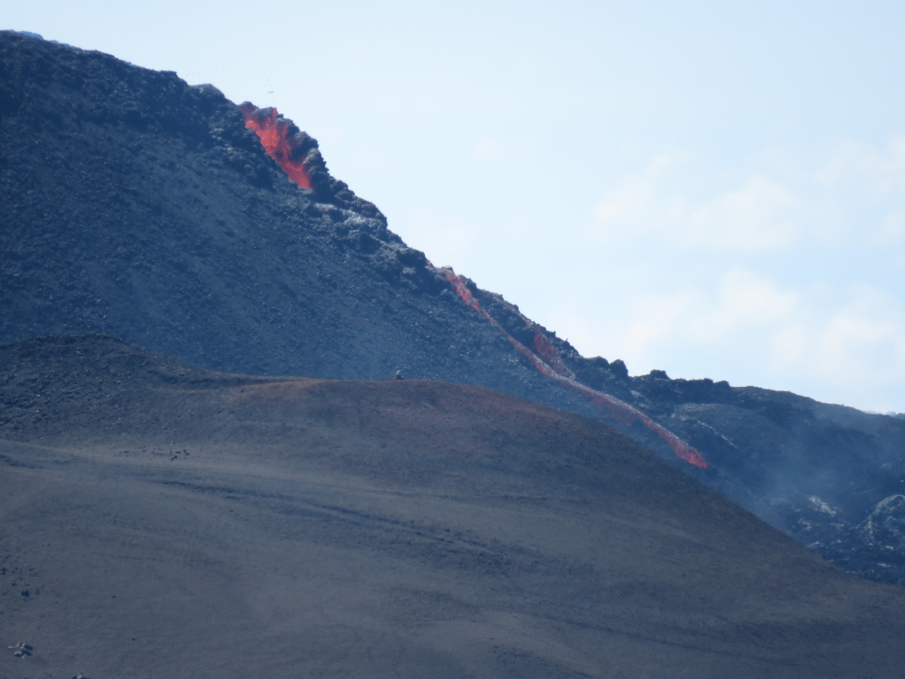 |
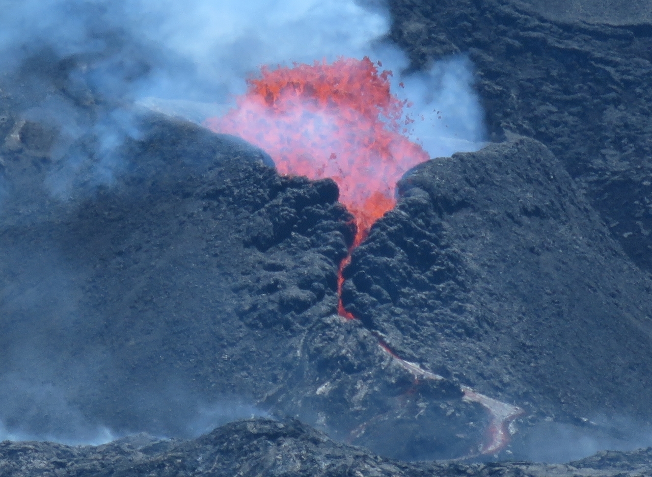
Flow
Position: 55 40.80, -21 15.27
Molten lava flowed down the edge of the caldera in a red, oozing stream.
|
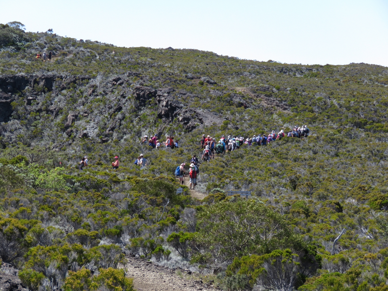 |
Track
Position: 55 41.07, -21 16.16
We were far from the only ones on the track—at least a hundred other hikers were here as well, including one tour bus full. This shot reminded us a little of that famous photo of prospectors crossing Chilkoot Pass during the 1898 Klondike Gold Rush.
|
|
|
Piton de Bois Vert
Position: 55 41.96, -21 16.62
We stopped at 7,460ft (2,274m) Piton de Bois Vert with an excellent view to the volcanic action. We watched for ages, amazed, as lava constantly boiled, bubbled, and spewed out of the volcano.
|
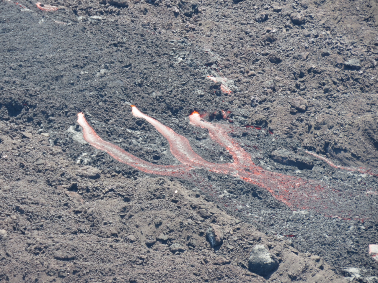 |
Lava river
Position: 55 41.96, -21 16.62
Molten lava flowed in rivers and reached almost to the edge of the cliff directly below us.
|
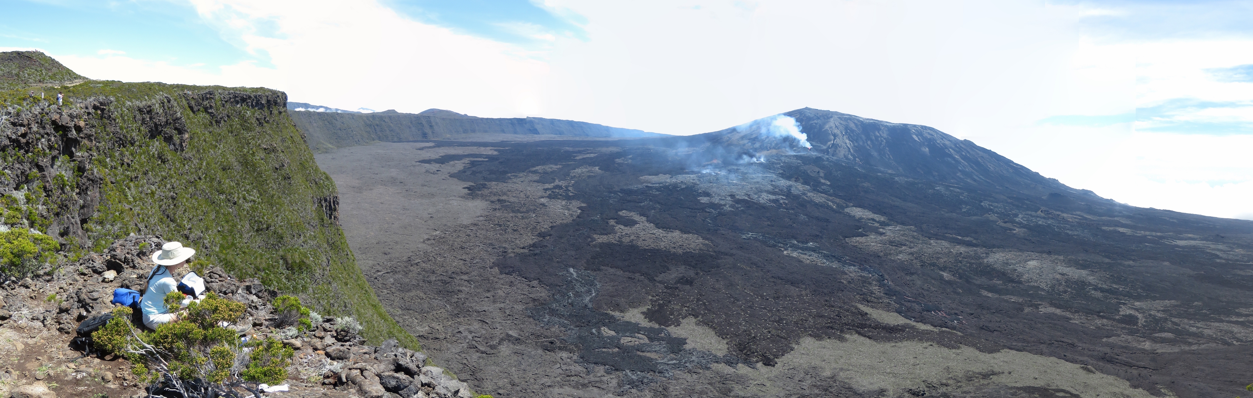 |
Lunch
Position: 55 41.96, -21 16.62
We had a picnic lunch cliff-side taking in the amazing scenery and the exciting volcanic activity. The video https://youtu.be/nYAz5wx9T1I (1:19) starts with a pan from our lunch perch to the lava rivers and then zooms in on the volcano. You can hear the sound of the volcano as ejected molten lava lands on the side of the caldera.
|
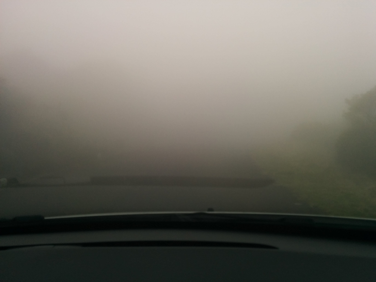 |
Fog
Position: 55 37.14, -21 12.16
Although we were in a real rush to reach the volcano early in case clouds obscured visibility, it’s a good thing we stopped to take a few photos on the way up. This is the view from inside the car around 1:30pm on the way back down. The fog was so thick we could barely see the road in front of us and couldn’t see the lit headlights of oncoming traffic until they were within three car-lengths away. The road was twisting with steep drop-offs on either side and at times we had to slow down to about 20 kph to avoid driving off the edge in the fog.
|

|
Click the travel log icon on the left to see these locations on a map, with the complete log of our cruise.
On the map page, clicking on a camera or text icon will display a picture and/or log entry for that location, and clicking on the smaller icons along the route will display latitude, longitude and other navigation data for that location. And a live map of our current route and most recent log entries always is available at http://mvdirona.com/maps. |
If your comment doesn't show up right away, send us email and we'll dredge it out of the spam filter.
The eruption from-above photo looks surreal. It’s hard to tell the scale of the thing. Is the mouth of the volcano tens, hundreds, or thousands of feet across?
Good point on perspective Frank. I think the volcano opening will be under 100′ in diameter but not by much.