The Foret de Bebour-Belouve is a lush tropical rainforest in the center of Reunion, directly south of the Cirque de Salazie, and within the island’s wetter east coast region. The forest is beautiful, with lots of walking tracks and picnic spots, but our primary motivation for visiting was to make the 3.5km walk to the Trou de Fer waterfall, considered one of Reunion’s most spectacular natural sights.
Trip highlights from October 14th follow. Click any image for a larger view, or click the position to view the location on a map. And a live map of our current route and most recent log entries always is available at http://mvdirona.com/maps
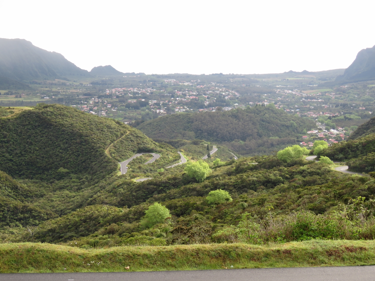 |
Plaine-des-Palmistes
Position: 55 35.45, -21 9.79
The view to sea over the town Plaine-des-Palmistes from Rue de la Republique. We’re just above a set of steep and windy switchbacks that will take us down into the valley below.
|
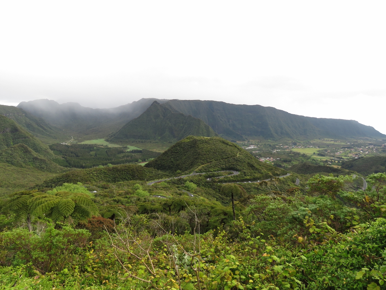 |
Foret de Bebour-Belouve
Position: 55 35.81, -21 9.70
Looking northwest to the Foret de Bebour-Belouve, our destination, where we plan to hike into the see the Trou de Fer waterfall. The eastern side of the island gets more rain and the flora and fauna is markedly different from the dryer west side. This feels much more like a jungle or rainforest.
|
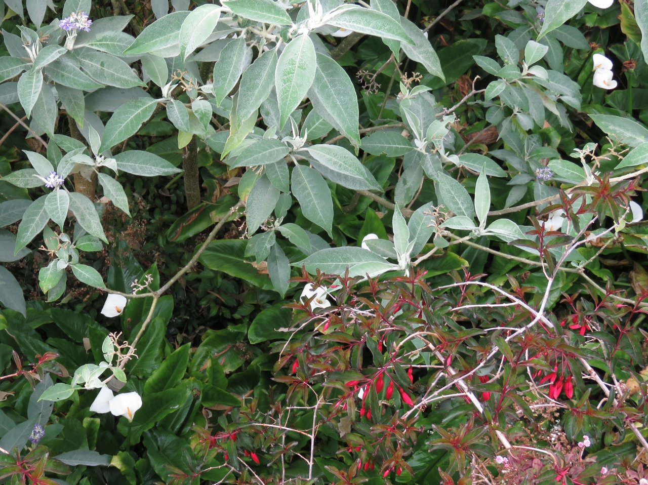 |
Arum
Position: 55 32.22, -21 3.71
We drove through thick, lush forest to a parking lot at the end of the road and from there walked a short distance to the start of the track. Along the way we passed many plants and flowers that we’d not seen in other parts of the island, including many stands of beautiful Arum (the white lily-like flower at the bottom left of photo).
|
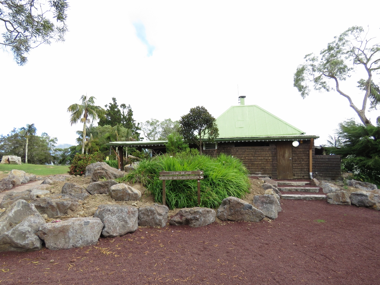 |
Gite de Belouve
Position: 55 32.19, -21 3.66
The Gite de Belouve provides visitor accommodation in the heart of the forest. The facility was larger than we had expected and looked like a great place to stay.
|
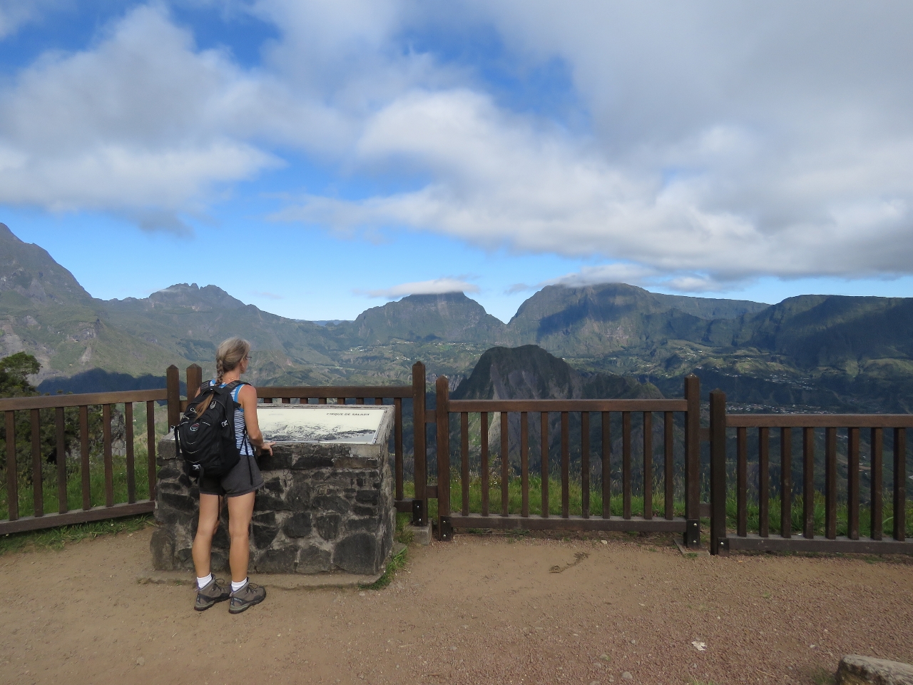 |
Cirque de Salazie
Position: 55 32.16, -21 3.62
Behind the gite is a fabulous viewpoint over the Cirque de Salazie. We were almost directly above Hell-Bourg, where we’d had lunch a couple of weeks ago.
|
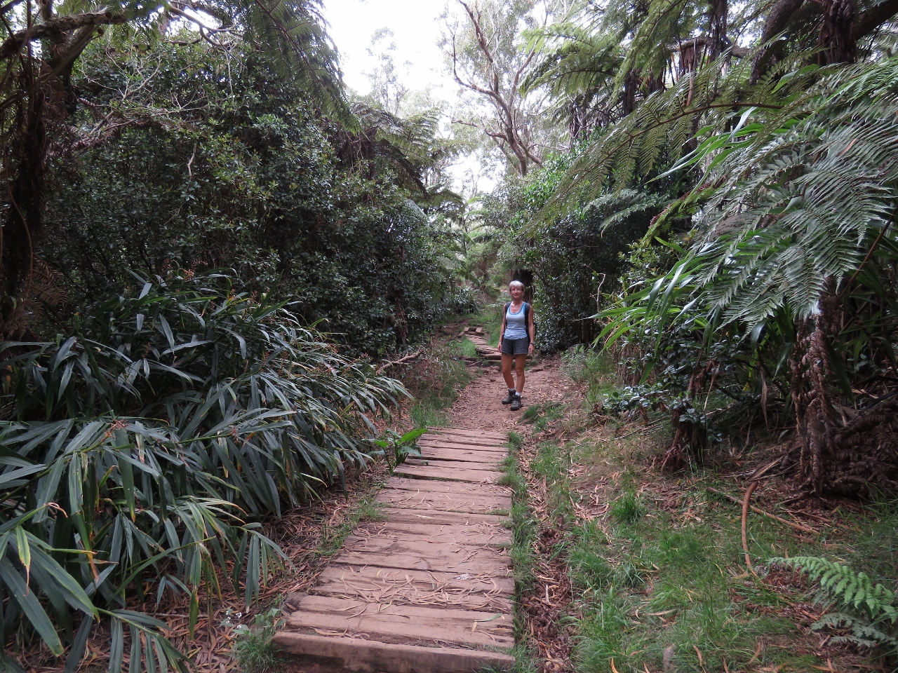 |
Sentier du Trou de Fer
Position: 55 32.25, -21 3.64
The Sentier du Trou de Fer (Trou de Fer track) took us deep into the rainforest. A few sections were muddy, but many parts that would have been had raised walkways, steps or wood laid across.
|
 |
Viewpoint
Position: 55 33.51, -21 2.64
From the thick enclosure of the forest, we popped out to a viewing platform above a deep gorge. About ten people were there when we arrived at 9:30am and by the time we left a half-hour later, at least twenty were there with more arriving by the minute. This is a popular hike.
|
|
|
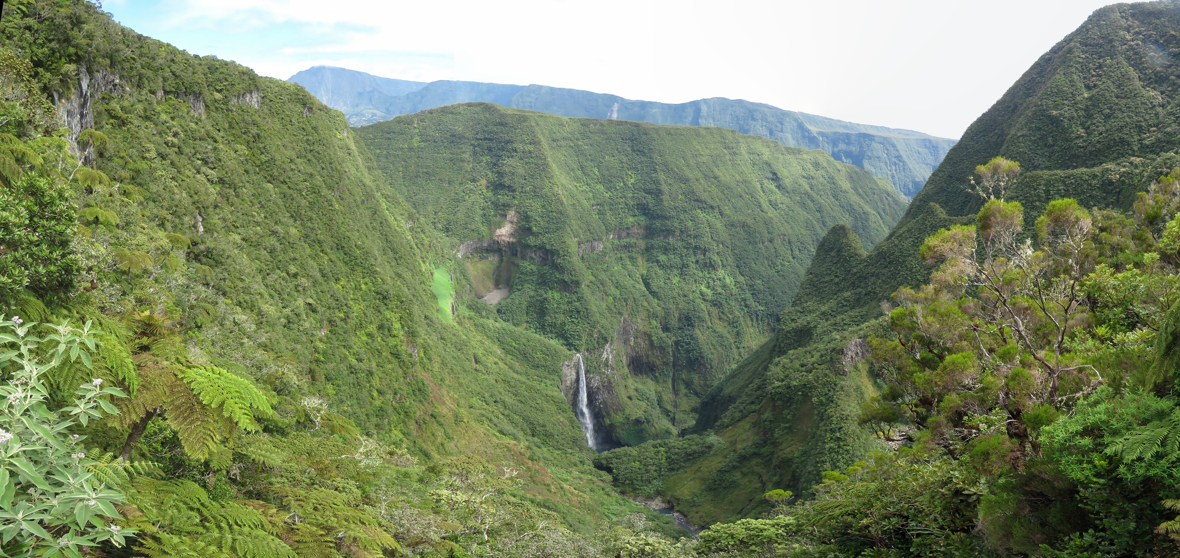
Trou de Fer
Position: 55 33.51, -21 2.64
The view to the Trou de Fer waterfall was fabulous (click image for an enlarged view). The video at https://youtu.be/yc16nIWyJo0 (0:47) shows the gorge and a close-up of the falls and the video at https://youtu.be/oyFv9BeEII4 (0:22) shows a helicopter making a pass across the falls and leaving through the ravine on the right.
|
 |
Breakfast
Position: 55 32.16, -21 3.64
We’d planned to have breakfast at the falls. But the platform was pretty muddy and too busy, so we returned back out to have our meal at a picnic table overlooking the Cirque de Salazie view. It’s a good thing we got those pictures earlier–by the time we finished breakfast the cirque was completely socked in as is typical by mid-morning.
|
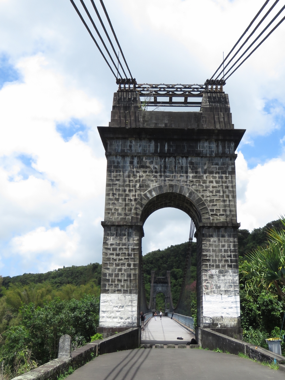 |
Suspension bridge
Position: 55 44.84, -21 7.41
From the Foret de Bebour-Belouve, we continued east through Plaine-des-Palmistes and along the southeast coast of the island. Along the way we stopped to check out the old East River Suspension Bridge (the bridge certainly has a French name, but surprisingly the only sign describing the bridge history was in English). The bridge opened in 1890, the successor to another bridge that the river had swept away only three years after it was completed. The suspension bridge was in service until 1979 when a new concrete bridge replaced it.
|
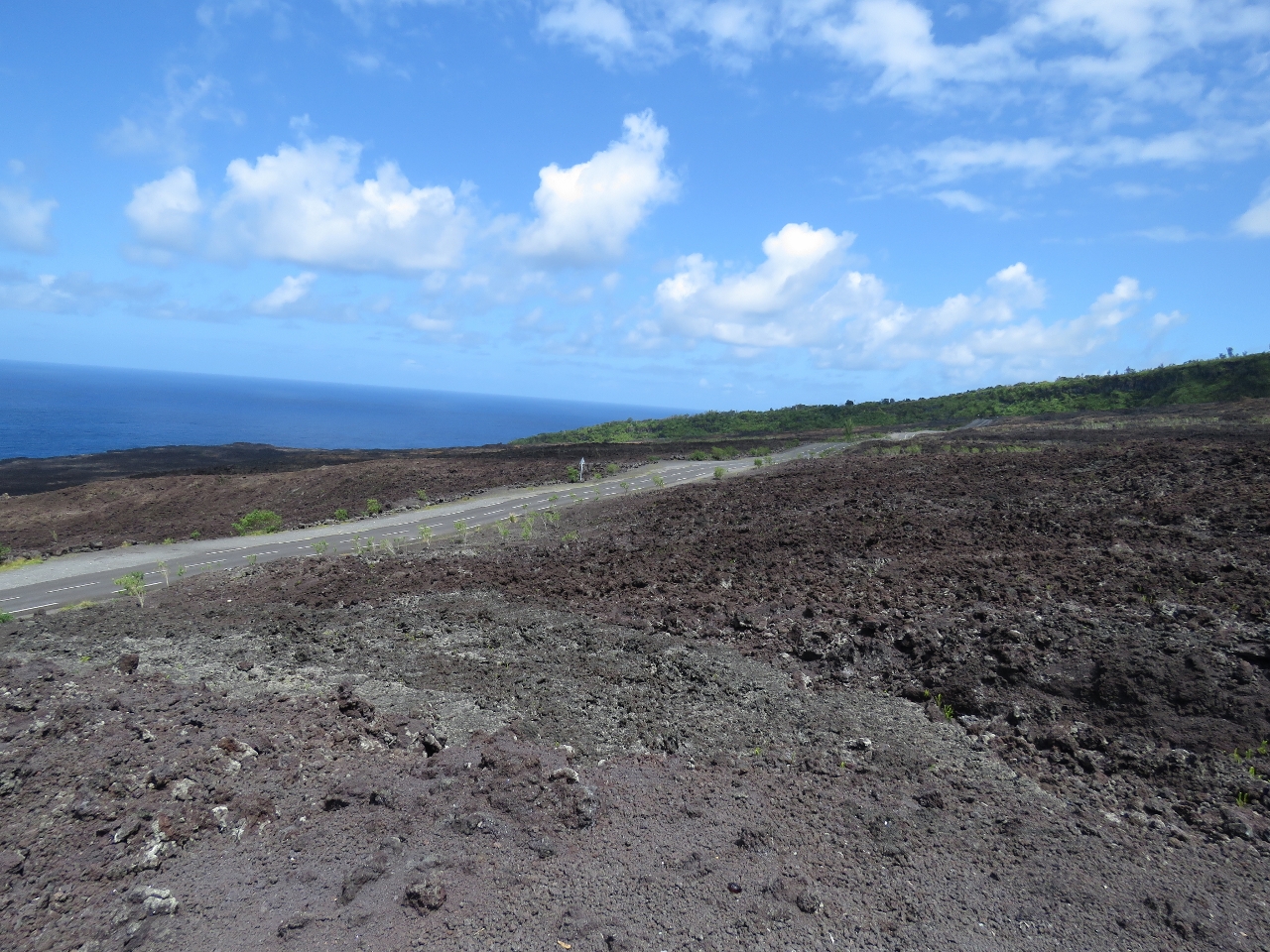 |
Lava flow
Position: 55 47.71, -21 16.91
The 2007 eruption of le volcan was one of the most violent ever recorded, producing 3 million cubic meters of lava per day. The flow reached the sea just north of Pointe du Tremblet and cut off the road for several months.
|
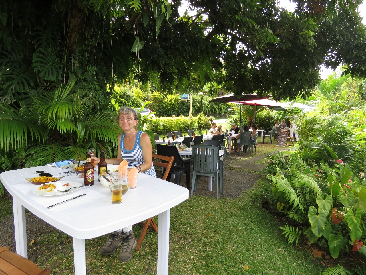 |
Le Vieux Port
Position: 55 47.90, -21 17.55
We had a delicious lunch of rougail boucane (smoked pork ribs prepared Croele-style) in the garden at Lonely Planet-recommended Le Vieux Port.
|

|
Click the travel log icon on the left to see these locations on a map, with the complete log of our cruise.
On the map page, clicking on a camera or text icon will display a picture and/or log entry for that location, and clicking on the smaller icons along the route will display latitude, longitude and other navigation data for that location. And a live map of our current route and most recent log entries always is available at http://mvdirona.com/maps. |
If your comment doesn't show up right away, send us email and we'll dredge it out of the spam filter.