We loved the Berkeley River, but the King George was even more spectacular. A narrow gorge leads from about halfway into the river to twin several-hundred-foot waterfalls at the head. The water is deep enough in front of both falls to bring the boat up fairly close, and we had just enough swing room to anchor with a view to them both as well. Nearby, a steep, but well-marked trail leads to the cliff-top for excellent view of the falls, the anchorage and the river gorge. For certain, this was one of the best anchorages we’ve ever experienced.
Trip highlights from June 4th through 8th follow. Click any image for a larger view, or click the position to view the location on a map. And a live map of our current route and most recent log entries always is available at http://mvdirona.com/maps
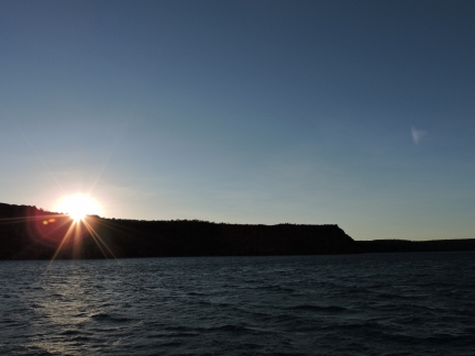 |
Koolama Bay
Position: 127 19.49, -13 56.05
We awoke just before sunrise in Koolama Bay after a late-afternoon departure from the Berkeley River. We’d arrived here around 11pm, had a relaxing glass of wine on the flybridge, and then went to bed with plans to cross the King George River bar this morning. The winds did pick up overnight to SE 20 as predicted, sending small wind waves through the anchorage, but no swell or larger waves reached us.
|
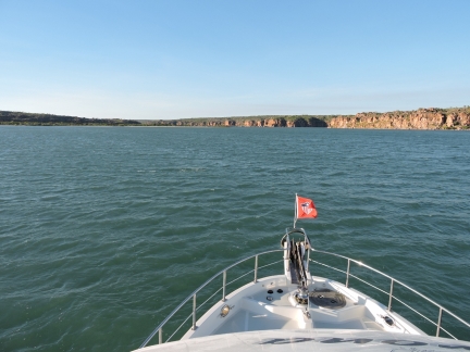 |
King George River bar
Position: 127 19.65, -13 57.18
We crossed the King George River bar about an hour before an 8.6ft (2.62m) high tide at 7:42am at Lesueur Island, rising from 1.5ft (0.45m) low tide at 12:26am. This was a much easier crossing than the Berkeley River bar. We saw a brief blip to around 8 ft as we reached the charted shallows, then depths gradually increased to 14 ft at the charted narrow neck between two sandbars, and 25 ft through the neck at the actual river mouth.
|
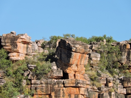 |
Balancing act
Position: 127 21.06, -13 59.91
We were soon into a narrow gorge with car-sized rocks perched precariously high above us. You would not want to be nearby when one of those tumbled loose.
|
 |
Gorge
Position: 127 21.38, -14 0.66
A narrow gorge leads from about halfway into the river to twin several-hundred-foot waterfalls at the head. We loved the Berkeley River, but the King George was even more spectacular. In the video https://youtu.be/p3-zSrQlZA4 (3:17) shows our cruise upriver through the gorge. At 1:56 is the final bend into the head. We bring the boat up close to the first waterfall at 2:10 and to the second at 2:35.
|
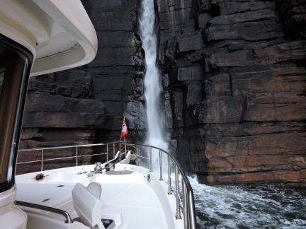 |
First waterfall
Position: 127 19.33, -14 2.59
Twin falls are at the head of the King George River. The water is deep in front of both falls, and you can bring the boat up fairly close.
|
 |
At the falls
Position: 127 19.32, -14 2.59
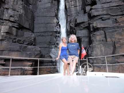
The southern of the two falls is in a narrow gorge where we were able to keep the boat stable enough to take a few photos of us together on the bow.
|
 |
Northern falls
Position: 127 19.26, -14 2.48
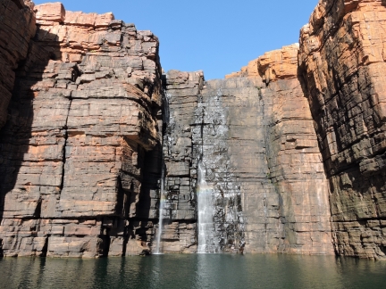
The northern falls spill down across a wide cliff wall.
|
 |
Close-up
Position: 127 19.21, -14 2.53
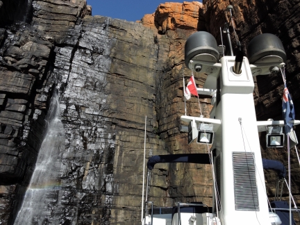
The northern falls, towering above Dirona.
|
 |
Anchorage
Position: 127 19.35, -14 2.41
We were surprised to find good holding over mud, and had just barely enough swing room to anchor in 70′ at the head. For certain, this is one of the best anchorages we’ve ever experienced.
|
 |
Treasure chest
Position: 127 19.26, -14 2.33
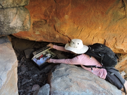
We followed a steep track, well-marked with rock cairns, up the western slope to the cliffs above the falls. Along the way was this treasure chest–we added our boat card to the collection inside.
|
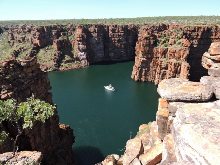 |
West anchorage view
Position: 127 19.23, -14 2.35
The view into the anchorage from the western cliffs.
|
 |
Waterfall view
Position: 127 19.20, -14 2.47
We hadn’t had breakfast yet, so stopped at the falls for the morning meal.
|
 |
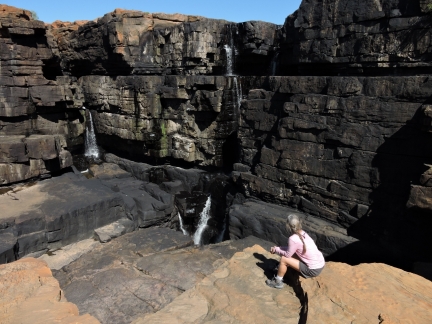
Down
Position: 127 19.31, -14 2.59
It’s a long way down from here.
|
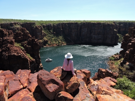 |
East anchorage view
Position: 127 19.38, -14 2.55
The view into the anchorage from the eastern cliffs above the first waterfall we were at earlier today in Dirona. The terrain above the waterfall is relatively easy walking, so we could quickly cover the distance.
|
 |
Helicopter
Position: 127 19.15, -14 3.00
We saw a helicopter land upriver, so walked down to check it out. We were expecting it was a tourist group, but it was a team of two doing controlled undergrowth burns from the helicopter. They had setup a base camp here to do burns in the immediate region.
|
 |
Lunch
Position: 127 19.30, -14 2.61
We expected to be up here for a while, so brought a lunch as well and had it on a sun-shaded shelf below where Jennifer is sitting.
|
 |
Gorge view
Position: 127 19.20, -14 2.47
One final view to the anchorage, this time looking downriver through the gorge. We’re going to have a tough time leaving here.
|
 |
R.I.C.E.
Position: 127 19.33, -14 2.44
R.I.C.E.: Rest, ice, compression, elevation. Jennifer slipped on the rocks while we were retrieving the dinghy and her shin swelled up immediately to a 1-inch ridge about 8 inches long. We were pretty concerned that we had a serious issue, but the ice got the swelling under control quickly and now it’s just a nasty scrape. We haven’t had much in the way of injuries since leaving Seattle–this has been probably the worst so far.
|
 |
True North
Position: 127 19.33, -14 2.44
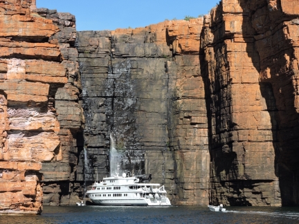
True North is a luxurious mini cruise ship bringing people to the Kimberley in style, with many high-speed tenders and a helicopter for overhead viewing and transport. Two chase boats preceded True North to the head of the inlet. The ship came right up to both falls and put the bow under so passengers could stand in the spray. Some of the passengers hiked up the path we’d taken yesterday to the top of the falls, and later were picked up by the helicopter.
|
 |
Bugs
Position: 127 19.33, -14 2.44
Besides the crocodile risk, the only other downside of the anchorage is these bugs. Fortunately they don’t seem to bite and their only irritating feature is that they seemed able to get through our screens and die in droves inside and outside the boat.
|
 |
Cockpit view
Position: 127 19.33, -14 2.44
The video https://youtu.be/80t0kNAgCw4 (0;33) shows the spectacular view around the gorge head from our cockpit. We’re definitely having trouble leaving.
|
 |
Charter boat
Position: 127 19.33, -14 2.44
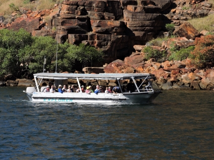
Another charter boat visited King George River today. This one didn’t cross the bar, but sent a small high-speed boat upriver to the head. Two inflatable chase boats accompanied it, and they took bathing-suit-clad passengers in small groups right under the falls.
|
 |
East arm
Position: 127 21.45, -13 59.52
We moved the boat downriver to explore the east arm. It’s shallow, and only accessible by dinghy, so we anchored near the mouth.
|
 |
Gorge
Position: 127 22.82, -13 59.33
The east arm starts out wide, then narrows near the head into a beautiful gorge.
|
 |
Climbing
Position: 127 22.86, -13 59.50
Sturdy climbing ropes had been rigged to reach the top. The climb would have been challenging, if not impossible, without them.
|
 |
Pool
Position: 127 22.86, -13 59.50
The reward for the climb is this tranquil pool with a waterfall in the background. A perfect place for lunch.
|
 |
View
Position: 127 22.86, -13 59.52
We couldn’t see an obvious way up higher, so climbed the east side above the pool. This is the view looking back down into the east arm from above.
|
 |
Gorge
Position: 127 22.84, -13 59.59
We followed along the east shore above the creek until we could find a way down into the bed. We followed the bed for a bit, then climbed back up the west side to look for a way back down. You can see on our track the various paths we took trying to find a route. The scenery up-creek was appealing, but the going was slow-going over large rocks, both climbing up, walking along and returning. Overall, the rope climb to the pool definitely was worth the effort. And the walk up-river was fun, but there really isn’t much unique beyond the pool.
|
 |
Balancing rock
Position: 127 22.81, -13 59.55
A close-up from the other side of the balancing rock you can see on the left of the previous photo.
|
 |
Click the travel log icon on the left to see these locations on a map, with the complete log of our cruise.On the map page, clicking on a camera or text icon will display a picture and/or log entry for that location, and clicking on the smaller icons along the route will display latitude, longitude and other navigation data for that location. And a live map of our current route and most recent log entries always is available at http://mvdirona.com/maps. |

G’day, King George Falls/Oomari is an awesome spot. I assume your visit was 2015? It is now no longer permitted to climb to the top of the Falls as it is of significant cultural sensitivity to the Balanggarra community. It contains burial sites amongst other aspects.
The image featuring the tender ‘Explorer’ is from Coral Princess, which has since been replaced.
Kalooma Bay is actually Koolama Bay, after the MV Koolama which was bombed by Japanese aircraft off Cape Londonderry in February 1942.
Cheers, Mike
Yes, it was 2015 when we were there and, having traveled around the world, King George Falls remains a real highlight of the trip. It was amazing. Thanks for the additional detail and the correction. We’ll update that.
Im so pleased you went to the Kimberley. My all time favorite place in the world We have been slowly circumnavigating for 18 years and now amdst the CV19 pandemic we are making a dash to Oz Age is catching up with us….. Love your blog
The Kiimberley region is GREAT and largely unknown in the international cruising community. We have seen some amazing sights in our world-wide tour but the Kimbereley ranks right up near the top. It’s a great time to be there. Thanks for the blog feedback.