We made an overnight run from the King George River to the Mitchell River. We didn’t need to run overnight as there are plenty of anchorage on the way. But we’re moving quickly to visit the rivers as early as possible since their flow will slowly be diminishing in the dry season. We’ll coastal-cruise on the way back to Darwin later in the month and catch up on what we missed. The Mitchell River doesn’t have the dramatic gorges of the Berkeley and King George Rivers–the draw here is a series of three beautiful waterfalls, accessible on foot from the tidal rock bar a several-mile tender ride upstream from the anchorage. We also had some unexpected excitement when we returned to the tender to find a large crocodile sunning where we’d tied off.
Trip highlights from June 8th and 9th follow. Click any image for a larger view, or click the position to view the location on a map. And a live map of our current route and most recent log entries always is available at http://mvdirona.com/maps
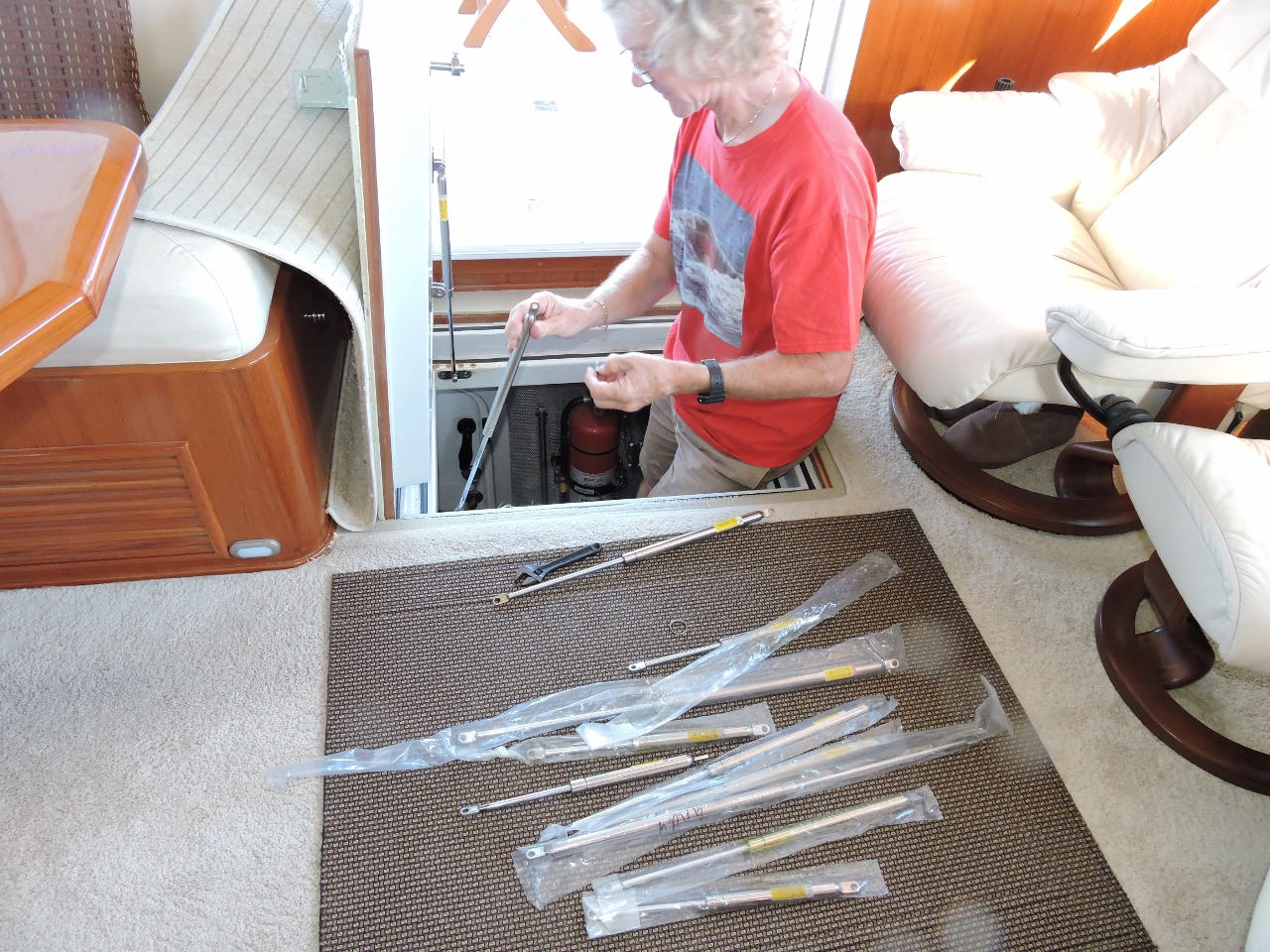 |
Struts
Position: 127 21.46, -13 59.54
One of the gas struts that supports the hatch from the salon to the engine room was failing, so we replaced it with a spare. The strength of these struts is important as it could easily catch a finger if it slammed shut. We also replaced one of the struts on the barbecue cover.
|
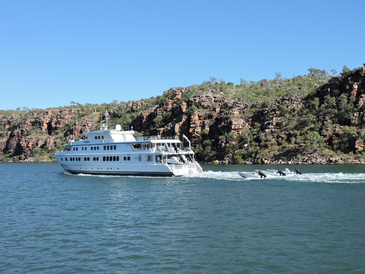 |
True North
Position: 127 21.46, -13 59.54
True North re-entering the King George River at high tide on a new passenger voyage out of Wyndham.
|
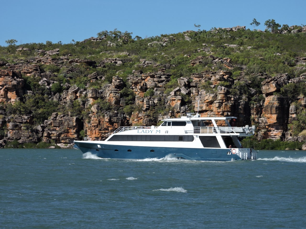 |
Lady M
Position: 127 20.49, -13 58.30
The winds had been blowing 30 kts for the past few days, and we were the only boat overnighting in the King George River during our entire stay. But now that the winds have settled down, more boats are arriving. Harmony came in shortly before Lady M. We exited about 90 minutes before an 8.4ft (2.55m) high tide at Lesueur Island rising from a 2.56 (0.78m) low tide 6:44 before high, and saw a minimum depth of 7.8′ on the way out.
|
 |
Cape Londonerry
Position: 126 56.37, -13 39.89
As capes go, Cape Londonerry is not very imposing.
|
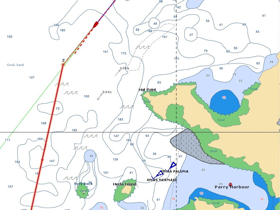 |
Parry Harbour
Position: 125 58.98, -13 53.34
On an overnight run from the King George River to the Mitchell River, we passed Parry Harbour around midnight. The bright lights of the anchored HMAS Paluma and HMAS Mermaid were visible a long way off. We didn’t need to run overnight as there are plenty of anchorage on the way. But we’re moving quickly to visit the rivers waterfalls as early as possible since their flow will slowly be diminishing in the dry season. We’ll coastal-cruise on the way back to Darwin later in the month and catch up on what we missed.
|
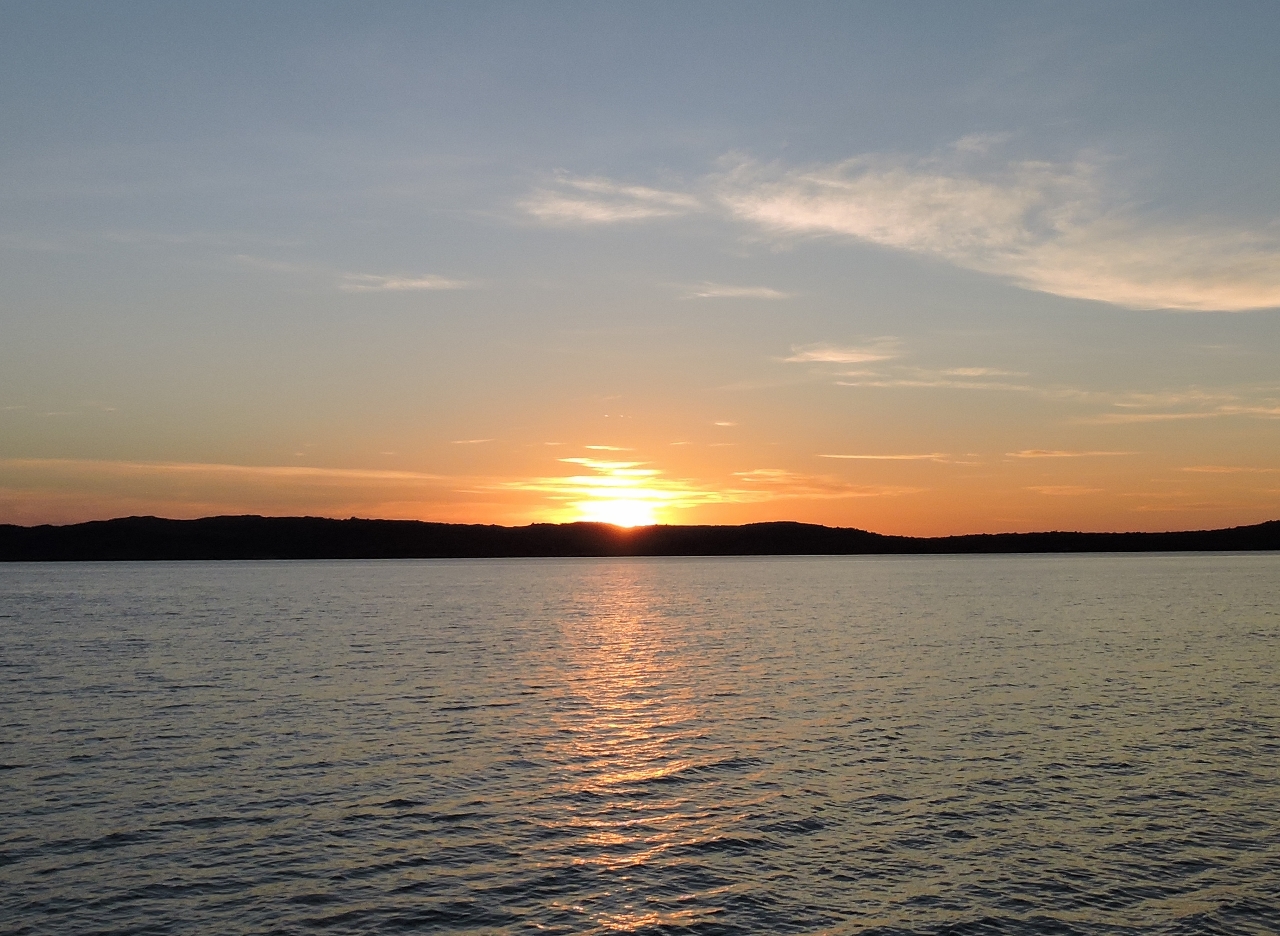 |
Walmesly Bay
Position: 125 42.01, -14 26.32
Sunrise as we approach Walmesly Bay at the mouth of the Mitchell River. We had an nice, easy overnight run. Conditions were particularly calm once we’d rounded Cape Londonerry.
|
 |
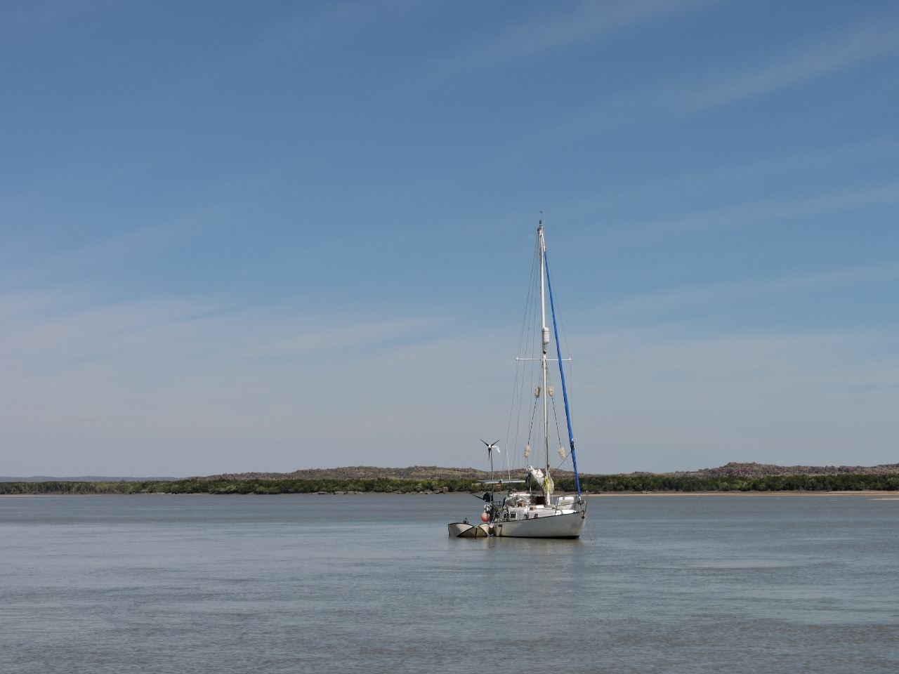
Middle Rocks
Position: 125 40.55, -14 33.97
At anchor in the Mitchell River north of Middle Rocks.
|
 |
Surveyors Creek
Position: 125 39.76, -14 37.34
With about 9ft of tide at Port Warrender, we had a tough time finding a route across the sandbars to take the dinghy upriver. We eventually found sufficiently deep water by running close to the east shore. Looking at the satellite imagery later, it’s clear that this was the right path. Mirrool had an appealing anchorage by the mangroves off Surveyors Creek.
|
 |
Black-necked stork
Position: 125 39.52, -14 37.56
This striking black-necked stork was fishing in the shallows off the sandbars.
|
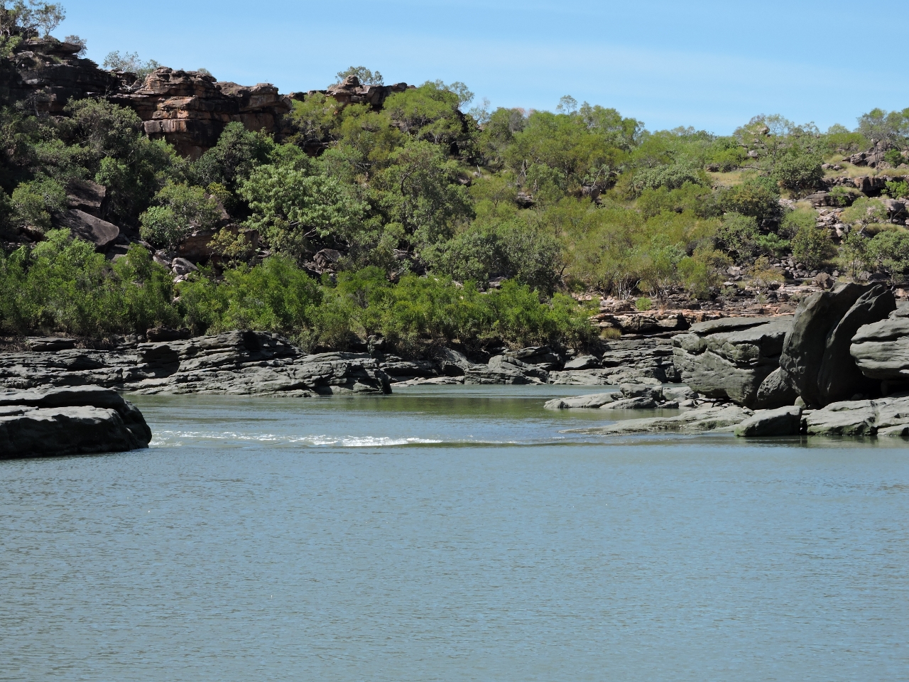 |
Rapids
Position: 125 39.42, -14 44.26
We arrived at the rock bar about 2.5 hours after a 7.25ft (2.21m) low tide at Port Warrender that was rising to 19.5ft (5.93m) over 6 hours. The inflowing rapids at the rock bar were slight and easily navigable.
|
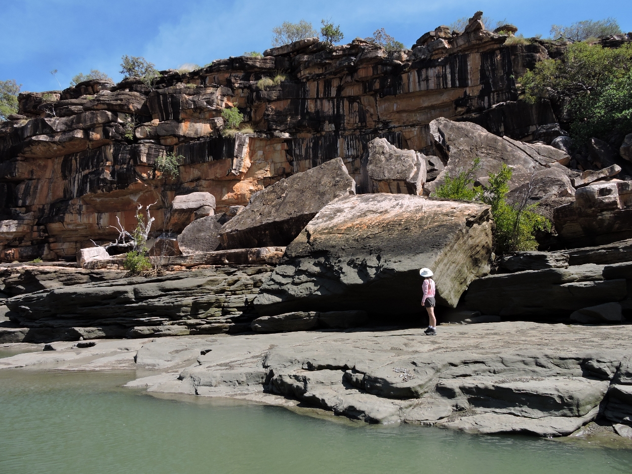 |
Slabs
Position: 125 39.50, -14 44.47
We had just enough water to work through the rocks and continue upstream. These massive slabs along the way had at one point tumbled from the wall behind.
|
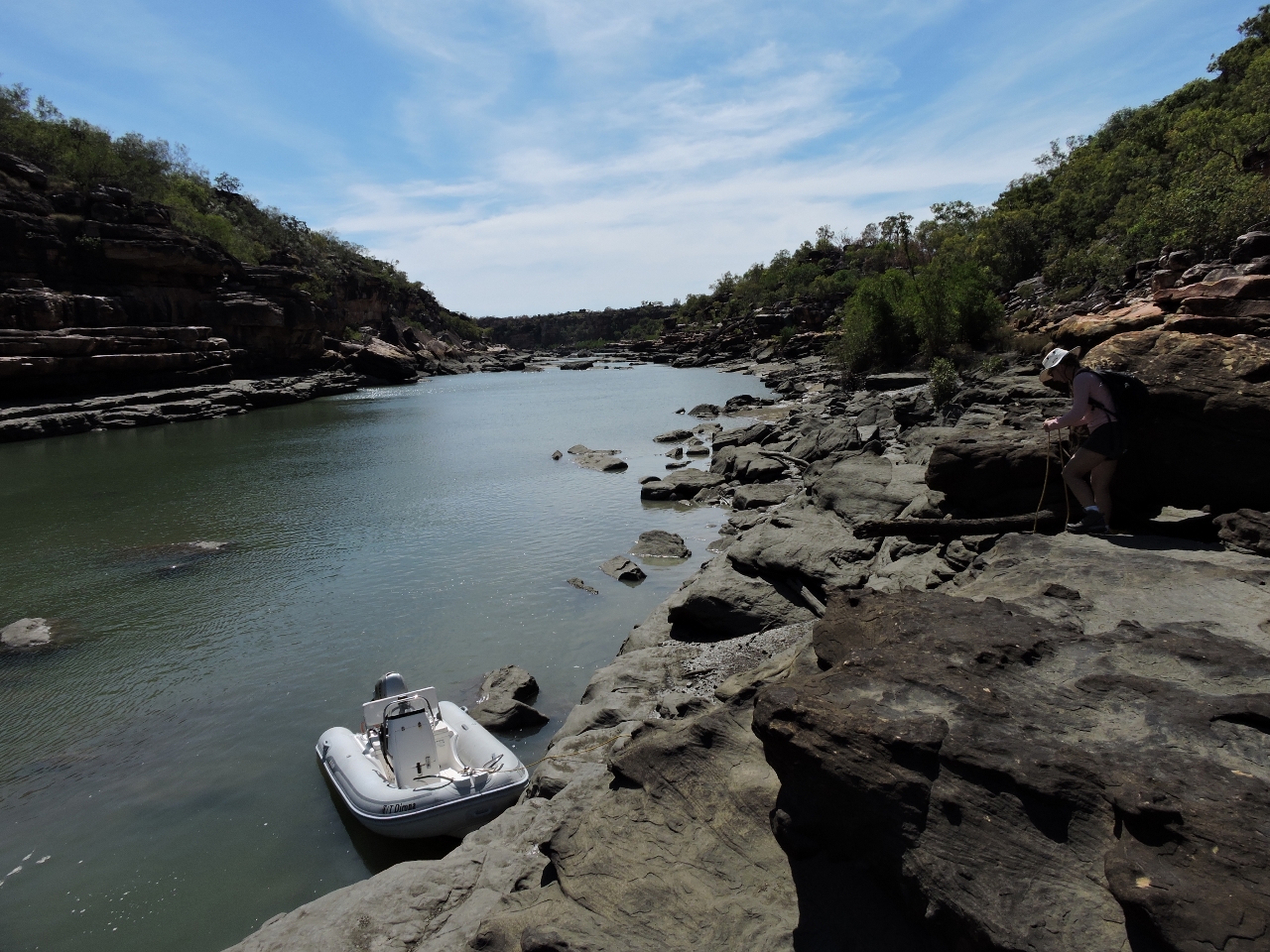 |
Landing
Position: 125 39.50, -14 44.71
Jennifer tying the dingy off to a log above the high tide line.
|
 |
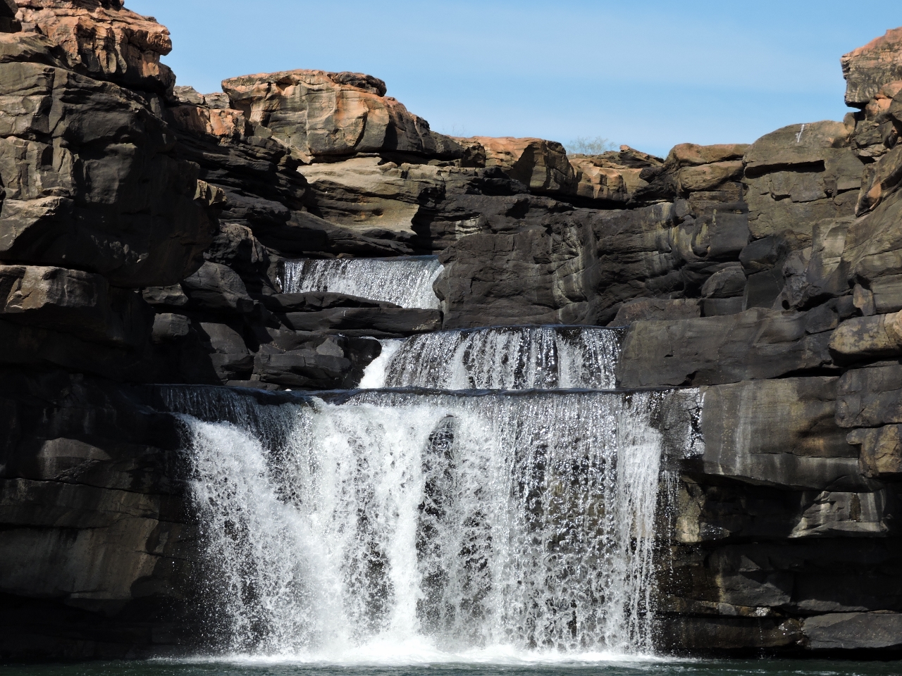
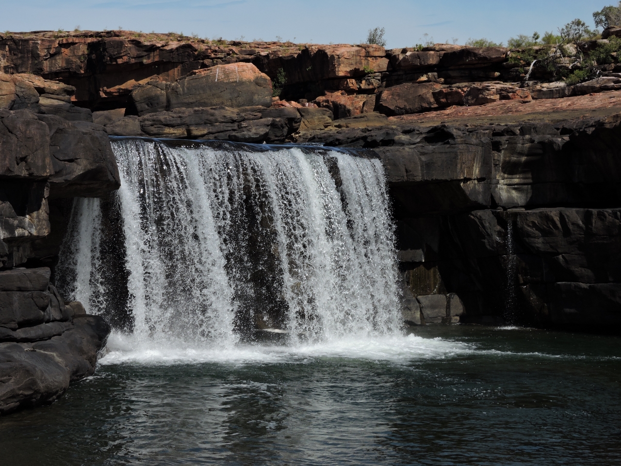
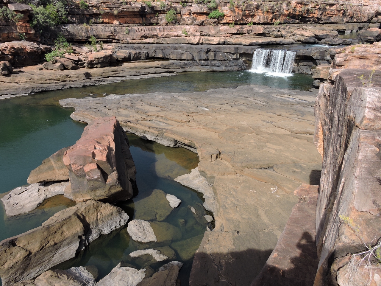
First falls
Position: 125 39.58, -14 45.07
In just under a half-hour of walking upstream, we arrived at the first set of falls where we stopped for lunch.
|
 |
Second falls
Position: 125 39.69, -14 45.18
Another ten minutes of walking brought us to the equally impressive second set of falls.
|
 |
Third falls
Position: 125 39.69, -14 45.29
And just beyond these were the third falls. What a beautiful place this is.
|
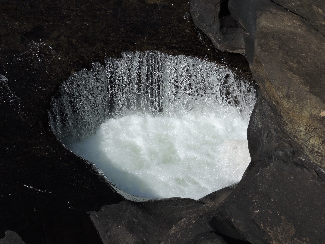 |
Circular waterfall
Position: 125 39.72, -14 45.31
In several places at each of the falls, the water flow had carved huge circles into the rocky river bed. Cylindrical holes are all over the place, but what makes these unusual is they’ve cut a hole down to a fissure and water flows in the top and out the bottom.
|
 |
Plateau
Position: 125 39.67, -14 45.21
Looking back to the second falls across the plateau.
|
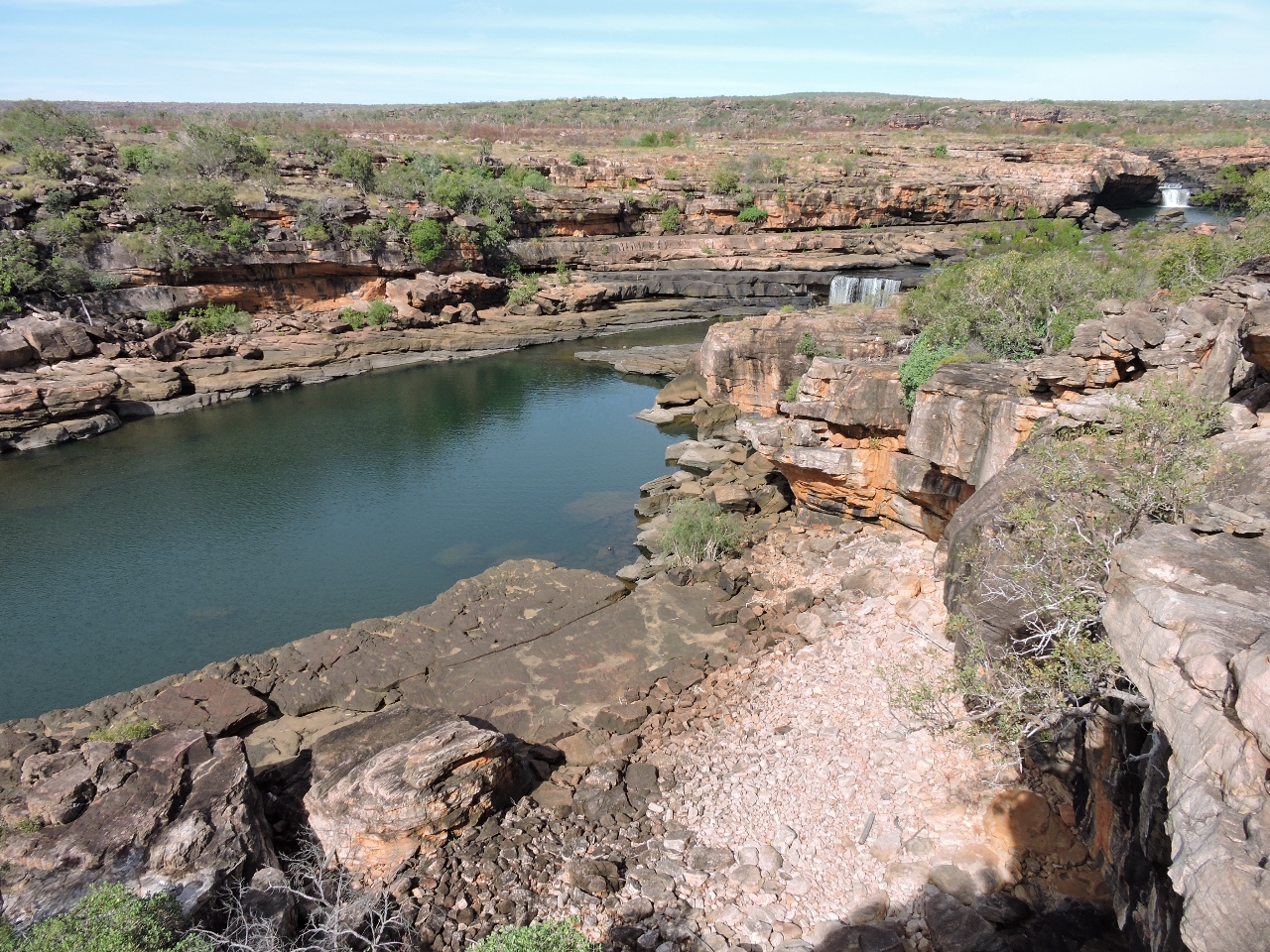 |
Both falls
Position: 125 39.63, -14 45.19
From some vantages, you can see the second and the third falls at the same time.
|
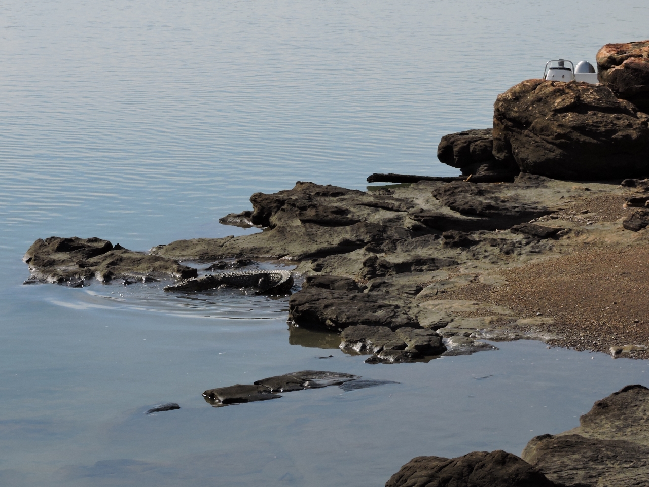 |
Crocodile
Position: 125 39.50, -14 44.73
The dinghy had risen 15+ feet when we arrived back, and was now tied off just above the water surface with lots of slack. It turns out that platform that was 15 feet above us when we tied off is actually a comfortable place for a crocodile to sun at high water and a particularly large specimen was waiting for us. (Click image to enlarge.) It moved off the rock when we approached, but was clearly interested and kept surfacing and watching about 20 feet away from the dinghy. We were able to get into the dinghy safely, but untying the line was going to be a challenge. Jennifer asked James to untie the line, but he distinctly remembered it was her turn. :) We considered cutting the line, but ended up recovering it by using the dinghy as a shield against the shore while we untied the line from inside the dingy. It reminds us of our Alaskan experiences with bears, except that the threat is invisible under the water. When bears swim, they stay at the surface: Bears Really Can Swim.
|
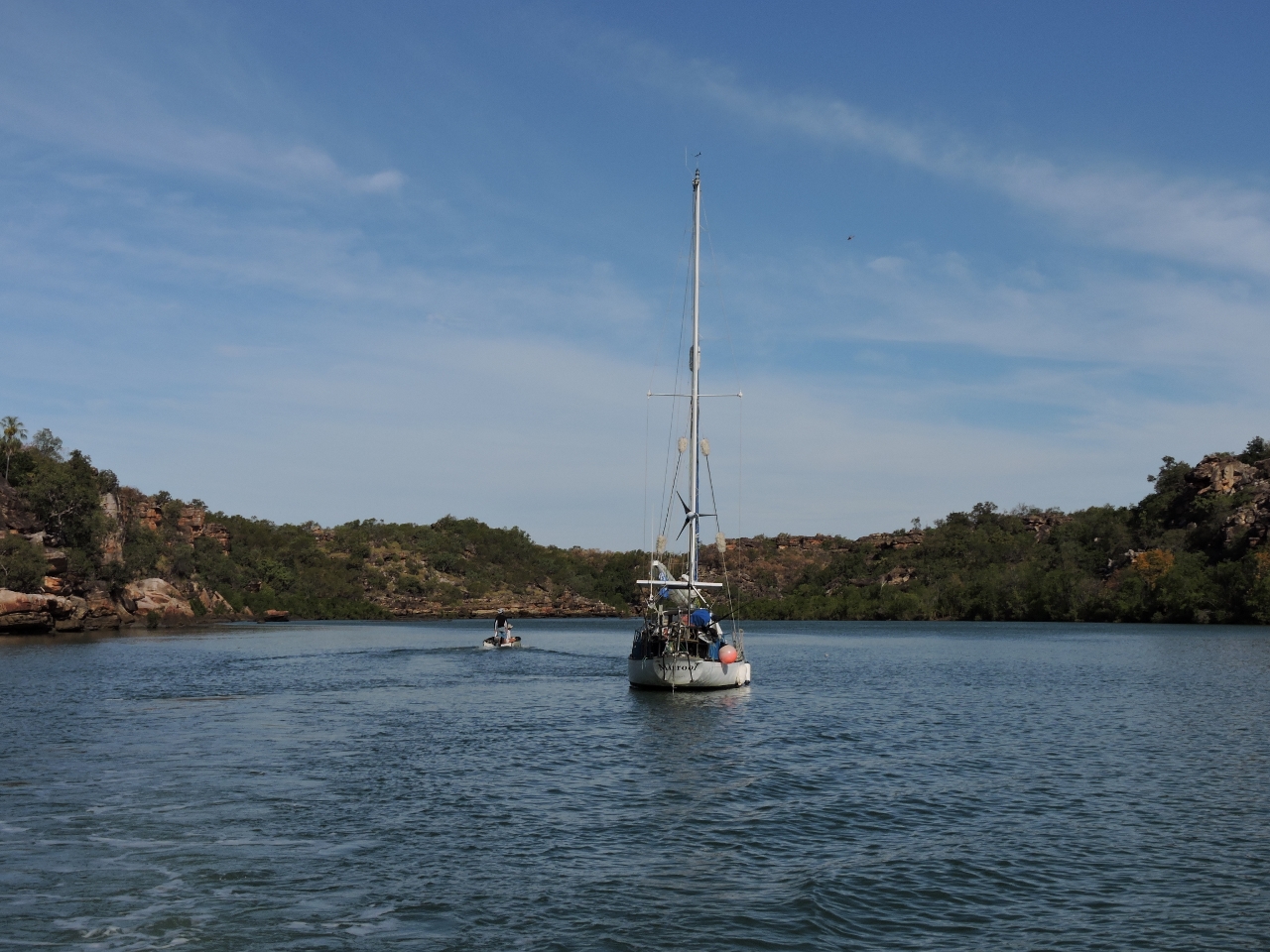 |
Mirrool
Position: 125 39.35, -14 44.10
When we returned back out, Mirrool had moved upriver from Surveyors Creek to the rock bar. We chatted with owner Troy Lechner and his friend Pascal, who were on their way for a swim upriver. Troy’s article Sailing – Not Just For The Rich And Privileged describing his independent and economical lifestyle is an interesting read. “The diesel consumption for the trip along the Queensland coast from Cairns to the Whitsundays added up to 18 litres,” Troy wrote. “This can be attributed to Mirrool’s nice manners and my pig headed insistence on sailing even when I got tides and wind wrong and was making 2 knots.”
|

|
Click the travel log icon on the left to see these locations on a map, with the complete log of our cruise.
On the map page, clicking on a camera or text icon will display a picture and/or log entry for that location, and clicking on the smaller icons along the route will display latitude, longitude and other navigation data for that location. And a live map of our current route and most recent log entries always is available at http://mvdirona.com/maps. |
If your comment doesn't show up right away, send us email and we'll dredge it out of the spam filter.
That photo of “True North” reminds one of goslings trying to keep up with their parents.
It’s true. It does look a bit like a parent bird with the train of little ones behind. Some of the sports fishing adventure boats trail their tenders behind one after the other even more closely emulating nature. For example: //mvdirona.com/Trips/Australia2014/Australia4.html?bleat=9%2F19%2F2014%3A+Ducklings.