
After an overnight run from Darwin across the Joseph Bonaparte Gulf, we spent three nights in the Berkeley River. This was our first time in Western Australia’s famed Kimberley region and it definitely is one of our top ten destinations ever. The scenery was incredible, and we saw our first crocodiles in the wild. Traveling upriver through red-cliffed gorges felt like we were cruising through the Grand Canyon. We were finding it hard to believe that this wasn’t the best of the Kimberley and sure were looking forard to the rest.
Trip highlights from May 30th through June 3rd follow. Click any image for a larger view, or click the position to view the location on a map. And a live map of our current route and most recent log entries always is available at http://mvdirona.com/maps
 |
Channel Rock
Position: 130 46.63, -12 24.83
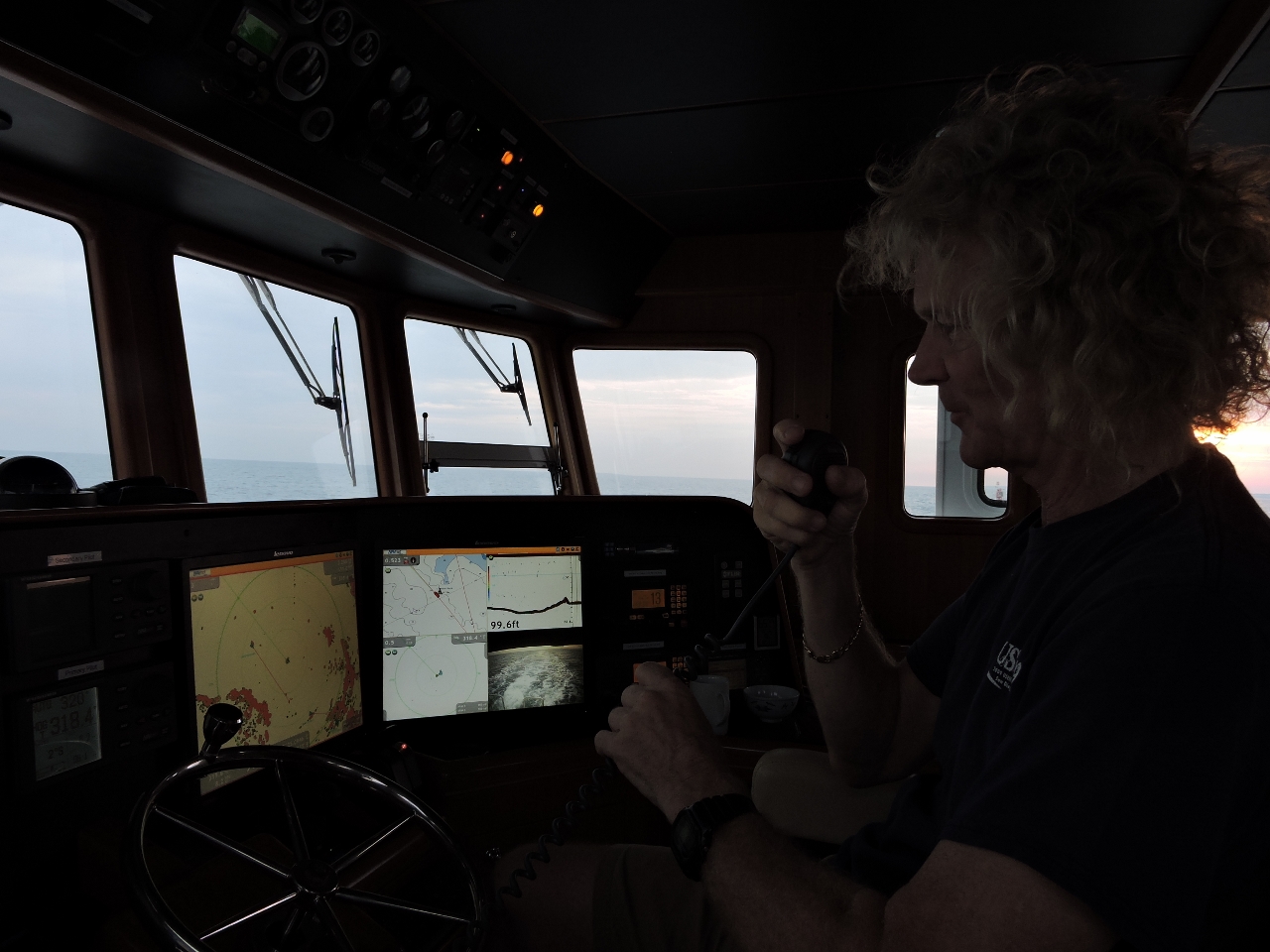
Notifying Darwin Harbour Control on channel 10 that we are clearing Channel Rock. Since Dirona is under 20m in length, we’re technically not required to participate in the Darwin Traffic Organization Scheme. But Harbour Control requested that we report, and we were happy to comply.
|
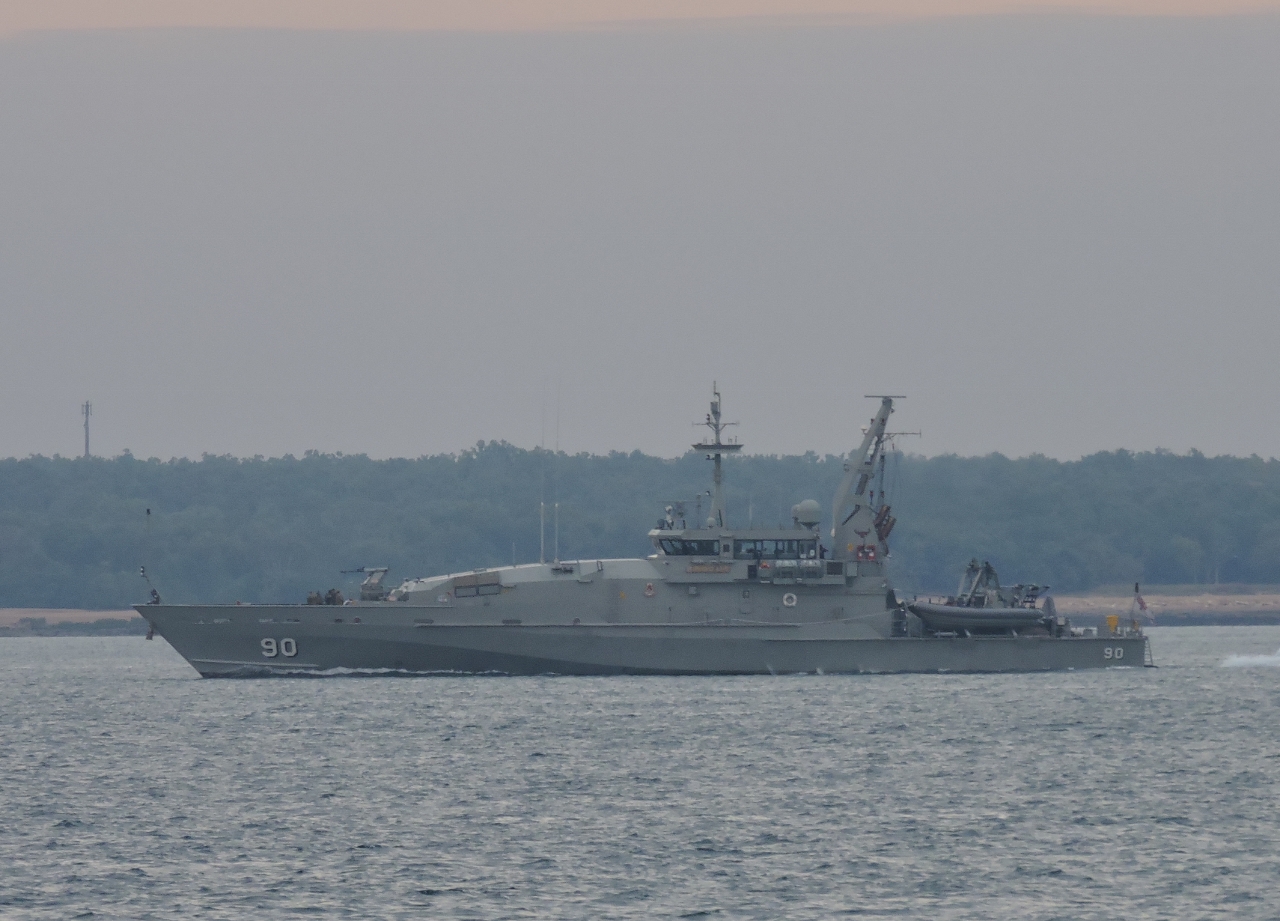 |
HMAS Broome
Position: 130 46.17, -12 24.51
The HMAS Broome returning to its home port in Darwin. The 186-ft (56.8 m) patrol boat can do 25 knots and is used for border and fisheries protection. And speaking of border protection, we were expecting to have frequent contact with Coastwatch, the Australia Customs monitoring planes. Last year, covering a portion of the distance, we were radioed every second day. But they only radioed us once during the entire run from the Gold Coast to Darwin.
|
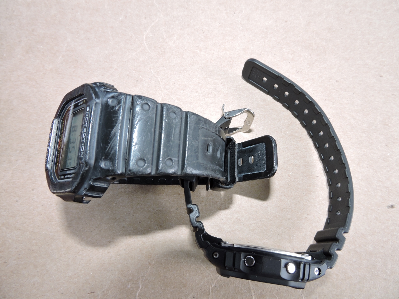 |
Watch
Position: 130 14.44, -12 28.46
Today we’re reminded of the importance of spares when James’ watch strap broke. It’s a trivial component, hardly related to life safety and only worth 30 bucks, but amazingly difficult to get where we are right now. That’s why we carry a lot of spares.
|
 |
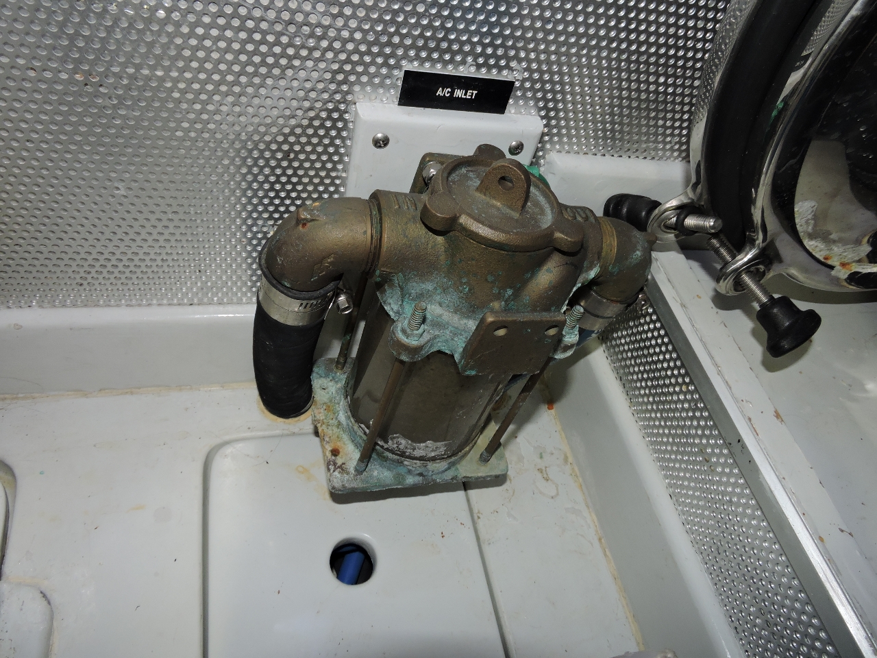
Sea strainer
Position: 130 1.16, -12 38.69
The original sea strainers all developed minor leaks. Eventually they can no longer be addressed and need to be replaced, so we’re gradually replacing them with high-quality Groco ones. The hydraulics sea strainer just started leaking in an unrecoverable way, so we replaced it today. The job was made more interesting by two factors. The first is that even with the new engine room cooling system, we are operating in mid-80F ambient temperatures so the engine room is up above 110F. And the second is that removing the 90-degree L fittings from the old strainer turned out to require an enormous amount of force. James eventually got them off, but claims he nearly turned the boat over doing it.
|
 |
New strainer
Position: 129 59.83, -12 39.71
The new Groco strainer in place. Here’s a picture of the old one. It’s pretty clear why we replaced it.
|
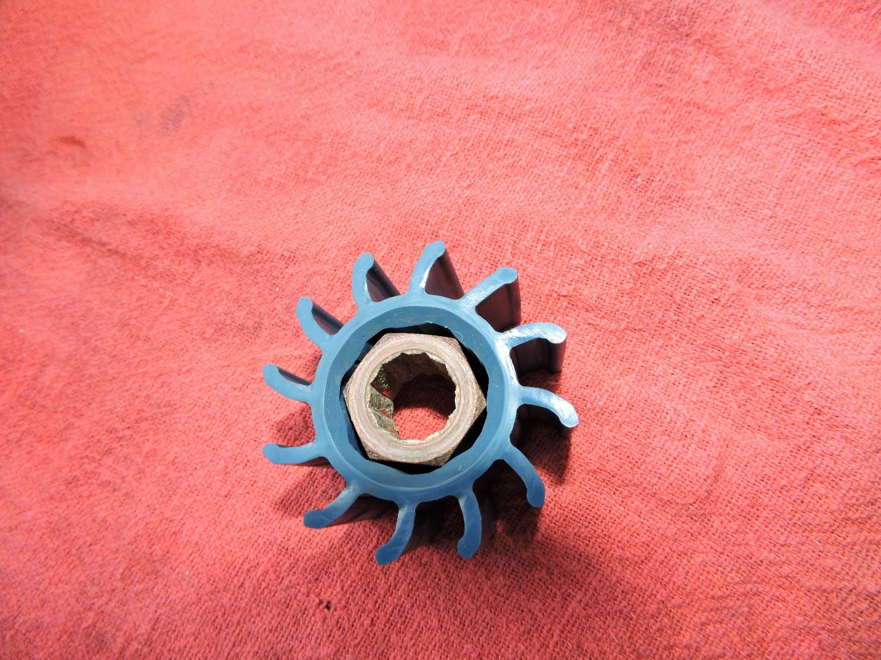 |
Impeller
Position: 129 46.41, -12 50.03
A reality of wet-exhaust engines, and we have two on-board, is you’re dependent on a raw water pump for cooling. We’ve found that impellers last somewhere between about ten minutes and three years, so it’s always a little difficult to know what to expect. All it takes is one jellyfish plugging the inlet and away goes that impeller. They’re not too hard to change, so it’s not much work to deal with a bad one. The wing engine impeller hasn’t been changed for two years. So even though the cooling system was operating fine and there was no obvious problem, we decided to change the impeller. Pictured is a failure mode we haven’t seen before. The core of the impeller had delaminated from the outer rubber and had been spinning inside the impeller. By the look of it, this has been happening for quite a long time, and yet the wing engine runs at a steady 188-189F degrees under load. The impeller must have been spinning just enough to satisfy the cooling requirements of the engine. It definitely was time to change it.
|
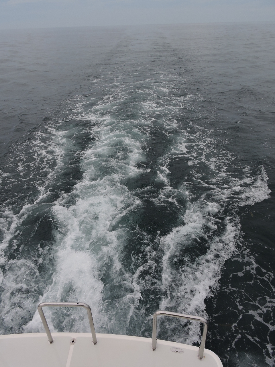 |
Joseph Bonaparte Gulf
Position: 130 0.27, -12 39.37
The body of water we’re traveling through on the 235-mile run between Darwin and the Kimberley is called Joseph Bonaparte Gulf. Conditions are so calm right now we can see our wake trailing way behind us in the distance with no waves to wipe it away. It’s not always like this though. While we were fueling in Darwin, Ben Dyson of Bailey’s told us some local fisherman refer to Joseph Bonaparte Gulf as “Blown Apart Gulf”. Apparently conditions can get pretty nasty here.
|
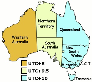 |
Timezone
Position: 129 54.60, -12 43.73
The Northern Territory is GMT+9:30, so we went back a half-hour from Queensland when we arrived in Darwin. And the Kimberley region is in Western Australia at GMT+8:00, so we’re now back two hours from Queensland.
|
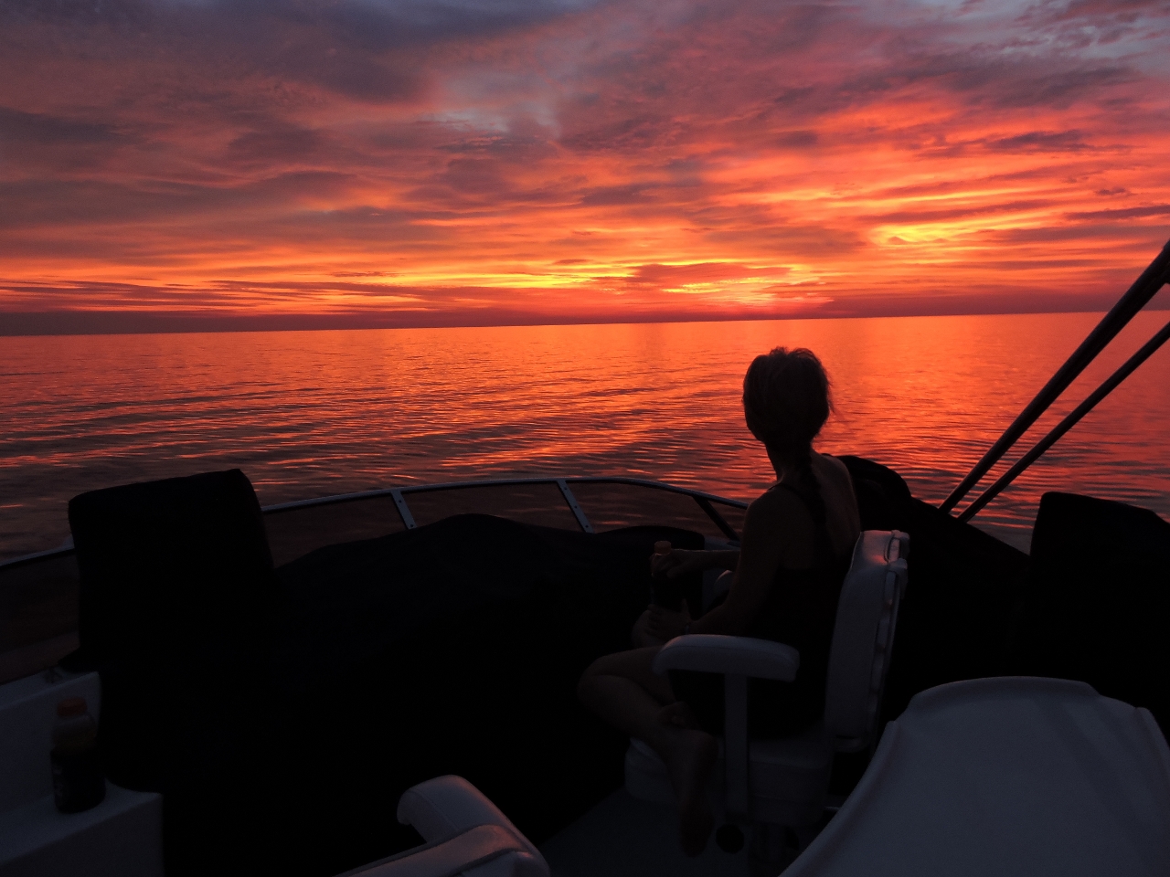 |
Sunset
Position: 129 38.91, -12 55.80
Sunset drinks (well, Cottees Fruit Cup cordial) on the flybridge. Conditions have remained wonderfully calm.
|
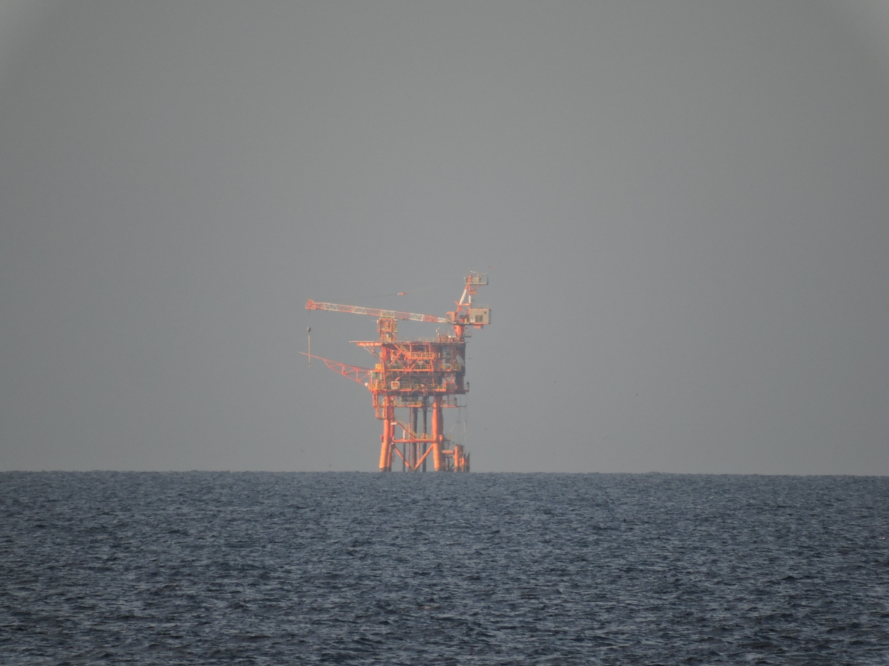 |
Petroleum rig
Position: 128 28.73, -13 49.66
We passed about three miles away from this petroleum drilling platform. It was clearly marked on our charts.
|
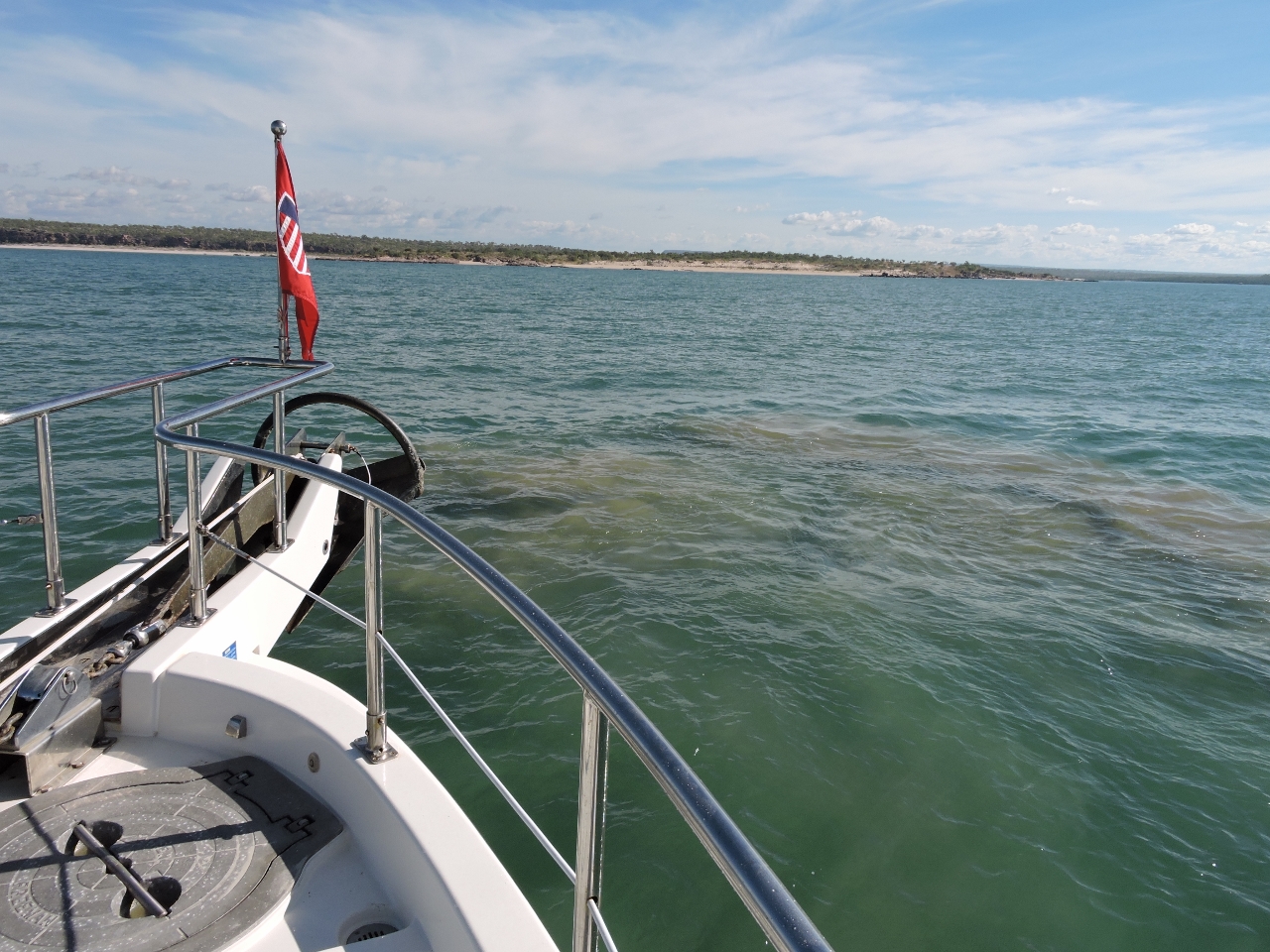 |
Berkeley River bar
Position: 127 47.52, -14 21.01
To cross the Berkeley River Bar, we were following the deepwater, four-waypoint route from Dennis and Annette Ford’s sailing directions. We arrived about 90 minutes before high tide at Reveley Island on an exchange from 6.72ft (2.05m) at 10:28am to 11.9ft (3.63m) at 3:51pm. Depths were mostly in the 9-10 ft range as we began. Then they dropped below 8ft, and as Captain Washburn in John McPhee’s Looking for a Ship would say “We might have touched bottom–I think”. We nosed around a bit and eventually made our way inside farther to the north with 8-10′ of water. The satellite imagery where we saw shallows shows breaking waves. Possibly the sandbar the Fords indicated was to our north had shifted south. We’ll try a different route on the way back out.
|
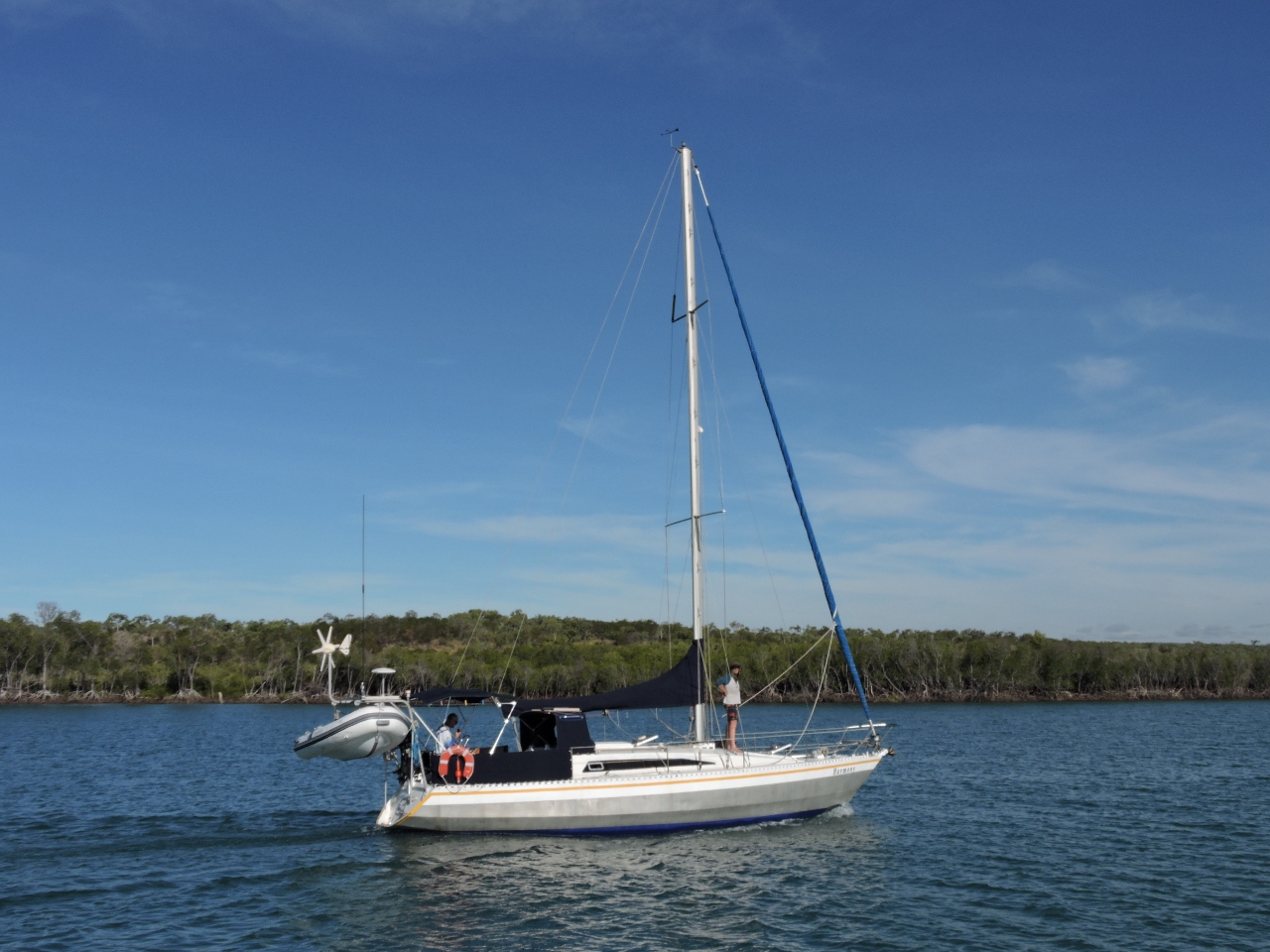 |
Harmony
Position: 127 46.22, -14 21.18
We were radioing back and forth with Harmony, who was following a similar track behind us. When we encountered the shallows, they scouted further north and found the deeper water route inside. As we pulled up behind them, we noticed that the boat was from Strahan, Tasmania. It turns out we’d seen each other before. Harmony‘s skipper was at the helm of Stormbreaker to pick up rafters along the Gordon River in Tasmania.
|
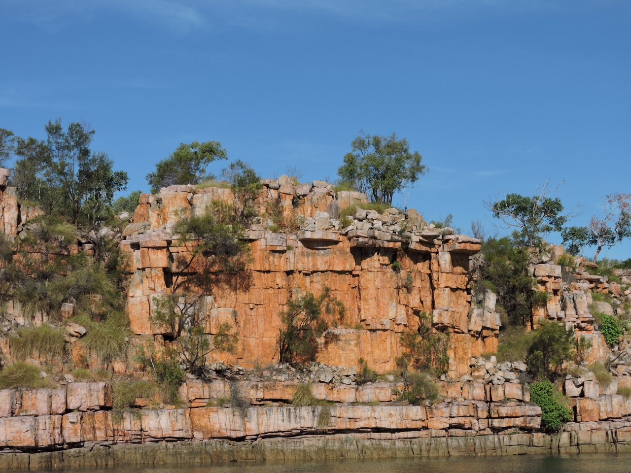 |
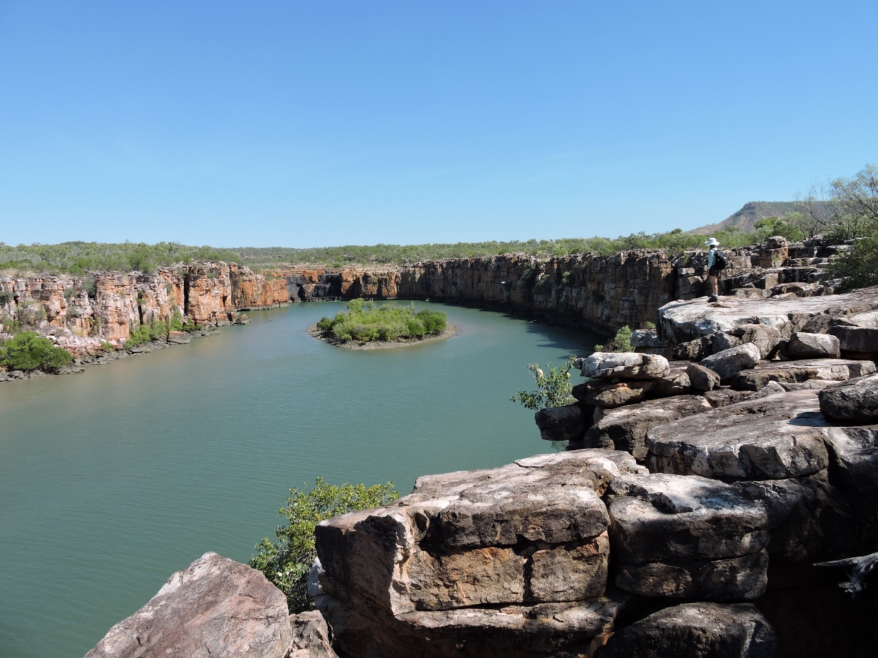
Berkeley River
Position: 127 45.56, -14 22.78
Dramatic red sandstone cliffs lined the waterway and the scenery just got better and better as we progressed. The humidity change markedly from 68% outside the river to 55% inside.
|
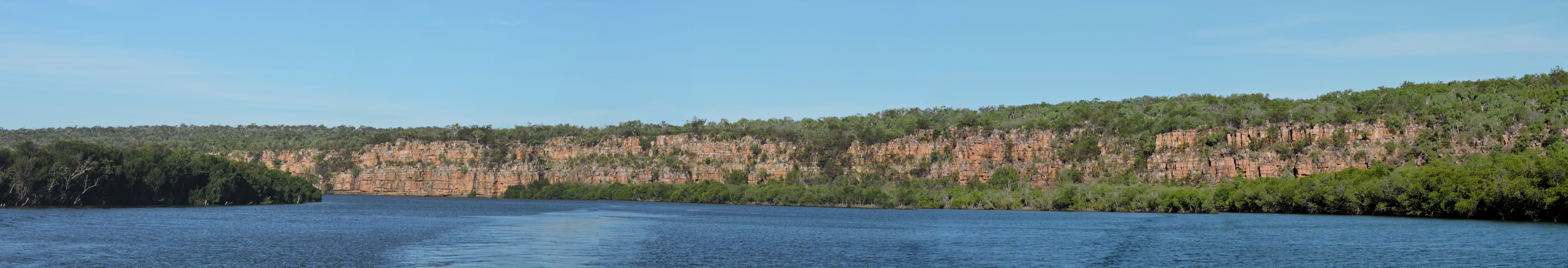 |
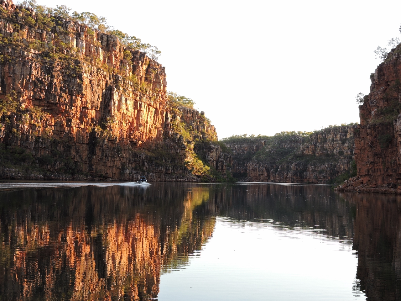
Grand Canyon
Position: 127 44.22, -14 23.17
Cruising along the Berkeley River felt being inside the Grand Canyon. Everyting is on such a large scale it’s hard to fit in a single shot–we ended up taking lots of panoramas to capture the views.
|
 |
Spire
Position: 127 43.37, -14 23.32
The rock formations were beautiful and complex. This spire is barely connected to the wall at the bottom.
|
 |
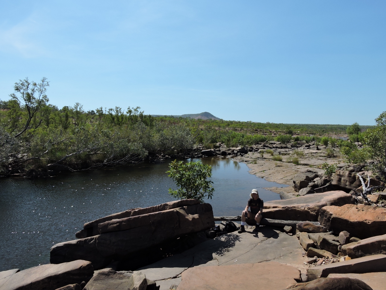
Casaurina Creek
Position: 127 43.11, -14 23.55
Casaurina Creek runs through a narrow, steep-walled canyon with a waterfall at the head, and is even more dramatic than what we’d seen so far. Depths were 14-16ft up to a rock scree on the north shore, then about 10ft beyond, and increased to 40ft at the head where we hoped to anchor. Swing room was very restricted and it was difficult to get the anchor to set in the rock bottom. We might have anchored closer to a small island and picked up some mud there and stern-anchored or tied off on the opposite wall. But it was late in the day so we returned back out to find easier pickings. This is the view looking to the falls from the head–you can see why we wanted to anchor there.
|
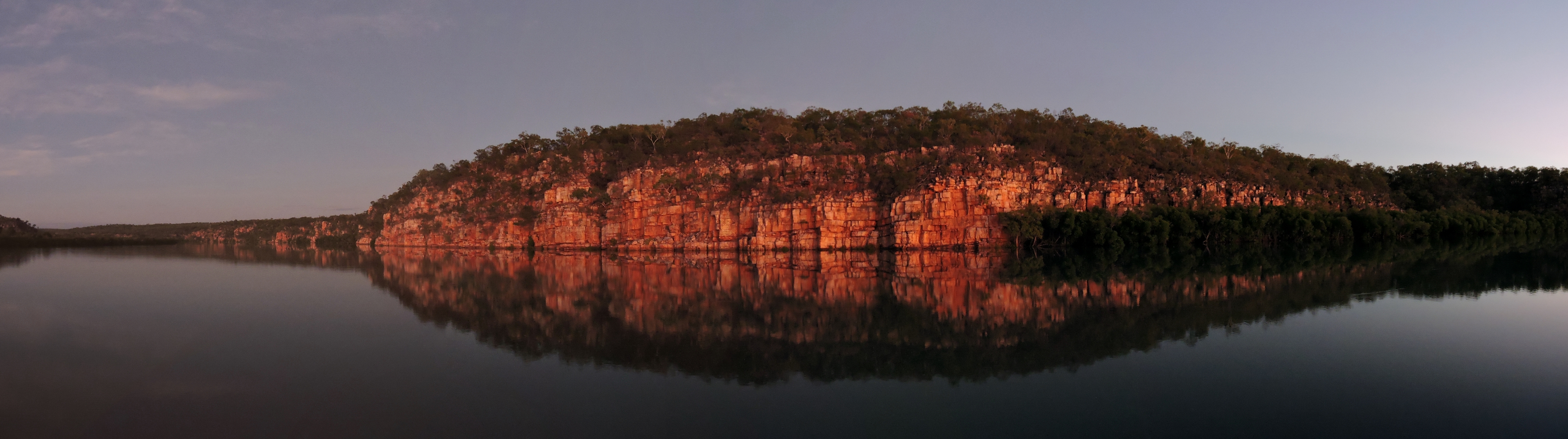 |
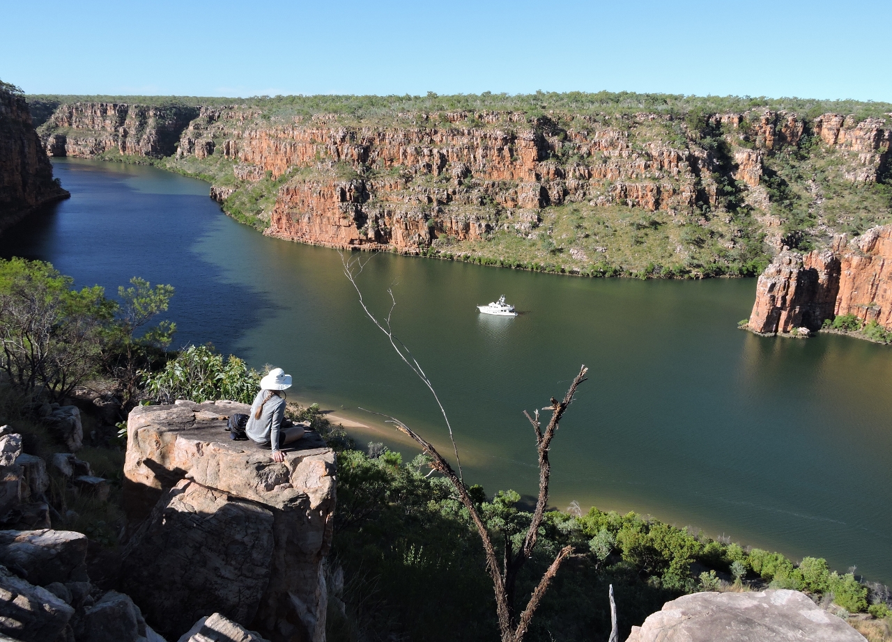
Sunrise
Position: 127 43.80, -14 23.48
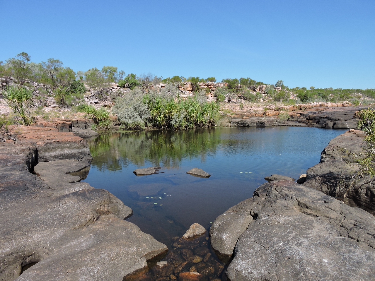
We anchored just south of the Casaurina Creek mouth, with excellent holding, plenty of swing room, and amazing scenery. This is the view looking upriver at sunrise. Having been in the Berkeley River for less than twelve hours, this is definately one of our top ten destinations ever and we’re finding it hard to believe that this isn’t the best of the Kimberley. We’re sure looking forward to the rest.
|
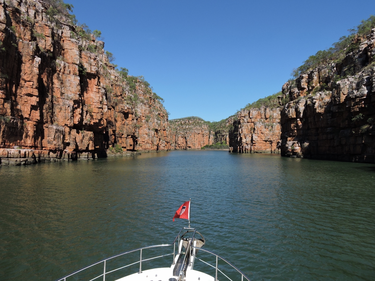 |
Gorge
Position: 127 41.27, -14 27.12
The scenery as we cruised up the Berkeley River just kept getting more and more amazing. The video http://youtu.be/Q9zcC6geRcA (2:06) shows our route through a narrow gorge with soaring red sandstone cliffs on either side.
|
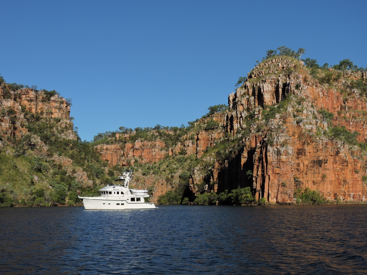 |
Amphitheatre anchorage
Position: 127 41.29, -14 28.44
Where we are isn’t a popular anchorage, but it definitely is the best in the river. We’re anchored just off a narrow amphitheatre that extends behind the boat to the east.
|
 |
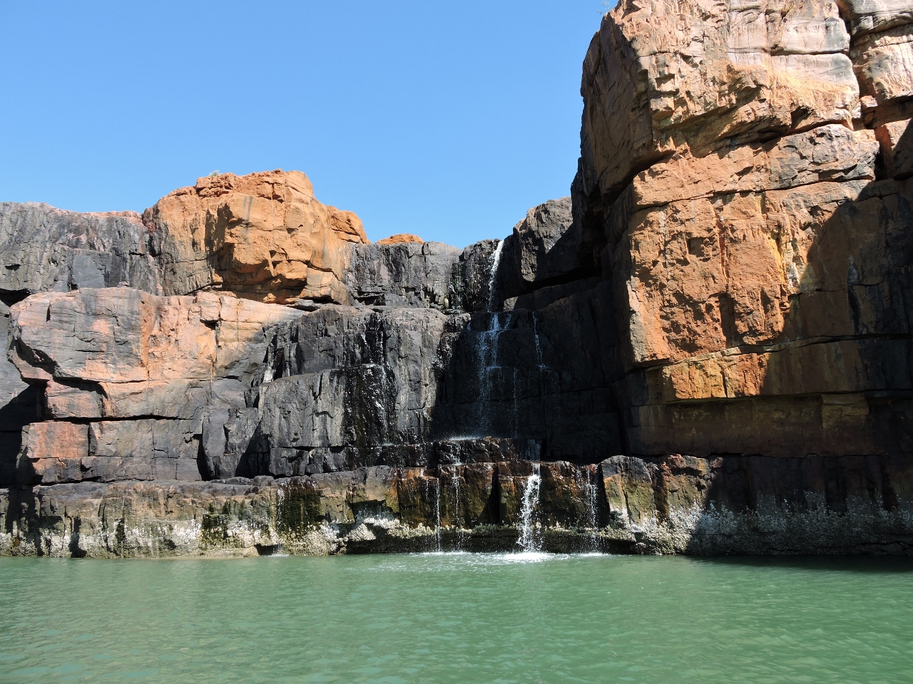
Amphitheatre falls
Position: 127 41.61, -14 28.55
We’re a little too far into the dry season for Amphitheatre Falls to be running, but the gorge still is incredible. You can barely see James at the base of the cliff in the dinghy.
|
 |
Lunch
Position: 127 41.19, -14 28.48
We climbed the slope on the west shore and had lunch with a sweeping view of the river and our anchorage. This sure feels like a marine version of the Grand Canyon, but we’ve really never seen anything like it.
|
 |
Dawn
Position: 127 41.33, -14 28.42
A small runabout, likely from the resort at the river mouth, heading downriver at dawn.
|
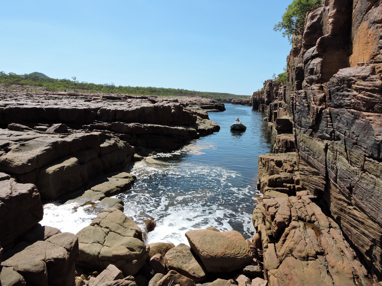 |
Rock bar
Position: 127 38.92, -14 29.74
Freshwater meets saltwater on the Berkeley River at this tidal rockbar.
|
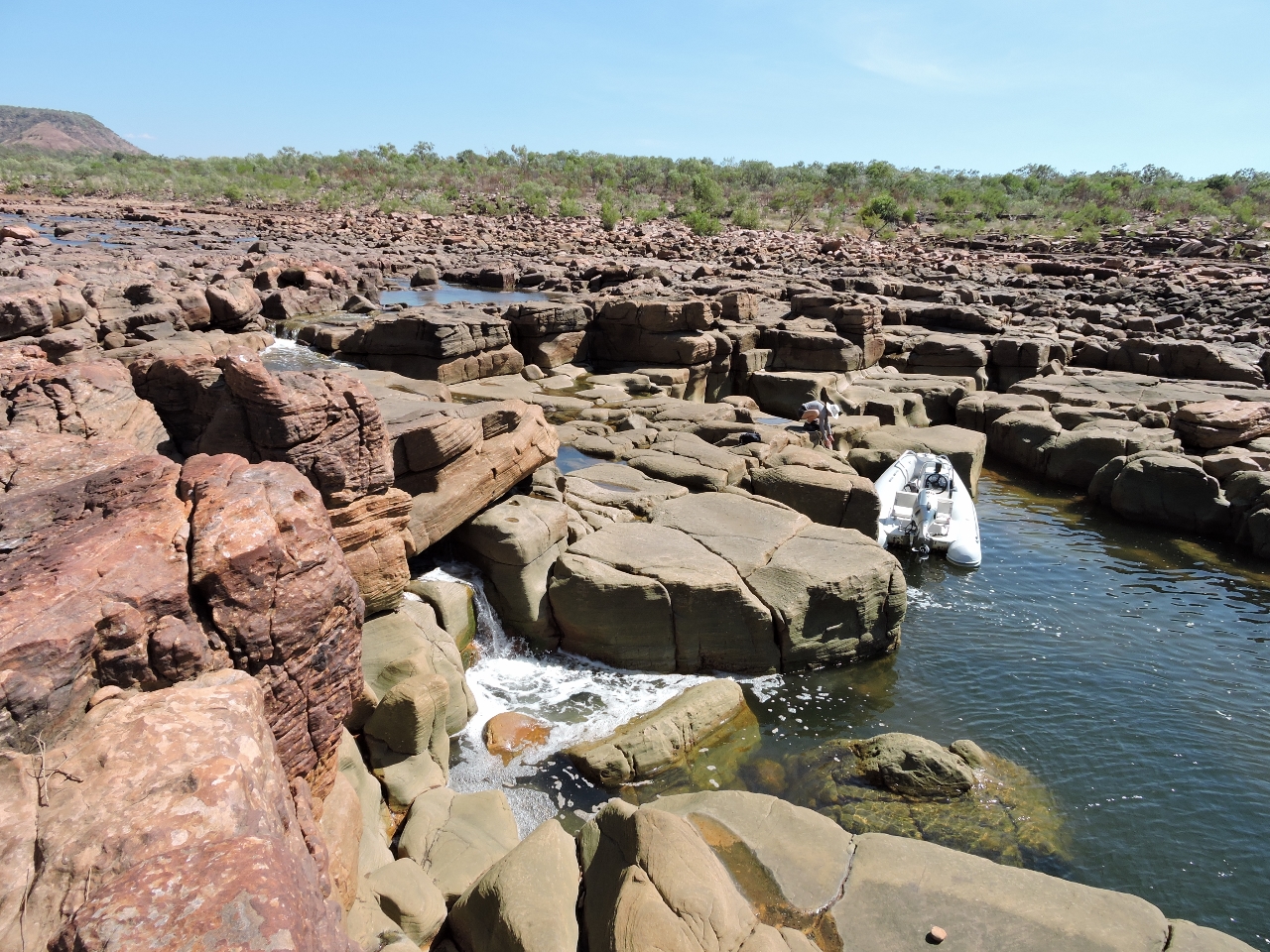 |
Landing
Position: 127 38.92, -14 29.72
We couldn’t get past the rockbar in the dinghy, so tied it off in a narrow pool to continue farther up-river foot.
|
 |
Track
Position: 127 38.45, -14 30.03
We walked about a mile upriver, past several tranquil freshwater pools. A four-wheel drive track crosses the water just over a half-mile from the rockbar. Except for the odd horse dropping, we didn’t see much other evidence of human activity.
|
 |
Break
Position: 127 38.65, -14 29.90
A quick stop for a drink and a break. It’s really hot up here.
|
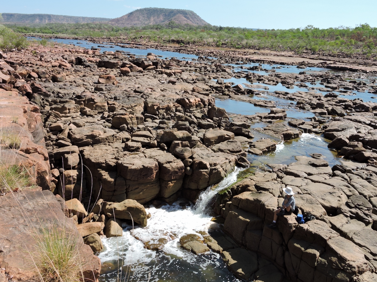 |
Lunch
Position: 127 38.90, -14 29.74
We returned back out to the rockbar for lunch by the falls. Visible in the distance is 700ft (213m) Mt. Casaurina.
|
 |
Falls
Position: 127 39.23, -14 29.55
On the way back downriver, we noticed this tiny gorge where a pond filled with waterlilies fed a lovely waterfall.
|
 |
Gorge
Position: 127 42.41, -14 25.28
The river is full of small tributaries, some ending in soaring cliffs like this one.
|
_3.web.jpg) |
Flying fox
Position: 127 43.15, -14 25.23
Screeching filled the air as we followed this small creek. What we initially thought were birds turned out to be dozens, if not hundreds, of black flying foxes (fruit bats). They mostly are black, but have a reddish-brown mantle. The black flying fox is one of the largest bat species in the world. One flew off and its wingspan was a yard across.
|
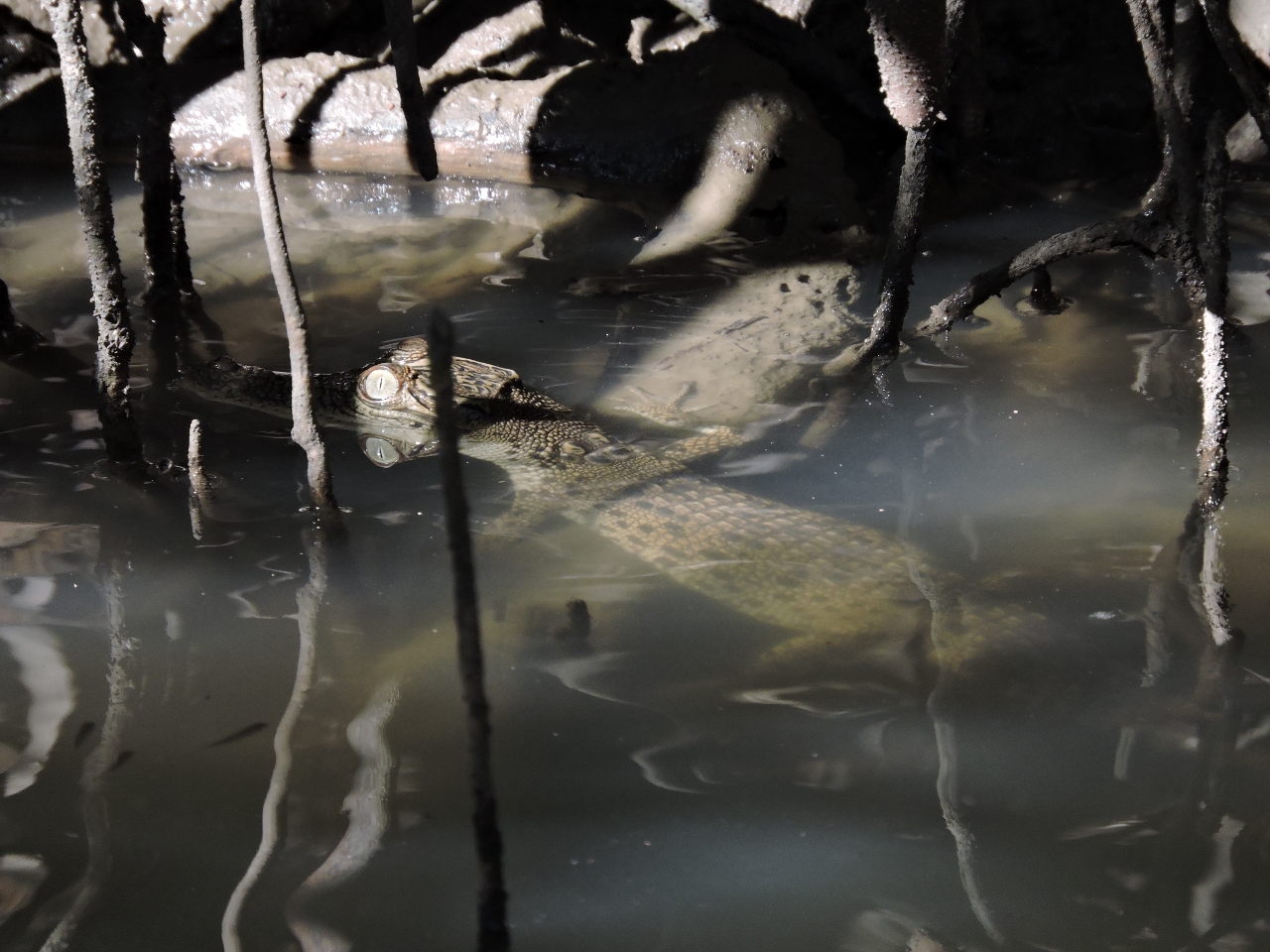 |
Crocodile
Position: 127 41.60, -14 26.18
Our first crocodile sighting in the wild–a juvenile less than a foot long tucked into the mangroves.
|
 |
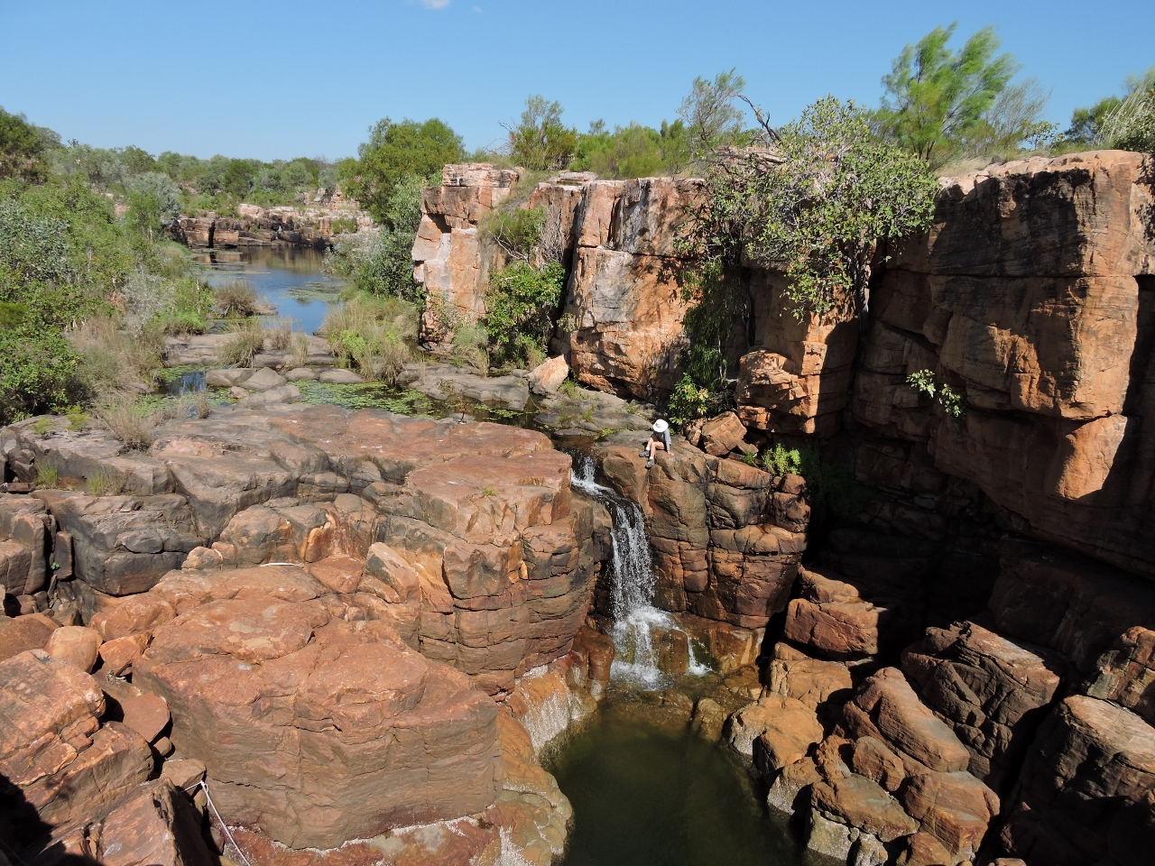
Casaurina Creek
Position: 127 43.13, -14 23.47
We moved the boat back to the Berkeley River mouth in preparation for a late-afternoon departure and to explore Casaurina Creek. Here’s another picture of the falls at the head of the gorge.
|
 |
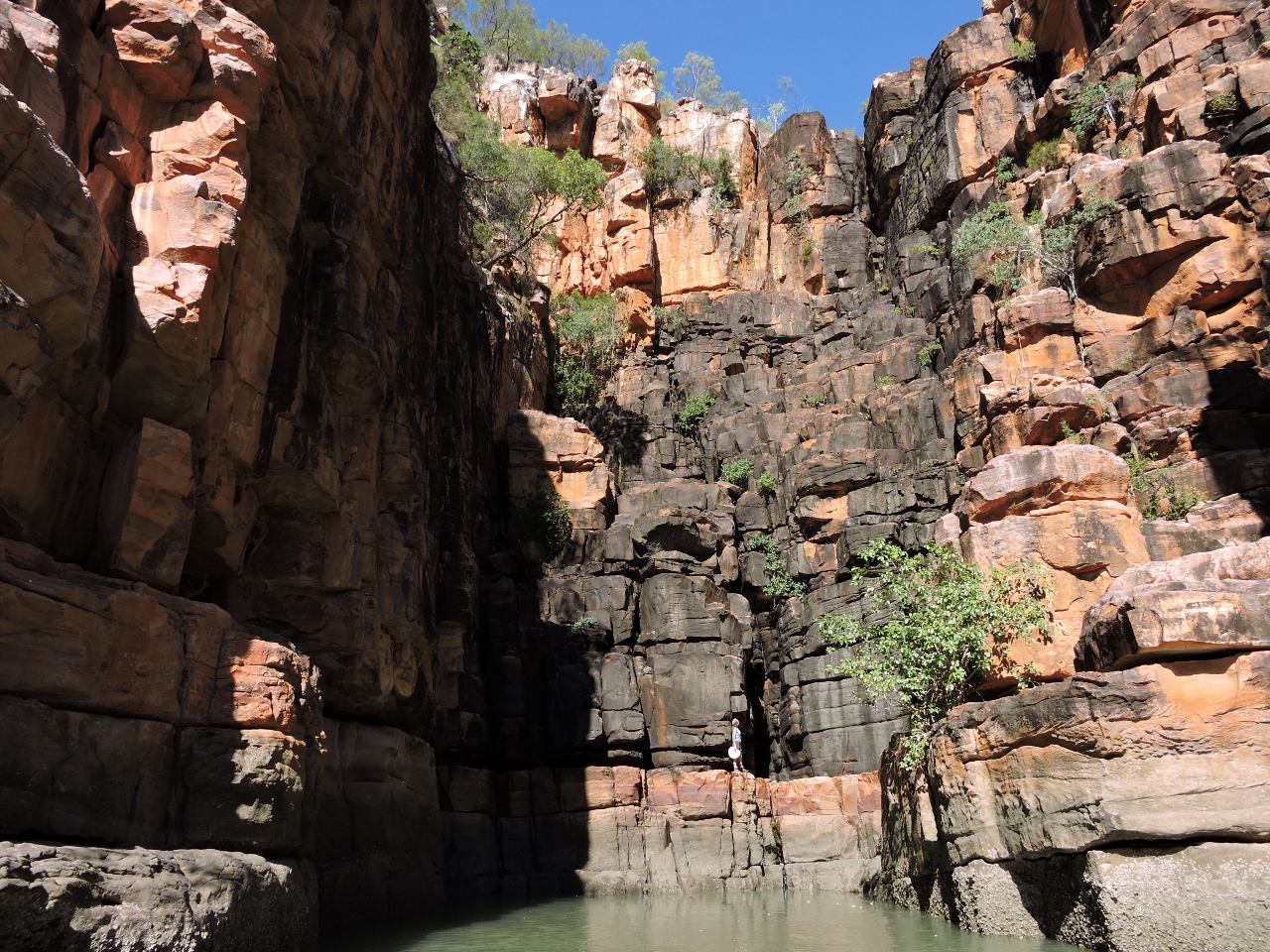
Cliffs
Position: 127 43.23, -14 23.39
We climbed a rock slide up to the top of the cliffs. A small boat already was tied off there, but we never did see the occupants. Cairns marked an inland path up-creek, but we didn’t find them particularly helpful and instead mostly followed along the cliff edge for better views and easier walking.
|
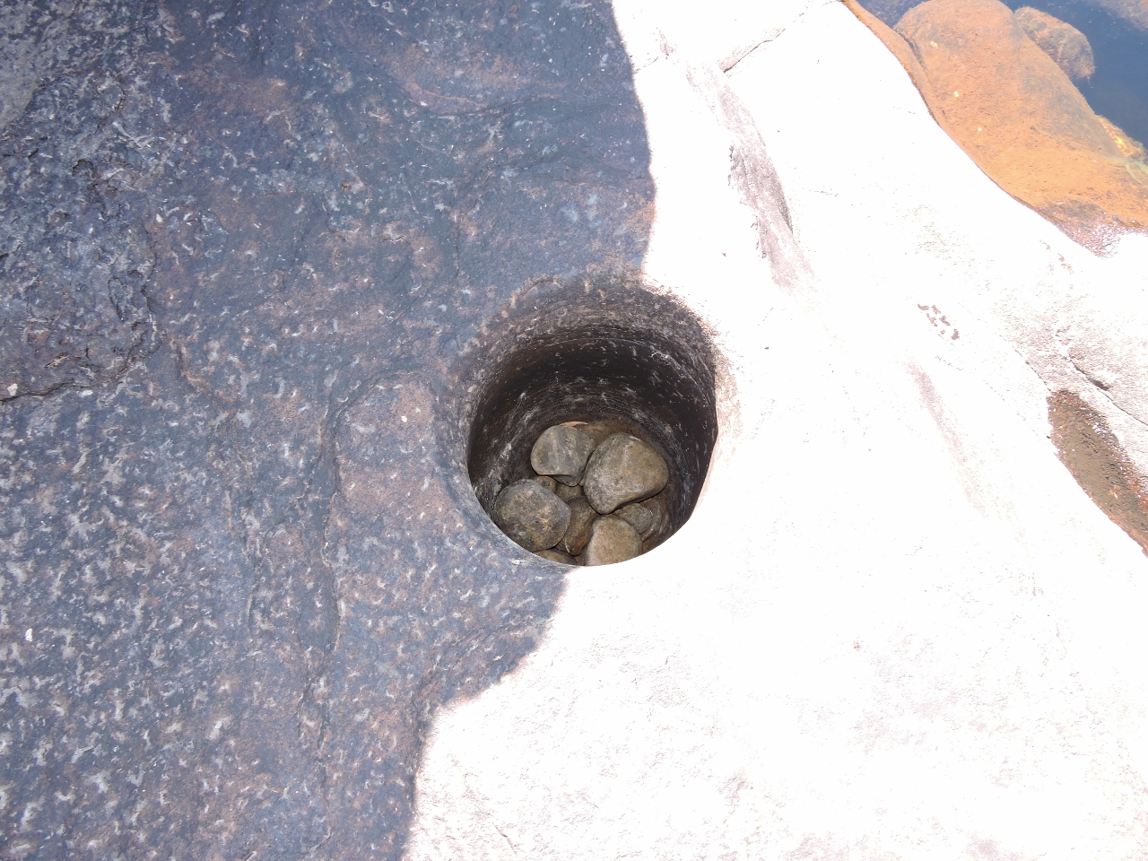 |
Rock bowl
Position: 127 43.09, -14 23.58
The water flows over with such velocity in the wet season that these rocks have swirled around and carved a deep almost-perfect cylinder into the river bed.
|
 |
Pools
Position: 127 43.07, -14 23.60
A series of freshwater pools can be found upriver from the falls.
|
 |
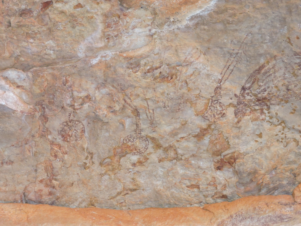
Bradshaws
Position: 127 42.92, -14 23.86
The creek led into a gorge where we found Bradshaw rock paintings under an overhang on the north shore. Known simply as “Bradshaws”, these are aboriginal paintings named after Joseph Bradshaw, who discovered them in the late 1800s. Two handprints are beside Jennifer’s hand, with other drawings on the wall to the right. The paintings bear a remarkable similarity in paint color and choice of location to the pictographs we’ve seen along the British Columbia coast.
|
 |
Jellyfish
Position: 127 42.92, -14 23.86
These Bradshaws were painted on the bottom of the overhang. We believe they depict jellyfish.
|
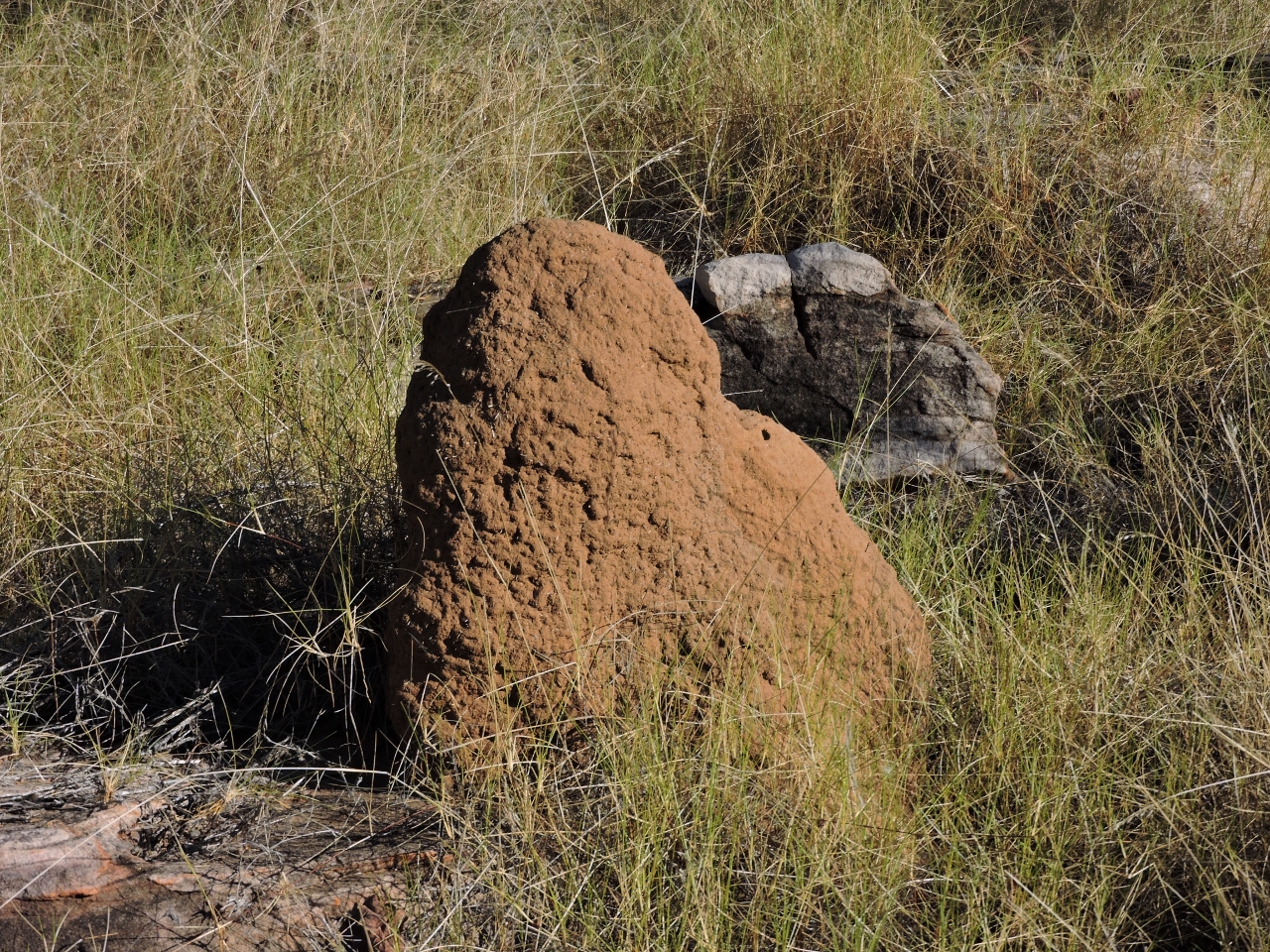 |
Termites
Position: 127 43.24, -14 23.36
Termite mounds were all along the track. These ones were relatively small at a couple of feet high–we’ve seen pictures of ones over six feet tall.
|
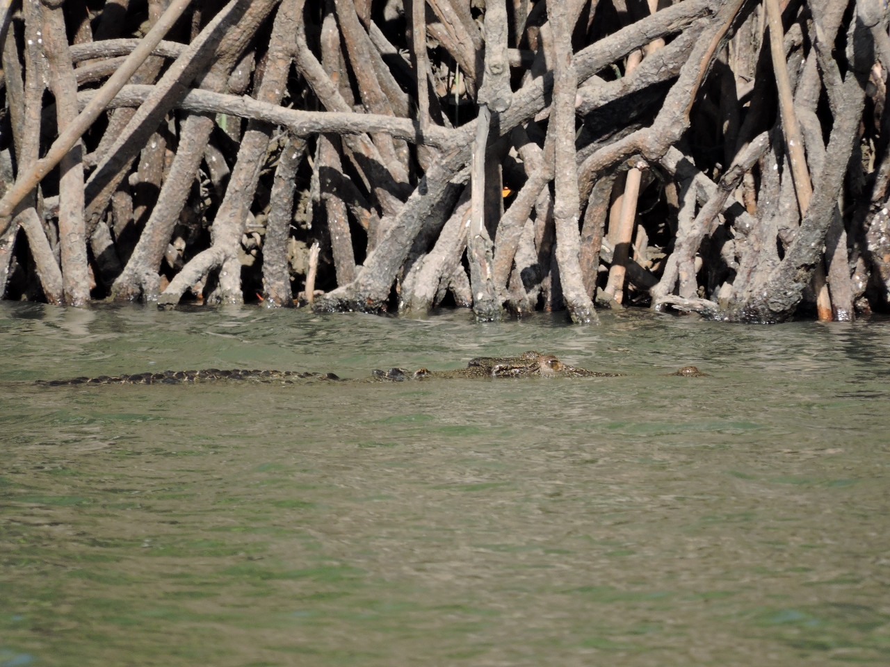 |
Crocodile
Position: 127 44.01, -14 23.16
We spotted our second crocodile shortly after exiting Casaurina Creek. This one was a mid-sized specimen, hunting along the river edge.
|
 |
Crossing the bar
Position: 127 47.94, -14 21.25
We scouted the bar in the dinghy, looking for a deeper path across, but couldn’t find one. We did find good water close to shore south of the river mouth, so decided to follow that route to where the chart and Western Australia Cruising indicated a path through the bar. We exited about 40 minutes before a 12.2ft (3.74m) high tide at 5:41pm at Reveley Island on an exchange from 5.6ft (1.7m) at 12:18pm. We saw between 10ft and 20ft running about 200 yards off the starboard shore as we exited the river and ran south. Turning northeast, we mostly saw at least 9ft-11ft through the exit channel, with the occasional blip to near 8ft. All around, it was a much better path then on entry. Had we exited the following morning, we would have had another three feet of water with the 15.8ft (3.81m) high tide, but the winds were predicted to come up to 30kts tomorrow morning and this is not a bar to cross in big winds.
|

|
Click the travel log icon on the left to see these locations on a map, with the complete log of our cruise.
On the map page, clicking on a camera or text icon will display a picture and/or log entry for that location, and clicking on the smaller icons along the route will display latitude, longitude and other navigation data for that location. And a live map of our current route and most recent log entries always is available at http://mvdirona.com/maps. |
If your comment doesn't show up right away, send us email and we'll dredge it out of the spam filter.
Wow travel around the world, i can see you everywhere:) !
I think you can write a book about your journey, it would be so great !