
From the southern Great Barrier Reef, we continued north to one of Australia’s premier cruising grounds, the Whitsunday Islands. Roughly 500 miles north of Brisbane, the Whitsundays are a group of 74 islands spread over 100 miles. Most of the islands are national park, with a half-dozen or so resorts sprinkled throughout. Offshore, the outer reefs of the Great Barrier Reef are only 20 miles away.
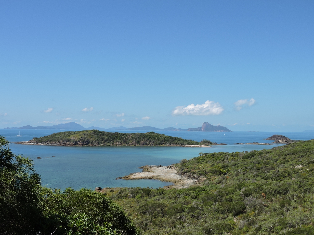
We spent the first half of our Whitsunday visit in the islands themselves. The anchorages were excellent and we particularly enjoyed the many view hikes. The panorama at the top of this post was taken from Mt. Oldfield on Lindeman Island, and the one below is looking north from Whitsunday Peak on Whitsunday Island.

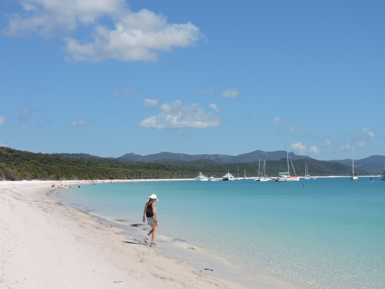
The Whitsundays also are famous for their beautiful beaches, the standout being Whitehaven Beach, a three-mile long silica-sand beach on the southeast corner of Whitsunday Island. The incredibly soft, white-sand beach stretches all around the bay, with multi-hued blue waters offshore. And a short track from the beach leads to a viewpoint with sweeping views. Whitehaven Beach is so popular that floatplanes and even helicopters make regular trips there.
 |
 |
 |
 |
We finished our Whitsundays trip in the outer reefs and had a fantastic time there. As with the Swain Reefs farther south, the outer reefs are landless and poorly charted, with few other boats. In the busy Whitsunday Islands we almost always shared an anchorage, but rarely saw another boat in the outer reefs. Unlike the Swains, the water temperature was over 80F, and we could ditch the cumbersome drysuits for our 3mm wetsuits. The visibility also was better, and the coral and fish life was excellent. We’d heard that reef life isn’t nearly as good as it used to be, but we certainly weren’t disappointed.
.web.jpg) |
.web.jpg) |
 |
 |
 |
Click the travel log icon on the left to see these locations and more on a map, with the complete log of our cruise through the Whitsundays. 100 Magic Miles is an excellent cruising guide for this area, with detailed anchorage and hiking maps. Alan Lucas’ Cruising the Coral Coast was helpful as well.
On the map page, clicking on a camera or text icon will display a picture and/or log entry for that location, and clicking on the smaller icons along the route will display latitude, longitude and other navigation data for that location. And a live map of our current route and most recent log entries always is available at http://www.mvdirona.com/maps/LocationCurrent.html. |
Doug,
Thanks for the feedback. Yes, the resort still is closed. It has been purchased and is under renovation with plans I think to open next year. Most of the park tracks were closed too due to lack of funding, except fortunately the one that matters to the top of Mt. Oldfield.
Very much enjoying the journal of your ambitious cruise.
Is the resort on Lindeman still closed? We stopped there a couple of years ago (using a somewhat dodgy, unmaintained mooring ball with a crew member left on board just in case) and found the place quite atmospheric, with its bats and deserted holiday facilities.