The Swiss Alps Jungfrau-Aletsch UNESCO World Heritage Site, established in 2001, comprises 318 sq mi (82,388 ha) of the High Alps, including the most glaciated part of the mountain range and the largest glacier in Eurasia. The dramatic scenery, centered on the mountains Jungfrau (13,642 ft; 4,158 m), Monch (13,480 ft; 4,110 m) and Eiger (13,024 ft; 3,967 m), has influenced European art, literature, mountaineering and alpine tourism for well over a century.
Between Jungfrau and Monch is the plateau Jungfraujoch, containing a tourist building with viewing platforms, restaurants and exhibits. The complex bills itself as the “Top of Europe,” even though the Matterhorn viewing platform actually is higher. But Jungfraujoch is reached through the highest railway in Europe, the Jungfraubahn, and the highest railway station on the continent. Also at Junghraujoch is the dramatic Sphinx Observatory, pictured above. Established in 1937, it is one of the highest in the world at 11,716 ft (3,571 m) above sea level.
We reached Junghraujoch from Murren through a series of six connections: a train to Grutschalp, a cable car down to Lauterbrunnen, a train to Zweilutschinen, another train to Grindelwald, a gondola to Eigergletscher and finally a cog railway to Junghraujoch. We very much enjoyed the trips and the scenery along the way, particularly the new Eiger Express gondola to Eigergletscher.
And the scenery at Junghraujoch is absolutely amazing, with Jungfrau and Monch so close by and the Aletsch Glacier trailing away into the distance below us. At 14 miles (23 km) long, the Aletsch is the longest glacier in the Alps. We spent ages taking in the scenery from the various viewpoints, then made a fabulous 45-minute hike across the across Jungfraufirn Glacier, a tributary of the Alesch, to the Monchsjochhutte (Monchsjoch Hut) below the mountain Monch.
We returned to Murren through only four connections, taking the Jungfraubahn to end of the run at Kleine Scheidegg, and from there taking the scenic train to Lauterbrunnen, followed by the cable car to Grutschalp and the train to Murren. We had another excellent meal back in town, taking in the mountain views at every opportunity.
Below are highlights from June 29th, 2022. Click any image for a larger view, or click the position to view the location on a map. And a map with our most recent log entries always is available at mvdirona.com/maps.
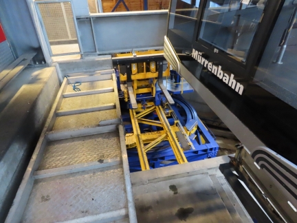 |
Cargo Transport
Position: 46°35.80’N, 7°53.46’E
Murren is not accessible by public road and most cargo arrives via one of the two cable car routes that serve the town. Here at the northern station Grutschalp, cargo is carried underneath the cable car. An application-specific forklift moves cargo directly from the cable car to the train and back.
|
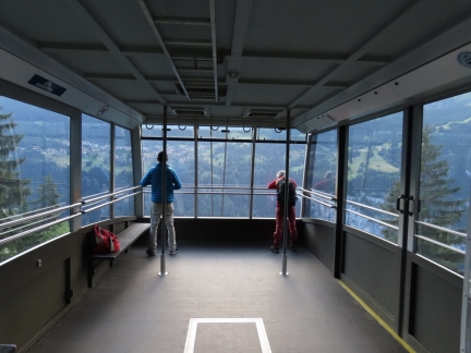 |
Cable Car
Position: 46°35.80’N, 7°53.47’E
We’re taking the first train and cable car of the day from Murren down to Lauterbrunnen and only a few people are riding with us compared to yesterday afternoon’s crowds on the way up.
|
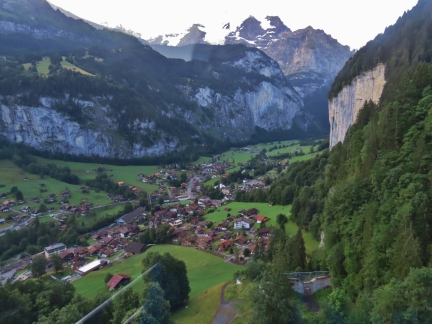 |
Lauterbrunnen Valley
Position: 46°35.84’N, 7°53.78’E
View to the Lauterbrunnen Valley from the cable car as we descend from Grutschalp.
|
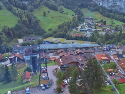 |
Lauterbrunnen Station
Position: 46°35.84’N, 7°53.78’E
Approaching the bottom of the cable car run, with the covered tracks of Lauterbrunnen Station visible beyond.
|
 |
To Zweilutschinen
Position: 46°35.92’N, 7°54.42’E
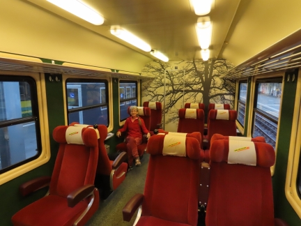
On board a train at Lauterbrunnen Station for our third leg of the day to Zweilutschinen, after taking a train from Murren to Grutschalp and a cable car down.
|
 |
To Grindelwald
Position: 46°38.19’N, 7°56.75’E
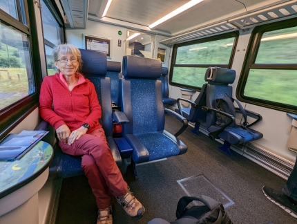
On our fourth leg of the day, a train from Zweilutschinen to Grindelwald Terminal.
|
 |
Route to Jungfraujoch
Position: 46°37.53’N, 8°1.05’E
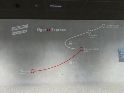
From Grindelwald Terminal, we’ll be taking our fifth and sixth legs to reach our ultimate destination of Jungfraujoch plateau. The Eiger Express gondala will carry us from 3,093 ft (943 m) above sea level to Eigergletscher at 7,611-ft (2,320 m). Then we’ll take a train to reach Jungfraujoch at 11,332 ft (3,454 m). The plateau lies between 13,642 ft (4,158 m) Jungfrau and 13,480 ft (4,110 m) Monch.
|
 |
Gondola Cables
Position: 46°37.53’N, 8°1.05’E
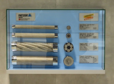
The Eiger Express is a new gondola cableway that opened in 2020. It uses a tri-cable system that allows for only 7 support towers over a distance of 4 miles (6.4 km). This display shows four of the cable types used. The diameter of the bottom cable is 2.2 inches (58 mm).
|
 |
Eiger Express
Position: 46°37.34’N, 8°1.05’E
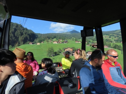
On board the Eiger Express, our fifth leg of the day, shortly after departing Grindelwald Terminal. We’re on the first run of the day and the car is about two-thirds full.
|
 |
Eiger North Face
Position: 46°36.48’N, 8°0.28’E
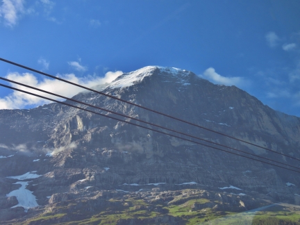
The north face of 13,024 ft (3,967 m) Eiger viewed from the Eiger Express gondola. One of the biggest sheer faces in Europe, the north face of Eiger has long been a famous, and deadly, climbing destination. At least sixty-four climbers have died here since 1935.
|
 |
Silberhorn
Position: 46°35.25’N, 7°59.19’E
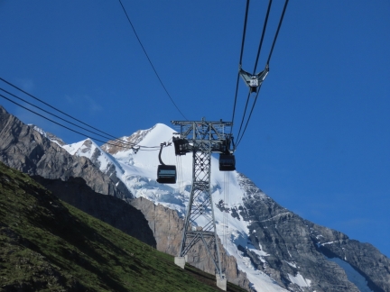
A mountain peak burst into view soon after we passed the Eiger North Face. We believe this is 12,123 ft (3,695 m ) Silberhorn, a satellite peak of 13,642 ft (4,158 m) Jungfrau.
|
 |
Eigergletscher
Position: 46°34.91’N, 7°58.88’E
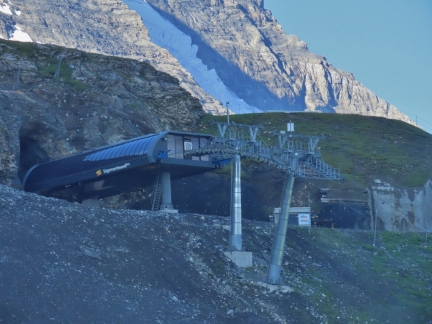
Approaching modern Eigergletscher, the top station of the Eiger Express at altitude 7,611-ft (2,320 m).
|
 |
Jungfraubahn
Position: 46°34.53’N, 7°58.55’E
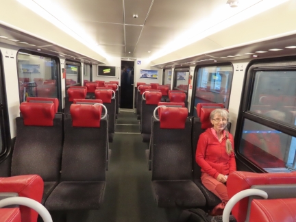
On the Jungfraubahn, the highest railway in Europe, for our sixth and final leg before reaching Jungfraujoch. The narrow-gauge cog railway opened in 1912 and terminates at the highest railway station on the continent.
|
 |
Tunnel Viewpoint
Position: 46°32.92’N, 7°59.09’E
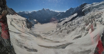
The Jungfraubahn runs above the permanent snow line. To protect the railway from snow and extreme weather, the engineers built a tunnel through adjacent Eiger and Monch. Near the top, the train makes a brief stop at a viewing window cut into the tunnel for our first view to the Aletsch Glacier.
|
 |
Jungfraujoch
Position: 46°32.85’N, 7°59.12’E
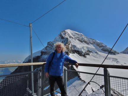
On the Sphinx observation terrace at Jungfraujoch in front of 13,480 ft (4,110 m) Monch. The scenery is absolutely amazing. At altitude 11,716 ft (3,571 m), it’s the second highest observation deck in Switzerland after the Matterhorn.
|
 |
Aletsch Glacier
Position: 46°32.85’N, 7°59.12’E
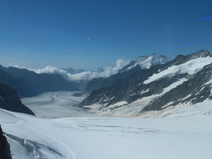
View to the Aletsch Glacier from the Sphinx observation terrace at Jungfraujoch. The 14-miles (23 km) glacier is the longest in the Alps.
|
 |
Jungfrau-Aletsch
Position: 46°32.85’N, 7°59.12’E
Jungfraujoch and the Aletcsh Glacier are part of the 318 sq mi (82,388 ha) Swiss Alps Jungfrau-Aletsch UNESCO World Heritage Site. Also included in the site are the mountains 13,480 ft (4,110 m) Monch, partly visible at left, and 13,642 ft (4,158 m) Jungfrau at right.
|
 |
Ice Palace
Position: 46°32.87’N, 7°58.87’E
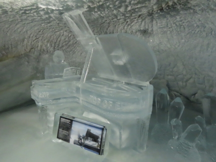
The Ice Palace is one of several tourist attractions at Jungfraujoch. Everything including the floors is made of ice and the palace is full of ice sculptures, some quite elaborate. This sculpture depicts the outdoor concert the famous pianist Lang Lang gave at Jungfraujoch.
|
 |
Top of Europe
Position: 46°32.86’N, 7°58.85’E
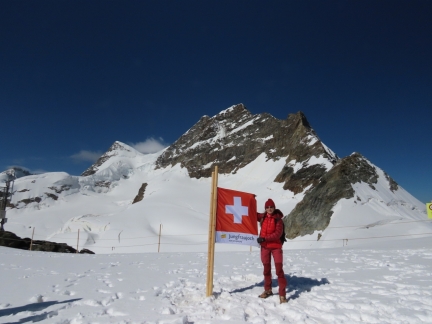
Jungfraujoch bills itself as the “Top of Europe” even though the Matterhorn viewing platform is higher. But we’ll play along :). Here Jennifer is standing on the plateau with 13,642 ft (4,158 m) Jungfrau behind.
|
 |
Jungfraujoch Buildings
Position: 46°32.86’N, 7°58.86’E
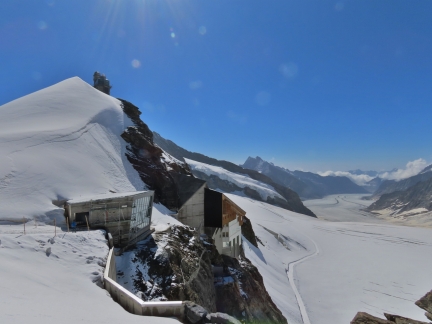
Looking back from the plateau to the buildings at Jungfraujoch. A new building is under construction in the foreground, with the main visitor center and train station to the right. At top left is the Sphinx Observatory and observation terrace, where we took our first pictures at Jungfraujoch.
|
 |
Sphinx Observatory
Position: 46°32.86’N, 7°58.86’E
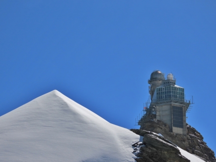
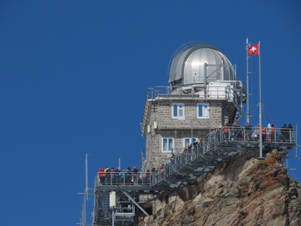
The Sphinx Observatory, established in 1937, is one of the highest in the world at 11,716 ft (3,571 m) above sea level. We’ve visited a higher one: the Canada-France-Hawaii at 13,796 ft (4,205 m) atop Mauna Kea in Hawaii. The highest in the world is the University of Tokyo Atacama Observatory in Chile at 18,500 ft (5,640 m).
|
 |
Snack
Position: 46°32.86’N, 7°58.89’E
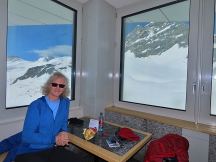
Enjoying a snack with a view to Jungfrau from the Jungfraujoch visitor center. While we were there, a helicopter suddenly ascended into view, bringing supplies for a building under construction.
|
 |
Jungfraufirn
Position: 46°32.85’N, 7°59.52’E
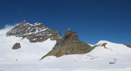
After exploring the visitor center, we set off on a 45-minute hike across Jungfraufirn glacier, a tributary of the Alesch Glacier, to the Monchsjochhutte (Monchsjoch Hut) below the mountain Monch. Here is the view back to Jungfraujoch from the trail (click image for a larger view). At left is 13,642 ft (4,158 m) Jungfrau and in the center is the Sphinx Observatory, atop the rocky crag of the same name. An elevator tunneled through the mountain connects the observatory with the station beneath (not visible behind the Sphinx). We’re among the first few hikers this morning, but a lot more are coming behind at bottom right.
|
 |
Sphinx Observation Deck
Position: 46°32.88’N, 7°59.44’E
The Sphinx observation terrace, viewed from the trail to Monchsjochhutte. We were one the first few visitors of the day to arrive at Jungfraujoch this morning at 9:15am, and perhaps a dozen other people were there with us. An hour later, it’s getting pretty crowded on the terrace, and will keep getting busier until mid-afternoon. Jungfraujoch is a very popular destination.
|
 |
Crevasse
Position: 46°32.89’N, 7°59.71’E
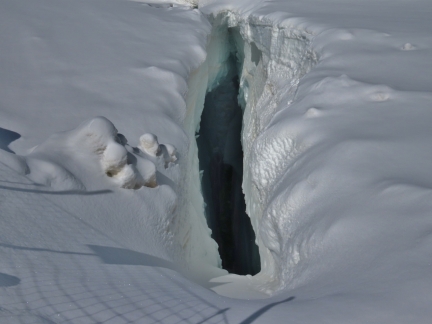
A deep crevasse just off the trail across the Jungfraufirn glacier to Monchsjochhutte.
|
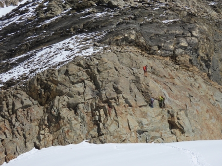 |
Climbers
Position: 46°33.10’N, 8°0.14’E
Climbers ascending Monch just north of the trail to Monchsjochhutte.
|
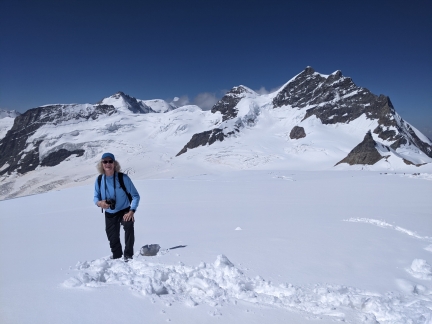 |
Jungfraufirn
Position: 46°33.10’N, 8°0.18’E
The trail across Jungfraufirn is well-marked and well-trod, and easy to walk in just hiking boots. But the snow is quite deep just off the trail. This is the fabulous scenery looking back from near Monchsjochhutte. 13,642 ft (4,158 m) Jungfrau is at top right, and below it are visible the Sphinx and a few hikers (click image for a larger view).
|
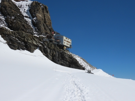 |
Monchsjochhutte
Position: 46°33.13’N, 8°0.27’E
The Monchsjochhutte, owned by the Swiss Alpine Club, hung off a cliff on the edge of Monch at 12,001 ft, (3,658 m). The hut is used for ascents of Monch, Jungfrau, and other mountains in the area.
|
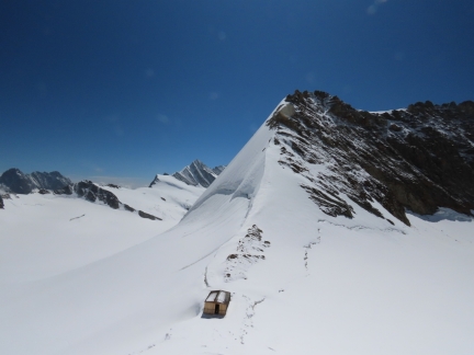 |
Trugberg
Position: 46°33.29’N, 8°0.36’E
Looking south to the 12,904 ft (3,933 m) mountain Trugberg. A group of explorers attempting to summit Jungfrau in 1841 initially thought this was their destination. After learning their error during the ascent, they named this mountain Trugberg, meaning Deceitful Mountain.
|
 |
Inside Monchsjochhutte
Position: 46°33.28’N, 8°0.36’E
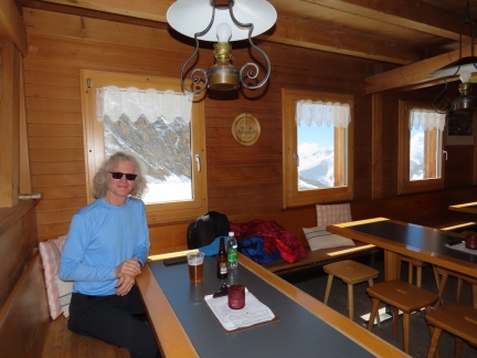
Enjoying a snack inside Monchsjochhutte with a view to Trugberg out the window. Our heart rates were surprisingly high given the hike was only 45 minutes and not very steep. The extreme altitude has a big impact.
|
 |
Hikers
Position: 46°33.29’N, 8°0.33’E
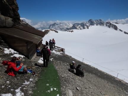
Several groups of hikers sitting outside Monchsjochhutte as we left to return to Jungfraujoch.
|
 |
Jungfraujoch Station
Position: 46°32.86’N, 7°58.88’E
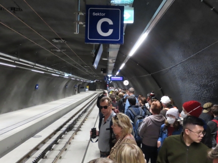
Crowds lining the platform at Jungfraujoch Station around 1:15pm, waiting to descend.
|
 |
Kleine Scheidegg
Position: 46°34.73’N, 7°58.07’E
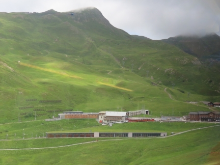
Train arriving into Kleine Scheidegg as we approach from Jungfraujoch. Rather than get off at Eigergletsher and return on the Eiger Express gondola the way we came, we continued to the end of the line at Kleine Scheidegg and will take a scenic train ride from there back to Lauterbrunnen. This is our seventh leg of the day.
|
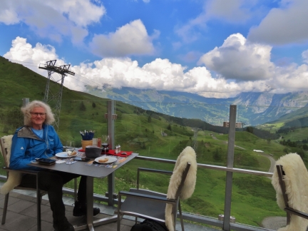 |
Restaurant Eigernordwand
Position: 46°35.19’N, 7°57.69’E
An enjoyable late lunch on the terrace at Restaurant Eigernordwand in Kleine Scheidegg before returning to Murren.
|
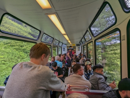 |
Train from Kleine Scheidegg
Position: 46°34.72’N, 7°57.43’E
On board the scenic train from Kleine Scheidegg to Lauterbrunnen. The platform at Kleine Scheidegg was super-crowded and we only barely got a seat together. This is our eighth leg of the day.
|
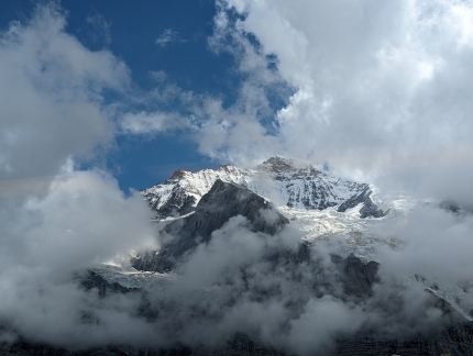 |
Jungfrau Northern Wall
Position: 46°34.52’N, 7°57.20’E
The fabulous view to the northern wall of Jungfrau as we descend from Kleine Scheidegg.
|
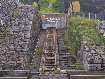 |
Funicular
Position: 46°35.92’N, 7°54.42’E
A section of the old funicular railway that ran from Lauterbrunnen to Grutschalp starting in 1891. The cable car we are riding replaced the funicular in 2006. This is our ninth leg of the day, and we have one more to go: the train from Grutschalp to Murren. We really enjoyed taking all the different modes of transport in the area.
|
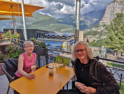 |
Hotel Eiger
Position: 46°33.82’N, 7°53.80’E
Happy Hour on the terrace at our hotel, the Hotel Eiger, with its fabulous mountain view.
|
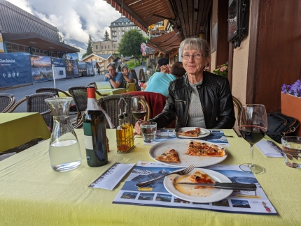 |
Eiger Guesthouse
Position: 46°33.84’N, 7°53.82’E
Another delicious dinner in Murren, this one at the Eiger Guesthouse near our hotel. The temperature was just warm enough to have our meal outside.
|
 |
Click the travel log icon on the left to see these locations on a map. And a map of our most recent log entries always is available at mvdirona.com/maps. |

If your comment doesn't show up right away, send us email and we'll dredge it out of the spam filter.