Trondheim is a beautiful waterside city with many excellent restaurants and attractions, including a rock music museum, the world’s only bicycle lift, the largest medieval building in Scandinavia, a 17th-century fort and the remains of a massive Nazi-built submarine pen. The city has made a real successful effort to be bicycle friendly and is a great place to explore by bike. We arrived into Trondheim about ten days before our trip to Seattle, and with unseasonably warm and sunny weather, spent much of that time enjoying the area by bike, tender and on foot.
Below are trip highlights from July 11th through 18th in Trondheim, Norway. Click any image for a larger view, or click the position to view the location on a map. And a live map of our current route and most recent log entries always is available at mvdirona.com/maps
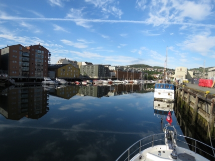 |
Vestre Kanalhavn
Position: 63°26.00’N, 10°23.29’E
A lovely calm setting for our first morning in Trondheim.
|
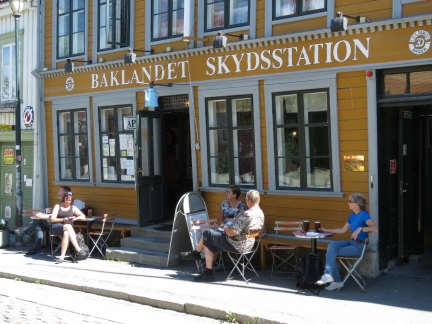 |
Baklandet Skydsstation
Position: 63°25.65’N, 10°24.19’E
We had a delicious lunch street-side at Lonely Planet-recommended Baklandet Skydsstation.
|
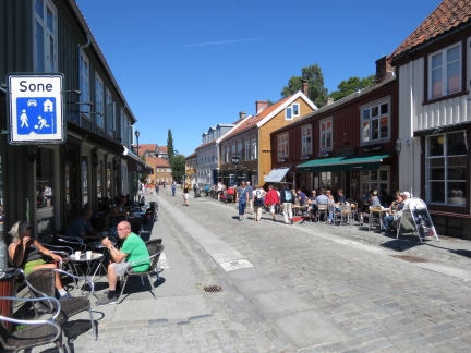 |
Nedre Bakklandet
Position: 63°25.68’N, 10°24.20’E
Everyone is out enjoying the sunny weather. This is looking north along Nedre Bakklandet.
|
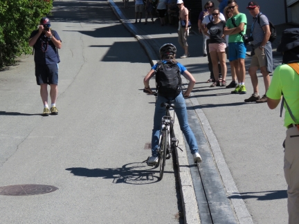 |
Bicycle Lift
Position: 63°25.68’N, 10°24.30’E
We were eager to try out Trondheim bicycle lift—the only one in the world and a popular tourist attraction. A rider puts their right foot against a small footplate and keeps their left foot on the pedal and the lift pushes them up the hill. (This video shows how it works: https://www.youtube.com/watch?v=7j1PgmMbug8.)
It looks easy, but is actually a little challenging. The narrow plate pushes with enough force that it’s hard to keep your foot against it. And Jennifer learned the hard way that if you let the plate get ahead of you, you’ll be pushed over. James had the same problem earlier in the ride, but gave up before getting knocked over. Neither of us had the strength to keep our foot on the plate the whole way up, but we had fun trying. |
 |
Kristiansten Fortress
Position: 63°25.58’N, 10°24.65’E
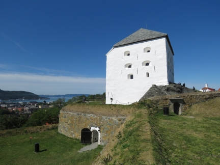
Kristiansten Fortress, built in 1681, is just up from the top of the bicycle lift. As with most forts, it has a great view of the area. This is looking northwest toward the harbor.
|
 |
Tyholttarnet
Position: 63°25.34’N, 10°25.91’E
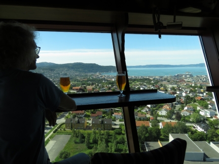
We took advantage of the beautiful clear day to bicycle up to Tyholttarnet, a 406-ft (124m) radio tower. It’s the tallest building in Norway and the observation deck has sweeping 360° views of the area.
|
 |
Mein Schiff 2
Position: 63°26.36’N, 10°24.08’E
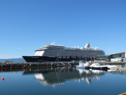
The 866 ft (264 m) cruise ship Mein Schiff 2, launched in 1997 for Celebrity Cruises, has a colorful history. Operating as the Celebrity Mercury in Seattle in 2006, US Coast Guard inspectors arrested the ship’s captain for intoxication. And in the Caribbean in 2010, 500 passengers were evacuated after a major outbreak of norovirus. In 2011, TUI Cruises purchased the ship from Celebrity Cruises.
|
 |
Leif Ericson
Position: 63°26.48’N, 10°24.12’E
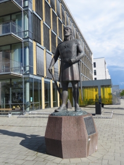
Trondheim was founded in 997 and was the Viking capital of Norway until 1217. According to legend, Leif Ericson sailed from Trondheim in the year 1000 on his historic voyage to reach North America. This statue of Ericson is an exact replica of the one standing in Shilshole Marina. The original statue was erected for the 1962 Seattle World’s Fair and in 1997 the Leif Ericson Society of Seattle gave a replica to Trondheim to honor the thousand-year anniversary of the city’s founding and Ercison’s epic journey.
|
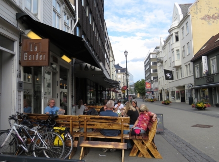 |
La Border
Position: 63°25.97’N, 10°23.90’E
A delicious Mexican dinner on the patio at La Border. Those are our bikes in the foreground.
|
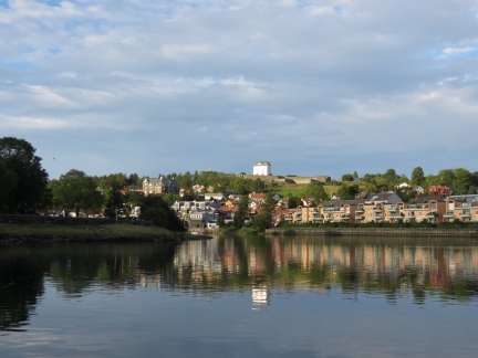 |
Nidelva River
Position: 63°25.48’N, 10°23.96’E
We took advantage of the high tide to see how far up the Nidelva River we could get. The water got too shallow before the big hairpin turn in the river, but we had a nice run. This is the view to Kristiansten Fortress as we return.
|
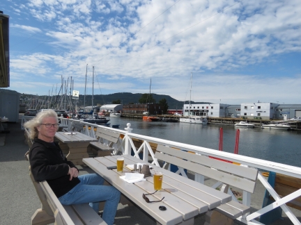 |
Ravnkloa Fish Market
Position: 63°26.04’N, 10°23.54’E
Lunch at Ravnkloa Fish Market overlooking the canal. Dirona is just visible directly below the parking sign (click image for a larger view).
|
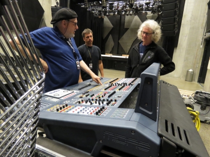 |
Sound Stage
Position: 63°26.32’N, 10°24.11’E
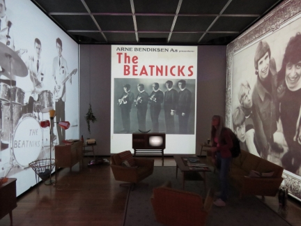
Just after entering Rockheim, Trondheim’s rock music museum, we noticed some people working on a sound board in a small sound stage near the back of the facility. They were a professional sound crew that work for the museum, but also support bands such as Norway’s TNT. The crew were super-receptive to our questions—they spent nearly an hour showing us through the sound stage and describing the equipment. The museum overall was excellent, but this informal section was by far the best. We learned a lot and really enjoyed the discussion.
|
 |
Rockheim
Position: 63°26.33’N, 10°24.10’E
Rockheim (‘Home of Rock’) is an excellent museum devoted to pop and rock music. The focus is on Norwegian bands, but the interactive displays are so interesting that not knowing most of the bands wasn’t a problem. We had a great time and stayed right until closing time.
|
 |
Den Gode Nabo
Position: 63°25.67’N, 10°24.12’E
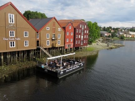
Dinner along the Nidelva River at Den Gode Nabo’s (‘The Good Neighbour’) floating pontoon. James is seated in the far right corner.
|
 |
King Olav Tryggvason
Position: 63°25.92’N, 10°23.80’E
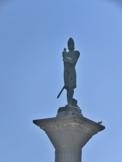
Statue in downtown Trondheim of King Olav Tryggvason, ruler of Norway from 995 to 1000. He founded Trondheim in 997.
|
 |
Tram
Position: 63°25.86’N, 10°23.42’E
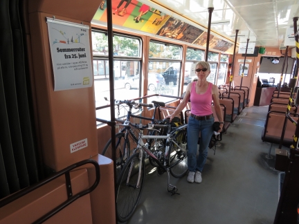
Riding the Grakallbanen tram up to Lian, in the hills southwest of Trondheim. Then we’ll cycle back down. The line was built in 1924 and is the world’s northernmost tramway.
|
 |
View
Position: 63°24.20’N, 10°22.89’E
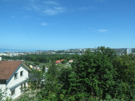
There are excellent views back to to Trondheim as the tram climbs up to Lian. Trondheim is the third-largest city in Norway and riding the tram through the mostly residential areas gave us a feel for the size of the city.
|
 |
Lianvannet
Position: 63°24.15’N, 10°18.65’E
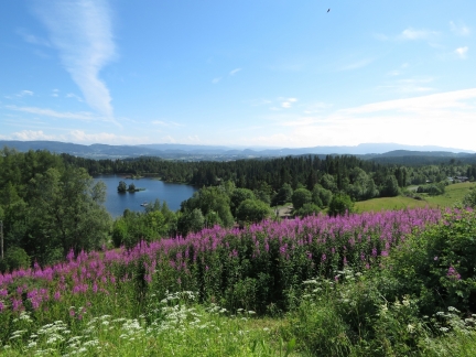
The view from a hilltop at the end of the Grakallbanen line over Lianvannet, a popular swimming lake
|
 |
Trail
Position: 63°24.43’N, 10°19.40’E
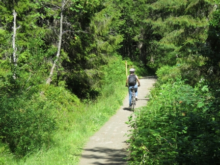
On the way back down we followed several beautiful recreation trails that likely double as cross-country ski trails in the winter.
|
 |
Tramway Museum
Position: 63°23.88’N, 10°21.51’E
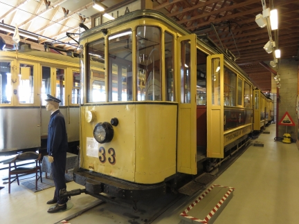
We arrived at the Tramway Museum just before it closed for the day, but had enough time for a quick tour. The museum includes many heritage trams and details the history of the tramway, including the protests in the 1980s when the city council decided to shut the line down.
|
 |
Havstein
Position: 63°24.44’N, 10°22.52’E
The excellent view to Trondheim from Havstein, directly south of downtown. Our berth is about one third of the way from the left and the radio tower Tyholttarnet is prominent on the right.
|
 |
Folkemuseum
Position: 63°25.20’N, 10°21.36’E
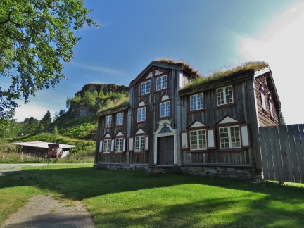
The Sverresborg Trondelag Folkemuseum includes artifacts and period buildings from the past 150 years. This 1800s miner’s residence was relocated to the museum from the nearby old mining town of Roros. In the background are the hilltop ruins of Sverre Castle, built in the 1100s, with great views over the area.
|
 |
Verthuset Tavern
Position: 63°25.32’N, 10°21.44’E
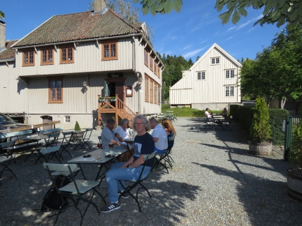
Verthuset Tavern was built in 1739 and transported piece-by-piece to the Sverresborg Trondelag Folkemuseum.
|
 |
Training
Position: 63°25.32’N, 10°21.44’E
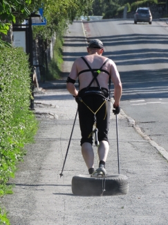
While we relaxed in the shade at Verthuset Tavern, this man passed dragging a tire full of rocks up a hill in training for cross-country skiing. Just watching him made us thirsty. :)
|
 |
Trondheim Microbryggeri
Position: 63°25.89’N, 10°23.57’E
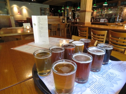
A delicious tasting flight of a few ounces of every beer made at Trondheim Microbryggeri.
|
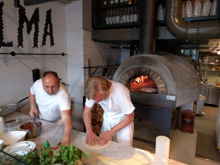 |
Selma
Position: 63°26.07’N, 10°24.72’E
We’ve taken a real liking to a beer and a delicious wood-fired pizza on the outdoor patio at Selma.
|
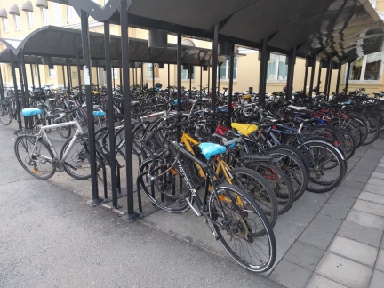 |
Bicycles
Position: 63°26.16’N, 10°23.92’E
Loads of bicycles at the Trondheim train station.
|
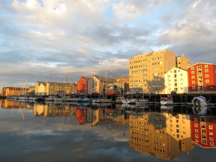 |
Reflections
Position: 63°26.00’N, 10°23.29’E
The evening sun reflecting into the canal, viewed from the boat deck. The period of summer, 24×7 sun in Trondheim is just past now—it’s just after 10:30pm and the sun will actually set for an hour or two.
|
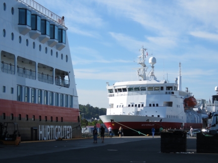 |
Hurtigrutens
Position: 63°26.62’N, 10°24.42’E
Trondheim is one of several cities along their route where the Hurtigruten ferry stops overlap. We often hear the boats arriving in the morning when they sound their horns and rode the bikes over today to have a look.
|
 |
Ladder
Position: 63°26.00’N, 10°23.30’E
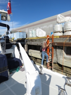
This is how we get on and off the boat tied to the fixed pier. Sometimes the tide is high enough that we can just stop onto the boat deck, but mostly we use the ladder.
|
 |
Munkholmen
Position: 63°27.02’N, 10°22.97’E
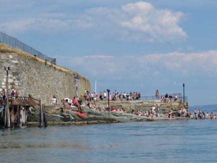
We ran the tender over to Munkholmen, a small island just off the Trondheim waterfront. Ferries run regularly during the summer from the canal where we are moored, and the beach there is exceedingly popular.
|
 |
Munkholmen Fort
Position: 63°27.07’N, 10°22.99’E
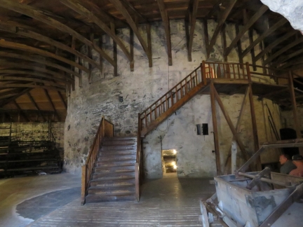
The Vikings used the island of Munkholmen as an execution grounds, and a monastery was later built there in the 12th century. The current building was constructed in 1658 as a fort and re-purposed as a prison. When the Nazis occupied Norway, they established an an anti-aircraft base here.
|
 |
DORA
Position: 63°26.42’N, 10°25.23’E
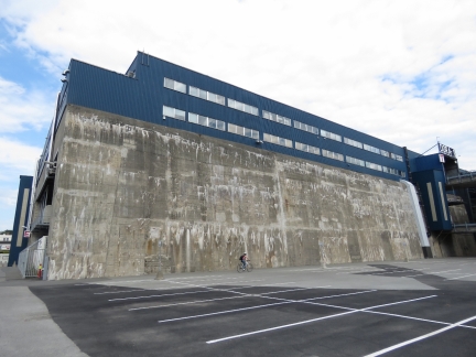
After visiting Munkholmen, we came back to the boat and set out on the bikes for a ride along the Lade Trail. Here Jennifer is cycling along the shorter side of DORA, a massive submarine pen the Germans built in World War II. The building is 500ft (153m) long and 345ft (105m) wide with a reinforced concrete roof that is 12ft (3.7m) thick and walls that are 8.2ft (2.5m) thick. Seven submarines can actually drive inside the building to be serviced. DORA looks huge, but is even larger below ground level than above.
|
 |
Lade Trail
Position: 63°27.10’N, 10°26.22’E
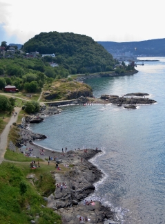
The view back south from a viewpoint along the Lade Trail that rings the Lade Peninsula. The trail is steep in places, and more suitable for mountain bikes, but we did fine for the most part in our Giant Hybrid bikes.
|
 |
Ladekaia
Position: 63°27.42’N, 10°26.82’E
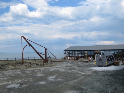
The restaurant Ladekaia is perched halfway along the Lade Trail with an excellent water view.
|
 |
Tesla
Position: 63°26.47’N, 10°27.48’E
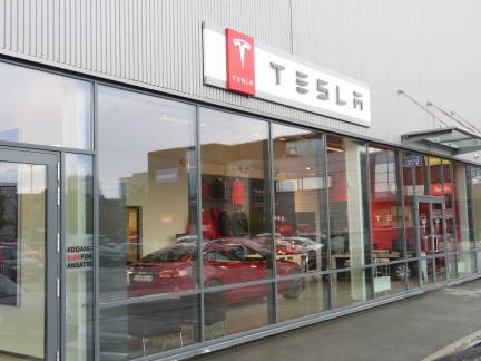
Norway is the world leader in electric cars, with more than half of new cars sold being electric or hybrid. Tesla is currently the most popular automaker in Norway— we’ve seen more Teslas here than anywhere else.
|
 |
E.C. Dahls
Position: 63°26.51’N, 10°25.65’E
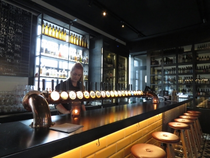
We ended the day with dinner at the E.C. Dahls brewpub. The prices here weren’t notably more expensive than the rest of Norway, but when our credit card company app notified us that we’d just spent $42 we realized that the beers were $21USD per pint.
|
 |
Kalas and Canasta
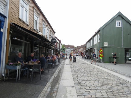
Position: 63°25.70’N, 10°24.19’E
A delicious lunch street-side at Kalas and Canasta on Nedre Bakklandet. As part of Trondheim’s successful effort to be bicycle-friendly, the city has installed flat paving stones at the edges of the cobblestone roads to give cyclists a smoother ride.
|
 |
Nidaros Cathedral
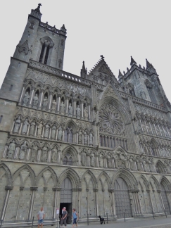
Position: 63°25.62’N, 10°23.72’E
The spectacular and ornate west wall of Nidaros Cathedral, the largest medieval building in Scandinavia. Construction of the cathedral began in 1153 and much of what stands was completed by the 14th century. The nave is a 19th-century reconstruction following several destructive fires. We were hoping to climb the tower for views over the city, but access was closed due to thunderstorms.
|
 |
Crown Jewels
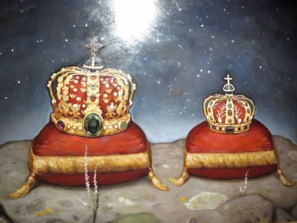
Position: 63°25.55’N, 10°23.75’E
Norway’s Crown Jewels are kept at the 12th-century Archbishop’s palace adjacent to Nidaros Cathedral. Picture-taking isn’t allowed, so we took a photo of a painting instead.
|
 |
Archbishop’s Museum
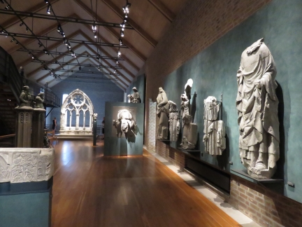
Position: 63°25.55’N, 10°23.79’E
The interesting Archbishop’s Museum contains many artifacts from Nidaros Cathedral, and in the basement displays archaeological findings made during the museum’s construction.
|

|
Click the travel log icon on the left to see these locations on a map, with the complete log of our cruise.
On the map page, clicking on a camera or text icon will display a picture and/or log entry for that location, and clicking on the smaller icons along the route will display latitude, longitude and other navigation data for that location. And a live map of our current route and most recent log entries always is available at mvdirona.com/maps. |

Thanks for the latest update James, I have really been enjoying your travels. It made me go back and watch your Youtube video on Dirona’s systems because of how you stressed automation is so cruical for your successful voyages. I can guess from your narrative about the troubles people have with using the bicycle lift why all those people are standing there watching and waiting. Looking forward to seeing where you and Jennifer go next!
Hi Stewart. Many people do use the lift successfully so better style than ours coupled with a stronger right leg can work. I got an applause for giving up on the lift and just pedaling my way up :-).
Love your report on Norway! I knew they have pushed electric cars & other vehicles more than anyone else . You know my bias for electrically assisted bikes…wouldn’t even need to use that contraption in Trondheim . Now you got me all wound up to get up there with my e-bike and race one of the users up the hill! ;)
For sure, you would win Jacques using your ebike up against the bicycle lift. After failing to get far on the lift, I just peddled up and I wasn’t going much slower.