We reached the mouth of the River Mersey late in the afternoon of October 30th, 2017 following an easy 150-mile overnight run from Belfast. Night fell as we ran the last 15 miles upriver to Liverpool, and it was completely dark when we reached the city.
The River Mersey has a tidal range of 33ft (10m) on spring tides, the second highest in Britain after the River Severn. The banks dry at low tide, so most of the Liverpool docks are behind locks. With our draft, the earliest we could enter Brunswick Lock to reach Liverpool Marina is with 22ft (6.7m) of tide. This unfortunately was well after dark at 5:45pm, not the ideal time to be approaching an unfamiliar area and entering a lock. But we didn’t have much choice unless we waited until the next morning. The weather would have been worse for the crossing from Belfast if we did that, so we opted for a night entry instead.
With so many lights ashore, Brunswick Lock was hard to even find in the shore-side clutter of light until we were quite close. As we neared, the strongly-lit locks became visible over the lights of the city behind. The Brunswick Lock gate is 8m wide, so we can easily fit our 5m beam through with a meter and a half, or five feet, to spare on each side. But it sure looked tight as we approached.
The video below shows footage from our run up the Mersey River and the night entry to Liverpool Marina through Brunswick Lock. Following are additional photographs and commentary from the overnight run from Belfast to Liverpool on Oct 29th through 30th, 2017. Click any image for a larger view, or click the position to view the location on a map. And a live map of our current route and most recent log entries always is available at http://mvdirona.com/maps
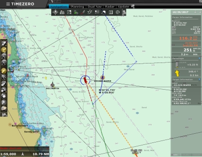 |
Golden Reaper
Position: -5 26.38, 54 38.49
Around 11:30pm, two hours out of Belfast, we made a course adjustment to avoid the fishing vessel Golden Reaper who was crossing our path on a near-collision course. We aim for a two-mile CPA (Closest Point of Approach) from other vessels at night, but the traffic in busier areas often makes it difficult to find two free nautical miles. Here we barely achieved one nautical mile (see bottom of right column). Most fishermen will give you room to work, especially at night, but not all.
|
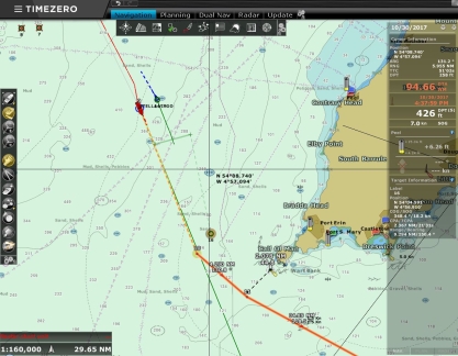 |
Calf of Man
Position: -5 9.72, 54 19.12
We saw a fair bit of traffic rounding the Calf of Man off the southwest tip of the Isle of Man. Here we are passing Tella Virgo with about one-mile separation and have an ARPA target approaching with a two-mile CPA. We continue to be impressed with the new CPA bars of our TimeZero chart-plotter.
If we had a few more days, we would have stopped at the Isle of Man, but we wanted to reach Liverpool by October 30th to make a trip to Manchester. |
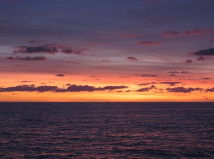 |
Dawn
Position: -4 32.70, 53 54.51
Conditions have been ultra-calm on this run from Belfast to Liverpool, with hardly any wind at all. The seas remain calm at dawn.
|
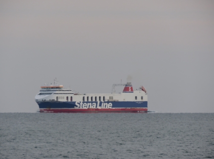 |
Stena
Position: -4 14.67, 53 48.46
One of several Stena ferries we passed on the run between Belfast and Liverpool.
|
 |
Burbo Bank Extension
Position: -3 43.23, 53 39.00
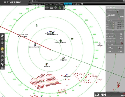
All those radar targets at the bottom of the screen are the windmills in the Burbo Bank Extension. The 258MW extension was completed this year, nearly quadrupling the output of the original farm from 90MW to 348 MW.
|
 |
Sea Titus
Position: -3 42.30, 53 38.75
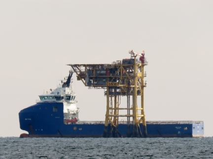
Offshore supply vessel Sea Titus at an oil rig near the Burbo Bank Wind Farm.
|
 |
Skyline
Position: -3 37.86, 53 37.52
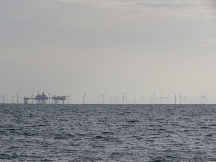
Wind mills and oil rigs to our south as we near the mouth of the Mersey River.
|
 |
Slow
Position: -3 29.89, 53 35.34
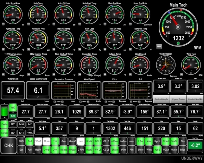
The lock at the entry to Liverpool Marina requires 21ft of tide to open, so we can only enter about two hours on either side of high tide. We have been running at about 6 kts on this passage from Belfast to avoid arriving too early.
|
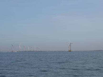 |
Burbo Bank
Position: -3 15.61, 53 31.40
Windmills in the original 90 MW Burbo Bank wind farm, built in 2007.
|
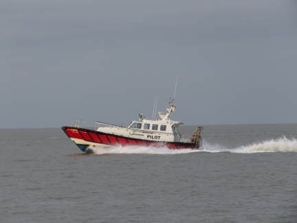 |
Pilot
Position: -3 10.88, 53 31.53
Pilot boat exiting the Mersey River.
|
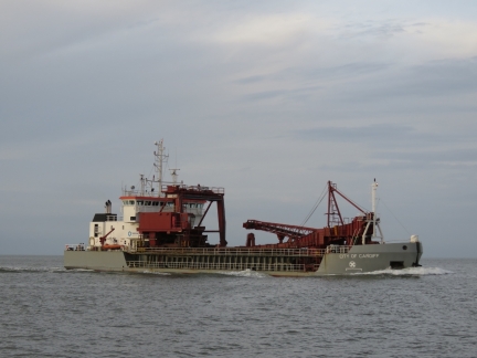 |
City of Cardiff
Position: -3 8.33, 53 31.59
We’re seeing lots of traffic as we enter the Mersey River. The dredger City of Cardiff passed heading inbound.
|
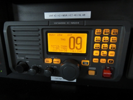 |
Channel 37
Position: -3 5.92, 53 29.94
We need to pass through the Brunswick Lock to reach our destination, the Liverpool Marina. As we approached, we got ready to radio the lock keeper on channel 37 according to their published procedures. It turns out we don’t have channel 37 on our primary Icom MC-604 radios. Of course they do have US, CAN, and INTL frequency choices but none have channel 37. We checked our Standard Horizon and ICOM hand-held VHFs and they don’t support channel 37 either. We did some research and found that the UK uses channel M (157.850Mhz also called 37), and channel M2, (161.425Mhz also called P1 or P4) for marinas, yacht clubs and pleasure craft. But radios not sold into the UK market don’t support this frequency. In fact, a good many that are sold into the UK market don’t support channel 37 either. This frequency seems like a rather unfortunate choice given they are an international port, but little could be done and we needed to come up with a way to contact the lock keeper.
We tried reaching the lock keeper on VHF 16, 13, and 12, the Mersey River Vessel Traffic Frequency, without success. We eventually contacted Mersey Vessel Traffic Services and they got a couple of phone numbers for us. While doing that, the skipper of a commercial vessel that was just entering the Brunswick Lock contacted us and offered to relay to the dock keeper on our behalf. Once we arrived, they told the lock keeper we were ready to enter. The keeper opened the gates and gave us three green lights to enter. When we left a week later, the marina contacted the lock on our behalf, as the lock keeper could only be reached on 37, not by phone. So we managed to make the two way trip without much complexity and appreciated the local help. |
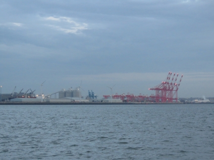 |
Port of Liverpool
Position: -3 3.82, 53 28.11
The Port of Liverpool once was the main terminus for trans-Atlantic traffic between the UK and North America. This dwindled in the 20th-century with the introduction of containerization but has since improved with the construction of a new port in the 1960s that currently handles about a quarter of all container traffic between the UK and USA. The five huge red Megamax cranes visible at the right of the picture dwarf the adjacent cranes and are part of a recent deep-water shipping port project that will increase the capacity of ships that can be handled from those carrying 3,500 containers to 13,500.
|
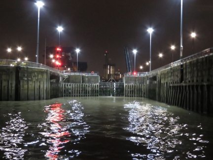 |
Brunswick Lock
Position: -2 59.07, 53 23.14
With a tidal range of 32.8 ft (10 m) on spring tides, the River Mersey has the second highest tidal range in Britain after the River Severn. The Mersey River banks dry at low tide, so most of the commercial docks are behind locks. In 1715, the world’s first enclosed commercial dock was built in Liverpool and additional docks and locks were constructed over the subsequent centuries. Even the new port built is behind a lock, which had the largest gates in the world when completed in 1971. As we approached, Mersey Vessel Traffic was announcing the “Ships Movement”, listing the name and time that each ship would passing through a given lock.
The original docks and locks are too small for most commercial shipping vessels and now are used mainly for pleasure craft and smaller commercial boats. Our destination, Liverpool Marina, is in an old commercial basin accessed through Brunswick Lock. With our draft, the earliest we could enter the lock is with 22ft of tide, which unfortunately was well after dark at 5:45pm. Not the ideal time to be approaching an unfamiliar area and entering a lock, but we didn’t have much choice unless we waited until tomorrow morning. The weather would have been worse for the crossing from Belfast if we did that, so we opted for a night entry instead. Fortunately the lock is well-lit and wasn’t difficult to enter at night. |
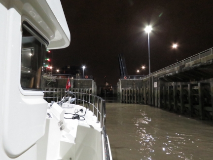 |
Gate Open
Position: -2 59.06, 53 23.15
A couple of boats locked through before we did, then the outer gates opened for us. At 8m wide the Brunswick Lock gate we can easily fit our 5m beam through, but it sure looks tight as we approach.
|
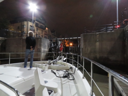 |
Inside the Lock
Position: -2 59.04, 53 23.22
Here we are, rising up inside the Brunswick Lock with the bow facing the inner gate. Interestingly, the Brunswick Lock itself is much wider that the gates, presumably to allow multiple ships to transit together. One other unusual feature is that the lock has a floating dock with standard cleats, just visible on the right, so we don’t need to tend dock lines as the water level changes.
|
 |
Rising
Position: -2 59.04, 53 23.22
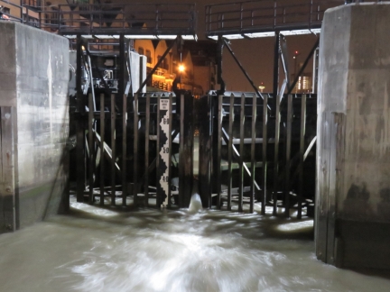
The Brunswick Lock keepers move boats through efficiently. The inner gates opened while the lock water level was still several feet below that of the inner dock and water poured in.
|
 |
Liverpool Marina
Position: -2 59.10, 53 23.44
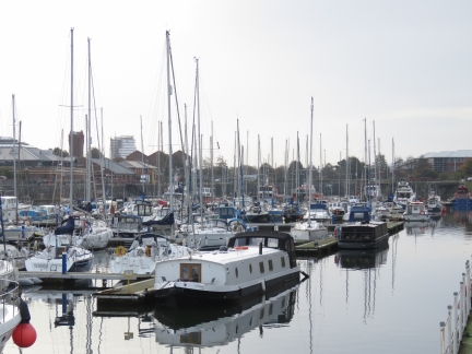
Looking across Liverpool Marina the morning after we arrived. Dirona‘s stack, with grey domes and a red British courtesy flag, is visible at the left of the picture and the lock is just out of the picture on the right. This is the first time we’ve been docked with canal boats—some of the privately-owned ones here are very nicely done. From here canal boats can access the 127m (204km), 91-lock Leeds and Liverpool Canal without leaving the protected lock system or entering the River Mersey.
|

|
Click the travel log icon on the left to see these locations on a map, with the complete log of our cruise.
On the map page, clicking on a camera or text icon will display a picture and/or log entry for that location, and clicking on the smaller icons along the route will display latitude, longitude and other navigation data for that location. And a live map of our current route and most recent log entries always is available at http://mvdirona.com/maps. |

If your comment doesn't show up right away, send us email and we'll dredge it out of the spam filter.