Iceland, “The Land of Fire and Ice”, is a geological wonder. The island nation lies atop the Mid-Atlantic Ridge between the North American and Eurasian tectonic plates and, as the plates move apart, magma from the earth’s core reaches the surface through thirty volcanic systems across the island. The magma also heats vast underground water reserves, producing dramatic geysers and geothermal energy. That’s the “fire” part of Iceland’s moniker. The “ice” refers to the country’s hundreds of glaciers, some atop live volcanoes. When these glacial volcanoes erupt, the resulting iceberg-filled floods can be devastating. On their own, the glaciers are a majestic sight as they flow through rugged mountain ranges, sometimes calving into the sea. And where they don’t reach the land’s edge, the glacial meltwater produces many spectacular waterfalls.
We recently spent four nights in Iceland prior to a cruise of Greenland’s east coast. We relaxed after our flight in the wonderfully decadent and exclusive Retreat Spa within Iceland’s famous Blue Lagoon, where patrons soak in geothermally-heated seawater that is rich in silica, algae, and minerals. We experienced first-hand the island’s recent volcanic activity as we drove past steaming, freshly lava fields, and had to make a lengthy detour when overnight lava flows blocked the road we’d arrived on.
Over the next two days, we visited the highlights on the Golden Circle scenic route, where we walked through the Mid-Atlantic Ridge at Thingvellir National Park, watched the sensational Stokkur Geysir erupt in the Geysir Geothermal Area, and viewed the stupendous Gullfoss Waterfall, pictured above.
Below are highlights from June 6th through 8th, 2024. Click any image for a larger view, or click the position to view the location on a map. And a map with our most recent log entries always is available at mvdirona.com/maps.
 |
Packing
Position: 47°36.99’N, -122°20.58’W
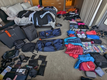
All our gear and clothes laid out for our upcoming 14-night Greenland cruise. We’ll be traveling again on Le Commandant Charcot and need everything from polar gear to formal wear, plus we’ll be spending a few days before the cruise exploring Iceland. Most will fit in the two extra-large LL Bean rolling duffles at center and a Travelpro rolling garment bag at far left. And we’ll carry on valuables such as camera gear in the Travelpro carry-on to the right of the garment bag.
|
 |
Sea-Tac
Position: 47°26.53’N, -122°18.05’W
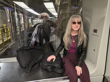
Riding the underground inter-terminal train at Sea-Tac airport en route to an 11pm flight with Iceland Air directly to Reykjavik. We’re wearing sunglasses to adjust our circadian rhythm to help avoid jet lag and quickly adapt to the seven-hour time difference with Iceland.
|
 |
Mt. Rainier from SeaTac
Position: 47°26.32’N, -122°18.13’W
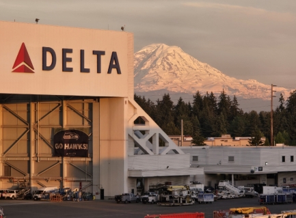
The evening sun lighting Mt. Rainier (“The Mountain”) beyond a Delta maintenance building, viewed from the Iceland Air lounge while we wait for our flight to Reykjavik.
|
 |
Iceland Air Arriving
Position: 47°26.32’N, -122°18.13’W
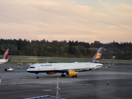
Our Iceland Air plane arriving from Reykjavik. It will be on the ground for about two hours before departing on the return flight with us aboard.
|
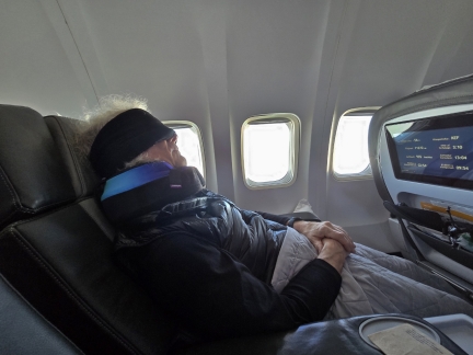 |
Sleeping En Route to Iceland
Position: 60°41.48’N, -94°51.29’W
Iceland Air is the only airline with direct flights between Seattle and Reykjavik, but their business class doesn’t have lie-flat seats. The alternatives involve hours more travel time with a connection. The direct flight won out, and to help us sleep we tried Cabeau neck pillows. They provide both neck and chin support and were quite effective. And they roll up into a compact storage bag when not in use. For a sleeping mask, we quite like the FRESHME Cotton Sleep Blackout Mask.
|
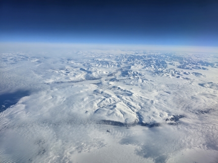 |
Greenland
Position: 60°41.48’N, -94°51.29’W
Flying over the glacier-covered interior of Greenland en route to Iceland.
|
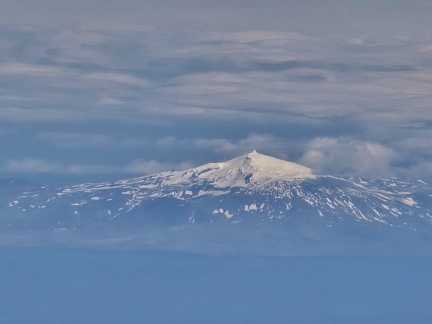 |
Snaefellsjokull, Iceland
Position: 64°11.66’N, -25°11.78’W
4,744 ft (1,446 m) Snfellsjokull in Snfellsjokull National Park on the Snaefellsnes peninsula in western Iceland. The mountain was made famous in Jules Vernes’ 1864 novel, Journey to the Center of the Earth as the location of the passage leading to the center of the earth.
|
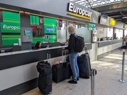 |
Europcar, Iceland
Position: 63°59.80’N, -22°37.37’W
Picking up our car from Europcar at Reykjavik–Keflavík Airport in Iceland. We’ll be touring the country for a few days before departing on our cruise to Greenland.
|
 |
Checkpoint
Position: 63°56.73’N, -22°25.71’W
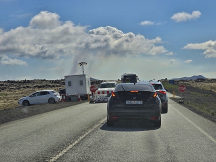
Our first stop in Iceland is the Blue Lagoon geothermal spa, where we’ll be spending a night before exploring further. Due to recent volcanic activity, Route 43 is closed to all except those heading to the Blue Lagoon, with checkpoints to ensure compliance.
|
 |
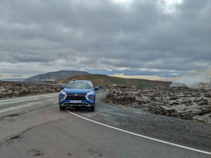
Lava Flows
Position: 63°53.27’N, -22°25.22’W
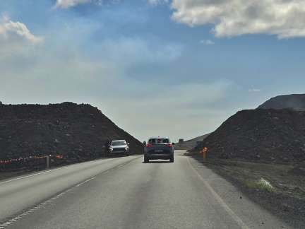
Route 43 cutting through the path of a lava flow. Evidence of recent volcanic activity is everywhere, with the ground steaming as we drive past.
|
 |
Silica Hotel
Position: 63°52.90’N, -22°26.55’W
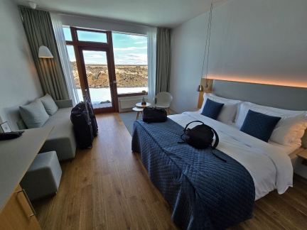
Our room for the night at the Silica Hotel in Iceland’s Blue Lagoon geothermal spa.
|
 |
Terrace
Position: 63°52.90’N, -22°26.55’W
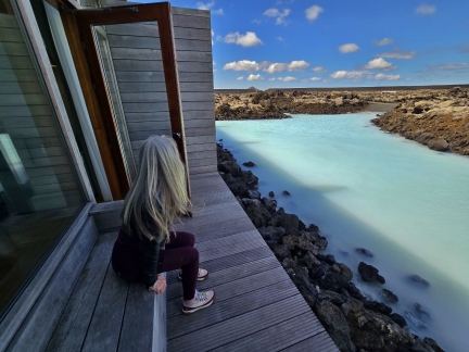
Taking in the view to the mineral-rich waters surrounding the building from the terrace of our room in the Silica Hotel.
|
 |
Blue Lagoon
Position: 63°52.77’N, -22°26.94’W
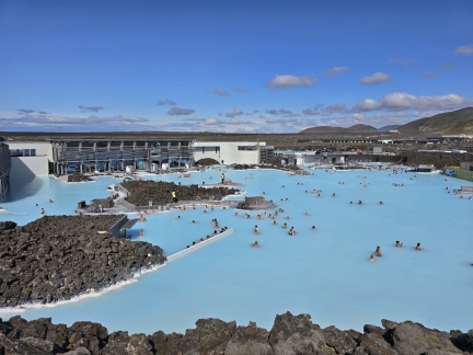
Blue Lagoon is famous for its geothermally-heated seawater that is rich in silica, algae, and minerals. It is a popular destination and can get quite busy during the height of the tourist season. The Silica Hotel where we are staying is visible in the distance on the right, and the main restraurants are on the left.
|
 |
Dressing Room
Position: 63°52.79’N, -22°27.07’W
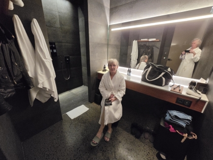
The Retreat Spa is a luxury “spa-within-a-spa” at Blue Lagoon, with more amenities and much fewer people. Here we are getting changed in our private dressing room that is ours for the duration of our spa visit.
|
 |
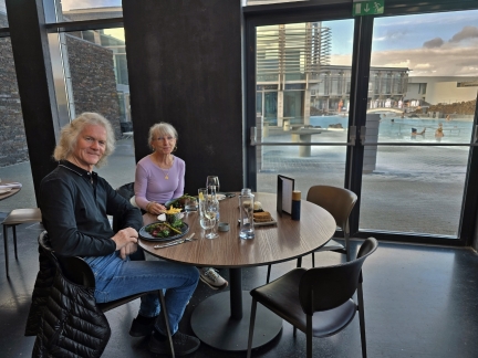
Lunch
Position: 63°52.78’N, -22°27.02’W
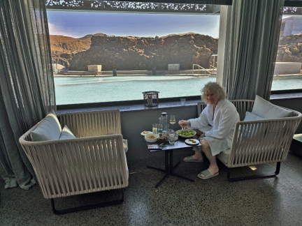
Enjoying a light lunch at the Retreat Spa, with the Retreat Lagoon in the background.
|
 |
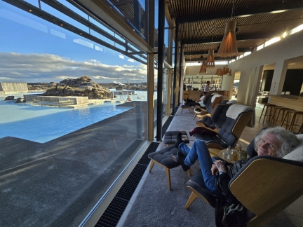
Nests
Position: 63°52.76’N, -22°26.98’W
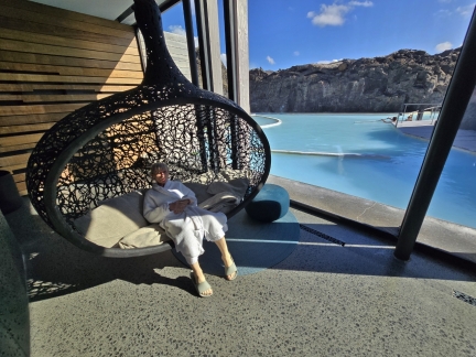
Relaxing in the hanging nests between soakings in the Retreat Lagoon and spending time in the sauna. We’re not really spa-goers, but found it a wonderfully relaxing way to spend the afternoon after our international flight.
|
 |
Lava Restaurant
Position: 63°52.79’N, -22°26.96’W
After our visit to the Retreat Spa, we had an excellent meal at the Lava Restaurant overlooking Blue Lagoon.
|
 |
Silica Hotel Lounge, Blue Lagoon
Position: 63°52.85’N, -22°26.52’W
Taking in the view to the Silica Lagoon from the hotel bar. We’re having a very chill day.
|
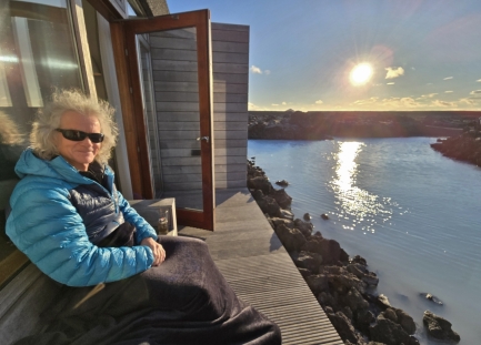 |
Evening Light
Position: 63°52.90’N, -22°26.56’W
Bundled up to enjoy the 9:20pm bright evening light from the terrace of our room at the Silica Hotel in Blue Lagoon. It’s early June, but with the wind blowing the temperature is quite chilly.
|
 |
Road Closed
Position: 63°52.93’N, -22°26.45’W
Our intention on departing Blue Lagoon was to retrace yesterday’s route along Route 43 north to Route 41 and then onto Thingvellir National Park. But Route 43 had closed due to fresh lava flow covering the road, so we had to make a fairly lengthy detour south and west past the town of Grinkavik.
|
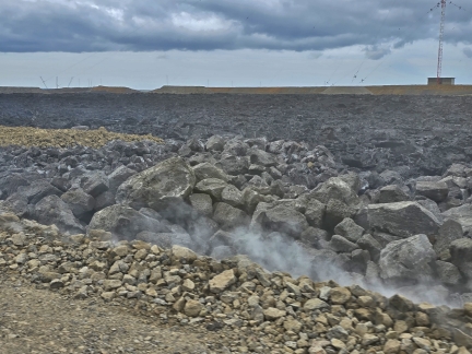 |
Fresh Lava
Position: 63°51.16’N, -22°26.62’W
All along the route, the sides of the road were steaming due to recent lava flow.
|
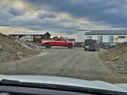 |
Grindavik
Position: 63°51.02’N, -22°26.42’W
The entire town of Grinkdavik was evacuated in November of 2023 due to seismic activity. After two eruptions, one that destroyed some buildings in town, residents were allowed to return in Februrary of this year, but were evacuated again in March and remain so. Our detour route, due to lava flow on Route 43, takes us through the outskirts of Grinkdavik, but the red search-and-rescue truck on the left is blocking any access to to town.
|
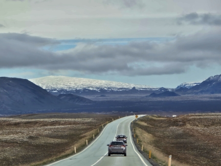 |
Skjaldbreiour Volcano
Position: 64°12.97’N, -21°14.65’W
A first taste of the fabulous Iceland mountain scenery we’ll be enjoying over the next few days as we head north from Blue Lagoon on Route 36 towards Thingvellir National Park. Visible in the distance is 3,497-ft (1,066 m) Skjaldbreiour, the second largest shield (broad, gently sloping) volcano in Iceland.
|
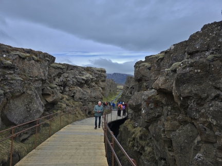 |
Almannagja Gorge
Position: 64°15.35’N, -21°7.70’W
At Almannagja Gorge in Thingvellir National Park, our first stop on Iceland’s Golden Circle scenic route. The gorge lies on the Mid-Atlantic Ridge that separates the North American (left) and Eurasian (right) tectonic plates, and is a marvel of geology. Fans of the television series Game of Thrones might recognize Almannagja as the filming location for the Bloody Gates.
|
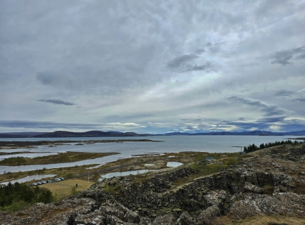 |
Thingvallavatn Lake
Position: 64°15.32’N, -21°7.69’W
View to Thingvallavatn Lake, a rift valley lake in Thingvellir National Park. With a surface area of 32 sq mil (84 km2), the lake is the largest in Iceland.
|
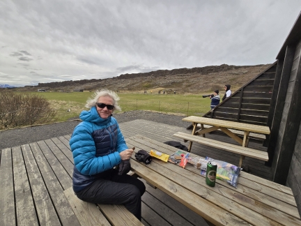 |
Picnic Lunch
Position: 64°15.89’N, -21°6.89’W
Enjoying a picnic lunch on a cool and windy day in Thingvellir National Park.
|
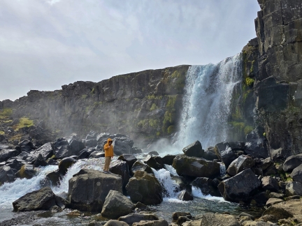 |
Öxarárfoss Waterfall
Position: 64°15.95’N, -21°7.03’W
Dramatic Öxarárfoss Waterfall in Thingvellir National Park drops 44 ft (13 m) over the North American side of Almannagja Gorge.
|
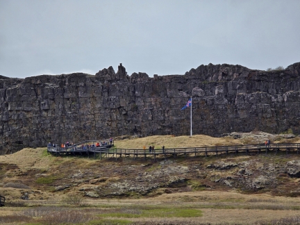 |
Place of Parliament Assembly
Position: 64°15.58’N, -21°7.07’W
Thingvellir National Park is famous not just for the Mid-Atlantic RidgeMid-Atlantic Ridge, but also for being the site of Iceland’s annual parliament from 930 through 1798 AD. The Icelandic flag marks the site of the meeting place.
|
 |
Mountain View
Position: 64°15.51’N, -21°7.01’W
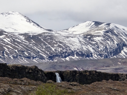
The view northwards to Öxarárfoss Waterfall in Thingvellir National Park, with the mountains Botnssulur (left) and Sulnaberg rising beyond.
|
 |
Tour Bus
Position: 64°15.33’N, -21°7.92’W
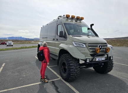
Highly capable offroad vehicles, with the ability to automatically adjust tire pressure, are common in Iceland. This one is a tour bus custom-built by former national rally champion Rally Palli.
|
 |
Gullfoss Waterfall
Position: 64°19.57’N, -20°7.46’W
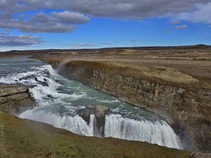
The stupendous Gullfoss Waterfall (translates to Golden Falls) is the namesake of the Golden Circle scenic route. The falls, dropping 104 ft (32m) in two levels, are one of the most popular to visit in Iceland. For scale, note the people standing at left (click image for a larger view).
|
 |
Geysir Hotel
Position: 64°18.60’N, -20°17.96’W
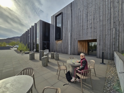
Enjoying a drink on the patio at the Geysir Hotel, where we will be spending the night before continuing on our Golden Circle tour tomorrow.
|
 |
Glíma
Position: 64°18.59’N, -20°18.02’W
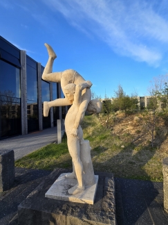
A statue at the Geysir Hotel of participants in Glíma, a form of wrestling that is the national sport of Iceland. The hotel is run by descendants of a famous wrestler who operated a sports school, and features much sporting memorabilia throughout the property.
|
 |
Stokkur Geysir, Iceland
Position: 64°18.76’N, -20°18.07’W
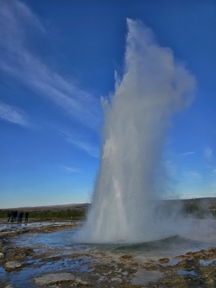
The spectacular Stokkur Geysir in the Geysir Geothermal Area across the road from the Geysir Hotel where we are staying. Strokkur erupts every five to ten minutes and shoots a column of water 50-65ft (15-20m) in the air, and sometimes as high as 130ft (40m). We spent ages watching it repeatedly erupt.
|

|
Click the travel log icon on the left to see these locations on a map. And a map of our most recent log entries always is available at mvdirona.com/maps. |

I noticed once again you use LLBean duffels when traveling. I like soft-sided bags also, especially on cruise ships so you can cram them under a bed, but for some reason I’ve never taken to LL Bean duffels. When I looked at them (years ago) they did not have sufficient pockets on the exterior or interior. I prefer lots of contained spaces in luggage bags.
Good observation John. We agree big bags need some way to be organized rather than just one large space. We initially liked this feature for moving large numbers of boat parts and consumables between North America and wherever we happened to be at the time. Big and open was a feature. We now have three modes of operation: 1) when we can fit in carry on luggage, we do that with Travelpro Maxlite 5 (https://www.amazon.com/dp/B07BL7JXHV?ref=ppx_yo2ov_dt_b_fed_asin_title&th=1), 2) when needing more space we go with Travelpro Platinum Elite Softside Expandable Checked Luggage (https://www.amazon.com/dp/B01MG6GKF3?ref_=ppx_hzsearch_conn_dt_b_fed_asin_title_2&th=1), and 3) when needing max space, we go with the L.L. Bean bags but use interior packing cubes (https://www.amazon.com/dp/B00T24Q3DS?ref_=ppx_hzsearch_conn_dt_b_fed_asin_title_4) for organization. Using packing cubes, we just pull them out of the bag and drop them in drawers or put them on a horizontal surface for easy access and keep the luggage somewhere out of the way.
Another eruption started this morning in the same spot in Iceland.
Everyone is safe but the Blue Lagoon parking lot is under lava. Very cool photo here.
https://www.mbl.is/frettir/innlent/2024/11/21/allt_bilaplanid_komid_undir_hraun/?utm_medium=Social&utm_campaign=mbl.is&utm_source=Facebook&fbclid=IwY2xjawGsKNBleHRuA2FlbQIxMAABHSViiRiWfPiQC72LtKs6X5RROIwOEJbv9AB438xqsXBQE-GvErt4WV2uFQ_aem_v1hQgZGX-pLiAG4X-zlyTg#Echobox=1732197057
Wow! The lava was close when we were there but it wasn’t THAT close. Thanks for posting the picture.
Wonderful photos of utterly dramatic vistas in Iceland. What a geological marvel. Thanks!
Your so right John. Iceland is simply amazing and we seem to just keep going back.