Vatnajokull National Park in southeastern Iceland is the largest of the country’s three national parks and a UNESCO World Heritage Site since 2019. The park is named after Vatnajokull glacier, the largest in Europe outside the Arctic, and contains many volcanoes, several beneath the glacier. At 5,778 sq miles (14,967 sq km) the massive park encompasses 14% of Iceland’s land mass and is the second largest in Europe after Yugyd Va in Russia. The park is popular to visit year-round, and supports a wide variety of recreational activities, including biking, hiking, and ice climbing.
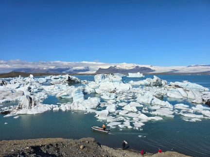
From Geysir, we completed our Golden Circle tour at Kerid Crater, a 3,000-year-old volcanic crater, then drove east to Vatnajokull National Park. En route we stopped at several spectacular waterfalls, including Seljalandsfoss, one of the most famous in Iceland, and Skogafoss, one the the largest. A highlight of the two nights we spent in the park was a boat tour through the iceberg field Jokulsarlon Glacier Lagoon, pictured above, where icebergs that break off from the glacier Breidamerkurjokull go aground in the shallows and become trapped. We also hiked right to to the edge of Skalafellsjokull, an outlet glacier of the Vatnajokull ice cap. We really enjoyed the park’s unique and dramatic scenery, and wished we had several more days to explore other areas.
Returning to Rejkjavik, we visited the Geothermal Exhibition, a museum within the active Hellisheidi geothermal power plant. The information-packed museum did a great job of explaining the source and production of Iceland’s extensive geothermal power supply. In Reykjavik, we briefly toured Skarfabakki Harbour before boarding Le Commandant Charcot for an unforgettable spring cruise along Greenland’s east coast.
Below are highlights from June 9th through 11th, 2024. Click any image for a larger view, or click the position to view the location on a map. And a map with our most recent log entries always is available at mvdirona.com/maps.
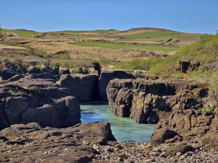 |
Bruarhlod Canyon
Position: 64°15.69’N, -20°13.45’W
The swift-flowing waters of the Hvita River flowing through the narrow neck at Bruarhlod Canyon. A nearby bridge across the canyon is the third built, after after the first two were washed away in floods.
|
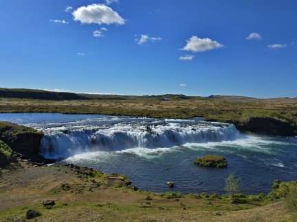 |
Faxafoss
Position: 64°13.55’N, -20°20.24’W
Beautiful Faxafoss is the shortest and widest of several Icelandic waterfalls that we’ll be visiting today, at 23 ft (7m) high and 262 ft (80m) wide.
|
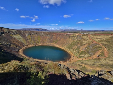 |
Kerid Crater
Position: 64°2.48’N, -20°52.98’W
Kerid Crater is a 3,000-year-old volcanic crater, about half the age of most others in Iceland. This relatively newness of the iron deposits gives the slopes their bright red color that contrast wonderfully with the blue water at the bottom. We first walked the trail around the rim, then took the second trail around the lake.
|
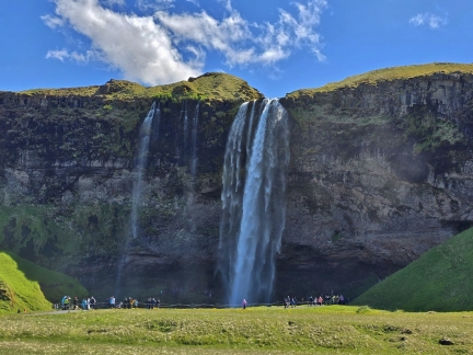 |
Seljalandsfoss
Position: 63°36.95’N, -19°59.55’W
Seljalandsfoss is one of the most famous waterfalls in Iceland and has appeared in several movies and videos. With a consistent flow from the the Eyjafjallajokull glacier, the falls plunge nearly 196 ft (60-m) into a pool below.
|
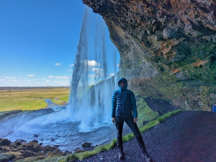 |
Behind Seljalandsfoss
Position: 63°36.91’N, -19°59.30’W
One of the things that make Seljalandsfoss so special is that you can walk right behind the falls. It is a little wet back there though.
|
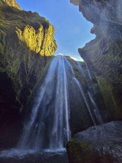 |
Gljufrabui
Position: 63°37.26’N, -19°59.17’W
Flowing over the same cliff at Seljalandsfoss, Gljufrabui is often called the “secret waterfall” because its hidden inside a large cavern and not apparent until you walk into the cave.
|
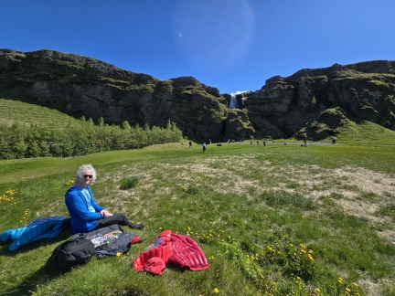 |
Lunch at Seljalandsfoss
Position: 63°37.27’N, -19°59.30’W
Enjoying a picnic lunch with a view to the top of Gljufrabui. Restaurants are not very common along our route, so we picked up some picnic provisions to allow us to eat when and where we wanted to. As with Norway, Iceland has excellent breads, and a good choice of sausages and cheeses.
|
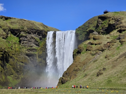 |
Skogafoss
Position: 63°31.78’N, -19°30.79’W
Spectacular Skogafoss is one of Iceland’s biggest waterfalls, at 82 ft (25 m) wide with a drop of 200 ft (60 m).
|
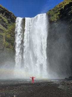 |
At Skogafoss
Position: 63°31.89’N, -19°30.72’W
Jennifer standing at the base of Skogafoss. Due to the volume of water and the amount of spray, a single or double rainbow is almost always visible here.
|
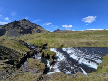 |
Hestavaosfoss
Position: 63°31.98’N, -19°30.40’W
From the base of Skogafoss, we climbed the stairs to a viewing platform at the top of the falls (visible at top right in the previous picture). From here, a trail runs 8 miles (13 km) upstream to the Thorsmork valley via the Fimmvorouhals pass. We only had time for a shorter walk, but passed several impressive waterfalls on the route, particularly pictured Hestavaosfoss.
|
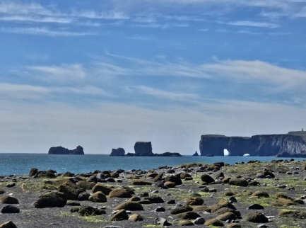 |
Dyrholaey Peninsula
Position: 63°24.23’N, -19°2.63’W
Dyrholaey Peninsula is the southernmost part of Iceland. The fierce North Atlantic storms there have carved fantastic sea arches and caves into the cliffs.
|
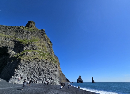 |
Reynisfjara Black Sand Beach
Position: 63°24.16’N, -19°2.56’W
Basalt columns, similar to Giant’s Causeway in Northern Ireland, and sea stacks at Reynisfjara Black Sand Beach. Iceland is amazingly diverse geologically.
|
 |
Mossy Lava Fields
Position: 63°43.15’N, -18°14.81’W
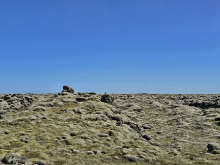
The Laki volcanic eruption in the late 1700s produced the largest lava flow in the world, the Eldhraun lava field, encompassing 218 square miles (565 km sq). Today the lava field is covered with a woolly fringe moss, a special kind of lichen that can survive the harsh Icelandic weather conditions.
|
 |
Vatnajokull National Park
Position: 63°58.12’N, -17°8.54’W
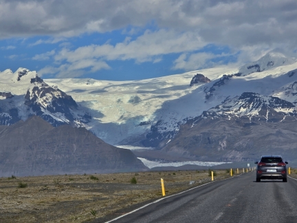
Spectacular scenery as we approach Vatnajokull National Park, one of three national parks in Iceland and a UNESCO World Heritage Site since 2019. The park is named after Vatnajokull glacier, the largest in Europe outside the Arctic, and contains many volcanoes, several of which are beneath the glacier.
|
 |
Skeioara Bridge Monument
Position: 63°59.07’N, -16°57.61’W
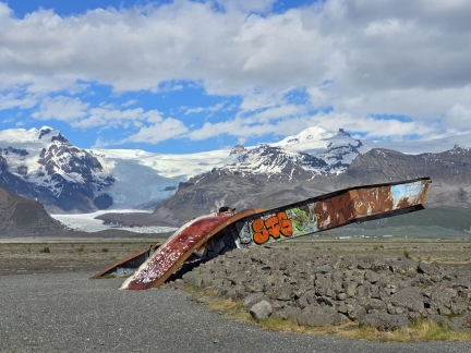
Skeioara Bridge was once the longest span in Iceland. The bridge was built to withstand major flooding, but was destroyed when a volcanic eruption generated a massive flood that carried house-sized icebergs out to sea, along with the bridge. The two metal girders are all that remain of the structure.
|
 |
Foss Hotel Glacier Lagoon
Position: 63°53.84’N, -16°36.61’W
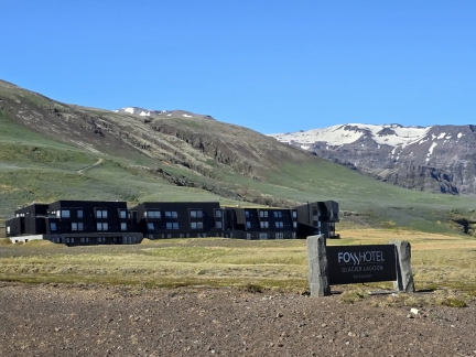
Arriving at Foss Hotel Glacier Lagoon, our home for the next two nights while we explore the area.
|
 |
Evening Drink
Position: 63°53.99’N, -16°36.49’W
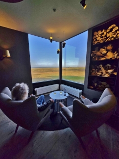
Enjoying an evening drink in the Foss Hotel Glacier Lagoon lounge after an excellent meal in their restaurant.
|
 |
The Office
Position: 63°53.97’N, -16°36.60’W
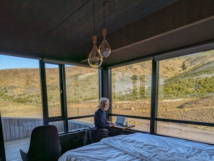
James getting some work done in our room at the Foss Hotel Glacier Lagoon.
|
 |
Jokulsarlon Glacier Lagoon
Position: 64°2.95’N, -16°10.86’W
At Jokulsarlon Glacier Lagoon, icebergs that break off from the glacier Breidamerkurjokull (visible in the background) go aground in the shallows and become trapped. The lagoon is a popular tourist destination with several companies offering boat tours through the iceberg field. In this photo, the massive pieces of ice dwarf several tour boats (click image for a larger view).
|
 |
Ice Lagoon Adventure Tours
Position: 64°3.12’N, -16°10.62’W
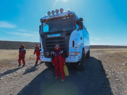
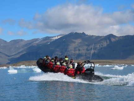
We booked a tour of Jokulsarlon Glacier Lagoon with Ice Lagoon Adventure Tours. They supply exposure suits and lifejackets, then transport us to the dock in a capable Scania truck. We’re quite partial to Scania after spending a day touring their Swedish manufacturing plant.
|
 |
Underway
Position: 64°3.29’N, -16°10.56’W
Our tour of Jokulsarlon Glacier Lagoon departed in two identical RIBs. The size and capability of the RIBs varies across companies, with Ice Lagoon Adventure Tours having some of the larger and more capable ones.
|
 |
Seal
Position: 64°4.44’N, -16°13.81’W
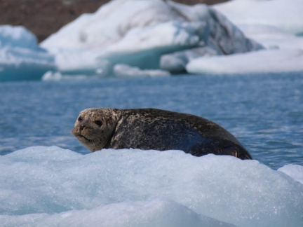
A watchful seal resting on the ice in Jokulsarlon Glacier Lagoon.
|
 |
Breidamerkurjokull
Position: 64°6.25’N, -16°16.64’W
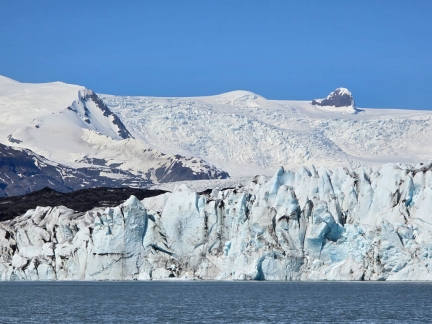
The glacier Breidamerkurjokull is a tongue of the largest ice cap in Europe, Vatnajokull, and produces the icebergs in Jokulsarlon Glacier Lagoon.
|
 |
Calving
Position: 64°6.28’N, -16°16.64’W
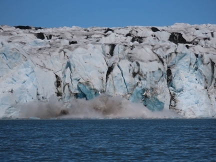
In order to produce all that ice in Jokulsarlon Glacier Lagoon, large pieces frequently calve off Breidamerkurjokull. This one generated a fair-sized wave that lifted our boat a couple of feet as it passed.
|
 |
Kayakers
Position: 64°4.86’N, -16°11.48’W
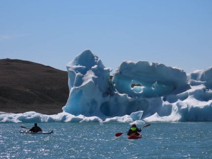
Besides taking a boat tour, visitors can also rent kayaks and paddle through Jokulsarlon Glacier Lagoon. They don’t get as close to the face of Breidamerkurjokull glacier as the high-speed RIBS do though.
|
 |
Hole in ice
Position: 64°4.90’N, -16°11.76’W
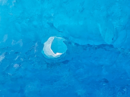
Being among the weather-sculpted ice bergs reminded us of our time in Antarctica.
|
 |
Diamond Beach
Position: 64°2.68’N, -16°10.70’W
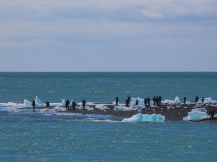
Smaller pieces of ice that float out of Jokulsarlon Glacier Lagoon often become marooned on the shore where the channel meets the sea. When the sun shines, they sparkle like diamonds against the black sand beach.
|
 |
Glacial River
Position: 64°2.73’N, -16°10.85’W
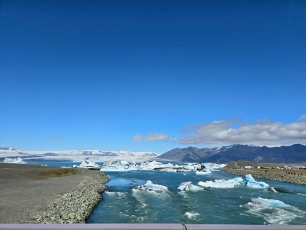
Looking up the glacial river that drains Jokulsarlon Glacier Lagoon, with the glacier Breidamerkurjokull visible in the distance. Some of those smaller pieces of ice lodged in the channel likely will wash up on Diamond Beach.
|
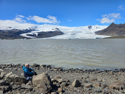 |
Fjallsarlon
Position: 64°1.08’N, -16°22.27’W
A picnic lunch along the shores of Fjallsarlon glacial lagoon, a smaller and less busy version of Jokulsarlon Glacier Lagoon. In the distance is Fjallsjokull, that like Breidamerkurjokull is an outlet of the Vatnajokull ice cap.
|
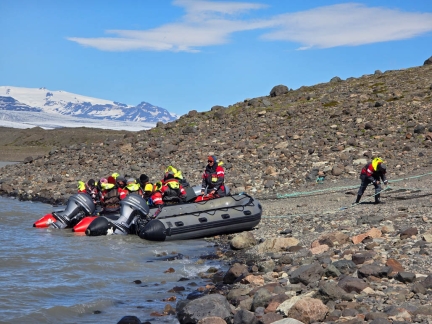 |
Fjallsarlon Tour Boats
Position: 64°1.08’N, -16°22.28’W
A RIB tour about to depart in Fjallsarlon glacial lagoon, with Breidamerkurjokull at Jokulsarlon Glacier Lagoon visible in the distance.
|
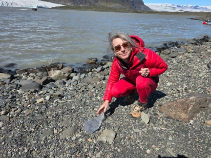 |
Glacial ice
Position: 64°1.08’N, -16°22.28’W
One of the operators of a returning RIB tour thoughtfully brought us over a piece of glacial ice from Fjallsarlon.
|
 |
Skalafell
Position: 64°14.89’N, -15°41.18’W
At Skalafell in Vatnajokull National Park to hike the Hjallanes trail into Skalafellsjokull glacier.
|
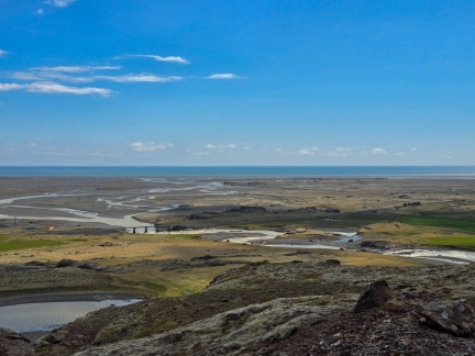 |
Kolgrma Estuary
Position: 64°15.23’N, -15°40.93’W
Looking out to sea across the estuary of the river Kolgrma from the Hjallanes trail.
|
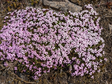 |
Moss Campion
Position: 64°15.76’N, -15°41.76’W
A typical pink-flowered moss campion, common in the arctic and mountainous regions of the Northern Hemisphere, on the Hjallanes trail. The plant is one of several known as a “compass plant” because it first flowers on the south side.
|
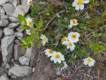 |
Mountain Aven
Position: 64°15.45’N, -15°40.25’W
Mountain Aven, the national flower of Iceland, on the Hjallanes trail in Vatnajokull National Park.
|
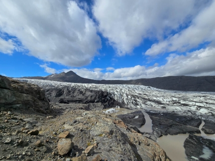 |
Skalafellsjokull
Position: 64°16.00’N, -15°42.04’W
At Skalafellsjokull, another outlet glacier of the Vatnajokull ice cap. Unlike the other two glaciers we saw today, that ended in lagoons, Skalafellsjokull terminates on land and leaves behind visibly scoured rock as it recedes.
|
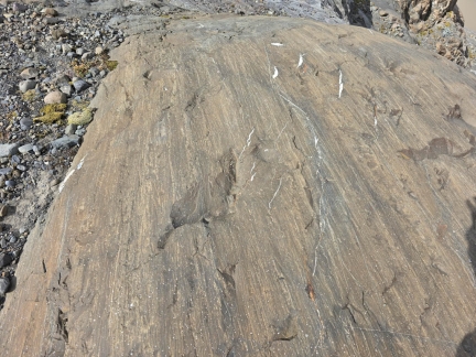 |
Glacial Scouring
Position: 64°16.00’N, -15°42.04’W
Scrape marks left on the rocks as Skalafellsjokull recedes.
|
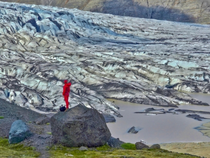 |
Erratic
Position: 64°15.85’N, -15°41.67’W
Jennifer taking in Skalafellsjokull from an erratic left behind. Erratics are large blocks of rock that have been moved by a glacier. We were surprised how close we could get to the glacier, as we were expecting to only view it from a distance.
|
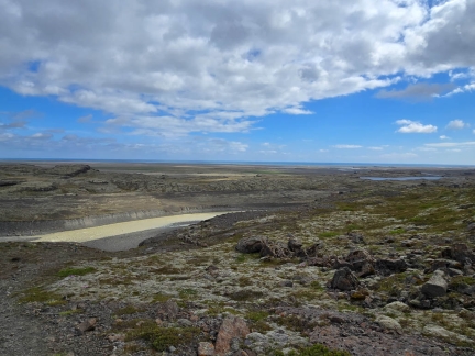 |
River Kolgrma
Position: 64°15.87’N, -15°39.58’W
View to the river Kolgrma that we’ll be following on the loop trail back to the Hjallanes trailhead. The Atlantic Ocean is visible in the distance.
|
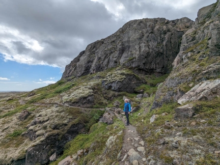 |
Cliffs
Position: 64°15.73’N, -15°39.77’W
The return path from the glacier Skalafellsjokull led beneath striking bluffs above the river Kolgrma. It was a wonderful hike, but about as much as we could stuff into one day.
|
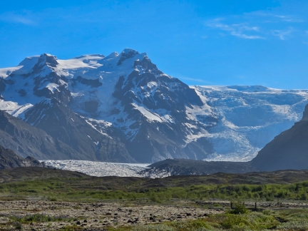 |
Vatnajokull
Position: 63°59.67’N, -16°54.20’W
A last look to the spectacular Vatnajokull icecap as we depart the area for Reykjavik, where we’ll be boarding Le Commandant Charcot for a cruise to Greenland.
|
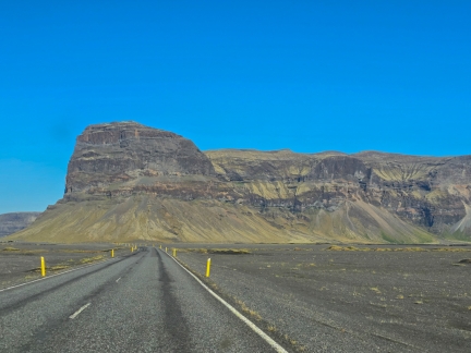 |
Lomagnupur Mountain
Position: 63°57.19’N, -17°26.24’W
Driving on Route 1 towards distinctive 2,257ft (688m) Lomagnupur Mountain on our way to Reykjavik.
|
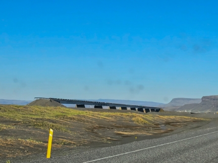 |
Old Nupsvotn Bridge
Position: 63°57.39’N, -17°27.48’W
Many accidents, some fatal, occurred on the old single-lane Nupsvotn Bridge. In 2023, it was replaced with the two-lane bridge we are about to cross.
|
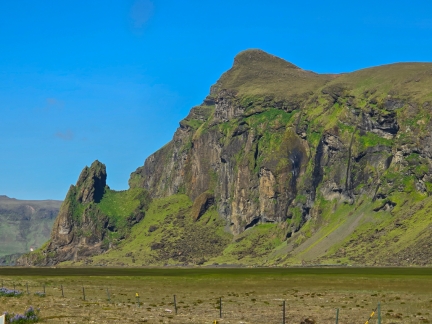 |
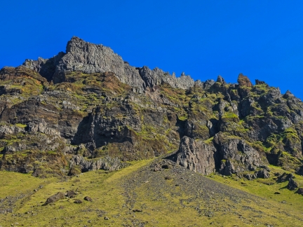
Vikurhamrar Cliffs
Position: 63°25.20’N, -18°56.28’W
The Vikurhamrar Cliffs are one of the many examples of the astonishing scenery along Iceland’s Route 1.
|
 |
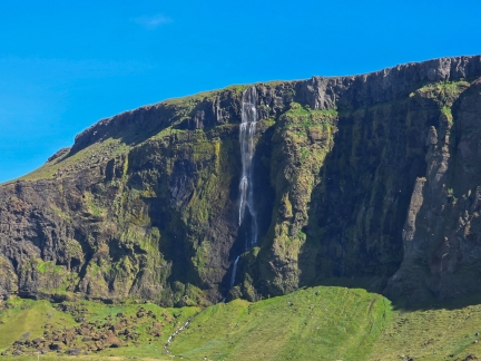
Steinafjall
Position: 63°32.67’N, -19°42.72’W
The striking Steinafjall cliffs rise 2,588 ft (789m) above sea level and have several good rock climbing routes.
|
 |
Gipur Waterfall
Position: 63°35.71’N, -19°58.29’W
Iceland has so many impressive waterfalls, such as Skogafoss, that Gipur Waterfall doesn’t even make the highlight list.
|
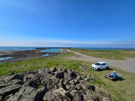 |
Lunch
Position: 63°51.95’N, -21°9.85’W
A picnic lunch seaside at Eyrarbakki Beach. The port visible behind was one of the biggest ports in the country in the 18th century, but seems no longer in use.
|
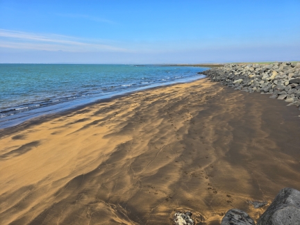 |
Eyrarbakki Beach
Position: 63°51.87’N, -21°10.07’W
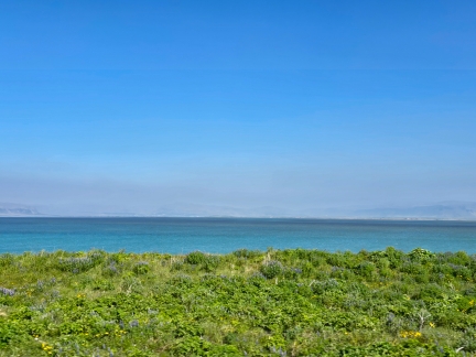
The small pocket sand beach near our picnic table at Eyrarbakki Beach.
|
 |
River Olfusa
Position: 63°52.81’N, -21°13.76’W
Looking across the vast delta of the River Olfusa, Icelands’s largest river by volume.
|
 |
Hellisheidi Geothermal Power Plant
Position: 64°2.03’N, -21°24.93’W
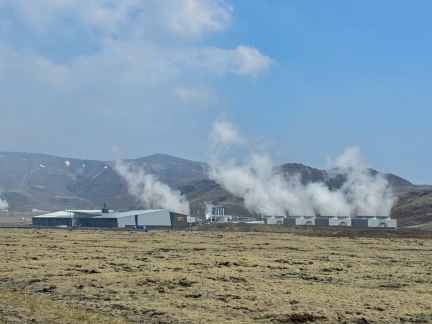
The Hellisheidi geothermal power plant is among the ten largest in the world, generating 303MW of electricity and 400MW of thermal energy. Most of the power feeds aluminum refineries in Reykjavik.
|
 |
Hot Water Pipes
Position: 64°2.22’N, -21°24.01’W
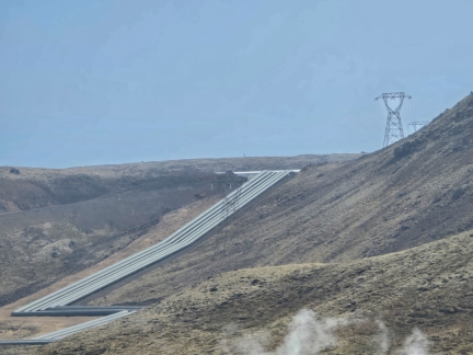
Hot water pipes for district heating snaking up the hill away from the Hellisheidi geothermal power plant.
|
 |
The Geothermal Exhibition
Position: 64°2.22’N, -21°24.05’W
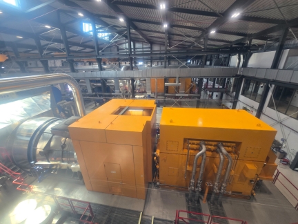
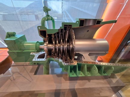
Besides being an active power plant, Hellisheidi also contains The Geothermal Exhibition museum. Visitors can see the plant in action and learn about all aspects of geothermal power production in Iceland. This is a view to one of the plant’s six high-pressure turbines.
|
 |
Turbine Model
Position: 64°2.22’N, -21°24.05’W
A cutout model at the Geothermal Exhibition of Hellisheidi’s high-pressure turbines. Hot steam from the boreholes drives the turbine to spin at about 3000 RPM, and the turbine axle is connected to an electrical generator to produce power.
|
 |
Geothermal Island
Position: 64°2.24’N, -21°24.05’W
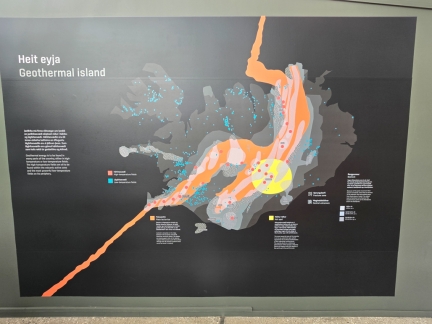
Diagram showing the high-temperature (red) and low-temperature geothermal fields in Iceland, roughly following the ridge (in orange) between the Eurasian and North American tectonic plates. The area inside the yellow circle is a hot spot of major volcanic and geothermal activity.
|
 |
Skarfagardur Lighthouse
Position: 64°9.47’N, -21°51.89’W
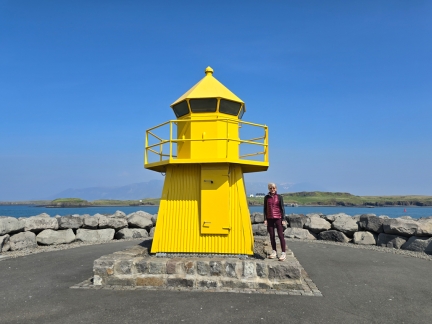
Skarfagardur Lighthouse marks the entrance to Skarfabakki Harbour in Reykjavik, where we will soon be boarding Le Commandant Charcot for our cruise to Greenland.
|
 |
Celebrity Silhouette
Position: 64°9.36’N, -21°52.01’W
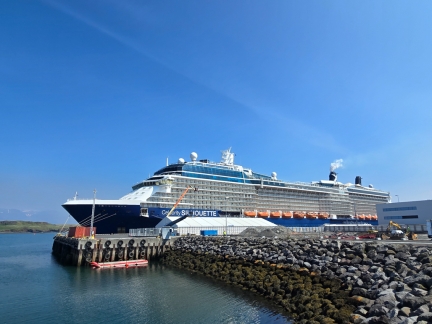
The Celebrity Silhouette moored at Skarfabakki Harbour in Reykjavik.
|
 |
Ex-Coast Guard
Position: 64°9.00’N, -21°51.64’W
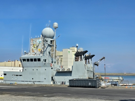
Aegir-class patrol ship moored at the Port of Reykjavik. The Icelandic Coast Guard commissioned two, Aegir and Tyr, in service from 1968-2021. Both were involved in the infamous “cod wars” fishing grounds disputes with the United Kingdom. During the disputes, Iceland several times fired live ammunition at British fishing vessels, and multiple ship collisions took place, including one between the Aegir and the British frigate HMS Scylla.
|
 |
Port of Reykjavik
Position: 64°8.96’N, -21°51.94’W
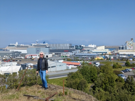
View to the Port of Reykjavik from a nearby bluff.
|
 |
Lupins
Position: 64°8.98’N, -21°51.99’W
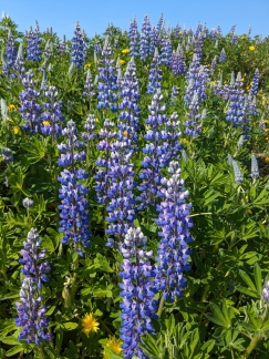
Lupins in bloom at the bluff overlooking the Port of Rejkjavik.
|
 |
Transferring containers
Position: 64°8.82’N, -21°51.06’W
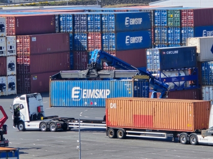
Transferring containers to outgoing trucks at the Port of Reykjavik. The Icelandic transportation company Eimskip is a major operator in this port.
|
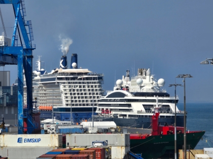 |
Le Commandant Charcot
Position: 64°8.82’N, -21°51.06’W
Our ship, Le Commandant Charcot, moored behind the Celebrity Silhouette at Skarfabakki Harbour. It may be a lot smaller, but the Charcot packs a much bigger punch with 34MW of power compared to 20.5MW for the Silhouette. The Charcot is the most powerful non-nuclear icebreaker in the world, and breaking ice takes a lot of power.
|
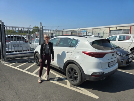 |
Rental car return
Position: 64°8.29’N, -21°50.86’W
Returning our rental car to Europcar near Skarfabakki Harbour. It seems a lot longer than four days ago that we picked it up at Reykjavik–Keflavík Airport.
|
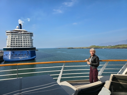 |
Aboard LCC
Position: 64°9.23’N, -21°51.53’W
Taking in the view from the balcony of our stateroom aboard Le Commandant Charcot.
|
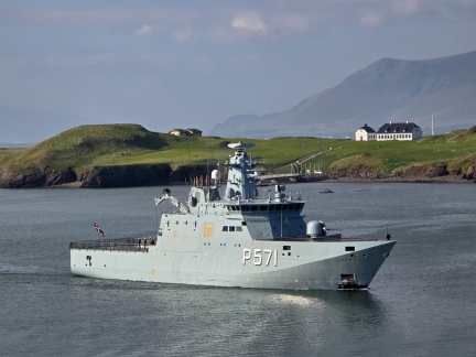 |
HMDS Ejnar Mikkelsen
Position: 64°9.19’N, -21°51.45’W
HMDS Ejnar Mikkelsen of Denmark arriving into Skarfabakki Harbour.
|
 |
Magni
Position: 64°8.72’N, -21°48.25’W
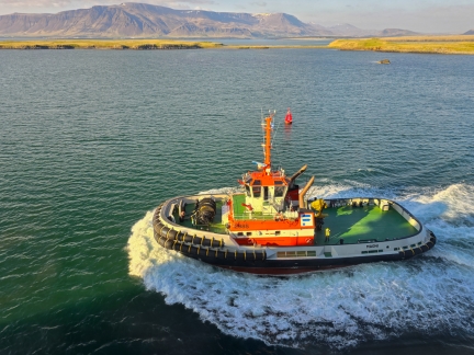
The tug Magni running alongside Le Commandant Charcot as we depart Skarfabakki Harbour for Greenland. We had an absolutely amazing cruise, and will blog the trip in detail.
|

|
Click the travel log icon on the left to see these locations on a map. And a map of our most recent log entries always is available at mvdirona.com/maps. |

If your comment doesn't show up right away, send us email and we'll dredge it out of the spam filter.