
We finished our four-day Labor Day weekend camping trip with a tour through the area near our site in search of other campsites and found several good possibilities. Our plan after that was to have lunch at the Packwood Brewing Co. But the road into town was jammed for the annual Packwood Flea Market, one of the largest flea markets in the western US that attracts hundreds of vendors and thousands of shoppers. We instead headed out of town and had a great meal at White Pass Tacqueria just outside town.
On our way home, we passed through the eastern section of Mt. Rainier National Park, crossing through Cayuse Pass at elevation 4,675 feet (1,425 m). We exited the park into Mt. Baker-Snoqualmie National Forest just south of Crystal Mountain Resort and continued towards home through more familiar territory along highway 410.
Below are highlights from September 5th, 2022. Click any image for a larger view, or click the position to view the location on a map. And a map with our most recent log entries always is available at mvdirona.com/maps.
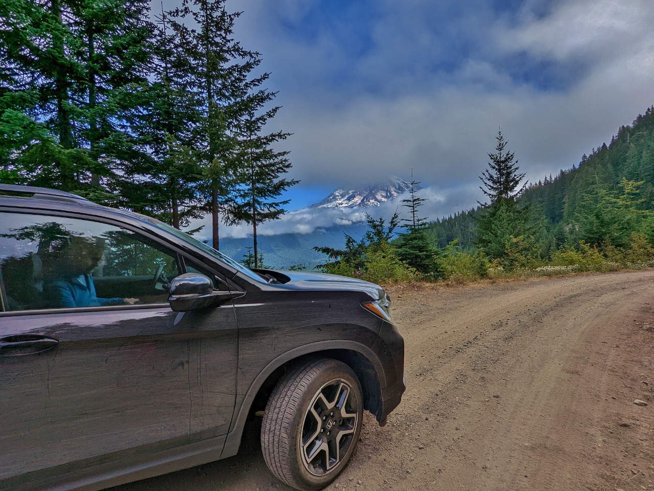 |
Breaking Camp
Position: 46°41.71’N, -121°52.53’W
A final glimpse to Mt. Rainier, partly covered by clouds, as we depart the campsite along Forest Road 8430. We initially were planning to camp in a couple of different locations over the long weekend, but this one was too good to give up.
|
 |
Potential Campsite
Position: 46°40.17’N, -121°50.55’W
Checking out a potential campsite at the end of a spur off Forest Road 8460. We found several good sites in the area with clear mountain views.
|
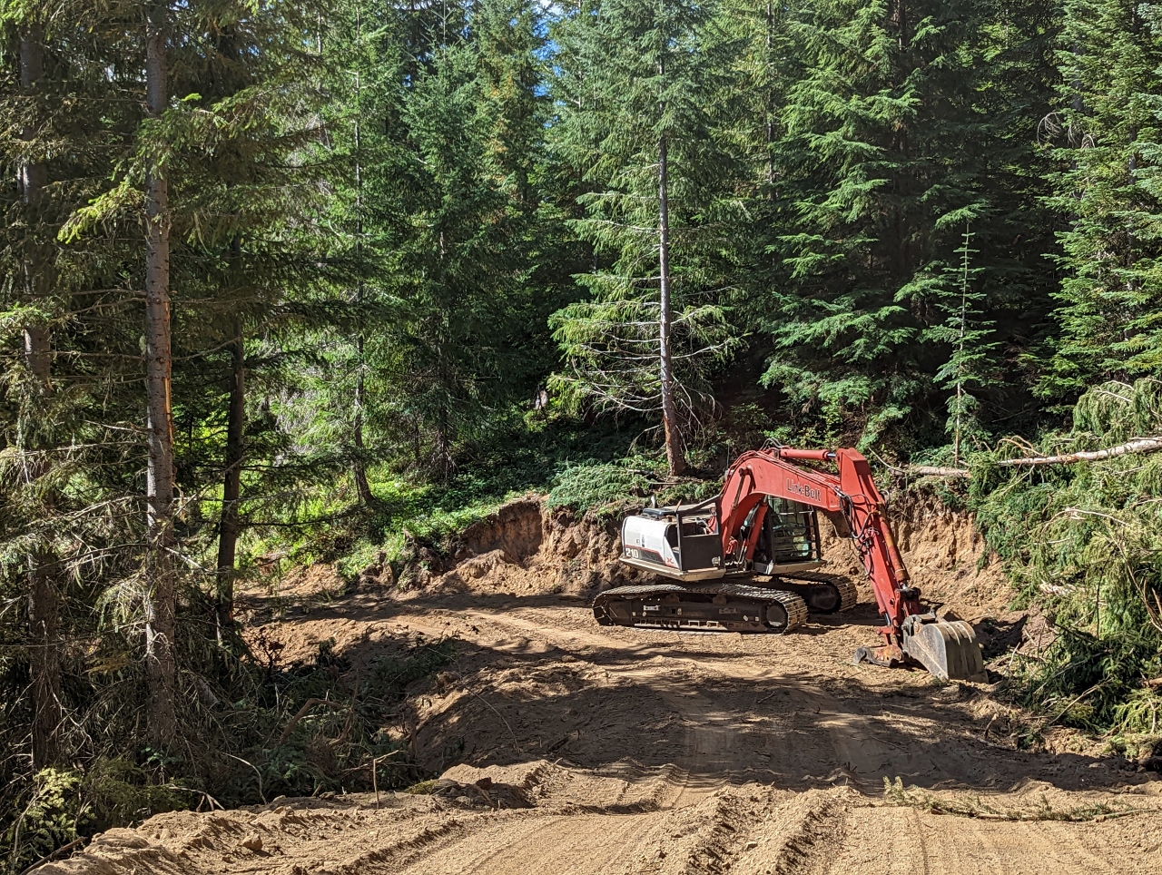 |
New Road
Position: 46°38.66’N, -121°48.25’W
A new logging road under construction off Forest Road 4745.
|
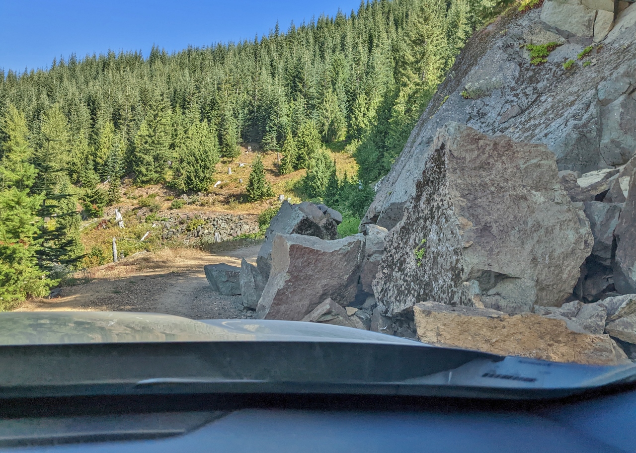 |
Rockslide
Position: 46°39.60’N, -121°48.23’W
A major rockslide along Forest Road 4745 nearly blocks the way, but we can just get around it.
|
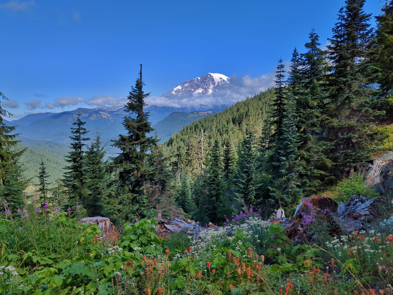 |
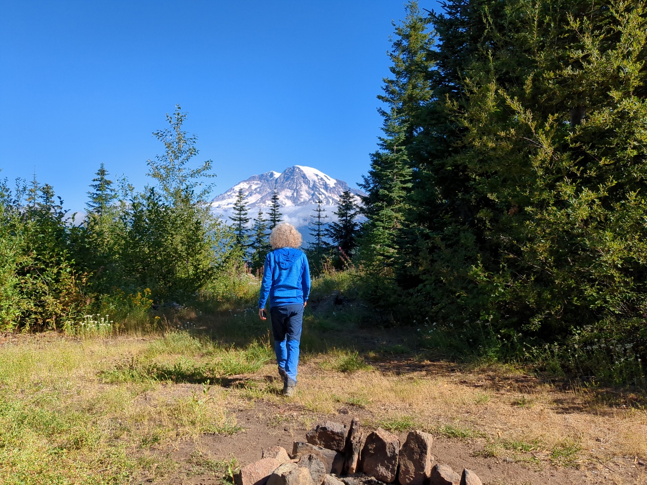
Wildflowers
Position: 46°39.87’N, -121°48.28’W
Colorful wildflowers and a view to Mt. Rainier at a campsite along the edge of Forest Road 4745.
|
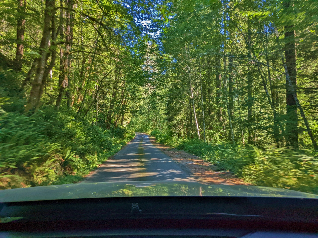 |
Road
Position: 46°37.54’N, -121°43.31’W
A lovely drive through sun-dappled woods along Forest Road 47
|
 |
Large Group
Position: 46°37.48’N, -121°42.34’W
A large group parked along Forest Road 47 near Packwood. The people density is much higher at lower elevations near population centers compared to the higher-altitude areas we prefer.
|
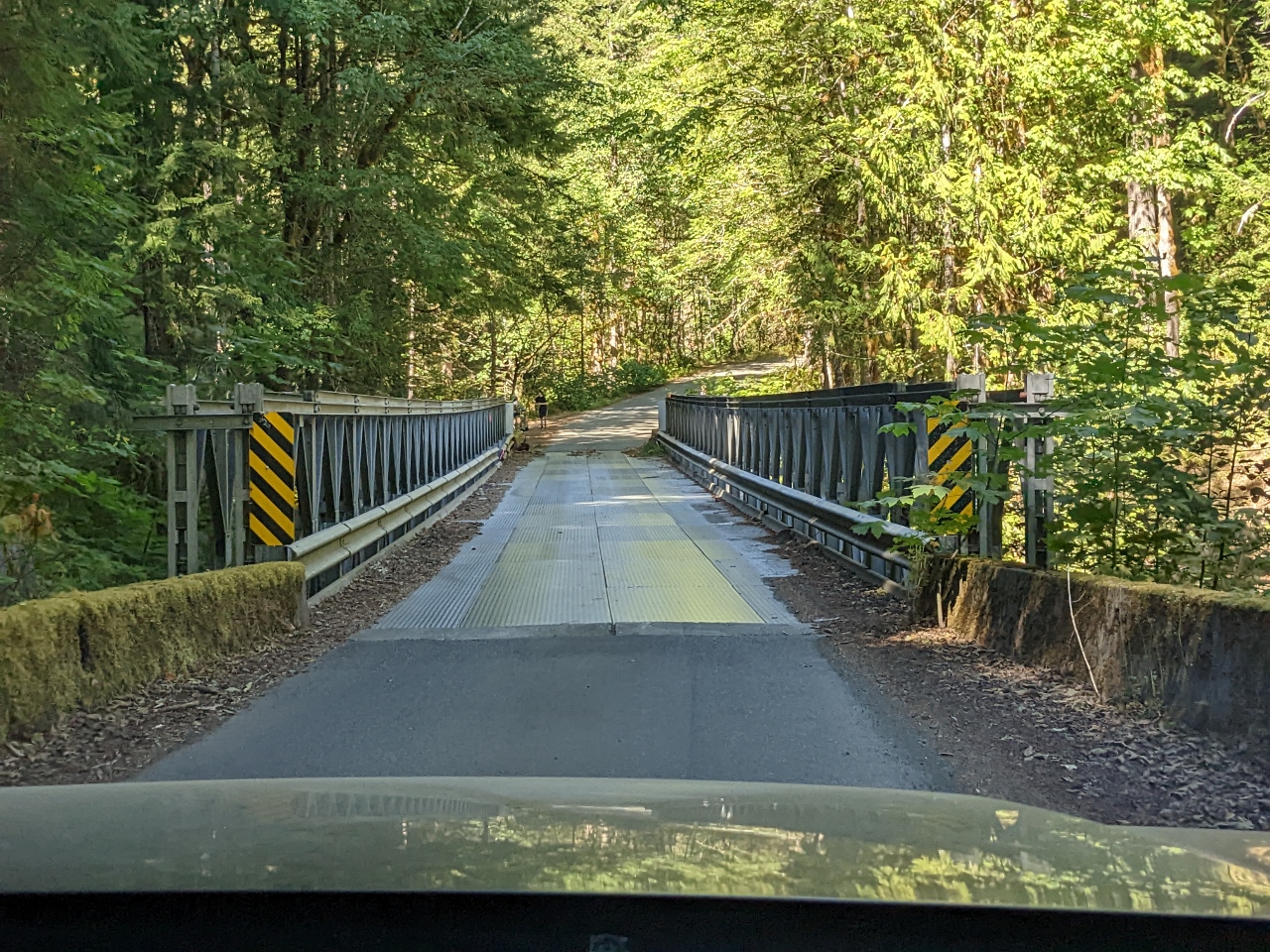 |
Skate Creek
Position: 46°37.95’N, -121°42.68’W
The bridge over Skate Creek is in much better shape than most of the bridges we crossed earlier in the weekend.
|
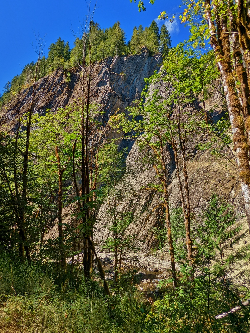 |
Gorge
Position: 46°38.10’N, -121°42.82’W
A dramatic gorge just south of the intersection of Forest Roads 47 and 52.
|
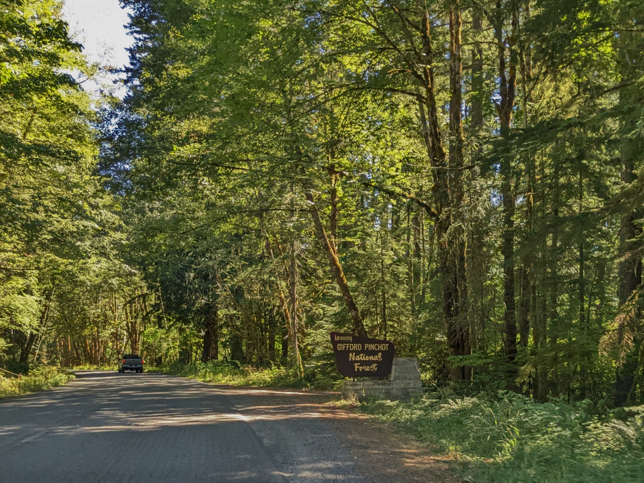 |
Leaving Forest
Position: 46°37.76’N, -121°41.91’W
Exiting Gifford Pinchot National Forest near Packwood.
|
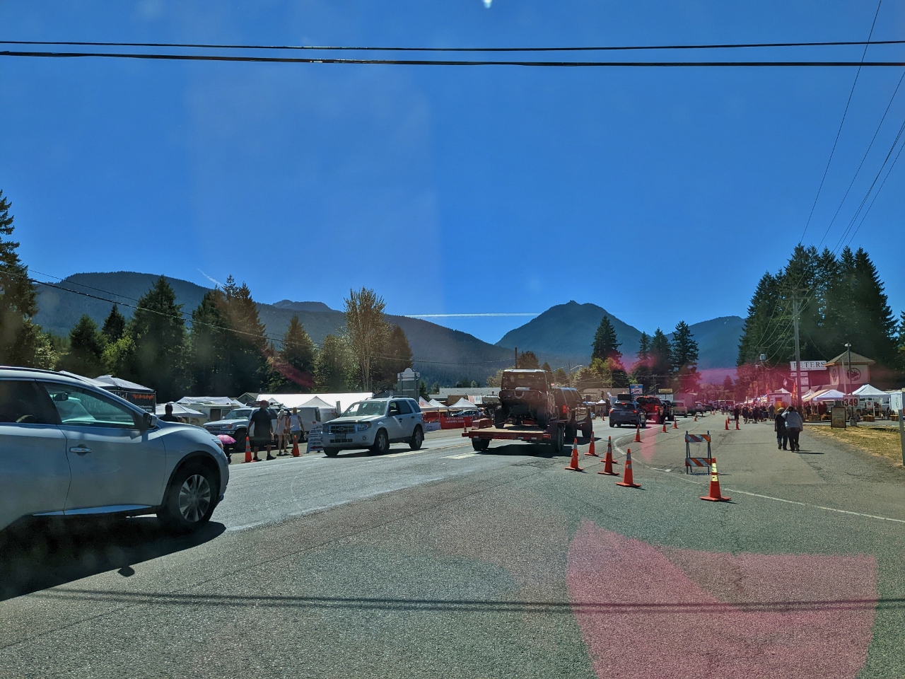 |
Packwood Flea Market
Position: 46°36.61’N, -121°40.14’W
Our plan in coming to Packwood was to turn right from Forest Road 52 and head to the Packwood Brewing Co. for lunch. But the road into town was jammed for the annual Packwood Flea Market. It’s one of the largest flea markets in the western US, attracting hundreds of vendors and thousands of shoppers. Even if we could reach the brewery in a reasonable time, we probably couldn’t get a seat. So we turned left instead.
|
|
|
White Pass Tacqueria
Position: 46°38.89’N, -121°36.96’W
At White Pass Tacqueria just outside Packwood. We had a great meal there and enjoyed watching the varied traffic passing by from our shaded table on their terrace.
|
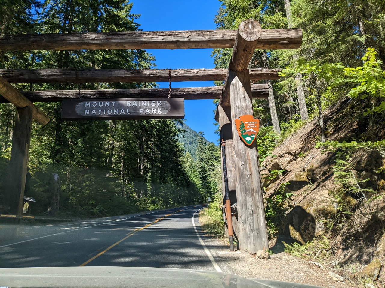 |
Mt. Rainier NP
Position: 46°43.00’N, -121°34.62’W
Entering Mt. Rainier National Park on our way back home along highway 123. We’re just about to join our path of a month ago from Stevens Canyon Road to Sunrise. This section of road we’re driving on is closed in the winter.
|
 |
East Side Tunnel
Position: 46°50.68’N, -121°31.76’W
About to pass through East Side Tunnel, completed in 1939 as part of the development of the Sunrise area of Mt. Rainer National Park.
|
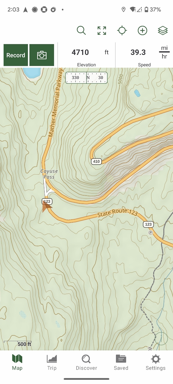 |
Cayuse Pass
Position: 46°50.97’N, -121°31.45’W
Arriving at Cayuse Pass (4,675 feet; 1,425 m) and the junction of State Routes 123 and 410. We’ll be taking 410 home to Seattle.
|
 |
MBS NF
Position: 46°58.45’N, -121°32.15’W
Exiting Mt. Rainier National Park and entering Mt. Baker-Snoqualmie National Forest just south of Crystal Mountain Resort. This is the point we drove to earlier in the year from the north when the road was still closed for the winter.
|
 |
Click the travel log icon on the left to see these locations on a map. And a map of our most recent log entries always is available at mvdirona.com/maps. |
If your comment doesn't show up right away, send us email and we'll dredge it out of the spam filter.