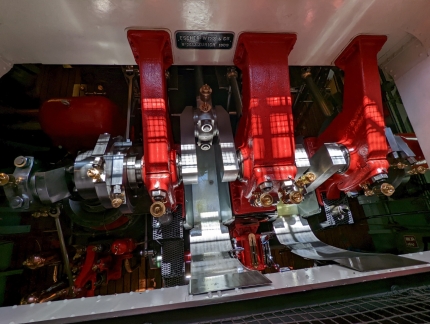
The steamboat Stadt Zurich is the oldest of more than a dozen passenger ships that ply the waters of Lake Zurich. Built in 1909, the steamship makes regular two-hour runs the length of upper Lake Zurich between Zurich and Rapperswill. The vessel is beautifully maintained, particularly the original Escher Wyss & Cie engine, also dating from 1909. The engine is an externally-oiled open crankcase design common in that era. What’s more unique is a viewing platform has been built into the lower passenger deck so the engine crankshaft can be seen rotating between brightly painted main bearings across the width of the boat when underway.
On our second day in Switzerland, we took the Stadt Zurich south on Lake Zurich to Rapperswill on a warm and sunny day. We really enjoyed being out on the lake and watching as the ship arrived and departed at the various stops along the way. In Rapperswill, we walked the grounds of 13th century Rapperswill Castle and through town, then returned to Zurich by train. Before dinner we just had time to squeeze in a couple of city viewpoints: one up 187 steps inside a tower of 13th-century Grossmunster church and the other at the historic park Lindenhof. After a wonderful meal street-side at Casco Viejo Tapas restaurant, we rode the Polybahn funicular up to the university district for one final view across the city.
Below are highlights from June 26, 2022. Click any image for a larger view, or click the position to view the location on a map. And a map with our most recent log entries always is available at mvdirona.com/maps.
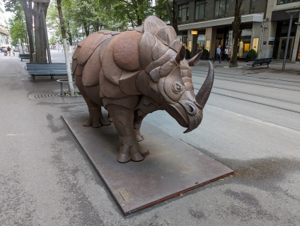 |
Panzernashorn
Position: 47°22.12’N, 8°32.39’E
Panzernashorn (Rhinocerous) sculpture by Zurich artist John A Tobler (1982) outside the Zuricher Kantonalbank. According to ViewFromTheBack, “It’s said to be a symbol of security, strength and steadfastness. Everything we want in a bank, really.”
|
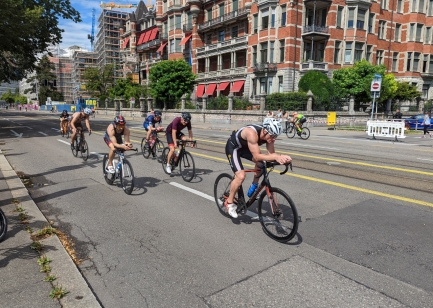 |
Zurich Triathlon
Position: 47°21.90’N, 8°32.29’E
The annual Zurich City Triathlon was taking place as we walked down to Lake Zurich from our hotel. Hundreds of cyclists were riding around the top of the lake along blocked-off General Guisan-Quai. The lake was so warm at 73.6°F (23.1°C) that wetsuits were not allowed for the swim portion.
|
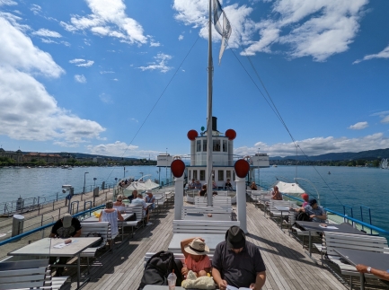 |
On Board
Position: 47°21.94’N, 8°32.46’E
On board the steam-powered paddle-wheeler Stadt Zurich for a two-hour cruise on Lake Zurich to Rapperswill.
|
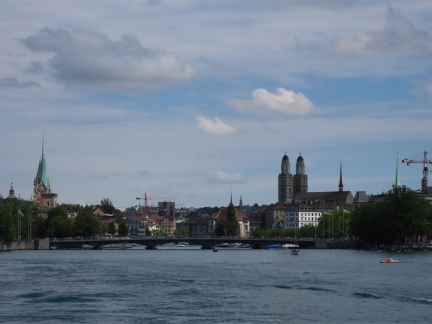 |
Zurich Skyline
Position: 47°21.82’N, 8°32.59’E
The Zurich skyline, viewed from the Stadt Zurich as we depart the dock.
|
 |
Lunch
Position: 47°20.32’N, 8°33.42’E
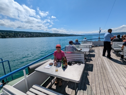
Lunch on the upper deck of the Stadt Zurich as we cruise Lake Zurich on a warm and sunny day. We really enjoyed being out on the lake and watching as the ship arrived and departed at the various stops along the way.
|
 |
Engine
Position: 47°19.37’N, 8°34.38’E
The exposed engine on the paddle-wheeler Stadt Zurich was very popular with the passengers. The engine, by Escher Wyss & Cie, dates from 1909 as does the ship.
|
 |
Kusnacht
Position: 47°19.15’N, 8°34.68’E
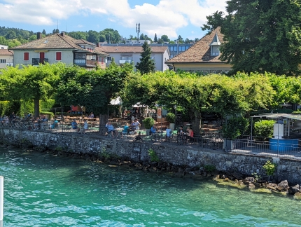
The tree-filled beer garden Sonne am See at Kusnacht, one of eight stops the Stadt Zurich made on the way to Rapperswill.
|
 |
Insel Ufenau
Position: 47°13.09’N, 8°46.60’E
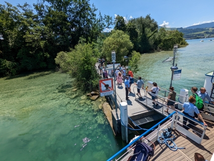
A few passengers got on and off at each stop along the way, but a much larger number disembarked at Insel Ufenau. The island has two medievel churches and is the largest in Switzerland not connected by bridge to the mainland.
|
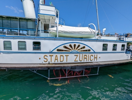 |
Paddle Wheel
Position: 47°13.54’N, 8°48.78’E
The paddle wheel of the Stadt Zurich viewed as we disembark at Rapperswill.
|
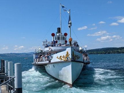 |
Position: 47°13.54’N, 8°48.80’E
Looking to the fine bow of the Stadt Zurich, with the paddle wheels churning up the water, as the ship departs Rapperswill.
|
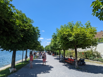 |
Buhlerallee
Position: 47°13.57’N, 8°48.81’E
The tree-line Buhlerallee, running along the Lake Zurich shore outside the walls of Rapperswill Castle, visible at right.
|
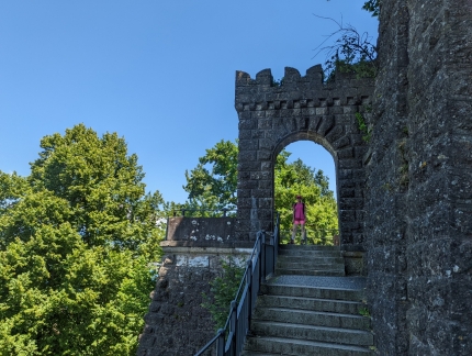 |
Rapperswill Castle
Position: 47°13.63’N, 8°48.78’E
After walking the waterline along Buhlerallee, we climbed a few flights of stairs to enter the grounds of 13th century Rapperswill Castle.
|
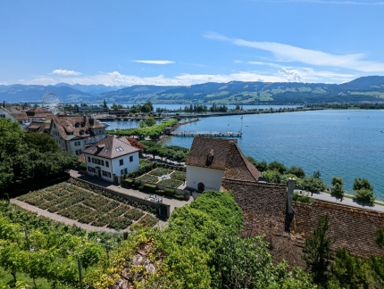 |
View
Position: 47°13.62’N, 8°48.78’E
As you would expect from a hilltop fortification, Rapperswill Castle has sweeping views of the the town and Lake Zurich beyond. The dock we landed on is roughly at center, directly above a rooftop.
|
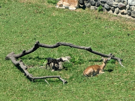 |
Deer Park
Position: 47°13.62’N, 8°48.78’E
The supervised deer park within the Rapperswill Castle grounds is home to about 15-20 European fallow deer.
|
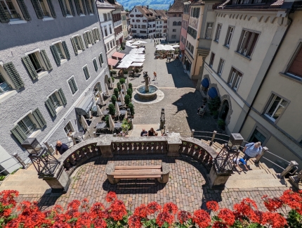 |
Hauptplatz
Position: 47°13.64’N, 8°48.96’E
Looking down restaurant-lined Hauptplatz from the Rapperswill Castle battlements.
|
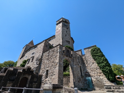 |
Clock Tower
Position: 47°13.63’N, 8°48.97’E
Rapperswill Castle is built in the shape of an equilateral triangle, with a tower at each corner. This is the five-sided clock tower on the east corner, with the castle behind.
|
 |
St. John’s Church
Position: 47°13.64’N, 8°48.98’E
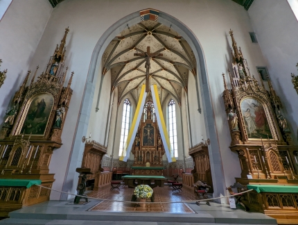
St. John’s Church on the Rapperswill Castle grounds was built in the early 13th century and was extended or renovated several times over the centuries.
|
 |
Kanada
Position: 47°13.65’N, 8°49.08’E
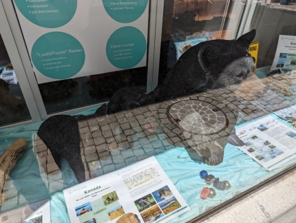
Model of a grizzly bear alongside a vacation advertisement for Algonquin Provincial Park in Kanada (Canada) at a travel agency in Rapperswill, Switzerland. James visited Algonquin many times while living in Ottawa during the 1970s.
|
 |
Riesen Rad
Position: 47°13.58’N, 8°48.99’E
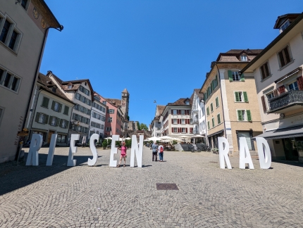
Riesen Rad means “travel by bike” in German. Raperswill is a stop along several multi-day cycling holidays through Switzerland.
|
 |
Train Station
Position: 47°13.47’N, 8°49.00’E
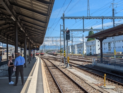
At the Rapperswill train station to return to Zurich.
|
 |
Train Routes
Position: 47°24.62’N, 8°37.32’E
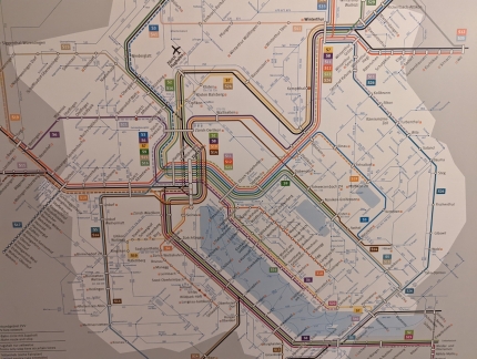
The amazing number of train routes in the Lake Zurich area, shown in the Rapperswil station.. The city of Zurich is roughly at center, off the north end of the lake, and Rapperswill is at lower right (click image for a larger view).
|
 |
Frankengasse
Position: 47°22.15’N, 8°32.69’E
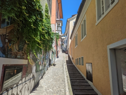
Looking up Zurich’s narrow alley Frankengasse, created in 1637.
|
 |
Grossmunster
Position: 47°22.19’N, 8°32.66’E
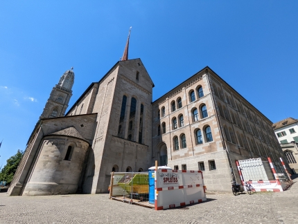
Looking northwest to Grossmunster church, one of the four major churches in Zurich. Construction of the buildings began around 1100 and it was inaugurated about a century later. One of the church’s two twin towers is visible on the left. The towers originally were built in the 15th century and replaced by the current towers in 1763 after fire destroyed the original wood constructs.
|
 |
Grossmunster Tower
Position: 47°22.21’N, 8°32.61’E
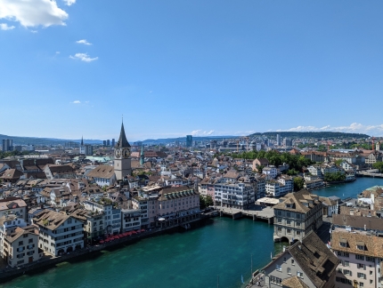
The view northwest across Zurich from one of the two Grossmunster towers, 187 wooden stairs up from the nave. The clock tower of St. Peter Church, near our hotel, is prominent in the skyline.
|
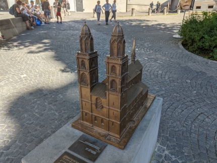 |
Grossmunster Model
Position: 47°22.23’N, 8°32.64’E
Model of Grossmunster outside the church. The church and its twin towers are one of the most recognizable landmarks of Zurich.
|
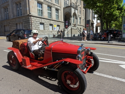 |
Ford Roadster
Position: 47°22.45’N, 8°32.63’E
A vintage Ford Roadster, carrying the classic Flying Goose hood ornament. The car likely dates from the late 1920s.
|
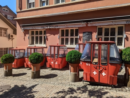 |
Cable Car
Position: 47°22.49’N, 8°32.68’E
Old cable cars, converted to dining tables, at Walliser Keller Swiss restaurant in Zurich.
|
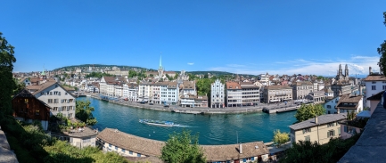 |
Lindenhof
Position: 47°22.38’N, 8°32.48’E
View from the historic park Lindenhof across the river Limmat to eastern sections of Zurich’s old town, with Grossmunster church where we just climbed the tower visible at right.
|
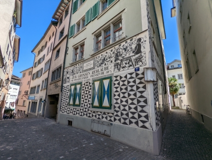 |
Kaiser’s Reblaube
Position: 47°22.32’N, 8°32.42’E
The restaurant Kaiser’s Reblaube, housed in a striking wood hotel building dating to 1260. The building is known as “Goethe’s Bedroom” because the German poet stayed here in 1779.
|
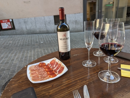 |
Casco Viejo
Position: 47°22.40’N, 8°32.61’E
One of several excellent courses enjoyed streetside on an old wine barrel at Casco Viejo Tapas restaurant in Zurich.
|
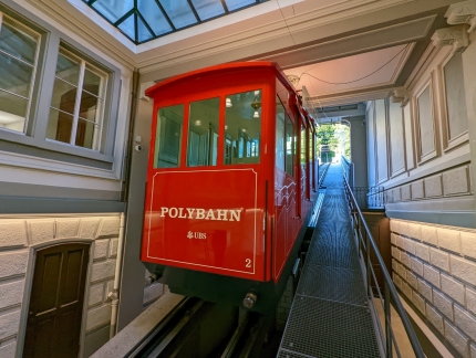 |
Polybahn
Position: 47°22.60’N, 8°32.66’E
The Polybahn is one of two funicular railways in Zurich and began operating in 1889. The line links Central Square, a transportation hub at the lower station, up to the main building of the public research university ETH Zurich.
|
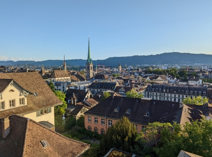 |
View from ETH Zurich
Position: 47°22.56’N, 8°32.82’E
Looking across the city from the ETH Zurich campus near the top of the Polybahn line. The steeple of 13th-century Fraumunster church is prominent in the skyline at center, with the clock tower of St. Peter Church near our hotel at right in the distance.
|
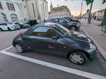 |
Ford StreetKa
Position: 47°22.16’N, 8°32.52’E
A Ford StreetKa parked in Zurich. We’ve never seen or heard of this model before. The StreetKa is convertible version of the popular Ford Ka, a small, low-cost car sold only in South America, Mexico, India, Europe and South Africa.
|
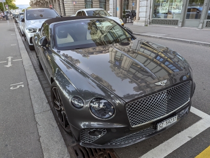 |
Bentley
Position: 47°22.12’N, 8°32.52’E
This Bentley parked in Zurich is also a convertible, but is at the other end of the price spectrum from the low-cost Ford StreetKa.
|
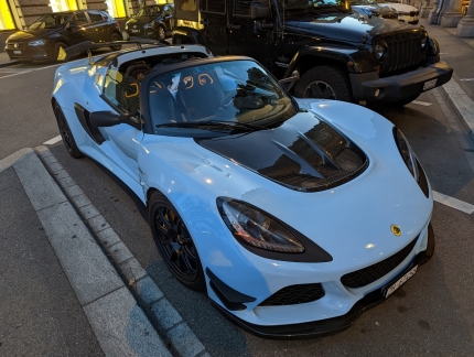 |
Lotus 380
Position: 47°22.09’N, 8°32.50’E
We’re seeing lots of interesting cars as we walk through Zurich. With a 375HP engine, this Lotus 380 can do 0-60 MPH in 3.5 seconds.
|
 |
Click the travel log icon on the left to see these locations on a map. And a map of our most recent log entries always is available at mvdirona.com/maps. |

If your comment doesn't show up right away, send us email and we'll dredge it out of the spam filter.