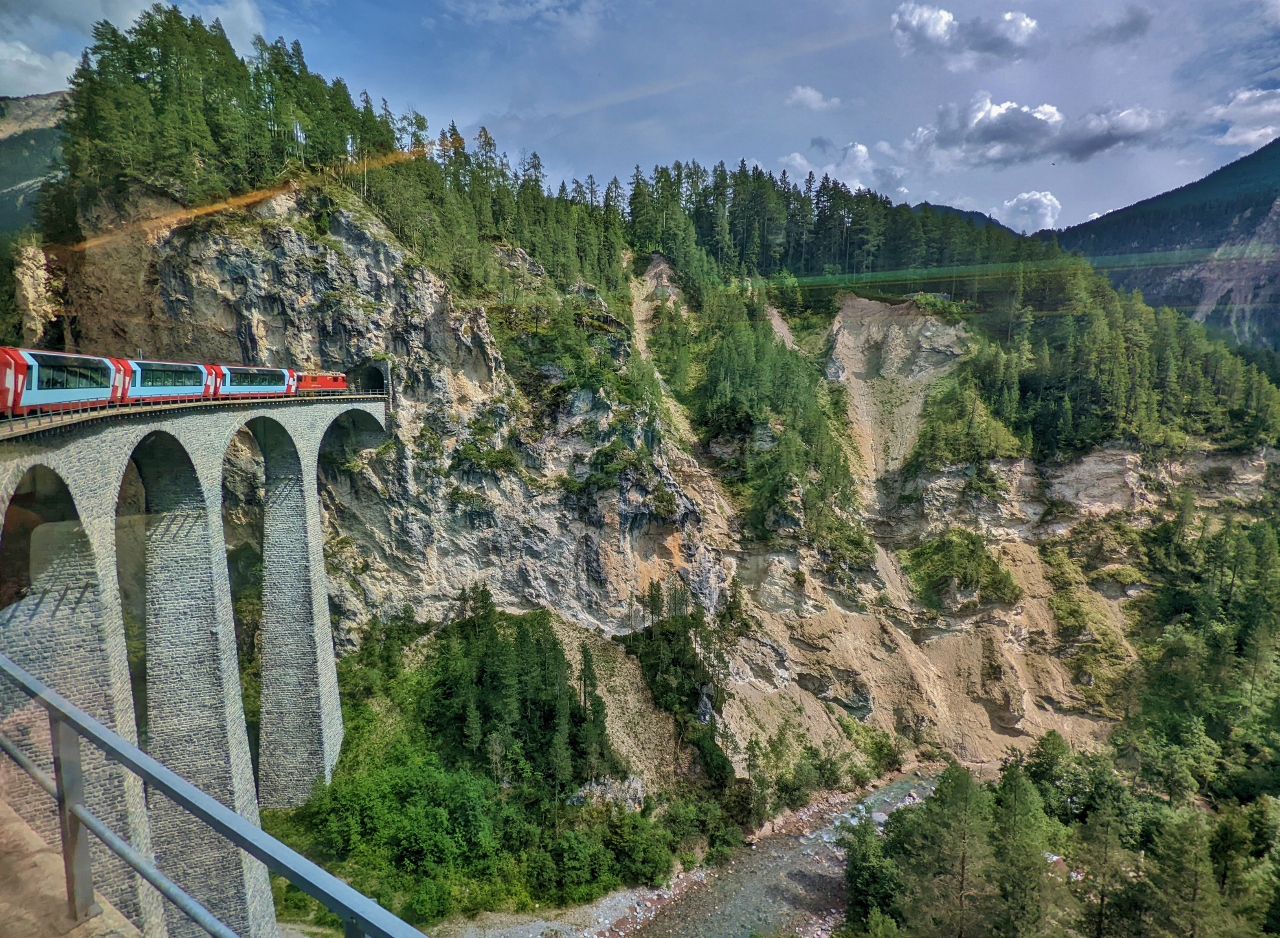
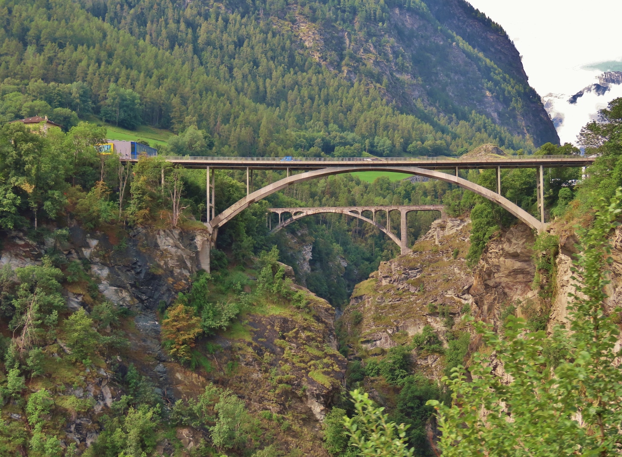
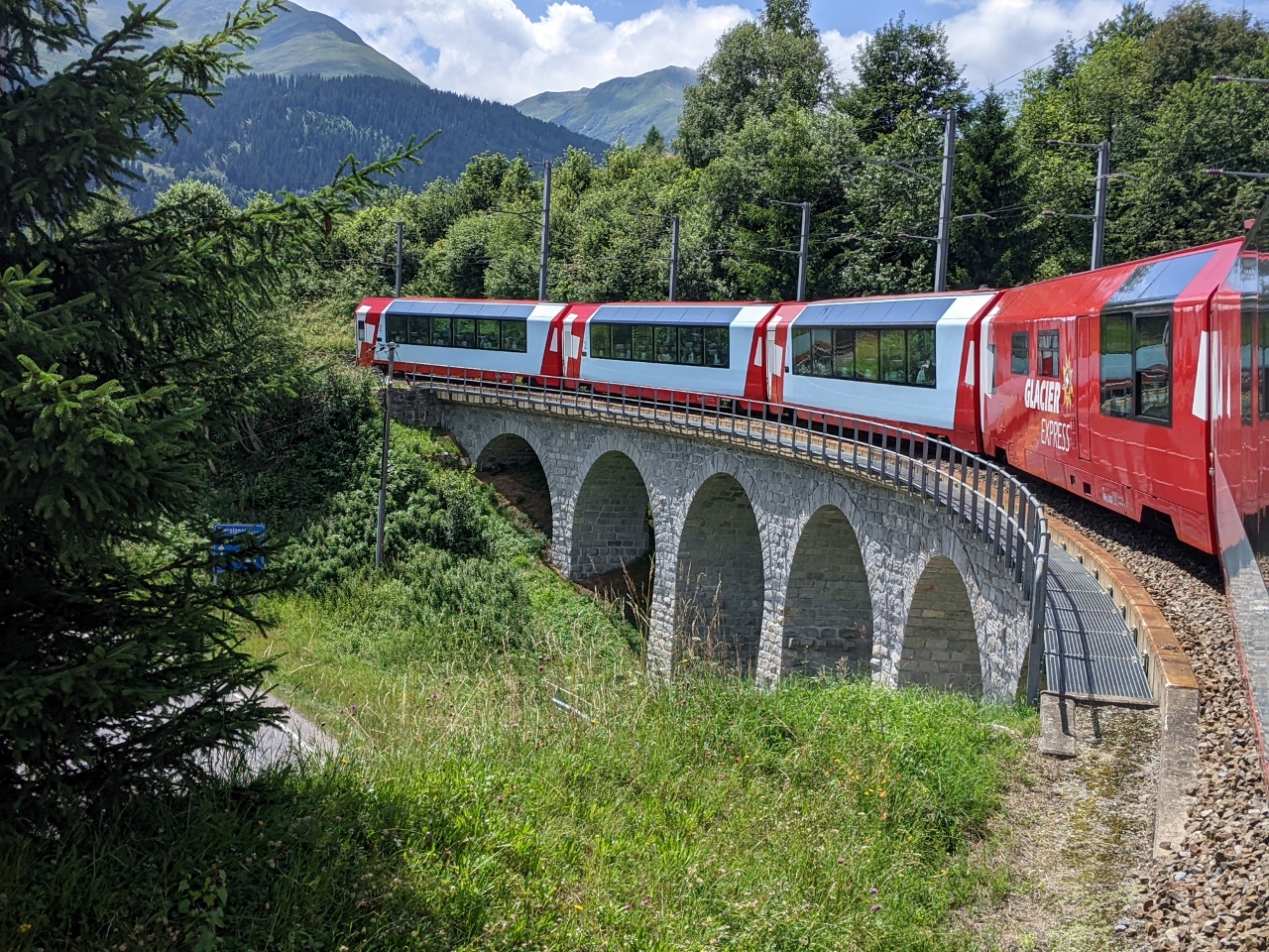
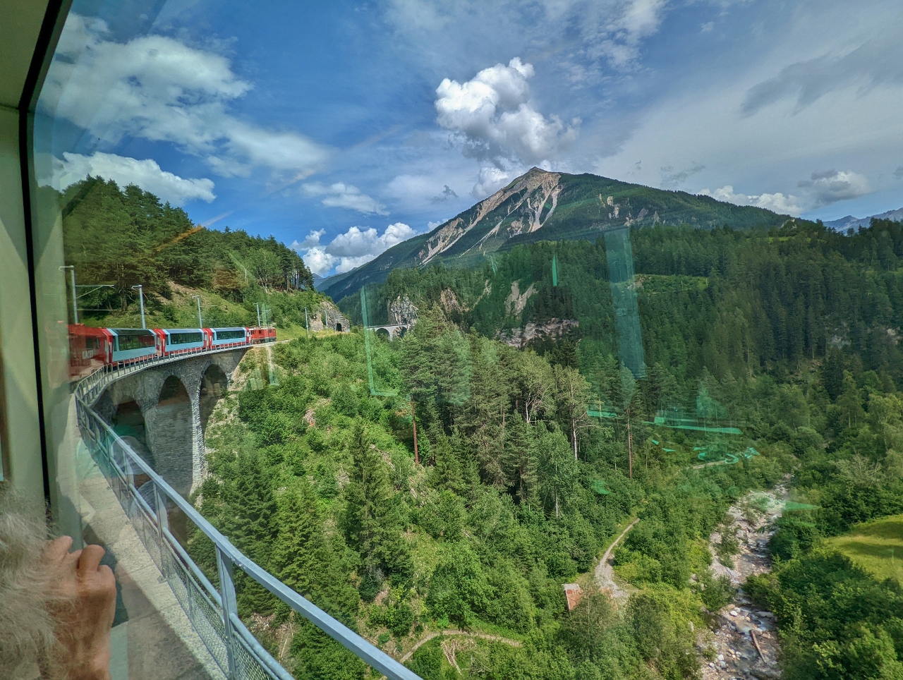
The Glacier Express is one of the two most scenic train rides in Switzerland (the other is the Bernina Express). Passengers travel through the Swiss Alps in specially-designed viewing carriages with large windows and skylights. The natural scenery is astounding, but so too is the infrastructure. The train passes through at least 91 tunnels and across 291 bridges, some marvels of early 20th-century engineering where a complex series of spiral tunnels and viaducts allows for a rapid elevation change. One of the most famous features of the route is the Landwasser Viaduct, pictured above. The striking curved viaduct stands 213 ft (65 m) above the Landwasser River and is 466 ft (142 m) long with six spans.
Billed as the “slowest express train in the world,” the Glacier Express is considered an express train only because it omits many stops along the way. The 181-mile (291 km) journey across the country takes about 7.5 hours at an average speed of 24 mph (38 kph). The focus is not on speed, but on enjoying the views.
We boarded in Zermatt and had a fabulous journey to St. Moritz, where we spent the night. The scenery was spectacular and the many complex tunnels and viaducts were amazing to both see and travel on. We’d love to make the journey in the winter for a completely different perspective.
Below are highlights from July 4th, 2022. Click any image for a larger view, or click the position to view the location on a map. And a map with our most recent log entries always is available at mvdirona.com/maps.
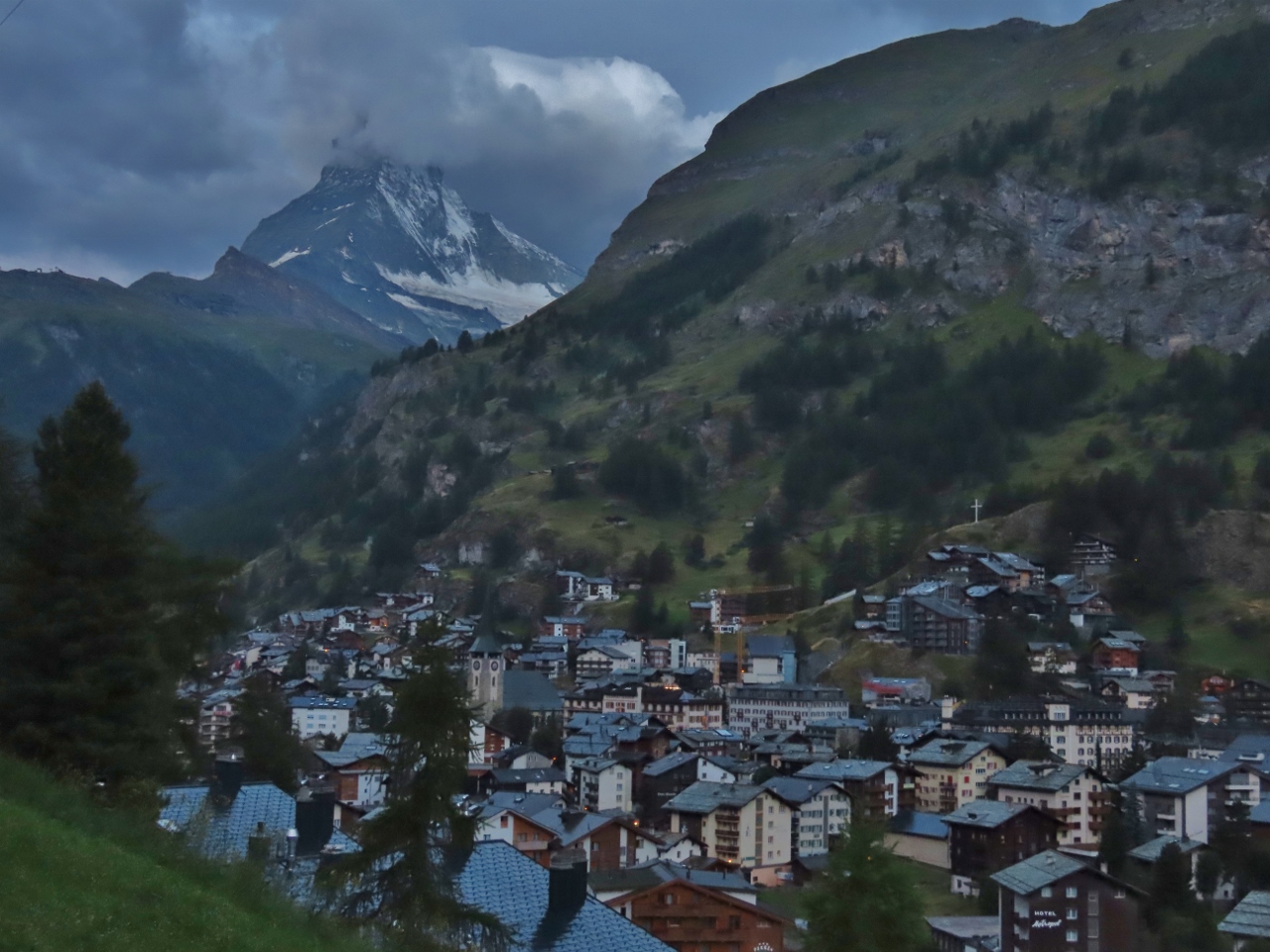 |
Matterhorn
Position: 46°1.30’N, 7°45.14’E
An early-morning Matterhorn view before we depart Zermatt for St. Moritz.
|
 |
Office
Position: 46°1.30’N, 7°45.14’E
James getting a little work done, with the Matterhorn visible in the backgroun, in our room at the Petit Chalet Schonegg.
|
 |
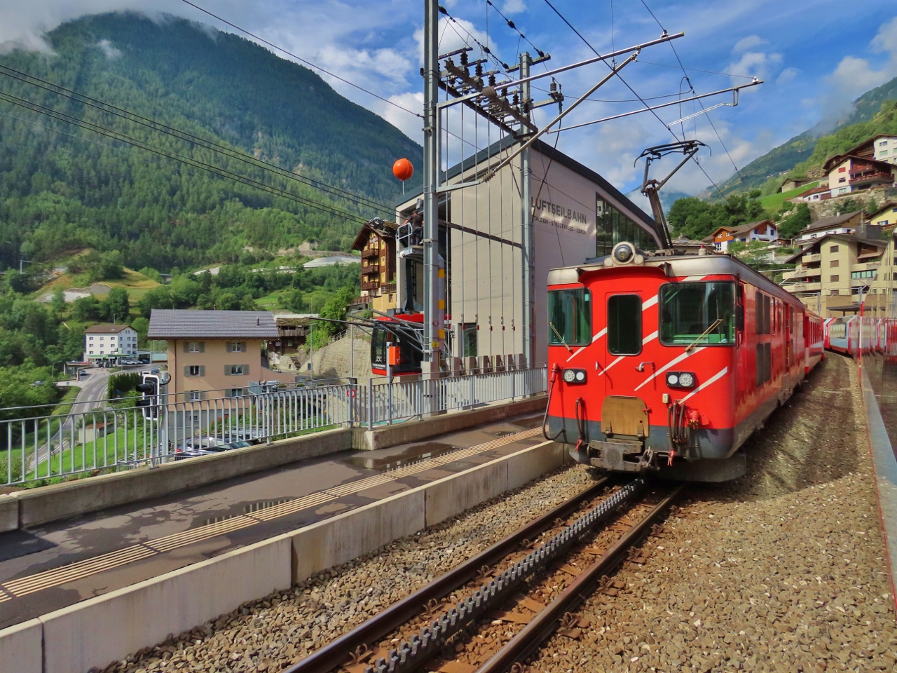
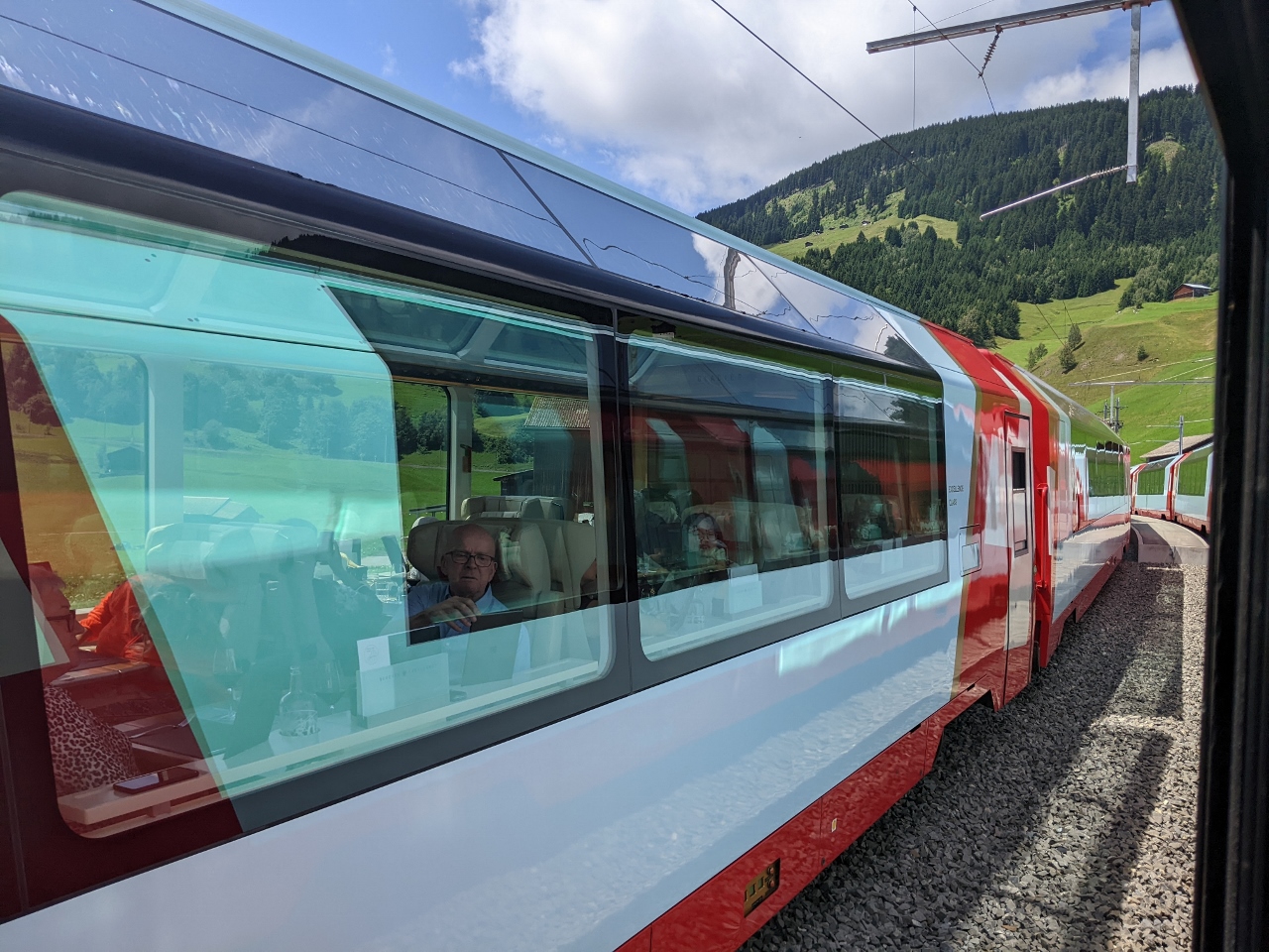
Glacier Express
Position: 46°1.50’N, 7°44.92’E
On board the Glacier Express shortly before departing Zermatt.
|
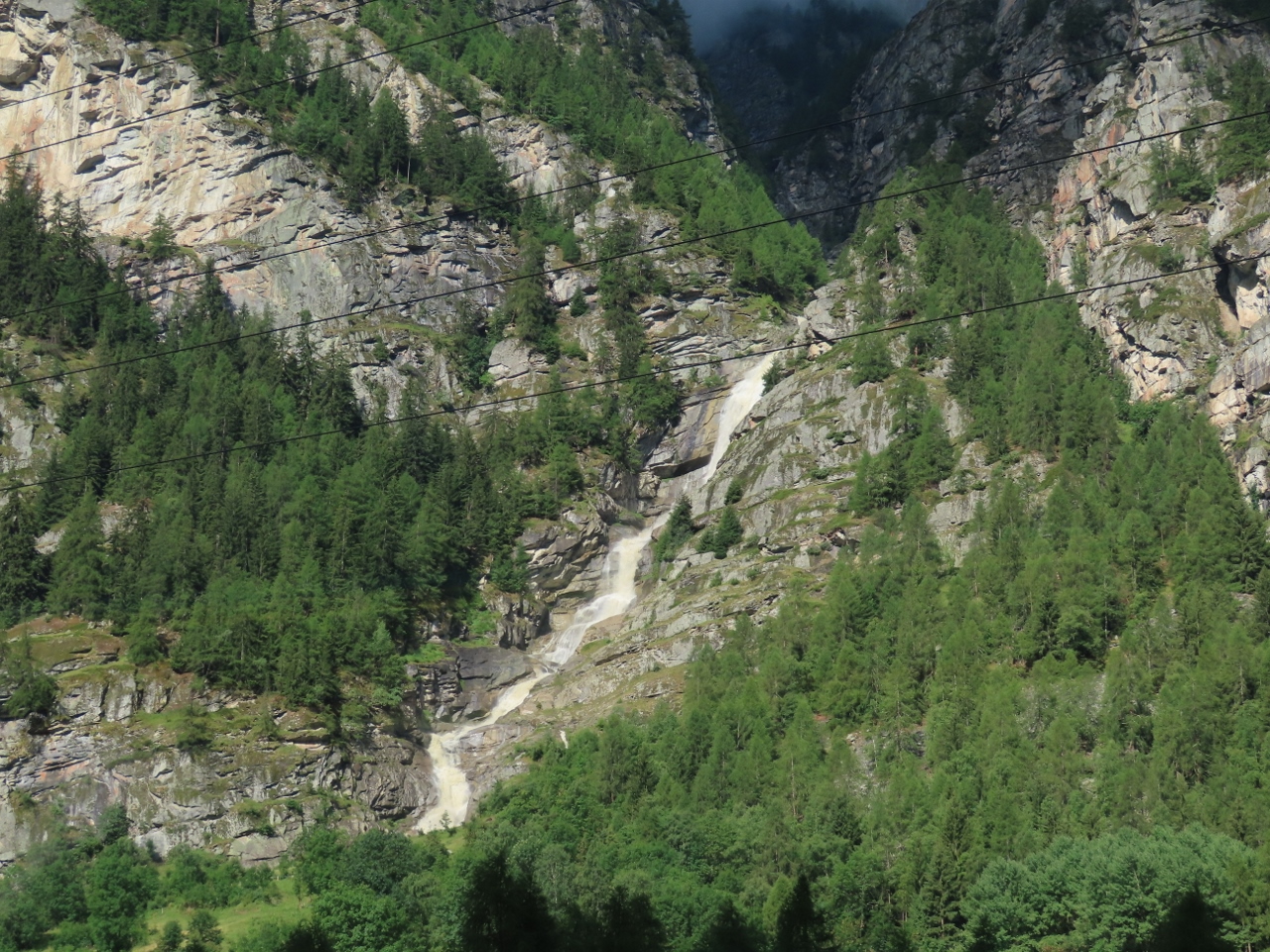 |
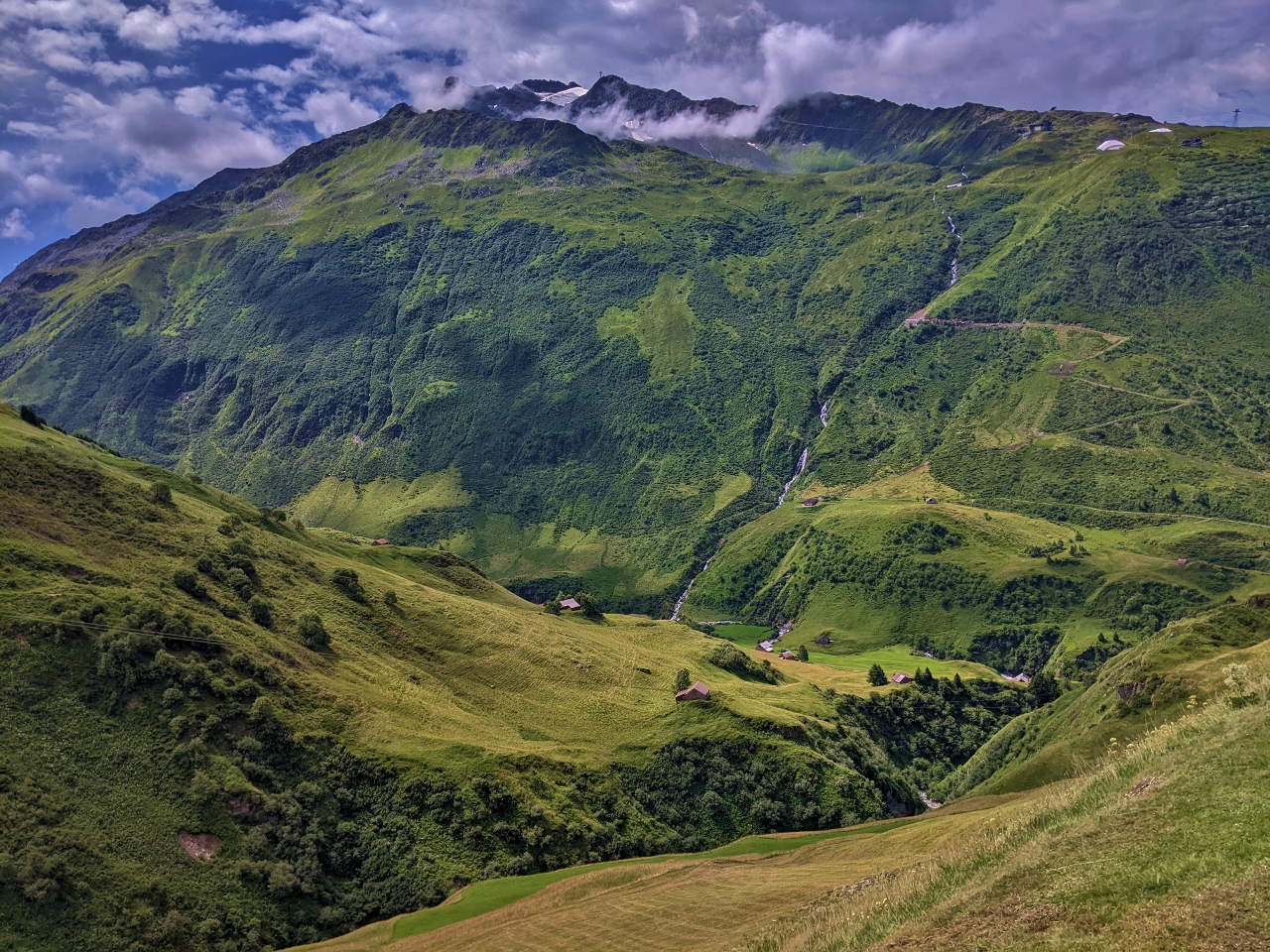
Tummigbach Waterfall
Position: 46°8.62’N, 7°47.57’E
The Tummigbach Waterfall spilling down from the mountains south of St. Niklaus.
|
 |
Illas and Merjen Bridges
Position: 46°13.69’N, 7°51.67’E
The Illas (foreground) and Merjen bridges straddling the deep gorge of the river Mattervispa. The first bridge across the gorge, the Kinn Bridge, was completed in the 16th century and still stands about a half-mile (1 km) away. The Merjen Bridge was completed in 1930 to support modern vehicle traffic that was too wide for the Kinn Bridge. This new bridge became too weak for heavy traffic and the Illas Bridge was completed in 1959.
|
 |
Rack Rail
Position: 46°13.81’N, 7°52.06’E
In many steeper sections of the route, such as this one through the Mattertal Valley, the train engages a cogwheel into a toothed rack rail for additional traction.
|
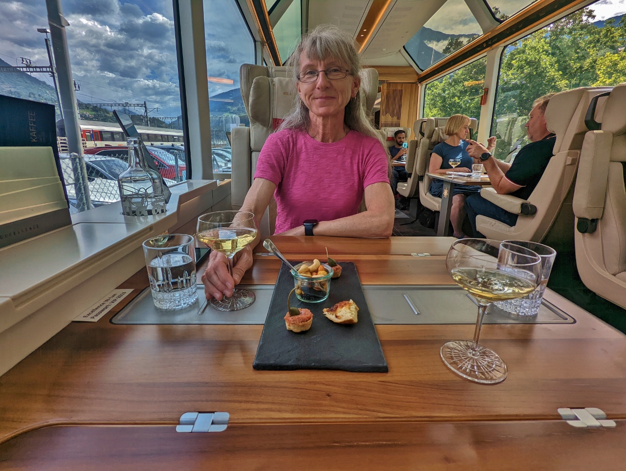 |
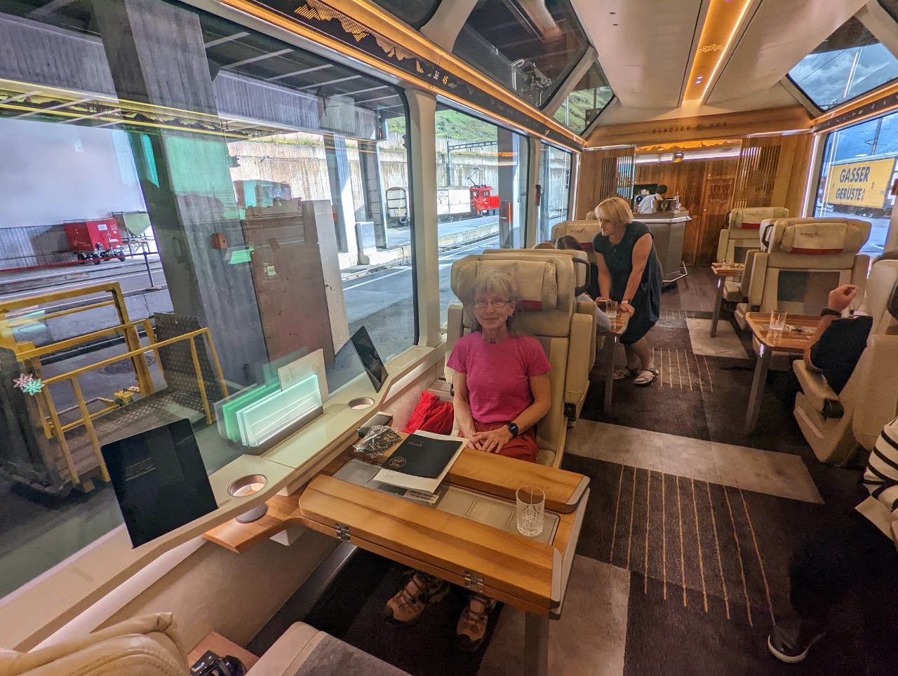
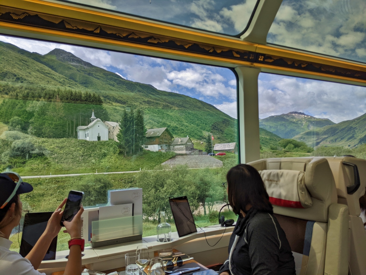
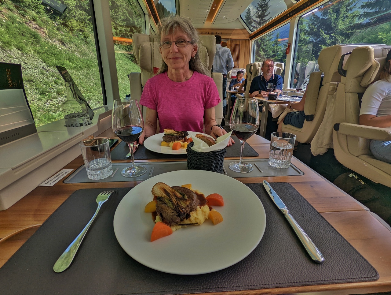
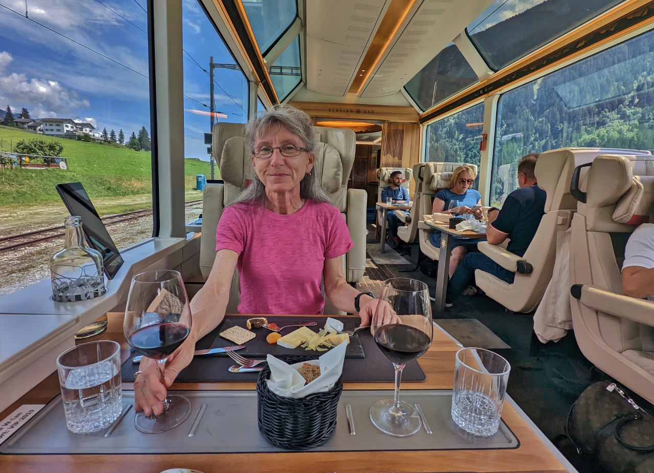
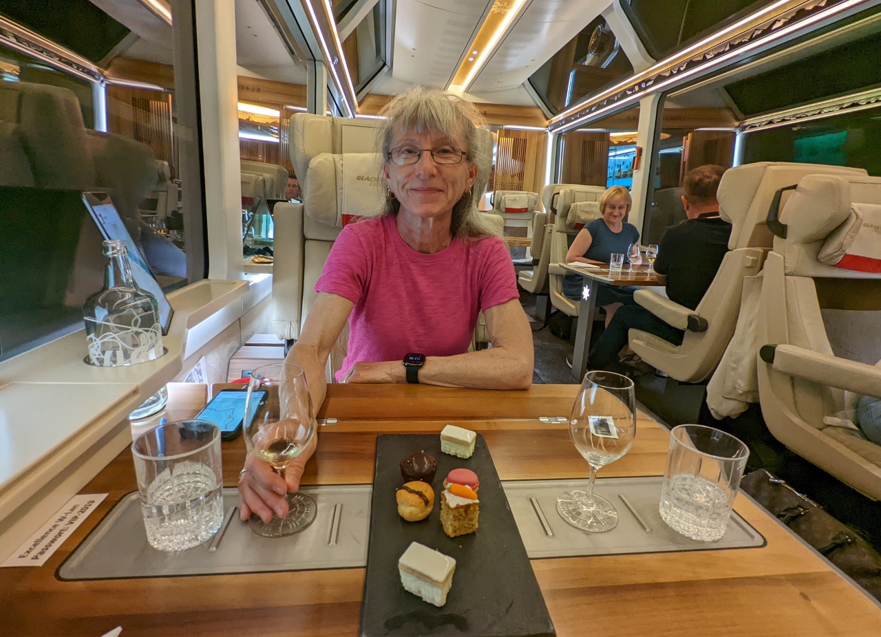
Starter Plate
Position: 46°19.14’N, 7°59.31’E
The booked a seat in the Glacier Express Excellent Class, mostly because all the seats are window seats. The package includes a seven-course meal served over the duration of the trip. Here we are having our first course, a starter plate with a tartar mini-tart, cheese tart and mixed spiced nuts.
|
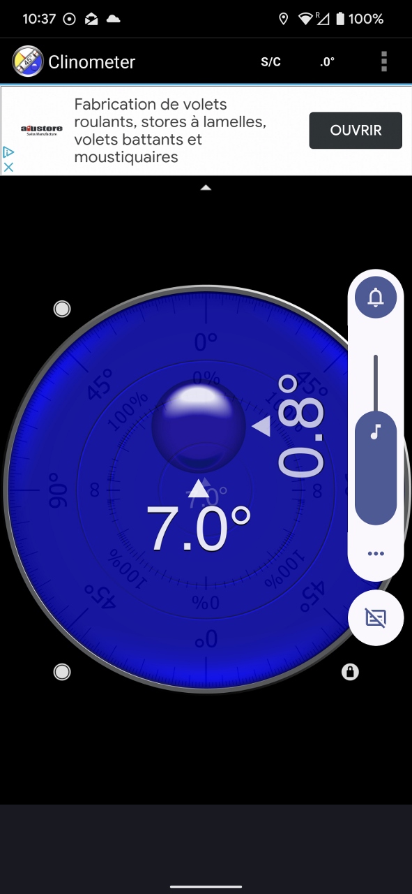 |
Seven Degrees
Position: 46°22.32’N, 8°5.09’E
The train is at an angle of seven degrees as we climb up through the Goms Valley, the uppermost valley along the Rhone River.
|
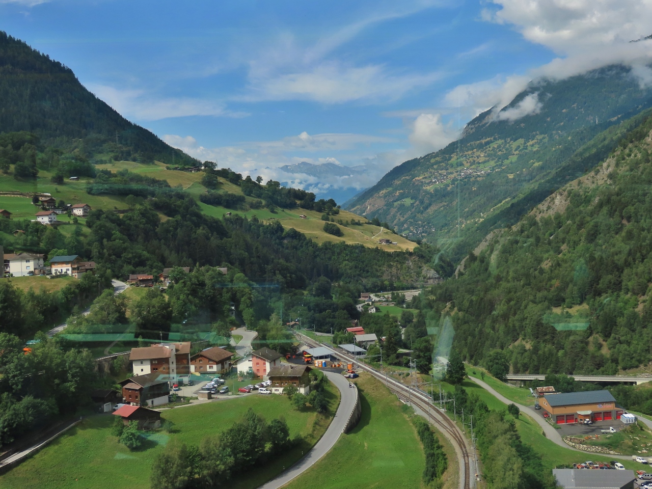 |
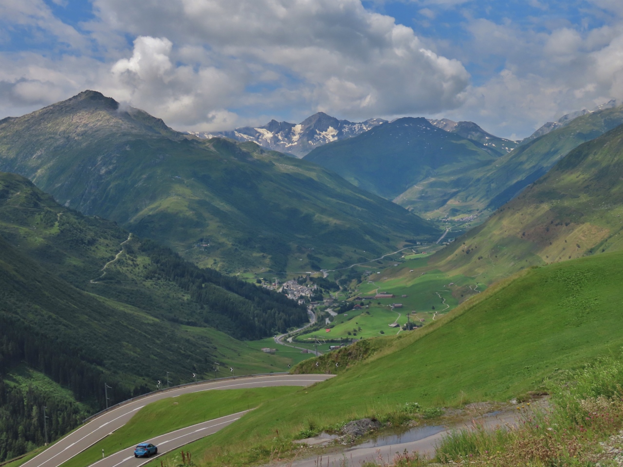
Grengiols
Position: 46°22.63’N, 8°5.75’E
Looking back to Grengiols and down to the tracks our train was just on. We’ve just passed through a 360° loop tunnel to bring us above the town. We’ve been traveling alongside the Rhone River, just out of sight on the right.
|
 |
Goms Bridge
Position: 46°24.49’N, 8°8.38’E
The 918-ft (280 m) Goms Bridge, completed in 2015, crosses the Lama Gorge 301 ft (92 m) above the Rhone River.
|
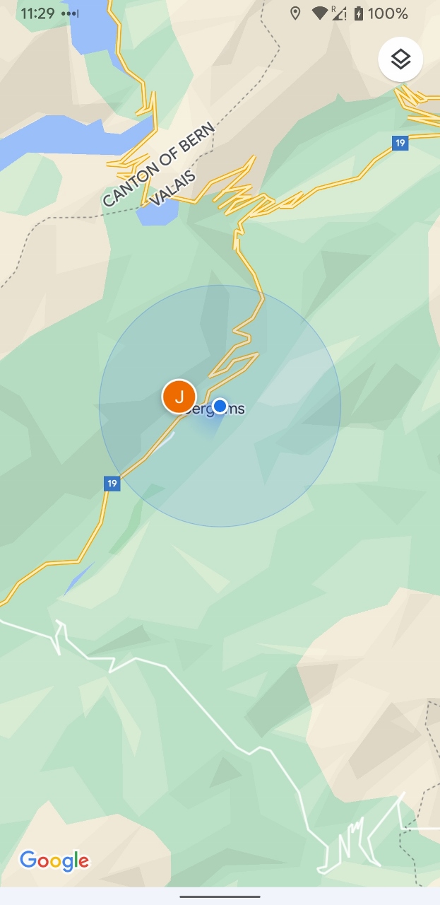 |
Obergoms
Position: 46°31.98’N, 8°20.66’E
At the town of Obergons, about to enter the Furka Base Tunnel. The Rhone River rises from the nearby Rhone Glacier, and we’ll be leaving the path of the river as we enter the tunnel.
|
 |
Furka Base Tunnel
Position: 46°33.70’N, 8°24.97’E
A second course of smoked trout as we pass through the Furka Base Tunnel. Completed in 1982, the 9.6 mile (15.4 km) tunnel provides year-round connection across the Furka Pass between the cantons of Valais and Uri.
Before this tunnel was completed, train traffic passed through the Furka Summit Tunnel, built in 1926. This tunnel had to be closed between October and June each year due to the risk of heavy snowfall, including dismantling and later re-installing the overhead electrical lines. Even for a June opening, heavy machinery was required to clear the snow from line. And in 1963, an avalanche swept away a team working on snow removal, with the loss of several lives. After this tragedy, construction of the Furka Base Tunnel was proposed. |
 |
Zumdorf
Position: 46°36.70’N, 8°32.30’E
Zumdorf is the smallest official village in Switzerland, with only a single family of three people living there. The village has a small church and even a restaurant. In 1851, the village had 50 residents when a huge avalanche buried it.
|
 |
Pea Mint Soup
Position: 46°36.95’N, 8°33.05’E
A third course of pea mint soup as we pass through the Urseren Valley alongside the Reuss River. The 102-mile (64 km) Reuss is the fourth longest river in Switzerland, after the Rhine, Aare and Rhone.
|
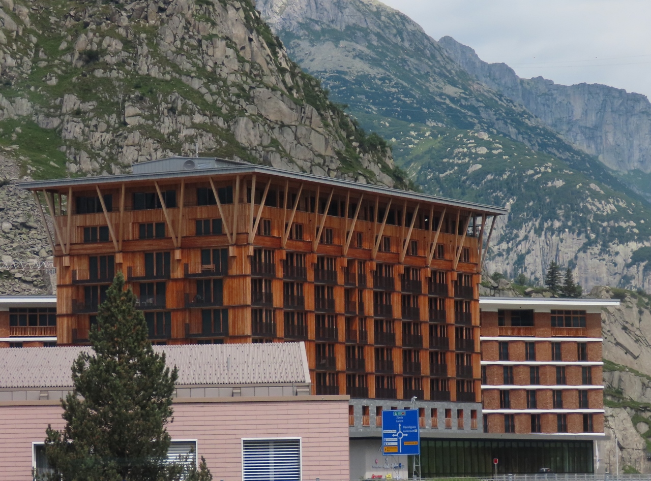 |
Radisson Blu
Position: 46°37.91’N, 8°35.27’E
The striking wooden building of the Radisson Blu Hotel Reussen in Andermatt is designed in a modern interpretation of a Swiss chalet.
|
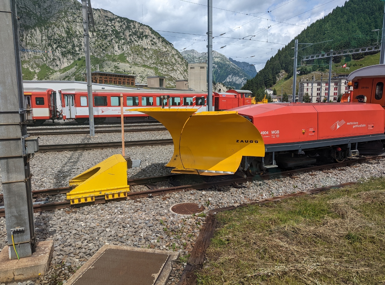 |
Zaug Snow Plow
Position: 46°38.22’N, 8°35.60’E
A snow plow made by Swiss company Zaug at the train station in Andermatt.
|
 |
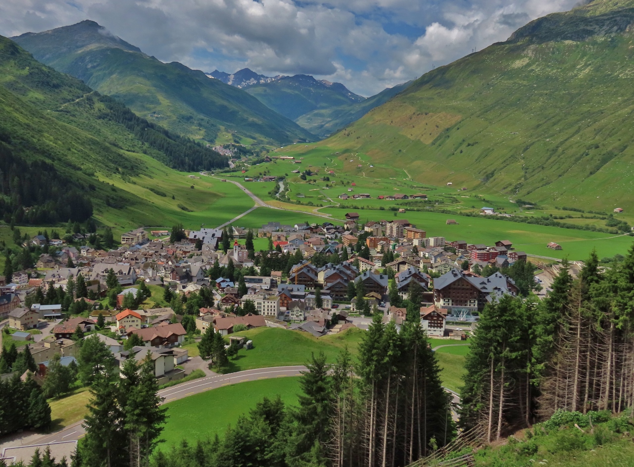
Andermatt
Position: 46°38.16’N, 8°36.10’E
Looking back down to Andermatt and the Urseren Valley, with the rear of our train visible at right, as we ascend through a series of switchbacks at the western end of the Oberalp Pass. Andermatt is a historical crossroads in Switzerland, situated at the confluence of three Alpine passes, the Furka Pass that we just crossed, the Oberalp that we are on now, and the St. Gotthard Pass to the south. And to the north, the Reuss River flows through the steeply descending Schollenen Gorge eventually to Lake Lucerne.
|
 |
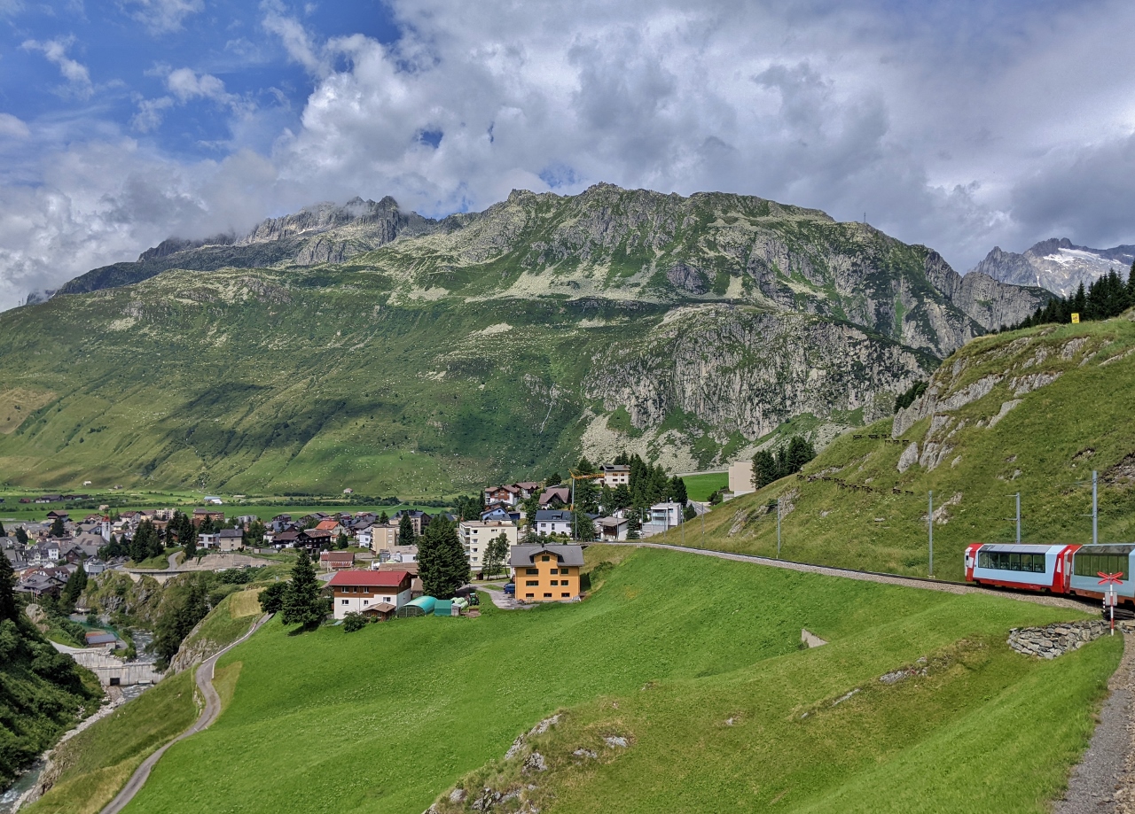
Urseren Valley
Position: 46°38.12’N, 8°36.34’E
View west through the Urseren Valley, with Andermatt in the foreground, as we continue to ascend the switchbacks of the Oberalp Pass.
|
 |
Oberalpreuss
Position: 46°38.34’N, 8°36.70’E
The lush Oberalpreuss river valley to our east.
|
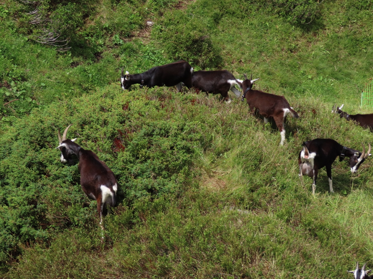 |
Goats
Position: 46°38.37’N, 8°36.78’E
Goats grazing alongside the train tracks.
|
 |
Train
Position: 46°38.53’N, 8°36.37’E
Exiting the final switcback above Andermatt. We’ve just ascended 1,200 ft (365 m) over a distance of only 2,000 ft (609 m).
|
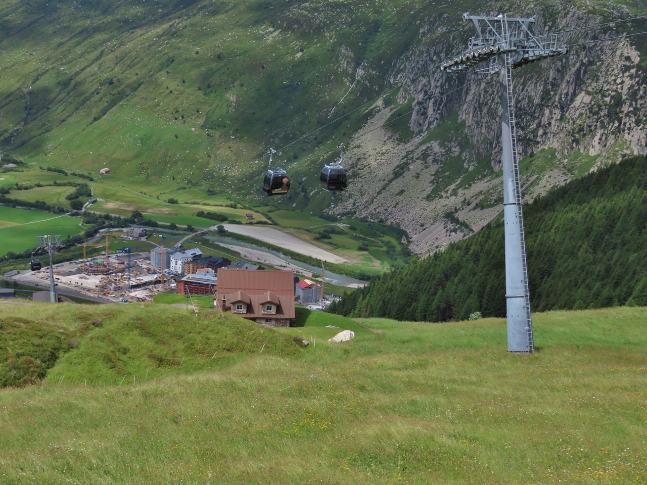 |
Gutsch Express
Position: 46°38.37’N, 8°36.78’E
The Gutsch Express gondola, opened in 2017, operates year-round from Andermatt up the Natschen mountain to Gutsch. The lift ascends from 4,715 ft (1,437 m) to 7,733 ft (2,357 m) in 8 minutes.
|
 |
Oberalpstrasse
Position: 46°38.50’N, 8°36.36’E
The switchbacks of the Oberalpstrasse road at the west end of Oberalp Pass, with the Urseren Valley in the distance. The train tracks, not visible, follow roughly the same route.
|
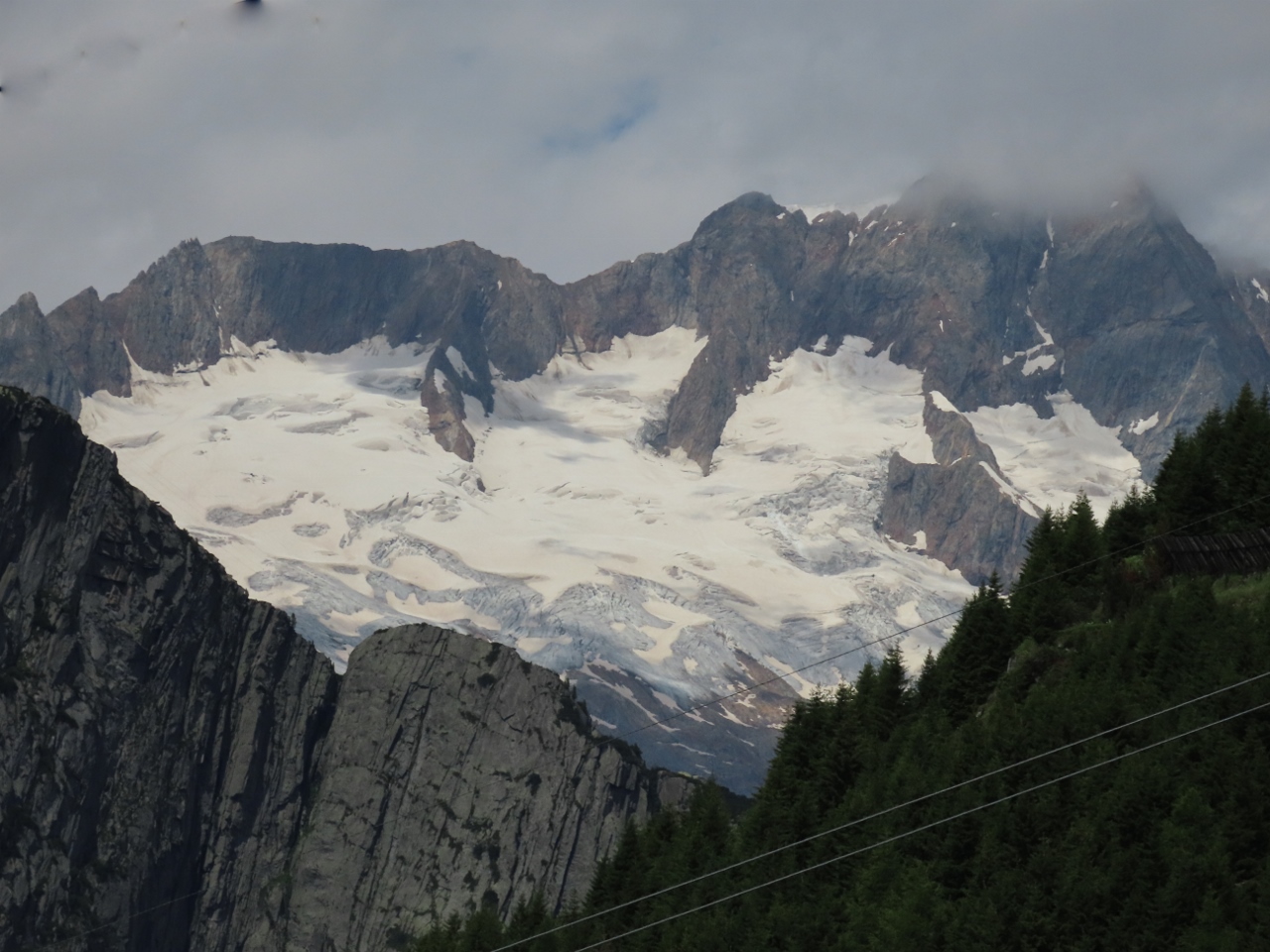 |
Sustenhorn
Position: 46°38.54’N, 8°36.61’E
The glaciated summit of 11,490-ft (3,502-m) Sustenhorn to our northwest. Although the train is called the Glacier Express, this is one of the few glaciers actually visible en route.
|
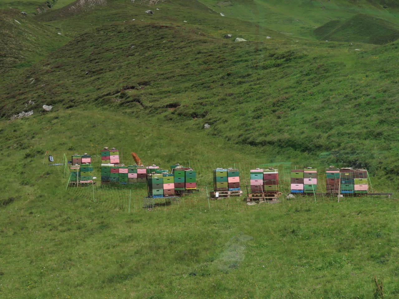 |
Bee Hives
Position: 46°38.54’N, 8°36.83’E
Bee hives in near the train station at Natschen.
|
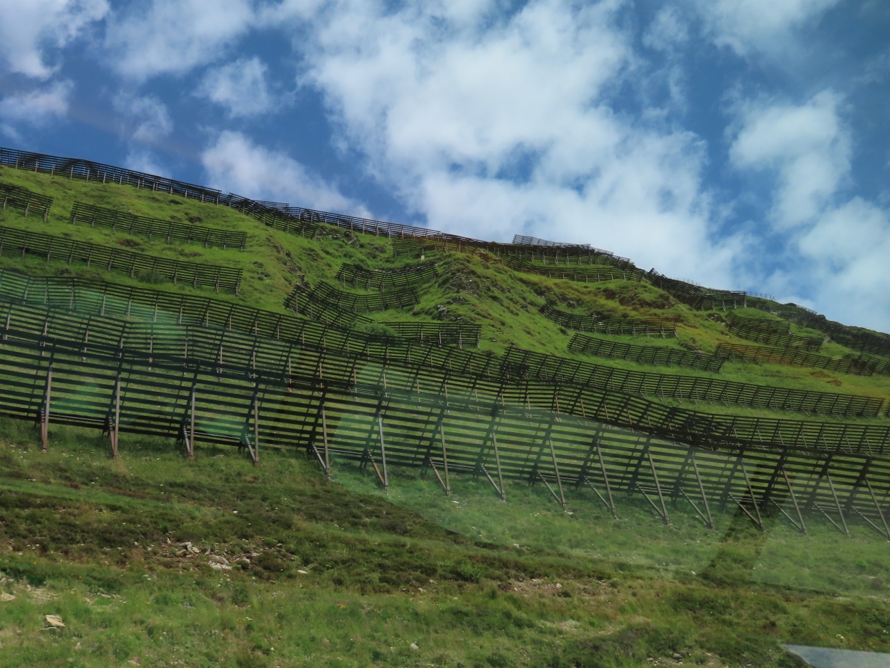 |
Avalanche Fences
Position: 46°39.12’N, 8°38.07’E
Steep slopes throughout Switzerland are covered with these avalanche fences. The fences are designed to stabilize the snow at avalanche initiation zones and prevent the triggering of an avalanche.
|
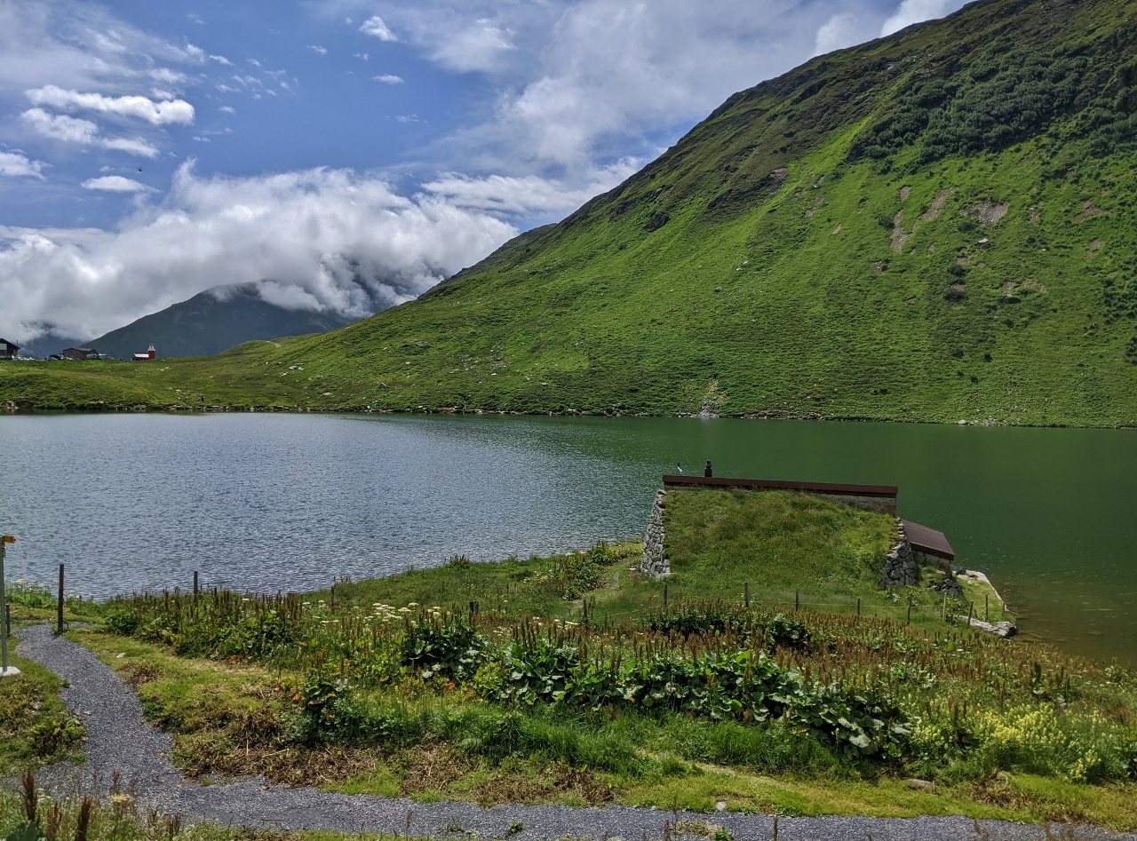 |
Oberalpsee
Position: 46°39.54’N, 8°39.24’E
The alpine lake Oberalpsee at altitude 6,673 ft (2,034 m), the highest point on the Oberalp Pass and on the Glacier Express line between Zermatt and St Moritz. The Rhine River rises at nearby Lake Tuma as the Vorderrhein and descends eastward to Chur. There it turns northwest and eventually reaches Basel, Switzerland, where we embarked on our Rhine River cruise in December of 2019.
|
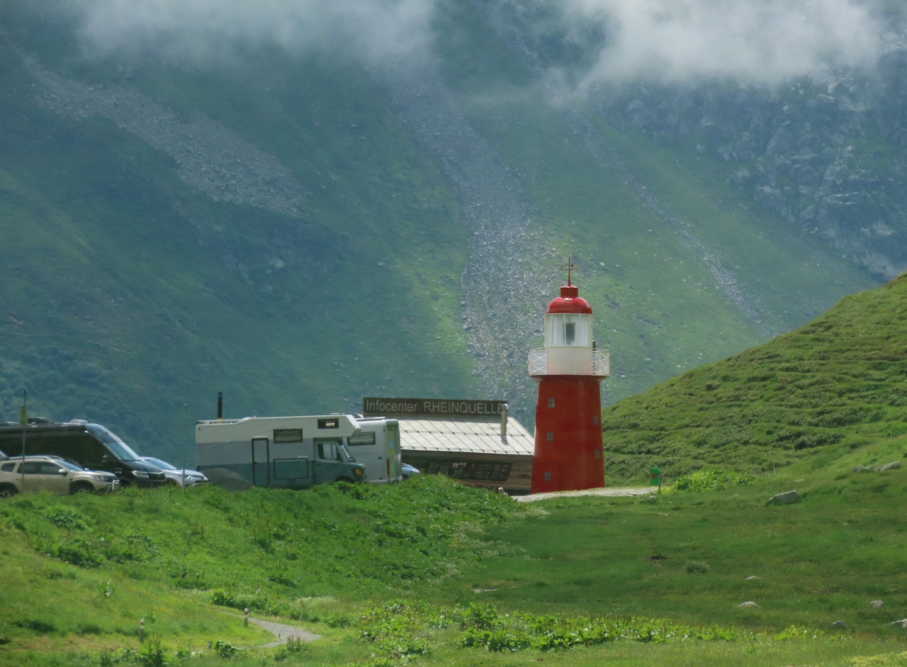 |
Rheinquelle Lighthouse
Position: 46°39.51’N, 8°39.15’E
The Rheinquelle lighthouse at Lake Oberalpsee on the Oberalp Pass was built in 2015 as part of a tourist marketing campaign to raise awareness of and attract visitors to the area. The light is a scale model of the former Hoek van Holland (“Hook of Holland”) lighthouse near Rotterdam that marked the mouth of the Rhine where it flowed into the North Sea. Rheinquelle is French for “source of the Rhine” and the idea behind the campaign was to mark the source of the Rhine with this lighthouse, and then float a ship up from the mouth of the Rhine to Basel, where it would be disassembled, transported here by road, and reassembled. So far, only the lighthouse has been built. Kind of sounds like a government project doesn’t it? :-)
|
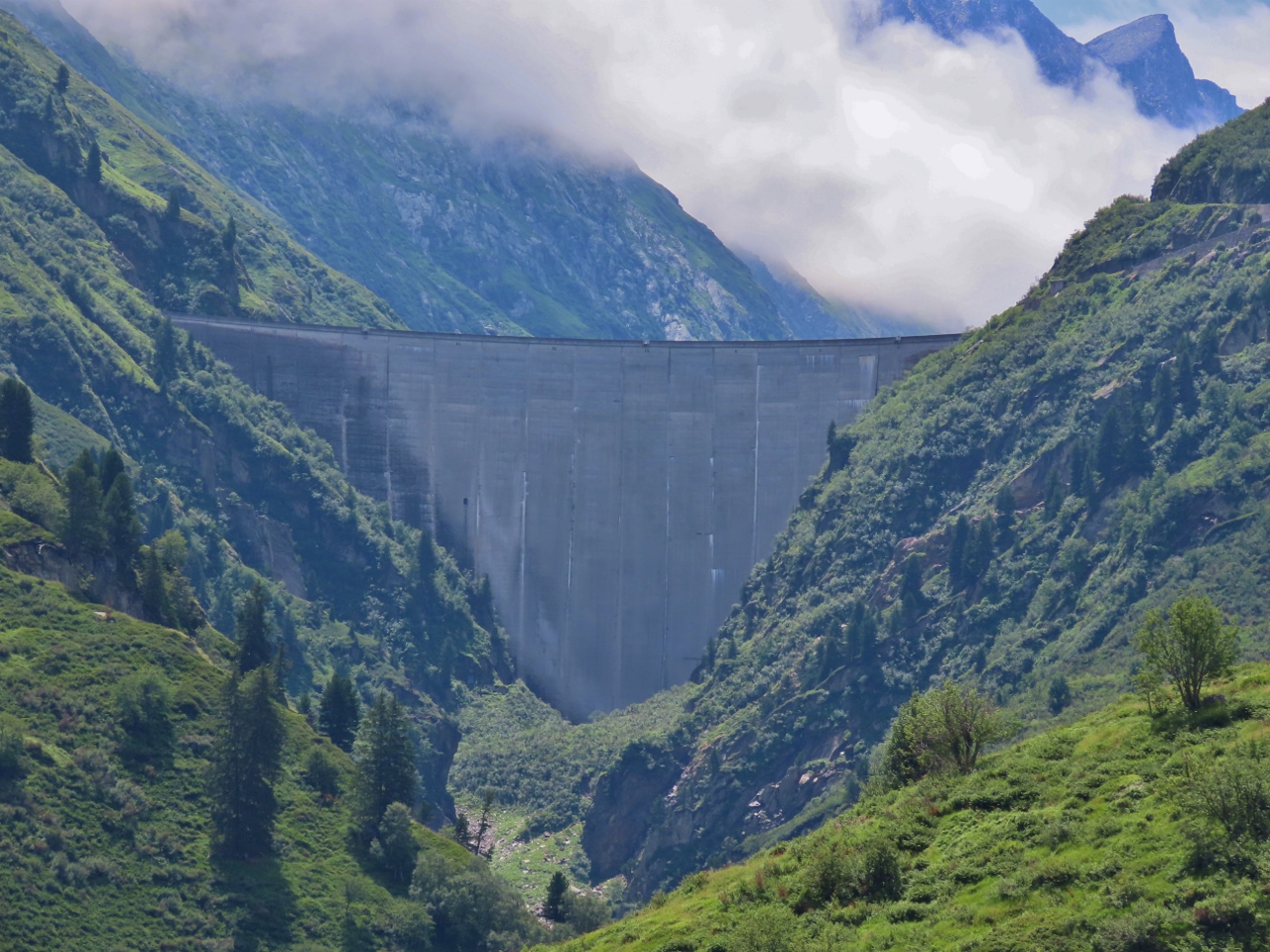 |
Curnera Dam
Position: 46°39.34’N, 8°40.65’E
The Curnera hydroelectric dam, completed in 1966, is 501-ft (153m) high with a crest length of 1,148 ft (350 m). It creates the Lai da Curnera reservoir, into which all surrounding rivers are diverted.
|
 |
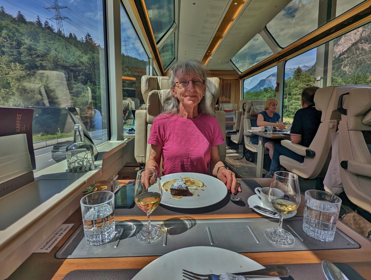
Beef Tenderloin
Position: 46°39.61’N, 8°42.98’E
A fourth course of Beef Tenderloin as we pass through the Surselva Valley alongside the Vorderrhein (Anterior Rhine).
|
 |
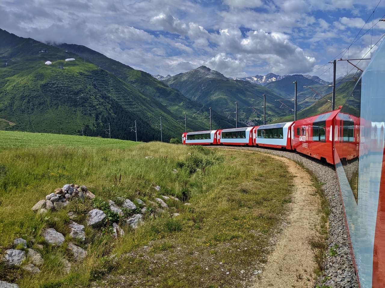
Glacier Express to Zermatt
Position: 46°41.47’N, 8°49.86’E
We’re about halfway through our journey now, and are passing the Glacier Express train that left this morning from St. Moritz for Zermatt. Only one Glacier Express train runs per day in each direction. But faster intercity trains run the route multiples times a day.
|
 |
Val Cuoz Viaduct
Position: 46°41.48’N, 8°50.11’E
The back of our train passing over the 1926 Val Cuoz Viaduct near Desintes.
|
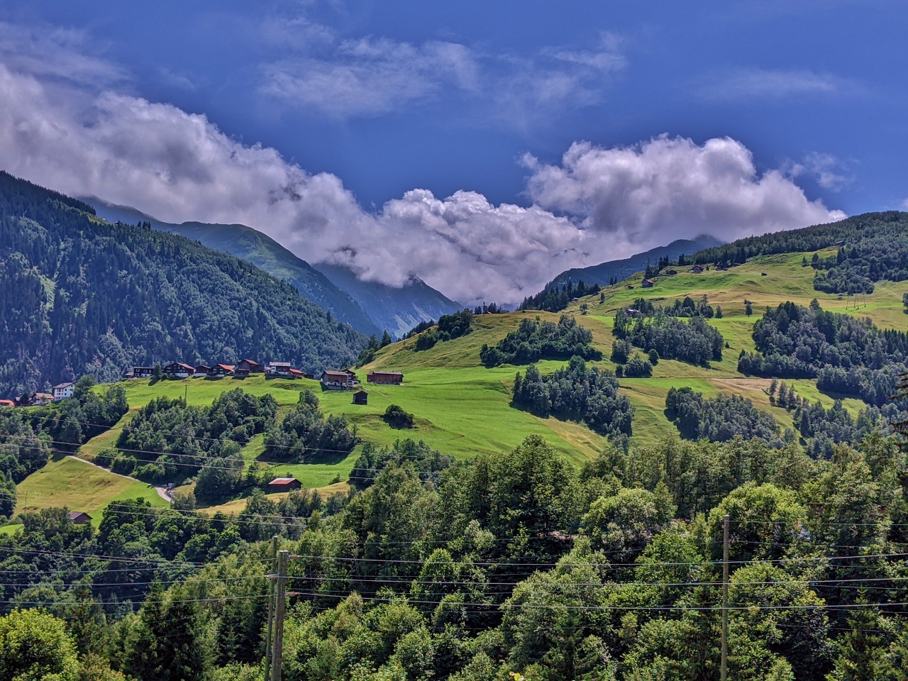 |
Medel
Position: 46°41.48’N, 8°50.11’E
Looking south to the village of Medel, with the Val Medal valley beyond. The Rein da Medel, the longest headwater of the Rhine, flows through this valley and joins with the Vorderrhein.
|
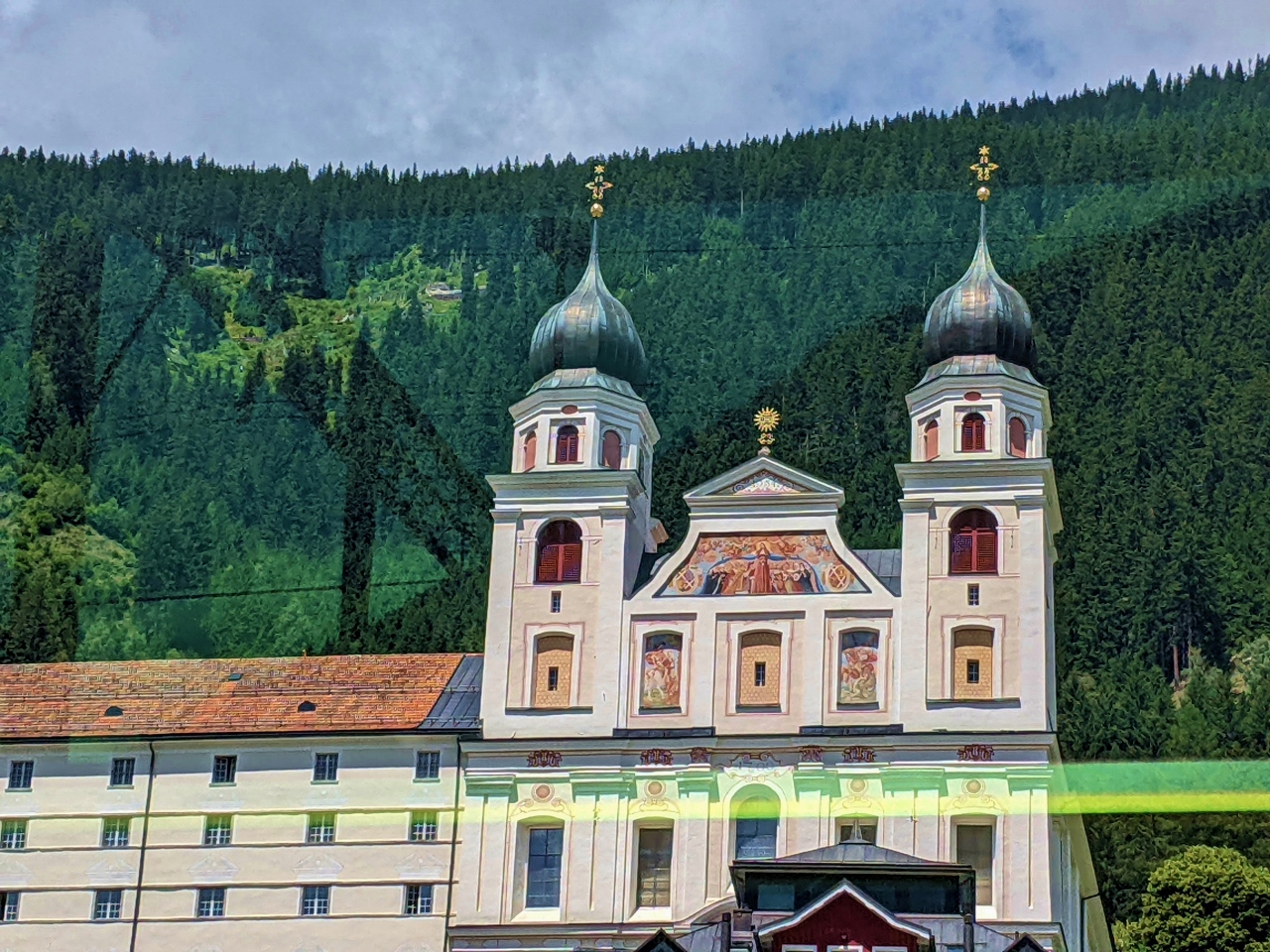 |
Disentis Abbey
Position: 46°42.12’N, 8°51.28’E
Historic Disentis Abbey was founded in the 7th century. Marauding Avars (an alliance of several groups of Eurasian nomads that controlled much of Central and Eastern Europe from the late 6th to the early 9th century) destroyed the original abbey, which was rebuilt in the 8th century and hosted Charlemagne in 800. Napoleon’s army burned and plundered the abbey in the 18th century and it was rebuilt again in 1880. Today the abbey remains a religious institute and the community there runs a highly-respected secondary school.
|
 |
Cheese Plate
Position: 46°43.89’N, 8°57.20’E
A cheese plate for our fifth course as we continue through the Surselva Valley alongside the Vorderrhein (Anterior Rhine).
|
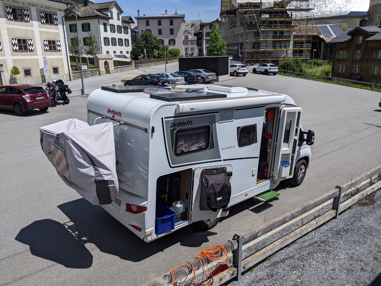 |
Dethleffs Caravan
Position: 46°43.94’N, 8°57.95’E
A well-equipped Dethleffs caravan parked alongside the train tracks in Surrien. Whip and ski pole manufacturer Arist Dethleffs invented the caravan in Germany in 1931 to allow his family to accompany him on business trips. He subsequently began building caravans to order and demand was so high that by 1958 the company ceased the other business to focus solely on caravan production.
|
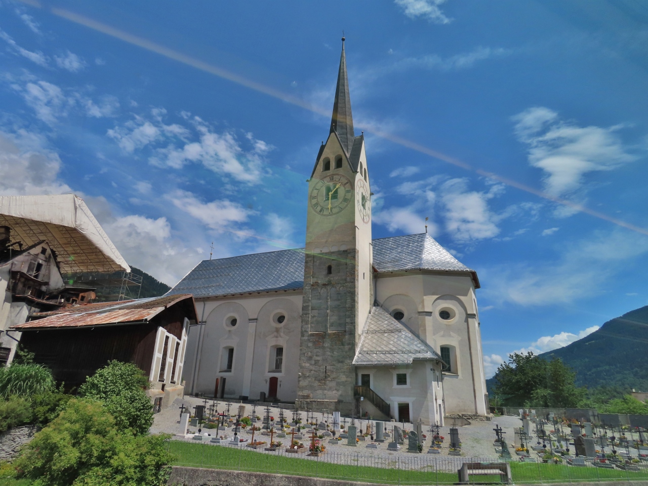 |
Martinskirche
Position: 46°44.40’N, 8°58.60’E
The foundation stones for the Martinskirche (Parish Church of St. Martin) in Trun were laid in 1658.
|
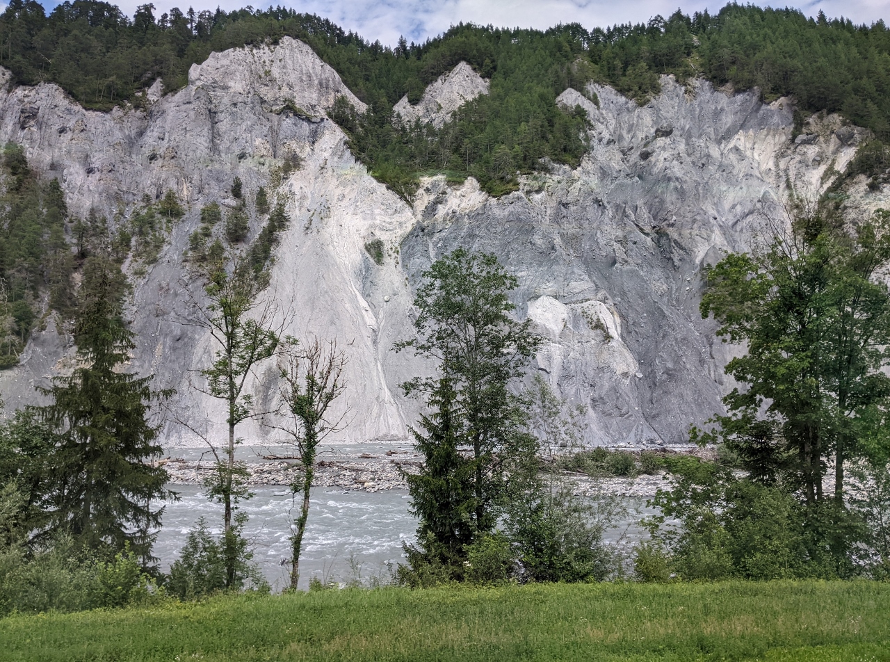 |
Rhine Gorge
Position: 46°47.70’N, 9°17.30’E
Passing through the Rhine Gorge in the debris field of the Flims Rockslide, the largest known landslide in the alps and the biggest still-visible slide in the world. The slide occurred around 10,000 years ago, setting about 2.9 cu mi (12 km3) of rock in motion and leaving debris piled as high as 2,000 ft (600 m).
|
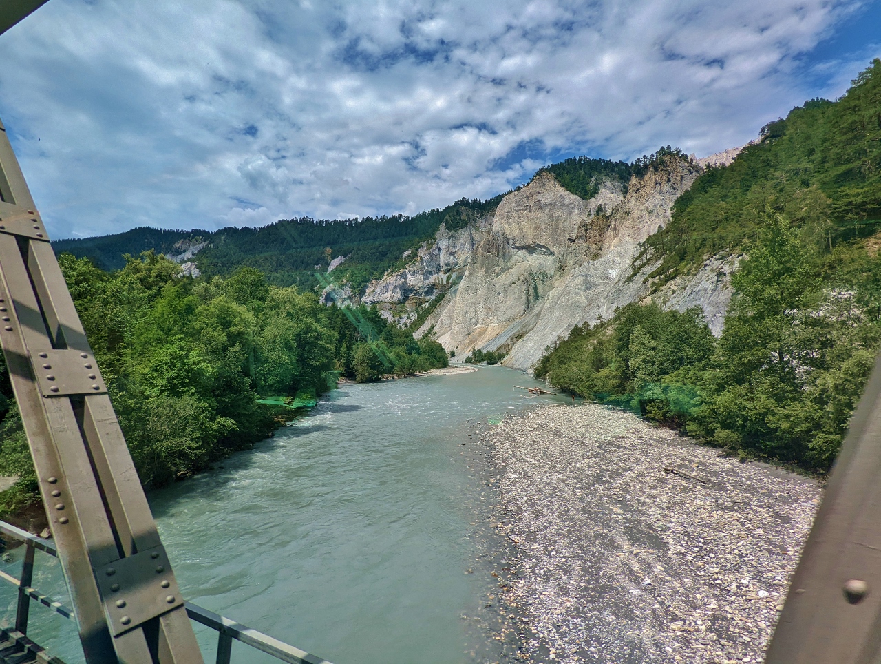 |
Isla Bella Bridge
Position: 46°48.38’N, 9°18.90’E
Crossing the Vorderrhein on the Isla Bella Bridge in the Rhine Gorge. The canyon also is known by its German name, Rheinschlucht, and as the Ruinaulta Canyon and the Grand Canyon of Switzerland.
|
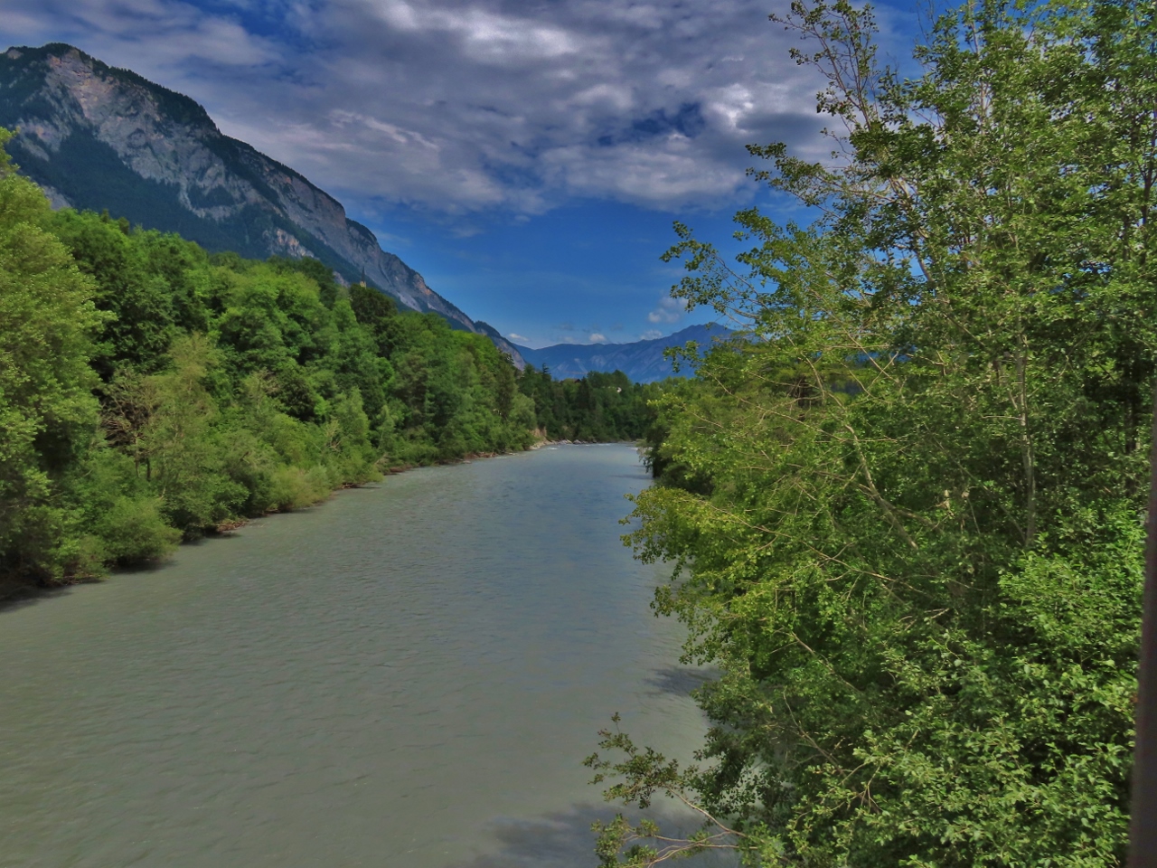 |
Farsch Bridge
Position: 46°49.39’N, 9°23.42’E
Looking east along the Vorderrhein as we exit the Rhine Gorge on the Farsch Bridge.
|
 |
Chur
Position: 46°51.26’N, 9°31.75’E
The train makes a brief stop in Chur, then turns around and heads back out on the same path before turning south towards St. Moritz. Here in Chur, the Rhine bends northwards en route to Basel.
|
 |
Chocolate Cake
Position: 46°47.22’N, 9°24.34’E
A sixth course of chocolate cake as we pass alongside the Hinterrhein through the Domleschg valley.
|
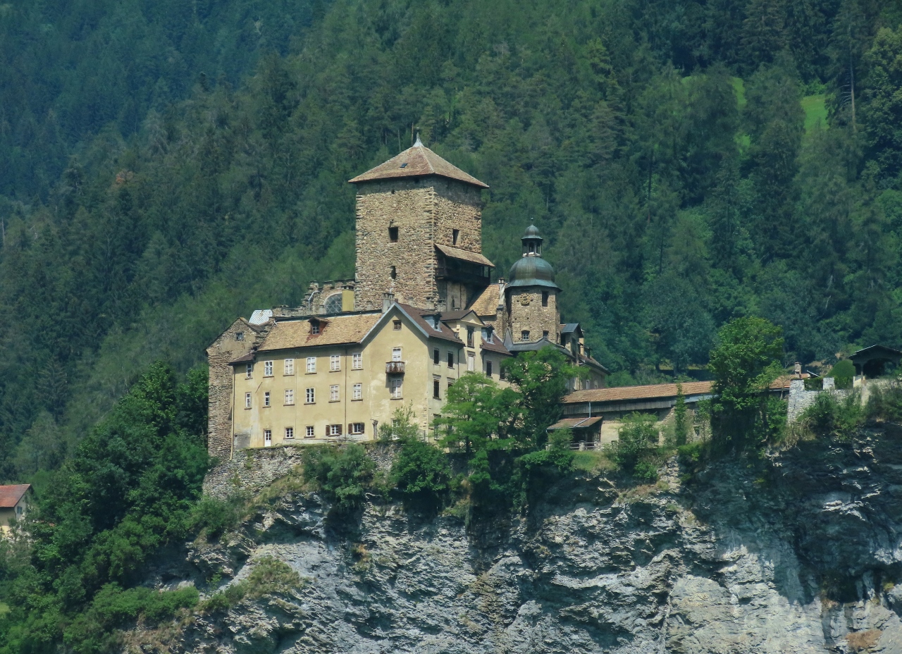 |
Ortenstein Castle
Position: 46°45.47’N, 9°25.45’E
Ortenstein Castle, built around 1250, is one of several castles and ruins in the Domleschg valley, indicating the importance of trade in the area.
|
 |
Afternoon Tea
Position: 46°41.70’N, 9°28.61’E
A seventh and final course, afternoon tea, as we pass through one of the 91 tunnels on the Glacier Express route.
|
 |
Solis Bridge
Position: 46°40.86’N, 9°31.52’E
The Solis Bridge across the Albula River, viewed as our train crosses on the Solis Viaduct. The Solis Bridge was built in 1868 and still is in use, while the Solis Viaduct was completed in 1903.
|
 |
Albula/Alvra
Position: 46°39.84’N, 9°34.54’E
Looking past the municipality of Albula/Alvra with the Albula Alps visible beyond.
|
 |
Schmittentobel Viaduct
Position: 46°40.06’N, 9°38.04’E
Passing over the Schmittentobel Viaduct with the famous Landwasser Viaduct visible beyond a short tunnel. The Schmittentobel Viaduct, completed in 1902, is 115 ft (35 m) high, 449 ft (137 m) long and has seven 49-ft (15m) spans.
|
|
|
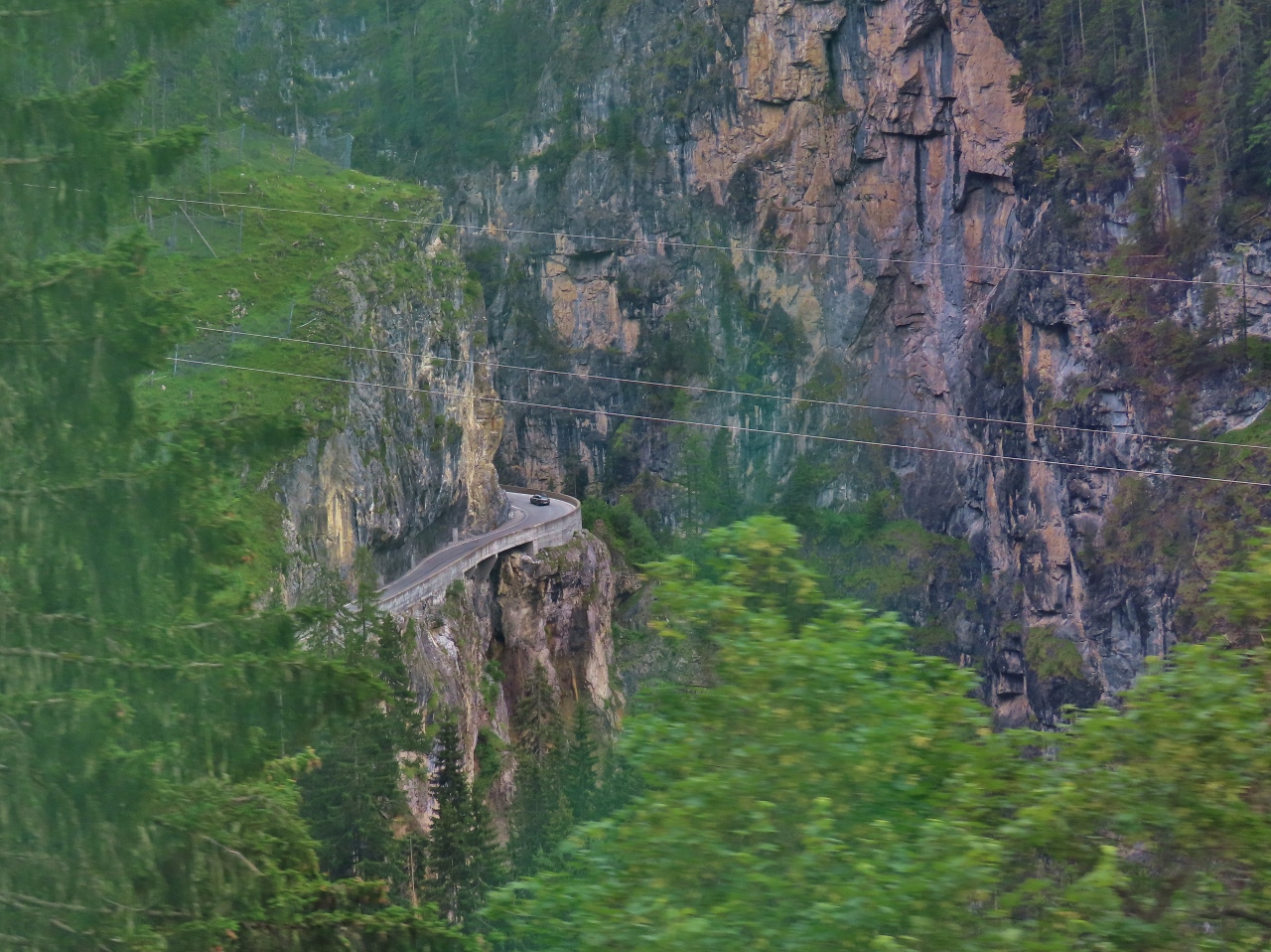
Landwasser Viaduct
Position: 46°40.86’N, 9°40.52’E
Heading into the Landwasser Tunnel over the Landwasser Viaduct, the most famous feature on the Glacier Express route. The striking curved viaduct stands 213 ft (65 m) above the Landwasser River and is 466 ft (142 m) long with six spans. It was renovated in 2009 for the first time since its initial completion in 1902.
|
 |
Albula River Valley
Position: 46°40.85’N, 9°40.58’E
A road hugging the cliff through the Albula River valley.
|
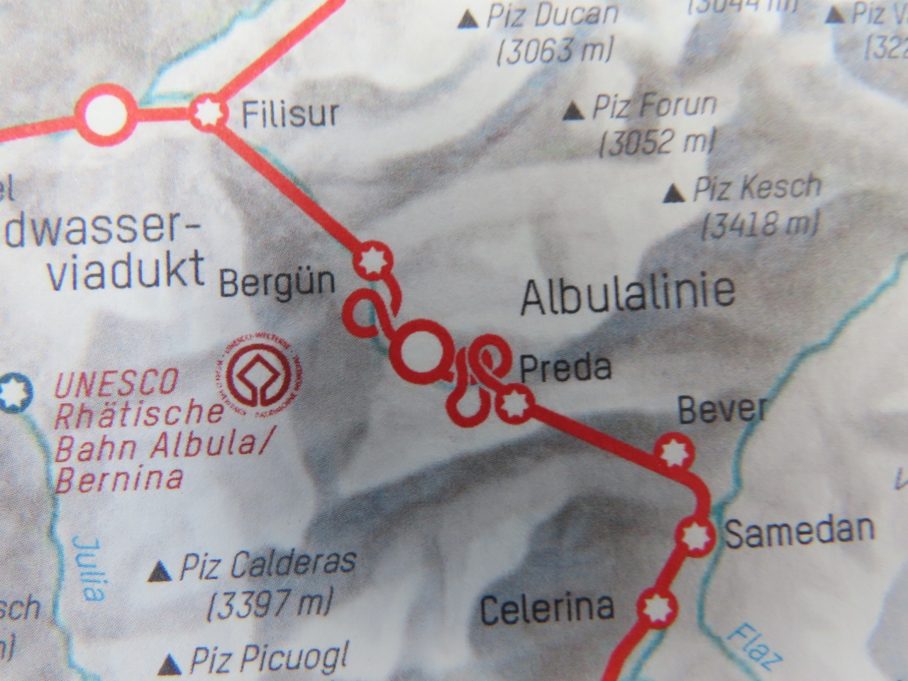 |
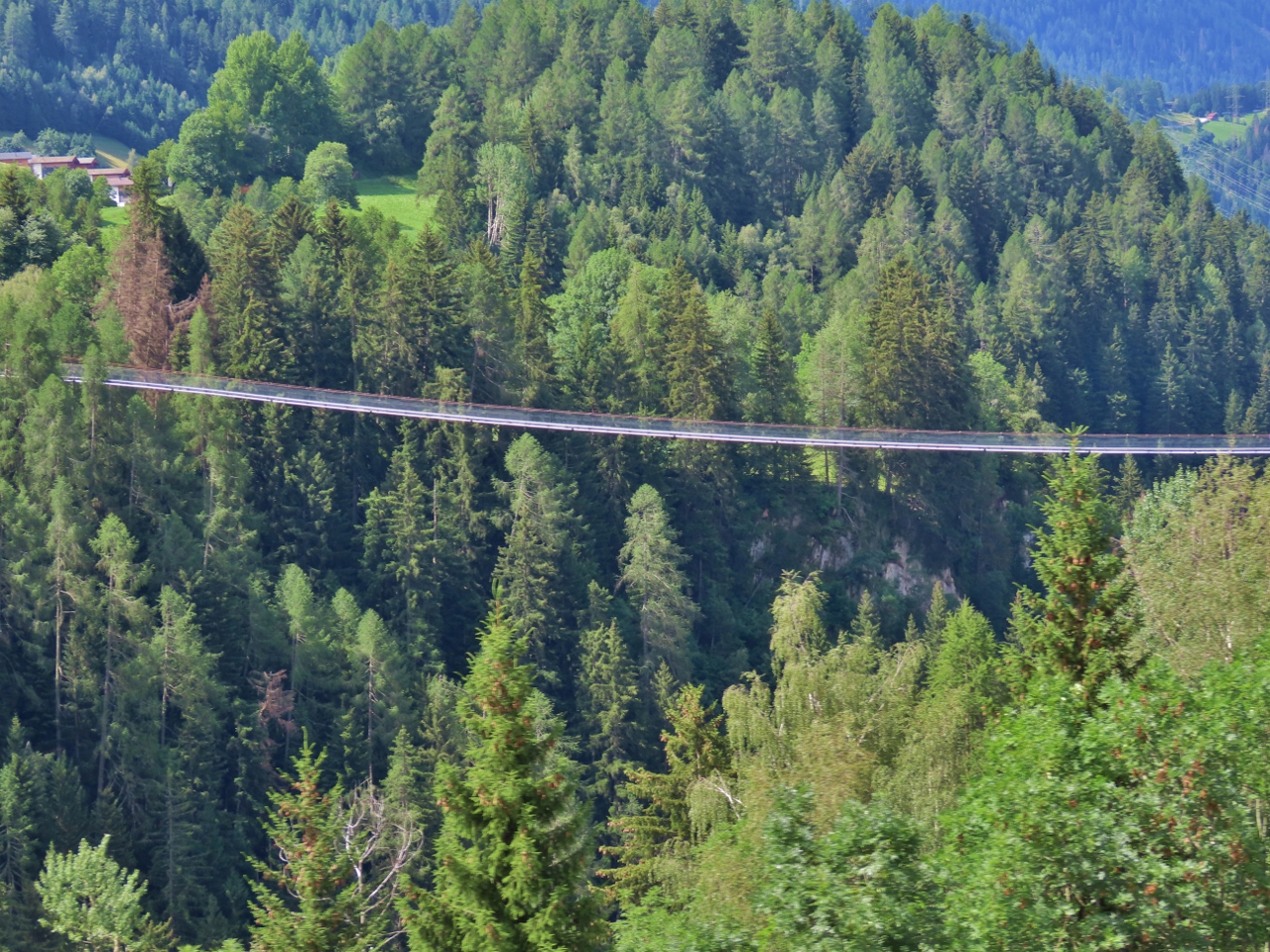
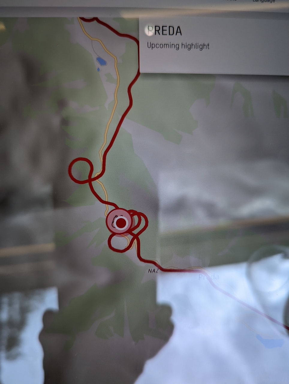
Spirals and Loops
Position: 46°38.27’N, 9°44.14’E
In just 3.75 miles (6 km) as the crow flies, the train ascends 1,368 ft (416 m) from Preda to Bergun, a 14% grade. This is accomplished through a complex 7.5-mile (12km) series of four spiral and loop tunnels and six viaducts that we’re about to enter. An excellent diagram of the most complex portion of this system is at Swiss Spiral Tunnels Cutaway. Built in 1902, the tunnels and viaducts are an impressive and beautiful engineering feat.
|
 |
Bergun Loop
Position: 46°37.21’N, 9°45.14’E
Passing through the first loop at Bergun.
|
 |
Rugnus Tunnel
Position: 46°35.77’N, 9°45.49’E
We’ve just exited the spiral Rugnus Tunnel and are crossing the road bridge above the Albula River. We’ll re-cross the river on the viaduct visible at upper left and enter the Zuondra and Toua spiral tunnels.
|
 |
Albula Viaduct
Position: 46°35.74’N, 9°45.66’E
On the Ablula Viaduct just after exiting the spiral Zuondra Tunnel. The tracks below are the ones we were just on to enter the tunnel. If our train was long enough, the end would be entering the tunnel as we exited, and we’d pass over it.
|
 |
Rugnux Tunnel
Position: 46°36.01’N, 9°45.29’E
Passing through the Rugnux Tunnel, the final in the series of loops and spirals between Preda and Bergun. We’re almost in St. Moritz now.
|
 |
Albula Tunnel
Position: 46°34.33’N, 9°49.15’E
Much of the rest of the journey to St. Moritz will be in the 3.6-mile (5.9km) Albula Tunnel. Completed in 1903, it is one of the highest tunnels in the Swiss Alps at altitude 5,970 ft (1,820 m). Construction is underway for a replacement tunnel, pictured, that is expected to open in 2022.
|
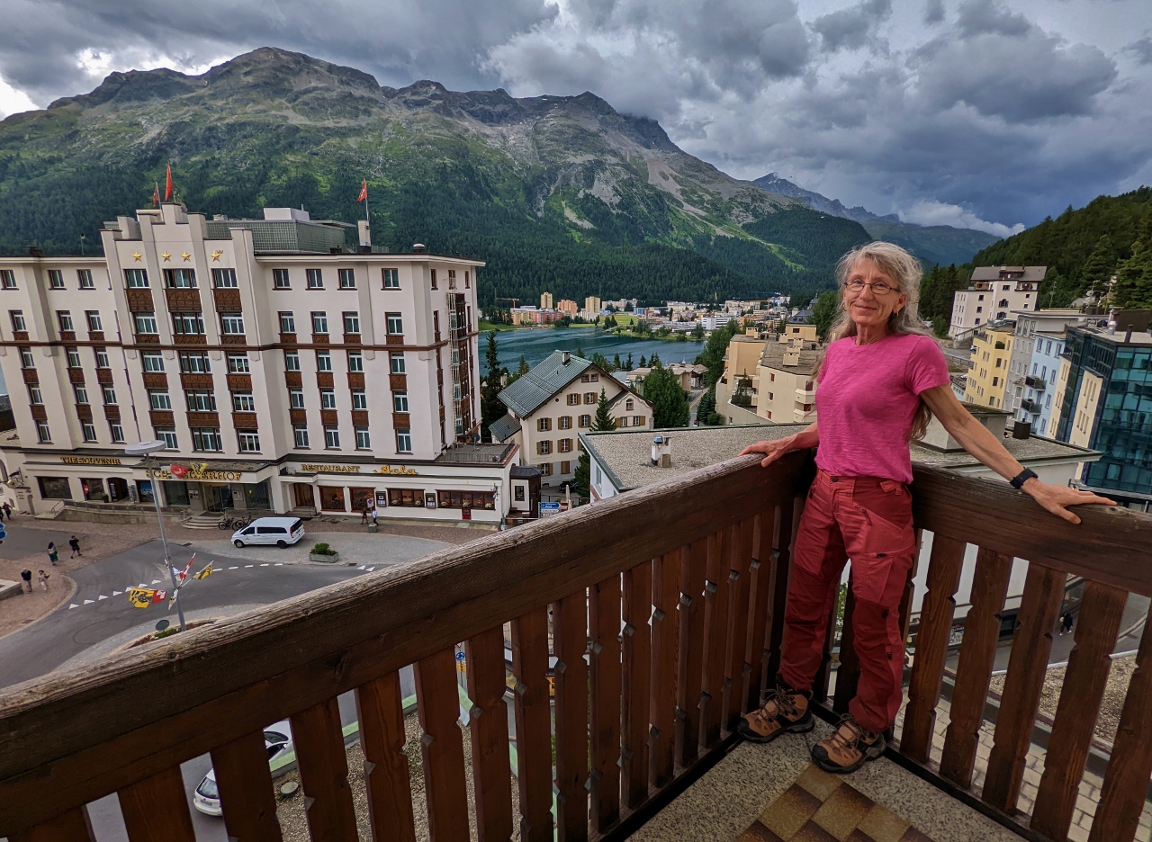 |
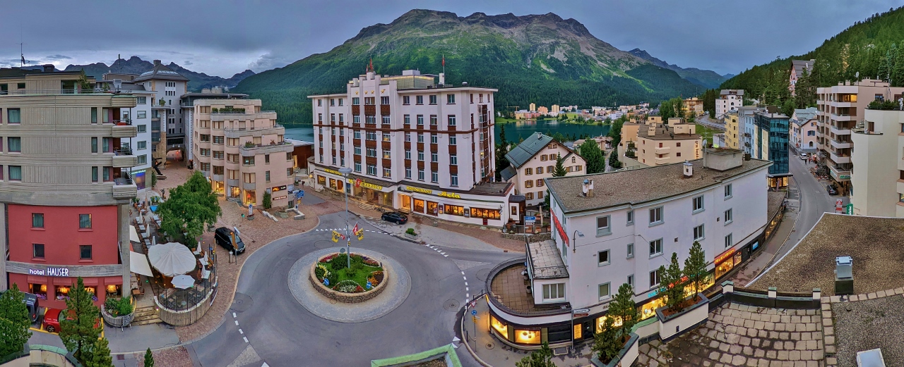
St. Moritz
Position: 46°29.85’N, 9°50.27’E
Overlooking St. Moritz from the balcony of our hotel room at the Hotel Steffani. A bit of Lake St. Moritz is visible in the distance beneath 10,246 ft (3,123 m ) Piz Rosatsch.
|
 |
Sculpture Garden
Position: 46°29.84’N, 9°50.25’E
We loved this rooftop sculpture garden on a building near the Hotel Steffani.
|
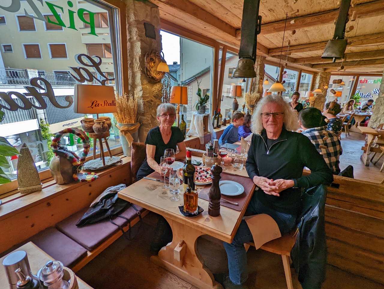 |
La Stalla
Position: 46°29.94’N, 9°50.41’E
An excellent meal over a bottle of Barola at La Stalla in St. Moritz.
|
 |
Chesa Futura
Position: 46°29.86’N, 9°50.34’E
Chesa Futura (“House of the Future”) by renowned architect Lord Norman Foster combines futuristic design with traditional building materials. The building contains ten exclusive apartments overlooking St. Moritz. It looks pretty wild from here, but even more so on the architect firm’s web site.
|
 |
Hotel Steffani
Position: 46°29.83’N, 9°50.27’E
Street view to the Hotel Steffani where we are staying in St. Moritz.
|
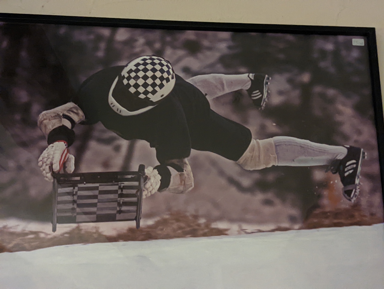 |
Skeleton Racing
Position: 46°29.85’N, 9°50.26’E
A photograph in the bar of the Hotel Steffani of a skeleton racer at the start of a race. In this sport, competitors make a running start and then fly head-first and face down along the track. St. Moritz is home of the Cresta Run, built in 1884, one of the few tobogganing courses in the world dedicated solely to skeleton racing.
|
 |
Via Traunter Plazzas
Position: 46°29.85’N, 9°50.27’E
Evening view across the Via Traunter Plazzas in St. Moritz from our room at the Hotel Steffani.
|
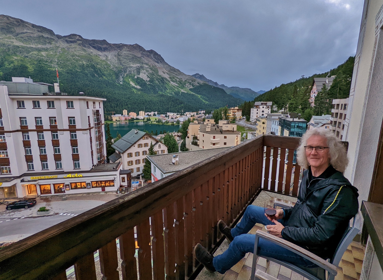 |
Dusk
Position: 46°29.84’N, 9°50.25’E
Enjoying a drink on the balcony of our room at the Hotel Steffani after an excellent, but big, day traveling from Zermatt to St. Moritz on the Glacier Express. We very much enjoyed the ride. The scenery was spectacular and the many complex tunnels and viaducts were amazing to both see and travel on.
|
 |
Click the travel log icon on the left to see these locations on a map. And a map of our most recent log entries always is available at mvdirona.com/maps. |
If your comment doesn't show up right away, send us email and we'll dredge it out of the spam filter.