The distinctive pyramid-shaped peak of the Matterhorn has been famous world-wide for more than a century. The 14,692 ft (4,478 m) mountain has inspired millions of photographers and thousands of climbers, with up to 150 attempting the summit on a good summer day. And the image of the Matterhorn has been used for a variety of products world-wide, ranging from the Canadian beer Alpine Lager to Swiss chocolates to Malaysian cigarettes. And Disneyland even created an attraction based on a scale model of the mountain, the Matterhorn Bobsleds.
From Murren, we traveled just over three hours in six legs to reach Zermatt, the Swiss town at the base off the Matterhorn. As we walked to our Zermatt hotel from the train station, we turned around and were super-excited to see the Matterhorn for the first time. We could not get enough of that mountain, it was just so amazing to see it in person, and we pretty much refused to do anything for the rest of the day that didn’t include a Matthorn view. Fortunately, that is not limiting in the Zermatt area.
We took a funicular from Zermatt at 5,301 ft (1,616 m) up to Sunnegga at 7,480 ft (2,280 m), then hiked a half-hour with the mountain ahead of us to the small hamlet of Findeln, where we had a wonderful lunch with a Matterhorn view. After lunch, we rode a gondola up to Blauherd and then to Rothorn at altitude 10,180 ft (3,103 m) with the Matterhorn front and center the whole time. On the return, we stopped off for a drink and a Matterhorn view at Blauherd, then returned back to Zermatt for dinner on the terrace of our hotel with its great mountain view. And we finished the day watching the sun set against the Matterhorn from our hotel room, pictured above, and were thrilled to later see lights of climbers sparkle on the peak as night fell.
Below are highlights from July 2, 2022. Click any image for a larger view, or click the position to view the location on a map. And a map with our most recent log entries always is available at mvdirona.com/maps.
 |
Morning View
Position: 46°33.82’N, 7°53.80’E
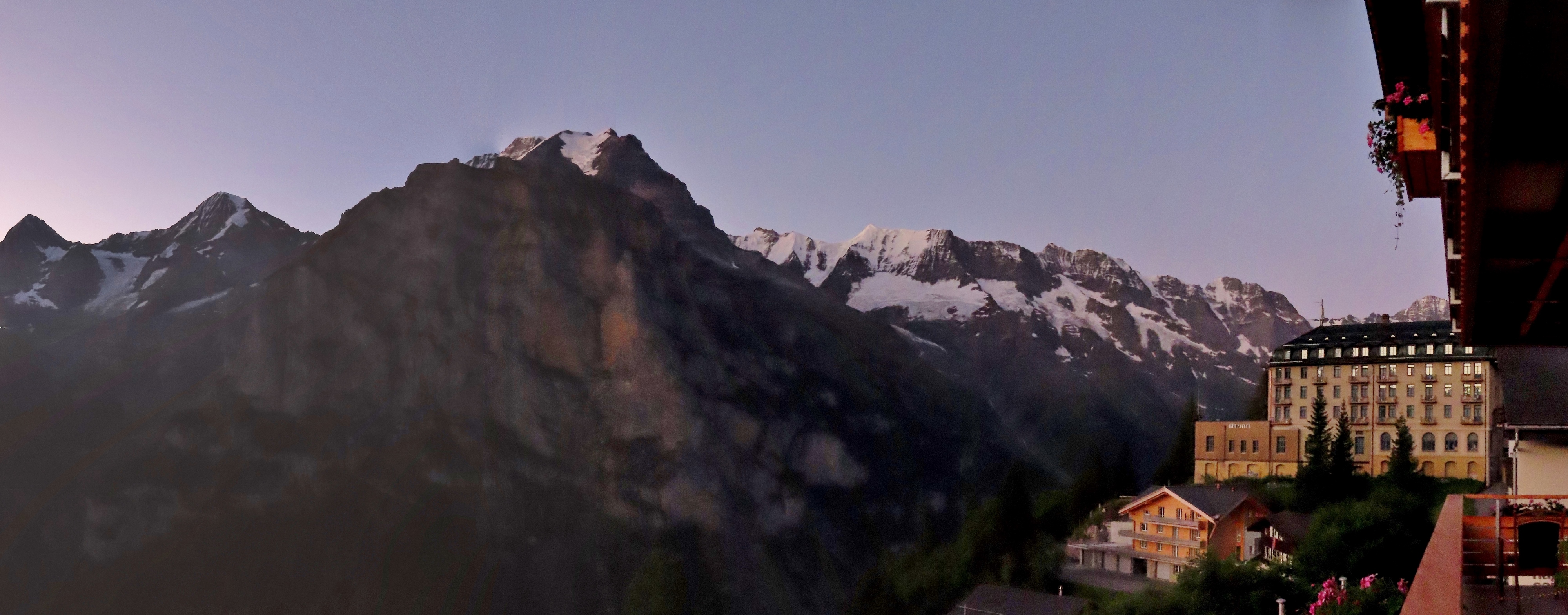
A final mountain view from our room at the Hotel Eiger in Murren on a beautifully clear day. We’ll be taking the first train this morning at 7am to travel to Zermatt.
|
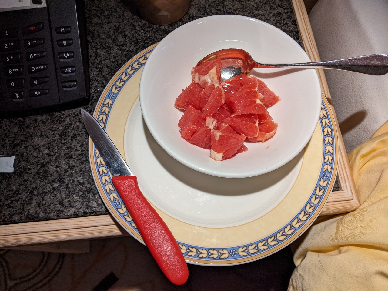 |
Paring Knife
Position: 46°33.82’N, 7°53.80’E
We are usually up before 5am and are hungry for breakfast well before most hotels are serving. Since we can’t bring our paring knife on the plane to Switzerland, we bought a temporary one at the Murren grocery store for while we’re here. We also picked up some fresh fruit and milk that we kept in our in-room fridge, plus some granola. With our travel kettle and a couple of place settings from the hotel, we’re well-equipped to make a complete breakfast in our room.
|
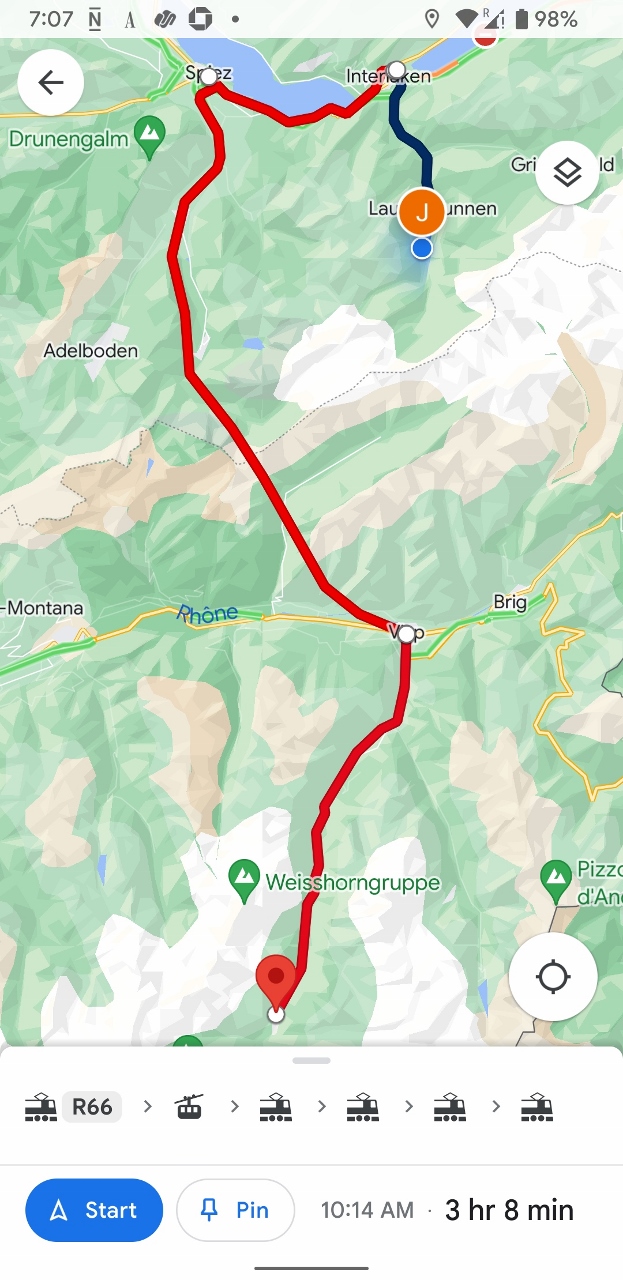 |
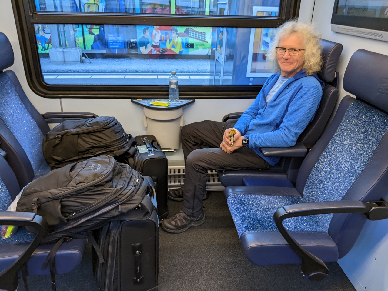
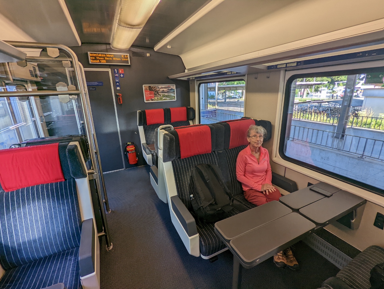
Murren to Zermatt
Position: 46°33.86’N, 7°53.85’E
Our route from Murren to Zermatt today will have six legs and take just over three hours. We’ll take the train to Grutschalp and a cable car to Lauterbrunnen, then trains to Interlaken, Spiez, Visp and finally, Zermatt. Train travel in Switzerland is very precise and efficient. Our connection time between trains usually is less than 15 minutes.
|
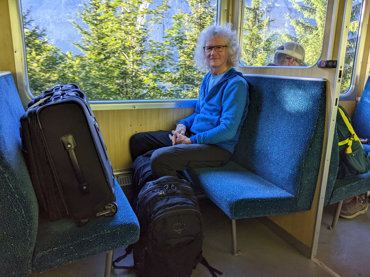 |
To Grutschalp
Position: 46°34.27’N, 7°53.97’E
On board the train from Murren to Grutschalp with all our luggage. We’re really liking having only carry-on bags with us given the number of transfers we sometimes have to make.
|
 |
Jungfraujoch
Position: 46°35.79’N, 7°53.45’E
It is rare to have a day clear enough to see Jungfraujoch from the Murren area. We were lucky to get this shot from Grutschalp.
|
 |
To Lauterbrunnen
Position: 46°35.93’N, 7°54.43’E
On our second leg of the journey to Zermatt, the cable car down to Lauterbrunnen. Not many people are on the first run of the day.
|
 |
To Interlaken
Position: 46°35.91’N, 7°54.47’E
Ready for our third leg of the day, a train from Lauterbrunnen to Interlaken.
|
 |
To Spiez
Position: 46°41.46’N, 7°52.19’E
In Interlaken after boarding the train to Speiz, the fourth leg of the day.
|
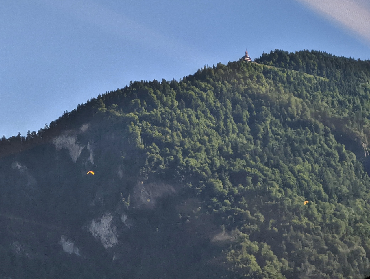 |
Harder Kulm
Position: 46°40.42’N, 7°50.12’E
A clear view to Harder Kulm and paragliders below, as our train departs Interlaken.
|
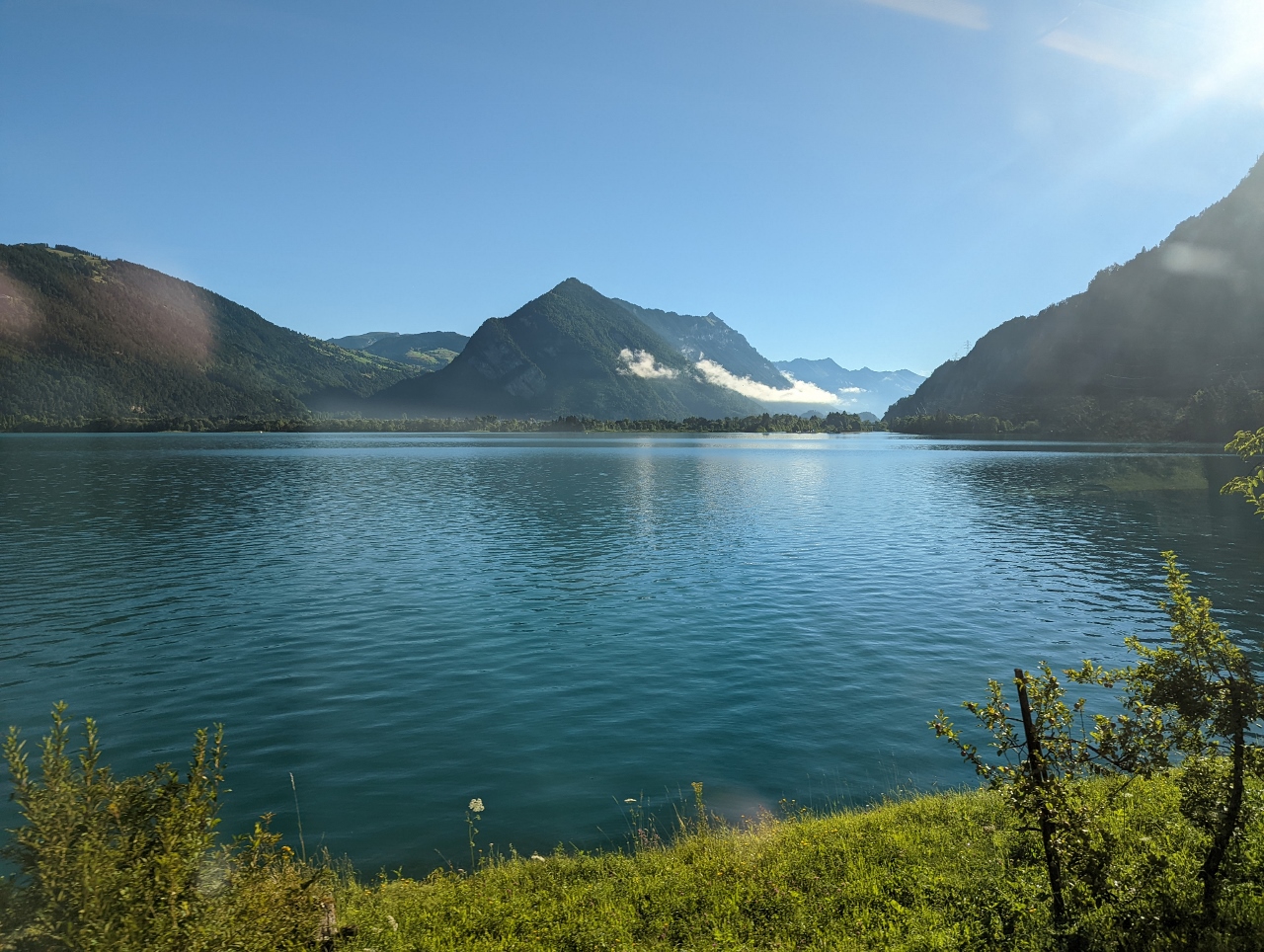 |
Thunersee
Position: 46°39.72’N, 7°44.44’E
Passing along the south side of Thunersee (Lake Thun), that we could see from atop Schilthorn a couple of days ago. Thunersee is the second of the two lakes that border Interlaken (Between Lakes). The other is Brienzersee that we passed alongside when we arrived into the area from Lucerne. Harder Kulm is roughly at center in the distance.
|
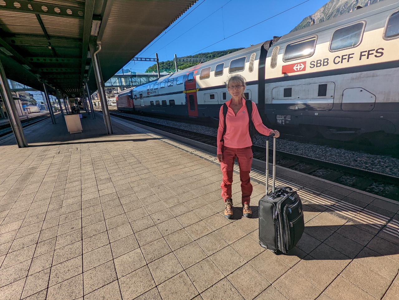 |
Spiez
Position: 46°41.16’N, 7°40.81’E
At Spiez station waiting for our train to Visp, the fifth leg of the day.
|
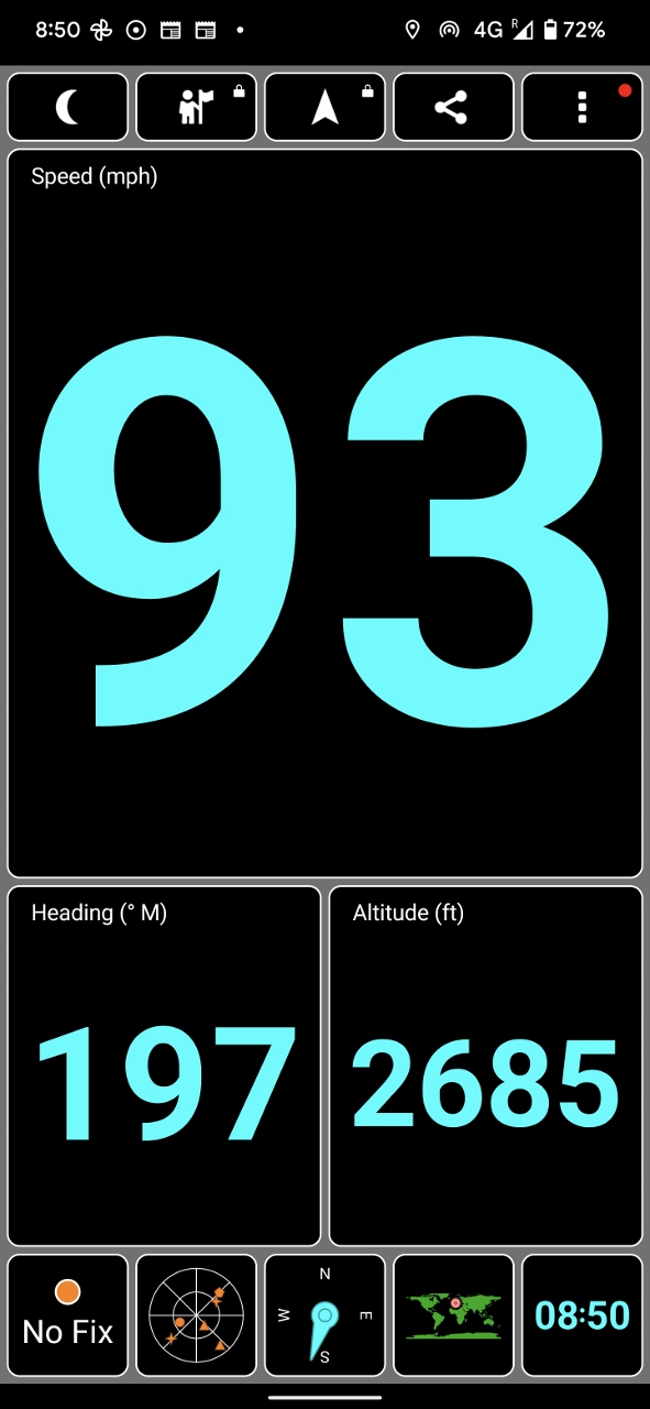 |
93 MPH
Position: 46°36.49’N, 7°40.15’E
We’re traveling south at 93 mph (149 kph) underneath the Swiss Alps through the Lotschberg Base Tunnel. Most of the trains we’ve been riding over the past few days seldom exceeded 100 kph, and the cog rails are much slower.br>
Completed in 2007, the 21.48-mile (34.57 km) Lotschberg Base Tunnel runs 1,300 ft (400 m) below the 1913 Lotschberg Tunnel. The new tunnel was built mainly to improve throughput of freight traffic, which had increased tenfold between the 1980s and the 2000s.
|
 |
To Zermatt
Position: 46°17.64’N, 7°52.92’E
Aboard our sixth and final leg of the day, a scenic train from Visp to Zermatt.
|
 |
Vineyards
Position: 46°14.54’N, 7°52.50’E
Vineyards covering the hills around Ackersand in the Canton of Valais, a major Swiss wine district.
|
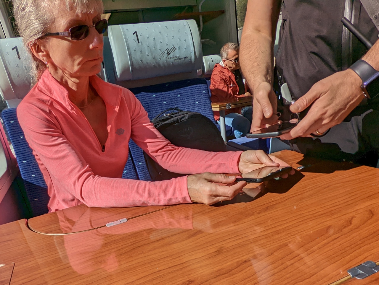 |
Swiss Travel Pass
Position: 46°14.54’N, 7°52.50’E
The conductor scanning our Swiss Travel Pass on the train to Zermatt.
|
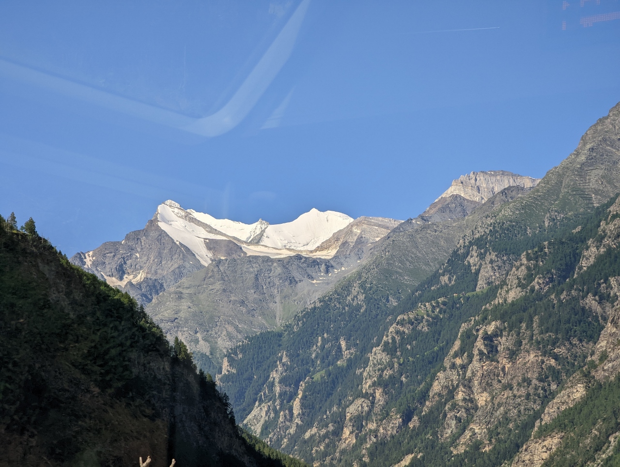 |
Brunneghorn
Position: 46°13.50’N, 7°51.23’E
The ride through valley of St. Niklaus through to Zermatt is one of the most scenic in Switzerland. This is 14,783 ft (4,506 m) Weisshorn, a major peak in the Swiss Alps.
|
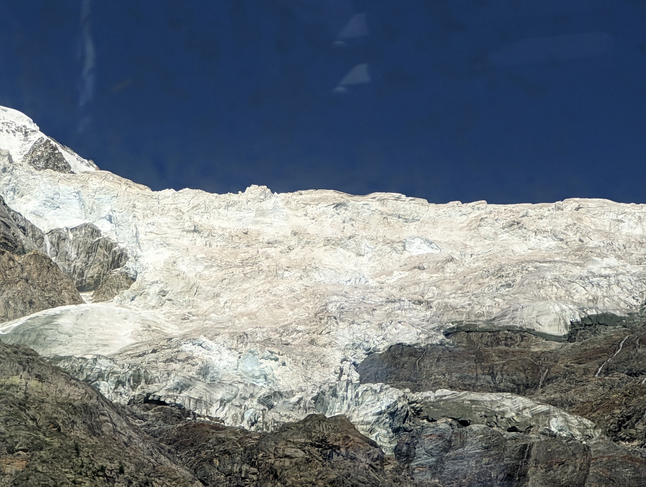 |
Bis Glacier
Position: 46°6.55’N, 7°47.13’E
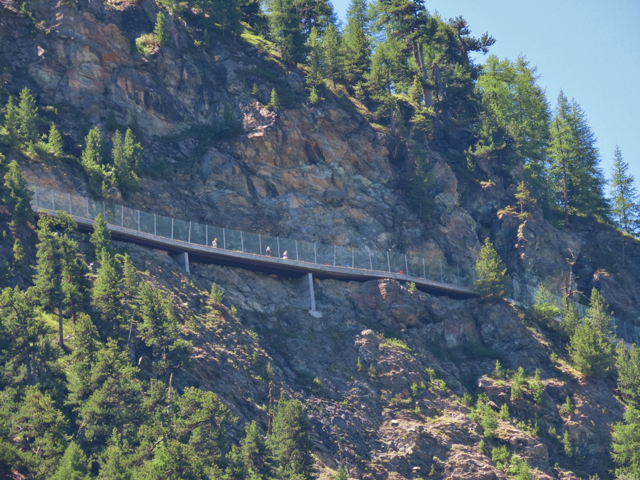
Bis Glacier hangs steeply on the cliffs of Weisshorn and poses a major avalanche risk to the town of Randa below. A sophisticated monitoring system has been installed to detect avalanches and automatically close the road below.
|
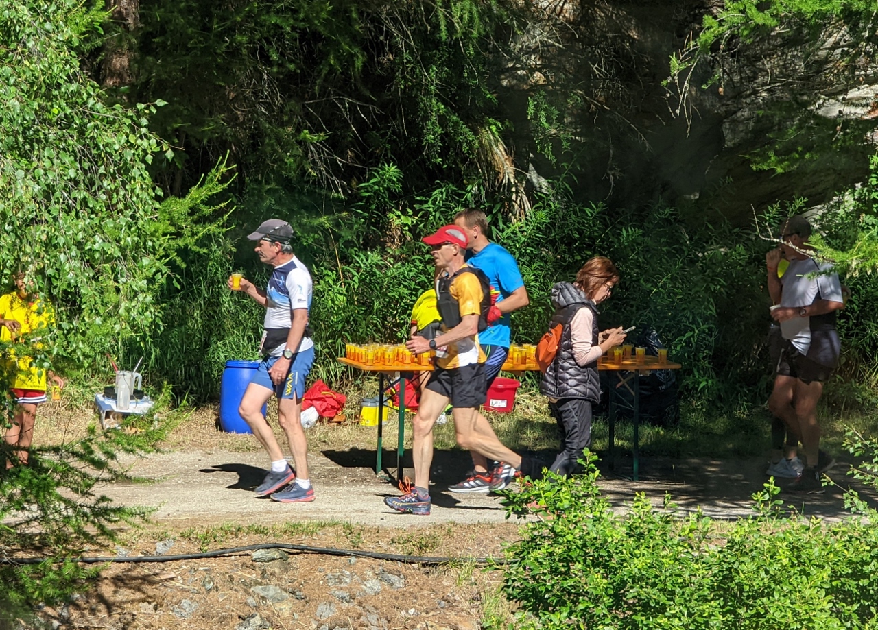 |
Zermatt Marathon
Position: 46°4.17’N, 7°46.47’E
Runners taking part in the Zermatt marathon that starts in St. Niklaus, about 8 miles (13km) behind us. Reservations can be made for an earlier train on this route that leaves St. Niklaus when the race starts. Dubbed the “Travelling Bleachers”, passengers can ride along and watch the race progress.
|
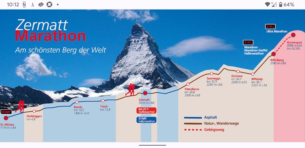 |
Marathon Course
Position: 46°3.24’N, 7°46.31’E
The Zermatt Marathon is considered one of the most challenging in Europe. The race starts at St. Niklaus at an altitude of 3,661 ft (1,116 m), ascends through Zermatt at 5,314 ft (1,620 m) and finishes at Riffelberg at 8,480 (2,585 m) for a total altitude gain of 4,819 ft (1,469 m) over 26 miles (42 km). And if that isn’t challenging enough, competitors in the Ultra-Marathon continue up to Gornergrat at 10,134 ft (3,089 m), for a total altitude gain of 6,473 ft (1,973 m) and a total distance of 28.3 miles (45.6 km). A half-marathon will also be run from Zermatt up to Riffelberg.
|
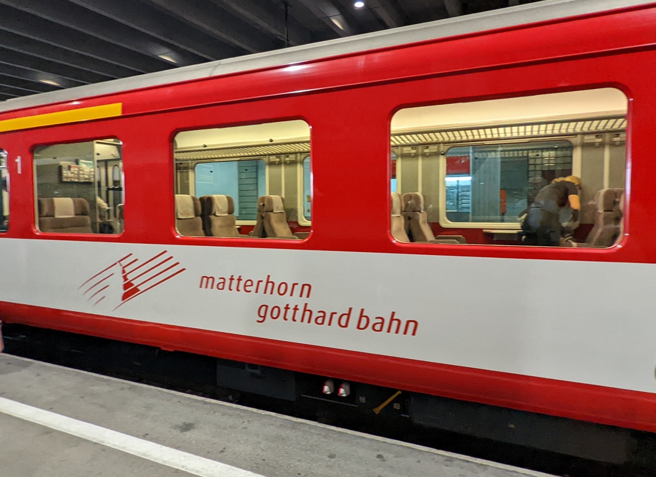 |
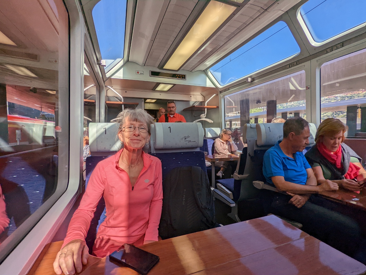
Matterhorn Gotthard Bahn
Position: 46°1.48’N, 7°44.89’E
The scenic train, the Matterhorn Gotthard Bahn, that we just took from Visp to Zermatt. The scenery really was spectacular.
|
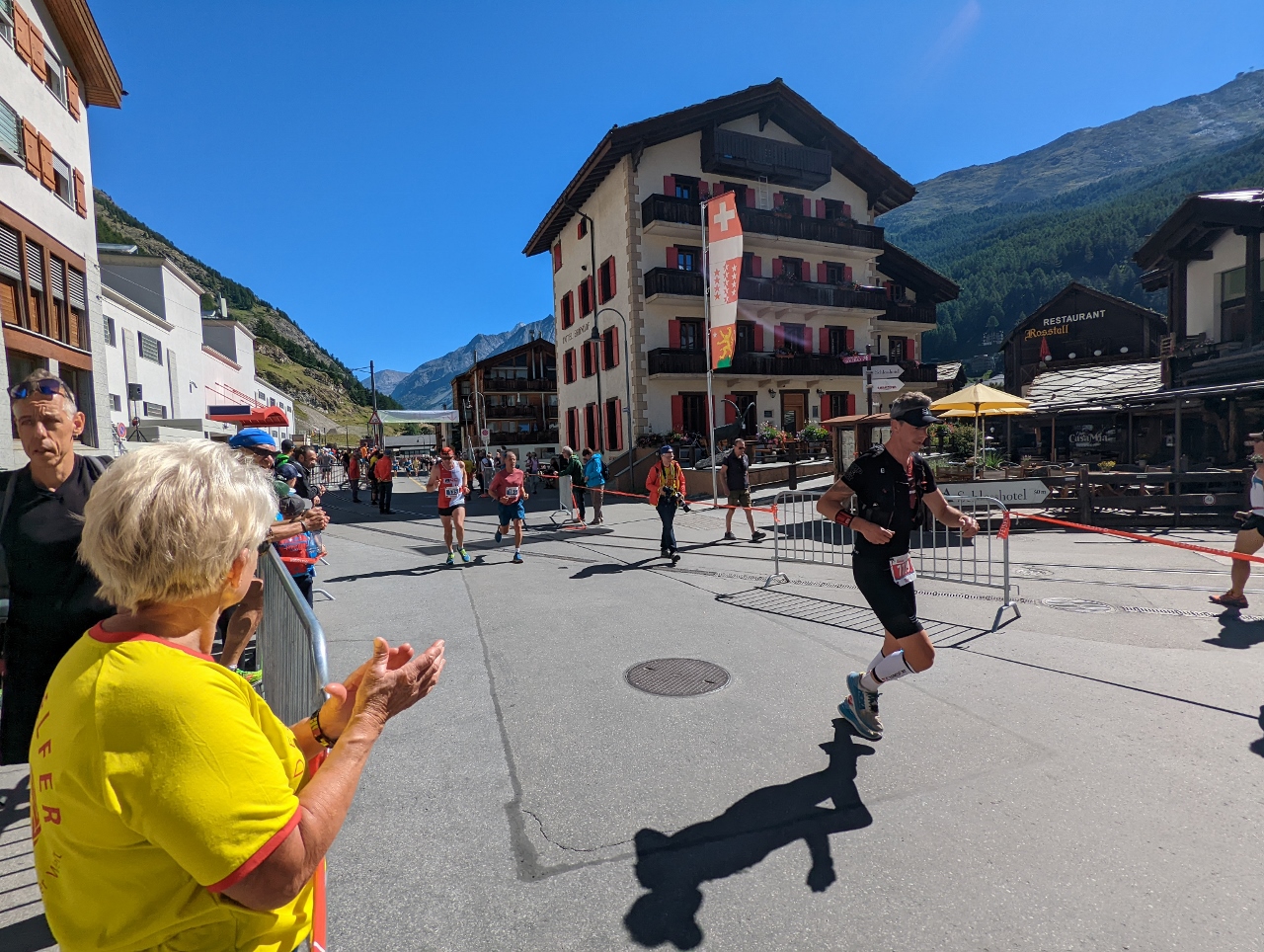 |
Runners Arriving
Position: 46°1.46’N, 7°44.90’E
Marathon runners passing through Zermatt as we exit the train station.
|
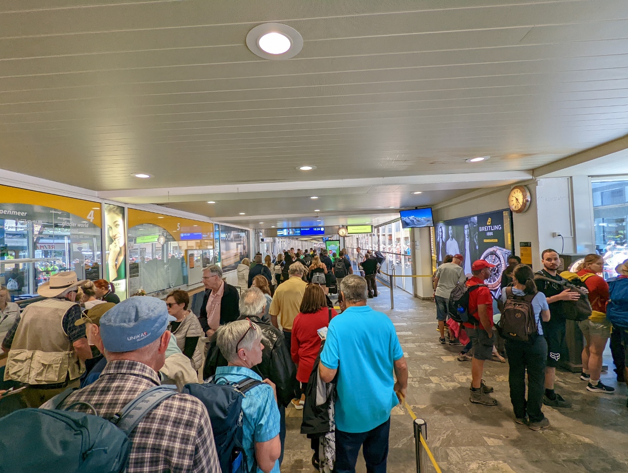 |
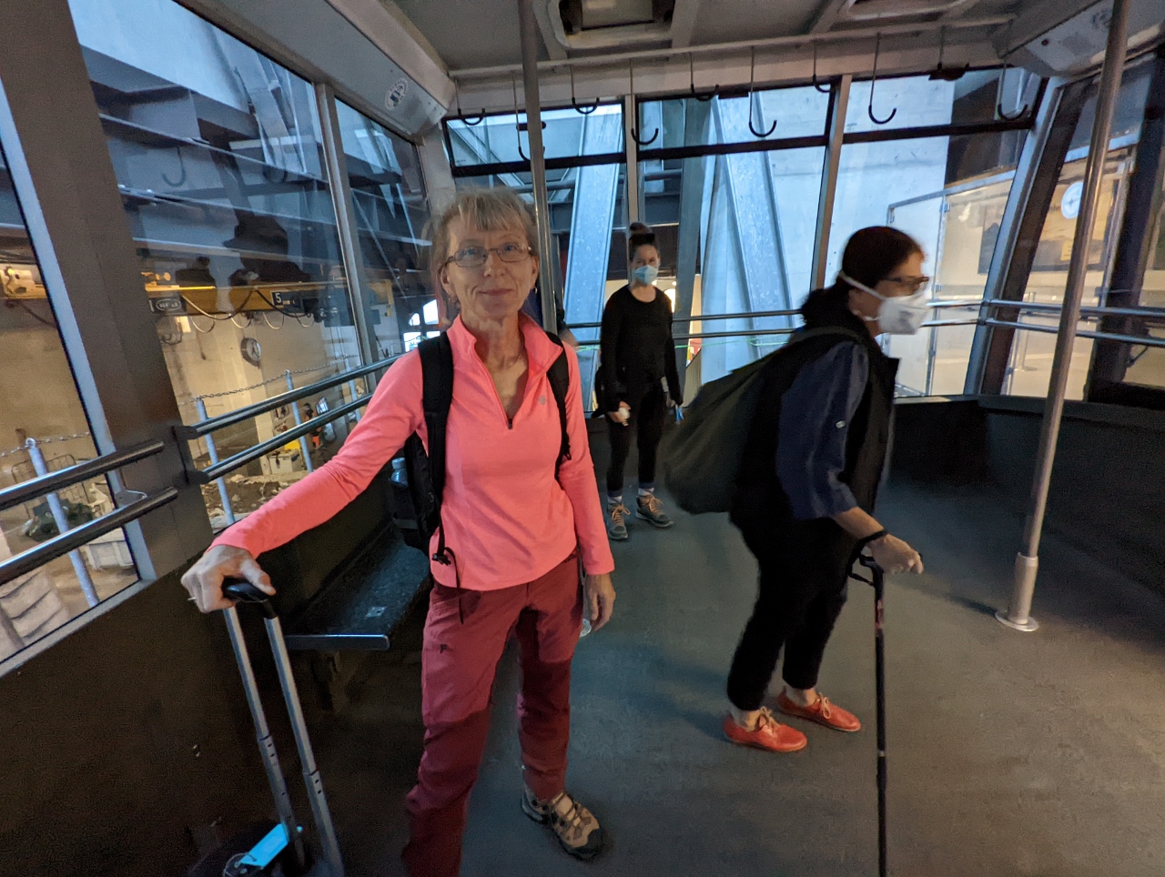
Gornergrat Bahn Station
Position: 46°1.43’N, 7°44.91’E
We’ll be taking the Gornergrat Bahn train tomorrow morning. We have a priority boarding reservation, but needed to stopped in at the station to pickup a Peak2Peak day pass that will cover the train ride, plus the cableways to Matterhorn Glacier Paradise. The Gornergrat Bahn ride is very popular and the station was jammed.
|
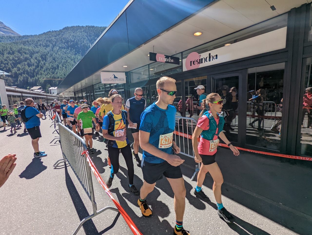 |
Half Marathon
Position: 46°1.43’N, 7°44.91’E
The Zermatt Half Marathon was just getting started as we left the Gornergrat Bahn station for our hotel.
|
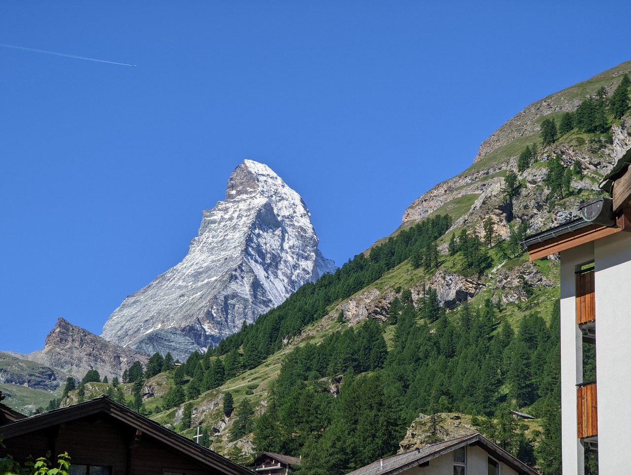 |
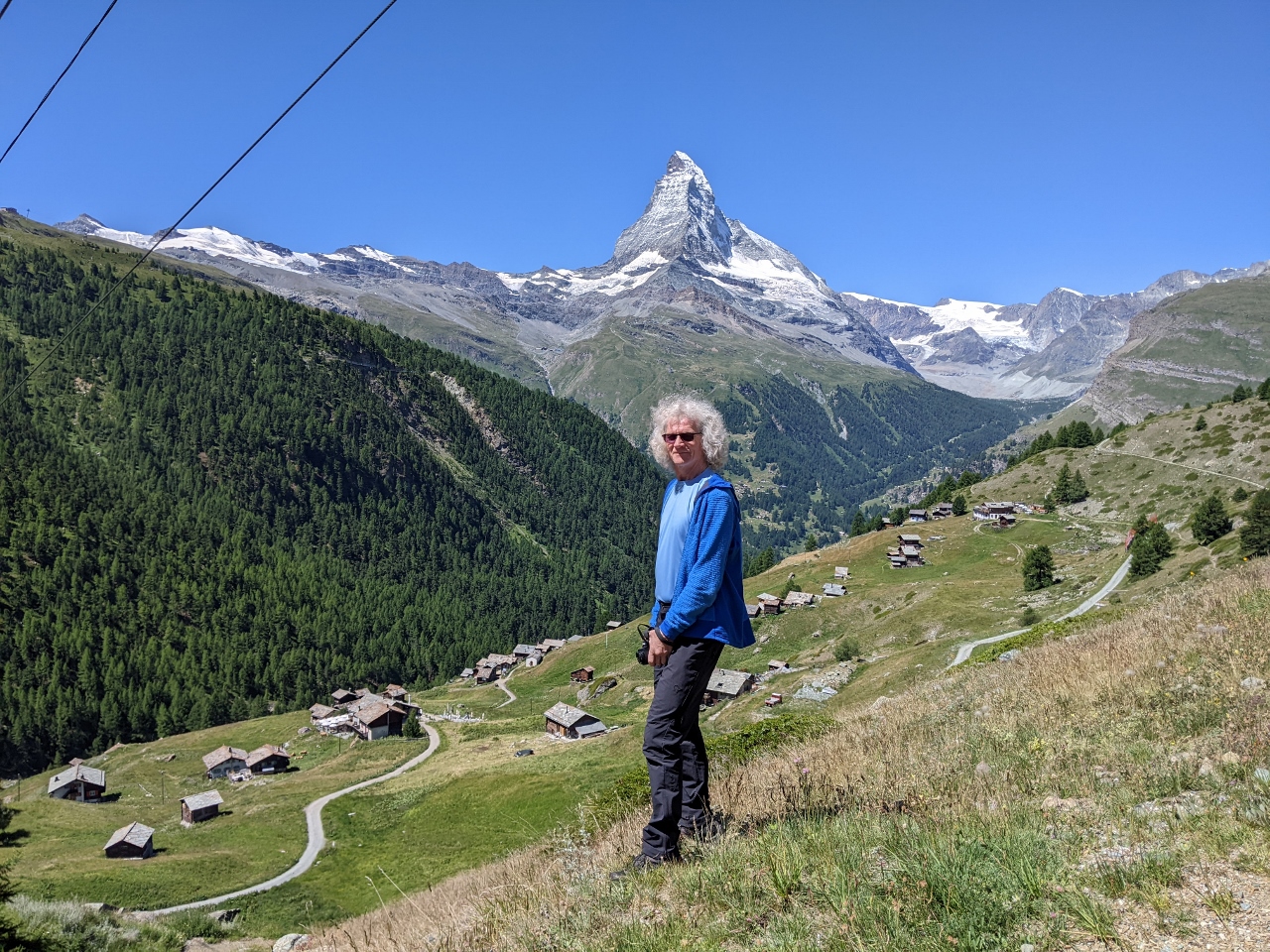
The Matterhorn!
Position: 46°1.41’N, 7°44.97’E
As we were walking through Zermatt to our hotel, we turned around and were super-excited to see the Matterhorn for the first time. Wow!
|
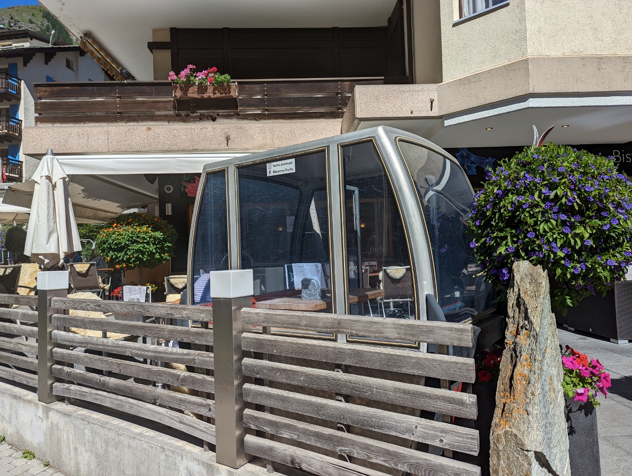 |
L‘ Atelier Grandsire
Position: 46°1.36’N, 7°45.05’E
Cable car table at L’Atelier Grandsire in Zermatt.
|
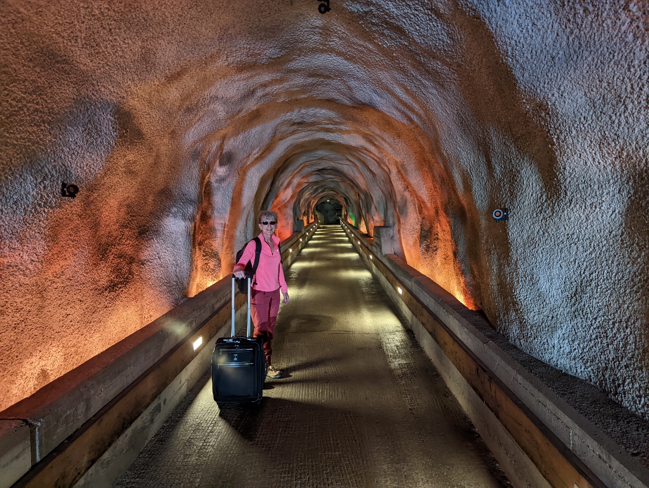 |
Tunnel to Hotel
Position: 46°1.30’N, 7°45.12’E
Our hotel, the Chalet Hotel Schonegg, is on the hill above us. To make it more accessible from street level, they’ve built a tunnel to an elevator to reach the hotel.
|
 |
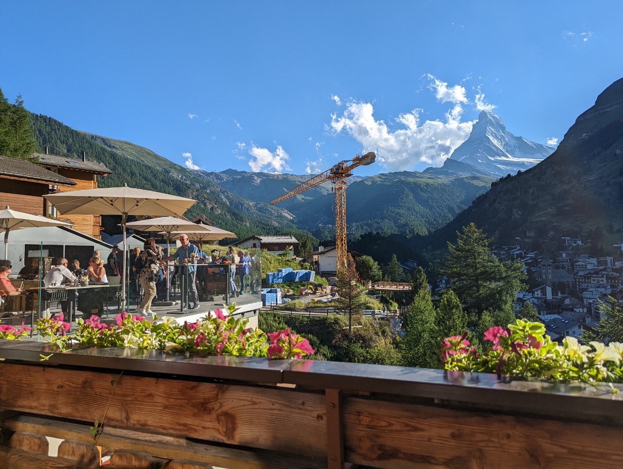
Drinks with a View
Position: 46°1.31’N, 7°45.15’E
The Chalet Hotel Schonegg has a fabulous deck with a view to the Matterhorn, reflected in the window behind us.
|
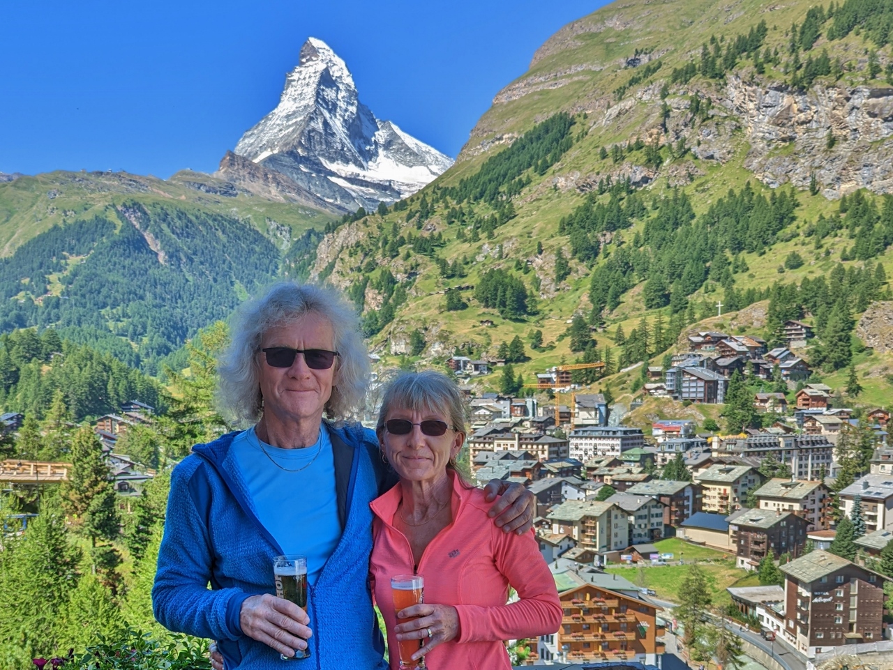 |
Us with Matterhorn
Position: 46°1.30’N, 7°45.15’E
We asked the waiter if he could take the previous picture with the reflection, which he did. But he also suggested just taking one of us with the mountain. It’s a pretty nice picture—why didn’t we think of that? :)
|
 |
Paragliders
Position: 46°1.31’N, 7°45.15’E
Paragliders in front of the Matterhorn (click image for a larger view). We cannot get enough of that mountain, it’s just so amazing to see it in person.
|
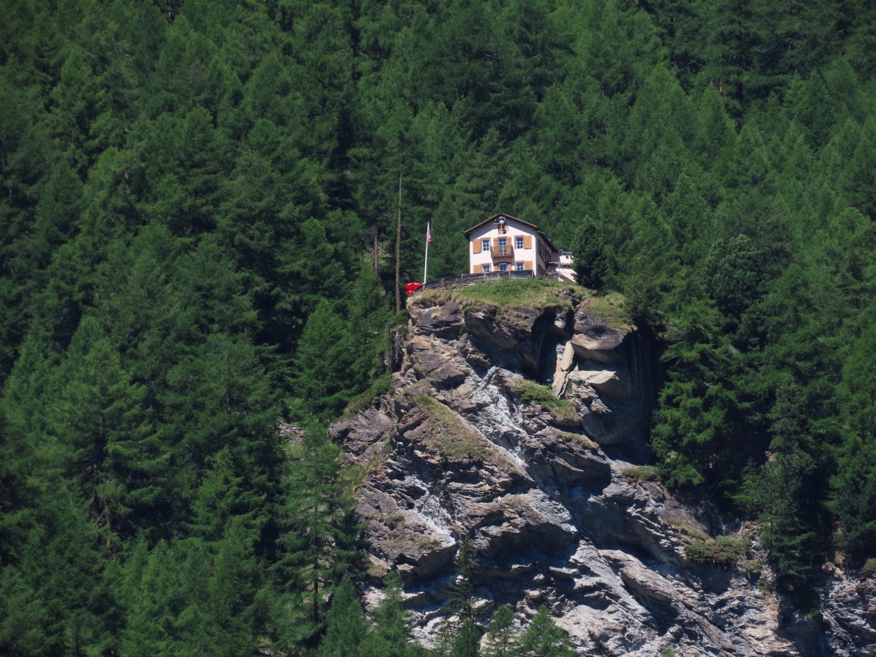 |
Edelweiss
Position: 46°1.30’N, 7°45.15’E
The Edelweiss Mountain Restaurant and Hotel, viewed from the terrace of the Chalet Hotel Schonegg. No roads reach the Edelweiss and the only way in or out is a 45-minute hike.
|
 |
Sunnegga Funicular
Position: 46°1.23’N, 7°45.82’E
On board the funicular from the base station near our hotel at 5,301 ft (1,616 m) up to Sunnegga at 7,480 ft (2,280 m). The lower station is accessed through a tunnel deep into the mountain and we’re currently still underground.
|
 |
Sunnega
Position: 46°1.01’N, 7°46.17’E
Zermatt Marathon participants running through Sunnega, the top of the funicular, with the ever-present Matterhorn in the background.
|
 |
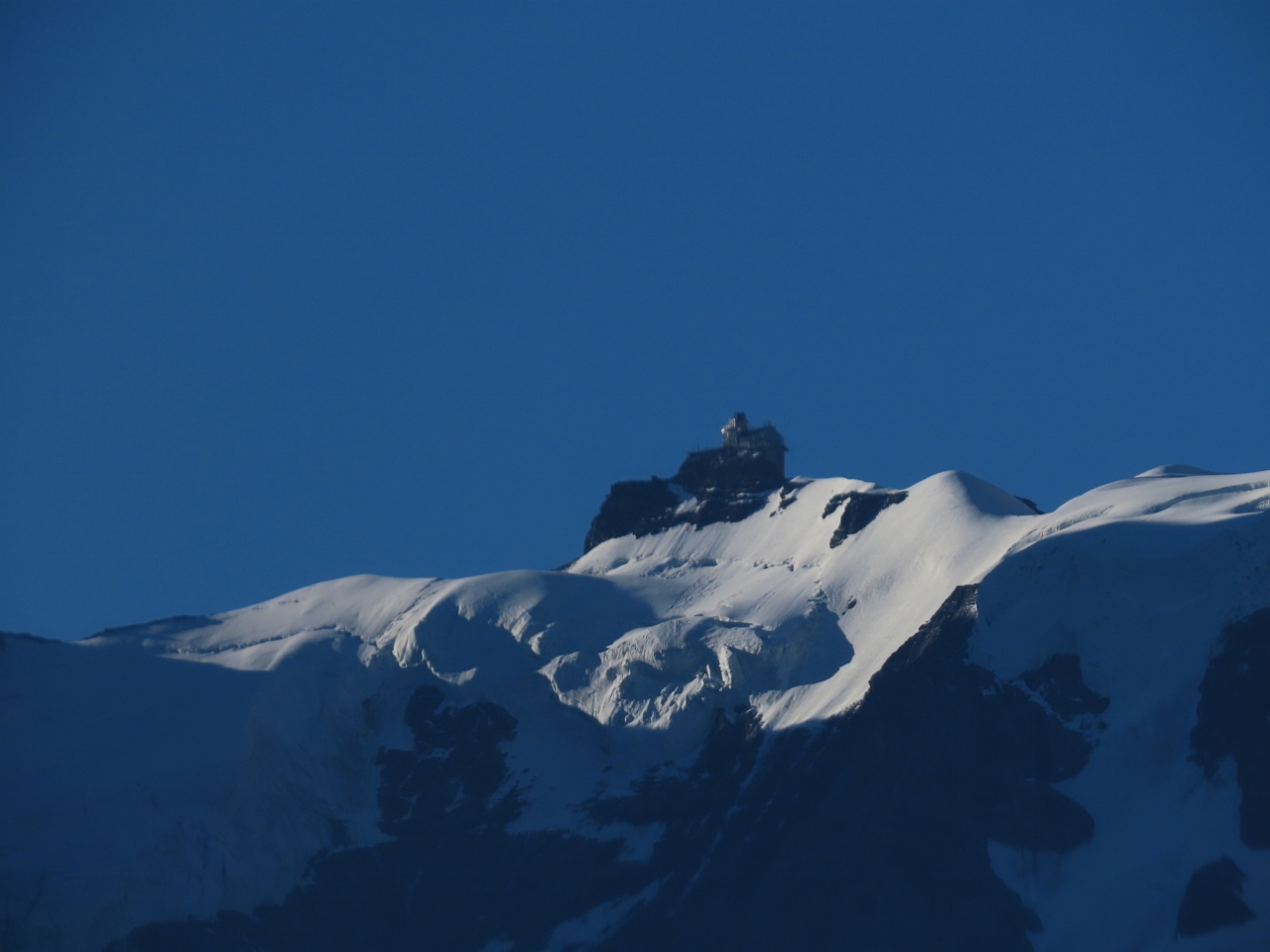
Matterhorn Glacier Paradise
Position: 46°0.93’N, 7°46.18’E
View from Sunnega to the Matterhorn Glacier Paradise station, the highest mountain station in Europe at 12,739 ft (3,883 m) above sea level. We’ll be visiting there tomorrow.
|
 |
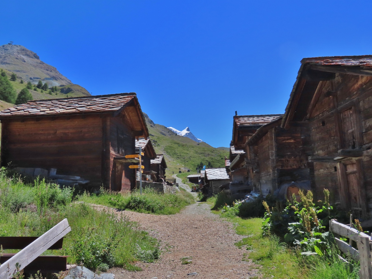
Walking to Findeln
Position: 46°0.81’N, 7°46.22’E
On a 25-minute walk down from Sunnega to the small hamlet of Findeln for lunch, with great Matterhorn views along the way.
|
 |
Eggen
Position: 46°0.81’N, 7°46.22’E
Passing traditional mountain houses in the hamlet of Eggen en route from Sunnega to Findeln.
|
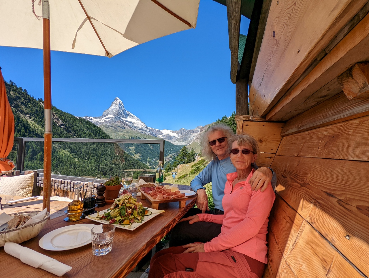 |
Restaurant Findlerhof
Position: 46°0.66’N, 7°45.85’E
We arrived at Restaurant Findlerhof in Findeln just before the lunch crowd and got this wonderful table on the edge of the terrace with a fabulous view to the Matterhorn. We’re pretty much refusing to do anything here unless we can see that mountain :-).
|
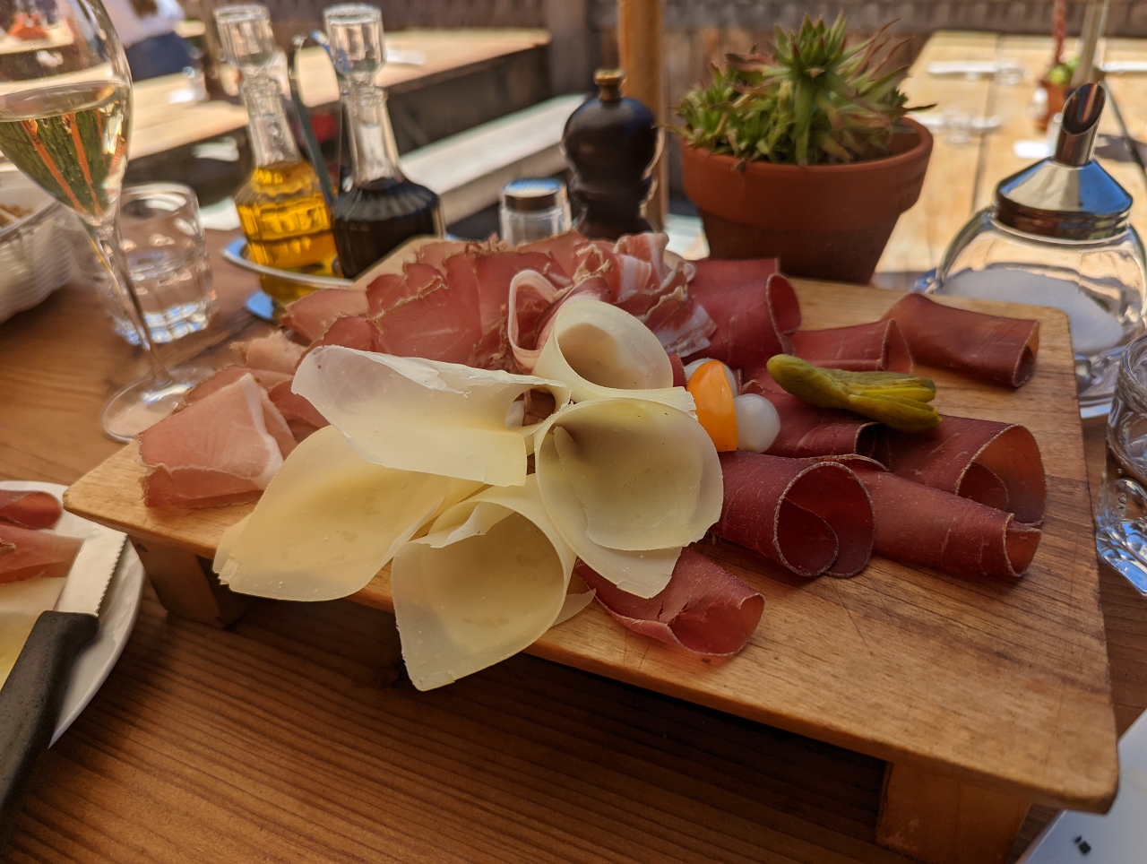 |
Walliserteller
Position: 46°0.66’N, 7°45.85’E
For lunch we shared a fresh green salad and this traditional Walliserteller (Valais platter) of local cold cuts and cheese shavings. It tasted as good as it looked.
|
 |
Runners
Position: 46°0.66’N, 7°45.85’E
High above Restaurant Findlerhof we could see Zermatt Marathon runners on the penultimate leg between Grunsee and Riffelalp. The grade on this section is fairly flat, with even a little bit of a descent, before the final leg with its gain of 1,181 ft (360 m) over 1.9 miles (3 km) for an average slope of 8.3%.
|
 |
Leisse Shuttle
Position: 46°0.96’N, 7°46.24’E
The walk back to Sunnega from Findeln has an altitude gain of 779-ft (235 m). We cut off the last 137 ft (42 m) by taking the Leisee Shuttle funicular up to Sunnega.
|
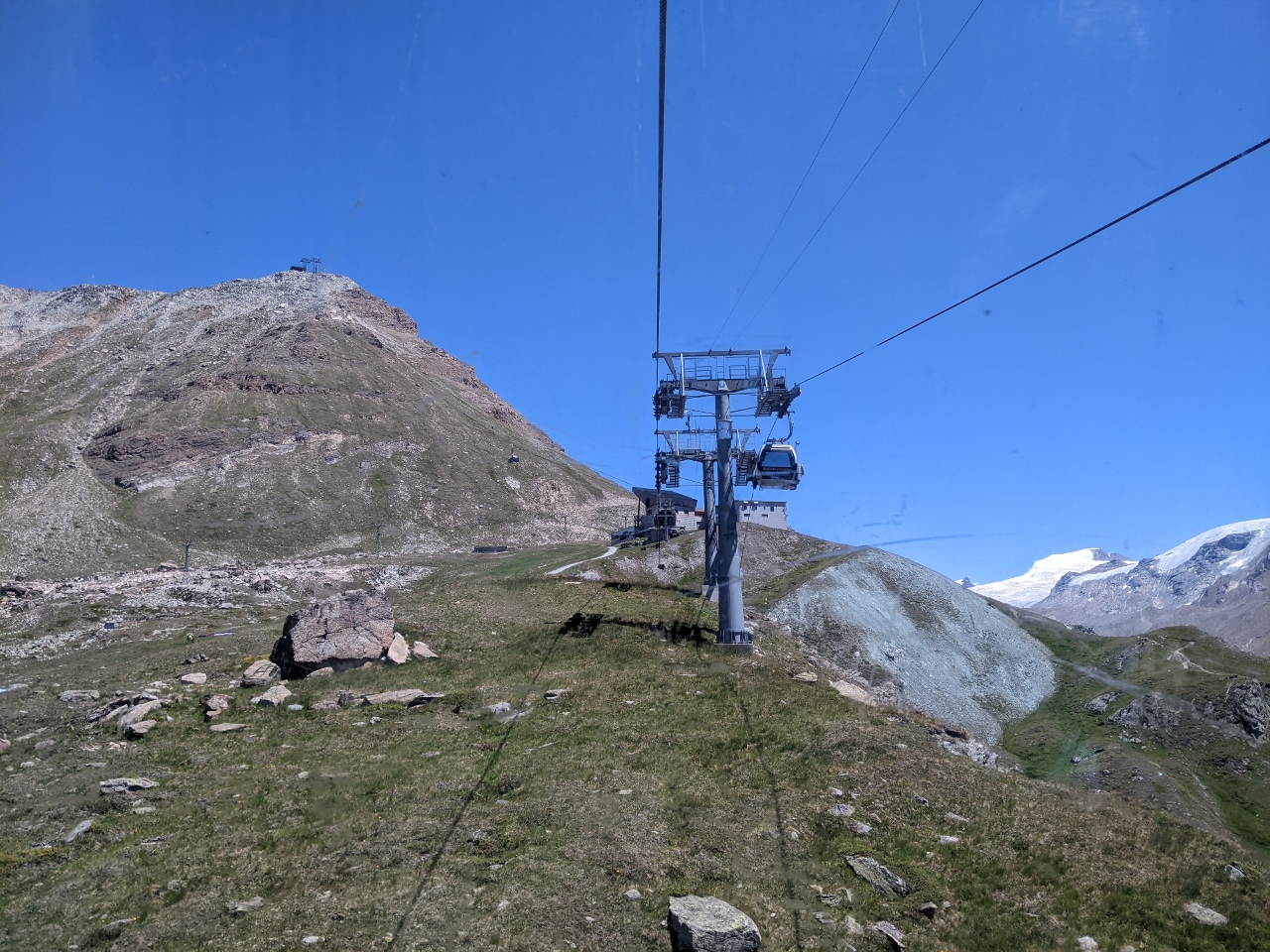 |
To Blauherd
Position: 46°1.05’N, 7°46.63’E
Riding an 8-person gondola from Sunnega up to Blauherd.
|
 |
View to Sunnega
Position: 46°1.08’N, 7°47.30’E
Looking back down to Blauherd at altitude 8,872 ft (2,705 m) from the cable car to Rothorn, with the Matterhorn visible in the distance.
|
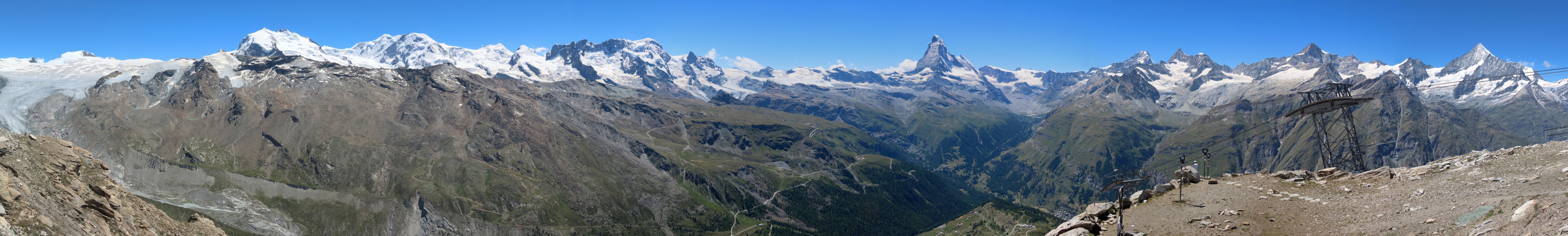 |
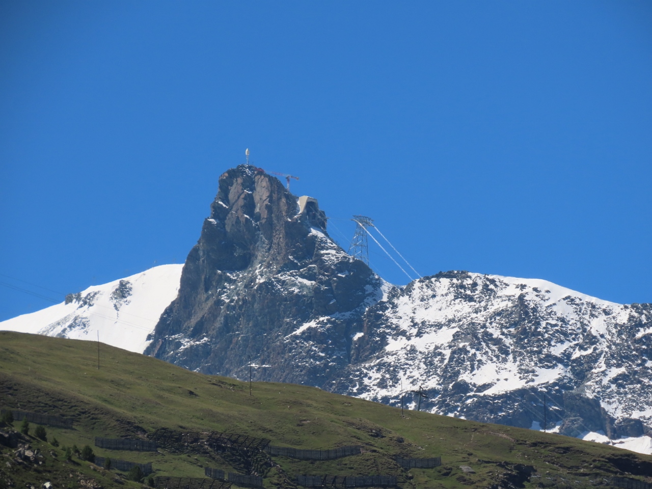
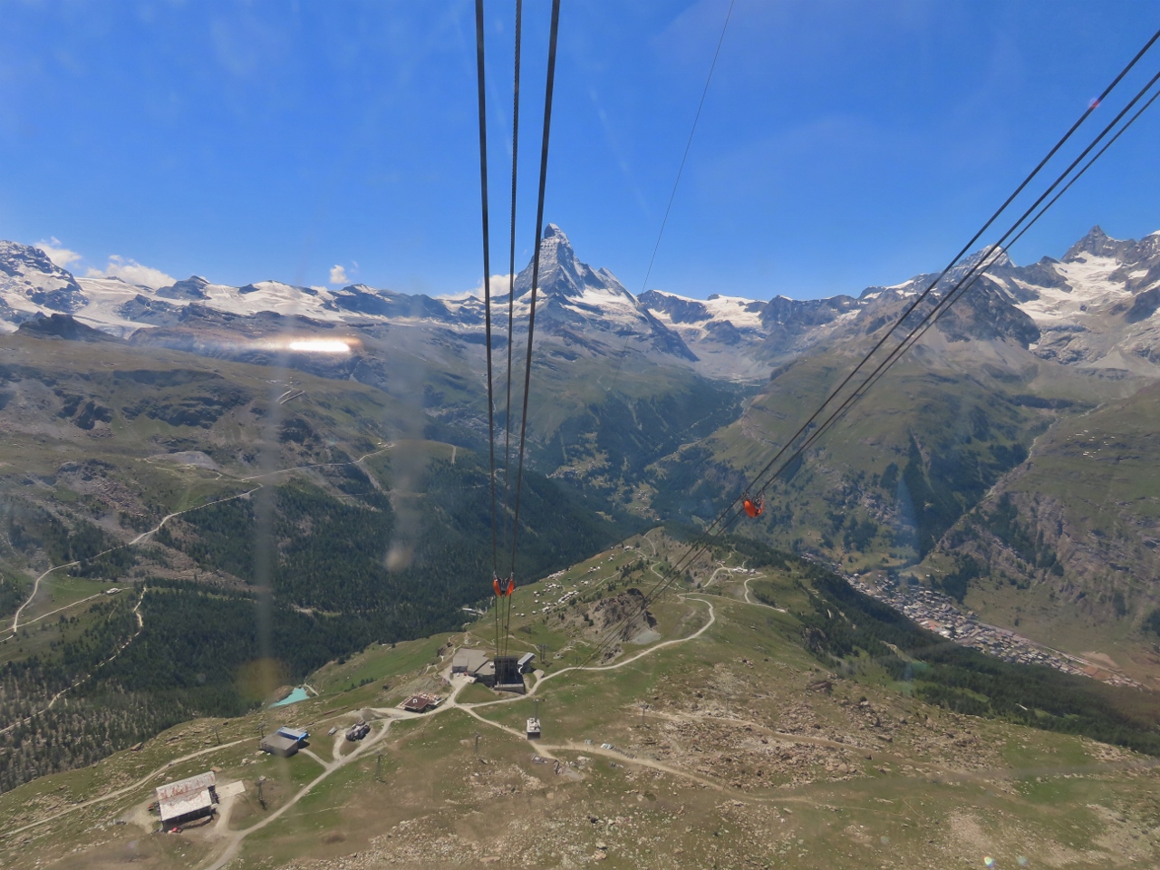
Panorama
Position: 46°1.26’N, 7°47.86’E
The fabulous view west from Rothorn at altitude 10,180 ft (3,103 m). The Matterhorn is just right of center and Gornergrat station is atop the closest mountain on the left (click image for a larger view).
Gornergrat is the finish line for the Zermatt Ultra-Marathon. At 10,134 (3,089 m), its pretty much the same altitude as we’ve reached with a funicular from Zermatt and two gondola rides. It’s hard to imagine running that far up, especially since Zermatt isn’t even the race starting point. |
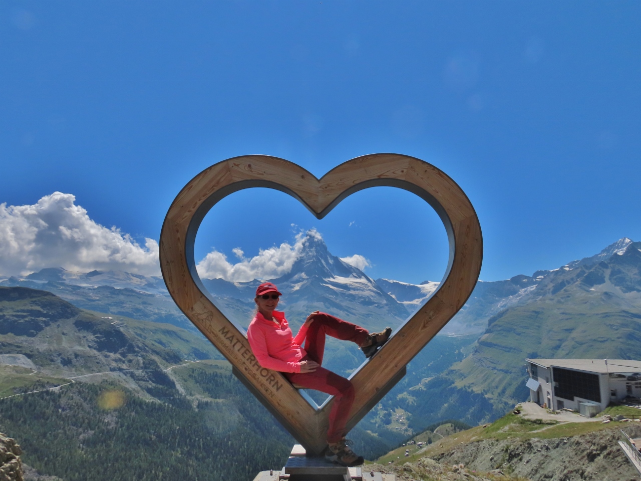 |
Love Matterhorn
Position: 46°0.96’N, 7°47.33’E
Yes, we love the Matterhorn!
|
 |
Beacon Check
Position: 46°1.29’N, 7°47.84’E
Avalanche beacon check sign at Rothorn. The area is covered in ski slopes and chair lifts and must be very busy in the winter.
|
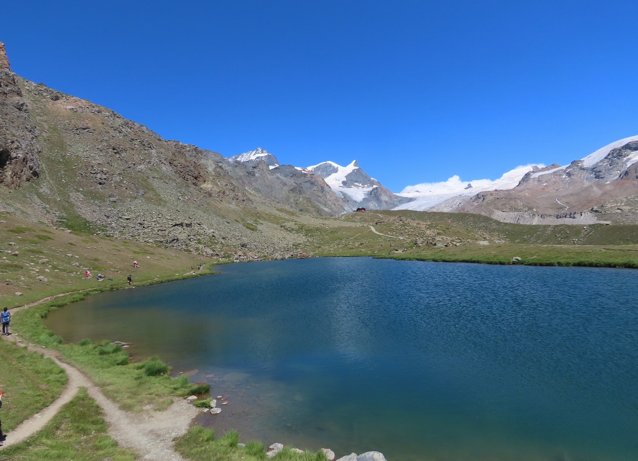 |
Stellisee
Position: 46°0.80’N, 7°47.92’E
From Rothorn, we made a short walk to the lake Stellisee. This is looking east across Stellisee, with the restaurant Fluhalp visible atop the crest in the distance (click image for a larger view).
|
 |
Blue Lounge
Position: 46°1.01’N, 7°47.21’E
Back down in Blauherd enjoying a break and the Matterhorn view from the terrace of the Blue Lounge.
|
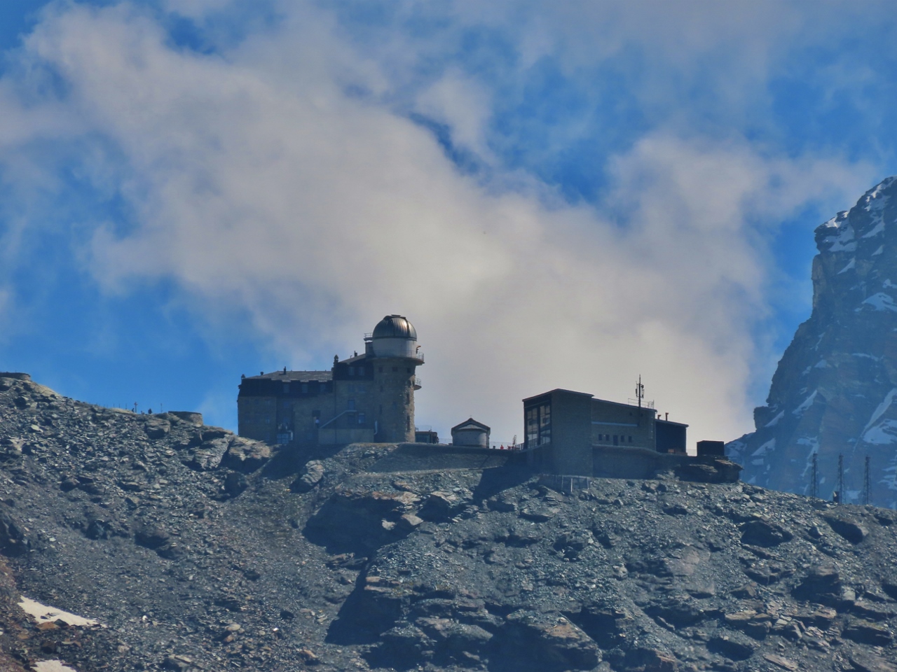 |
Gornergrat
Position: 46°1.01’N, 7°47.21’E
Looking south from Blauherd to the observatory building and train station at Gornergrat. We’ll be visiting there first thing tomorrow morning.
|
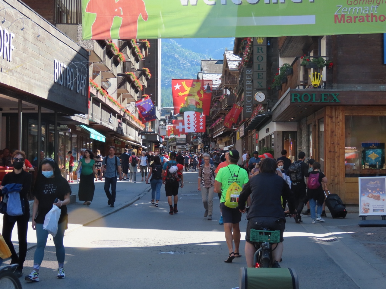 |
Bahnhofstrasse
Position: 46°1.42’N, 7°44.88’E
Walking busy Bahnhofstrasse back down in Zermatt.
|
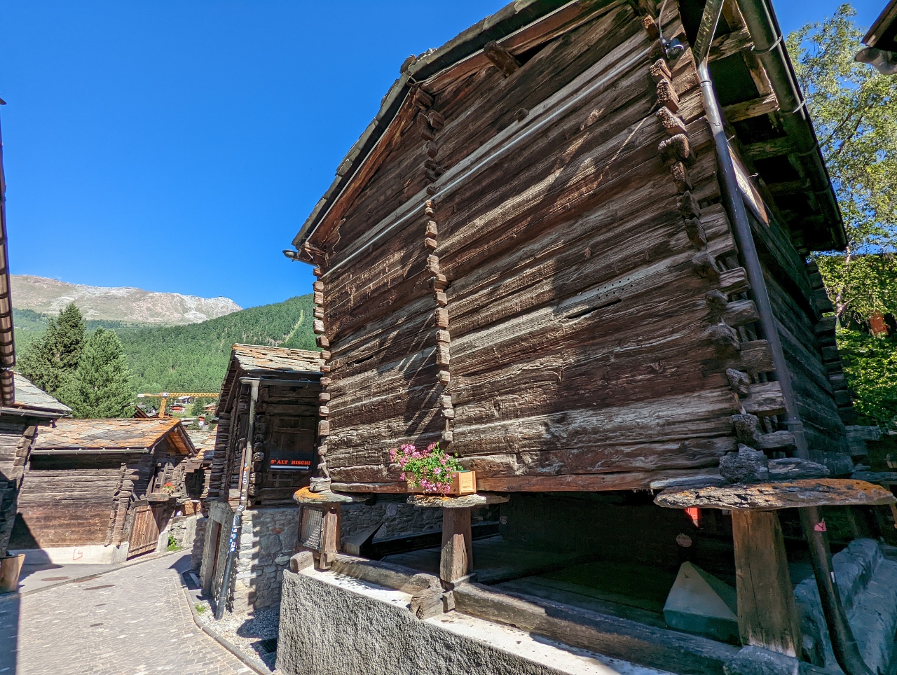 |
Hinterdorfstrasse
Position: 46°1.25’N, 7°44.85’E
Walking through Hinterdorfstrasse, Zermatt’s old town, where some buildings date to the 15th-century. Most rest atop stone slabs balanced on poles, a design used to protect the food stored inside from rodents and other animals.
|
 |
Dinner
Position: 46°1.31’N, 7°45.15’E
A delicious dinner on the terrace at our hotel, the Chalet Hotel Schonegg, with a Matterhorn view.
|
|
|
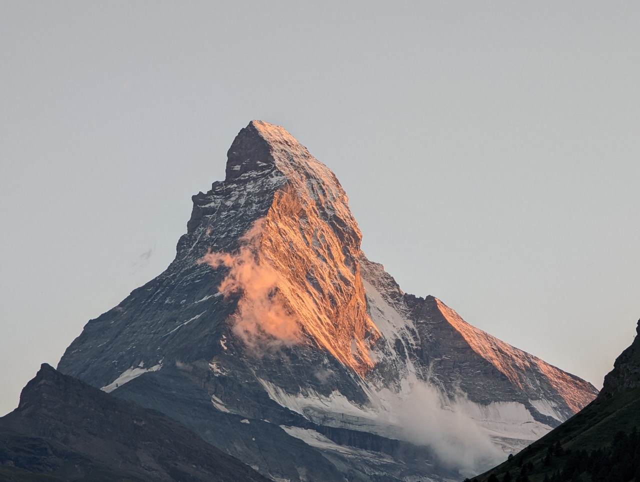
Sunset
Position: 46°1.31’N, 7°45.15’E
The evening sun setting the Matterhorn aglow, viewed from the terrace of our room at the Petit Chalet Schonegg. We stayed here specifically for a Matterhorn view, and were very happy with the room.
|
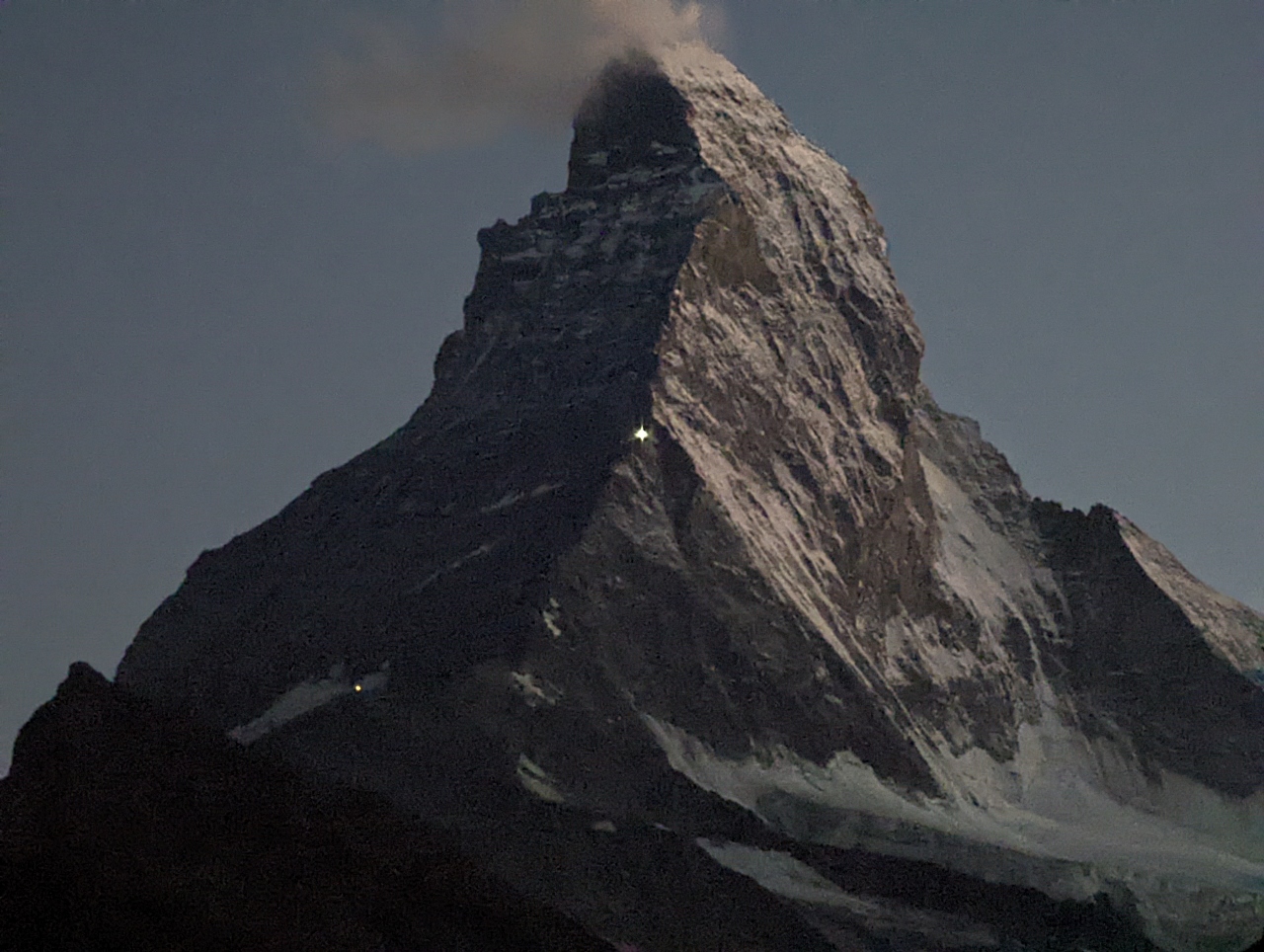 |
Dusk
Position: 46°1.32’N, 7°45.16’E
As night fell, we were super-excited to see lights on the Matterhorn (at bottom left and center—click image for a larger view). These are from climbing huts atop the mountain.
|
 |
Click the travel log icon on the left to see these locations on a map. And a map of our most recent log entries always is available at mvdirona.com/maps. |
Beautiful! After a visit there all my son could talk about was moving to Switzerland. I think the economic realities of doing so have since put that idea on permanent hold.
Yes, Switzerland is both beautiful and more expensive than many other parts of Europe. Still, like your son, we would love to live there.