On our second day of snowshoeing at Hurricane Ridge on Olympic National Park, we walked about 2 miles (3.2 km) along the Kahhane Ridge towards 6,454 ft (1,967 m) Mt. Angeles. Known as the Sunrise Ridge Route, the trail has equally spectacular views as our previous day’s hike to Hurricane Hill, but with a lot more climbing. The route included several ascents and descents, one particularly steep, and we were impressed with the grip of our new MSR Lighting Ascents snowshoes.
We had a great time, particularly with another day of spectacularly clear weather. Afterwards, we strolled through Port Angeles and had a relaxing evening at Barhop Brewing where we watched the Coho ferry arrive.
Below are highlights from March 6th, 2022. Click any image for a larger view, or click the position to view the location on a map. And a map with our most recent log entries always is available at mvdirona.com/maps.
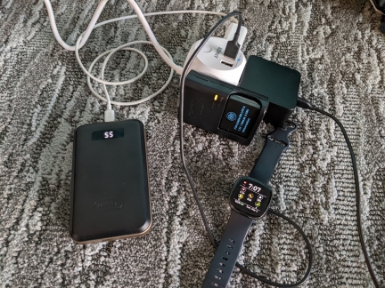 |
PowerPort Cube
Position: 48°7.13’N, -123°25.66’W
We bought this Anker PowerPort Cube initially to plug into a European adapter in hotel rooms and increase the number of available North American sockets, and to give us an extension when the socket is in an inconvenient place. But we find we use it a lot in North America for much the same reason. Here we’re charging a FitBit watch, a camera battery, a portable battery to power our phones and a laptop.
|
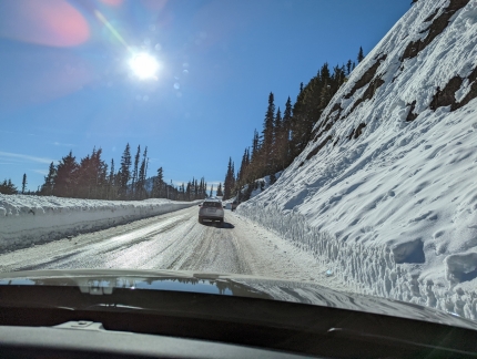 |
Slides
Position: 47°58.69’N, -123°28.39’W
Heading back up to Hurricane Ridge for some more snowshowing. Yesterday the slopes were completely snow-covered, but many small slides since then have revealed dirt below.
|
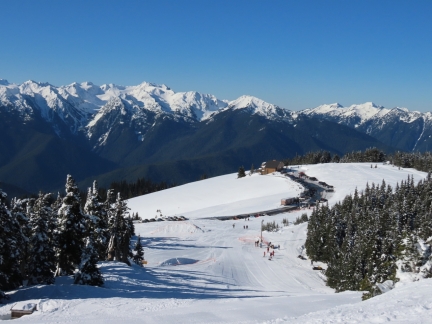 |
Visitor Center
Position: 47°58.23’N, -123°29.57’W
The view back down to the Hurricane Ridge Visitor Center from partway up to the start of the Kahhane Ridge trail.
|
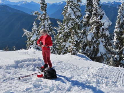 |
Getting Ready
Position: 47°58.30’N, -123°29.50’W
We just walked up the road to reach the Kahhane Ridge trailhead, and then donned our snowshoes at the start of the ridge.
|
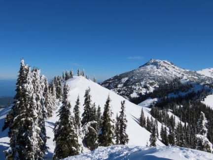 |
Kahhane Ridge
Position: 47°58.30’N, -123°29.50’W
The showshoe trail, known as the Sunrise Ridge Route, runs about 2 miles (3.2 km) along the Kahhane Ridge towards 6,454 ft (1,967 m) Mt. Angeles, visible in the distance.
|
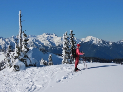 |
Hurricane Ridge
Position: 47°58.75’N, -123°28.89’W
Enjoying the view to Hurricane Ridge from Kahhane Ridge at altitude 5,374 ft (1638m).
|
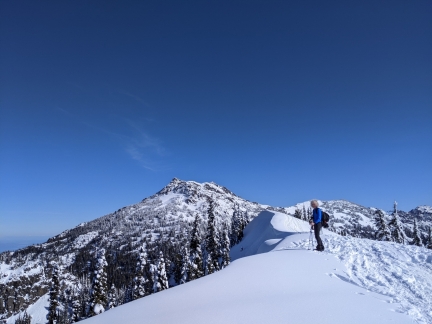 |
Powder
Position: 47°58.80’N, -123°28.86’W
We’ve not seen anyone on the trail so far, compared to dozens yesterday on the Hurricane Hill trail. While plenty of tracks are visible, there also lots of fresh powder en route.
|
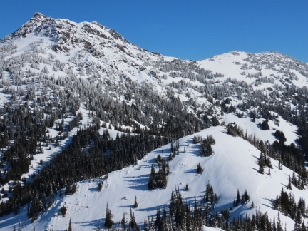 |
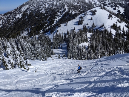
Getting Closer
Position: 47°58.82’N, -123°28.80’W
Getting closer to Mt. Angeles, about a mile down the trail, at altitude 5,443ft (1,659 m). Unfortunately, we’ve got a big hill in front of us to descend.
|
 |
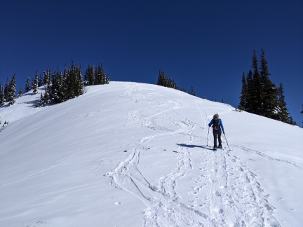
Steep
Position: 47°58.87’N, -123°28.72’W
Working down a very steep slope. Our snowshoes, MSR Lighting Ascents have excellent grip and are doing really well in the steep terrain. We’re super happy with them.
|
 |
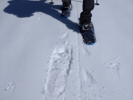
And Back Up
Position: 47°59.00’N, -123°28.45’W
Working back up the next ridge. We’re going to be very tired by the end of this day.
|
 |
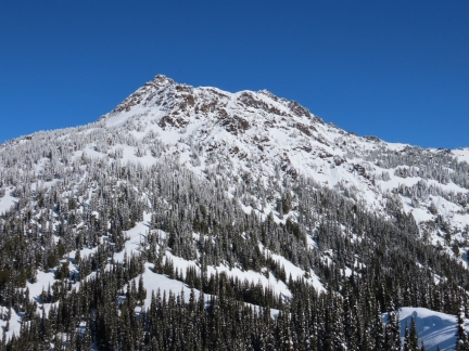
Heel Lift
Position: 47°59.04’N, -123°28.41’W
Our snowshoes heel lefts that can easily be popped up or down with the tip of our pole. The heel lift reduces fatigue and increases traction when going up steep slopes. You can see how aggressively the forward crampon digs in with the heel lift engaged.
|
 |
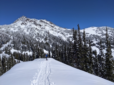
Mt. Angeles
Position: 47°59.04’N, -123°28.40’W
6,454 ft (1,967 m) Mt. Angeles rising above us.
|
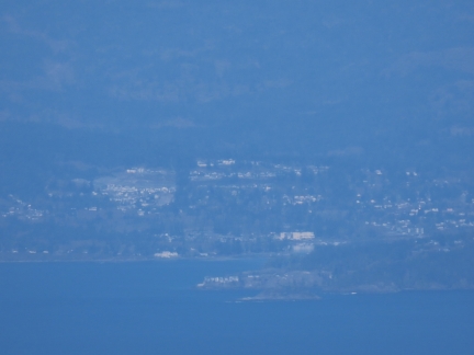 |
Victoria
Position: 47°59.05’N, -123°28.39’W
View from the trail to Victoria, Canada, about 30 miles (48 km) away. We’re really enjoying the clear weather.
|
 |
Tracks
Position: 47°59.12’N, -123°28.26’W
Once we descended the big hill, there were a lot fewer tracks on the route. It’s just spectacularly beautiful out here.
|
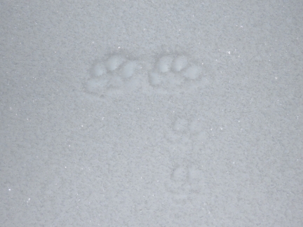 |
Paw Prints
Position: 47°59.37’N, -123°28.22’W
Prints, possibly from a bobcat, in the snow near the base of Mt Angeles.
|
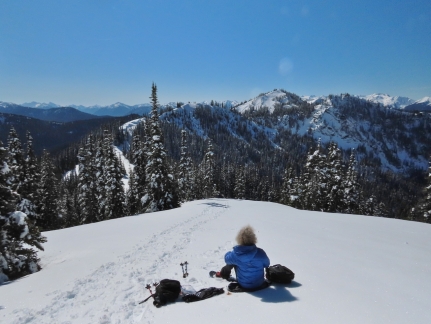 |
Snack
Position: 47°59.39’N, -123°28.21’W
Enjoying a snack with a view to the Bailey Range before turning around to head back. The ridgeline we followed is visible at left and the big hill we descended is slightly to the right of center.
|
 |
Ski Tracks
Position: 47°59.08’N, -123°28.32’W
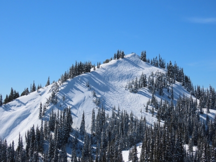
Ski tracks on the big hill that we descended, with a few hikers/snowshoers visible at the top (click image for a larger view).
|
 |
Woods
Position: 47°58.95’N, -123°28.60’W
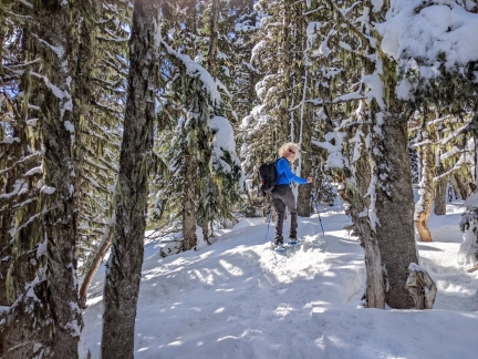
Walking through the woods in the sunshine. Snowshoeing has really opened up some amazing winter hiking opportunities.
|
 |
Climbing
Position: 47°58.91’N, -123°28.67’W
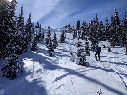
Starting the big climb back up the hill. We were super-tired by the time we reached the top. It looks like a gentle slope, but the last half is sufficiently steep that it’s quite heavy going.
|
 |
Steepest
Position: 47°58.86’N, -123°28.72’W
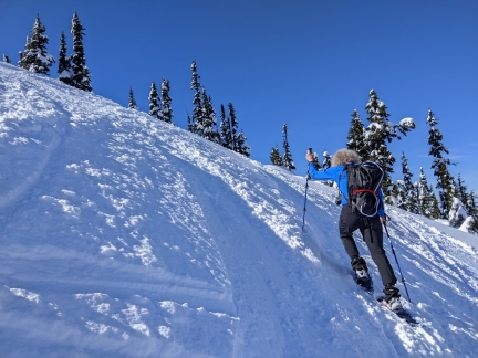
James tackling the steepest section of the hill just short of the top. The snowshoes have amazing traction—we’d have trouble just hiking up such steep slopes bare of snow. Man, this was tiring, but totally worth it with these views.
|
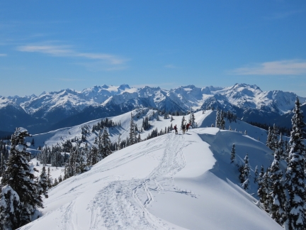 |
Bailey Range
Position: 47°58.86’N, -123°28.75’W
The return trip provided us with frequent impressive view to the Bailey Range.
|
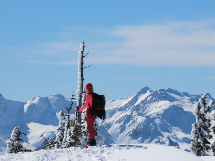 |
Mt Appleton
Position: 47°58.84’N, -123°28.77’W
We believe that is 6,000ft (1829m) Mt. Appleton to Jennifer’s right, looking west from Kahhane Ridge.
|
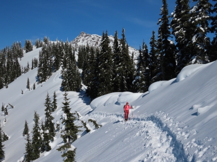 |
Below Ridge
Position: 47°58.62’N, -123°28.98’W
Walking a steep slope below the top of the ridge, with Mt. Angeles just visible in the background.
|
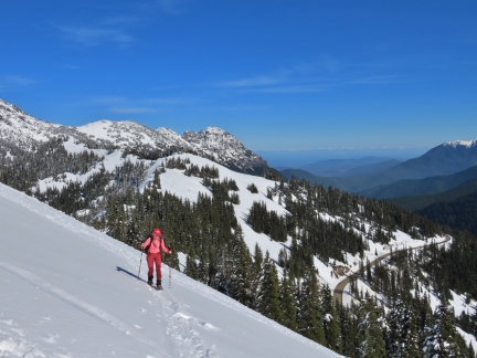 |
Road
Position: 47°58.43’N, -123°29.44’W
We’re nearly back to the trailhead, with Hurricane Ridge Road visible below.
|
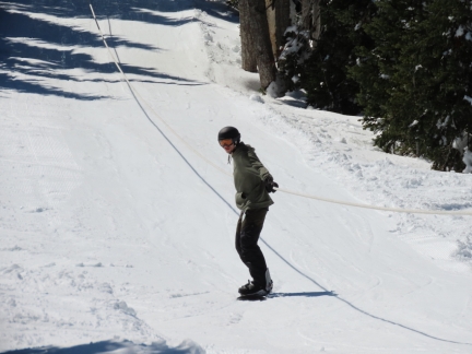 |
Tow Rope
Position: 47°58.34’N, -123°29.52’W
Snowboarder riding a tow rope up in the ski area just between the parking lot and the trailhead.
|
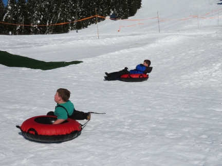 |
Snow Tubing
Position: 47°58.26’N, -123°29.51’W
Snow tubing is popular at Hurricane Ridge.
|
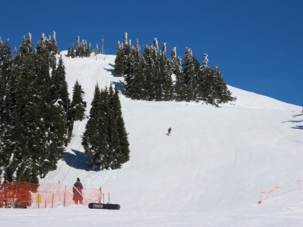 |
Skiing
Position: 47°58.22’N, -123°29.55’W
In the center of the shot, a skier coming down the hill with the tow rope visible at left. The trailhead for our hike was at the top of the rope.
|
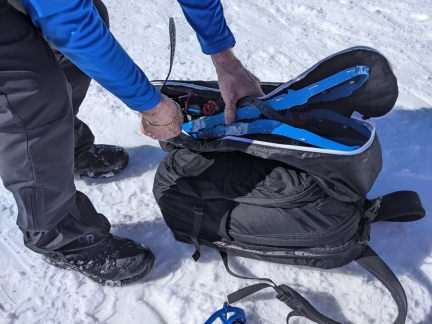 |
Stowing Gear
Position: 47°58.21’N, -123°29.69’W
We bought a couple of Athletico snowshoe bags to stow our gear and are quite happy with them. They have several pockets for keeping things organized, elastic tiedowns to secure our poles, and they keep the sharp snowshoes from damaging anything.
|
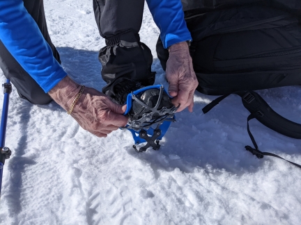 |
Microspikes
Position: 47°58.21’N, -123°29.69’W
Putting on microspikes to walk the icy parking lot back to the car.
|
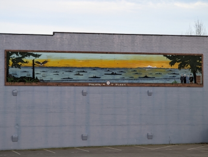 |
Pacific Fleet
Position: 48°7.27’N, -123°26.05’W
Mural depicting the Pacific Fleet at Port Angeles. The fleet exercised there annually from 1895 to 1935 and one year had 70 ships in the harbor.
|
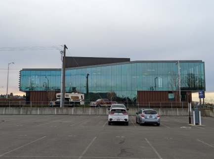 |
Events Hall
Position: 48°7.25’N, -123°26.03’W
The striking Field Arts & Events Hall in Port Angeles, scheduled to open in 2023.
|
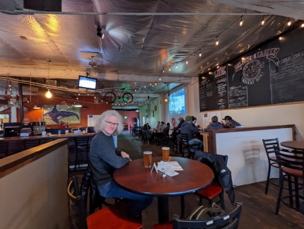 |
Barhop Brewing
Position: 48°7.27’N, -123°26.00’W
An excellent dinner at Barhop Brewing and Artisan Pizza. Thanks for the recommendation John Worl!
|
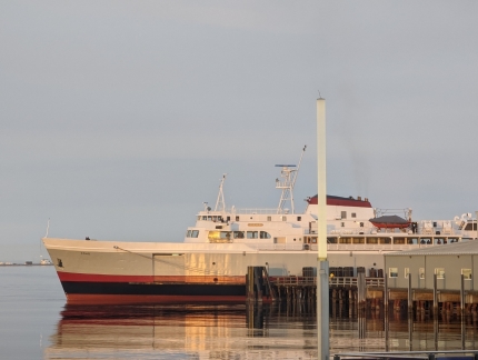 |
Coho
Position: 48°7.27’N, -123°26.00’W
The Coho arrived into Port Angeles while we were having dinner at Barhop Brewing. Here they have attached a bow line and are completey a pivot before backing into the berth.
|
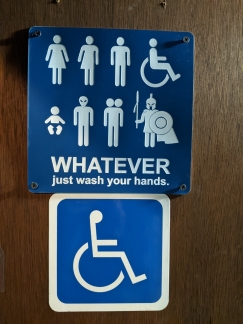 |
Bathroom Sign
Position: 48°7.26’N, -123°26.00’W
We got a giggle out of the bathroom sign at Barhop Brewing.
|
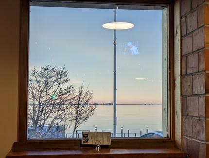 |
Dusk
Position: 48°7.27’N, -123°26.00’W
Dusk looking into Port Angeles Harbor from Barhop Brewing, ending a fabulous weekend of snowshoeing in Olympic National Park.
|
 |
Click the travel log icon on the left to see these locations on a map. And a map of our most recent log entries always is available at mvdirona.com/maps. |

If your comment doesn't show up right away, send us email and we'll dredge it out of the spam filter.