The Washington State Ferry fleet is the largest in the United States with 21 vessels that annually carry over 23 million passengers. The ferry system also is the second largest in the world for vehicles, transporting an annual average of 10.3 million as part of the state highway network. Ten routes operate out of 20 terminals across eight counties, ranging from Tacoma in the south and the San Juan Islands in the north, plus one international run between Anacortes and Sidney, Canada on Vancouver Island.
From our apartment in Seattle, we can see the large Washington State ferries arriving into and departing Coleman Dock in downtown Seattle, and also the regional passenger-only ferries that serve Bremerton and Kingston. And after months of watching them come and go, we finally took a ride on one.
On a cold December day, with unseasonable snow still on the ground, we took a ride on the 362-ft (110 m) Washington State car ferry Chimacum to Bremerton. The route took us through scenic and narrow Rich Passage, pictured above, with wonderful views to the snow-covered Olympic Mountains. Bremerton is home to the Puget Sound Naval Shipyard, the largest naval shore facility in the the Pacific Northwest, employing 14,000 people. There we toured the town on foot and had a long and enjoyable lunch at the Horse & Cow pub, packed with memorabilia from the local submariner community.
We returned on the 36-knot fast ferry Lady Swift, arriving in half the time of our outbound journey. We had a super-fun day and really enjoyed getting back out on the water, our first boat trip since arriving into Charleston back in late May. Below are highlights from December 29th, 2021. Click any image for a larger view, or click the position to view the location on a map.
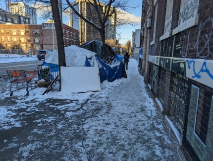 |
Indoor Heat
Position: 47°36.94’N, -122°20.62’W
Downtown Seattle has a large tent-dwelling population and over the past six months we’ve noticed some that are expanding into two-tent “apartments”. Some even have fenced-off areas with No Trespassing signs for their “yard”. With the cold spell and snow that’s recently descended upon Seattle, the innovation continues and they now have indoor heat. Many of the tents have extension cords running out of them, sometimes hundreds of feet, to the closest live power socket available.
|
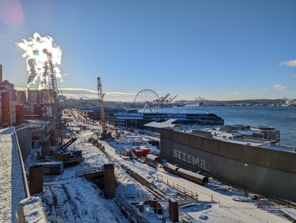 |
Waterfront
Position: 47°36.40’N, -122°20.38’W
Snowy scene looking across the a portion of the construction area for Seattle’s new waterfront to the The Seattle Great Wheel, with the Port of Seattle beyond.
|
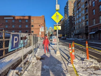 |
Icy
Position: 47°36.40’N, -122°20.38’W
The temperatures have remained below freezing the past few days and the sidewalks are thick with ice. We could use those shoe grippers we got in Bergen.
|
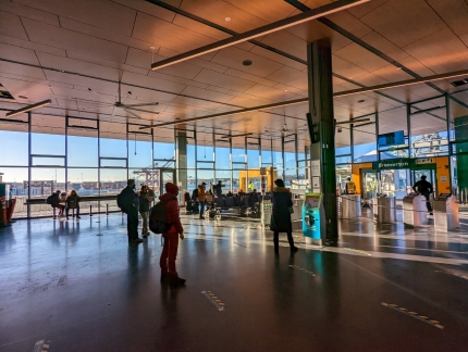 |
Coleman Dock
Position: 47°36.14’N, -122°20.25’W
At Coleman Dock to take the ferry to Bremerton. There aren’t many people here for the Saturday morning trip.
|
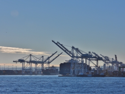 |
Port of Seattle
Position: 47°36.10’N, -122°21.86’W
View to the Port of Seattle as the 362-ft (110 m) ferry Chimacum pulls out from Coleman Dock en route to Bremerton.
|
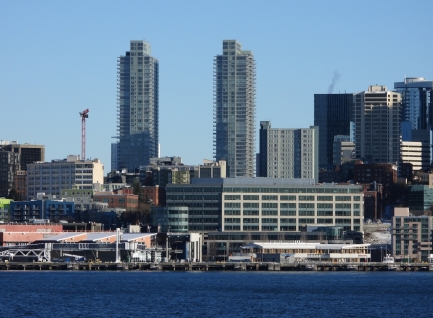 |
Insignia
Position: 47°36.09’N, -122°22.28’W
The twin towers of the Insignia condominium complex where we live. Our apartment is at the top left of the south (right) tower.
|
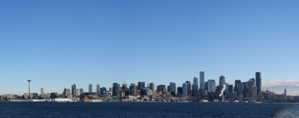 |
Seattle Skyline
Position: 47°36.10’N, -122°23.46’W
The beautiful Seattle skyline on a crisp and clear winter day. Flanking the high-rises are two Seattle icons: the Space Needle at left and the Smith Tower at right. The 605-ft (184 m) Space Needle was built for the 1962 World’s Fair and the 462-ft Smith Tower was the tallest in the country west of Ohio when completed in 1914.
|
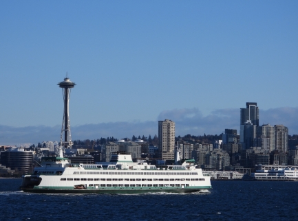 |
Tacoma
Position: 47°35.98’N, -122°23.82’W
The 460-ft (140 m) ferry Tacoma en route to Colman Dock from Bainbridge Island.
|
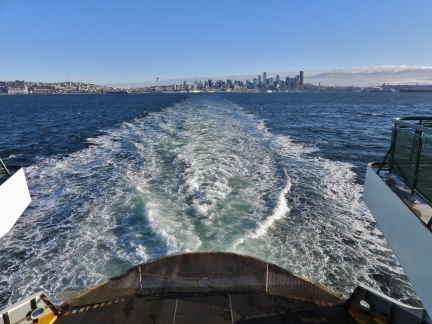 |
Wake
Position: 47°34.27’N, -122°29.24’W
Looking back along the ferry Chimacum‘s wake as Seattle recedes in the distance.
|
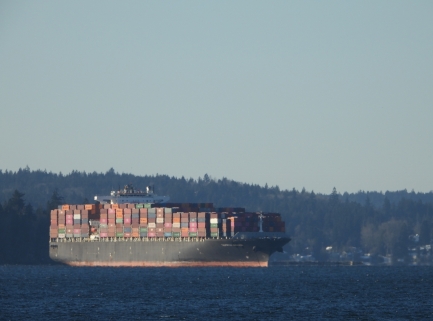 |
Yukon Harbor
Position: 47°34.27’N, -122°29.24’W
One of several container ships moored in Yukon Harbor, awaiting space in the Port of Seattle.
|
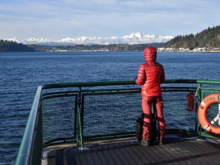 |
On the Bow
Position: 47°34.02’N, -122°30.54’W
Enjoying the view from the bow of the ferry Chimacum as we enter narrow Rich Passage. It’s really cold out here, but the scenery is fabulous.
|
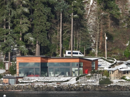 |
Waterfront Home
Position: 47°33.97’N, -122°30.93’W
We’ve transited Rich Passage many times in our own boat and this modern waterfront home on Bainbridge Island always catches our attention.
|
 |
Beans Point
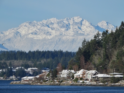
Position: 47°33.97’N, -122°30.93’W
View to the snow-covered Olympic Mountains across Beans Point on Bainbridge Island.
|
 |
Communication Towers
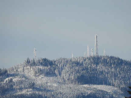
Position: 47°33.86’N, -122°36.33’W
Hilltop west of Bremerton bristling with communication towers, likely for the nearby naval base.
|
 |
Manette Bridge
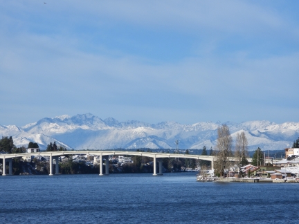
Position: 47°33.39’N, -122°37.08’W
We’ve passed under the Manette Bridge in our boats many times en route to Dyes Inlet. Silverdale and Oyster Bay are popular stops for us.
|
 |
Bremerton
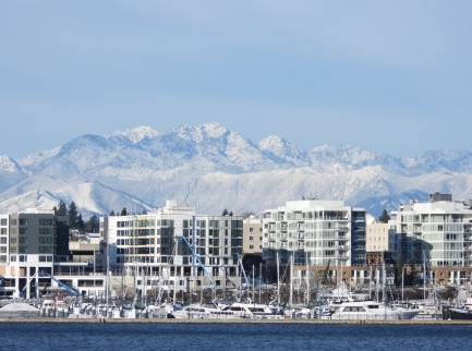
Position: 47°33.48’N, -122°37.31’W
The Bremerton Marina in front of several new condominium complexes. Bremerton has change a lot since our last visit well over a decade ago.
|
 |
Enetai
Position: 47°33.69’N, -122°37.48’W
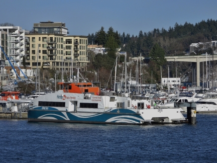
The fast ferry Enetai moored at Bremerton. From our apartment, we frequently see the commuter vessel underway between Bremerton and Seattle.
|
 |
Position: 47°33.69’N, -122°37.48’W
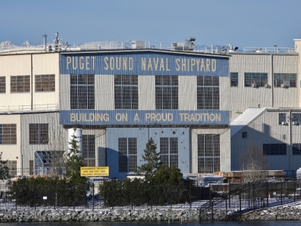
The ferry docks in Bremerton are adjacent to the Puget Sound Naval Shipyard, established in 1891. It is largest naval shore facility in the the Pacific Northwest, employing 14,000 people.
|
 |
Hammerhead Crane
Position: 47°33.70’N, -122°37.49’W
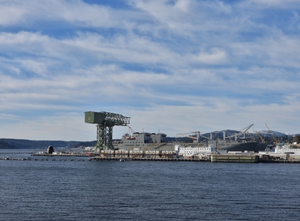
The prominent green hammerhead crane at the Puget Sound Naval Shipyard, built in 1933, is 250 ft (76 m) tall, 80 ft (24 m) wide, and has a lifting capacity of 250 tons.
|
 |
Construction
Position: 47°33.70’N, -122°37.49’W
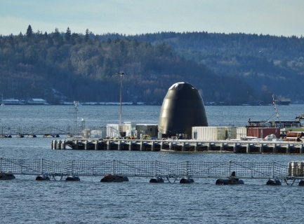
The elite nuclear-powered fast-attach submarine USS Connecticut was towed into Bremerton a week ago to undergo repairs after striking an uncharted seamount in the South China Sea. This certainly is the sub we saw from our apartment. The ship’s sonar dome was lost in the collision and will be replaced for an estimated $10M. This structure, that looks like a submarine nose cone, might be part of the repair project.
|
 |
Bremerton Arrival
Position: 47°33.70’N, -122°37.49’W
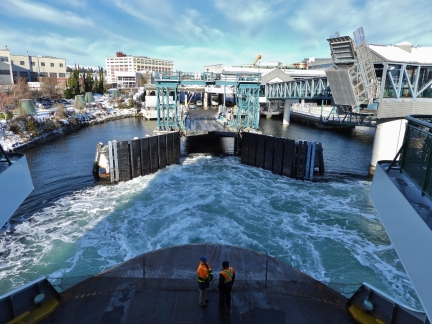
Wash from the ferry Chimacum as it slows down to dock in Bremerton.
|
 |
Horse & Cow
Position: 47°33.96’N, -122°37.69’W
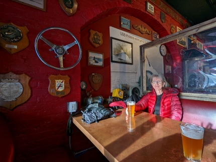
A long and enjoyable lunch at the Horse & Cow pub in Bremerton. The bar was established in 1953 to serve the large submariner community in Bremerton and is packed with submarine memorabilia including many photographs and other items signed by captains and crew.
|
 |
Banners
Position: 47°33.96’N, -122°37.68’W
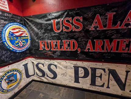
Huge banners, filled with submarine crew signatures, cover the walls in one section of the Horse & Cow pub in Bremertion. These two are from the USS Alabama and the USS Pennsylvania, both Ohio-class nuclear-powered ballistic missile submarines.
|
 |
Fisherman
Position: 47°33.95’N, -122°37.61’W
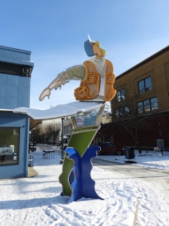
Statue of a fisherman being snagged by a fish in downtown Bremerton. The fish, not visible in the photo, is on the opposite street corner.
|
 |
USS Turner Joy
Position: 47°33.76’N, -122°37.48’W
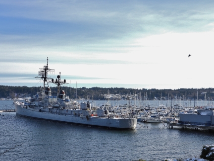
The destroyer USS Turner Joy served from 1958 to 1982 and now is a museum ship moored permanently in Bremerton alongside the marina.
|
 |
Proud Tradition
Position: 47°33.83’N, -122°37.39’W
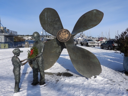
The sculpture “Proud Tradition” was installed in 1991 to commemorate the Puget Sound Naval Shipyard’s centennial. The statue honors Naval shipyard workers and shows a man wearing a hardhat handing a boy a model of an aircraft carrier.
|
 |
Heading Home
Position: 47°33.71’N, -122°37.39’W
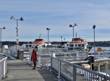
On the fast-ferry dock to return home.
|
 |
On Board
Position: 47°33.96’N, -122°37.68’W
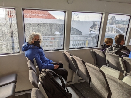
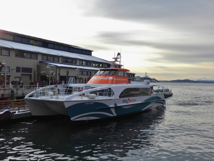
On board the fast ferry Lady Swift to return back to Seattle. The ferry carries 118 passengers with a service speed of 36 knots. We’ll return home in 30 minutes, compared the one-hour outbound trip on the car ferry Chimacum. The vessel is one of two ultra-low-wake craft designed for fast ferry service between Seattle and Bremerton through Rich Passage. A previous generation of fast ferries, introduced in the late 1990s, was pulled from service after residents of Rich Passage filed a successful lawsuit claiming the wakes were damaging their waterfront property. Years later the ferries were sold to Golden Gate Ferries in San Franciso at a deep discount.
|
 |
Temporary Dock
Position: 47°36.32’N, -122°20.40’W
The Colman Dock is being upgraded and the Lady Swift moors in a temporary dock farther north. We were impressed at how easily the skipper brought the vessel into such a tight spot.
|
 |
Bell Harbor Marina
Position: 47°36.57’N, -122°20.75’W
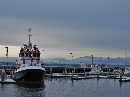
The fire boat Leschi moored at Bell Harbor Marina, our old home port.
|
 |
Dusk
Position: 47°37.00’N, -122°20.55’W
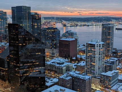
Dusk looking southwest across snow-covered buildings in downtown Seattle with the Port of Seattle in the distance.
|
 |
Lake Union
Position: 47°37.00’N, -122°20.55’W
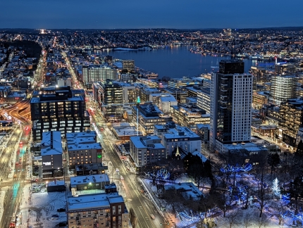
A beautifully clear and calm evening looking across Lake Union.
|

Nice post and really enjoyed reading it. Great photos too. Thank you!
Thanks for the blog feedback!