Bend, Oregon is a mecca for outdoor enthusiasts, with river-rafting, hiking, world-class climbing, and hundreds of miles of mountain-biking trails. And that’s just in the summer. Bend also is close to some of the best skiing in Oregon at the Mt Bachelor ski resort. The town also is home to more than 22 breweries, and has many excellent pubs and restaurants.
From the Oregon coast, we traveled east to spend the final few days of our road trip in Bend. We had a fabulous time there, checking out several pubs and restaurants and hiking the trails at dramatic Smith Rock State Park, pictured above.
The 197-mile (317-km) drive to Bend brought our total trip distance to 4,829 miles (7,771 km) across 13 states (South Carolina, Georgia, Florida, Alabama, Mississippi, Louisiana, Texas, New Mexico, Arizona, Utah, Nevada, California, and Oregon).
Below are highlights from July 2nd through 5th, 2021. Click any image for a larger view, or click the position to view the location on a map. And a live map of our current route and most recent log entries always is available at mvdirona.com/maps.
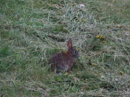 |
Rabbit
Position: 44°53.32’N, -124°1.34’W
A wary rabbit in the grass outside our room at the Salishan Lodge.
|
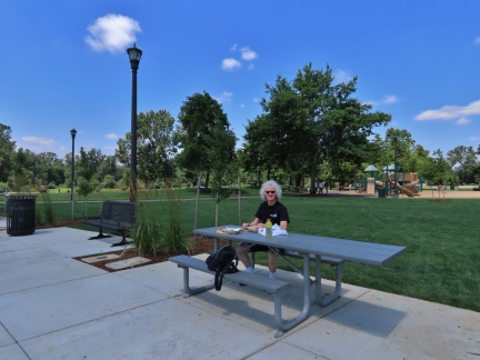 |
Salem
Position: 44°56.40’N, -123°2.60’W
At the Riverfront City Park in Salem, Oregon having delicious street tacos for lunch from nearby Azul’s Taco House. We’re heading east towards Bend Oregon for a the July 4th holiday weekend.
|
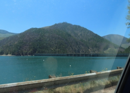 |
Detroit Dam
Position: 44°43.34’N, -122°14.79’W
The Detroit Dam at right was completed on the North Santiam River in 1953 under the Flood Control Act of 1938. This created the 9-mile-long Detroit Lake, visible in the foreground.
|
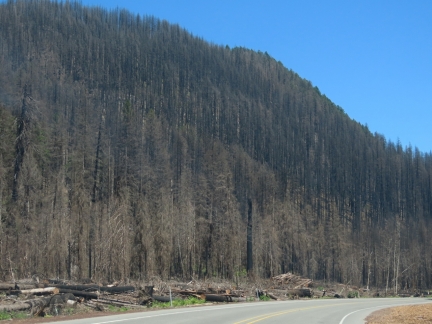 |
Santiam Fire
Position: 44°41.62’N, -122°2.87’W
The Santiam Fire burned from August through December of 2020 across 402,274 acres (162,794 ha) and was one of the most destructive in Oregon history. Over 1,500 structures were destroyed, including much of the towns of Detroit, that we just passed through.
|
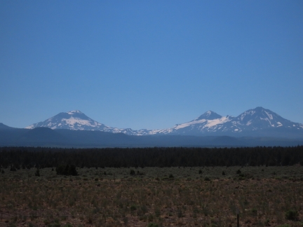 |
Three Sisters
Position: 44°13.07’N, -121°25.59’W
View to Oregon’s iconic Three Sisters volcanic peaks as we near the city of Bend.
|
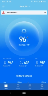 |
Heat Advisory
Position: 44°3.05’N, -121°18.87’W
Back away from the coast the temperature is high again, at 96°F (36° C) in Bend, Oregon with a heat advisory in effect.
|
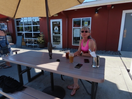 |
Immersion Brewing
Position: 44°3.05’N, -121°18.87’W
Great brews over dinner at Immersion Brewing in Bend, Oregon.
|
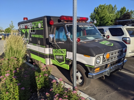 |
Cider Response
Position: 44°3.05’N, -121°18.86’W
We got a chuckle out of the AVID Cider Company’s “Emergency Cider Response” Unit.
|
 |
Old Mill District
Position: 44°2.88’N, -121°18.89’W
Bend’s Old Mill District is a beautiful retail space full of shops and restaurants built in an old industrial mill site.
|
 |
Winterfest
Position: 44°2.78’N, -121°18.96’W
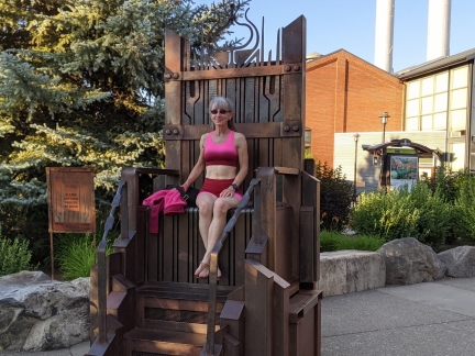
The throne of the Fire King, crowned annually at the Oregon Winterfest in Bend. The weather is decidedly more warm now than it would be for the February coronation.
|
 |
Packing Cubes
Position: 44°2.71’N, -121°18.59’W
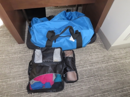
Between the hotel and the car, We each carry a knapsack with our laptops and other items, Jennifer carries Spitfire and a large North Face duffle bag with Spitfire’s “Kitty Central“, while James brings an LL Bean XL rolling duffle bag carrying most of our gear, and our Engel cooler.
We use packing cubes, pictured, inside the large LL Bean duffle to keep things organized and not have to be constantly sifting through loose gear. The packing cubes also work well when optimizing for space in smaller bags. They were super-effective for traveling light on the Rhine River cruise we took a couple of years back. |
 |
Three Sisters
Position: 44°2.77’N, -121°18.69’W
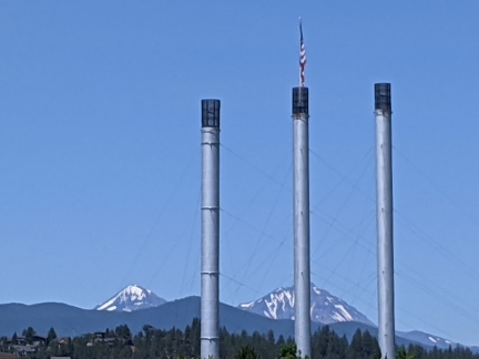
View to the Three Sisters mountains over the old smokestack’s in Bend’s Old Mill District.
|
 |
Deer
Position: 44°2.78’N, -121°18.82’W
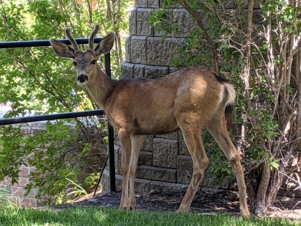
This deer was munching on grass between two buildings and let us get surprisingly close as we passed by along the walking path.
|
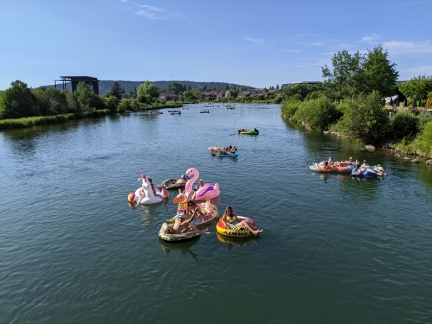 |
River Tubing
Position: 44°2.71’N, -121°18.96’W
Tubing down the Deschutes River in Bend, Oregon is incredibly popular, particularly with the hot weather we’ve been having. Around 200,000 people float down annually.
|
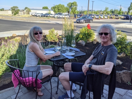 |
Elixer Wine
Position: 44°3.10’N, -121°18.86’W
A wonderful dinner over a tasting flight of wine on the patio at Elixer Wine in Bend, Oregon.
|
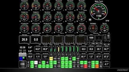 |
Running Engines
Position: 44°2.78’N, -121°18.96’W
Running the wing and main engines on the boat in Charleston from our hotel room in Bend, Oregon. We added remote start for the wing shortly before leaving Charleston on the road trip.
|
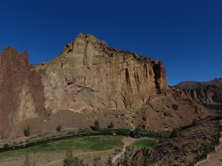 |
Smith Rock State Park
Position: 44°21.87’N, -121°8.30’W
At Smith Rock State Park, about an hour’s drive from Bend. The scenery here is rather unique for Oregon, and feels very similar to Utah. The switchbacks for the Misery Ridge trail that we’ll be hiking can be seen at the base of the cliff, Misery Ridge, slightly right of center.
|
 |
Misery Ridge Trailhead
Position: 44°22.01’N, -121°8.33’W
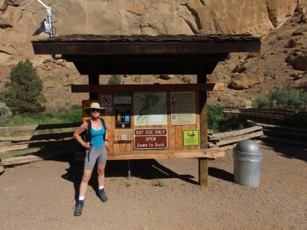
At the Misery Ridge trailhead in Oregon’s Smith Rock State Park. The trail is one of the more difficult in the park, but isn’t all that bad at distance of just over a half mile and en elevation gain of 600ft.
|
 |
Crooked River
Position: 44°22.12’N, -121°8.39’W
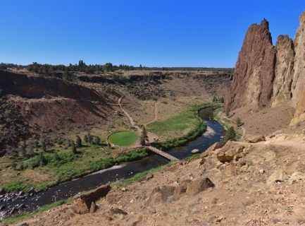
Looking down to the Crooked River from the Misery Ridge trail.
|
 |
Misery Ridge View
Position: 44°22.21’N, -121°8.43’W
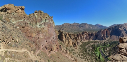
This fabulous view north is the reward for climbing the Misery Ridge trail.
|
 |
Monkey Face
Position: 44°22.18’N, -121°8.51’W
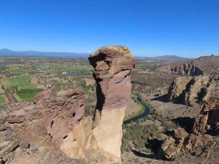
We continued west across Misery Ridge for even better views, including the dramatic 350-ft spire Monkey Face. Smith Rock State Park is an internationally popular climbing destination and this formation contains some of the more difficult climbs in the world. Barely visible in the shadows, two climbers were making their way up the left side when we passed.
|
 |
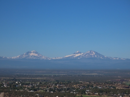
Cascade
Position: 44°22.20’N, -121°8.56’W
An amazing view west to the Cascade Range from the top of Misery Ridge (click image for a larger view).
|
 |
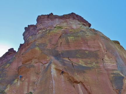
Three Sisters
Position: 44°22.16’N, -121°8.47’W
Oregon’s iconic Three Sisters, viewed from the west end of Misery Ridge.
|
 |
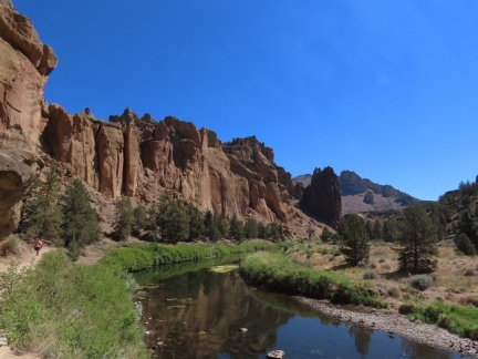
Climbers
Position: 44°22.20’N, -121°8.66’W
As we descended the Mesa Verde trail on the other side of Misery Ridge, we could see climbers everywhere. Here are a couple ascending the Mesa Verde wall.
|
 |
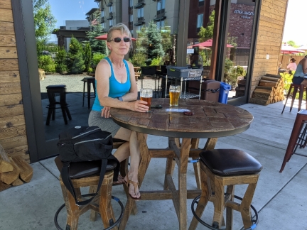
River Trail
Position: 44°21.82’N, -121°8.74’W
We returned back to our car along the Crooked River trail. We really enjoyed the hike—the scenery was really impressive and diverse, and the weather was wonderful.
|
 |
Crosscut Taphouse
Position: 44°3.01’N, -121°18.87’W
A late lunch after our hike at Crosscut Taphouse in Bend.
|
 |
AVID Cider
Position: 44°3.06’N, -121°18.86’W
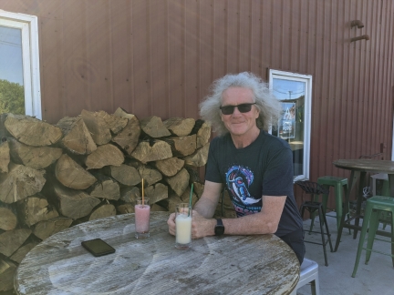
Delicious, and unusual, cider smoothies at AVID Cider in Bend Oregon, home of the “Emergency Cider Response” Unit.
|
 |
Click the travel log icon on the left to see these locations on a map, with the complete log of our cruise.
On the map page, clicking on a camera or text icon will display a picture and/or log entry for that location, and clicking on the smaller icons along the route will display latitude, longitude and other navigation data for that location. And a live map of our current route and most recent log entries always is available at mvdirona.com/maps. |

If your comment doesn't show up right away, send us email and we'll dredge it out of the spam filter.