Capitol Reef National Park in Utah is known for its many long and narrow canyons, some so tight a person can barely squeeze through and others wide enough for vehicles to pass. One of the more unique is Capitol Gorge with its Pioneer Register: as 19th- and early 20th-century pioneers and settlers passed through the canyon, many carved their names in the rocks alongside the route.
From our hotel in nearby Torrey, we spent a great day hiking and driving through several of the many canyons in Capitol Reef. In addition to the canyons, we also made an excellent scenic hike to spectacular Cassidy Arch, where you can pose for pictures atop the 50-foot-wide formation.
Below are highlights from June 24th, 2021. Click any image for a larger view, or click the position to view the location on a map. And a live map of our current route and most recent log entries always is available at mvdirona.com/maps.
 |
Capitol Reef National Park
Position: 38°19.20’N, -111°19.00’W
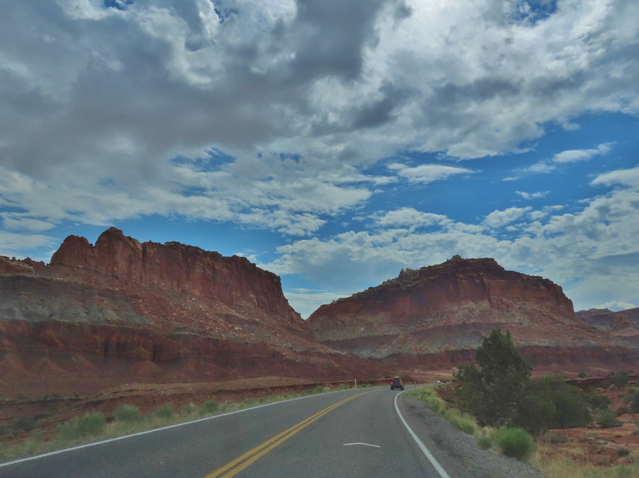
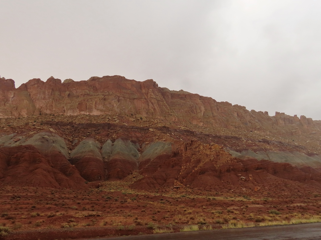
Entering Capitol Reef National Park, another of Utah’s incredibly scenic areas. The state has 5 national parks, third behind Alaska and California, and 43 state parks.
|
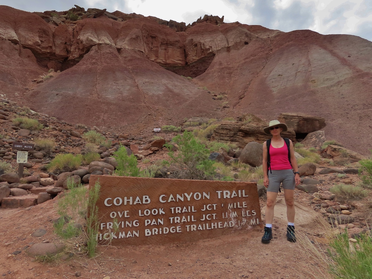 |
Cohab Canyon Trailhead
Position: 38°17.02’N, -111°14.76’W
At the Cohab Canyon trailhead in Capitol Reef National Park.
|
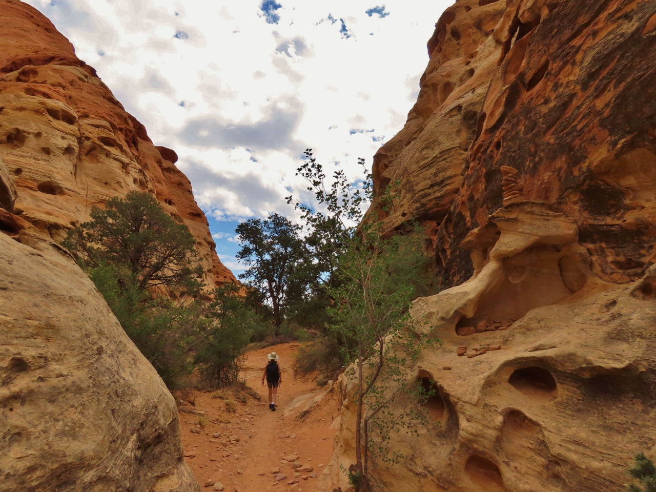 |
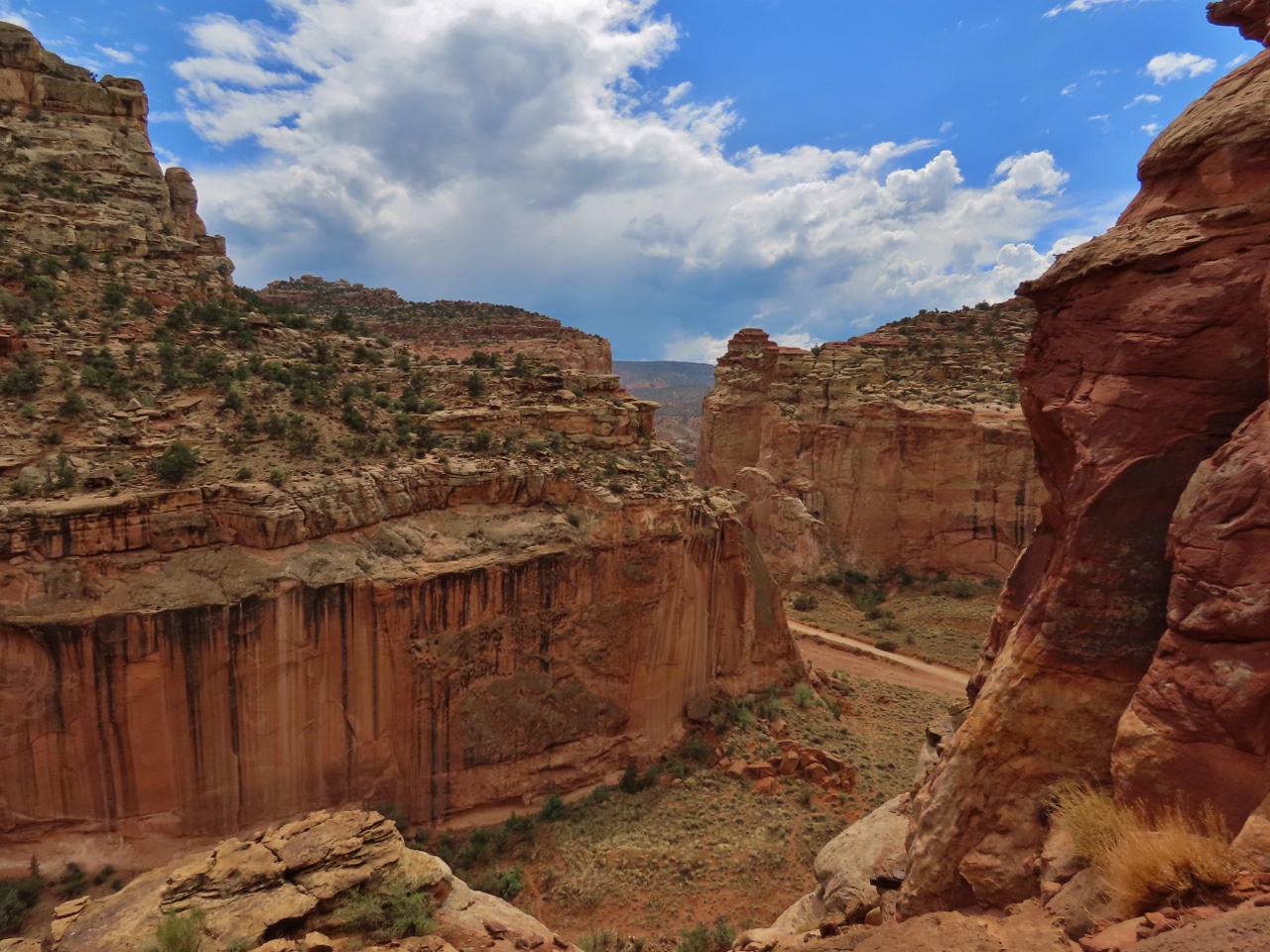
Cohab Canyon
Position: 38°16.88’N, -111°14.65’W
Walking through Cohab Canyon. The trail is much narrower and intimate than the trails in Zion, but equally beautiful.
|
|
|
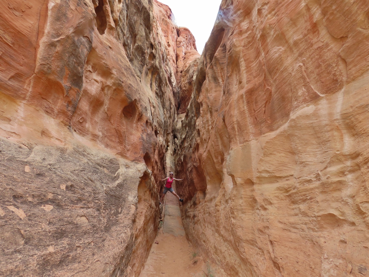
Slot Canyon
Position: 38°16.93’N, -111°14.46’W
Capitol Reef is known for its many slot canyons, some with several-mile-long trails extending through them. Here is Jennifer inside a short slot canyon on the Cohab Canyon trail.
|
 |
Cohab Overlook
Position: 38°17.21’N, -111°14.23’W
View to the Fremont River Valley from Cohab Canyon overlook in Capitol Reef National Park. The park name comes from early settlers who associated the white-capped Navajo Sandstone with the Washington Capitol building.
|
 |
Cuts Canyon
Position: 38°16.01’N, -111°14.70’W
Shortly after we returned from our hike through Cohab Canyon, heavy rain started to fall. It was time for lunch anyway, so we had an in-car picnic at a viewpoint in Cuts Canyon.
|
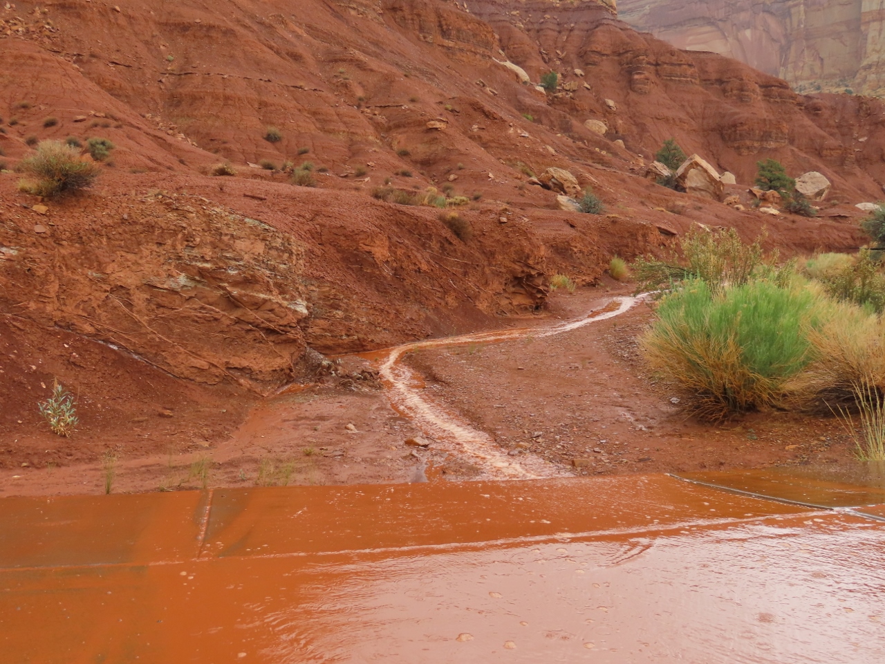 |
Runoff
Position: 38°13.18’N, -111°12.95’W
The rain hadn’t fallen for very long, but the dry ground doesn’t absorb much and small creeks already were forming. Its easy to see how flash-floods can occur here.
|
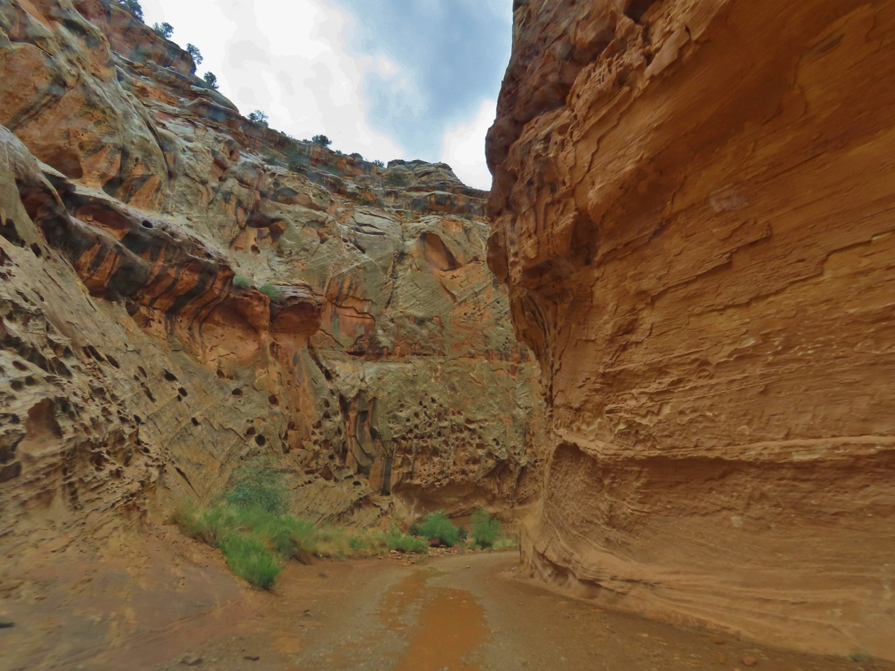 |
Capitol Gorge
Position: 38°12.63’N, -111°11.37’W
Driving the dirt road tight up against the cliffs in Capitol Gorge en route to a trail through the gorge. The scenery was amazing and the small bit of “off-roading” was a lot of fun.
|
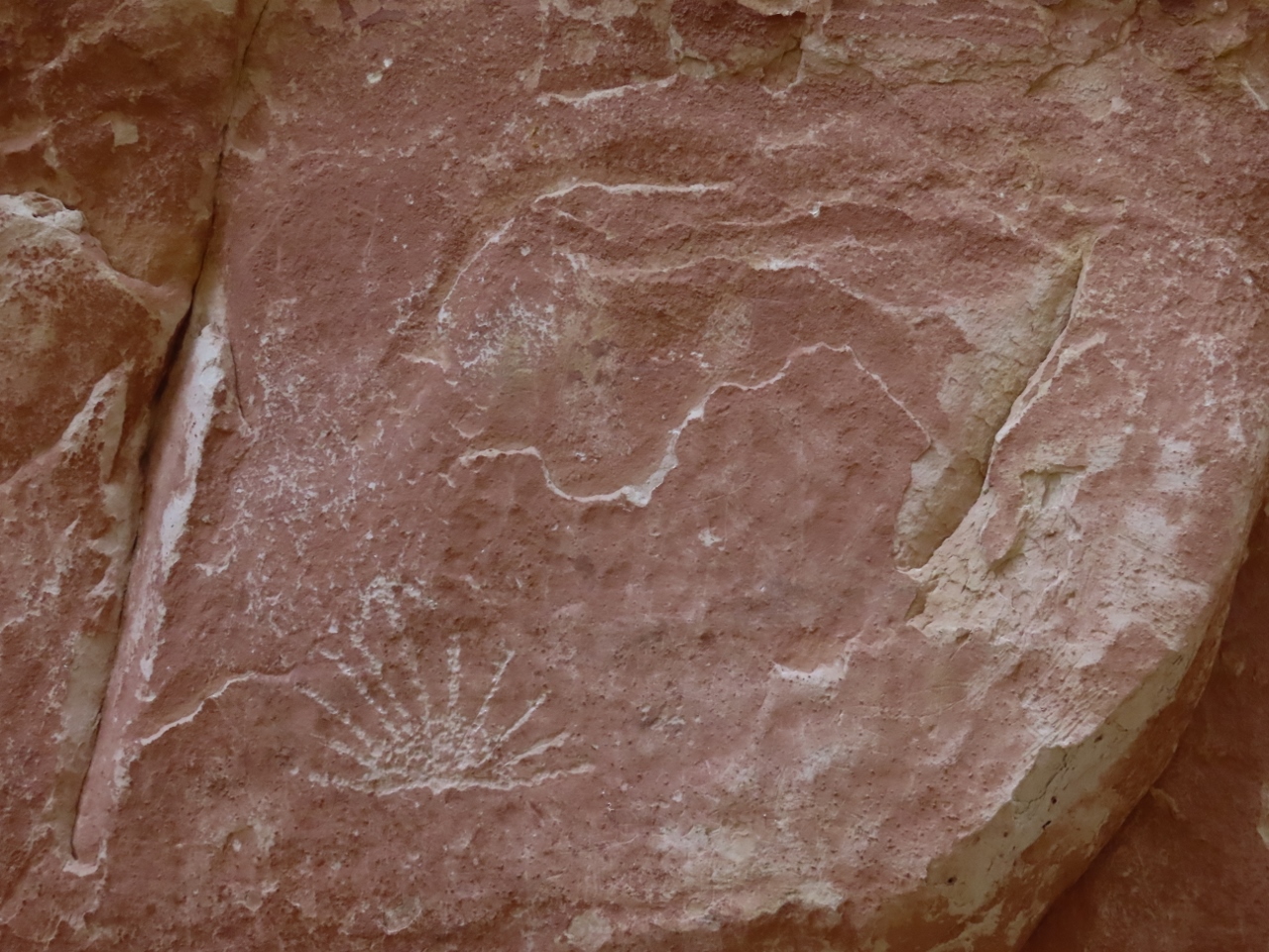 |
Petroglyphs
Position: 38°12.56’N, -111°10.05’W
Native American Petroglphs on the trail through Capitol Gorge.
|
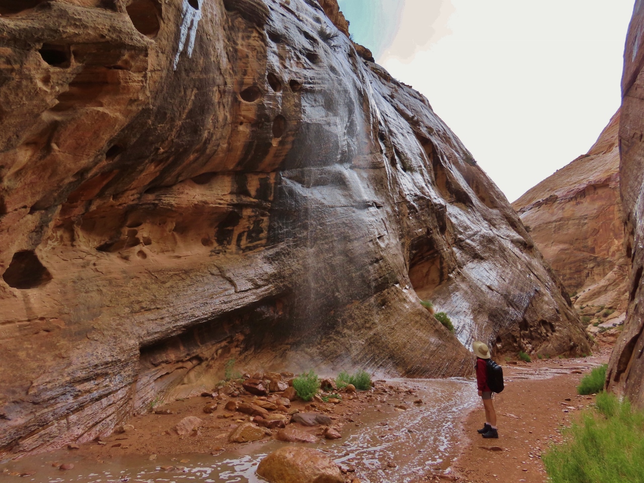 |
Waterfall
Position: 38°12.66’N, -111°9.82’W
One of several waterfalls that formed in Capitol Gorge during the rainfall. By the time we returned back out, less than an hour later, the rain had stopped and the waterfall was gone.
|
 |
Pioneer Register
Position: 38°12.71’N, -111°9.55’W
19th and early 20th-century pioneers and settlers passed through Capitol Gorge and many carved their names in the rocks alongside the route.
|
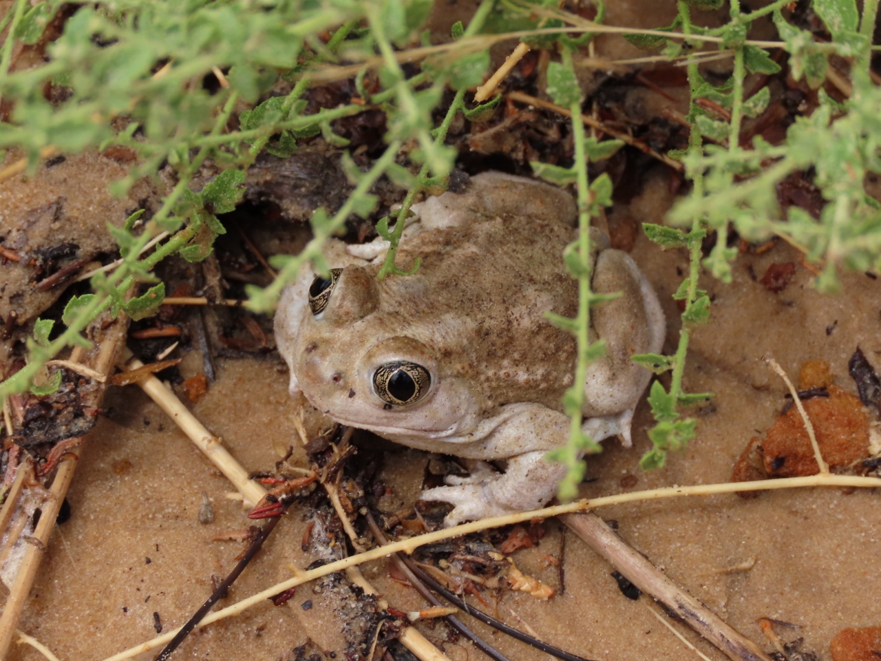 |
Frog
Position: 38°12.84’N, -111°9.47’W
Small frog in Capitol Gorge.
|
 |
Tanks
Position: 38°12.84’N, -111°9.50’W
Walking among the pot holes, called tanks, just above Capitol Gorge. The holes filled after heavy rains and passing pioneers used these “water tanks” to replenish their supply.
|
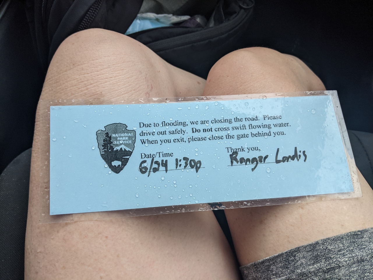 |
Road Closed
Position: 38°12.50’N, -111°10.50’W
During the first part of our hike through Capitol Gorge, the rain had continued to fall and the park closed the dirt road to the trailhead due flood risk. They left a notice on our car asking us to please close the gate behind us as we left and warning us not to cross swift-flowing water.
|
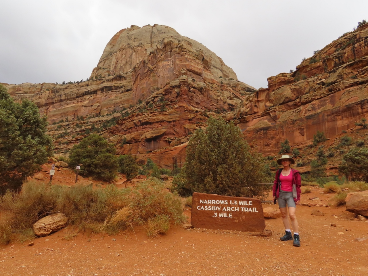 |
Cassidy Arch Trailhead
Position: 38°15.71’N, -111°13.13’W
At the trailhead for Cassidy Arch, a natural arch 1.7 miles (2.8km) from the trailhead. Although the trail isn’t very long, the elevation gain is 670 ft (204m) or a 13% grade, making it a bit strenuous in the hot Utah desert.
|
 |
Cassidy Arch Trail
Position: 38°15.88’N, -111°12.89’W
The view back to the road to the trailhead from the Cassidy Arch trail in Capitol Reef National Park.
|
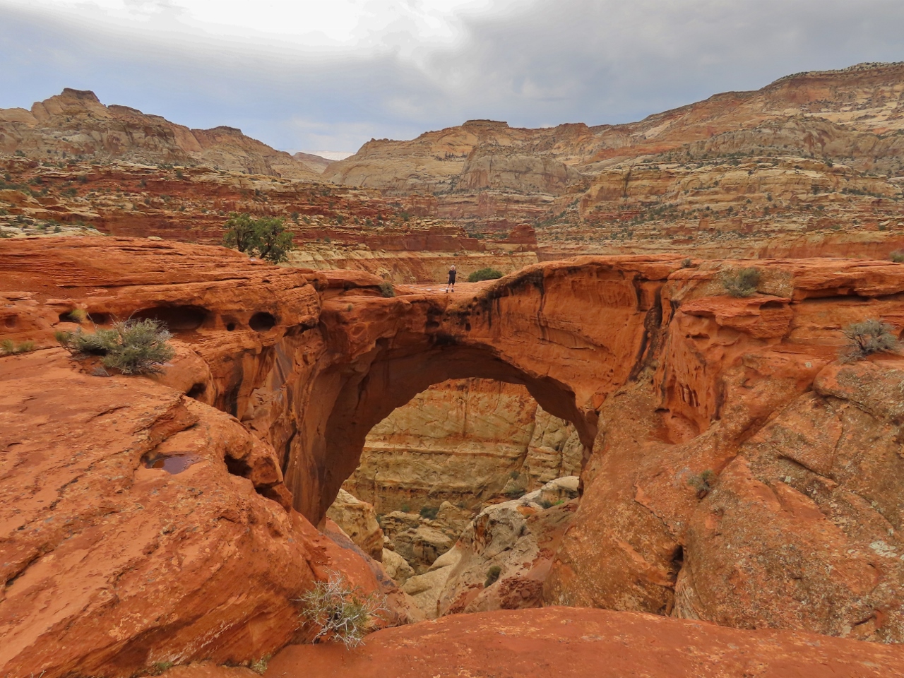 |
Cassidy Arch
Position: 38°15.66’N, -111°13.56’W
James standing atop spectacular Cassidy Arch in Capitol Reef National Park. The arch is named for the famous Wild West train and bank robber Butch Cassidy, who reportedly had a hideout nearby in the late 1800s.
|
 |
Panorama Point
Position: 38°18.44’N, -111°17.74’W
A final view to Capitol Reef National Park from Panorama Point. We really enjoyed our day there, and as with Bryce Canyon National Park, would love to return and explore more of the trails
|
 |
Click the travel log icon on the left to see these locations on a map, with the complete log of our cruise.
On the map page, clicking on a camera or text icon will display a picture and/or log entry for that location, and clicking on the smaller icons along the route will display latitude, longitude and other navigation data for that location. And a live map of our current route and most recent log entries always is available at mvdirona.com/maps. |
If your comment doesn't show up right away, send us email and we'll dredge it out of the spam filter.