Visby, on the island of Gotland, was designated a UNESCO World Heritage site in 1995 for it’s well-preserved medieval structures, include a mostly intact 2.1m (3.4 km) 12th-century wall and a number of church ruins, the majority dating to the 12th century. Walking around the main town, packed on steep, narrow and winding streets within the old city walls, feels like stepping back into the medieval ages.
Visby was high on our list of places to visit, and we’d planned to take Dirona there, but the weather didn’t cooperate when we were in the area so we instead made an overnight trip from Nynashamn by ferry. We spent a fabulous two days there, exploring the town and church ruins, visiting the excellent Gotland Museum and of course, walking the entirety of the wall.
Below are trip highlights from April 13th and 14th in Visby, on the island of Gotland in Sweden. Click any image for a larger view, or click the position to view the location on a map. And a live map of our current route and most recent log entries always is available at mvdirona.com/maps
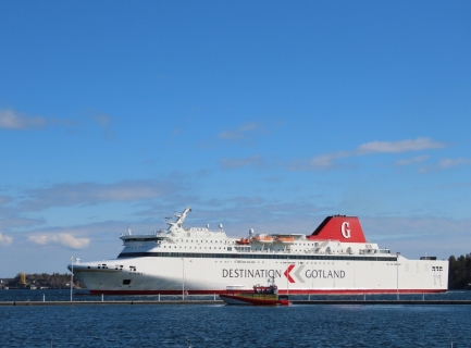 |
Visby Arriving
Position: 58°54.01’N, 17°57.32’E
The Destination Gotland ferry Visby arriving into Nynashamn. We’ll be on board when it departs for Gotland later this morning.
|
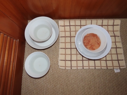 |
Pate-sicle
Position: 58°54.01’N, 17°57.32’E
Cat food frozen into a “pate-sicle” for Spitfire to eat while we’re away for a night on Gotland.
|
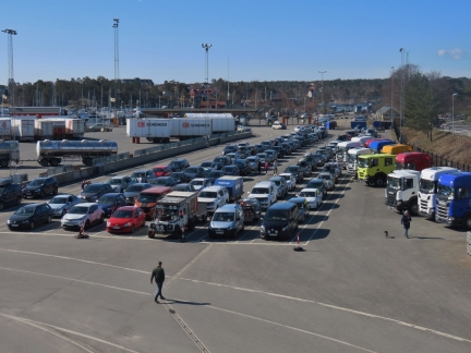 |
Car Traffic
Position: 58°54.25’N, 17°57.35’E
Cars getting ready to load onto the ferry to Visby. The ferry is 100% booked today—we watched them load and completely fill both car decks.
|
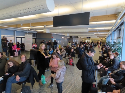 |
Foot Traffic
Position: 58°54.25’N, 17°57.35’E
Waiting with the other passengers to board our ferry to Gotland.
|
 |
Nynashamn Guest Harbour
Position: 58°54.25’N, 17°57.35’E
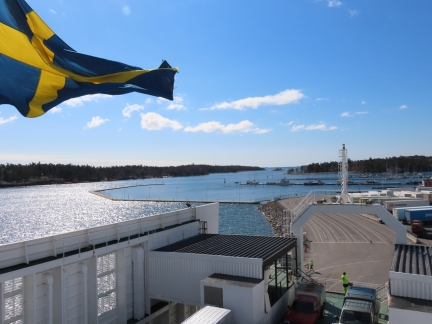
The Nynashamn Guest Harbour viewed from the ferry Visby, with Dirona just right of center. The marina is lightly occupied now in the off-season, but this picture shows how packed it can be in the summer. The large breakwater to the left is full, with boats rafted three deep in places, and boats are moored bow-to the dock where we currently are side-tied.
|
 |
Cruise Ship Ramp
Position: 58°54.44’N, 17°57.97’E
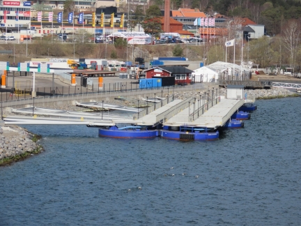
A folding cruise ship boarding ramp, similar to what we saw at Geirangerfjord in Norway last year.
|
 |
Mining Trucks
Position: 58°54.60’N, 17°58.28’E
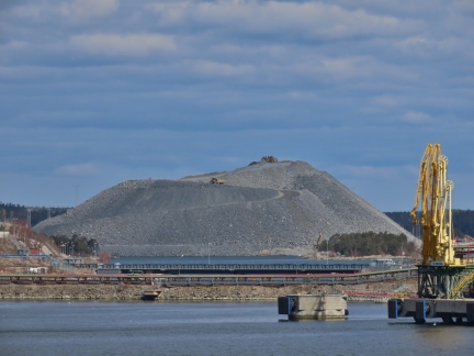
Mining trucks working a huge pile just north of Nynashamn, probably fuel for the nearby heat and power plant.
|
 |
Underway
Position: 58°50.32’N, 18°4.21’E
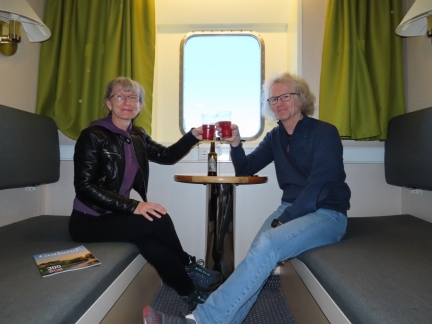
Celebrating being underway for Gotland with a Visby-brewed Sleepy Bulldog Pale Ale. We’re super-excited about the trip as we really wanted to visit Visby. We’d planned to go by boat from the Vastervik area on the mainland directly to the west, but the weather didn’t cooperate, so we continued north. The 1500-passenger ferry was completely booked, except for the day cabins, so we enjoyed the 3:15 run in our own private room.
|
 |
Visby
Position: 57°38.90’N, 18°14.41’E
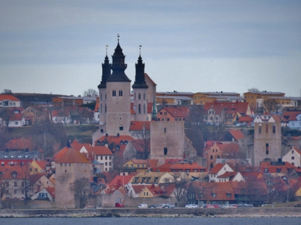
Our first view to Visby on Gotland. The town was designated a UNESCO World Heritage site in 1995 for it’s well-preserved medieval structures, include a mostly intact 2.1m (3.4 km) 12th-century wall and a number of church ruins, most dating to the 12th century. The wall and one of its towers is visible at the lower left of the picture, Visby Cathedral, built in the 12th and 13th centuries is prominent slightly left of center and two church ruins are at the center and far right.
|
 |
Clarion Hotel Wisby
Position: 57°38.33’N, 18°17.46’E
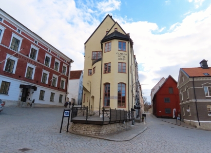
Our home for the night, the Clarion Hotel Wisby, inside the city walls.
|
 |
Wall
Position: 57°38.14’N, 18°17.18’E
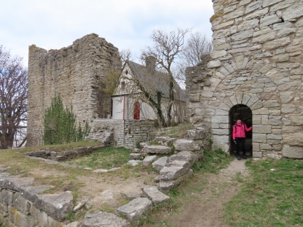
Jennifer standing in an archway that goes through the wall at the southwest corner. We loved how the city had evolved inside the wall, with more modern buildings constructed right up against it, becoming almost a part of the wall.
|
 |
Soldiers
Position: 57°38.13’N, 18°17.17’E
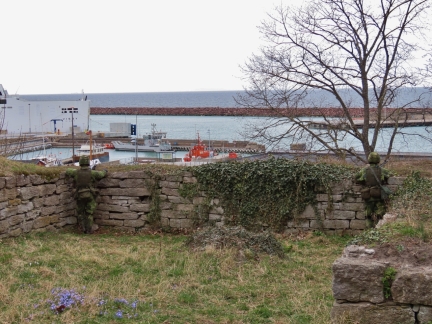
We passed through the wall to the outside and noticed camouflaged figures with guns overlooking the harbour. We initially thought they were manikins placed there to depict more modern defense techniques, until one of them moved quite close to us. That was a surprise. They told us they were on a training exercise and we saw dozens more as we walked about outside the wall.
|
 |
Windmill
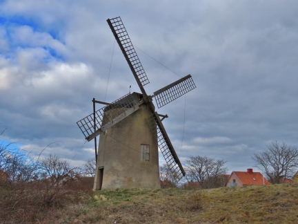
Position: 57°37.75’N, 18°16.89’E
Historic windmill, one of several outside the Visby walls.
|
 |
Visby Departing
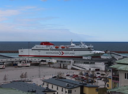
Position: 57°37.90’N, 18°16.91’E
The ferry we arrived on, the Visby, departing for Nynashamn. The captains do an amazing job maneuvering the huge ships in very tight quarters.
|
 |
Saddle Tower
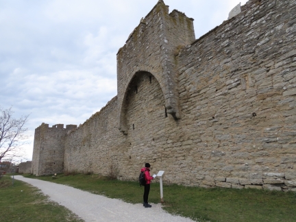
Position: 57°38.09’N, 18°17.40’E
One of the nine remaining saddle towers from the 22 originally built into the wall.
|
 |
Sodra Murgatan
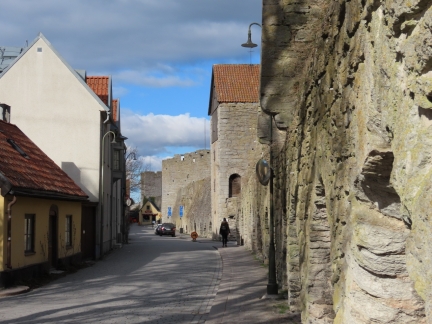
Position: 57°38.26’N, 18°17.83’E
Walking along Sodra Murgatan just inside the Visby wall.
|
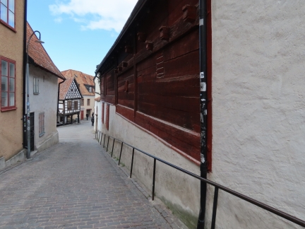 |
Smittens Backe
Position: 57°38.37’N, 18°17.79’E
Centuries-old buildings along narrow Smittens Backe.
|
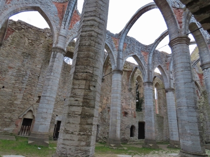 |
St. Catherine’s Ruin
Position: 57°38.44’N, 18°17.77’E
St. Catherine’s ruin, overlooking the Visby Town Square, is one of the most beautiful of the town’s church ruins. Construction of the church began in early 13th century and the structure was abandoned in the 1520s after the Franciscan convent that built it disbanded.
|
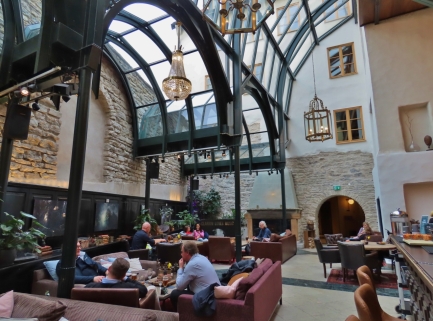 |
Atrium
Position: 57°38.31’N, 18°17.47’E
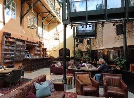
We stopped off for a drink in the fabulous atrium of our hotel, the Clarion Wisby. The left side of the room is a centuries-old stone wall with a glass roof enclosing and connecting it to the hotel. We loved it.
|
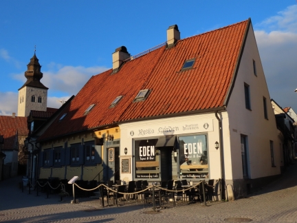 |
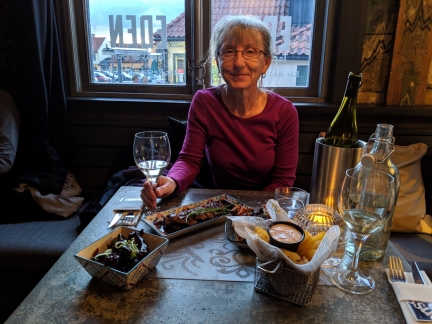
Eden
Position: 57°38.45’N, 18°17.79’E
Eden, along the Visby Town Square, where we will have dinner.
|
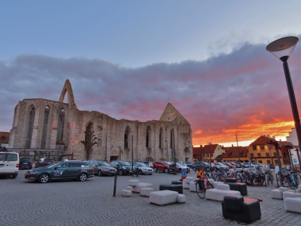 |
Sunset
Position: 57°38.45’N, 18°17.79’E
Fabulous sunset looking across the Visby Town Square to the St. Catherine’s church ruin.
|
 |
Tapas
Position: 57°38.45’N, 18°17.79’E
A delicious tapas selection for dinner at Eden in Visby.
|
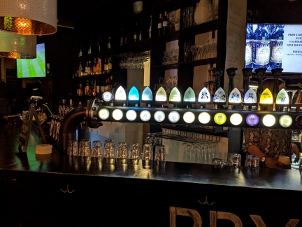 |
Taps
Position: 57°38.46’N, 18°17.74’E
Local microbrews on tap at Brygghuset Visby. At least five breweries operate on the island of Gotland.
|
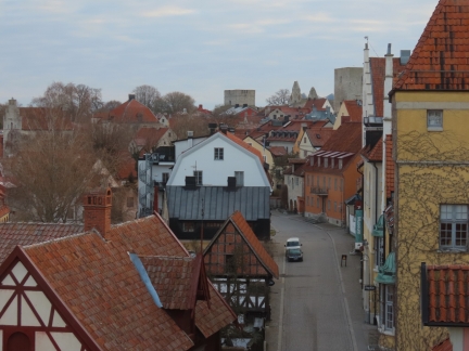 |
Hotel Room View
Position: 58°54.01’N, 17°57.32’E
Visby from our window at the Clarion Hotel Wisby.
|
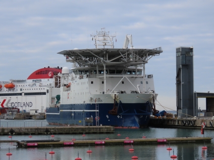 |
Stril Explorer
Position: 57°38.31’N, 18°17.29’E
The 250 ft Norwegian Offshore Supply Ship Stril Explorer home ported in Hammerfest Norway, that we visited last year.
|
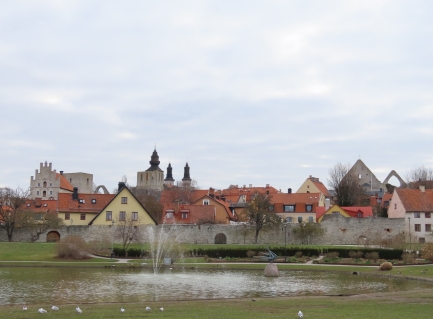 |
Almedalen Park
Position: 57°38.43’N, 18°17.40’E
Looking to Visby from Almedalen Park as we set off for a walk around the town wall.
|
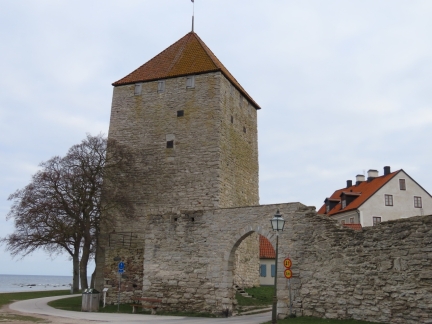 |
Gunpowder Tower
Position: 57°38.51’N, 18°17.47’E
The Gunpowder Tower is the oldest in the wall and one of the oldest surviving secular buildings in Scandinavia, likely dating from the mid-12th century. Work on the Town Wall began sometime in the 13th century, and this tower was incorporated as one of the 29 wall towers. The tower was a powder magazine in the 18th century, which is how it got its name.
|
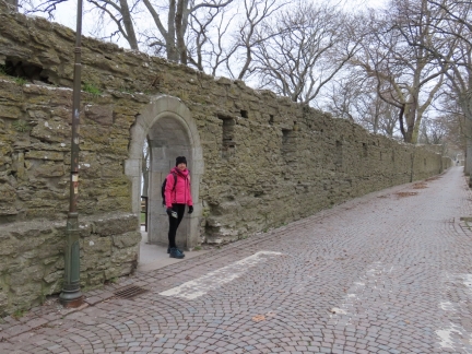 |
Love Gate
Position: 57°38.64’N, 18°17.58’E
In medieval times, ropes were tarred near this gate and the word for tar in Swedish sounds a bit like the beginning of the Swedish word for love, hence the name.
|
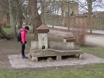 |
Wall Model
Position: 57°38.81’N, 18°17.78’E
A model of the northwest corner of the Visby Town Wall, including the Silver Cap at right and the Snackgard’s Gate at left.
|
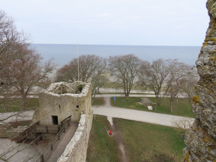 |
Silver Cap
Position: 57°38.80’N, 18°17.79’E
The Silver Cap at the northwest corner of the Town Wall, viewed from the Snackgard’s Gate. The old Sentry Walk here has been restored and is open to the public. Stairs lead up to the Silver Cap and beyond to the Snackgard’s Gate.
|
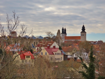 |
Visby looking South
Position: 57°38.80’N, 18°17.79’E
Great view to Visby looking south from the top of the Snackgard’s Gate.
|
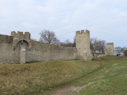 |
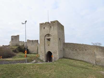
Saddle Tower
Position: 57°38.78’N, 18°17.91’E
The oldest and smallest of the saddle towers in the wall. 22 saddle towers were built, but only 9 remain. Snackgard’s Gate is at the far right of the picture.
|
 |
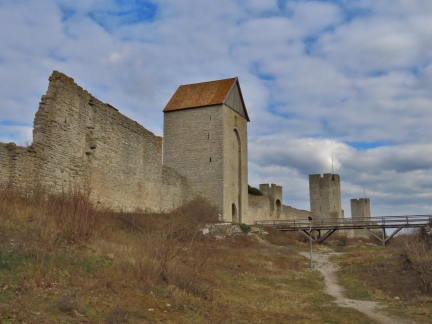
North Gate
Position: 57°38.70’N, 18°18.07’E
The North Gate is one of the oldest towers in the wall, dating to around 1280.
|
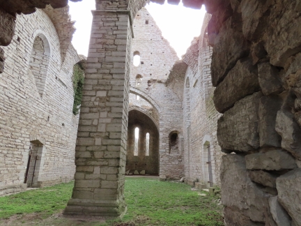 |
St. George’s Ruin
Position: 57°38.86’N, 18°18.18’E
St. George’s was a church and hospital for lepers outside the city walls to protect Visby from the infected. The church likely was built in the late 12th or early 13th century.
|
 |
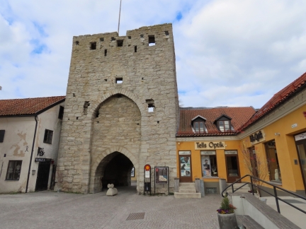
Dalman Tower
Position: 57°38.46’N, 18°18.05’E
The Dalman Tower was built over an original gateway in the oldest wall, still visible in the gateway arch. The 17m building also served as a navigation mark for the medieval port. It was walled up and roofed over in the late 18th century for use as a granary.
|
 |
East Gate
Position: 57°38.30’N, 18°17.92’E
The East Gate was one of three main gates in the wall, and was probably built in the late 13th century.
|
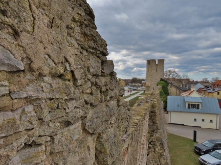 |
Kaisar Tower
Position: 57°38.15’N, 18°17.63’E
The view south down the wall from stairs up the Kaiser Tower that once served as a prison.
|
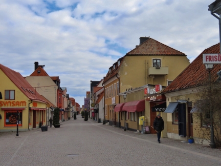 |
Adelsgatan
Position: 57°38.09’N, 18°17.50’E
Looking down Adelsgatan from just inside the South Gate.
|
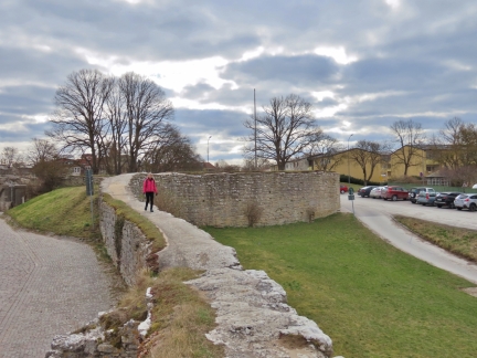 |
Walking Wall
Position: 57°38.11’N, 18°17.23’E
The only portion of the wall that is walkable is at the extreme south end.
|
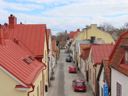 |
Skeppargatan
Position: 57°38.12’N, 18°17.21’E
Looking along Skeppargatan from atop the wall at the south end.
|
 |
Visborg Castle
Position: 57°38.20’N, 18°17.29’E
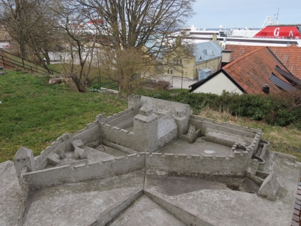
Model of Visborg Castle in Slottsparken. The castle once stood at the southwest corner of the wall, but was destroyed when the Danish invaded in 1679.
|
 |
Breakfast
Position: 57°38.31’N, 18°17.46’E
We’d gotten an early start to the day and returned to the hotel just in time for a Hobbit’s “second breakfast” at the Clarion Wisby atrium. We had a short but good stay here, and particularly enjoyed the atrium. We stopped back in again later in the day before our ferry home.
|
 |
Strandgatan
Position: 57°38.38’N, 18°17.55’E
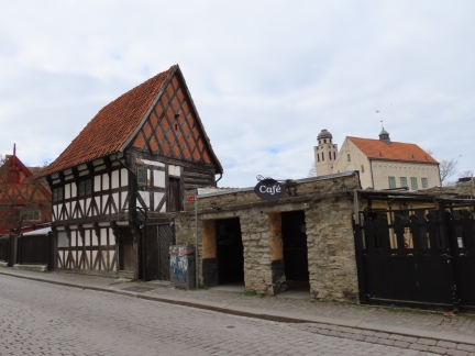
Medieval building on Strandgatan.
|
 |
Picture Stones
Position: 57°38.39’N, 18°17.56’E
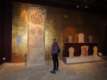
The excellent Gotland Museum has a large collection of pre-Viking picture stones. These date from the 5th to 7th centuries.
|
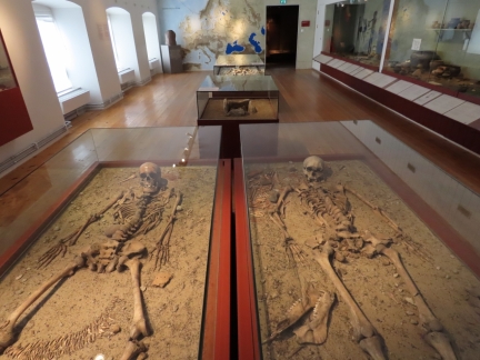 |
Hedgehog Girl
Position: 57°38.38’N, 18°17.58’E
Stone Age skeletons at the Gotland Museum. Those on the left are called the Hedgehog Girl because the young woman was buried in a cap made of hedgehog spines.
|
 |
Church Artifacts
Position: 57°38.37’N, 18°17.54’E
A large display of historic church artifacts at the Gotland Museum.
|
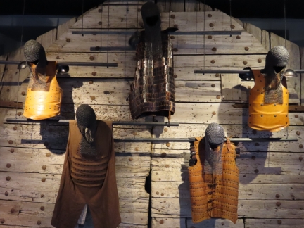 |
Armor
Position: 57°38.37’N, 18°17.54’E
Medieval armor hanging on the original door from the East Gate of the Visby Town Wall. We really enjoyed our visit to the museum—it was much larger than we were expecting and the presentations and displays were very well done.
|
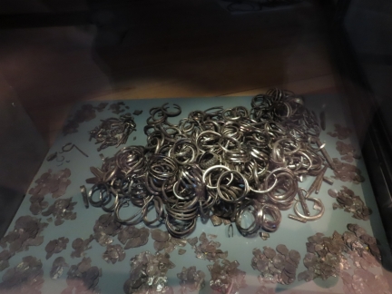 |
Silver Hoard
Position: 57°38.36’N, 18°17.56’E
Visby was a major, and wealthy, Hanseatic port in medieval times. But the Vikings that controlled the island before that were exceptionally wealthy. More than 700 silver hoards have been found on the island, the most impressive being the Spillings Hoard. Found in 1999 on the Spillings farm in northern Gotland, it is the world’s largest Viking treasure. The hoard weighed 148 lb (67 kg) before conservation and included 14,295 coins.
|
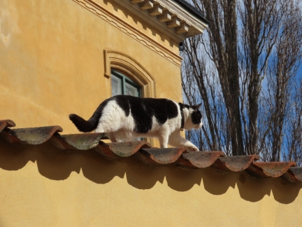 |
Visby Cat
Position: 57°38.38’N, 18°17.62’E
One of the local Visby cats on the prowl.
|
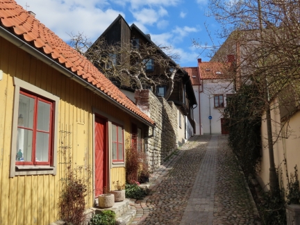 |
Cobblestones
Position: 57°38.45’N, 18°17.64’E
Looking up one of Visby’s picturesque cobblestone streets.
|
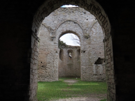 |
Drotten Ruin
Position: 57°38.51’N, 18°17.67’E
Drotten Church was built in the 13th century and dedicated to the Holy Trinity. It was abandoned at the Reformation in the 16th century.
|
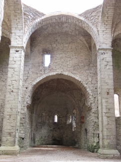 |
St. Lawrence’s Ruin
Position: 57°38.49’N, 18°17.70’E
St. Lawrence’s Church, dedicated to St. Lawrence, was built in the 13th century across from Drotten Church. It also was abandoned at the Reformation in the 16th century.
|
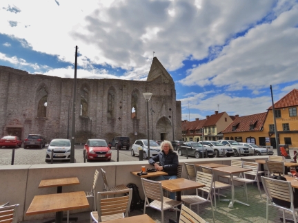 |
Town Square
Position: 57°38.45’N, 18°17.75’E
A number of people were out having a drink along the Visby Town Square, enjoying the cold but sunny mid-April weather. We couldn’t resist joining them.
|
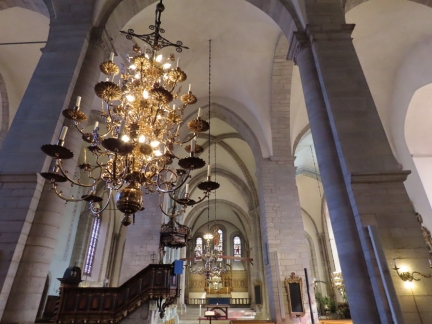 |
Visby Cathedral
Position: 57°38.51’N, 18°17.87’E
Spectacular Visby Cathedral was built in the 12th and 13th centuries by and for wealthy German traders.
|
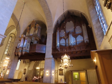 |
Organ
Position: 57°38.51’N, 18°17.87’E
The Visby Cathedral organ.
|
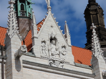 |
Sculpture
Position: 57°38.49’N, 18°17.84’E
Ornate sculptures on the exterior of Visby Cathedral.
|
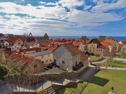 |
Kyrkberget
Position: 57°38.48’N, 18°17.92’E
The view southwest across Visby to the port from Kyrkberget above Visby Cathedral.
|
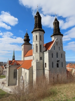 |
Visby Cathedral Exterior
Position: 57°38.51’N, 18°17.93’E
Visby Cathedral viewed from the park Kyrkberget.
|
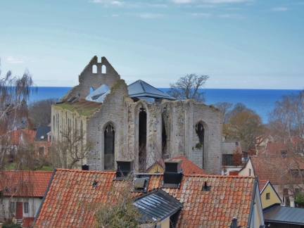 |
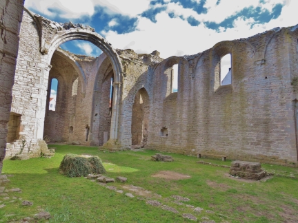
St. Nicholas’ Ruin
Position: 57°38.63’N, 18°18.02’E
St. Nicholas’ Church dates to 1227 and was originally part of the Dominican monastery. In modern times, a glass roof has been added and the floor paved with limestone and the facility is commonly used to hold concerts. A sign out front offers to “rent a ruin”.
|
 |
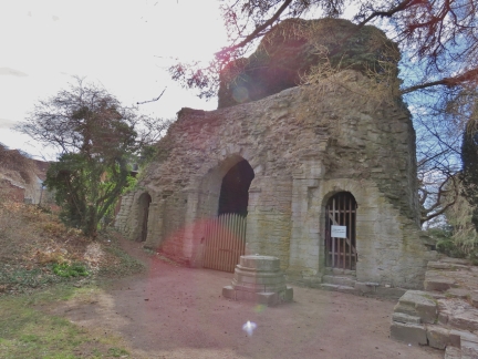
St. Clemen’s Ruin
Position: 57°38.59’N, 18°17.76’E
St. Clemen’s Church was built about 1060 and is one of the oldest church ruins in Visby.
|
 |
St. Olaf’s Ruin
Position: 57°38.59’N, 18°17.63’E
St. Olaf’s Church was built around 1240 as a German parish church to replace St. Nicholas’ that was taken over by the Dominican Order. It was abandoned after the Reformation in the 16th century.
|
 |
Helge Ands Ruin
Position: 57°38.57’N, 18°17.89’E
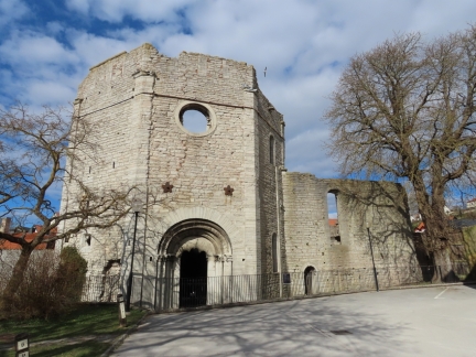
Helgo Ands Church was built in 1200 in an octagonal style that is unique in Sweden. After a fire partially destroyed the upper levels, what remained of the building was converted to a cow shed.
|
 |
Gotlands Bryggeri
Position: 57°38.49’N, 18°17.71’E
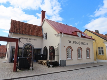
Gotlands Bryggeri in Visby, one of at least five breweries on Gotland.
|
 |
St. Peter and St. Hans Ruin
Position: 57°38.27’N, 18°17.54’E
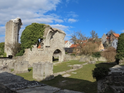
The two churches St. Pers and St. Hans were both built in the 13th century and joined together to form a single complex.
|
 |
Atrium Wall
Position: 57°38.31’N, 18°17.48’E
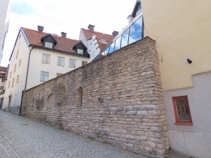
The outside of the stone wall that forms one side of the atrium at the Clarion Hotel Wisby.
|
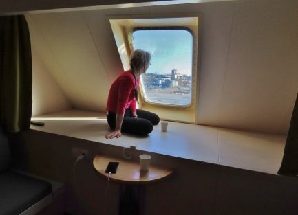 |
Forward Cabin
Position: 57°38.10’N, 18°16.77’E
We had an exceptional time in Visby and were really glad we found a way to visit. We had economy tickets for the return trip, but enjoyed the cabin so much on the outbound journey that we upgraded on the return and requested one forward-facing.
|
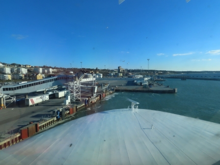 |
Backing Out
Position: 57°38.10’N, 18°16.77’E
Looking across the bow of the Visby as it backs out from the dock. The skippers really do an amazing job in such tight quarters.
|
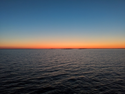 |
Sunset
Position: 58°45.50’N, 18°5.91’E
Sunset looking across Landsort at the southern tip of the Stockholm Archipelago, viewed on the ferry from Gotland nears Nynashamn.
|
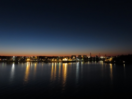 |
Refinery
Position: 58°54.80’N, 17°58.39’E
Refineries always look great at night.
|
 |
Nynashamn
Position: 58°54.20’N, 17°57.53’E
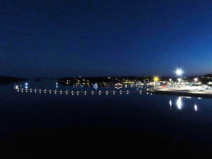
Nynashamn at night, viewed from our ferry as we arrive back from Gotland. Dirona is lit in blue at the center of the picture.
|
 |
Click the travel log icon on the left to see these locations on a map, with the complete log of our cruise.
On the map page, clicking on a camera or text icon will display a picture and/or log entry for that location, and clicking on the smaller icons along the route will display latitude, longitude and other navigation data for that location. And a live map of our current route and most recent log entries always is available at mvdirona.com/maps. |

By some weird Internet magic, last weekend I found a program on YouTube called Medieval Dead which is good program about archaeology at various historical sites. One of these was about a battle/slaughter at Masterby, Gotland, before a second battle/slaughter at the walls of Visby. I happened to watch one of the videos and then read your post of visiting the town.
Short history was the Danes invaded and wiped out the local Gotlanders at Masterby and then marched to Visby. Another group of Gotlander militia was not allowed into Visby and the Dane’s killed them all in a battle outside the town gates.
The town of Visby was not inhabited by native people of Gotland but by traders from around the Baltic. They used the town walls as protection but also as a way of taxing the native Gotlanders who wised to trade with the town.
Visby paid a ransom and surrendered to the Danes.
The first show about Masterby is here, https://www.youtube.com/watch?v=Ta_Gd4Fgxpw and the show about Visby is at https://www.youtube.com/watch?v=_vQOZA1T64s.
Ya’ll might enjoy these videos when you get to a place where you can stream video.
Enjoy,
Dan
Thanks for the links and the info Dan. The Gotland Museum had a good section on that conflict and surmised that perhaps the Hanseatic residents of Visby had colluded with the Danes to deal with an uprising of the native Gotlanders over trading rights. Apparently the Danes didn’t occupy the town for long or show much interest in it long term.
Jennifer
On ancient buildings. The Romans used cement, but i was forgotten with the fall of Rome. In the Nordic countries bricks were used from around 1100 with lime mortar in building parish church’s castles etc.. You will find many of these today still.
Brick, stone, and lime mortar are durable building materials and many of the structures are remarkably well preserved. Even more impressive given how much military action there has always been in the Baltic. We’re really enjoying the trip and are starting to conclude we’ll need to come back.
Amazing so many ruins dating back to 1060 and 1200’s are still more or less extant, given what must have been fairly crude building materials back then. All the buildings are made of stone — I wonder if there was a form of cement back then to really bind the stones?
Some of the arches in the old church and cathedral ruins are lovely and impressive. Enjoyed the details on Visby Cathedral as well.
It’s hard to tell to what extent these structures have been been restored but I agree that they are very well preserved. It’s been a fun pass through the islands. When we planned this trip, 7 months in the area seemed like a very long time. But there’s a lot to see. I’m sure you could spend years in the area and still mostly be seeing new things. It’s a wonderful cruising area.