We were looking forward to visiting the ultra-modern, newly-built city of Dubai, but we also wanted to see the real desert while we were there. And not just a little sand, we wanted to see the endless dunes and Jennifer really wanted to ride a camel. We had an excellent seven-hour adventure with Platinum Heritage where we saw desert wildlife, learned about Bedouin falcon training techniques, traveled between oases in a 4×4, and enjoyed native foods with fire-dancing at the end of the evening. And Jennifer got her camel ride.
Below are highlights from November 17th, 2018 on a Dubai desert safari. Click any image for a larger view, or click the position to view the location on a map. And a live map of our current route and most recent log entries always is available at mvdirona.com/maps
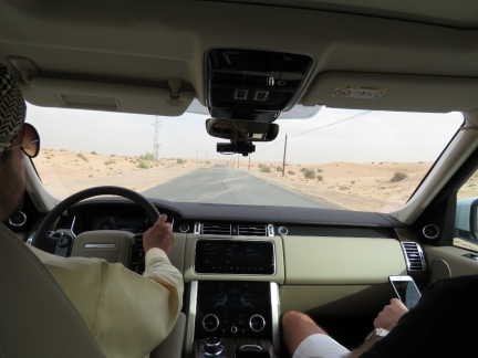 |
Desert Safari
Position: 24°49.89’N, 55°36.91’E
Nearing our destination of the Dubai Desert Conservation Area, about a half-hour’s drive from Downtown Dubai.
|
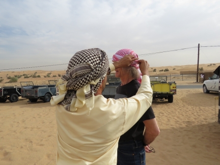 |
Ghutra
Position: 24°49.85’N, 55°37.48’E
Our guide Saeed tying a ghutra, a traditional Arab head scarf, for James prior to our tour. The ghutra protects against sun, dust and sandstorms and is commonly worn by men in the UAE.
|
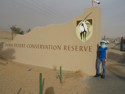 |
Dubai Desert Conservation Reserve
Position: 24°49.84’N, 55°37.46’E
The 87 sq mi (225 sq km) Dubai Desert Conservation Reserve, established in 2003, is the UAE’s first national park.
|
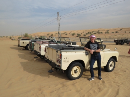 |
Vintage Land Rovers
Position: 24°49.86’N, 55°37.47’E
Our tour would be in a modern, enclosed Land Rover but Platinum Heritage also has a fleet of 1950s-era Series 1 Land Rovers used on some of their other tours.
|
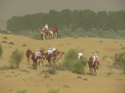 |
Camels
Position: 24°49.88’N, 55°37.45’E
A group of camels walking through the dunes. We’ll be taking a ride later in the day.
|
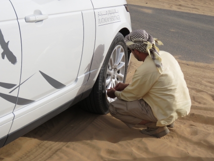 |
Tire Pressure
Position: 24°49.85’N, 55°37.47’E
Lowering the tire pressure in the Land Rovers before we shift from pavement to sand.
|
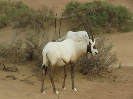 |
Arabian Oryx
Position: 24°48.13’N, 55°37.35’E
One of several groups of Arabian Oryx we passed while touring the Dubai Desert Conservation Reserve.
|
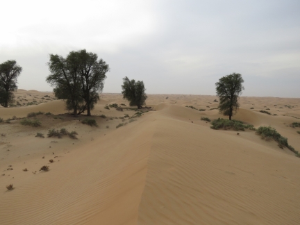 |
Dune
Position: 24°47.76’N, 55°36.66’E
Sharp-edged sand dune formed from the constantly-blowing winds. The desert scenery was fabulous.
|
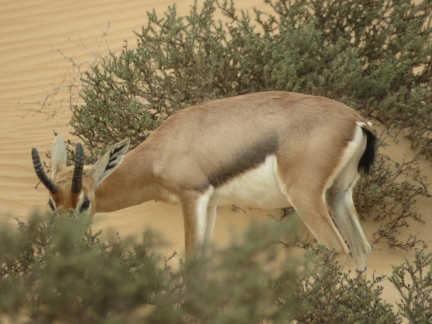 |
Arabian Gazelle
Position: 24°48.21’N, 55°36.93’E
Arabian Gazelle eyeing us from behind the foliage.
|
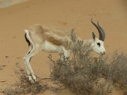 |
Sand Gazelle
Position: 24°48.09’N, 55°37.49’E
The elegant curved horns of a male sand gazelle.
|
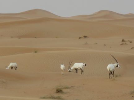 |
Oryx and Dunes
Position: 24°46.97’N, 55°38.26’E
A herd of Arabian Oryx with dunes extending beyond.
|
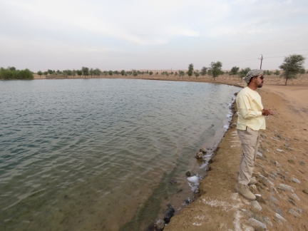 |
Lake
Position: 24°47.33’N, 55°40.39’E
A man-made lake within the reserve, built with the hopes of attracting migratory birds.
|
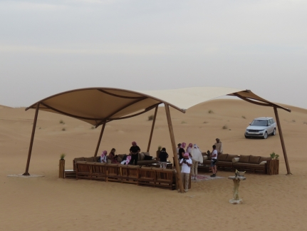 |
Majlis
Position: 24°50.58’N, 55°37.50’E
After driving through the reserve, the vehicles arrived at a desert majlis (“place of sitting”) for refreshments and to watch a falconry demonstration.
|
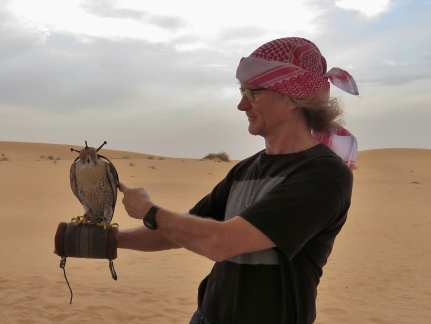 |
Falcon
Position: 24°50.61’N, 55°37.49’E
James stroking a falcon prior to the demonstration. Falcons are the fastest animals in flight and the Bedouin nomadic Arab hunted with them.
|
 |
Falconry Demonstration
Position: 24°50.61’N, 55°37.49’E
A falconer explained how the Bedouin trained the falcons for hunting and demonstrated using a quail-feather decoy swung in the air. The demonstration is at 1:22 in the video https://youtu.be/9rP78zYCUEI. After the demonstration, the falcon is rewarded with quail meat.
|
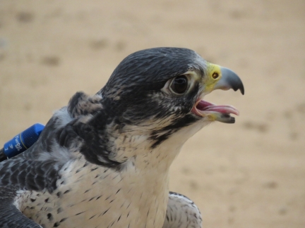 |
Panting
Position: 24°50.61’N, 55°37.49’E
After the demonstration, the falcon can be seen actually panting from the exertion of flying swiftly after the decoy. The small blue capsule on its back is a GPS locater. Should the falcon not return, the falconer can hopefully locate it with a “Find Your Falcon”-type smartphone app.
|
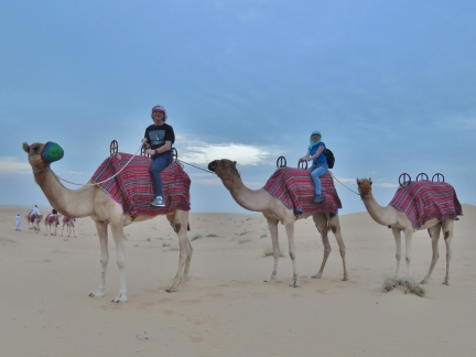 |
Camel Ride
Position: 24°50.64’N, 55°37.58’E
Following the falconry display, we took a short camel ride to a small oasis area where we would have dinner. Jennifer has been wanting to ride a camel since becoming interested in Ancient Egypt as a child.
|
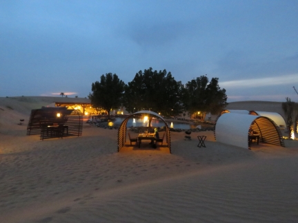 |
Dinner
Position: 24°50.74’N, 55°37.43’E
After our camel ride, we had a an exceptional six-course meal in a private cabana overlooking a small oasis.
|
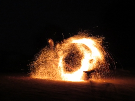 |
Fire Show
Position: 24°50.73’N, 55°37.40’E
We topped off the evening with an Arabian fire show. The performer, dressed all in black, is nearly invisible as the sparks fly.
|
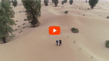 |
Dubai Desert Safari
Position: 24°50.73’N, 55°37.40’E
We had a fabulous time on the desert safari and really enjoyed the entire experience. This is the video from our trip, showing some of the desert wildlife, Bedouin falcon training techniques, travelling between oases in a 4×4, a camel ride, and native foods with fire-dancing at the end of the evening.
|
 |
Click the travel log icon on the left to see these locations on a map, with the complete log of our cruise.
On the map page, clicking on a camera or text icon will display a picture and/or log entry for that location, and clicking on the smaller icons along the route will display latitude, longitude and other navigation data for that location. And a live map of our current route and most recent log entries always is available at mvdirona.com/maps. |

Hello, James, Do you happen to know the source of the water for the man made lake? Regards Malcolm dale
The water is from an on-site well. They pump it up to the surface to form a lake and must pump enough water up that they keep up with evaporation in the very dry desert.