With a strategic position at the mouth of the Limfjord, Aalborg has long been an important Danish city. Settlement dates back to 700AD and it currently is Denmark’s fourth-largest city. A major industrial 20th-century industrial center, the city has done a wonderful job of revitalizing it’s waterfront and has a number of beautiful heritage buildings. It also is a center for modern architecture, being the home of Danish architect Jorn Utzon who designed of the Sydney Opera House.
Below are trip highlights from October 11th and 12th underway for and at Aalborg, Denmark. Click any image for a larger view, or click the position to view the location on a map. And a live map of our current route and most recent log entries always is available at mvdirona.com/maps
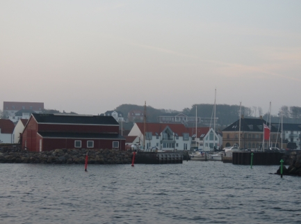 |
Logster Harbour
Position: 56°58.23’N, 9°15.16’E
Passing Logster Harbour around 8am en route from Fur Island to Aalborg.
|
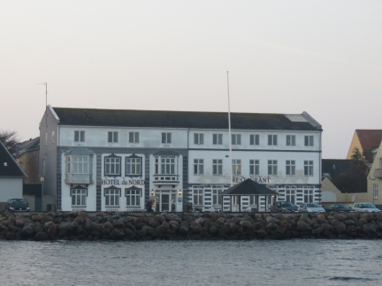 |
Hotel du Nord
Position: 56°58.27’N, 9°15.37’E
Hotel du Nord overlooking the waterway in Logster.
|
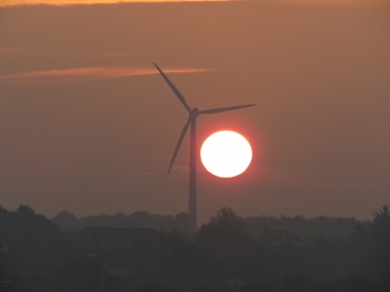 |
Sunrise
Position: 56°58.51’N, 9°16.13’E
A spectacular sunrise through the wind turbines.
|
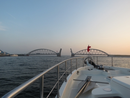 |
Aggersund Bridge
Position: 56°59.83’N, 9°17.48’E
The Aggersund railway and car bridge opening for us to pass through. Most of the bridges on the Limfjord open on request, but only during daylight hours for pleasure craft.
|
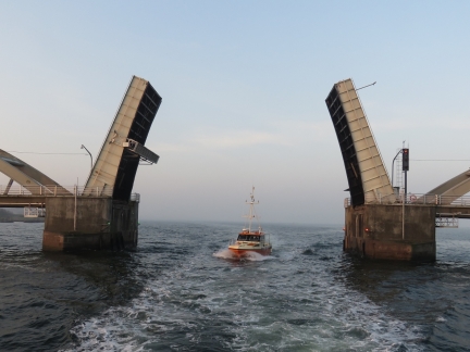 |
Echo
Position: 57°0.08’N, 9°17.92’E
The survey boat Echo passing under the Aggersund Bridge behind us.
|
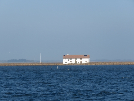 |
Fruens Holm
Position: 57°4.10’N, 9°47.43’E
Abandoned farmhouse on uninhabited Fruens Holm. The family lived in the upper floor because during strong winds the island could disappear under a meter of water.
|
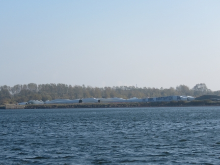 |
Wind Turbine Blades
Position: 57°3.14’N, 9°51.54’E
Massive wind turbine blades stockpiled outside of Siemens Wind Power near Aalborg.
|
 |
Marina Fjordparken
Position: 57°3.34’N, 9°52.48’E
Moored for the night at Marina Fjordparken on the outskirts of Aalborg.
|
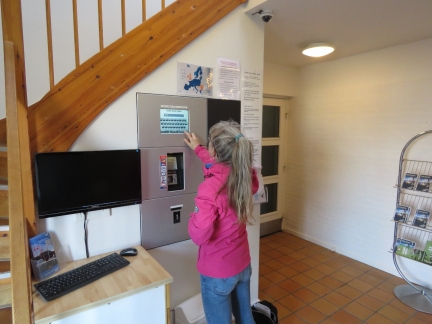 |
Paying
Position: 57°3.32’N, 9°52.52’E
Paying for our moorage at the self-service machine in the Aalborg Sailing Club.
|
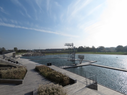 |
Vestre Fjordpark
Position: 57°3.51’N, 9°53.08’E
We walked to Aalborg along the waterfront past Vestre Fjordpark, a 165,000 m2 recreation area along the Limfjord with a 50m outdoor pool.
|
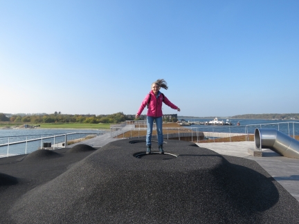 |
Trampoline
Position: 57°3.51’N, 9°53.13’E
Bouncing on one of the mini-trampolines at Vestre Fjordpark .
|
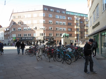 |
Bicycles
Position: 57°2.97’N, 9°55.04’E
Aalborg is full of bicycles. This scene repeated all over town.
|
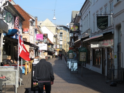 |
Jomfru Ane Gade
Position: 57°2.97’N, 9°55.16’E
Jomfru Ane Gade is famous in Denmark for its continuous row of bars and restaurants and lively atmosphere, particularly on warm summer evenings.
|
 |
Sogaards Bryghus
Position: 57°2.94’N, 9°55.20’E
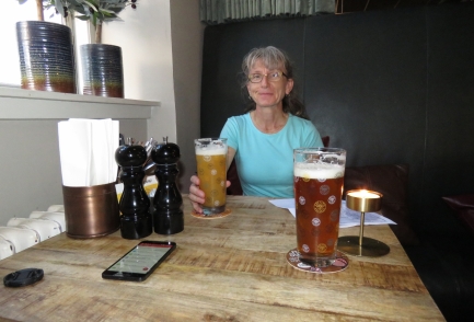
Lunch with fine local brews at Aalborg’s brew pub, Sogaards Bryghus.
|
 |
Budolfi Domkirke
Position: 57°2.87’N, 9°55.17’E
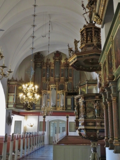
The richly detailed pulpit and organ of 12th-century Budolfi Domkirke.
|
 |
Graves
Position: 57°2.89’N, 9°55.14’E
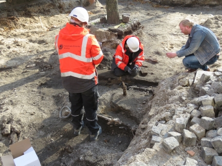
Nordjyllands Historiske Museum archaeologists excavating two graves outside Budolfi Domkirke. It appeared some construction work was being done in the area and the graves were found by accident. It’s wierd to see human remains inches below the surface right downtown.
|
 |
Old Town Hall
Position: 57°2.87’N, 9°55.26’E
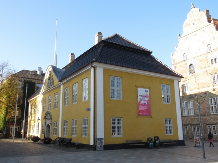
Aalborg’s old town hall building dates to 1762.
|
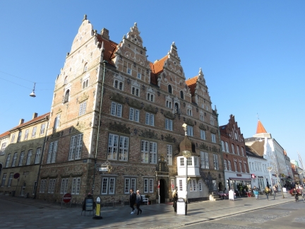 |
Jens Bangs Stenhus
Position: 57°2.89’N, 9°55.29’E
Jens Bangs house, built in the early 1600s for a wealthy merchant.
|
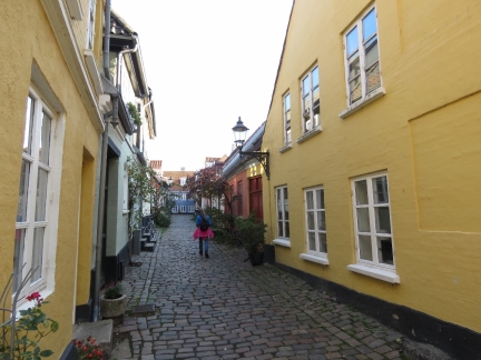 |
Hjelmerstald
Position: 57°2.80’N, 9°55.32’E
The cobbled street Hjelmerstald dates to the Renaissance period.
|
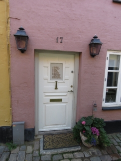 |
Residents
Position: 57°2.79’N, 9°55.37’E
This sign on a door on Hjelmerstald lists all the owners/residents since 1787.
|
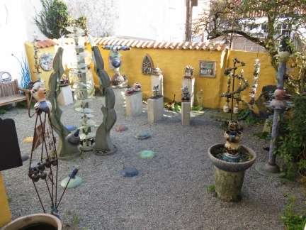 |
Langes Gard
Position: 57°2.78’N, 9°55.37’E
Whimsical sculptures and ceramics in the Langes Gard courtyard off Hjelmerstald.
|
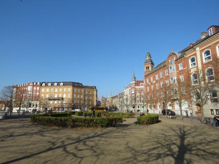 |
John F. Kennedy Square
Position: 57°2.56’N, 9°55.10’E
Looking north across John F. Kennedy Square, dedicated to the 35th American president. We couldn’t find any relationship between JFK and Aalborg/Denmark.
|
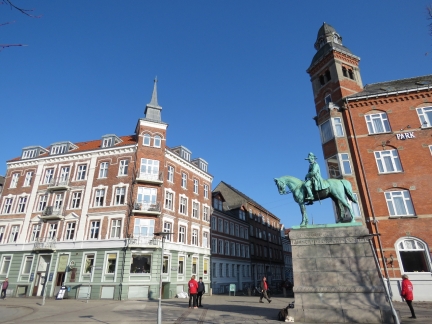 |
Christian IX
Position: 57°2.61’N, 9°55.09’E
Statue in John F. Kennedy Square of Christian IX, King of Denmark from 1863 to 1906.
|
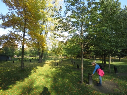 |
Park of Music
Position: 57°2.57’N, 9°54.91’E
More than 80 artists have planted a tree the Park of Music to commemorate their visit to Aalborg, including Sting, ZZ Top, Rod Stewart and Bryan Adams. Adjacent to some of the trees are small music boxes that play the artist’s music. Jennifer is playing a tune by Elton John.
|
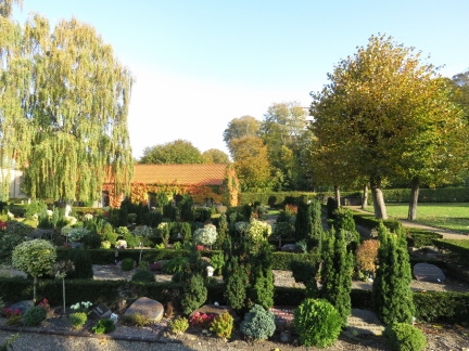 |
Ansgars Kirken
Position: 57°2.56’N, 9°54.53’E
The carefully-tended Ansgars Kirken graveyard was among the most beautiful gardens we’ve ever seen.
|
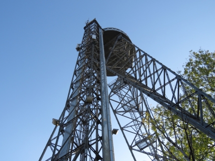 |
Aalborg Tower
Position: 57°2.52’N, 9°54.28’E
Aalborg Tower, at 344ft (105m) above sea level, is the tallest structure in the area. We were hoping to take in the sweeping views from the top, especially on such a clear day. But nobody was there during their published opening hours, so we didn’t get to the top.
|
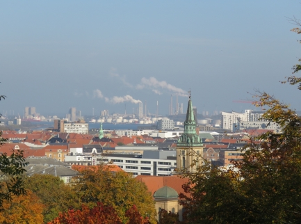 |
Hill
Position: 57°2.51’N, 9°54.30’E
Although the Aalborg Tower was closed, we still got a decent view to the city from the hill the tower stands on.
|
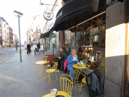 |
Penny Lane
Position: 57°2.83’N, 9°55.21’E
Having a cold drink at Penny Lane. The proprietors must be Beatles fans—their other establishment is called Abbey Road.
|
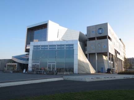 |
Musikkens Hus
Position: 57°2.91’N, 9°55.93’E
Aalborg’s wild-looking concert hall opened in 2014.
|
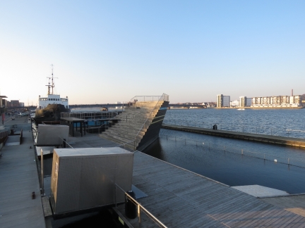 |
Waterfront
Position: 57°3.07’N, 9°55.35’E
Looking west along Aalborg’s beautifully revitalized waterfront. A saltwater pool is in the foreground and behind is an old icebreaker that’s been converted to a bar/restaurant.
|
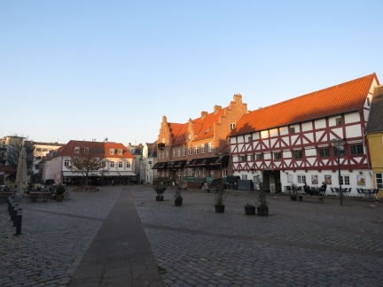 |
CW Obels Plads
Position: 57°2.93’N, 9°55.20’E
Looking across CW Obels Plads. The microbrewery where we had lunch is in the brick building roughly center in the photo.
|
 |
Aalborg Monastery
Position: 57°2.91’N, 9°55.12’E
The Aalborg Monastery was established in 1431 and is the country’s oldest social order.
|
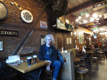 |
Irish House
Position: 57°2.98’N, 9°55.33’E
Enjoying a pint at the very authentic Irish House. They had every Irish beer we could think of on tap. Jennifer has a Murphy’s and James tried, for the first time, the Guinness IPA.
|
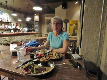 |
Dinner
Position: 57°3.02’N, 9°55.32’E
We capped of an great day in Aalborg with a wonderful meal at El Mariachi Mexican gastropub. We’re not sure if it’s the quality of the food, the excellence abmience, the attention to detail of the proprieter, but somehow the combination made it one of the best meals we’ve had in months.
|
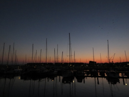 |
Dawn
Position: 57°3.37’N, 9°52.50’E
Dawn from our berth at Marina Fjordparken.
|
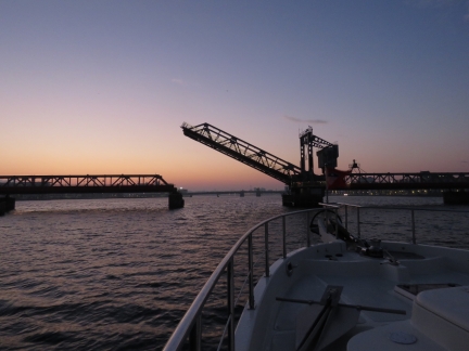 |
Railway Bridge
Position: 57°3.45’N, 9°54.70’E
The railway bridge at Aalborg opening for us just past 7am as we depart Aalborg.
|
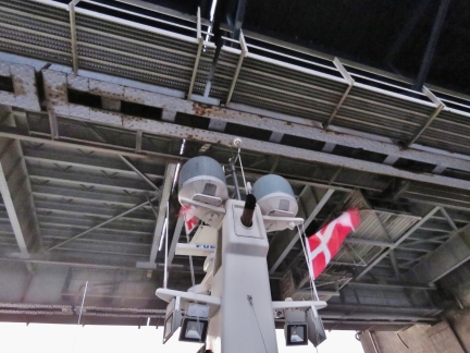 |
Limfjordsbroen
Position: 57°3.26’N, 9°55.21’E
Passing under the closed Limfjords bridge. It only opens for pleasure craft once an hour, and not during rush hour, so we’d have had to wait about 40 minutes. The wait wasn’t that appealing, so we asked the operator the exact clearance at the current tide. He reported 9.5m (31.2ft). We used our Nikon Forestry Pro Laser Rangefinder and confirmed there was room for our just under 30-ft clearance requirement. We crept under slowly with Jennifer at the stern of the aft deck watching the clearance, and it looks like we had a foot and a half to spare.
|
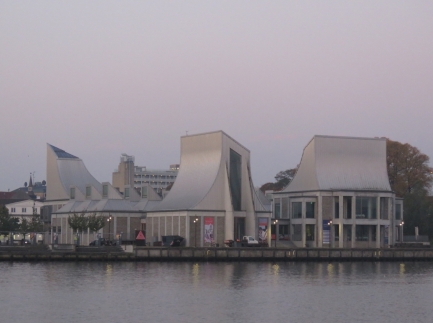 |
Utzon Center
Position: 57°3.03’N, 9°56.03’E
Danish architect Jorn Utzon grew up in Aalborg and is most well-known as the designer of the Sydney Opera House. Utzon Center in Aalborg is the last building he designed before his death in 2008. This is the most famous architectural work in Aalborg, but we actually found the concert hall more striking.
|

|
Click the travel log icon on the left to see these locations on a map, with the complete log of our cruise.
On the map page, clicking on a camera or text icon will display a picture and/or log entry for that location, and clicking on the smaller icons along the route will display latitude, longitude and other navigation data for that location. And a live map of our current route and most recent log entries always is available at mvdirona.com/maps. |

About the John F. Kennedys Plads Picture
The site was originally called the Banegårdspladsen (railway station square), it was built in connection with the “new” railway station, which was commissioned on December 8, 1990. But in memory of US President John F. Kennedy, assassinated on November 22, 1963, a united city council on December 2, 1963 renamed it the John F. Kennedy Square.
Thanks for the background on the naming of the square.