The hike to the summit of 5,131 ft (1,564m) Slogen is considered one of the top ten in Norway due to the scenery en route, the views from the top and the fact that it rises directly from Norangsfjorden. It was the most strenuous hike we’d done so far, with an elevation gain from trailhead to summit of 4,900ft (1,500m) over 1.9 miles (3.1km), giving an average grade of 48%. But the astonishing view from the summit was worth the effort.
Below are trip highlights from August 31st hiking Slogen, Norway. Click any image for a larger view, or click the position to view the location on a map. And a live map of our current route and most recent log entries always is available at mvdirona.com/maps
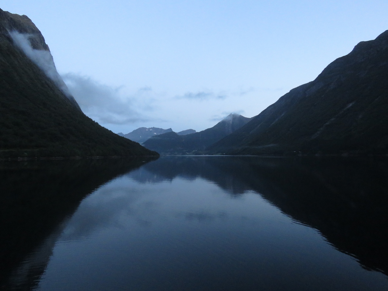 |
Morning
Position: 62°11.70’N, 6°38.85’E
Looking west down Norangsfjorden from the anchorage at 6am. The days are getting shorter and shorter as summer is ending.
|
 |
Norangsfjorden
Position: 62°11.69’N, 6°39.16’E
The spectacular anchorage at the head of Norangsfjorden. Our tender is tied off on the guest dock at the left of the picture.
|
 |
Slogen Trail Head
Position: 62°11.26’N, 6°40.58’E
At the trail head for the hike to Slogen. At 5,131 ft (1564m), this will be our highest mountain hike yet.
|
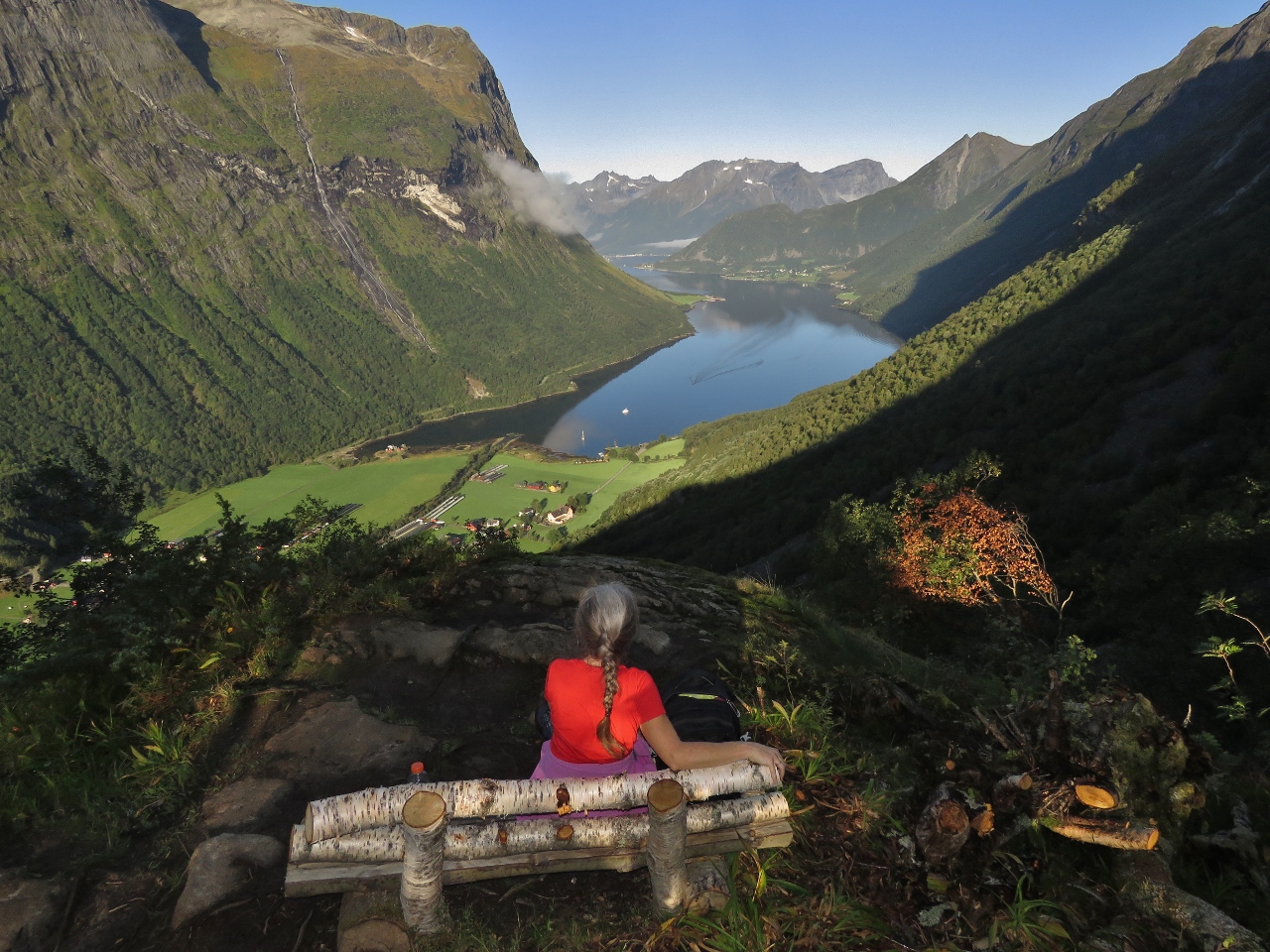 |
Bench
Position: 62°11.55’N, 6°40.75’E
Enjoying the view from a bench at 1300 ft (396 m) on a beautiful clear day.
|
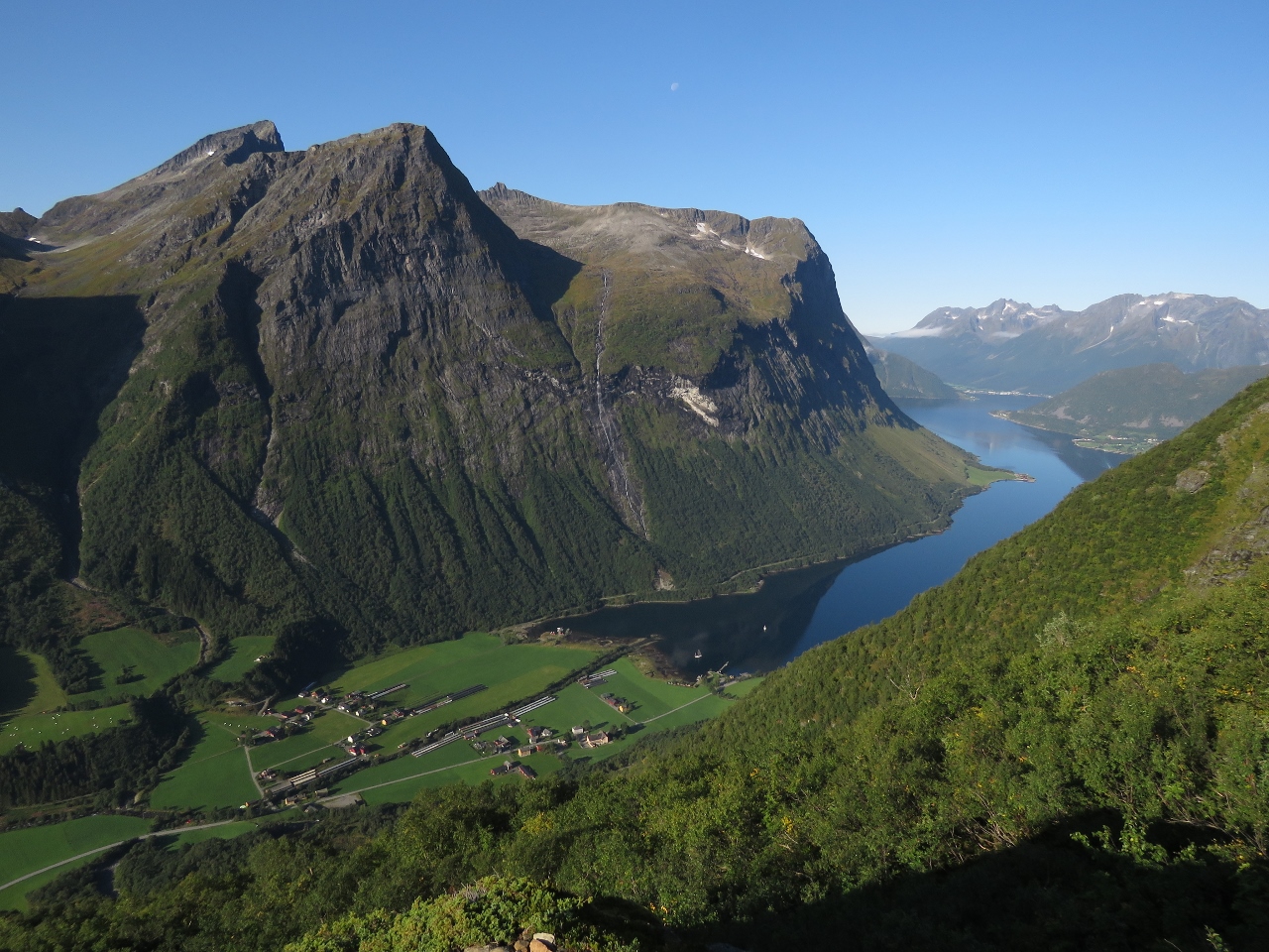 |
2,324 ft
Position: 62°11.82’N, 6°40.91’E
Another great view from 2,324 ft (708 m) up on the trail to Slogen.
|
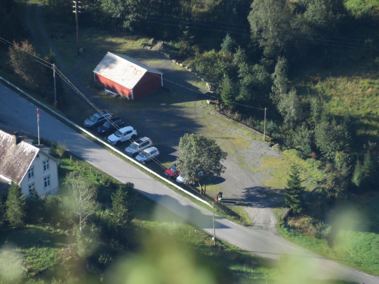 |
Parking
Position: 62°11.84’N, 6°40.88’E
Slogen is a popular hike. When we passed the trail head car park at 8am this morning, only one car was there. By 10am, seven cars are now parked there.
|
 |
East Face
Position: 62°11.92’N, 6°40.94’E
The sheer east face of Slogen, described in the 1953 booklet Rock Climbs in Sunnmore as a “horrible and dangerous route which has been made only by two English and Swedish climbers. The mere fact that they survived and lived to tell, makes on believe in miracles.”
|
 |
Break
Position: 62°11.98’N, 6°41.01’E
Taking a break at 2,855 ft (870 m) up. The waterfall Helganeset, that tumbles down beside our anchorage, is visible on the opposite shore. We’re about even with the top.
|
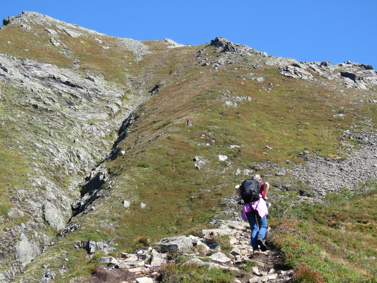 |
Switchbacks
Position: 62°12.12’N, 6°41.11’E
The trail has been quite steep to this point, but at 3,107 ft (947 m) we started up a series of even steeper switchbacks to reach the top of the ridge visible above. From there we’ll turn left to reach the summit. Another climber, wearing red, can be seen working down about halfway along.
|
 |
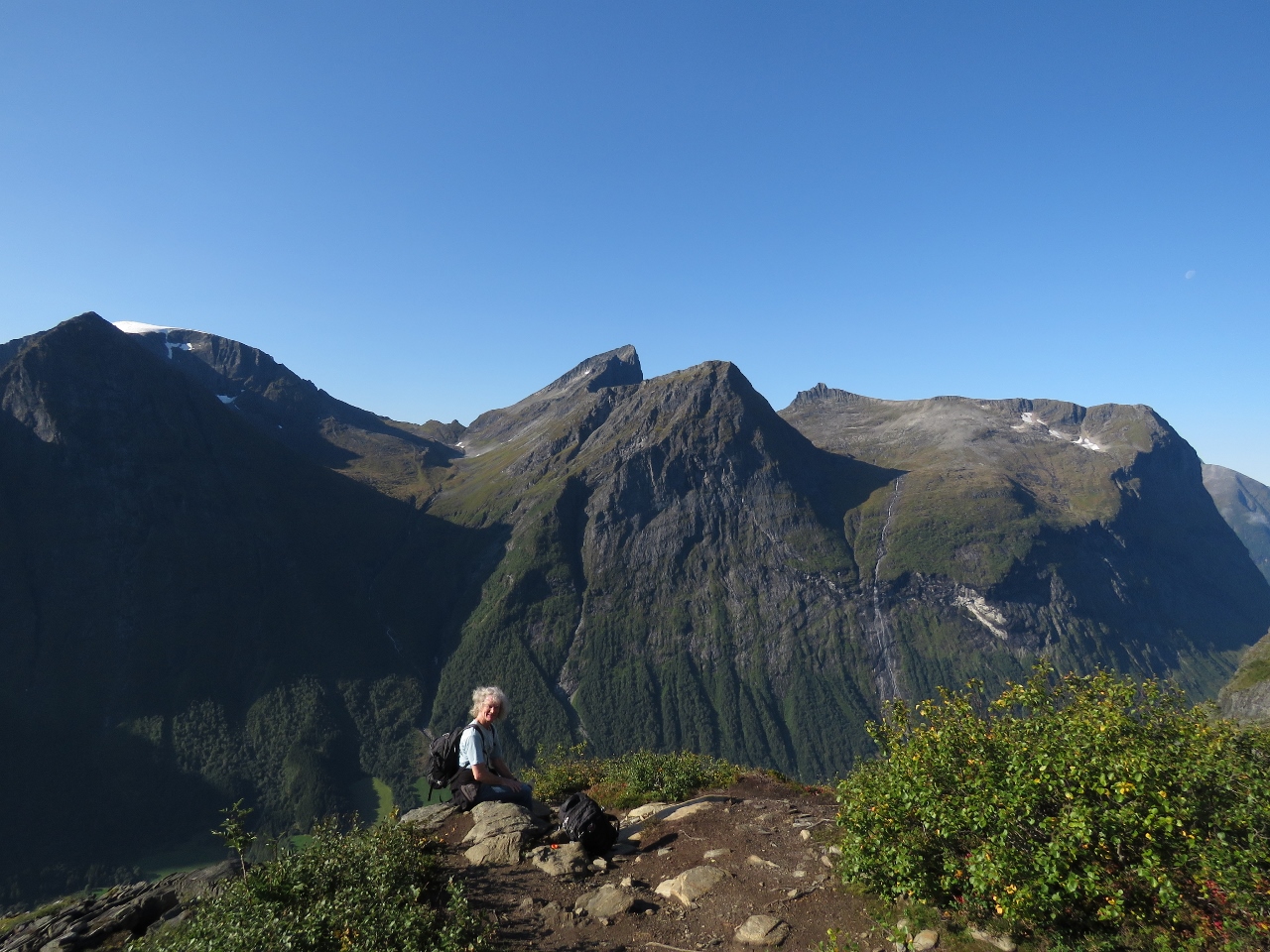
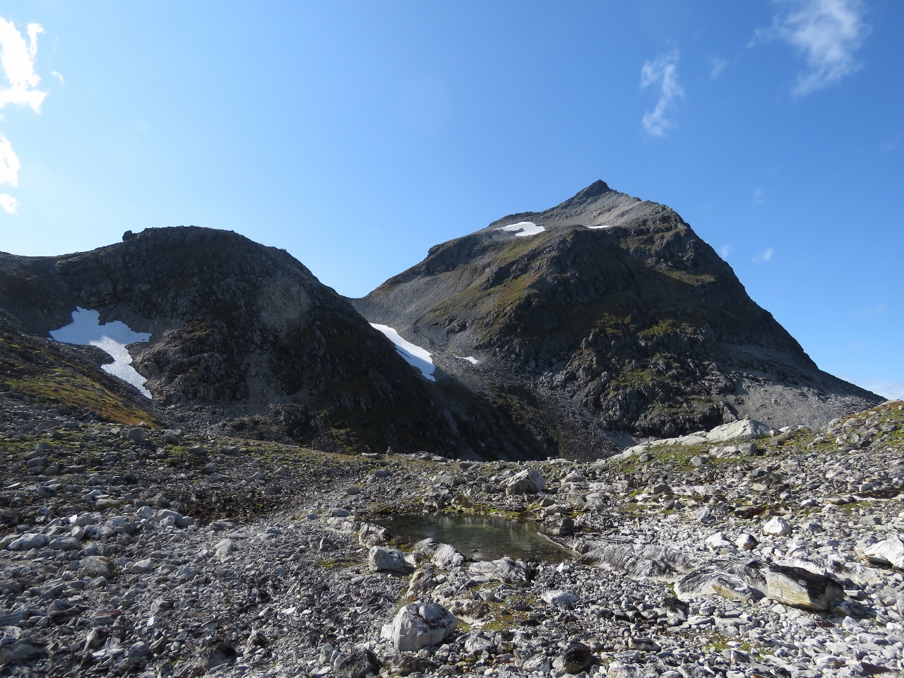
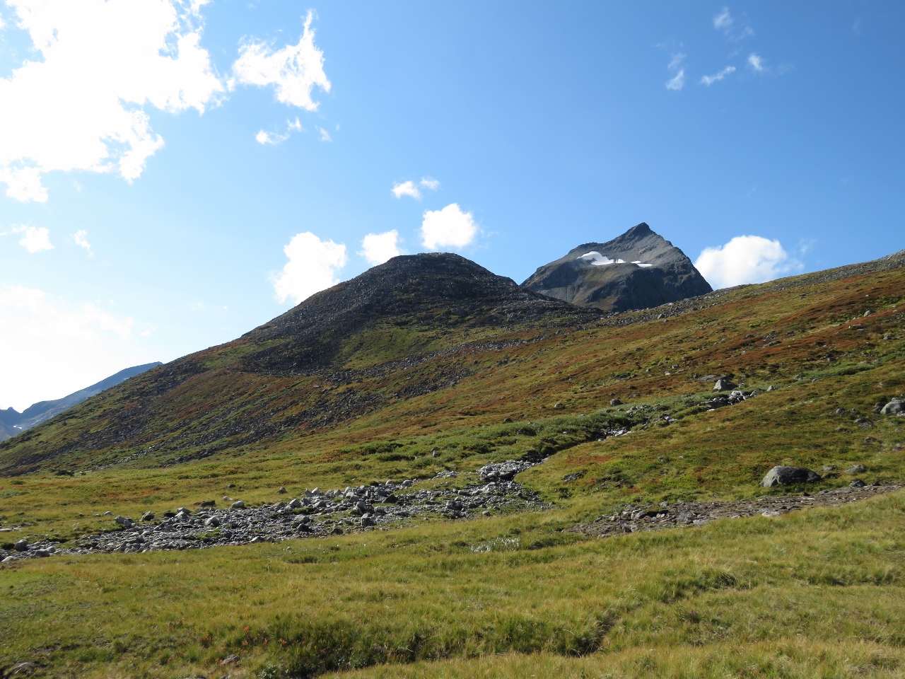
Ridge
Position: 62°12.34’N, 6°41.09’E
We still have another 1,187ft (362m) of altitude gain ahead of us, but reaching the ridge top at 3,944 ft (1,202 m) is a major milestone.
|
 |
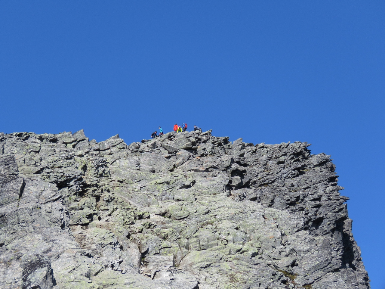
Goal
Position: 62°12.34’N, 6°41.09’E
From the ridge, we can now see our goal of the the summit of Slogen. If you look closely, you can see at least five other hikers making their way to the top (click image for a larger view).
|
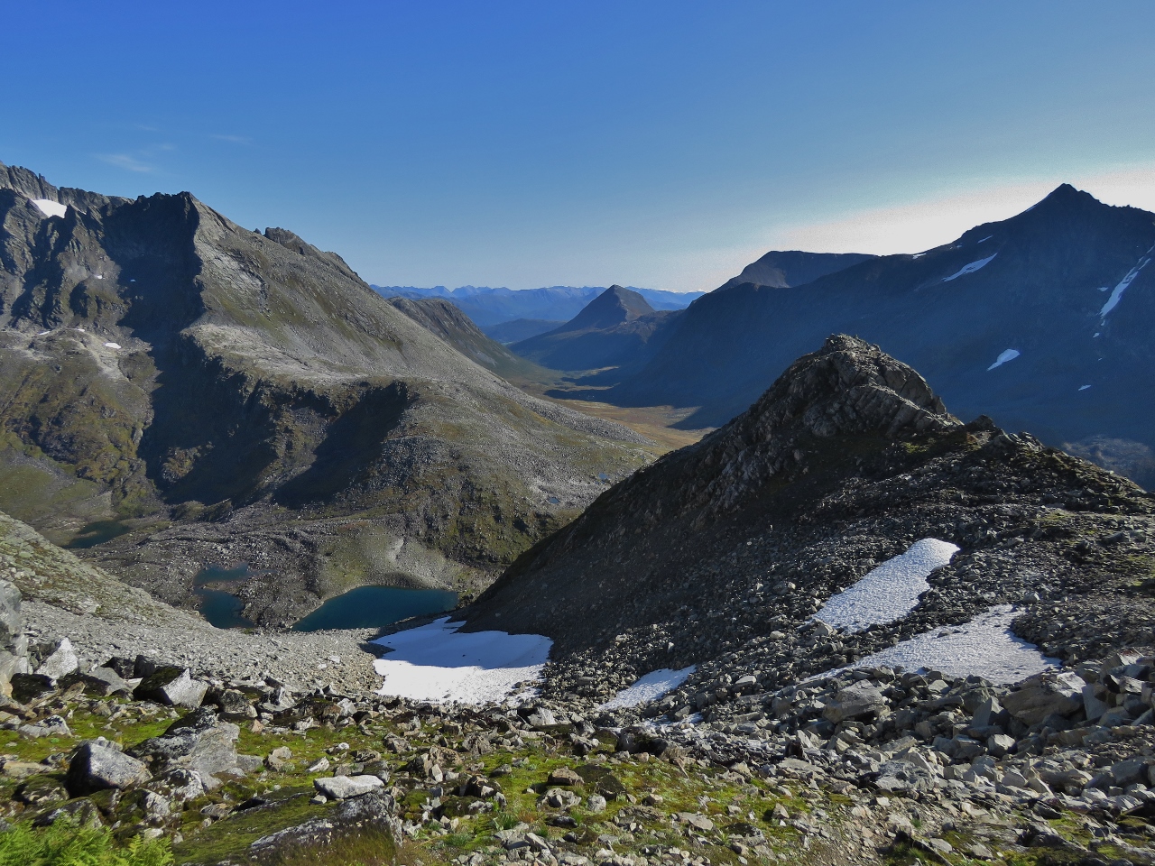 |
Lakes
Position: 62°12.36’N, 6°40.95’E
Beautiful lakes visible from the ridge as we continue on to the Slogen summit.
|
 |
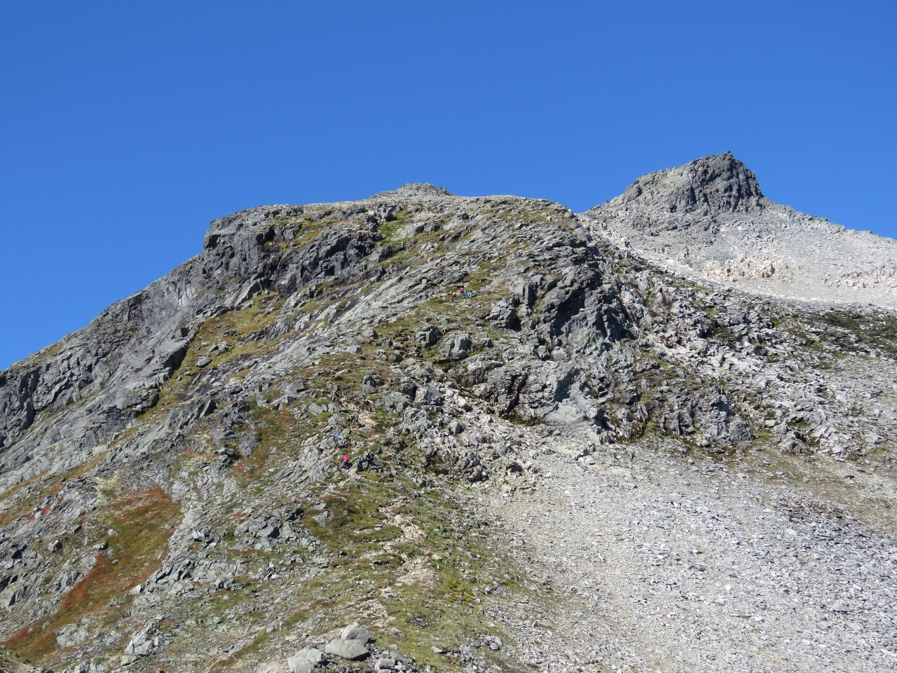
Crowds
Position: 62°12.44’N, 6°40.46’E
We can see at least six people on the summit already. Nobody passed us on the trail, so likely many overnighted at a nearby mountain hut and hiked up this morning.
|
 |
Dirona
Position: 62°12.44’N, 6°40.45’E
Dirona is a white speck anchored 4,948 ft (1,508 m) below us (click image for a larger view).
|
 |
Nearing 5,000ft
Position: 62°12.45’N, 6°40.44’E
Taking a break and enjoying the view northeast at altitude 4,977 ft (1,517 m). We’re starting to take breaks more frequently as we near the top. Partly because we’re nearly a mile above sea level but mostly because it’s heavy going.
|
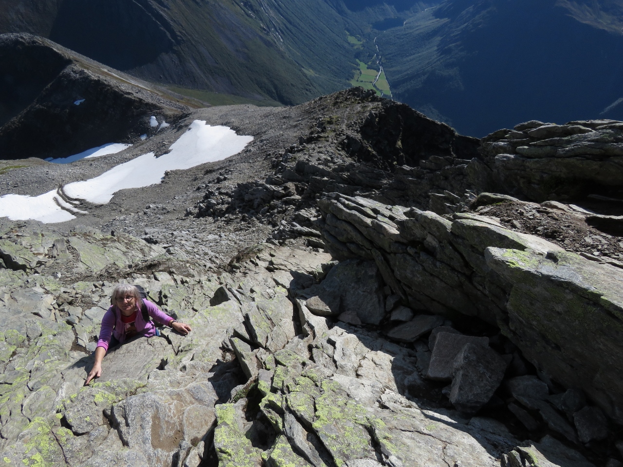 |
Climbing
Position: 62°12.48’N, 6°40.38’E
Climbing up the rock face on the final portion of the ascent to the summit of Slogen. The road we started on is way, way down below in the distance.
|
 |
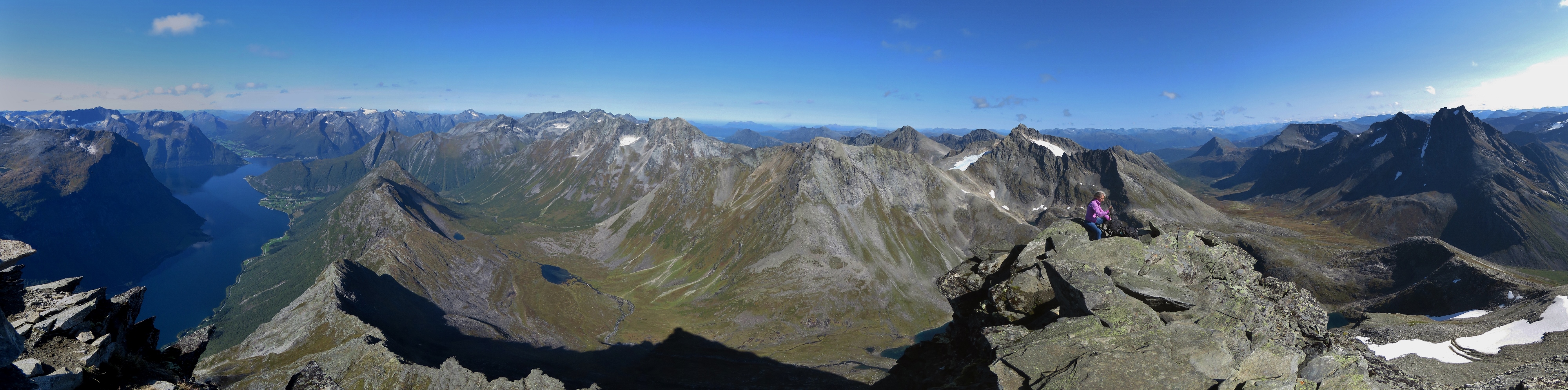
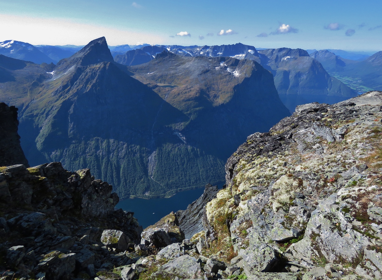
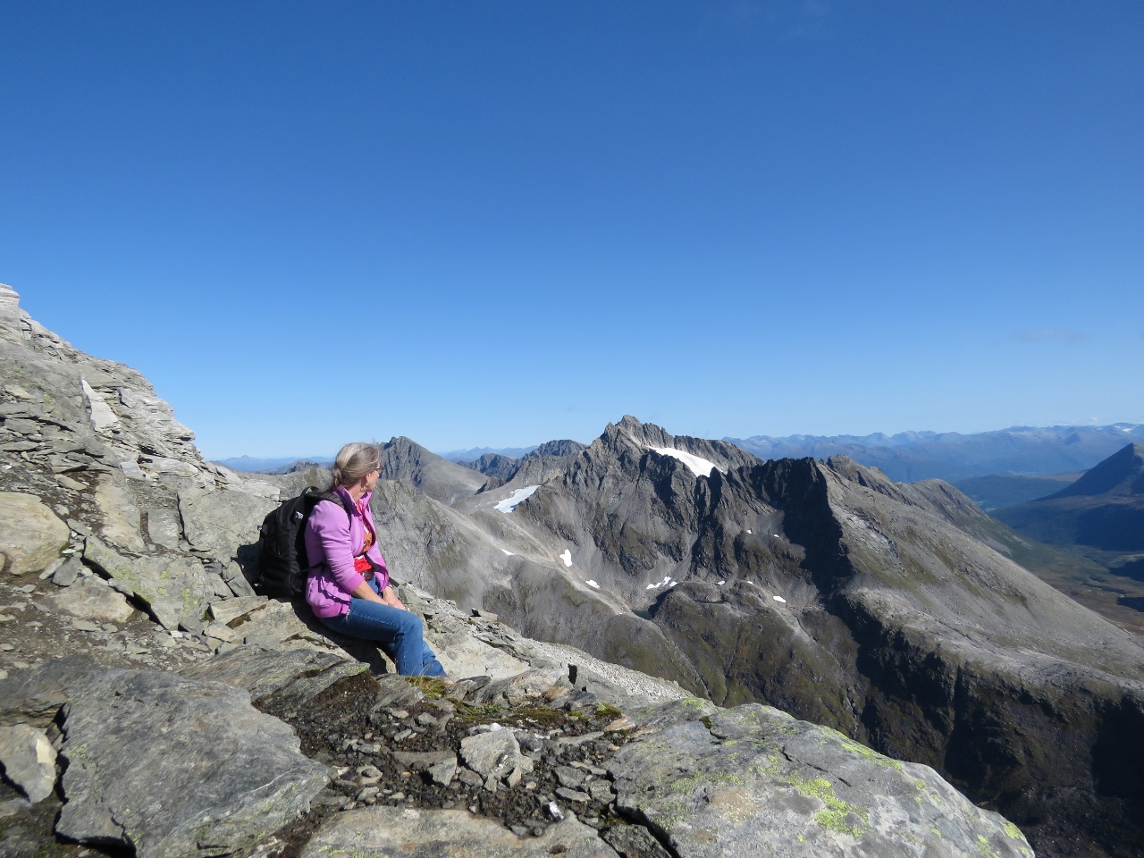
Slogen Summit
Position: 62°12.49’N, 6°40.38’E
The spectacular view at 5,131 ft (1,564m) up from the Slogen summit. Wow! (Click image for a larger view.)
|
 |
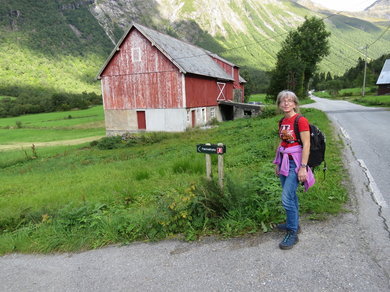
Patchell Hut Trail
Position: 62°12.55’N, 6°41.81’E
We returned down by following the ridge farther east toward the Patchell Hut. This is looking back west to the Slogen Summit from partway down. This route is further than the route we took up the mountain, but the terrain and views are surprisingly different.
|
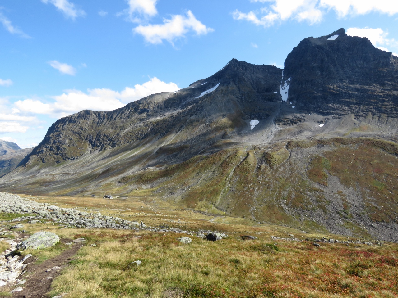 |
Meadow
Position: 62°12.67’N, 6°42.44’E
The scenery along the trail to the hut was quite different, with mountain meadows rather than cliff views. We enjoyed it.
|
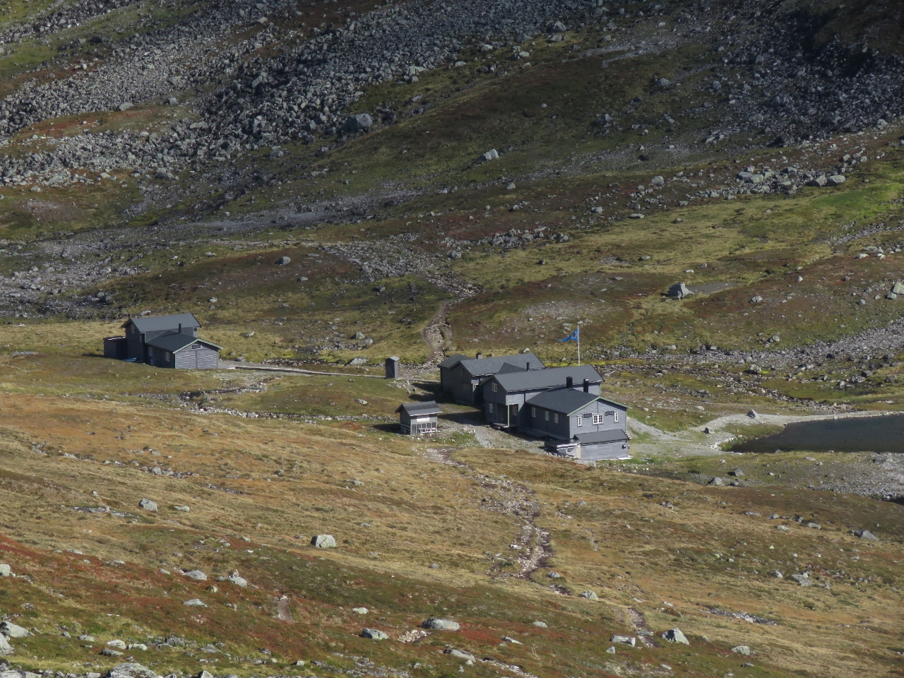 |
Patchell Hut
Position: 62°12.67’N, 6°42.44’E
The Patchell Hut is a popular Norwegian Trekking Association cabin, reconstructed in 1996, with 23 bunks and even 2 gas cookers. We took a shortcut to reach the trail back down to the road, so didn’t go all the way to the cabin.
|
 |
Slogen View
Position: 62°12.54’N, 6°42.86’E
Looking back to Slogen from the trail leading south toward Oye from the Patchell Hut.
|
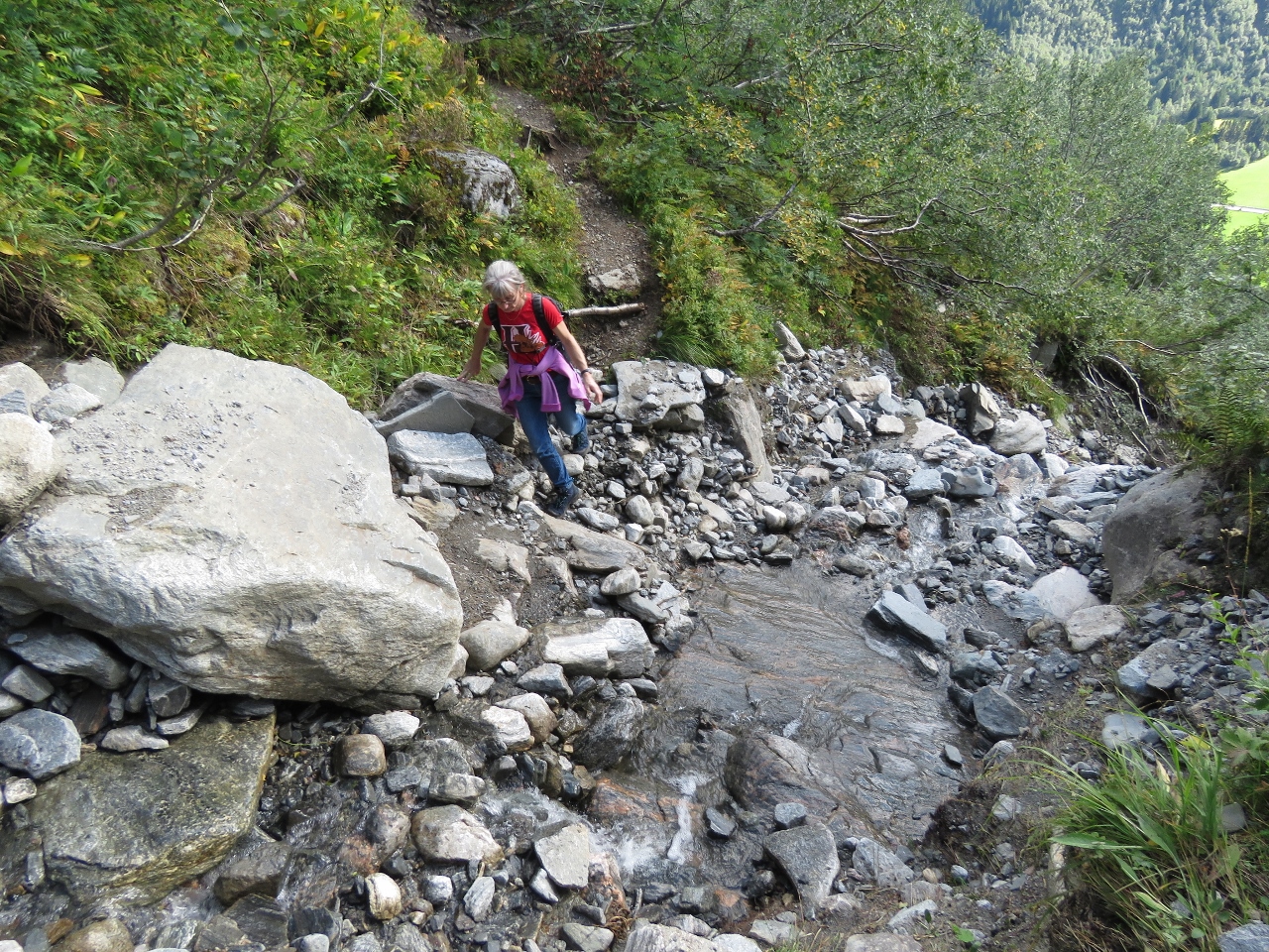 |
Creek
Position: 62°11.67’N, 6°41.75’E
Skirting a creek at altitude 1,346 ft (410 m). The trail from the hut started out on a reasonably gentle slope, but gets more steep toward the bottom.
|
 |
Pavement!
Position: 62°11.19’N, 6°41.48’E
You know it’s been a long hike when walking on pavement is a relief and feels almost like resting.
|
 |
Avanti
Position: 62°11.27’N, 6°40.42’E
The 200ft (60.97m) super-yacht Avanti had arrived and anchored behind us while we were on our hike. Sometimes Dirona looks big in context and other times very small. Next to Avanti, Dirona looks decidedly on the small side.
|
 |
Parking Lot
Position: 62°11.30’N, 6°40.33’E
The parking lot at the Slogen trail head was nearly full when we walked by. We passed several other groups of hikers on our way down from the summit to the ridge.
|
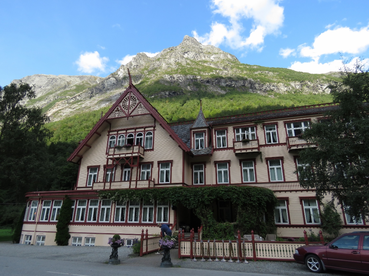 |
Hotel Union
Position: 62°11.59’N, 6°39.58’E
The Hotel Union in Oye was established in 1891 and has had many famous guests over the years, including Kaiser Wilhelm, Sir Arthur Conan Doyle and Edvard Grieg. The peak behind is near the top of Slogen.
|
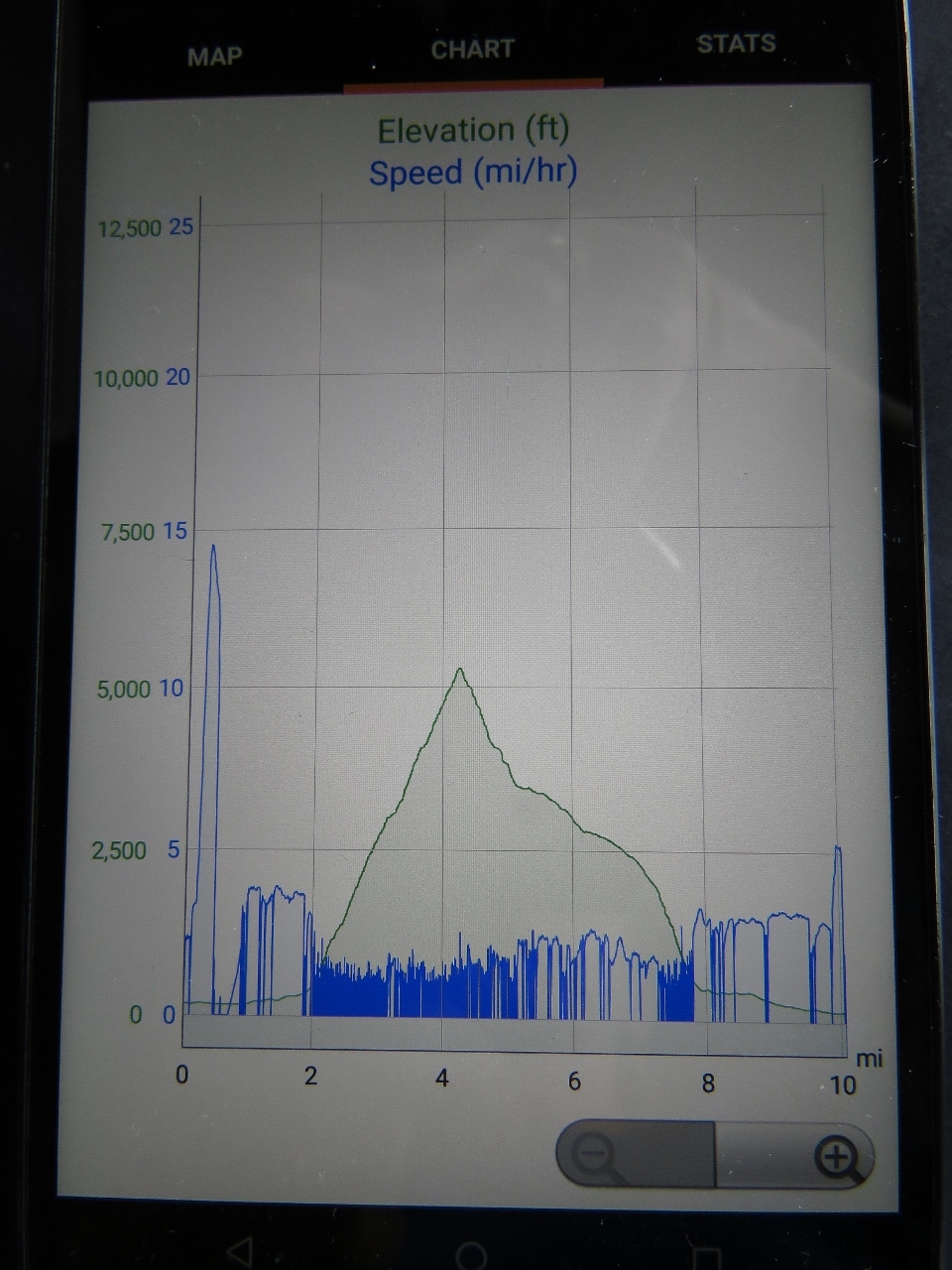 |
Slogen Hike Profile
Position: 61°55.11’N, 5°25.08’E
The speed (blue) and elevation (green) profile from our Slogen hike. The initial quick blue blip to 15mph (24kph) is our dinghy run ashore, then we’re walking at about 4mph (6.5kph) on fairly level ground to reach the trailhead. Our speed fell to between 1 and 2 mph (1.6-3.1kph) as we ascended the steep slope to 5,131 ft (1564m). We took a less-steep return route and made closer to 3mph (4.8kph), then up to 4mph (6.4kph) as we reached the road to return back to the tender.
|
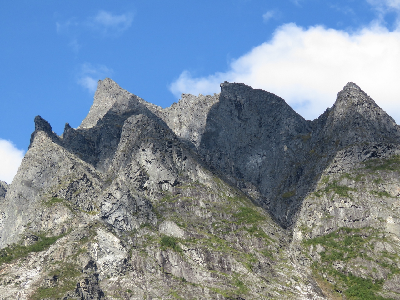 |
Peaks
Position: 62°11.70’N, 6°38.85’E
We love those craggy peaks above the anchorage to our south.
|

|
Click the travel log icon on the left to see these locations on a map, with the complete log of our cruise.
On the map page, clicking on a camera or text icon will display a picture and/or log entry for that location, and clicking on the smaller icons along the route will display latitude, longitude and other navigation data for that location. And a live map of our current route and most recent log entries always is available at mvdirona.com/maps. |
And no doubt a right slog to climb ;-) A great effort, and thanks for sharing that panoramic photo taken at the summit, it’s wonderful.
Mountains are the bones of the natural world!
Paul said “Mountains are the bones of the natural world!” Yes! Mountains are amazing because they each hold some challenge to climb where the challenge can be sized to your skill set and ability and yet each has a reward at the top. Love those views and we’re willing to work hard while we still can to get them.