Andalsnes is close to some of Norway’s most spectacular and unique scenery, including 5900ft (1800m) Trollgiven, the highest vertical mountain wall in Europe and the dramatic Trollsigten route, a narrow roadway that climbs at a gradient of 1:12 through 11 hairpin turns with a viewing platform above. And an hour or two’s hike from town leads to the fabulous Rampestreken view point, cantilevered over the valley at 1902 ft (580m), and then on to the summit of Nesakskla at 2,345ft (715m) for even better views.
From our anchorage at Vagsetervagen we made a short run to Andalsnes and moored in the guest harbor there, and then hiked to Rampestreken and Nesakskla. Below are trip highlights from August 20th in Andalsnes, Norway. Click any image for a larger view, or click the position to view the location on a map. And a live map of our current route and most recent log entries always is available at mvdirona.com/maps
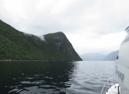 |
Romsdalsfjorden
Position: 62°36.77’N, 7°24.01’E
The storm system has passed and we’re heading up Romsdalsfjorden towards Andalsnes in wonderfully calm conditions.
|
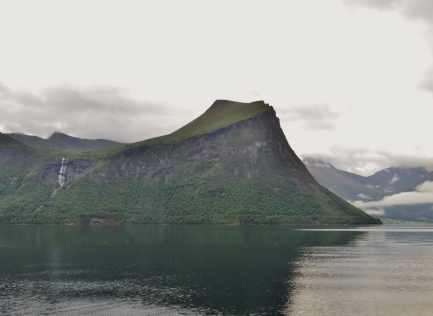 |
Scenery
Position: 62°33.11’N, 7°33.72’E
The scenery in Romsdalsfjorden is spectacular. This is looking south just past Mandalen.
|
 |
10,000 Hours
Position: 62°33.73’N, 7°37.74’E
We just crossed an amazing 10,000 trouble-free hours on our John Deere 6068AFM75. Nothing runs like a Deere.
|
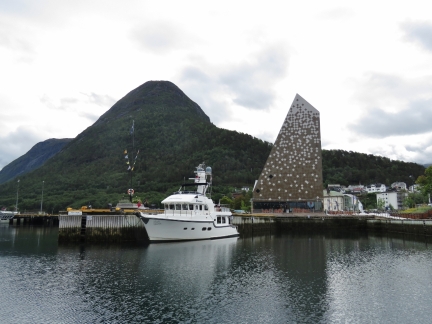 |
Andalsnes
Position: 62°34.10’N, 7°41.31’E
Dirona moored at Andalsnes harbour in front of their modern visitor center. Today we plan to climb the mountain visible behind, 2,345-ft (715m) Nesakskla.
|
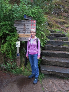 |
Trailhead
Position: 62°33.84’N, 7°41.55’E
Jennifer at the trailhead for Nesakskla peak, and several other trails. Time to break in the new hiking boots.
|
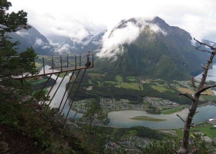 |
Rampestreken
Position: 62°33.65’N, 7°42.76’E
At Rampestreken, a fantastic cantilevered viewpoint at 1902 ft (580m) en route to the Nesakskla summit.
|
 |
View
Position: 62°33.65’N, 7°42.76’E
The spectacular view from Rampestreken.
|
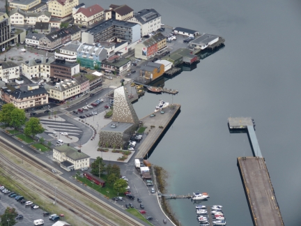 |
Dirona
Position: 62°33.64’N, 7°42.75’E
Dirona moored in Andlasnes, viewed from the Rampestreken lookout.
|
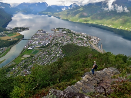 |
Stairs
Position: 62°33.66’N, 7°42.82’E
The trail continues up from Rampestreken to the summit of Nesakskla along beautiful stone steps.
|
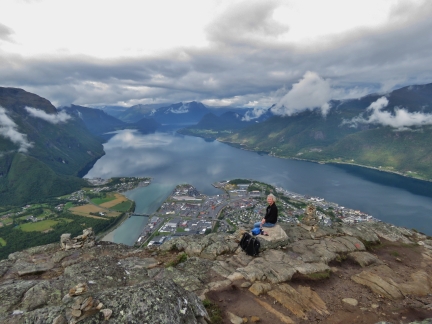 |
Lunch
Position: 62°33.64’N, 7°42.90’E
Lunch with a view at the top of Nesakskla.
|
 |
Romsdalsfjorden Head
Position: 62°33.63’N, 7°43.10’E
Another great view looking east towards the head of Romsdalsfjorden from the summit of Nesakskla. The structure on the left is a small stone mountain hut. Dirona is just visible as a white speck at the right side of the town (click image for a larger view).
|
 |
Climb Profile
Position: 62°33.97’N, 7°41.35’E
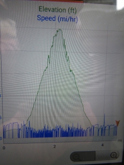
The elevation profile of our climb today—pretty much straight up, then right back down.
|
 |
Convoy
Position: 62°33.97’N, 7°41.34’E
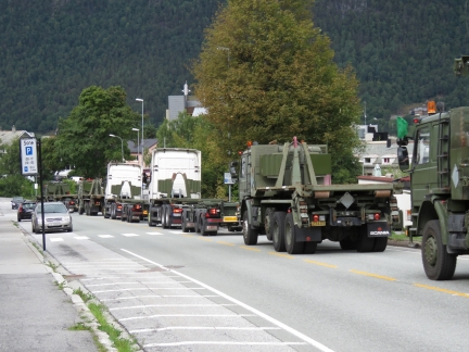
A convoy of army trucks heading into Andalsnes as we return to Dirona from our hike.
|
 |
Fuel Filter Vacuum
Position: 62°34.11’N, 7°41.37’E
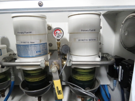
We installed a pressure sensor today to put our fuel filter vacuum reading onto the NMEA 2000 bus to enable alerts and alarms on the level.
|
 |
Bakgarden Thai
Position: 62°34.06’N, 7°41.24’E
A delicious meal at Bakgarden Thai in Andalsnes.
|

|
Click the travel log icon on the left to see these locations on a map, with the complete log of our cruise.
On the map page, clicking on a camera or text icon will display a picture and/or log entry for that location, and clicking on the smaller icons along the route will display latitude, longitude and other navigation data for that location. And a live map of our current route and most recent log entries always is available at mvdirona.com/maps. |

Trollveggen with it’s insane total vertical drop of 1.700 meters, including complete vertical drop of more than 1.000 meters – with 50 meter of overhang – is an impressive view. Further up in the valley is an small waterfall called Mongefossen – 773 meters high – this one is considered one of the worlds highest waterfalls, but it’s regulated for hydro electric production, and is a rare sight to see. In Loen where you are staying now is a simular waterfall, Ramnefjellfossen falling into lake Lovatnet in 3 drops, total waterfall height 818 meters – by some publications listed as the world third-highest. You can also see the scar in the mountain Ramnefjell from 2 big rockfall/landslides that caused catastrophical tsunamis in 1905 and 1936 – killing 135 people living along lake Lovatnet. Sounds scary? – you just passed a similar mountain on your tender-ride to Geiranger – mount Åkernesnibba – this mountain is under 24/7 surveillance because Norways next big fjord tsunami is expected here – the landslide might come next week – or in 2-hundreds year time (nobody knows, but the mountain will fall). When the mountain fall the fjord tsunami will cause a 80 meter wave in the village of Geiranger. A last word on impressive mountains – on your way north you passed mount Hornelen on Bremanger Island just south of Måløy – you will pass this mountain again when you go west and turn south. Hornelen (860 meters) is considered Europe’s highest sea cliff.
I’ve read about the Fjord Tsunamis and find myself thinking as we pass along the shorelines, “it will happen again.” Logically, these are very rare events but they have happened before and will happen again.
We hiked up Mount Skala yesterday and were lucky enough to have a very clear day. Over 1800 meters or nearly a nautical mile in the sky affords incredible views. Wow!
After following your blog for years while you travelled the whole world – it’s fun to follow you exploring my home region (Ålesund) – and to see what you choose to have a look at.
From Åndalsnes you travelled Raumabanen railway through Romsdal valley (meaning Roms- or Rauma-valley). For Nordhavn nerds that name should ring a bell, the Romsdahl trawler yachts (1950s – 1960s) is often mentioned as one of the main inspirations for the Nordhavn yachts. Romsdal trawlers was build by several small shipbuilders along Norways west coast (Ålesund – Stavanger) for the american market – by the same builders that build the traditional north sea fishingboats. This is also why Nordhavn got their norwegian name (North-harbour). Nordhavns looks like they are made for cruising in our waters, but still they are a rare sight in Norway. I only know about 2 Nordhavns with Norwegian flags (one N46 and one N47), the only other Nordhavn I have seen in Ålesund beside Dirona was N86-01 Cary Ali – many years ago.
I do remember Romsdahl — the Nordhavn 62 has a similar look and I love them both. Very strong boats with a heavy duty, semi-commercial boat styling that we really like.
We are really enjoying Norway. Every few days we think we have found the “best in Norway” and then, a week later, we find an even more amazing location. We’re loving it.