Bodø, Norway was the ultimate destination of American pilot Gary Powers’ ill-fated U2 flight that garnered international attention in 1960 when he was shot down and captured over Russia during a high-altitude surveillance pass. The exceptional Norwegian Aviation Museum there has a vast collection, including a U2 spy plane, that we’d been looking forward to visiting for months.
Another Bodø attraction is the nearby Saltstraumen Maelstrom, among the fastest in the world. When the moon is full, the rapids can run at nearly 20 knots—we ran the tender over to check them out maximum ebb.
And Bodø is where we finally crossed paths with Nordhavn 57 Summer Star owners Kristina Thyrre and Atle Moe who were heading north as we are returning south. We’d been corresponding for years, much more so recently since we’ve both been in Norway, and it was wonderful to meet in person.
Below are trip highlights from June 29th through July 3rd en route to and in Bodø, Norway. Click any image for a larger view, or click the position to view the location on a map. And a live map of our current route and most recent log entries always is available at mvdirona.com/maps
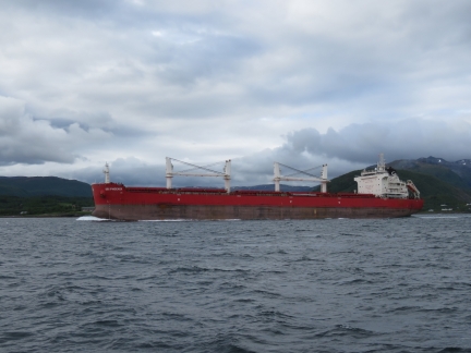 |
SBI Phoenix
Position: 68°25.98’N, 16°38.17’E
The 652-ft (199m) bulker SBI Phoenix en route to Narvik at the mouth of Ofotfjorden.
|
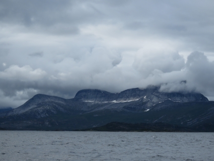 |
Tysfjorden
Position: 68°22.70’N, 16°13.61’E
Dramatic bald cliffs to our south as we pass Tysfjorden.
|
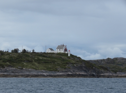 |
Barøy Lighthouse
Position: 68°21.59’N, 16°5.16’E
The 90 ft (27.5-metre) Barøy Lighthouse was built in 1903 and automated in 1980.
|
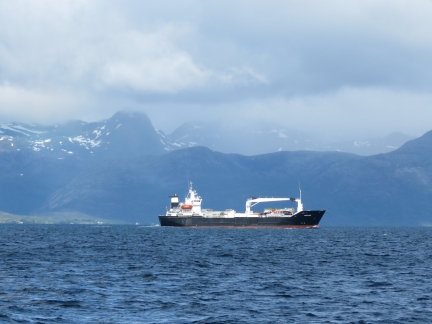 |
Silver Pearl
Position: 68°19.53’N, 15°58.25’E
The freighter Silver Pearl to our west, with the mountains of the Vesterålen islands visible in the distance beyond.
|
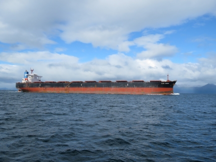 |
Cape Heron
Position: 68°19.02’N, 15°56.88’E
The 948ft (289m) bulker Cape Heron en route to Narvik. We seem to be back on the main shipping channel and are seeing a lot more commercial traffic than we have in the past month or so.
|
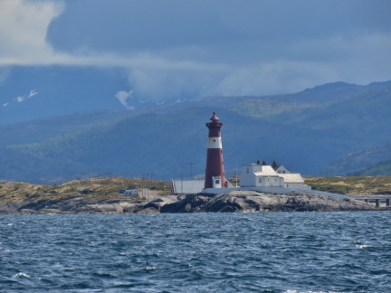 |
Tranøy Lighthouse
Position: 68°11.48’N, 15°32.43’E
The 89 ft (27-metre) round cast iron tower of the lighthouse on the island of Tranøy. The lighthouse has been developed as a tourist attraction and has superb view across to the Lofoten Islands.
|
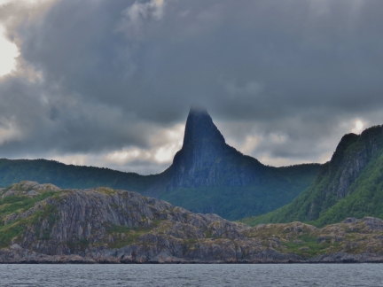 |
Stetind Mountain
Position: 68°7.15’N, 15°19.34’E
Spectacular Stetind (“Anvil of the Gods”) mountain in Tysfjorden.
|
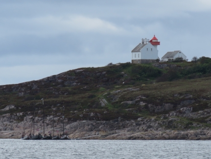 |
Flatøya
Position: 67°55.35’N, 14°48.18’E
A fleet of replica Viking boats moored beneath the lighthouse on the island of Flatøya.
|
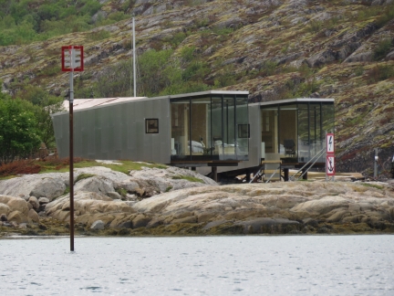 |
Cabins
Position: 67°50.16’N, 14°47.26’E
Two beautiful cabins overlooking the anchorage at Nordskot.
|
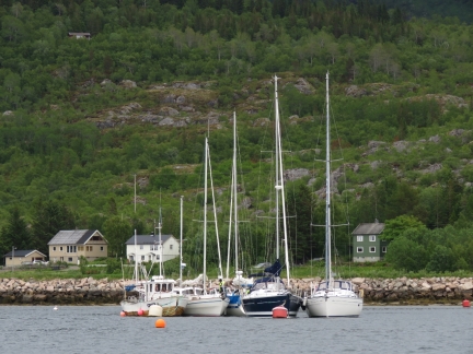 |
Rafted
Position: 67°50.17’N, 14°47.26’E
When we first arrived at Nordskot, several pleasure craft were on moorings with a few spaces open in the marina. Over the course of the evening at least a dozen more arrived, rafting five deep on the moorings in places and three deep on the docks. We’re told rafting on Norway is commonplace, but we’ve not seen anything like this so far. Norwegians typically take vacation in July, so perhaps this is the start of the busy season.
|
 |
Vikings
Position: 67°50.16’N, 14°47.25’E
The fleet of Viking boats we’d passed earlier at Flatøya also arrived and moored against the commercial dock at Nordskot.
|
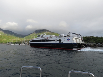 |
Steigtind
Position: 67°50.16’N, 14°47.26’E
We’d anchored several hundred yards off the commercial dock, but it still felt pretty close when the fast ferry Steigtind loomed through our port windows.
|
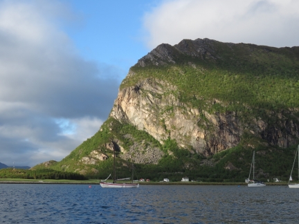 |
Cliff
Position: 67°50.16’N, 14°47.26’E
The evening sun lighting up the cliffs north of the anchorage at Nordskot.
|
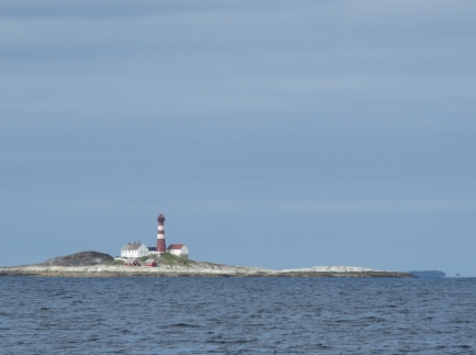 |
Landegode Lighthouse
Position: 67°26.90’N, 14°28.35’E
The 95-ft (29 m) iron tower of the Landegode Lighthouse was erected in 1902.
|
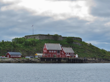 |
Bremnes Fortress
Position: 67°17.33’N, 14°21.83’E
Bremnes Fortress was built in World War II by the occupying Germans to protect the entrance to Bodø harbor.
|
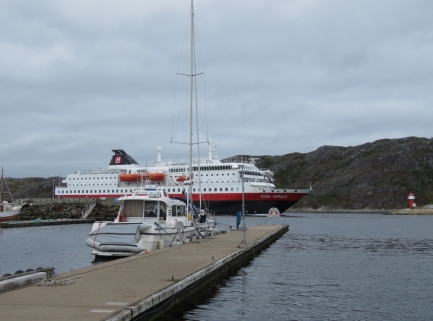 |
Kong Harald
Position: 67°17.03’N, 14°22.17’E
Our ‘Gruten, the Kong Harald, arrived into Bodø shortly after we did. Since dropping us off in Tromsø six days ago, the Kong Harald has completed the trip south to Bergen and now is returning north.
|
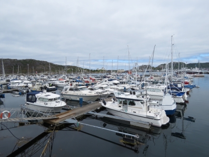 |
Bodø Havn
Position: 67°16.93’N, 14°22.12’E
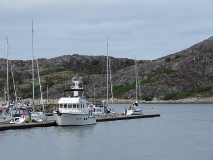
Looking across the recreational docks in Bodø Havn. Dirona is just visible on the other side of the marina at center (click image for a larger view).
|
 |
Fast Ferries
Position: 67°17.00’N, 14°22.20’E
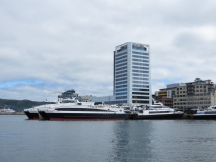
Bodø is the terminal for several fast ferries that run to the Lofoten and Vesterålen Islands.
|
 |
Guest Dock
Position: 67°17.01’N, 14°22.40’E
Dirona moored on the guest dock at Bodø Havn.
|
 |
Lunch
Position: 67°16.98’N, 14°22.37’E
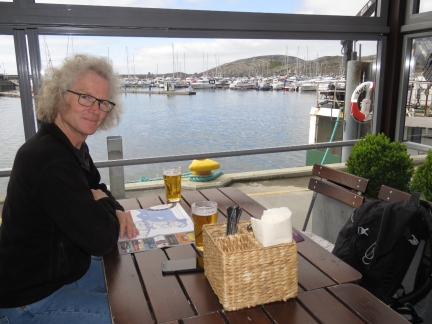
We had a good lunch with a great harbor view at Bryggerikaia.
|
 |
Nordland Museum
Position: 67°16.91’N, 14°22.95’E
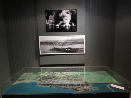
The small but information-packed Nordland Museum on Bodø details the towns history, particularly the destruction during World War II when a 1940 German bombing attack levelled much of the town center.
|
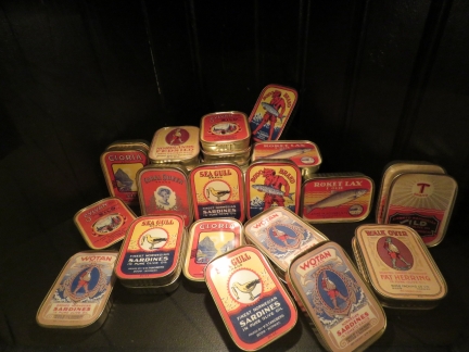 |
Sardines
Position: 67°16.91’N, 14°22.95’E
A display at the Nordland Museum showing various brands of canned herring, once a major Bodø export.
|
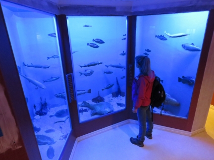 |
Dry Aquarium
Position: 67°16.91’N, 14°22.95’E
Dry aquarium in the basement of the Nordland Museum. The display was created to teach fishers how to identify fish found in the ares.
|
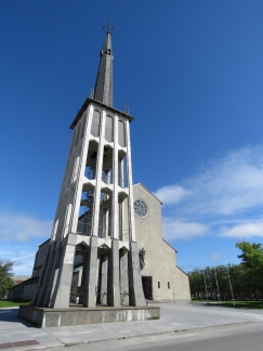 |
Bodø Cathedral
Position: 67°16.94’N, 14°22.84’E
Bodø Cathedral was completed in 1956. It replaced an earlier church that was destroyed during the World War II bombing.
|
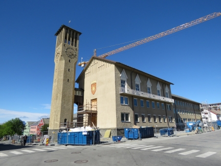 |
City Hall
Position: 67°16.97’N, 14°22.96’E
Bodø’s city hall also was destroyed in the World War II bombing and rebuilt in the 1950s. A dramatic new city hall building is now under construction.
|
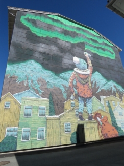 |
Street Art
Position: 67°17.01’N, 14°23.16’E
Wonderful street art in Bodø showing a youngster painting the Northern Lights onto the sky.
|
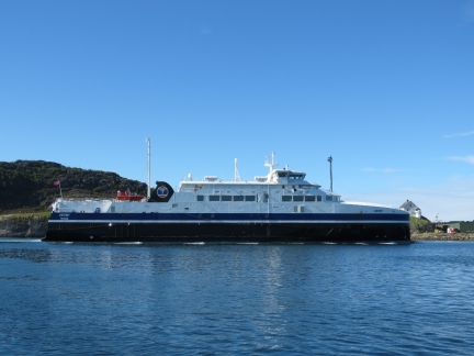 |
Værøy
Position: 67°17.04’N, 14°22.14’E
The ferry Værøy arriving into Bodø from Moskenes, just south of Reine in the Lofoten archipelago.
|
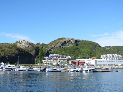 |
Pontoons
Position: 67°17.72’N, 14°23.36’E
After walking around town, we took the tender on a tour of the harbor. This is a small pontoon at the north end of the harbor.
|
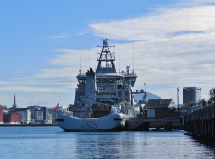 |
Barentshav
Position: 67°17.68’N, 14°23.36’E
The 305 ft (93 m) Norwegian Coast Guard vessel Barentshav moored at Bodø Harbor. Delivered in 2009, the Barentshav is the coast guard’s first LPG vessel and can reach speeds of 20 knots.
|
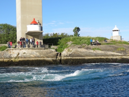 |
Saltstraumen Maelstrom
Position: 67°13.85’N, 14°37.06’E
Spectators gathered along the shore near Bodø to watch the Saltstraumen Maelstrom, among the fastest in the world. When the moon is full, the rapids can run at nearly 20 knots. The video https://youtu.be/rAMC4hlXtgM shows us making a pass through the channel with the rapids running at maximum ebb, creating huge whirlpools and upwellings.
|
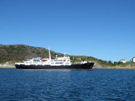 |
Lofoten
Position: 67°17.04’N, 14°22.14’E
The Hurtigruten Lofoten arriving into Bodø on a northbound run.
|
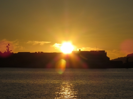 |
Midnight Sun
Position: 67°17.04’N, 14°22.14’E
Bodø ‘s midnight sun period ends in ten more days, and we’ll be out of the midnight sun zone sooner as we continue south. We woke up around 2am and snapped this photo of the sun rising back up above the horizon.
|
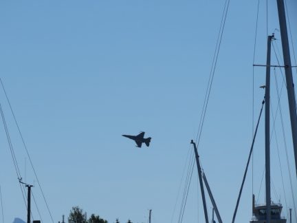 |
F-16
Position: 67°17.04’N, 14°22.14’E
F-16 fighters from the nearby Bodø Main Air Station made frequent passes over the area while we were there.
|
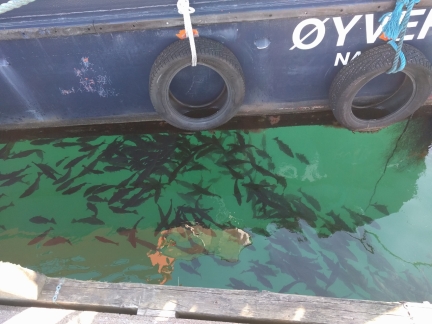 |
Fish
Position: 67°17.03’N, 14°22.17’E
The water in the harbor is incredibly clean and clear with a healthy fish population.
|
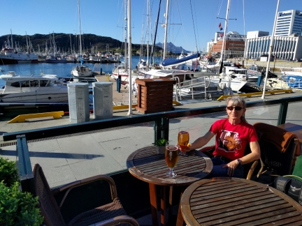 |
Egon
Position: 67°16.86’N, 14°22.34’E
Under a clear sky with the temperature nearly 70°F (21°C), we had a wonderful meal al fresco at Egon overlooking the harbor.
|
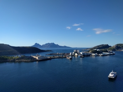 |
View Northwest
Position: 67°17.05’N, 14°22.50’E
After dinner, we went up to sky bar in the Scandic Havet for 360° views of the area. (At 18 floors high, this is northern Norway’s tallest building.) This is the view looking northwest to the channel we came through before entering Bodø Harbor. Bremnes Fortress is just out of the picture on the left.
|
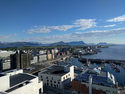 |
Marina
Position: 67°17.03’N, 14°22.50’E
The view looking southeast from the Scandic Havet sky bar. We had dinner at Egon, across the street from the yellow buildings about center in the picture.
|
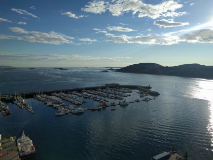 |
View South
Position: 67°17.04’N, 14°22.49’E
Dirona moored on the guest dock, viewed looking southwest from the Scandic Havet sky bar.
|
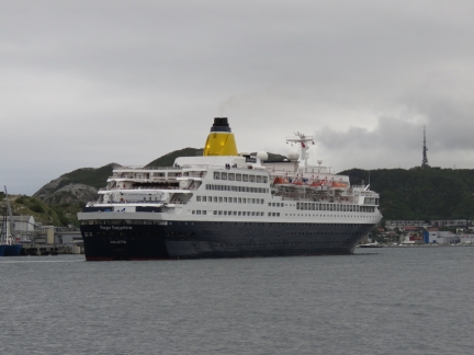 |
Saga Sapphire
Position: 67°17.04’N, 14°22.15’E
The 655ft (200m) cruise ship Saga Sapphire arriving into Bodø.
|
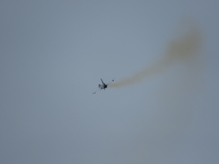 |
F-16
Position: 67°16.50’N, 14°23.95’E
F-16 fighter taking off from Bodø Main Air Station.
|
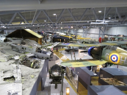 |
Norwegian Aviation Museum
Position: 67°16.59’N, 14°24.78’E
Bodø has an exceptional aviation museum that we’ve been looking forward to visiting for months. This is the vast commercial aviation section, with displays ranging from the early days of flight to modern times. On the left is the recovered wreck of a German Junkers Ju-88 A-4 that was found in the Norwegian mountains and transported piece-by-piece to the museum.
|
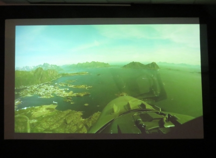 |
Aerial Footage
Position: 67°16.56’N, 14°24.83’E
We spent ages at the Norwegian Aviation Museum watching aerial footage from a jet flight over northern Norway, recognizing many places we’ve visited. This shot is approaching Svolvaer from the south.
|
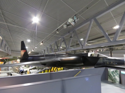 |
U-2 Spy Plane
Position: 67°16.59’N, 14°24.77’E
A U-2 spy plane is one of the feature displays at the Norwegian Aviation Museum. The U-2 program gained international attention in 1960 when the Soviets shot down and captured American pilot Gary Powers while he was making a high-altitude surveillance pass en route from Peshawar, Pakistan to Bodø, one of the permanent stations for the U-2 operations. The excellent movie Bridge of Spies describes the events leading up to Powers’ capture and ultimate release.
|
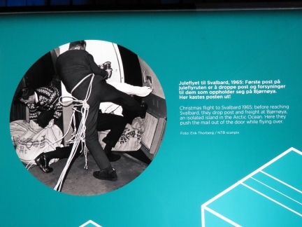 |
Mail Drop
Position: 67°16.54’N, 14°24.80’E
We loved this photo at the Norwegian Aviation Museum of a 1965 Christmas mail drop to Bjørnøya, a remote Arctic island. Two men, roped to the plane, are opening the door mid-flight to push mail and freight out as they fly past.
|
 |
Insomnia
Position: 67°17.06’N, 14°22.91’E
More fabulous street art in Bodø, this one Insomnia by the Italian street artist Millo.
|
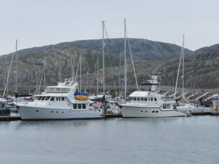 |
Summer Star
Position: 67°17.02’N, 14°22.41’E
Docked bow-to-stern Nordhavn 57 Summer Star in Bodø. We’ve not seen a single other US-flagged vessel since leaving London.
|
 |
Kristina and Atle
Position: 67°17.08’N, 14°22.68’E
We’ve been corresponding with Nordhavn 57 Summer Star owners Kristina Thyrre and Atle Moe for years, and much more so recently since we’ve both been in Norway. They are heading north as we are returning south, and we’d been hoping to cross paths and finally meet in person. We had an exceptional evening with them, first on Summer Star, then over dinner at Hundholmen Brygghus and Gastropub, then later on Dirona.
|

|
Click the travel log icon on the left to see these locations on a map, with the complete log of our cruise.
On the map page, clicking on a camera or text icon will display a picture and/or log entry for that location, and clicking on the smaller icons along the route will display latitude, longitude and other navigation data for that location. And a live map of our current route and most recent log entries always is available at mvdirona.com/maps. |

If your comment doesn't show up right away, send us email and we'll dredge it out of the spam filter.