We crossed 9,500 hours our John Deere 6068AFM75 main engine on the 243nm run from Dublin, Ireland to Falmouth, UK. This run would take us past the strong and sometimes dangerous currents off the most western tip of the UK at Land’s End, so we we left just before midnight to catch favourable tides. Conditions were calm, with the current in our favor, at the start of the trip, but 30-knot winds produced rolls up to 25.9 degrees as we passed south of Wales. We rounded Land’s End 29 hours after our departure, right at slack water, and had a nice easy run the rest of the way into Falmouth.
Below are trip highlights from December 16th and 17th, 2017. Click any image for a larger view, or click the position to view the location on a map. And a live map of our current route and most recent log entries always is available at http://mvdirona.com/maps
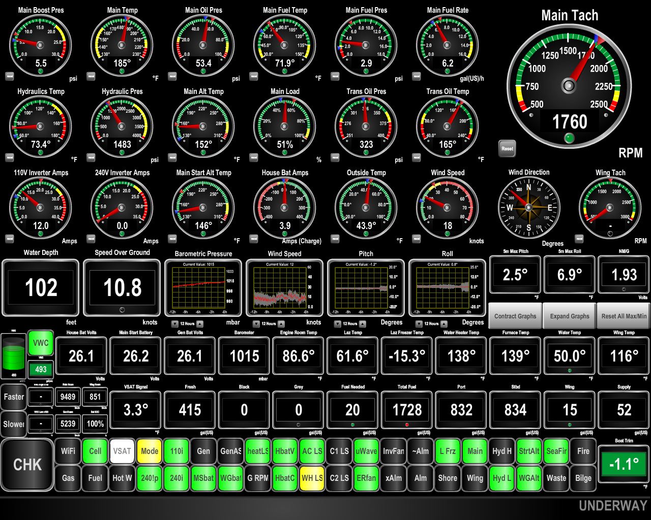 |
10.8 knots
Position: -5 55.91, 53 7.19
The winds finally settled down enough for us to make a run to Falmouth at the southwest corner of the UK. We left around midnight to catch favourable tides on our departure and around Land’s End. Right now we’re doing 10.8 knots as we run through the narrow channel west of India Bank. Normally we’d be doing just over 8 knots at 1760RPM.
|
 |
Arklow Bank Wind Park
Position: -5 52.71, 52 49.80
We just northeast of the 25 megawatt Arklow Bank Wind Park. Commissioned in 2004, it is Ireland’s first offshore wind farm and the first in the world to use wind turbine’s rated at over 3 megawatts.
|
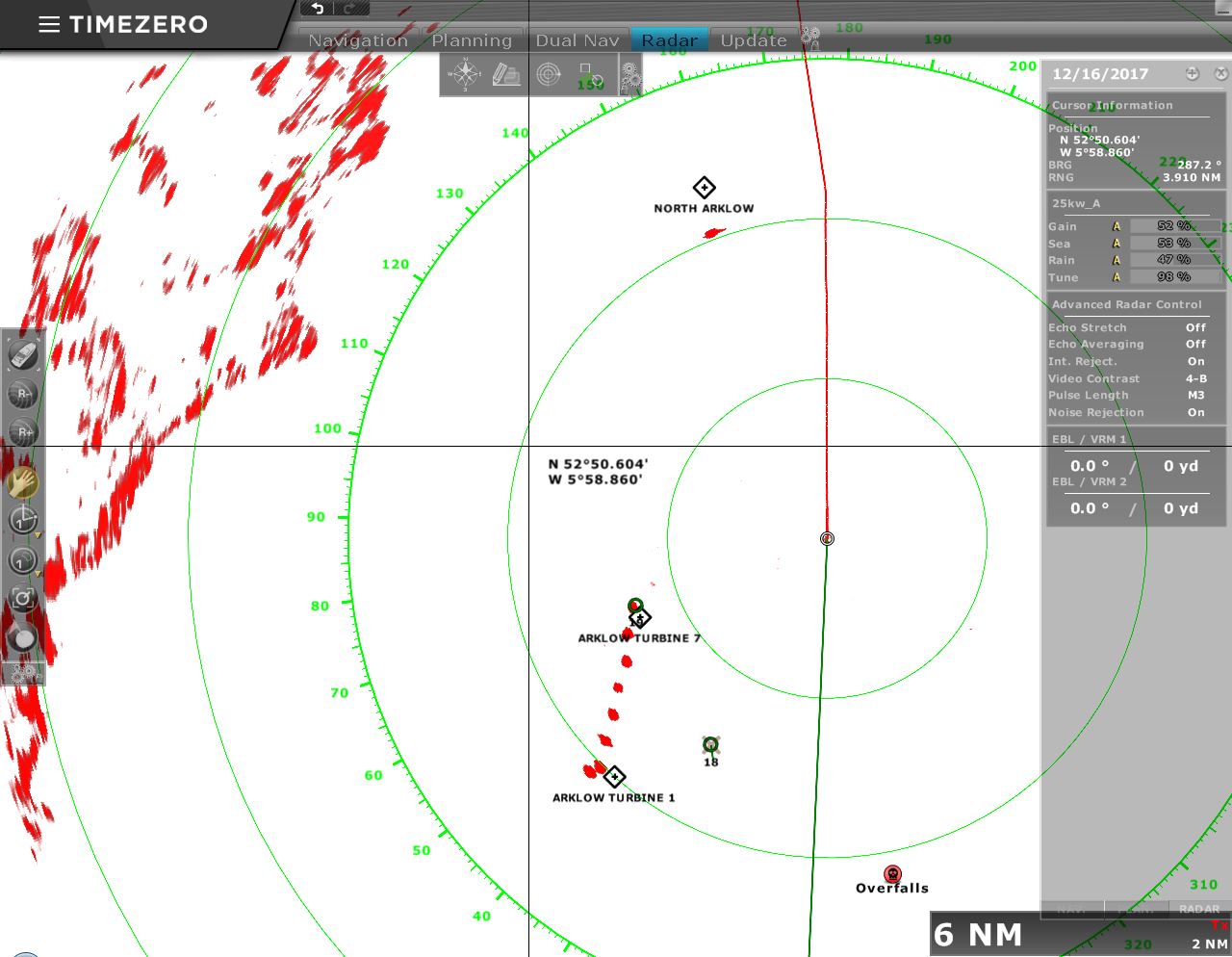 |
Radar Image
Position: -5 52.71, 52 49.53
The Arklow Bank wind turbines make very good radar targets.
|
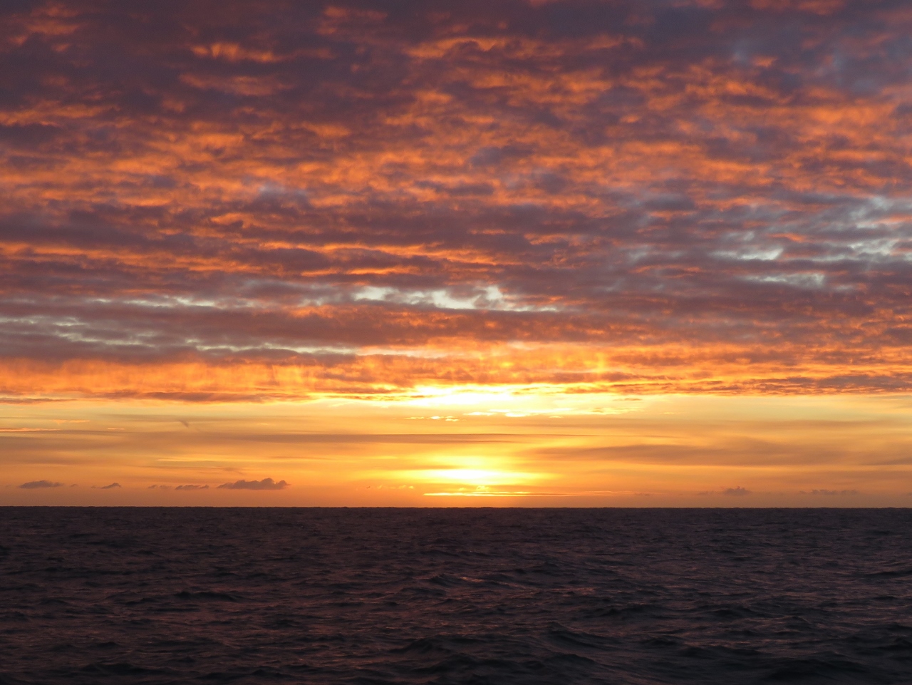 |
Sunrise
Position: -5 52.46, 52 14.89
A spectacular sunrise as we approach the south end of St. George’s Channel.
|
 |
Stena Europe
Position: -5 52.85, 52 11.04
The capable-looking Stena Europe on the run between Roslare, Ireland and Fishguard, South Wales.
|
 |
Traffic
Position: -5 54.27, 52 0.21
Lots of traffic as we near the traffic separation lanes off St. Anne’s Head.
|
|
|
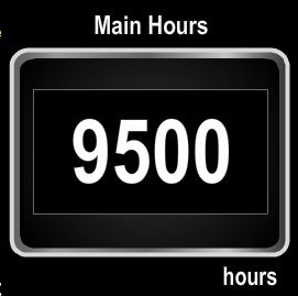
9500 Hours
Position: -5 55.29, 51 52.49
We just crossed 9,500 hours on our John Deere 6068AFM75 main engine.
|
 |
25.9 Degrees
Position: -5 55.82, 51 29.97
We were expecting winds up to 20 knots and seas mostly behind us. But we’ve been seeing steady winds up to 30 knots and big beam seas resulting in significant roll despite the stabilizers and we just rolled 25.9°.
|
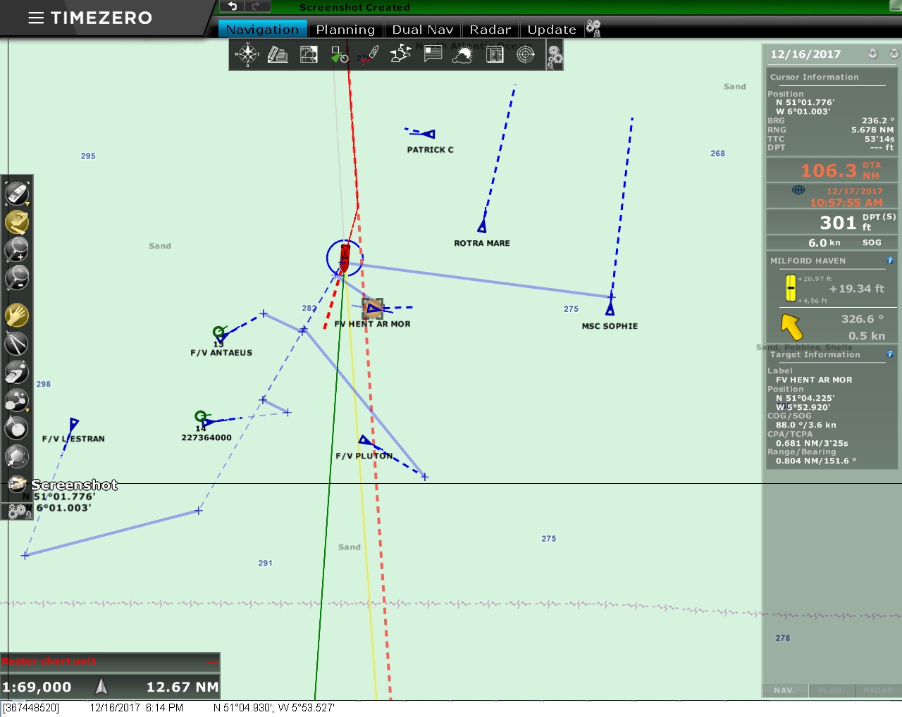 |
Course Change
Position: -5 53.48, 51 5.08
We had to change course to avoid heavy traffic just north of Land’s End. The dashed red line is where we intended to go and the blue lines with x’s on each end are CPA (closest point of approach) lines that our chartplotter, TimeZero, draws. Each CPA line shows where Dirona and the target ship will be at the closest point between the two. At night we try to maintain a 2-mile CPA to other ships, but can’t always achieve that if traffic is as heavy as it is now. We’ve diverted off course to the west and the CPA/TCPA information at the bottom right of the screen shot shows the closest we’ll get to the fishing vessel Hent Ar Mor directly to our south will be 0.691nm in 3 minutes, 25 seconds.
|
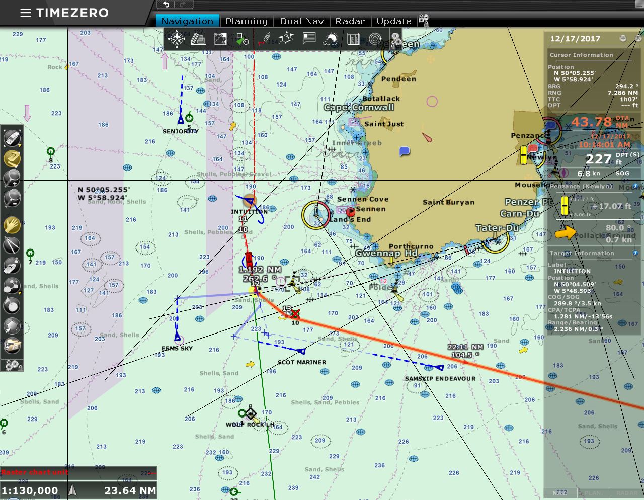 |
Land’s End
Position: -5 48.63, 50 2.33
We’re approaching Land’s End just outside the traffic separation lanes at 3:52am. You can see we had to make another course adjustment to avoid the fishing vessel Intuition directly to our north.
|
 |
Conditions
Position: -5 37.18, 49 59.09
The roll graph shows that conditions have improved markedly, a combination of turning the corner at Land’s End and putting the waves on our stern, and falling winds.
|
 |
Pendennis Castle
Position: -5 2.07, 50 7.62
Pendennis Castle was built by Henry VIII in the 1500s to defend Cornwall from foreign invasion. The castle stands above Falmouth and will be the launching point for their New Year’s Eve fireworks display.
|
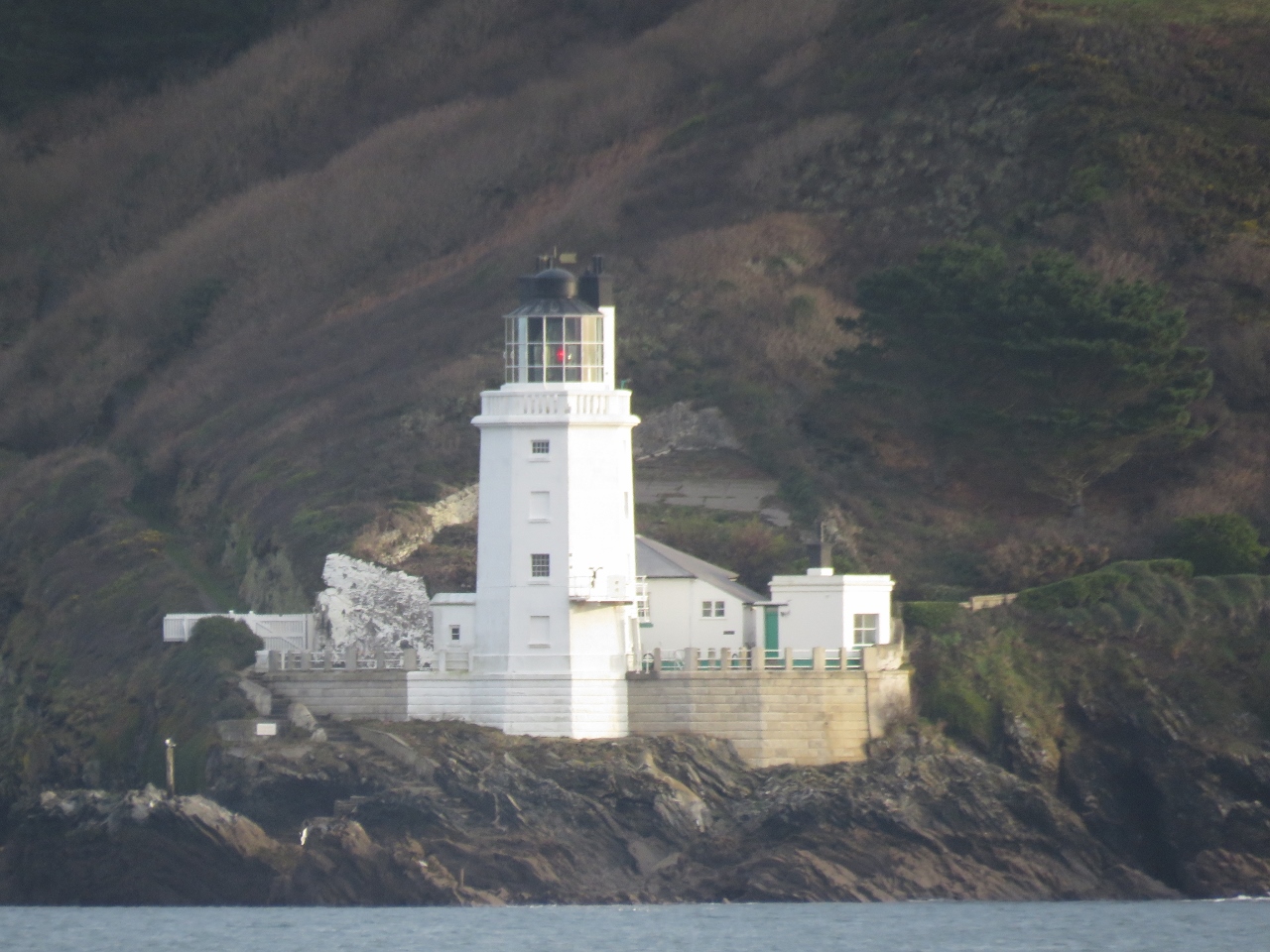 |
St. Anthony Lighthouse
Position: -5 2.08, 50 7.72
St. Anthony Lighthouse was built in 1835 and was the Fraggle Rock Lighthouse in UK version of Jim Hensen’s Fraggle Rock puppet television series.
|
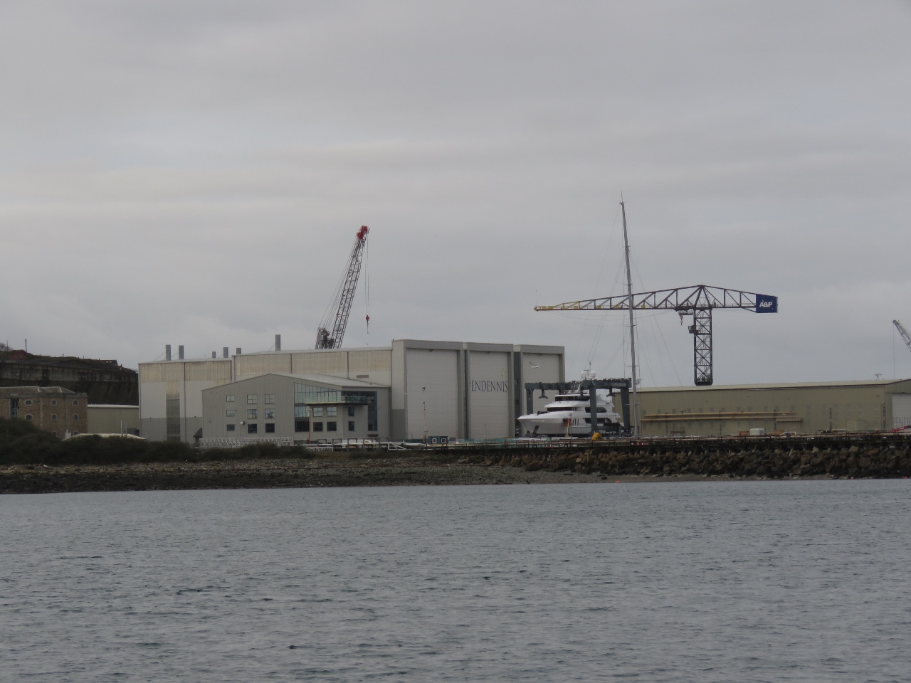 |
Pendennis Shipyard
Position: -5 2.43, 50 9.41
Pendennis Shipyard is a superyacht builder in Falmouth that has averaged one ship a year, mostly large sailing yachts, over the past 30 years.
|
 |
Rowing Santas
Position: -5 2.96, 50 9.45
A boatload of Santas rowing past Pendennis Shipyard as we approach Falmouth.
|
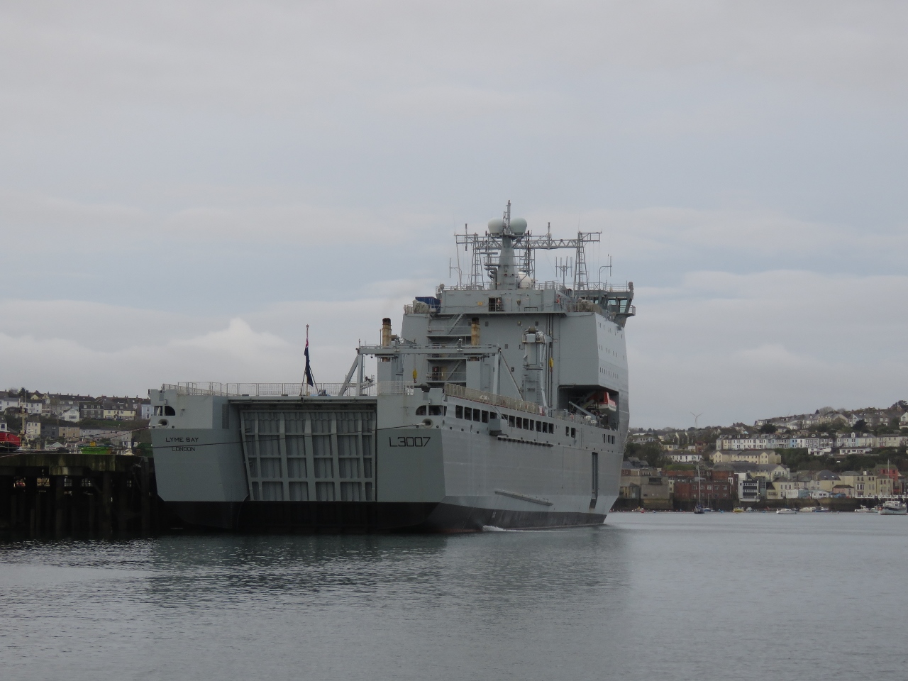 |
RFA Lyme Bay
Position: -5 3.11, 50 9.46
The British landing ship dock RFA Lyme Bay moored at Port Falmouth.
|
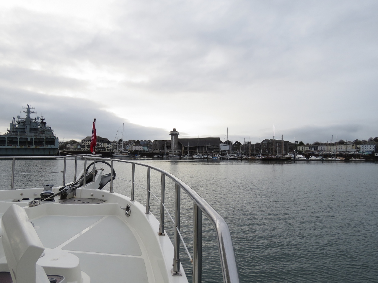 |
Approach
Position: -5 3.67, 50 9.28
The distinctive tower in the distance as we approach the marina is the National Maritime Museum. The RFA Argus is on the left.
|
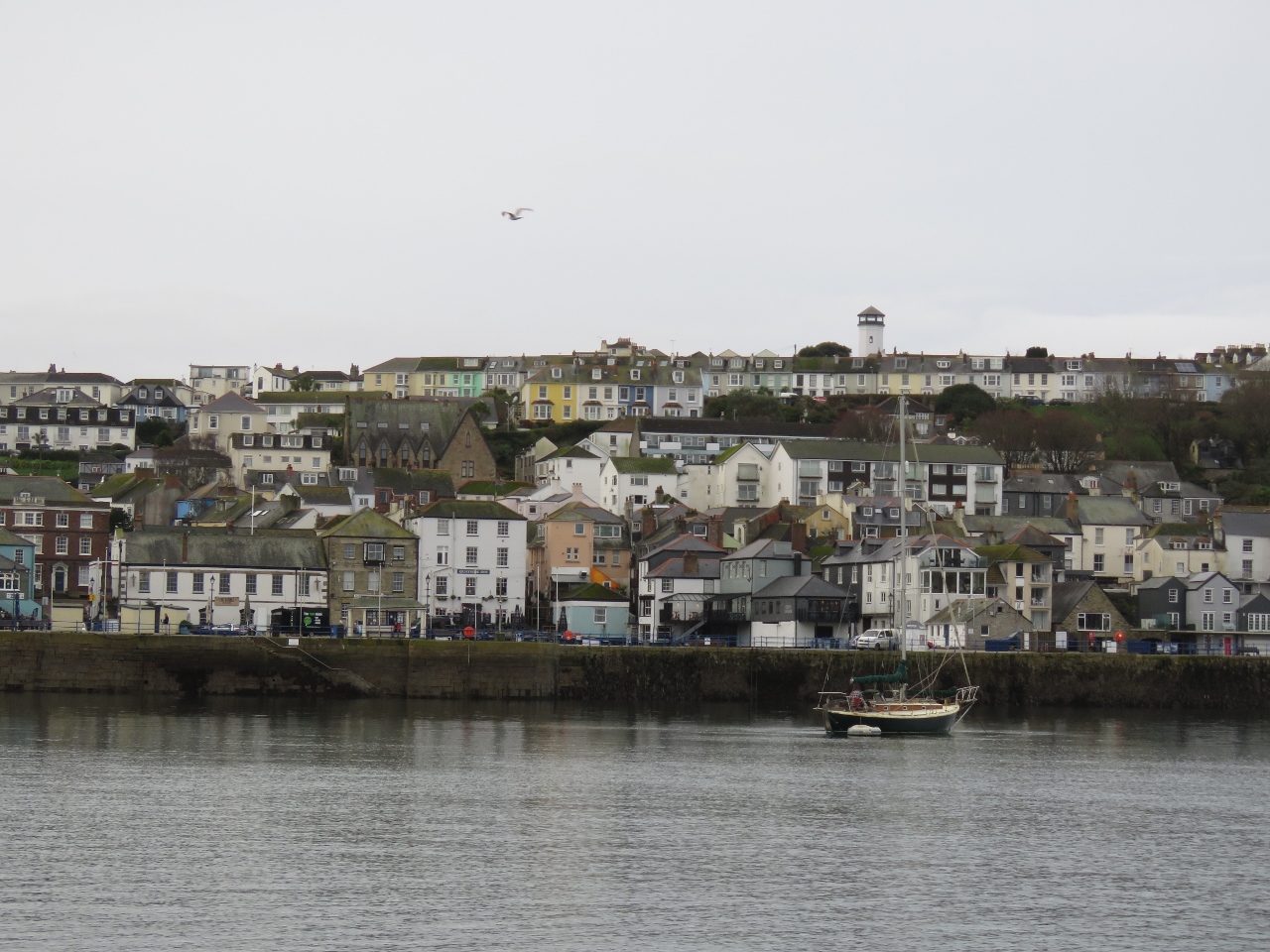 |
Falmouth
Position: -5 3.67, 50 9.28
The town of Falmouth is packed with buildings right up to the waterfront.
|
 |
First Smell
Position: -5 3.66, 50 9.14
Spitfire getting his first smell of Falmouth while eying the RFA Argus. He doesn’t like other boats getting too close.
|
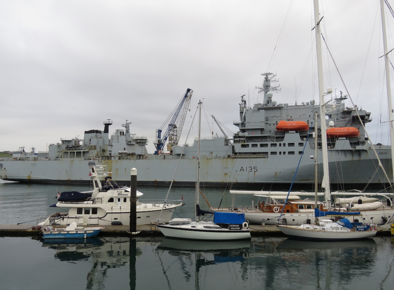 |
Port Pendennis Marina
Position: -5 3.66, 50 9.09
Our home for the next couple of weeks at Port Pendennis Marina with the RFA Argus beyond.
|

|
Click the travel log icon on the left to see these locations on a map, with the complete log of our cruise.
On the map page, clicking on a camera or text icon will display a picture and/or log entry for that location, and clicking on the smaller icons along the route will display latitude, longitude and other navigation data for that location. And a live map of our current route and most recent log entries always is available at http://mvdirona.com/maps. |
If your comment doesn't show up right away, send us email and we'll dredge it out of the spam filter.