We’d been monitoring our fuel levels with the hopes of waiting until we return to Ireland in November to refuel since the prices are better there. We succeeded, and arrived at Dun Laoghaire with only 310 total gallons (1,178L) of fuel on board and needing 1,438 gallons (5,443L). Dun Laoghaire Marina has an easy-to-use fuel dock, but they only stock 1,000L. So we fueled by truck at the commercial pier, which gave us better pricing as well.
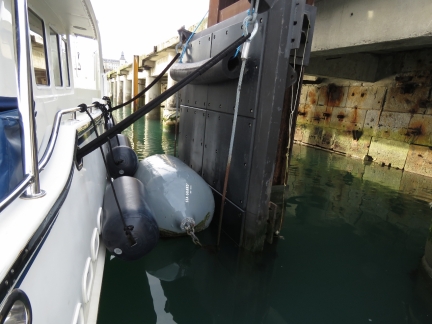
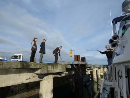
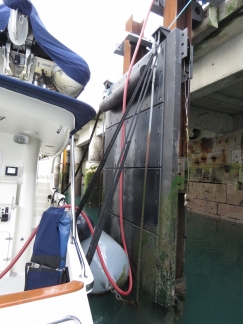
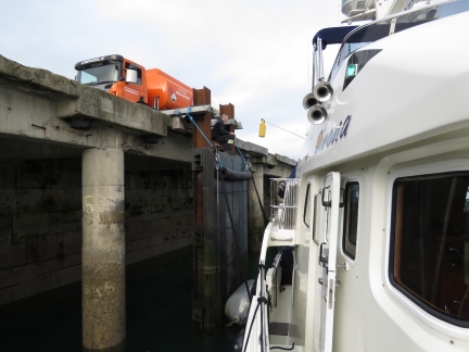
The pier is designed for multi-hundred foot vessels, so we ended up tying against one of the large ship fenders and made do. We couldn’t easily get on or off the boat there, so when immigration arrived while we were fueling to stamp our passports, we passed them across in a drybag with a boat hook and used the same approach to pay for the fuel.
Below are trip highlights from November 15th in Dublin, Ireland. Click any image for a larger view, or click the position to view the location on a map. And a live map of our current route and most recent log entries always is available at http://mvdirona.com/maps
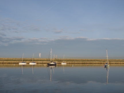 |
Calm
Position: -6 8.34, 53 17.97
A lovely calm morning looking toward the west pier inside Dun Laoghaire Harbour.
|
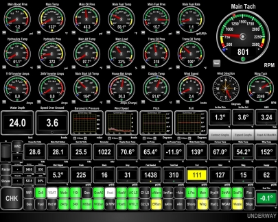 |
Time To Fuel
Position: -6 8.33, 53 17.98
The port-side tank is showing yellow to indicate we’ve got less than 125 gallons in that tank. The two indicators to the left show we’re down to only only 310 total gallons of fuel on board and will need 1,438 at the next fueling. We’ve been monitoring our fuel levels with the hopes of waiting until we return to Ireland to refuel since the prices are better there.
|
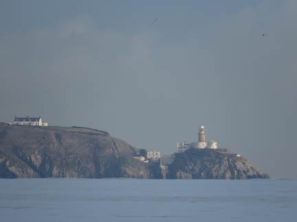 |
Baily Lighthouse
Position: -6 8.15, 53 17.98
We’re making a small run this morning over to Carlisle Pier to refuel. This is the Baily Lighthouse on Howth Head Peninsula, just visible across Dublin Bay through the Dun Laoghaire harbour piers.
|
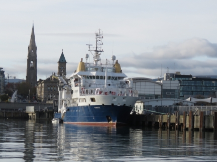 |
ILV Granuaile
Position: -6 7.81, 53 17.91
We watched the Irish Lights Vessel Granuaile arrive at St. Michael’s pier this morning. Irish Lights headquarters is at the harbour in Dun Laoghaire.
|
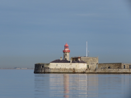 |
East Pier
Position: -6 7.72, 53 17.86
The light on the end of east pier, viewed in calm conditions as we near Carlisle Pier.
|
 |
Carlisle Pier
Position: -6 7.79, 53 17.71
Docked at Carlisle Pier to take on fuel by truck. We arranged with the harbourmaster to use this pier, where fueling is allowed and the huses will reach, for a €100 bunkering fee. This is a large commercial pier, designed for multi-hundred foot vessels, so we ended up tying against one of the large ship fenders. With nobody to help with the lines, we tied on to whatever we could reach, which will work ok in these conditions but isn’t particularly secure.
Dun Laoghaire Marina does have an easy-to-use fuel dock, but they only stock 1,000L and we need 5,443L. So a truck is the only option and the pricing is better as well. |
 |
Immigration
Position: -6 7.79, 53 17.71
Before arriving into Ireland, we’d contacted Irish Customs, Immigration and Agriculture to enquire about bringing the boat, ourselves and Spitfire back into the country. Neither Customs nor Agriculture needed to inspect us, but Immigration would need to stamp our passport and said they’d be out today. They arrived this morning while we were waiting for the fuel truck. Fortunately they didn’t need to come on board, as it would be pretty challenging with our current docking arrangement. Instead we placed our passports in a small drybag and passed them across with a boat hook to get them stamped, giving us another 90 days in Ireland.
|
 |
Fueling
Position: -6 7.79, 53 17.71
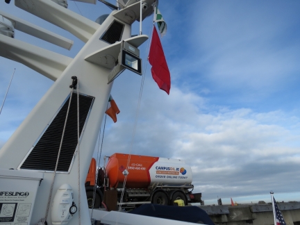
Fuel by truck from Campus Oil with a red flag flying to indicate we’re taking on dangerous cargo.
|
 |
Low Tide
Position: -6 7.79, 53 17.71
We had to adjust our lines several times during the fueling to accommodate the falling tide. In our short stop here to fuel, we’ll go down more than five feet.
|
 |
Payment
Position: -6 7.79, 53 17.71
We used our successful passport-stamping process to pass a credit card over to the Campus Oil driver to pay for the fuel. Overall we took on 5,459 liters (1,442 gal), only 16 liters (4 gal) more than we expected. Those Maretron FPM100 Fluid Pressure Monitors sure are accurate, as we discovered on our Indian Ocean crossing.
|

|
Click the travel log icon on the left to see these locations on a map, with the complete log of our cruise.
On the map page, clicking on a camera or text icon will display a picture and/or log entry for that location, and clicking on the smaller icons along the route will display latitude, longitude and other navigation data for that location. And a live map of our current route and most recent log entries always is available at http://mvdirona.com/maps. |

If your comment doesn't show up right away, send us email and we'll dredge it out of the spam filter.