We returned to the Republic of Ireland at Dublin after four months in the UK. Conditions on the overnight run from Liverpool were rougher than predicted, with winds blowing 30-40 kts on the bow and a maximum pitch of 21.9°. But the winds eventually settled down and we had calm weather for the last part of the run. Whenever we told someone we were heading to Dublin, they always replied that we would be able to get a proper pint of Guiness. We’re not sure if the Guiness was better, but it sure tasted good on arrival.
Below are trip highlights from November 10th and 11th en route to Dublin, Ireland. Click any image for a larger view, or click the position to view the location on a map. And a live map of our current route and most recent log entries always is available at http://mvdirona.com/maps
 |
Brunswick Lock
Position: -2 59.05, 53 23.22
Back in Brunswick Dock at high tide to make an overnight run from Liverpool to Dublin.
|
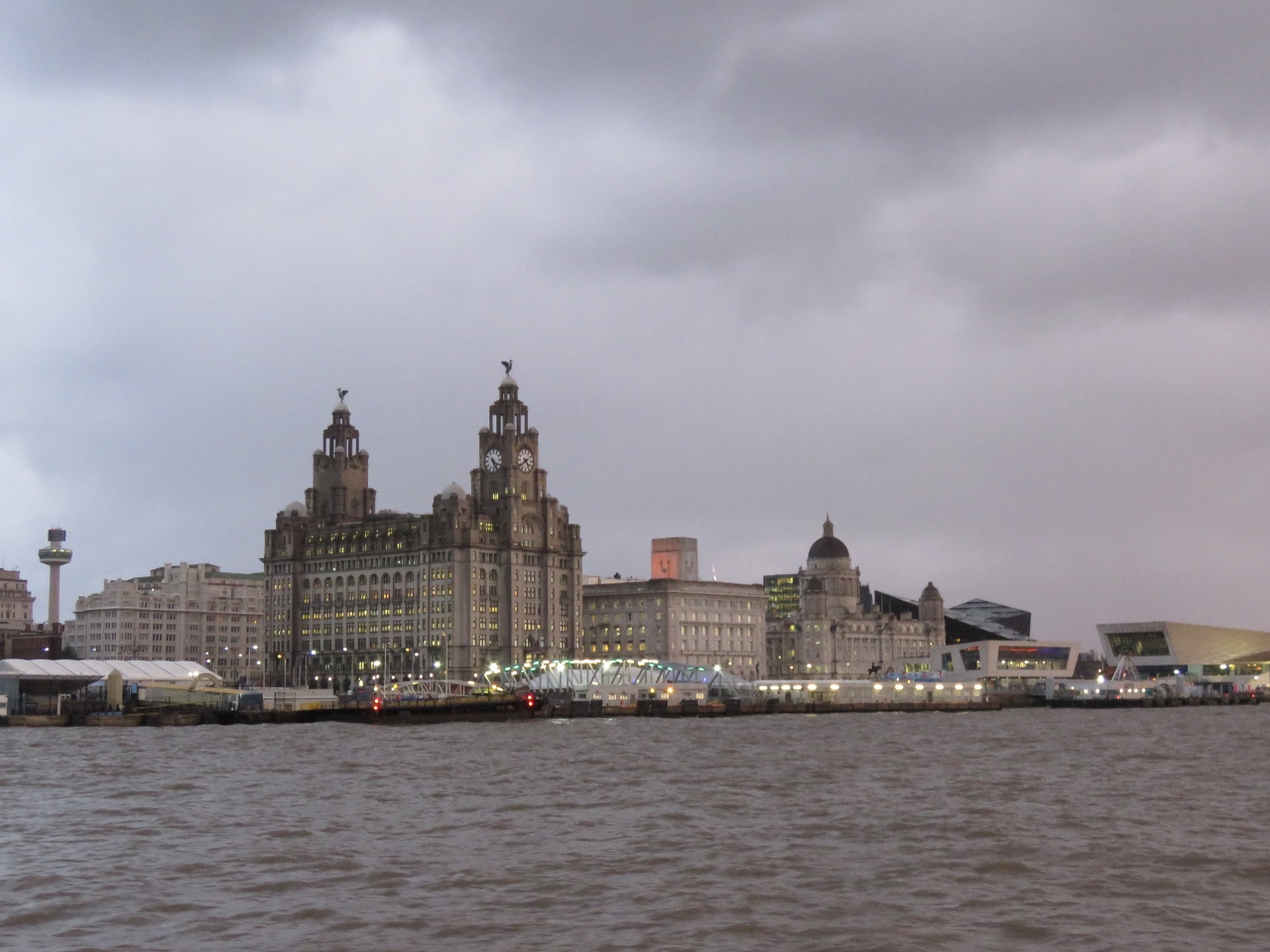 |
Liverpool
Position: -3 0.12, 53 24.18
One final look at the Three Graces in beautiful downtown Liverpool.
|
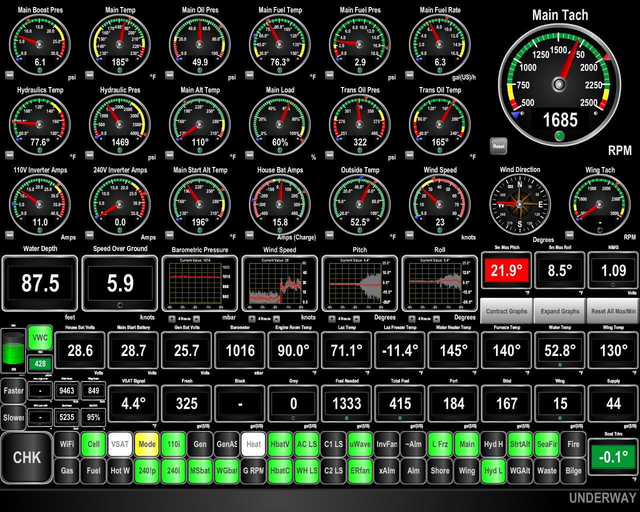 |
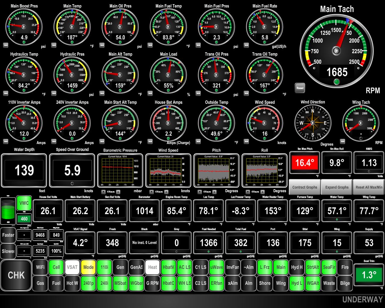
21.9°
Position: -3 8.71, 53 31.78
The forecast called for westerly winds in the 20s for the first couple of hours of our run to Dublin, then they should settle down to below 10 knots. But we’re seeing mostly 30 knots on the bow with gusts into the 40s. The current against the wind is generating steep, tight waves producing considerable boat motion with a maximum pitch of 21.9° in the past five minutes. We normally don’t mind a bit of boat motion, but we’ll be glad when this is over.
|
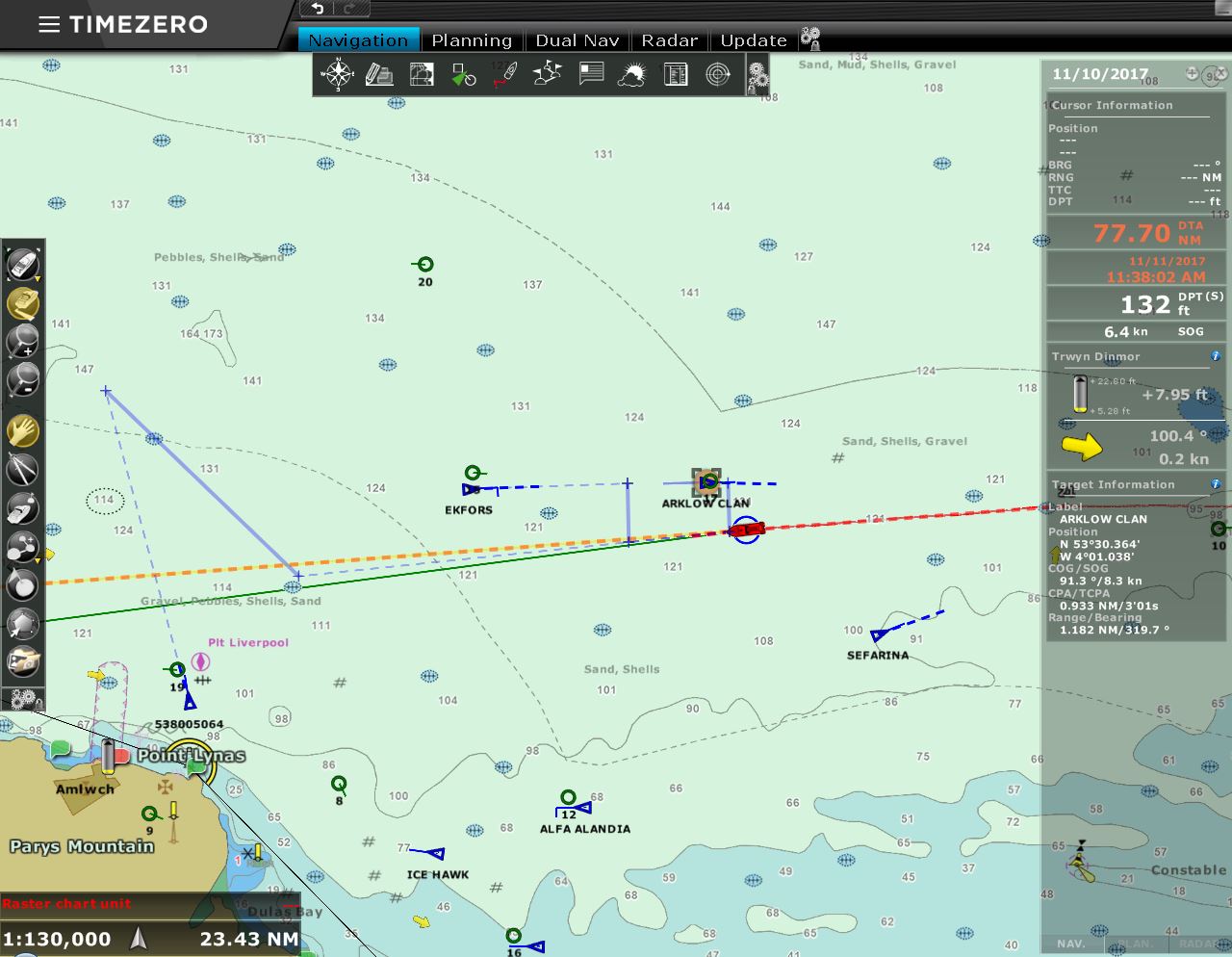 |
Traffic
Position: -3 59.63, 53 29.47
We’re about five hours out of Liverpool and conditions remain rougher than predicted and the traffic in and out of the busy Liverpool port is heavy.
|
 |
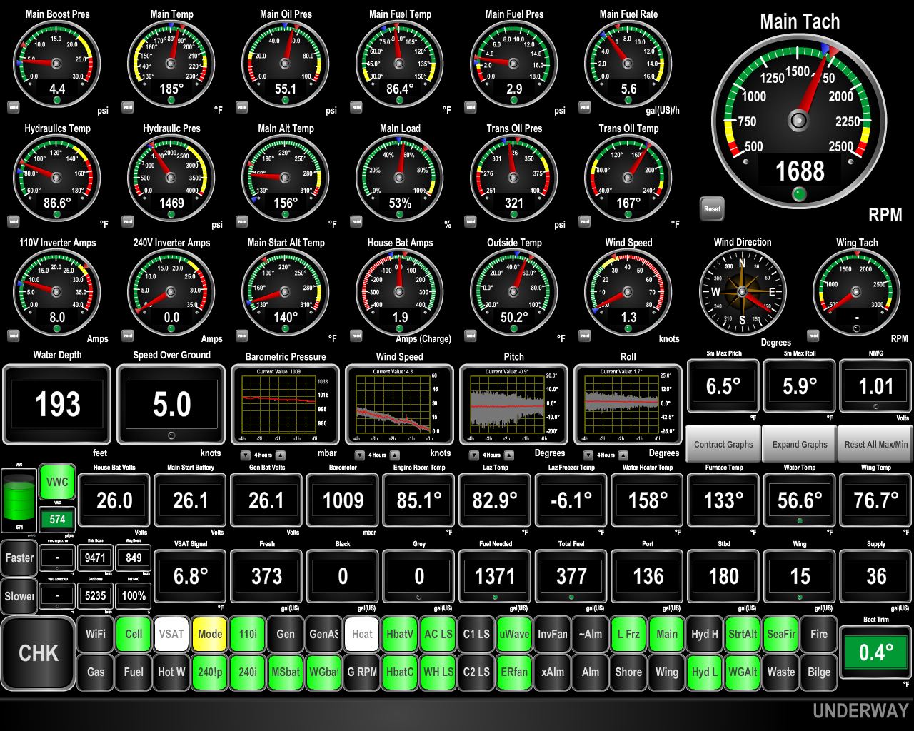
16.4°
Position: -4 2.10, 53 29.38
The winds are falling and conditions have improved relative to what they were earlier. We’re still pitching 16 degrees, but that should settle down soon.
|
 |
Calm
Position: -4 28.68, 53 28.74
We’re now seeing the calm conditions we were expecting for most of this trip. The winds are now less than 5 knots and pitch and roll are down to around 6 degrees each and falling. The rest of the run to Dublin should be enjoyable.
|
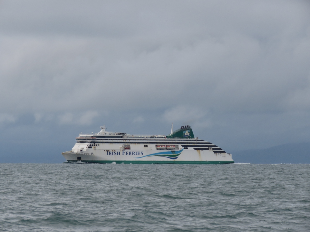 |
Ulysses
Position: -5 47.90, 53 20.21
Traffic dropped off as we left the Welsh coast, but has picked up again as we approach Dublin. This is the Irish Ferry Ulysses heading to the capital from Holyhead in North Wales.
|
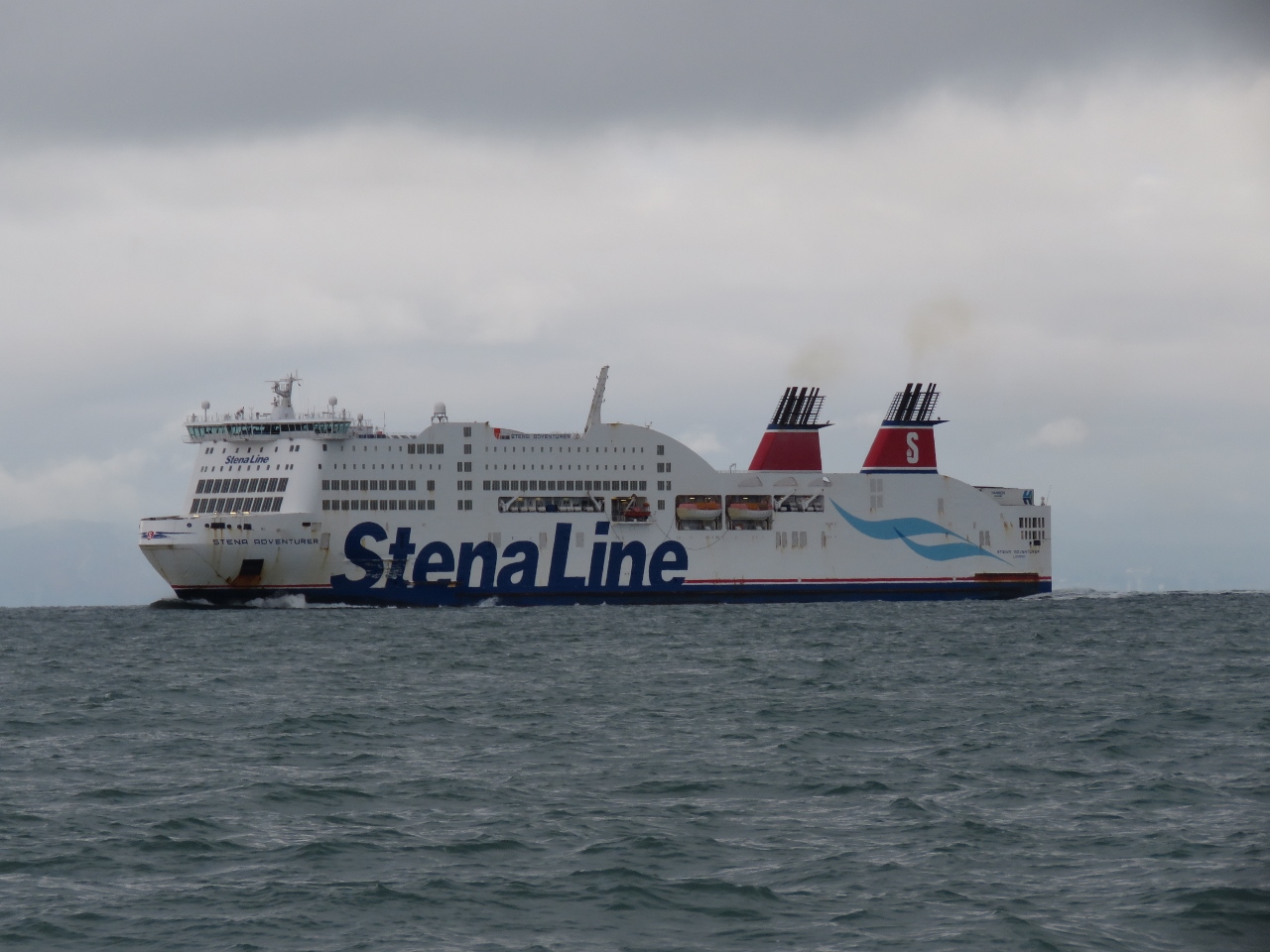 |
Stena Adventurer
Position: -5 50.42, 53 19.90
The Stena Adventurer, also en route to Dublin from Holyhead, North Wales.
|
 |
Kish Bank
Position: -5 55.14, 53 19.32
The distinctive 100 ft (30 m) lighthouse at Kish Bank was installed in 1965. The hat-like top is a helicopter landing pad.
|
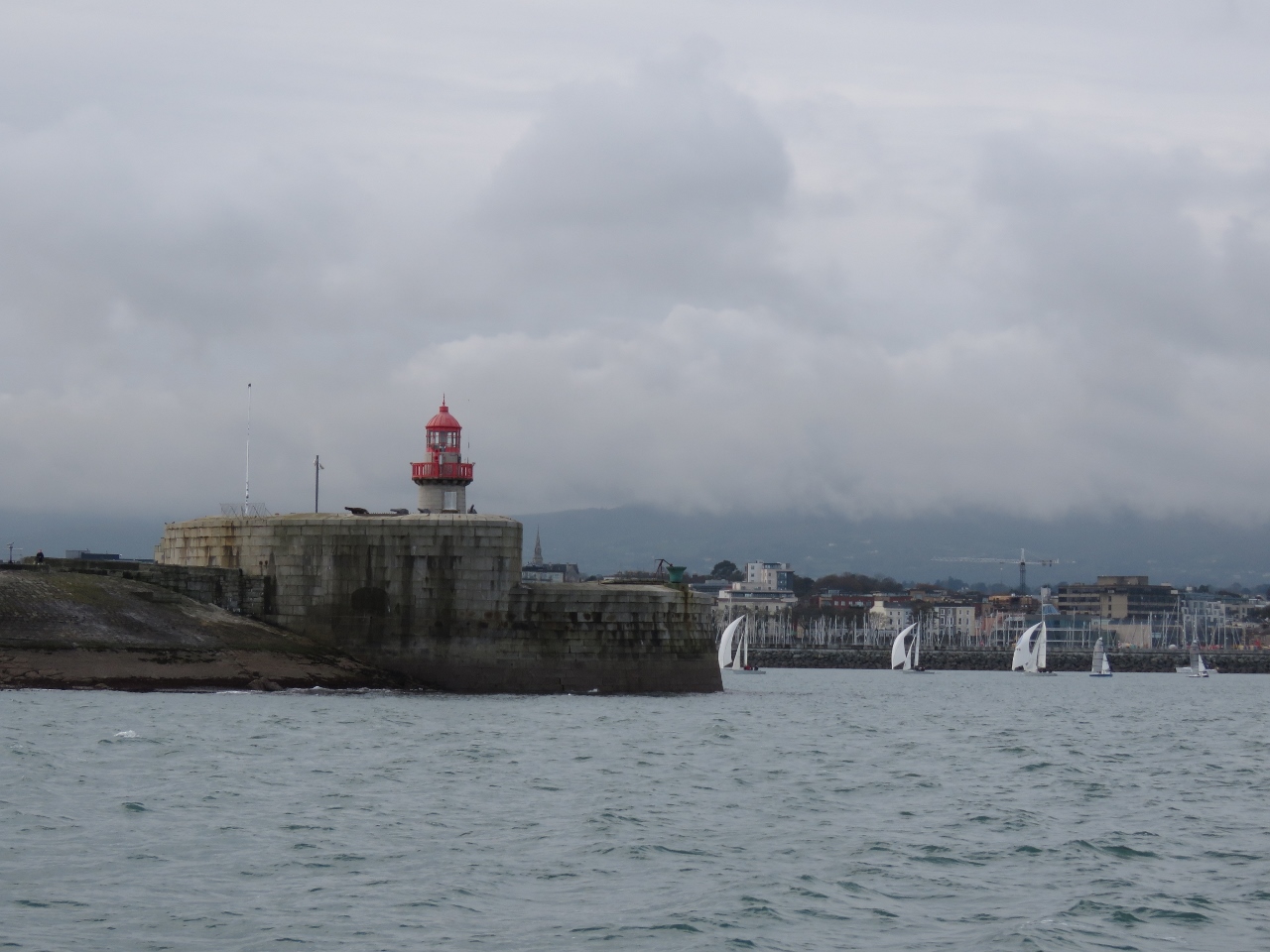 |
East Pier
Position: -6 7.08, 53 18.18
Two massive piers, built in the early 1800s, create a huge 250-acre (101-hectare) sheltered harbour at Dun Laoghaire (pronounced Dun Leary). This is looking past the east pier light to a group of boats sailing inside the harbour walls.
|
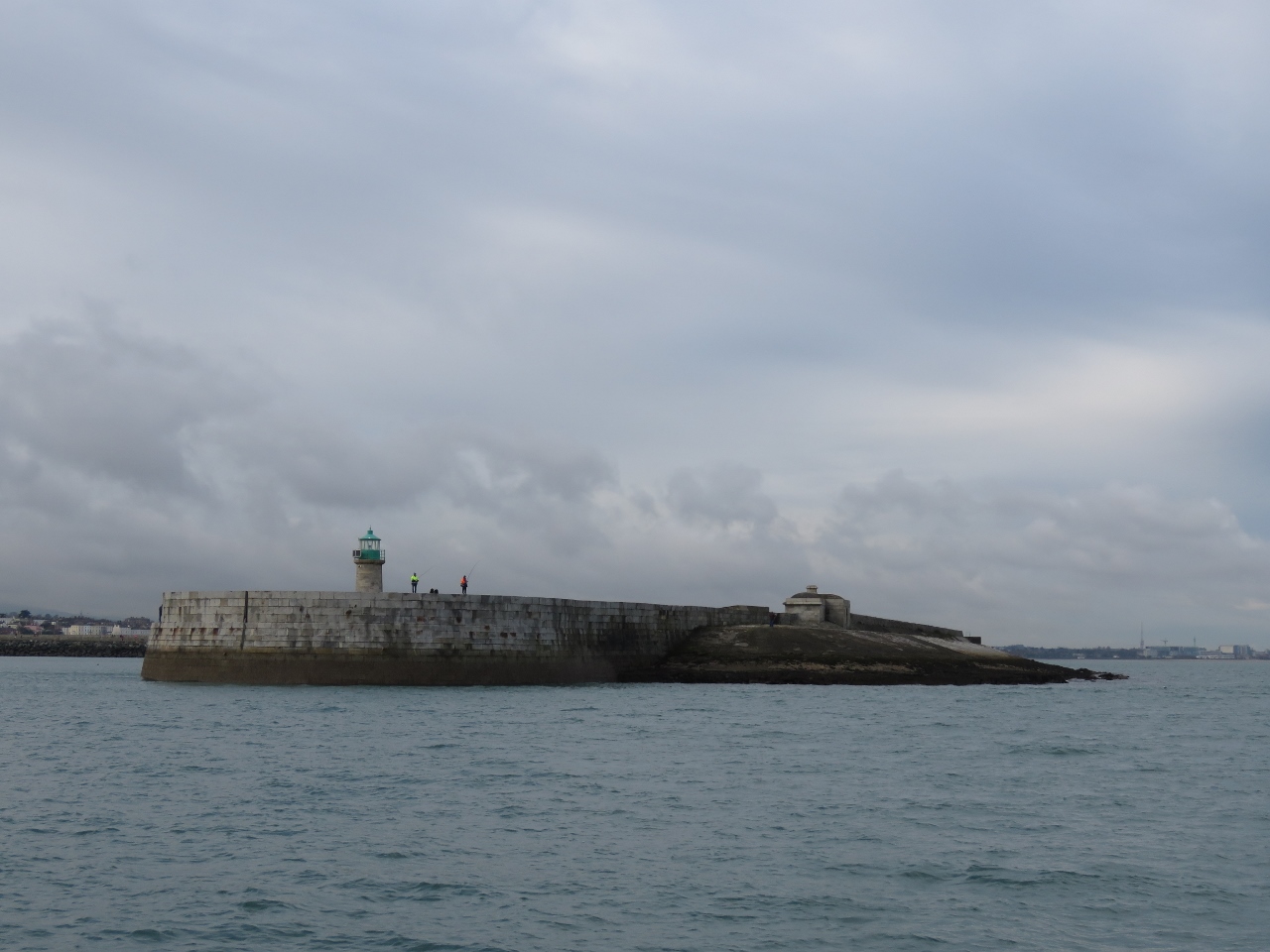 |
West Pier
Position: -6 7.29, 53 18.23
Fishers beside the Dun Laoghaire west pier light give a feel for how high the wall is (click image for larger view).
|
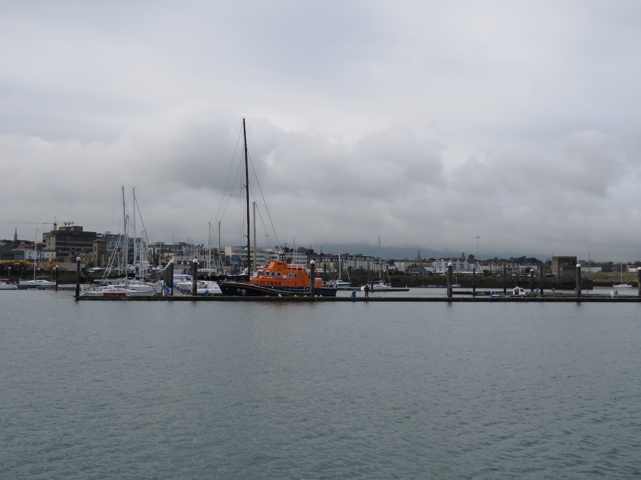 |
Dun Laoghaire Marina
Position: -6 8.07, 53 18.00
Dun Laoghaire Marina, our destination, is a large 820-boat marina behind a second set of breakwaters within the protected harbour. Although the marina is outside Dublin proper, it has convenient train access to the city with a large number of shops and restaurants close by in Dun Laoghaire.
|
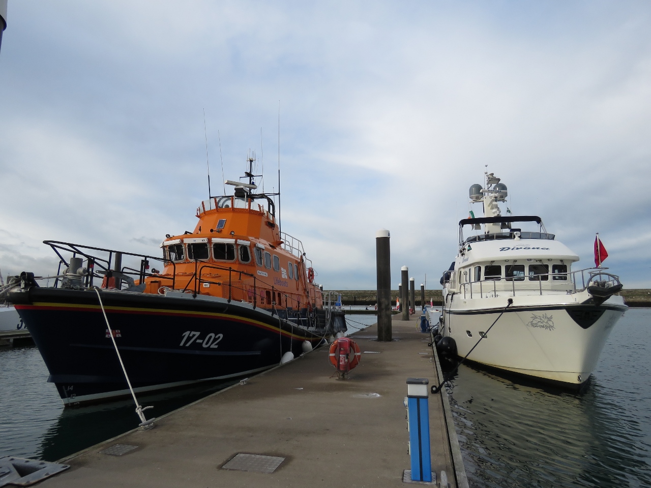 |
Fast Friends
Position: -6 8.33, 53 17.96
We’re once again moored beside an RNLI boat. This is at least the third time, the last of which was beside the RNLB Macquarie at Inverness.
|
|
|
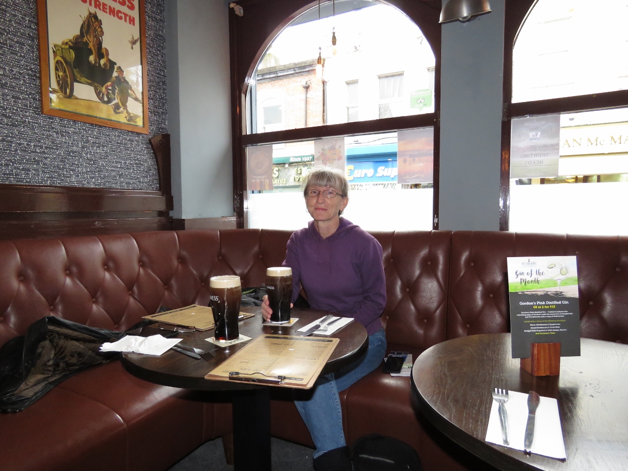
The Lighthouse
Position: -6 8.25, 53 17.57
At The Lighthouse pub in Dun Laoghaire for lunch and a welcome pint of Guiness after our overnight run from Liverpool. Whenever we told someone we were heading to Dublin, they always replied that we would be able to get a proper pint of Guiness. We’re not sure if the Guiness was better here, but it sure tasted good.
|

|
Click the travel log icon on the left to see these locations on a map, with the complete log of our cruise.
On the map page, clicking on a camera or text icon will display a picture and/or log entry for that location, and clicking on the smaller icons along the route will display latitude, longitude and other navigation data for that location. And a live map of our current route and most recent log entries always is available at http://mvdirona.com/maps. |
If your comment doesn't show up right away, send us email and we'll dredge it out of the spam filter.