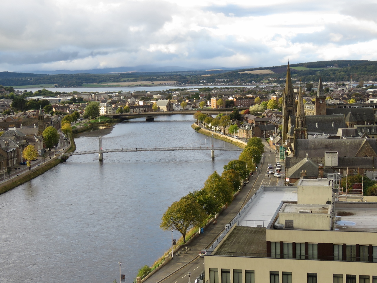
Inverness, founded around the 12th century, is the capital city of the Scottish Highlands and a gateway to the Caledonian Canal. We arrived after an easy three-hour run from Cromarty Firth, and spent a great afternoon exploring this historic town along the River Ness.
Below are highlights from October 7th, 2018 in northern Scotland. Click any image for a larger view, or click the position to view the location on a map. And a live map of our current route and most recent log entries always is available at http://mvdirona.com/maps
 |
Troms Castor
Position: -4 2.99, 57 40.85
Offshore supply vessel Troms Castor, of Tromso, Norway, departing Cromarty Firth this morning beyond the two jack-up oil rigs. Tromso is at the northern tip of mainland Norway‐we hope to visit next summer when we cruise Norway.
|
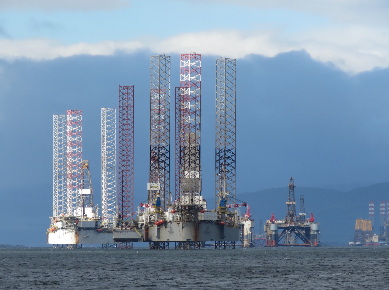 |
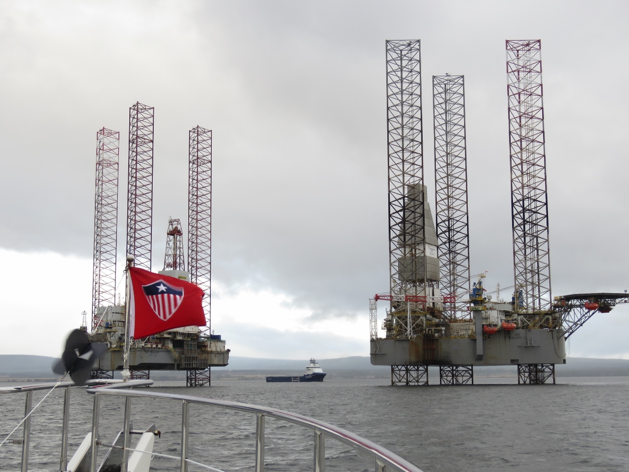
Oil Rig Graveyard
Position: -4 0.16, 57 41.17
A last look to the Cromarty Firth oil rig graveyard as we depart.
|
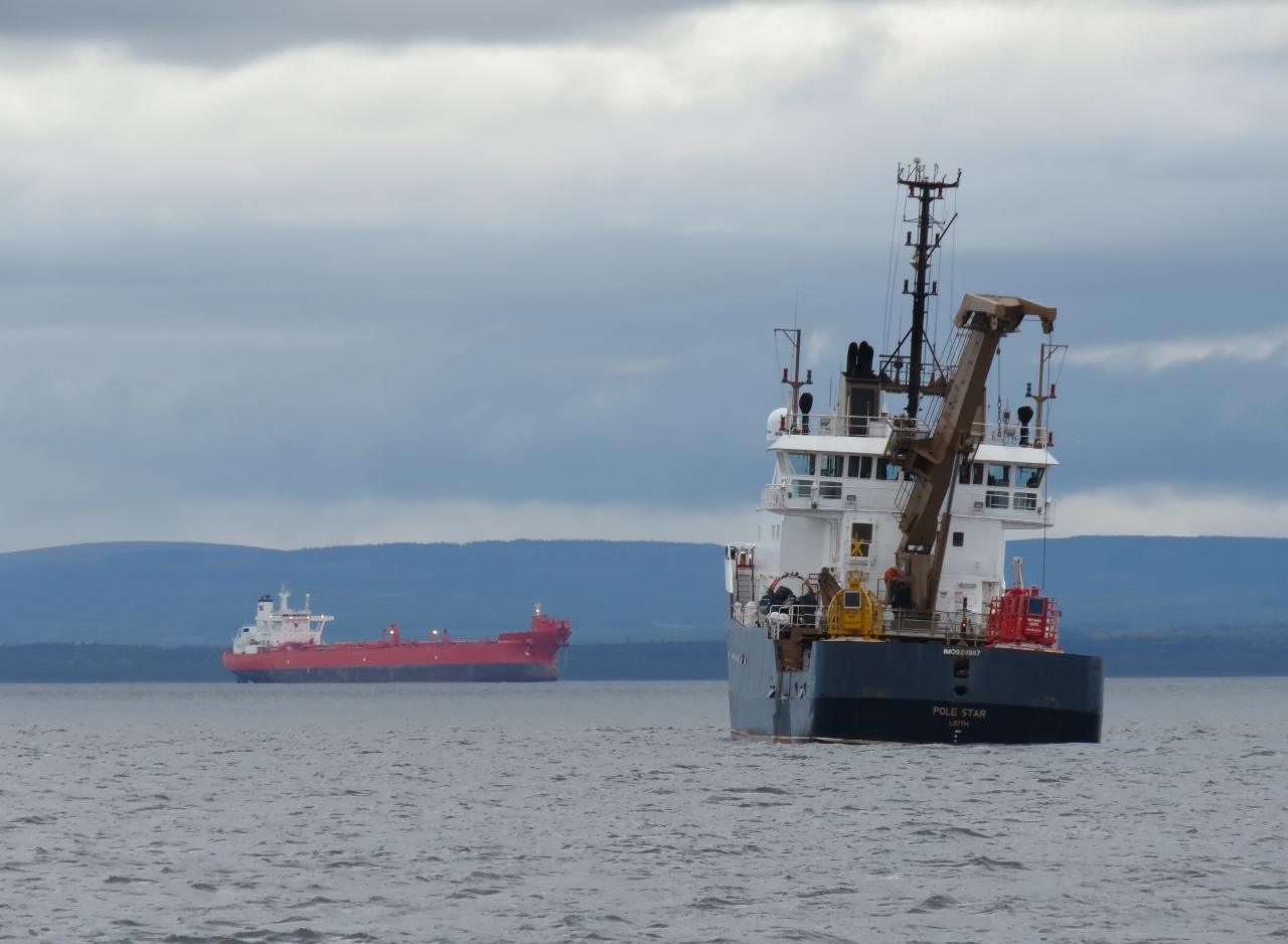 |
Pole Star
Position: -3 59.97, 57 41.16
Buoy tender Pole Star of Leith working off Cromarty Firth.
|
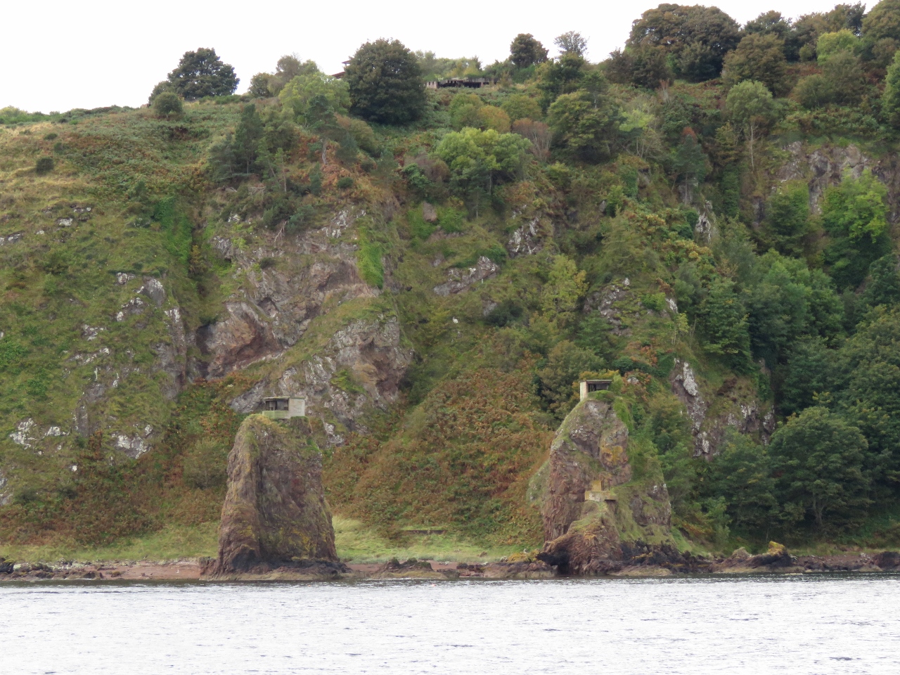 |
South Sutor
Position: -3 59.17, 57 40.77
Cromarty Firth was a naval base during both World Wars. Coastal fortifications and gun emplacements are on both sides of the opposing headlands, called the Sutors, that guard the entrance. This is looking to South Sutor where two lookouts are visible on the pinnacle hills.
|
 |
Chanonry Point
Position: -4 5.22, 57 34.51
Chanonry Point is the best land-based place in Scotland to spot dolphins, who come to feed when the tide turns. We passed through the narrows about three hours before high water at Inverness on a flooding spring tide and the water surface was smooth. Apparently conditions can get rough here with a large wind and/or swell against an ebbing current.
|
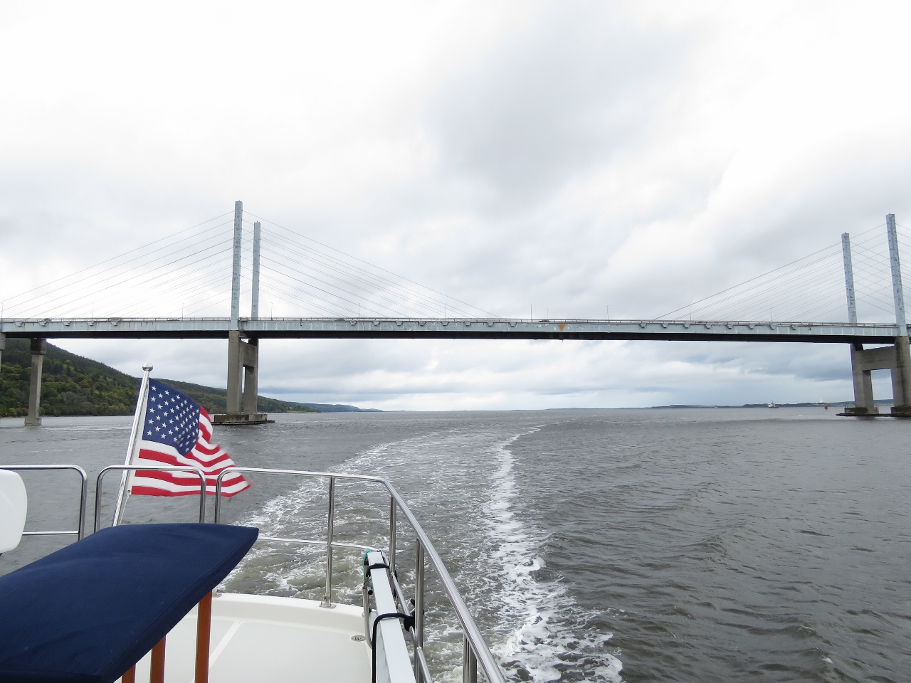 |
Kessock Narrows
Position: -4 14.03, 57 29.88
Currents in Kessock Narrows can run up to 6 knots on spring tides. Today is a spring tide, so we timed our passage through the narrows for about an hour before high water at Inverness and felt little current. The Kessock Bridge was built in 1982 to withstand winds of up to 86 kts and tidal currents of up to 8 knots and is the only cable-stay bridge in Britain.
|
 |
Entrance Channel
Position: -4 14.11, 57 29.65
Entering the Inverness Marina along the River Ness. We’ll enter between the red mark on the left and the pier on the right. A slight but constant ebb current flows out of the river, so we’ll bias to the starboard side on entry to keep from being swept over to the port side.
|
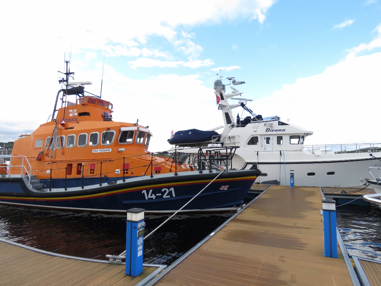 |
RNLB Macquarie
Position: -4 14.04, 57 29.67
Once again we’re moored next to an RNLI lifeboat, this one the 14-meter Macquarie.
|
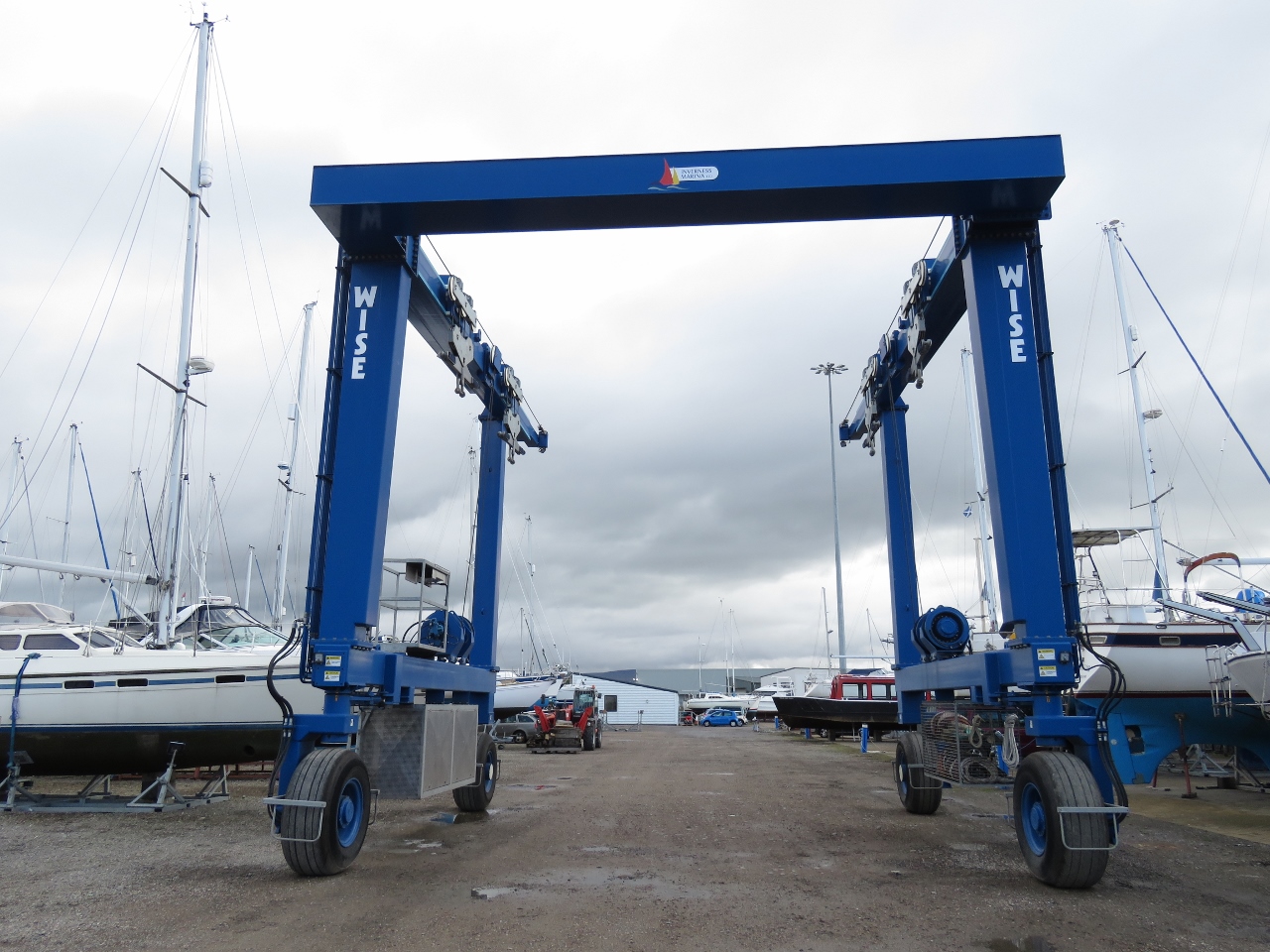 |
Boat Hoist
Position: -4 14.06, 57 29.61
Inverness Marina has a 75-ton hoist. They could lift 50-ton Dirona with lots of safety margin.
|
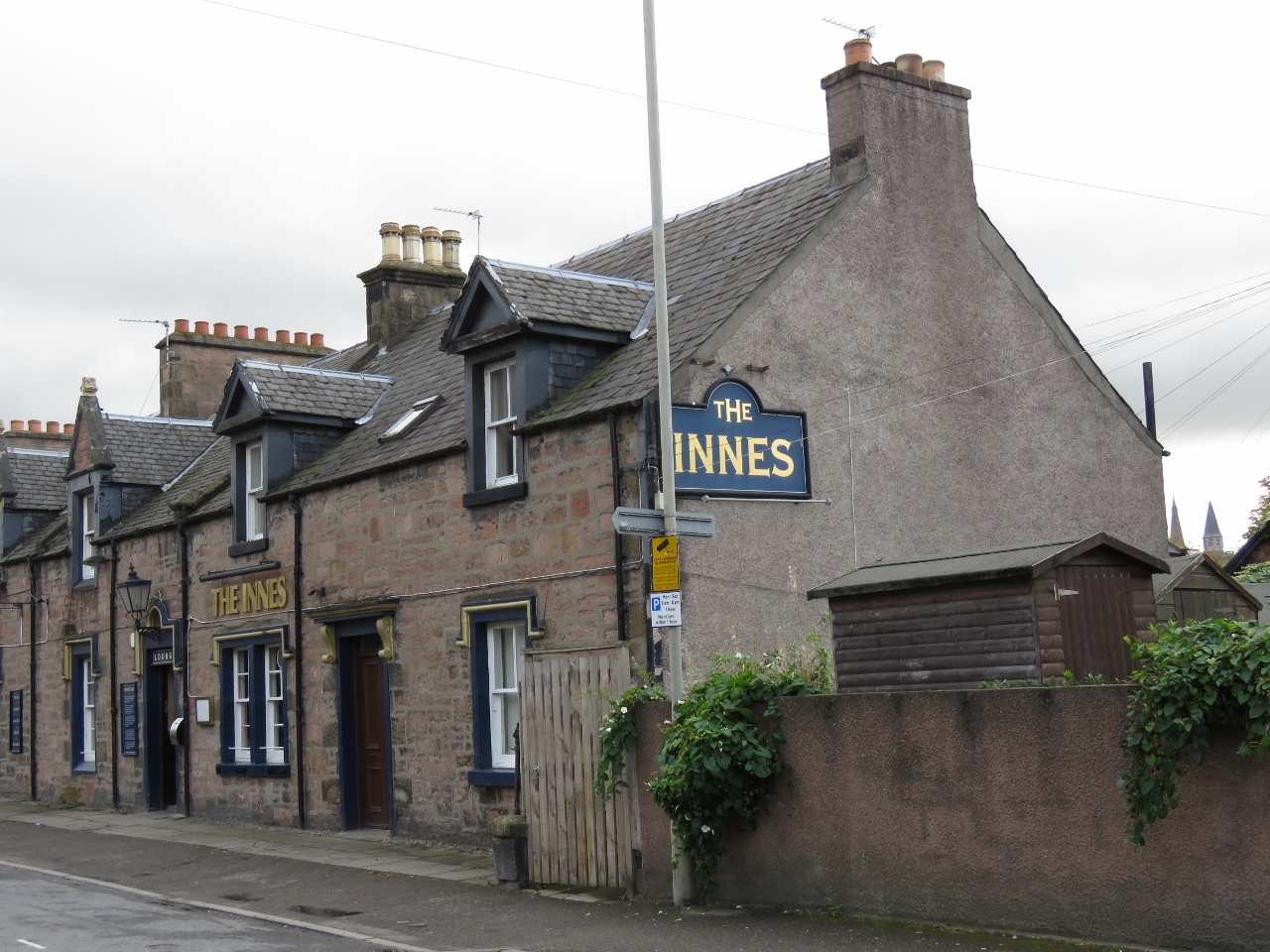 |
The Innes
Position: -4 13.77, 57 29.01
We passed the local pub, The Innes, on a walk into town. We tried to stop in for a drink later that evening on the way home, but it was completely packed with locals.
|
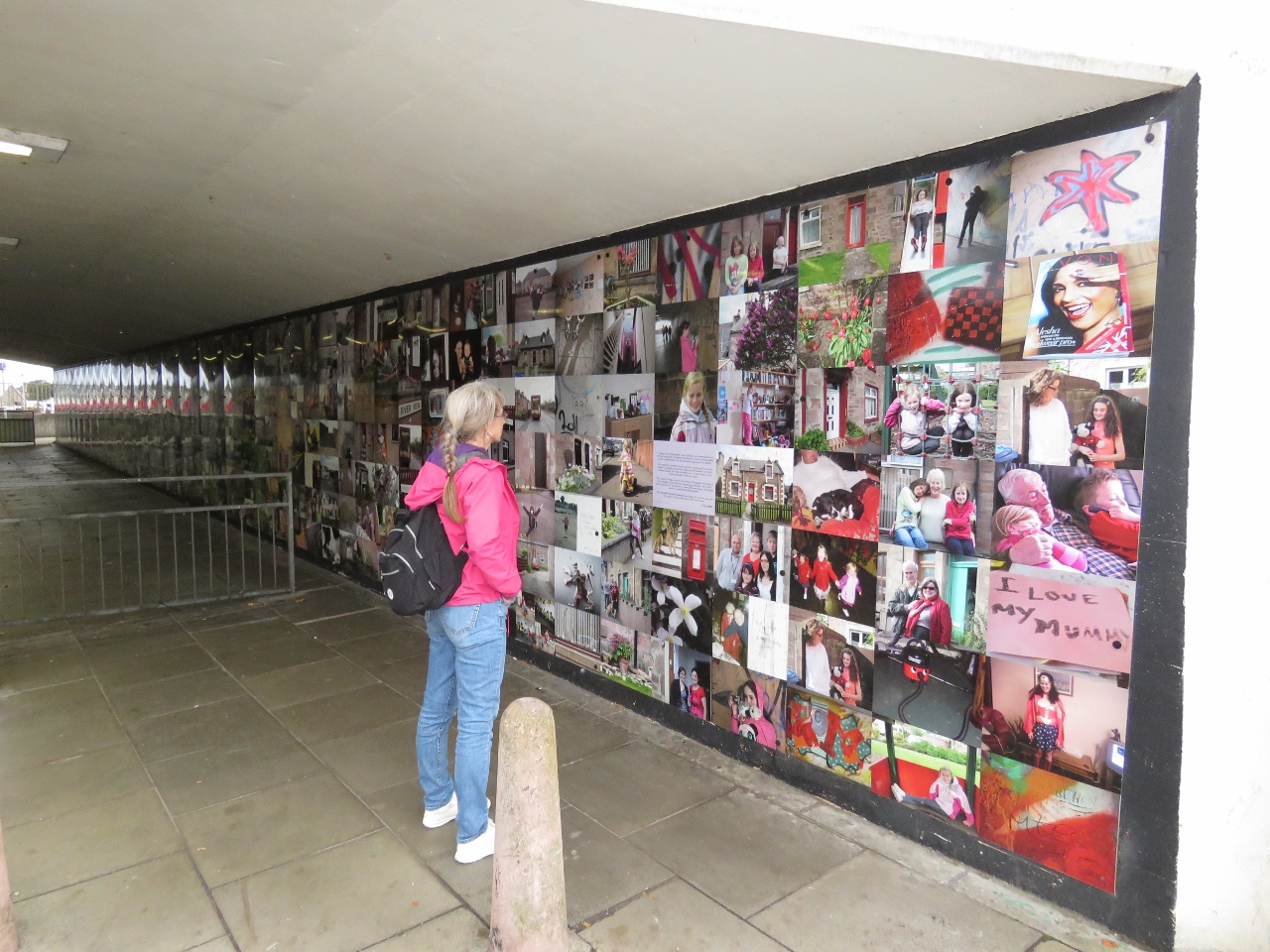 |
Underpass
Position: -4 13.56, 57 28.94
A simple pedestrian underpass has been transformed into a work of art with a photographic mural of local people and sights. What an excellent idea.
|
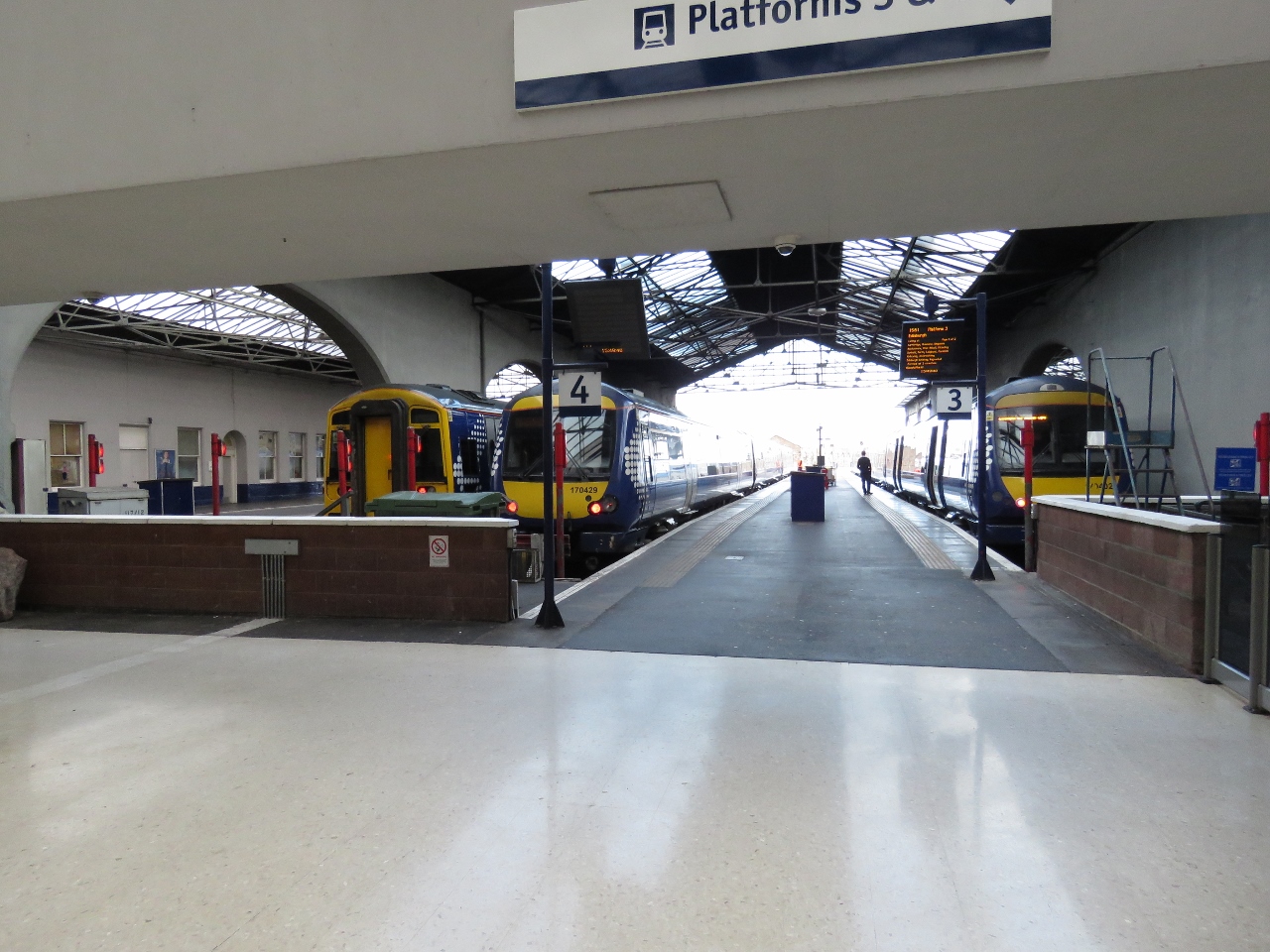 |
Train Station
Position: -4 13.42, 57 28.78
The Inverness train station. We’ll be taking a train in a couple of days to Kyle of Lochalsh.
|
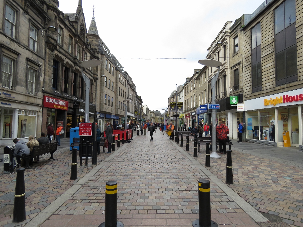 |
High Street
Position: -4 13.50, 57 28.65
Pedestrian mall along High Street in downtown Inverness.
|
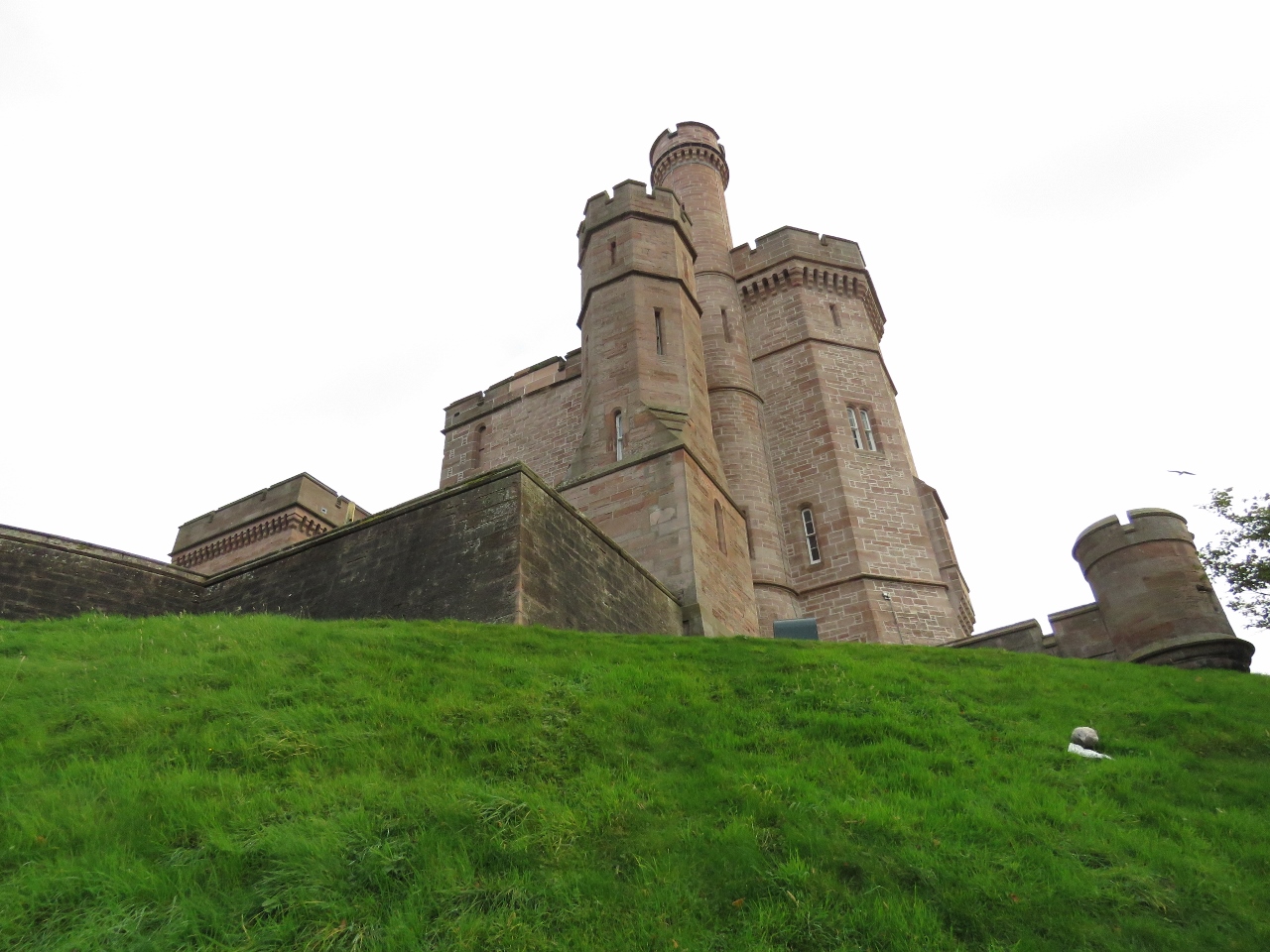 |
Inverness Castle
Position: -4 13.54, 57 28.61
Looking up to Inverness Castle from an adjacent walkway. It is believed the first fortification on the site was built in the 11th century during the reign of Malcolm 3rd. Bonnie Prince Charlie’s army destroyed the castle there in 1745 and it lay in ruins until the present castle was built in 1834.
|
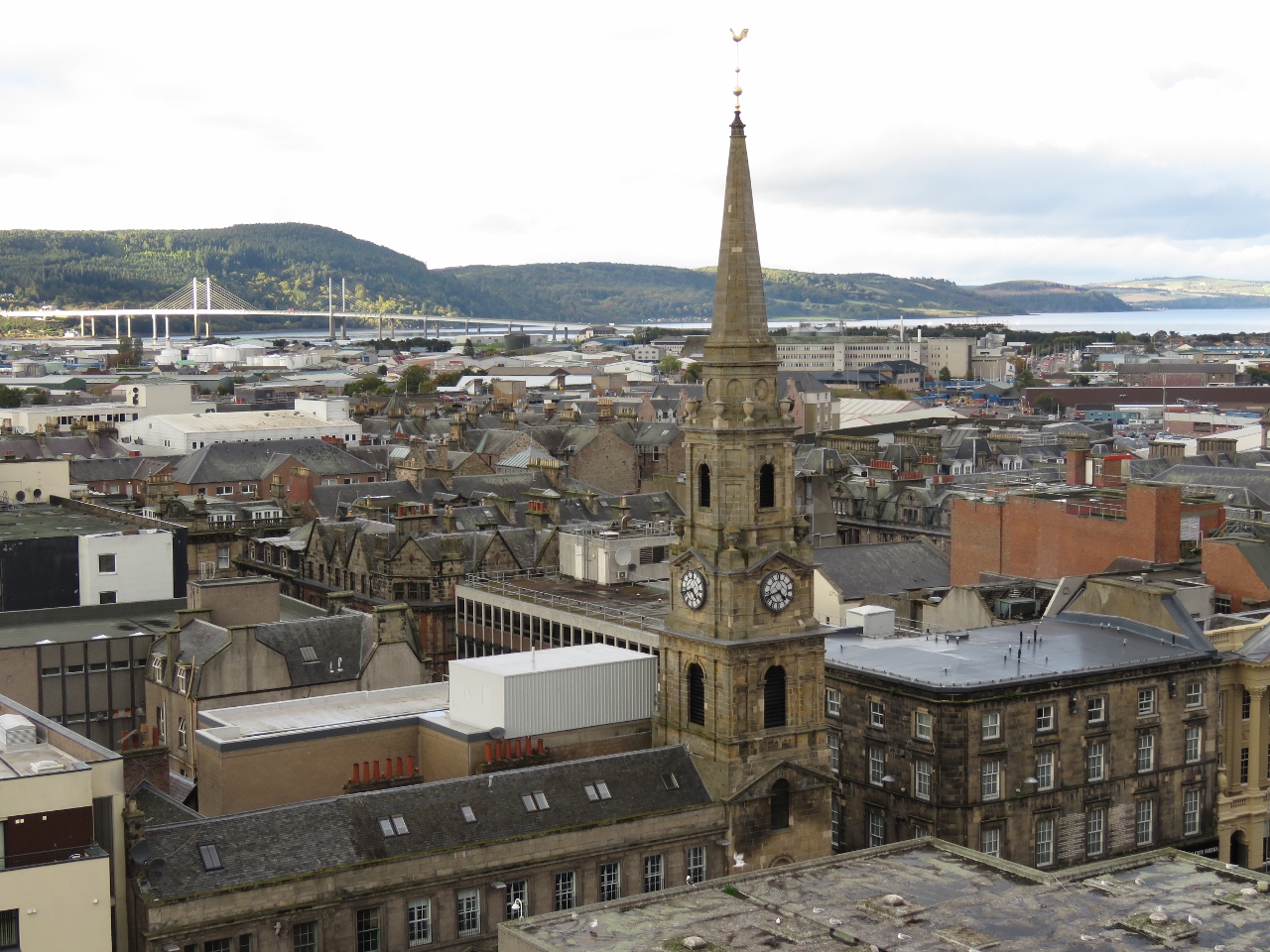 |
Tolbooth Steeple
Position: -4 13.54, 57 28.60
Tolbooth Steeple viewed from the top of Inverness Castle. The steeple was erected in 1791 next to the Old Court House and jail. Kessock Bridge is visible in the distance, and the Inverness Marina is just out of the shot to the left of the photo.
|
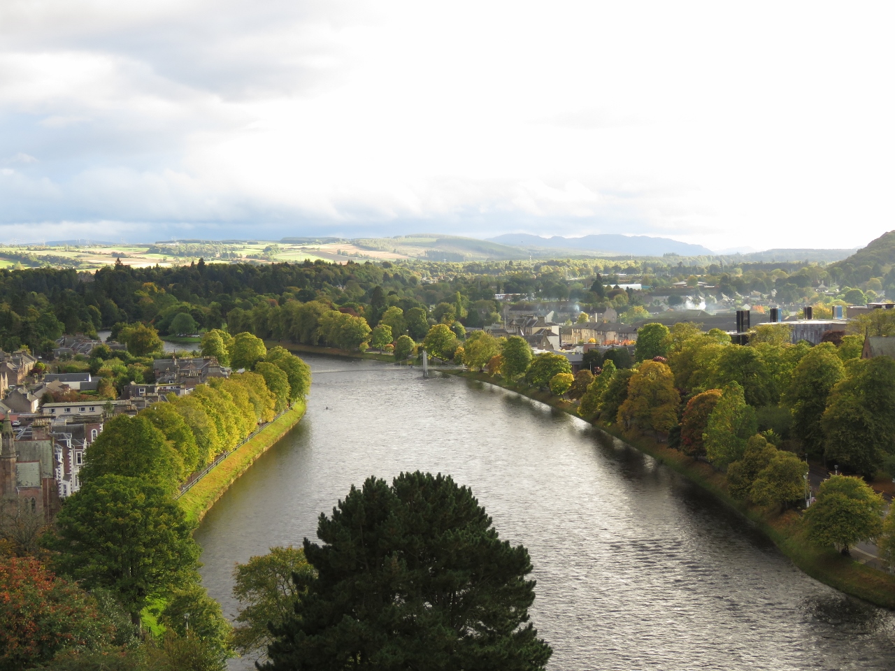 |
River South View
Position: -4 13.54, 57 28.60
Looking south along the River Ness from the top of Inverness Castle. The Caledonian Canal runs parallel to the River Ness and is just on the other side of the partially visible hill at the far right of the picture.
|
|
|
River North View
Position: -4 13.55, 57 28.60
The view north along the River Ness from the top of Inverness Castle. The spire on the right is St. Columbo’s High Church, built in 1852. The Inverness Marina and Kessock Bridge are just out of the picture at top right.
|
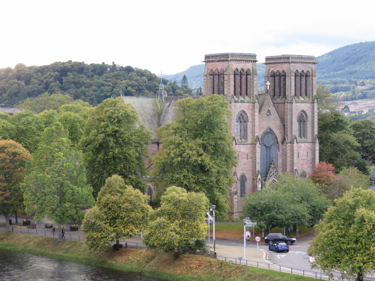 |
Inverness Cathedral
Position: -4 13.54, 57 28.55
Inverness Cathedral, completed in 1869, near Inverness Castle across the River Ness.
|
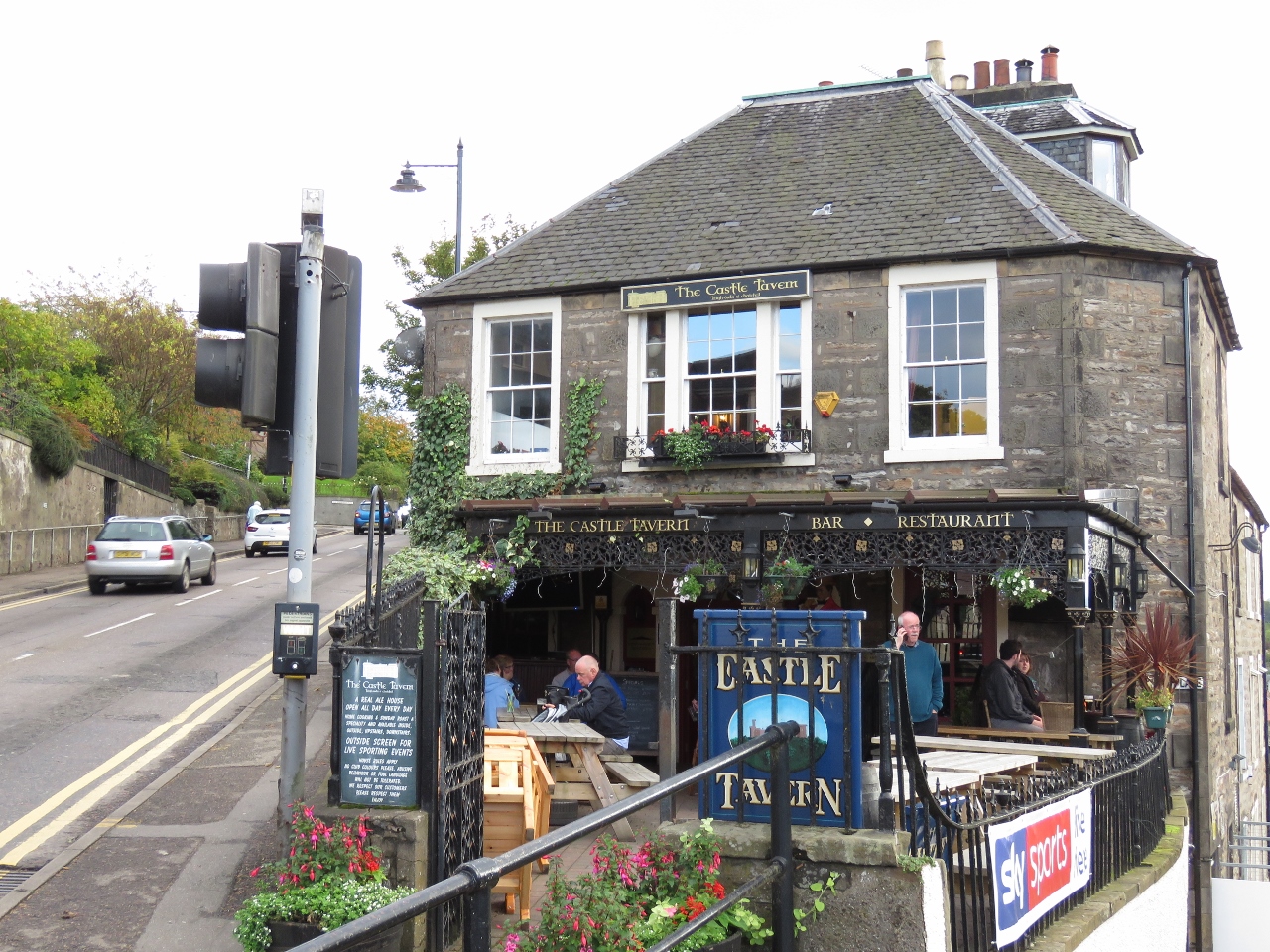 |
Castle Tavern
Position: -4 13.52, 57 28.52
The Castle Tavern, near Inverness Castle, advertises themselves as “A real ale house—Open every day—Home cooking & Sunday roast a specialty and available inside, outside, upstairs, downstairs”. We’ll definitely be back.
|
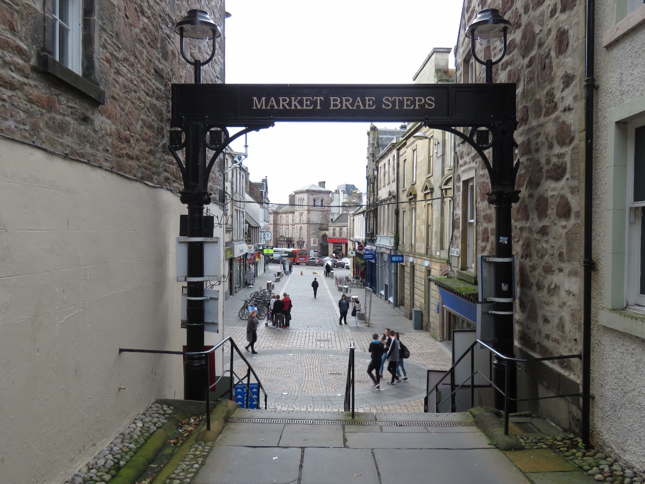 |
Market Brae Steps
Position: -4 13.35, 57 28.67
Looking out to Inglis Street from the bottom of Market Brae Steps.
|
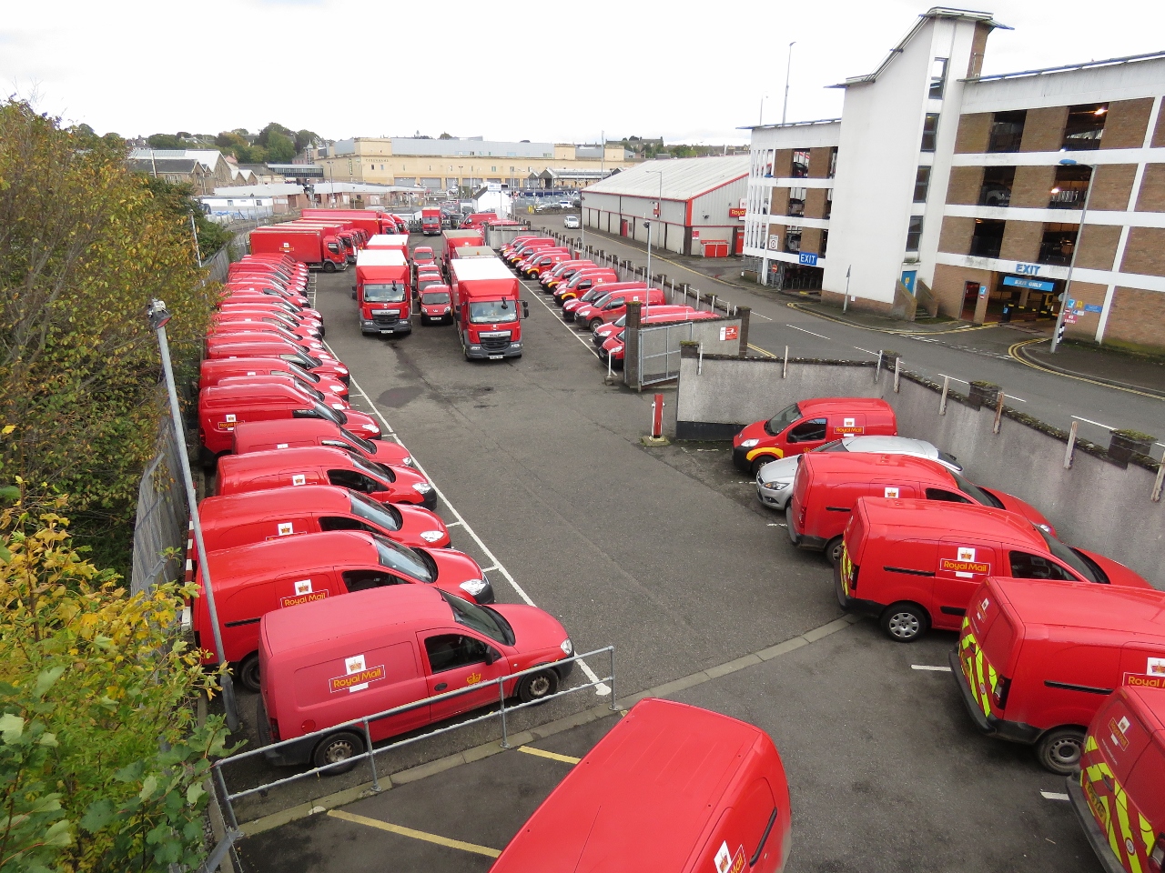 |
Royal Mail
Position: -4 13.47, 57 28.94
We see the bright red Royal Mail vehicles all over Britain. Here’s a large group, ready for the start of the next work day.
|
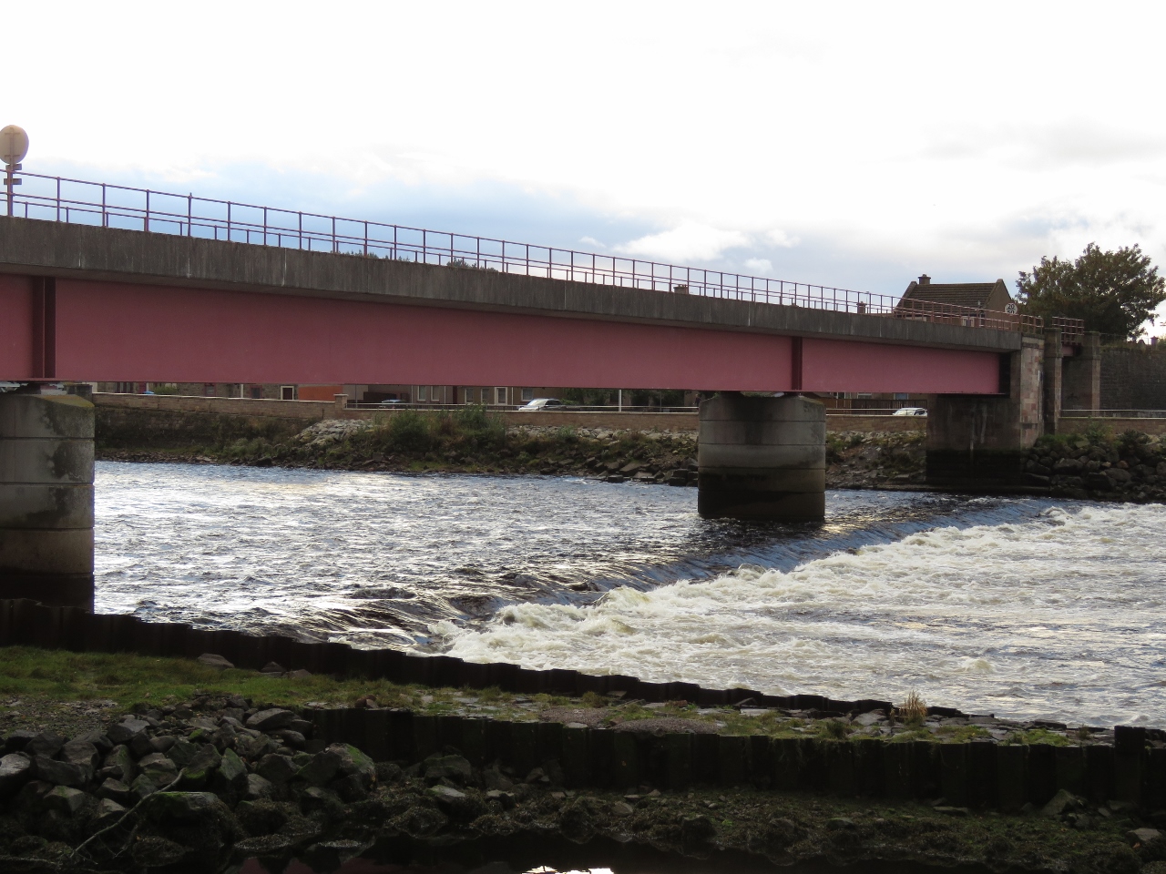 |
Strong Current
Position: -4 13.80, 57 29.06
Strong currents flowing out of the River Ness.
|
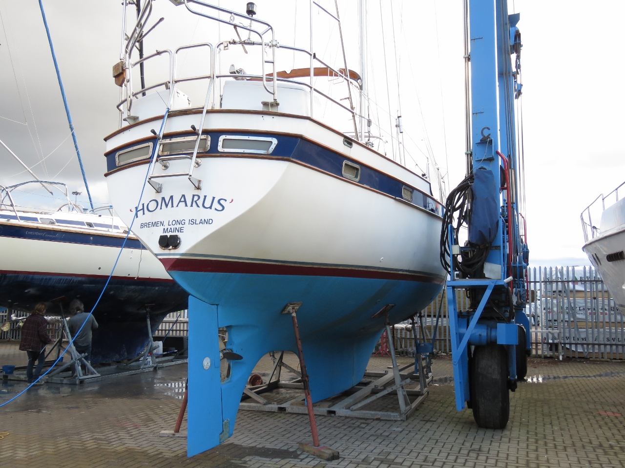 |
Homarus
Position: -4 14.06, 57 29.60
Homarus of Bremen, Long Island, Maine is only the second US-flagged boat we’ve since since arriving in Europe in May of this year. The first was Nordhavn 55 Odyssey. Vast numbers of US-flagged vessels are in the Mediterranean but not that many are in this area.
|
 |
First Smell
Position: -4 14.06, 57 29.67
Spitfire getting his first smell of Inverness. We’ve been telling him Nessie stories and he’s been worriedly studying the water since we arrived.
|

|
Click the travel log icon on the left to see these locations on a map, with the complete log of our cruise.
On the map page, clicking on a camera or text icon will display a picture and/or log entry for that location, and clicking on the smaller icons along the route will display latitude, longitude and other navigation data for that location. And a live map of our current route and most recent log entries always is available at http://mvdirona.com/maps. |
If your comment doesn't show up right away, send us email and we'll dredge it out of the spam filter.