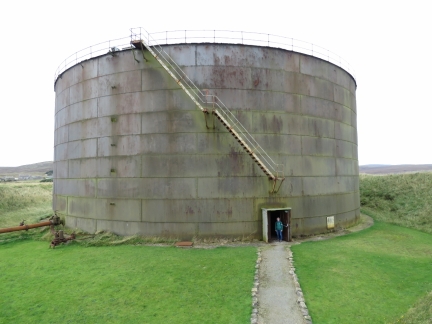
Scapa Flow, a large bay in the center of the Orkney Islands, was the base for the British Fleet during the two World Wars. The former Royal Navy base at Lyness now is the Scapa Flow Visitor Center and Museum, covering the history of the area and it’s use as a naval base, plus lots of memorabilia from the period. The museum building itself is inside the former oil-pumping house, used to off-load oil from incoming tankers into large above-ground storage tanks and to fuel ships from those tanks.
Below are trip highlights from September 22nd, 2017 in the Orkney Island, Scotland. Click any image for a larger view, or click the position to view the location on a map. And a live map of our current route and most recent log entries always is available at http://mvdirona.com/maps
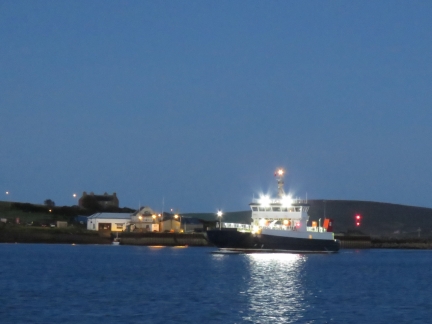 |
Hoy Head
Position: -3 11.81, 58 48.19
The ferry Hoy Head underway from Longhope near dawn.
|
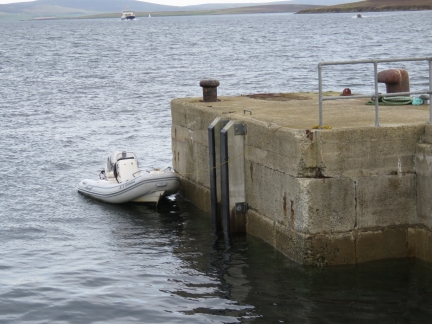 |
Tender
Position: -3 11.44, 58 50.06
Now that our tender was back to operational, we made a run over to Lyness to tour the Scapa Flow Museum. Due to the tender failure we were two days later than we’d originally planned, but we finally made it.
|
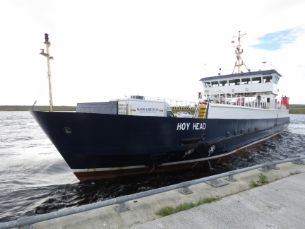 |
Lyness Pier
Position: -3 11.43, 58 50.02
The familiar ferry Hoy Head arrived at Lyness shortly after we did. We watched the master skillfully and gently dock with 20-knot winds pushing the vessel onto the pier.
|
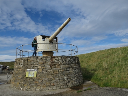 |
Deck Gun
Position: -3 11.70, 58 50.02
The Scapa Flow Museum grounds are full of artifacts from the World Wars, such as this 150mm deck gun salvaged from the German mine-laying cruiser SMS Bremse. The ship arrived in Scapa Flow with the surrendered German naval fleet. 52 of the 74 ships later were later scuttled in the area. including the SMS Bremse.
|
 |
Pumphouse
Position: -3 11.81, 58 50.03
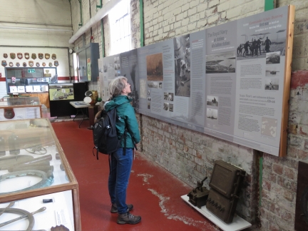
The Scapa Flow Museum has detailed interpretive signs covering the history of the Scapa Flow area and it’s use as a naval base, plus lots of memorabilia from the period.
|
 |
Boilers
Position: -3 11.81, 58 50.03
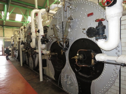
The museum building is inside the former oil-pumping house used to off-load oil from incoming tankers into large above-ground storage tanks and to fuel ships from those tanks. These are the three original Lancashire boilers, built by Wilson’s of Glasgow, used to power the pumps. The boilers also heated the heavy oil to reduce the viscosity so that it could be pumped.
|
 |
Pumps
Position: -3 11.83, 58 50.03
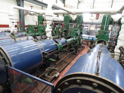
The pumphouse has six steam powered triple-expansion duplex Worthington pumps.
|
 |
Pump
Position: -3 11.82, 58 50.03
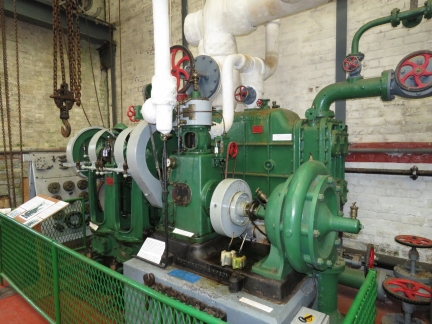
This steam engine drives two pumps. The one on the left pumps water from the water storage tank to the boiler under pressure. The pump on the right collects condensate water from the boiler and pumps it back into the water storage tank. Two of these steam-driven pumps are in the building, and this one has been setup as a display. It is powered by a small electric motor rather than steam but is otherwise operational so you can see the pump in action.
|
 |
Oil Tank
Position: -3 11.87, 58 50.01
Jennifer about to enter the only surviving of twelve above-ground tanks that once held fuel oil for the fleet. This one has a 15,000 ton capacity. By 1943 six tanks buried underground at Wee Fea, capable of storing 100,000 tons of oil and diesel, replaced these above-ground tanks that were vulnerable to aircraft bombing. A second pumphouse built halfway up the hill was used to transfer fuel to and from the new tanks.
|
 |
Movie
Position: -3 11.90, 58 50.01
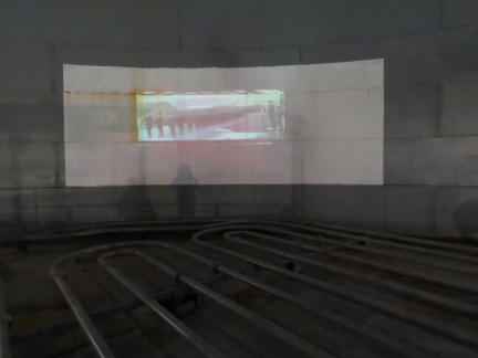
The inside of the fuel oil tank has been converted to a display area with historical movies projected onto the tank wall. The pipes visible along the bottom of the tank are used to heat the heavy oil to reduce the viscosity for pumping.
|
 |
Air-Raid Shelter
Position: -3 11.76, 58 50.15
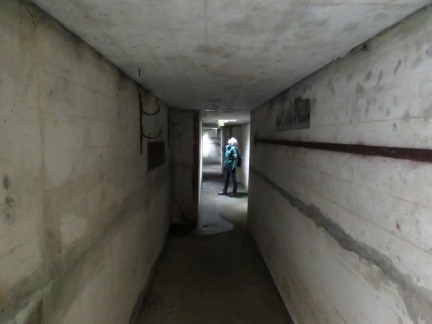
Air raids were particularly common in the spring of 1940 and a large two-entrance air-raid shelter was built for base personnel. The main construction consists of concrete reinforcement and corrugated iron sheeting with earth piled over the top.
|
 |
Boom Chain
Position: -3 11.73, 58 50.15
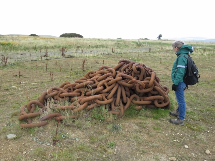
A massive chain used as part of the defensive boom system to protect the anchorage during World War II. This is exactly the same sized chain our anchor got stuck in one of the links of a few days later in Widewall Bay.
|
 |
Sea Snake
Position: -3 11.46, 58 50.16
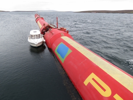
A Pelamis Wave Energy Converter, known as a “Sea Snake”, used to create electricity from the motion of surface waves. The device was decommissioned and sold to the Orkney Island Council for £1 after the developing company, Pelamis Wave Energy, went bankrupt.
|

|
Click the travel log icon on the left to see these locations on a map, with the complete log of our cruise.
On the map page, clicking on a camera or text icon will display a picture and/or log entry for that location, and clicking on the smaller icons along the route will display latitude, longitude and other navigation data for that location. And a live map of our current route and most recent log entries always is available at http://mvdirona.com/maps. |

If your comment doesn't show up right away, send us email and we'll dredge it out of the spam filter.