In 1866, the first transatlantic telegraph cable was completed between Newfoundland and Valentia Island. Prior to the cable, messages between Europe and North America were sent by sea and took two weeks, or more, to reach their destination. Valentia Island also is known for it’s slate quarry that produced slate for the Paris Opera House, London’s Houses of Parliament and many billiard tables, including one made for the Duke of Wellington and Queen Victoria. The island has some fabulous viewpoints, including the road to the slate quarry and Geokaun Mountain. And this being Ireland, of course a pub or two can be found.
Trip highlights from June 22nd and June 23rd, 2017 follow. Click any image for a larger view, or click the position to view the location on a map. And a live map of our current route and most recent log entries always is available at http://mvdirona.com/maps
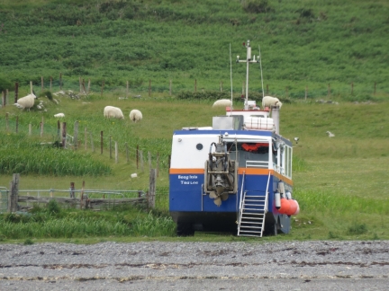 |
Amphibious
Position: -10 17.54, 51 56.09
From the anchorage, we noticed this amphibious vehicle had driven ashore on Begenish Island and offloaded a group for a picnic.
|
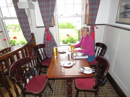 |
Hotel Valentia
Position: -10 17.29, 51 55.57
We had a good lunch with a view to the harbour at the Royal Hotel Valentia before setting off on a bike ride around the island.
|
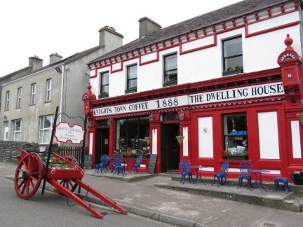 |
Knightstown
Position: -10 17.49, 51 55.53
The village of Knightstown was built in the 1840’s according to a grid pattern plan laid out by Alexander Nimmo, and is one of the few planned villages in Ireland. The Dwelling House, and the Royal Hotel Valentia where we had lunch, date from that period.
|
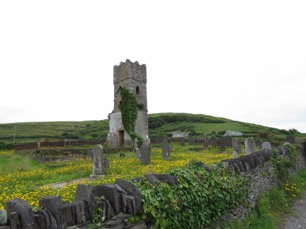 |
Church of Ireland
Position: -10 18.40, 51 55.46
The ruins of an 18th-century Church of Ireland and graveyard a short distance outside Knightstown.
|
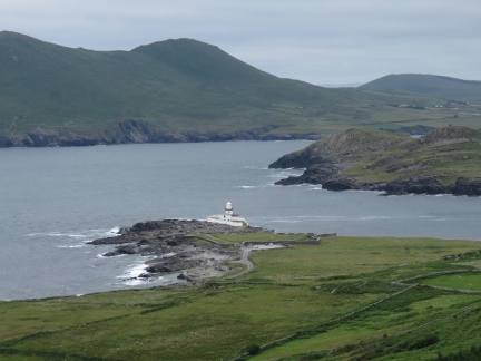 |
Valentia Lighthouse
Position: -10 19.88, 51 55.45
We made a steep climb up to the Valentia Island Slate Quarry with great views to the Valentia Lighthouse and harbour. The channel on the right is the one we passed through yesterday to reach our anchorage.
|
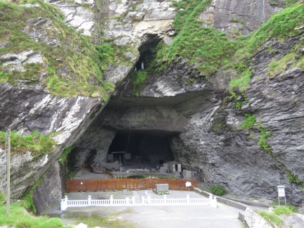 |
Slate Quarry
Position: -10 20.54, 51 55.49
The high-quality slate produced in the Valentia Island Slate Quarry was used in the Paris Opera House, London’s Houses of Parliament and many billiard tables, including one made for the Duke of Wellington & Queen Victoria. High above the quarry entrance are statues of Our Lady & Bernadette—a yearly communion mass is held in the fenced area in front of the quarry entrance.
|
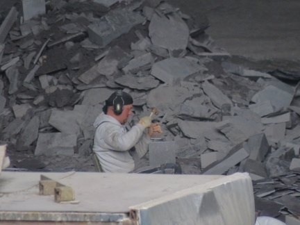 |
Making Tiles
Position: -10 20.54, 51 55.49
We could see a worker inside the quarry and were surprised to see him making slates by hand.
|
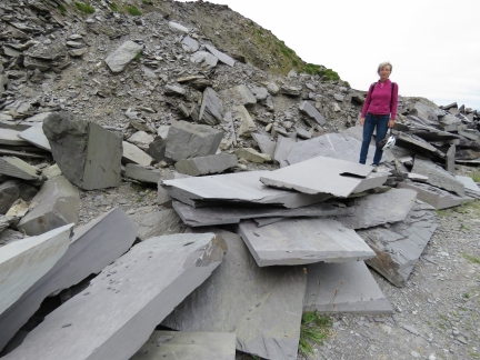 |
Slate
Position: -10 20.53, 51 55.55
Big piles of discarded slate outside the quarry.
|
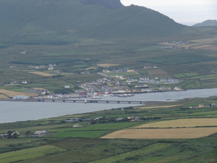 |
Portmagee Channel
Position: -10 20.73, 51 55.34
After the quarry, we made another steep climb to Geokaun Mountain. The 360-degree view was incredible. This is looking southwest to Portmagee Channel and the village of Portmagee on the mainland, with a bridge connecting to Valentia Island on the right.
|
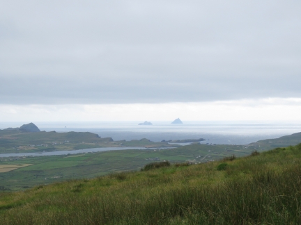 |
Skelligs
Position: -10 20.73, 51 55.34
The view to sea beyond Portmagee Channel to The Skelligs from Geokaun Mountain.
|
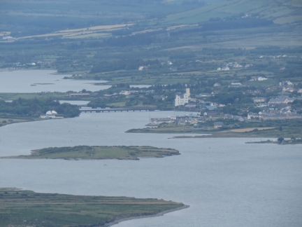 |
Cahersiveen
Position: -10 20.73, 51 55.34
Looking northeast to Cahersiveen from Geokaun Mountain. The Old Barracks are visible slightly right of center and the Cahersiveen Marina is at the center of the picture.
|
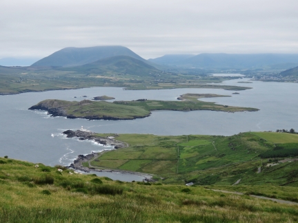 |
Valentia Harbour
Position: -10 20.73, 51 55.34
Valentia Harbour, viewed from Geokaun Mountain. Valentia Lighthouse is at the left of the photo and Cahersiveen is at the far right in the distance. Dirona is a small speck in the right third of the picture.
|
 |
Fogher Cliffs
Position: -10 21.22, 51 55.29
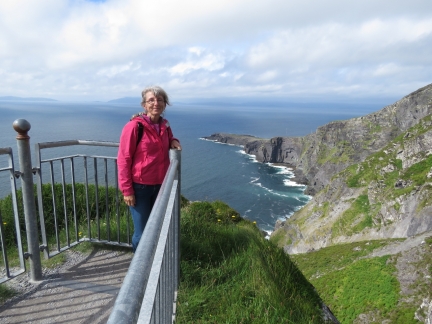
Ireland seems to have no shortage of dramatic cliffs. This is the Fogher Cliffs viewing deck at Geokaun Mountain.
|
 |
Telegraph Field
Position: -10 23.42, 51 53.59
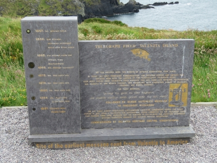
In 1866, the first transatlantic telegraph cable was completed between Newfoundland and here at Telegraph Field on Valentia Island. Prior to the cable, messages between Europe and North America were sent by sea and took two weeks, or more, to reach their destination.
|
 |
Portmagee Harbour
Position: -10 21.85, 51 53.23
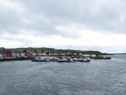
Portmagee Harbour, with the town’s colorfully-painted buildings behind. The majority of boats that provide tours to Skellig Michael leave from here.
|
 |
Wild Atlantic Way
Position: -10 21.95, 51 53.16
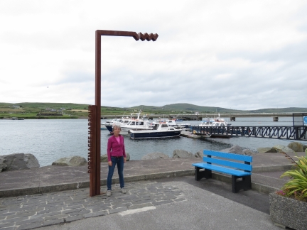
The “Wild Atlantic Way” is a successful marketing campaign to promote tourism along Ireland’s West Coast. We frequently see these metal signs that mark highlights along the route.
|
 |
Bridges
Position: -10 21.94, 51 53.15
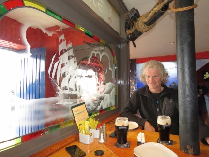
An excellent meal at Bridges restaurant and pub in Portmagee. During the filming of Star Wars: The Force Awakens, the film crew and actors stayed in and around Portmagee. The bar is full of Star Wars memorabilia, including a video of Mark Hamill (who plays Luke Skywalker), taking the “The Force Perfect Pint” challenge in trying to pour a perfect pint of Guinness.
|
 |
Lifeboat
Position: -10 17.02, 51 55.63
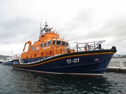
We know Ireland sees some serious weather and these RNLI (Royal National Lifeboat Institution) lifeboats, common along the coast, are designed to handle these storms.
|
 |
Americas Cup
Position: -10 17.54, 51 56.10
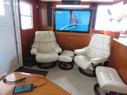
We’ve been unsuccessful at finding a way to watch any of the America’s Cup coverage and finally found a way today through a phone app that we mirrored to our TV. After meeting Tom Slingsby and several other team members at Team Oracle USA Foiling Camp in Australia, we were pretty disappointed to see them lose.
|

|
Click the travel log icon on the left to see these locations on a map, with the complete log of our cruise.
On the map page, clicking on a camera or text icon will display a picture and/or log entry for that location, and clicking on the smaller icons along the route will display latitude, longitude and other navigation data for that location. And a live map of our current route and most recent log entries always is available at http://mvdirona.com/maps. |

If your comment doesn't show up right away, send us email and we'll dredge it out of the spam filter.