16th-century Ballycarbery Castle is a modern structure compared to two other fortifications near Cahersiveen: the ring forts of Leacanabuile and Cahergal. Ring forts are difficult to date, but archeologists believe these were built in the 9th and 10th centuries. We visited all three on a bicycle tour of the area, and also took in the sweeping view from the “Top of the Rock” viewing platform.
Trip highlights from June 21st, 2017 follow. Click any image for a larger view, or click the position to view the location on a map. And a live map of our current route and most recent log entries always is available at http://mvdirona.com/maps
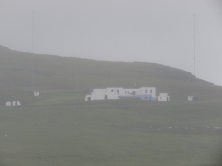 |
Valentia Radio
Position: -10 20.16, 51 56.29
Passing well-known Valentia Radio station on a short run to Valentia Harbour from Ballinskelligs Bay. In the early 1900s, Guglielmo Marconi built a wireless radio station at Crookhaven that in 1914 was transferred to Wireless Point on Valentia Island. During the mid 1920s, in the days of Morse Code, Valentia Radio handled more traffic than any other UK radio station. In 1999, it was one of the last stations to discontinue Morse service.
|
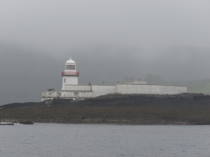 |
Valentia Lighthouse
Position: -10 19.20, 51 56.15
The Valentia Lighthouse was first lit in 1841 and automated in 1947. Conditions were overcast, but calm as we arrived, nothing like the seascape showing a storm at http://www.valentiaisland.ie/explore-valentia/lighthouse/.
|
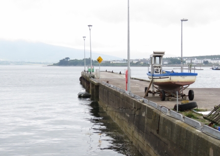 |
Tender
Position: -10 16.64, 51 55.72
We anchored off Begenish Island then ran the tender over to the pier at Reenard Point for a bicycle tour of the Cahersiveen area.
|
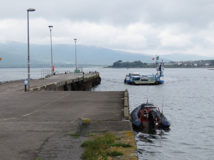 |
Ferry
Position: -10 16.65, 51 55.74
The ferry from Valentia Island arriving at Reenard Point.
|
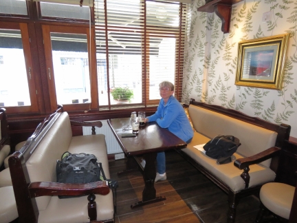 |
The Fertha
Position: -10 13.55, 51 56.79
Our first stop was in the village of Cahersiveen for a great lunch at The Fertha, named for the river that flow along the town.
|
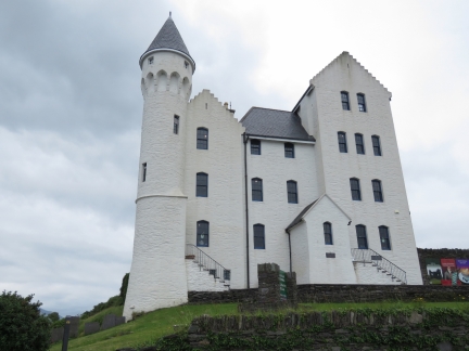 |
Old Barracks
Position: -10 13.50, 51 56.99
In 1858, the first transatlantic cable was laid between Heart’s Content, Newfoundland and Valentia Island, Ireland. The Royal Irish Constabulary barracks were built in Cahersiveen an imposing structure to protect the Irish end of the cable. The Bavarian building style, unusual for the area, generated a story that the building plans were mixed up with ones for the Punjab in India. But it’s probably not true, as the the designer hired for the barracks favoured the Bavarian style. The building was burnt down in 1921 during the Irish Civil War, but later reconstructed and now houses a museum.
|
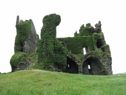 |
Ballycarbery Castle
Position: -10 15.51, 51 56.93
The MacCarthey Mores built Ballycarbery Castle in the 16th century on the site of previous 14th-century building. In 1652, Oliver Cromwell’s troops attacked the castle with cannons and destroyed the back wall of the castle. Local farmers later removed many of the fallen stones for building material, but much of the front and side walls still stand, and you can walk inside and up to the second level.
|
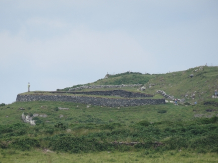 |
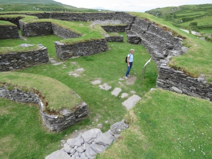
Leacanabuile
Position: -10 15.53, 51 56.93
The view to our next stop, Leacanabuile ring fort, from Ballycarbery Castle.
|
 |
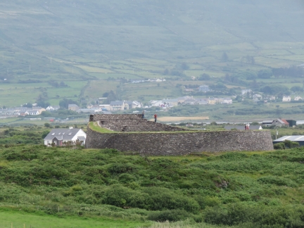
Inside Leacanabuile
Position: -10 15.70, 51 57.49
Leacanabuile ring fort was built in the 9th century and was the protected homestead of a wealthy farmer. The circular enclosing wall is over 9ft thick and was built by erecting two strong walls, one within the other, and filling the gap with smaller stones. Inside are the remains of a round house and an attached square house.
|
 |
Cahergal
Position: -10 15.70, 51 57.49
The view to our next stop, Cahergal ring fort, from nearby Leacanabuile ring fort.
|
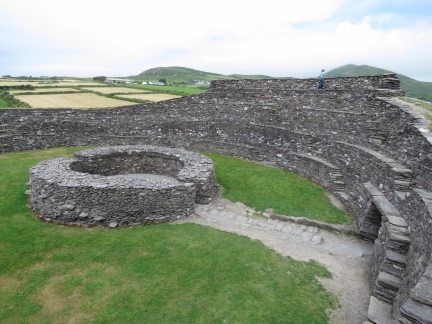 |
Inside Cahergal
Position: -10 15.48, 51 57.35
Cahergal ring fort is larger and more impressive than Leacanabuile and likely built in 10th century, (stone forts are difficult to date). The main wall, including the terraces and several flights of steps of steps was recently reconstructed, but much of the rest stands from the 10th century, including the remains of a large circular dry-stone building.
|
 |
Top of the Rock
Position: -10 15.25, 51 57.76
Our final stop on the bicycle tour was the “Top of the Rock” viewing platform. The village of Cahersiveen, where we had lunch, is at the left side of the photo. The Fertha River runs from Cahersiveen to Valentia Harbour, about center in the photo, with Valentia Island in the distance. is hidden behind Begenish Island, roughly in the center of the picture. Doulus Head on the mainland is to the right of center, and Cooncrome Harbour is on the right.
|
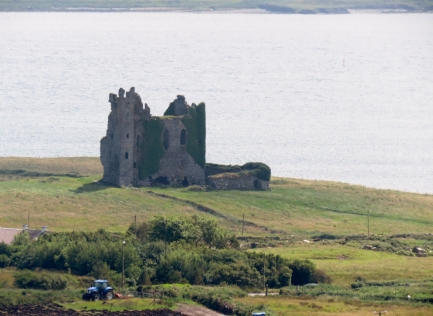 |
Ballycarbery Castle From Rock
Position: -10 15.31, 51 57.71
The view to Ballycarbery Castle from “Top of the Rock”.
|
 |
Marina
Position: -10 13.97, 51 56.84
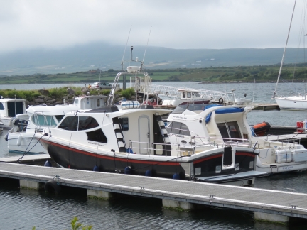
On our way back to Dirona, we checked out the marina at Cahersiveen. This is another Safehaven Marine Genesis 37 Interceptor, similar to Force Awakens that took us to Skellig Michael.
|
 |
Holy Cross Abbey
Position: -10 13.71, 51 56.81
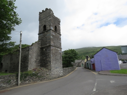
The ruins of the Holy Cross Abbey in Cahersiveen. The church is interesting in that it doesn’t have a steeple. From 1695 to 1820, Irish law aimed at bolstering Protestantism and restricting Catholicism prohibited Catholic churches from having a steeple or bell.
|
 |
Memorial Church
Position: -10 13.50, 51 56.81
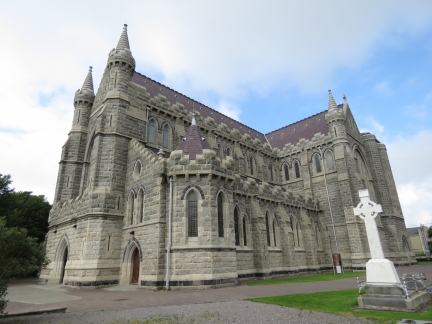
The imposing Daniel O’Connell Memorial Church in Cahersiveen. Daniel O’Connell was a 19th-century Irish politician who pushed for the removal of restrictions on Catholicism in the United Kingdom, and for the repeal of the Act of Union that joined Ireland with Great Britain. The Daniel O’Connell Memorial Church is the only church in Ireland named after a layman.
|

|
Click the travel log icon on the left to see these locations on a map, with the complete log of our cruise.
On the map page, clicking on a camera or text icon will display a picture and/or log entry for that location, and clicking on the smaller icons along the route will display latitude, longitude and other navigation data for that location. And a live map of our current route and most recent log entries always is available at http://mvdirona.com/maps. |

If your comment doesn't show up right away, send us email and we'll dredge it out of the spam filter.