Skellig Michael is one of the most remarkable places we’ve ever visited. Sometime in the 6th-8th centuries, Christian monks landed on this rugged and remote island off the southwest coast of Ireland. Over the centuries they built a monastery with beehive huts and a chapel high atop the island’s peaks, and extensive steps to reach them from several sides of the island. Besides the well-preserved monastery, Skellig Michael has amazing views from high above the cliffs with the ocean crashing below, and is covered with puffins, one of our favorite birds.
The island is accessible only by boat and has long been a popular tourist destination, and even more so since it was used as a filming site for the final scene of Star Wars: The Force Awakens. Only 180 people are allowed to land on the island per day and we were lucky to get a chance to visit this unique and beautiful place.
The video below shows footage from our tour, and additional trip highlights from June 20th, 2017 follow. Click any image for a larger view, or click the position to view the location on a map. And a live map of our current route and most recent log entries always is available at http://mvdirona.com/maps
 |
Spoiled
Position: -10 15.87, 51 48.87
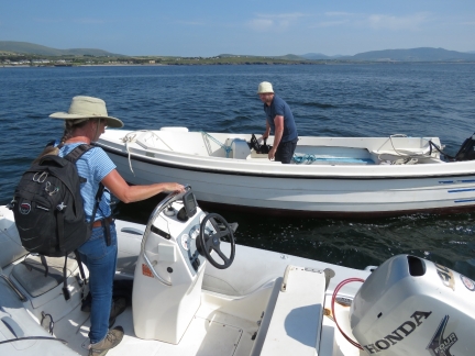
We were planning to run the tender to the Ballinskelligs Pier this morning for our trip to Skellig Michael, but David called and offered to pick us up instead. We’re definitely feeling spoiled.
|
 |
Boarding
Position: -10 16.39, 51 48.68
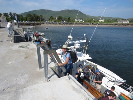
Boarding Force Awakens at the Ballinskelligs Pier.
|
 |
Force Awakens
Position: -10 18.76, 51 47.38
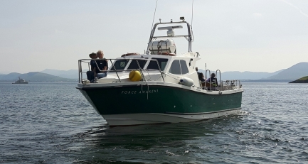
David took this picture of us riding on the bow of Force Awakens. The boat is a Genesis 37 Interceptor by Safehaven Marine of Cork, Ireland, who specialize in strong and capable fiberglass for applications such as pilot vessels and patrol boats. Besides being one of the nicest boats in the fleet of 15 vessels licensed to land at Skellig Michael, Force Awakens has a feature most don’t have: a head. This is important as Skellig Micheal has no bathroom facilities and the round trip from the mainland can take can take six hours or more.
|
 |
Calm
Position: -10 25.09, 51 46.79
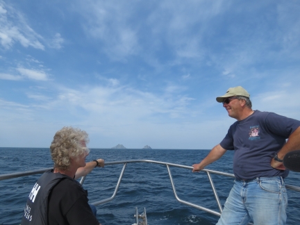
Conditions, as we know, can be rough out in the open Atlantic but the seas were so calm today we were able to ride on the bow the entire way. That’s Skellig Michael and Little Skellig in the distance.
|
 |
Landing
Position: -10 32.20, 51 46.37
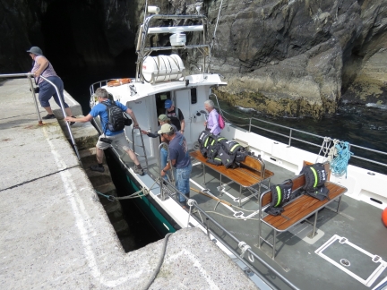
Passengers disembark at Skellig Michael on the landing built for the lighthouse. Landing can be rough and difficult in heavy swell, similar to St. Helena, but we had an easy time of it in today’s calm conditions.
|
 |
Lighthouse Road
Position: -10 32.26, 51 46.27
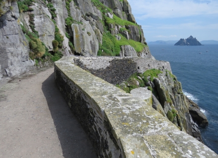
Looking back to Little Skellig from the lighthouse road.
|
 |
Puffin!
Position: -10 32.32, 51 46.20
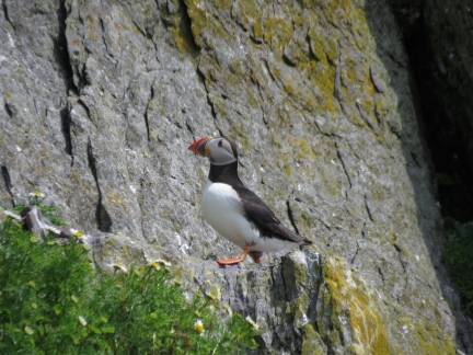
We love puffins, but haven’t seen one in the wild since Brooks Peninsula off the west coast of Vancouver Island in British Columbia, Canada.
|
 |
Ledge
Position: -10 32.34, 51 46.21
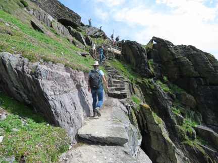
From the lighthouse road, we ascended up the to the saddle on the monk’s steps. Partway along is a ledge with a sheer drop to one side where chains have been added for a handhold. Despite all the warnings about the difficulty of the ascent, we didn’t have any trouble. The Precipice Climb in Acadia National Park was harder and even that wasn’t a big deal.
|
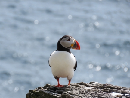 |
Second Puffin
Position: -10 32.33, 51 46.21
We were worried we might not see any puffins today, as we’d not seen any yesterday, but they are everywhere on Skellig Micheal.
|
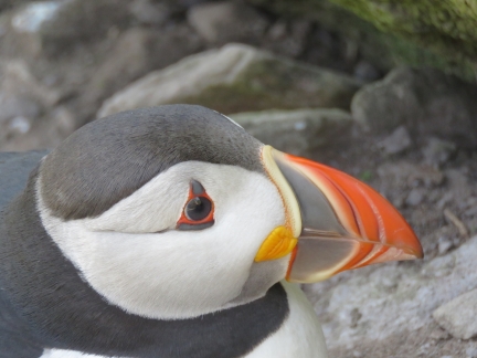 |
Another Puffin
Position: -10 32.33, 51 46.21
You can never see too many puffins.
|
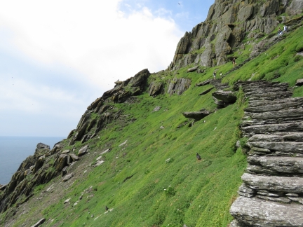 |
Steps
Position: -10 32.39, 51 46.22
The steps lead up and up along the steep slopes.
|
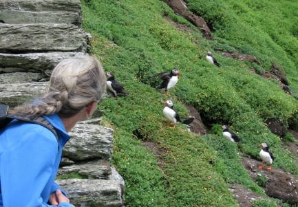 |
Puffins on Slope
Position: -10 32.42, 51 46.22
The puffins seemed used to people and would approach reasonably closely. We sure loved watching them.
|
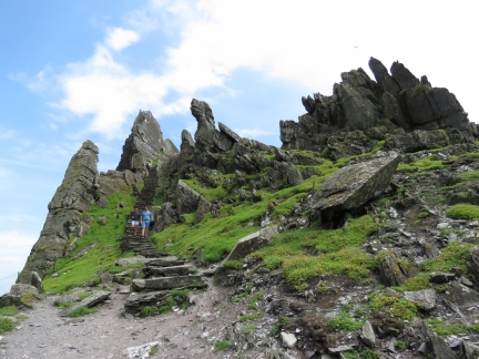 |
Rockscape
Position: -10 32.41, 51 46.25
The dramatic rockscape as we near the saddle between the two peaks.
|
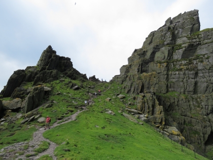 |
Saddle
Position: -10 32.41, 51 46.25
Looking up to the south peak from the saddle.
|
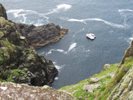 |
Boats
Position: -10 32.40, 51 46.26
All the tour boats remain just offshore while their passengers visit the island.
|
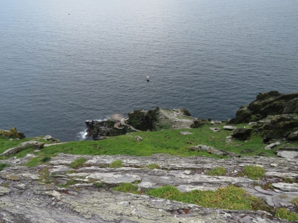 |
Helicopter Pad
Position: -10 32.39, 51 46.27
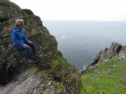
The helicopter pad far below us. If you’re afraid of heights, this isn’t a great place to visit.
|
 |
West View
Position: -10 32.47, 51 46.24
Looking down to the western cliffs from the base of the South Peak.
|
 |
North Peak
Position: -10 32.46, 51 46.24
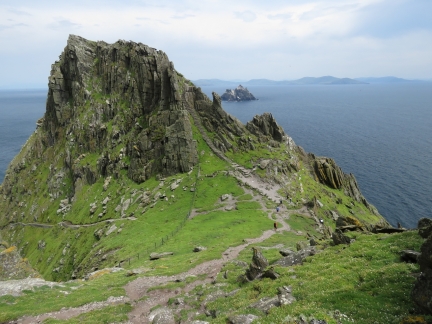
The view from the South Peak to the leading up to the monastery on the North Peak, with Little Skellig in the background and steps heading down along the north cliffs.
|
 |
North Steps
Position: -10 32.47, 51 46.24
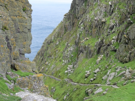
Closer view to the steps leading down the north side of the island from the saddle.
|
 |
Puffin on Wall
Position: -10 32.36, 51 46.30
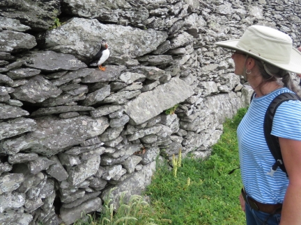
This little guy popped out of the wall as we walked past.
|
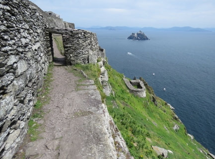 |
Entrance
Position: -10 32.36, 51 46.30
The entrance to the monastery with Little Skellig in the distance.
|
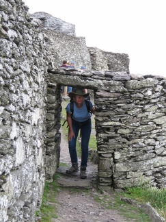 |
Doorway
Position: -10 32.34, 51 46.31
Those monks must have been very short, or they banged their heads a lot.
|
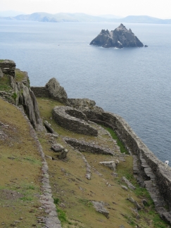 |
Lower Garden
Position: -10 32.34, 51 46.31
The island had no level ground, so the monks excavated terraces for gardens and the monastery. This is the lower garden.
|
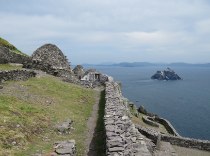 |
Upper Garden
Position: -10 32.35, 51 46.31
The Upper Garden at the main level of the monastery.
|
 |
Church
Position: -10 32.33, 51 46.32
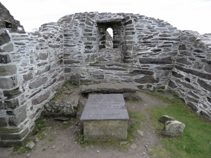
Saint Michael’s Church is the only mortared structure in the monastery. It was probably built in the 11th century and remodelled in the 12th century. On the ground in front is a memorial to a lightkeeper’s sons, who died on the island 1868 and 1869 at ages 2 and 4.
|
 |
Beehive Huts
Position: -10 32.33, 51 46.32
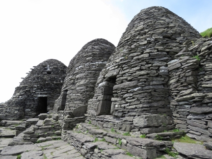
The monks built several beehive huts for shelter. Likely the smaller ones in the foreground were residences and the larger one a communal structure.
|
 |
Cell B and C
Position: -10 32.33, 51 46.32
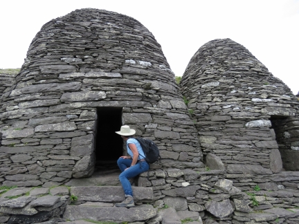
Jennifer looking into Cells B and C. It’s remarkable that these have stood for centuries in such a storm-swept island. The monks did build the terraces to channel the wind over the monastery, but it’s still amazing.
|
 |
Graveyard
Position: -10 32.32, 51 46.33
The monk’s graveyard at the east end of the monastery.
|
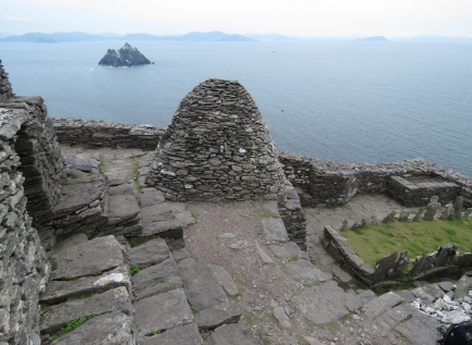 |
Terrace
Position: -10 32.33, 51 46.33
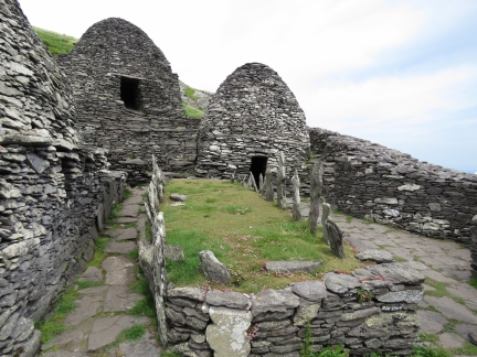
Looking to Little Skellig across Cell F with the graveyard on the right.
|
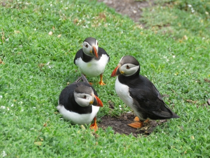 |
Last Puffins
Position: -10 32.43, 51 46.22
A final view of the puffins as we return back to the landing.
|
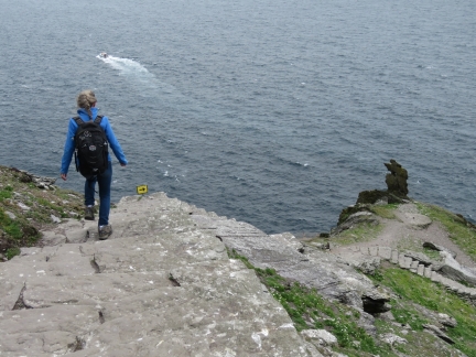 |
Corner
Position: -10 32.36, 51 46.22
It’s a long drop down if you miss that sign at the corner.
|
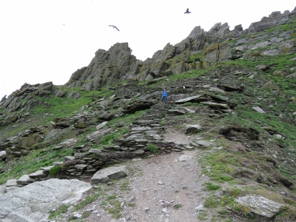 |
Coming Down
Position: -10 32.33, 51 46.22
Returning back down the steps.
|
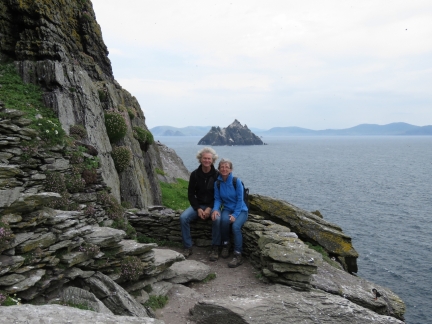 |
Great Day
Position: -10 32.33, 51 46.21
Skellig Michael is among the most remarkable places we’ve ever been—were lucky to have an opportunity to visit.
|
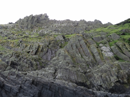 |
North Cliffs
Position: -10 32.47, 51 46.32
After picking up his passengers, helmsman Brendan Walsh took us in for a close-up to the north cliffs.
|
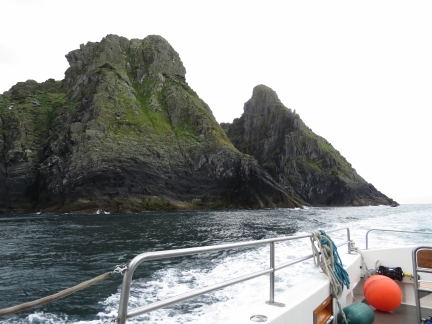 |
Last View
Position: -10 32.24, 51 46.55
Our last view to Skellig Michael before we return to Ballinskelligs.
|
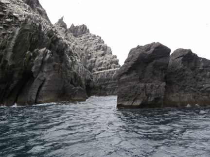 |
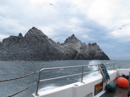
Tight
Position: -10 30.43, 51 46.95
Brendan took Force Awakens through this narrow gap between the rocks and Little Skellig. It looks as tight as it was—an impressive job at the helm.
|
 |
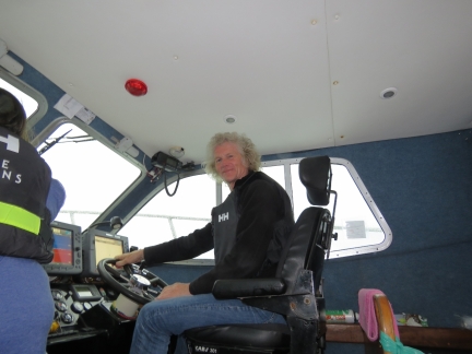
Spray
Position: -10 30.20, 51 47.02
The winds had picked up a little on the return trip, so we got a fair bit of spray as we pass the lee of Little Skellig.
|
 |
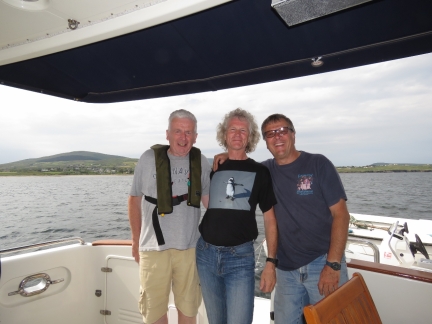
At the Helm
Position: -10 17.42, 51 47.65
James at the helm of Force Awakens on the return trip.
|
 |
Brendan and Derek
Position: -10 15.85, 51 48.88
Brendan Walsh (left) and Derek Noble of Force Awakens stopped by for a visit on Dirona after we returned to Ballinskelligs. It was truly a memorable day.
|

|
Click the travel log icon on the left to see these locations on a map, with the complete log of our cruise.
On the map page, clicking on a camera or text icon will display a picture and/or log entry for that location, and clicking on the smaller icons along the route will display latitude, longitude and other navigation data for that location. And a live map of our current route and most recent log entries always is available at http://mvdirona.com/maps. |
If your comment doesn't show up right away, send us email and we'll dredge it out of the spam filter.

Thanks for your suggestion to book this tour Jennifer. We did book in March and the first available is July 30t. We are all so looking forward to it!
You’re most welcome Laurie. I’m amazed how busy it is and makes us feel even luckier we were able to book something at the last minute when we went. We hope you, Alec and Jack have a great time there and along the Irish west coast. Happy to answer any questions if you have them.
Jennifer
> “It’s remarkable that these have stood for centuries in such a storm-swept island”
They were actually rebuilt in the late 20th century – 1970s I think. My father-in-law was part of the team that stayed on the rock for weeks undertaking this work. All the stone they used is local to the island.
There have been repairs, but most of it is reported to still be original. From http://www.worldheritageireland.ie/skellig-michael/built-heritage/conservation-works/:
“The current phase of conservation works began in 1978 when some urgent repairs were made to a collapsed wall in the Monastery. The initial programme of works concentrated on the South Steps and the structures within the Monastery itself.”
Jennifer
What a great day you both had James. Thanks for sharing these photos. Glad you had calm seas traveling over. It must have been a very harsh life for those monks; especially in winter. The stone huts remind me of the many neolithic structures you can find in Ireland.
We were very lucky to get a booking to visit, especially with such nice weather and calm conditions, and on a good boat. Most of the operators we called were booked for weeks in advance. It definitely was a harsh life for the monks. Besides religious tolerance improving on the mainland, one of the reasons they left the island is the annual temperature went down a couple of degrees and made winters that much more difficult.