The three-mile-long Arthur Ravenel Jr. Bridge crosses the Cooper River between Charleston and Mt. Pleasant. The bridge has a pedestrian and cycle lane with fabulous views to the city, the river and out to sea. We got the bikes down and spent a great day riding through Charleston and across the bridge, and explored a bit of Mt. Pleasant on the other side.
Trip highlights from January 2nd, 2017 in Charleston, SC follow follow. Click any image for a larger view, or click the position to view the location on a map. And a live map of our current route and most recent log entries always is available at http://mvdirona.com/maps
 |
Bikes
Position: -79 57.16, 32 46.66
Ready for the day’s ride.
|
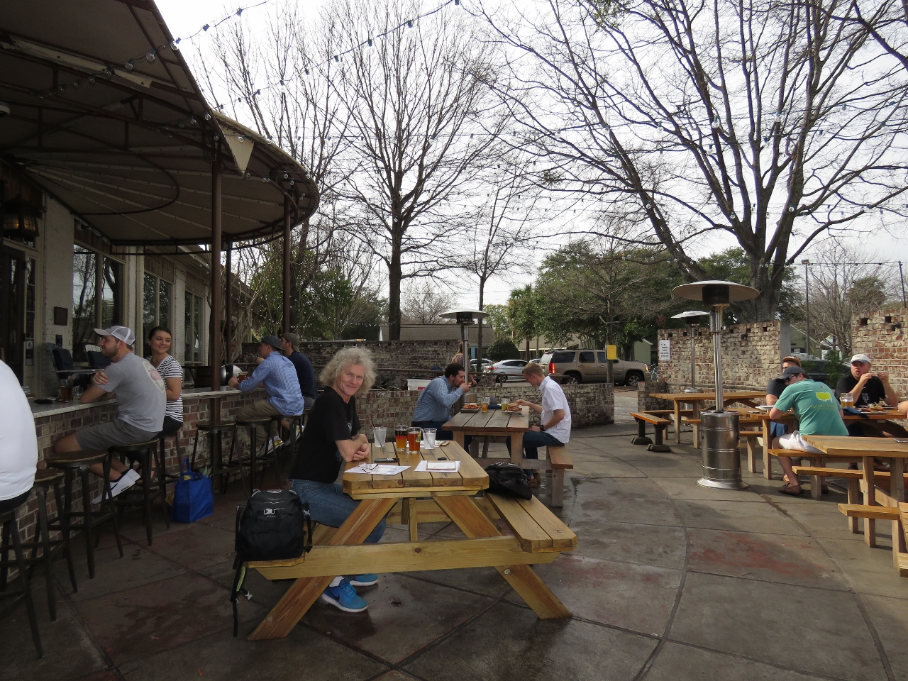 |
Biergarten
Position: -79 55.89, 32 47.53
An excellent lunch on the patio at the Bay Street Biergarten. Although we like high-latitude cruising, we have to admit we are enjoying the warmer weather further south.
|
|
|
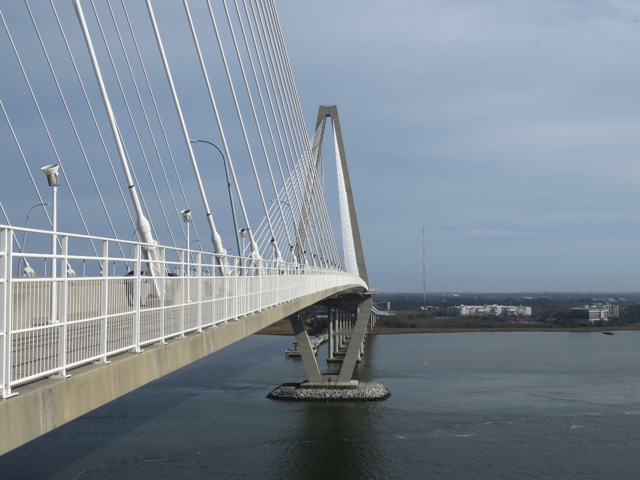
Towers
Position: -79 55.05, 32 48.18
The pedestrian and cycle lane was surprisingly busy given the 6-mile round trip. We passed at least a hundred people. This is looking east beneath one bridge tower to the next.
|
 |
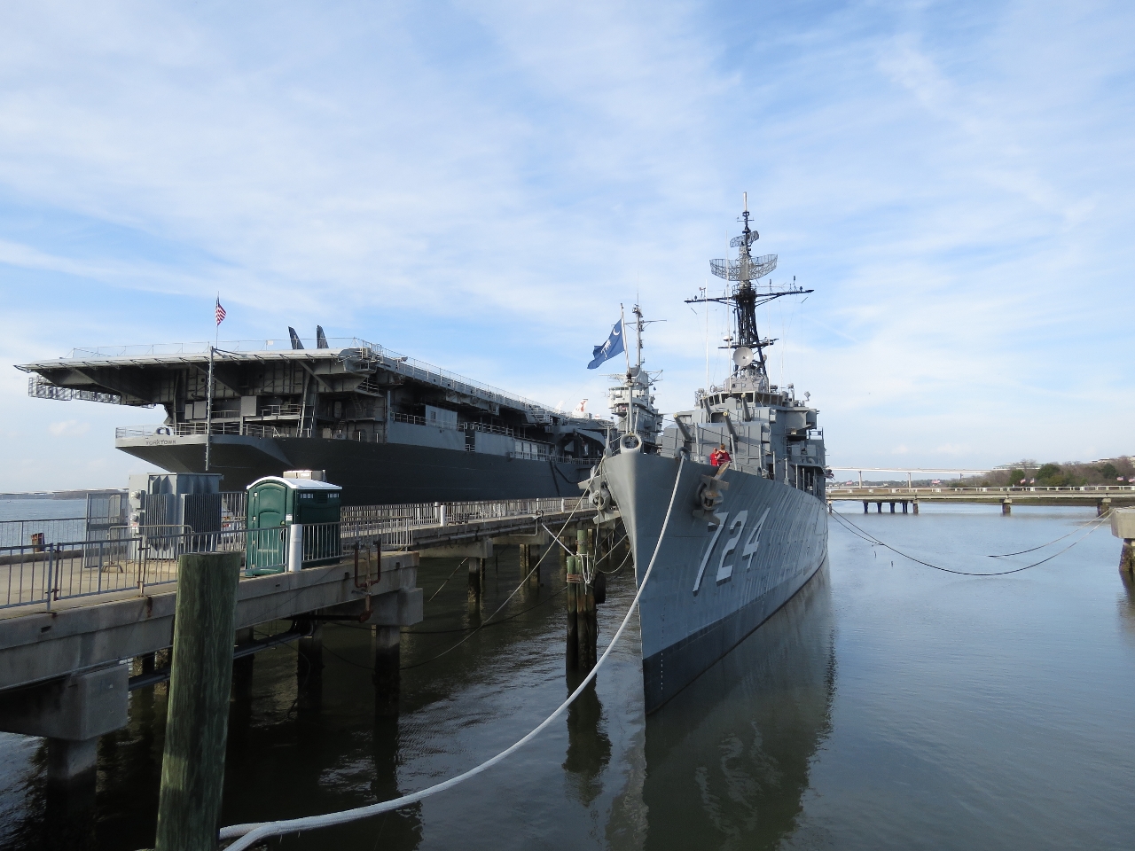
USS Yorktown
Position: -79 55.05, 32 48.18
Looking south across the USS Yorktown from the Arthur Ravenel Jr. Bridge to sea. The diesel submarine USS Clagamore is visible at the right of the picture. Both ships are part of the Patriots Point Naval and Maritime Museum.
|
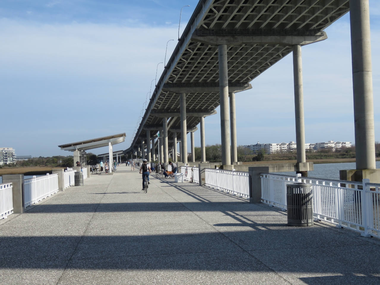 |
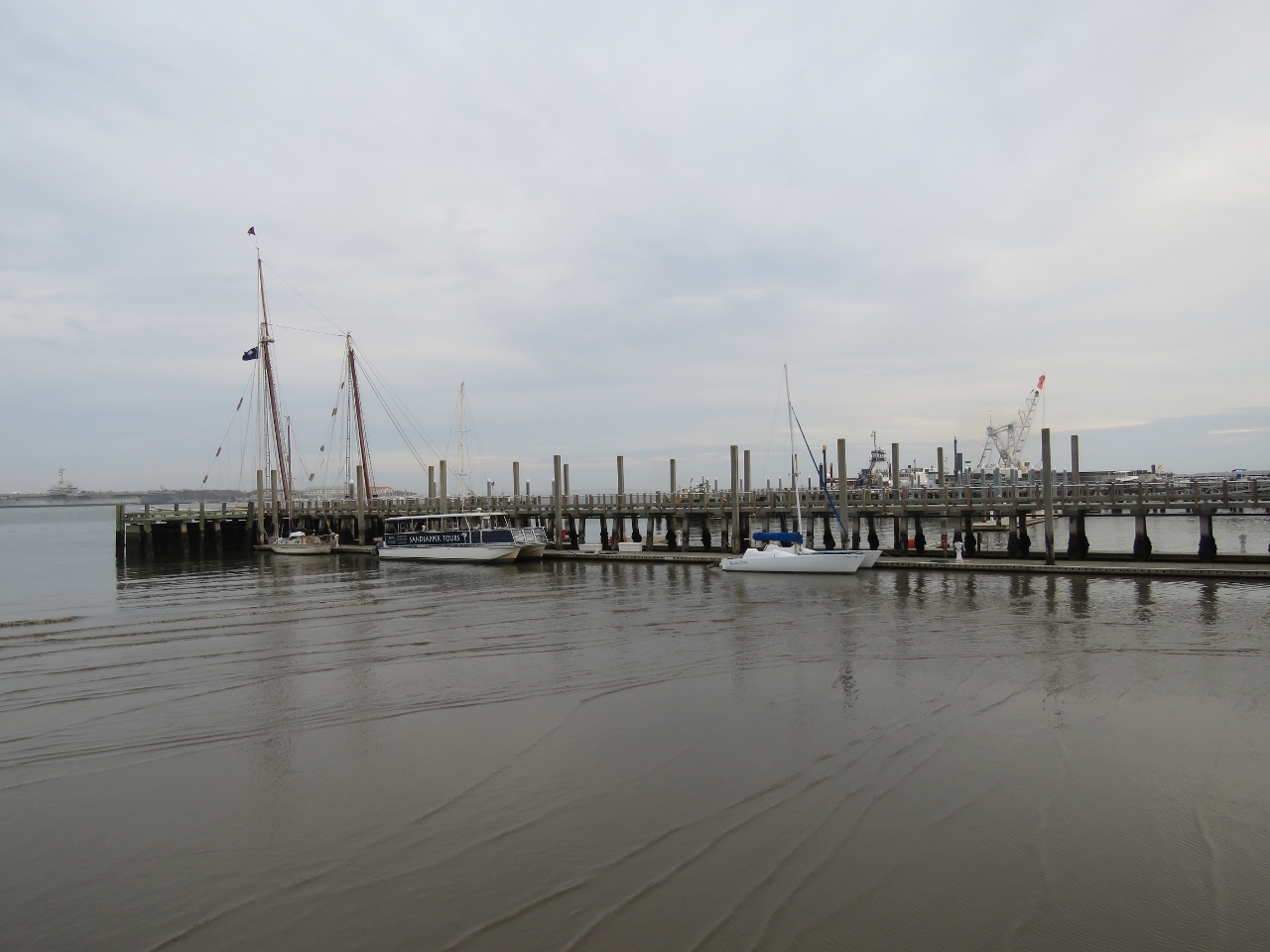
Mt. Pleasant Pier
Position: -79 54.58, 32 48.16
After crossing the bridge we biked down to the end of the 1250-foot long Mt. Pleasant Pier that extends under the bridge.
|
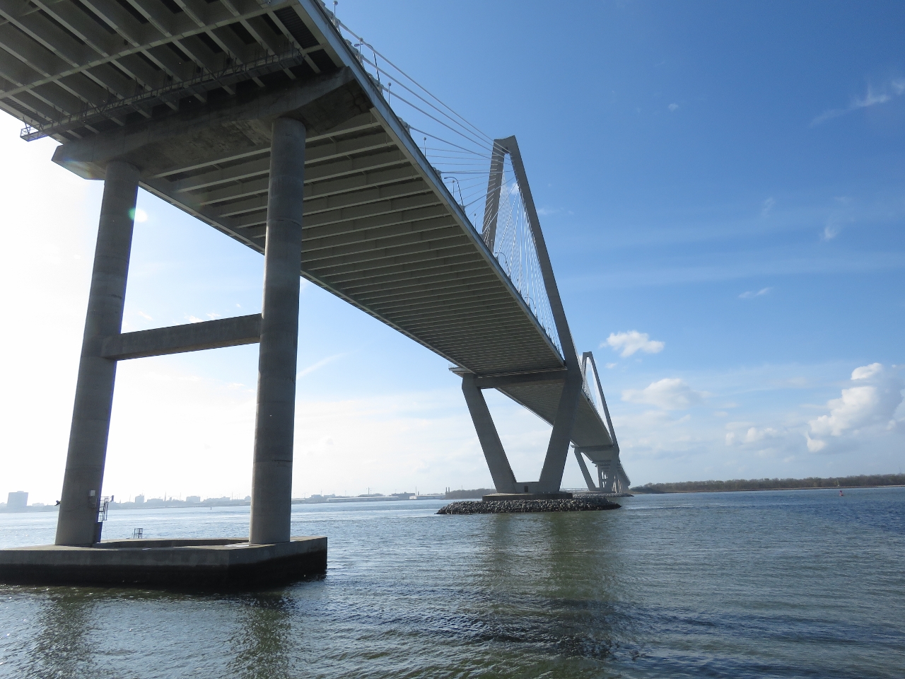 |
Under Bridge
Position: -79 54.59, 32 48.16
Looking up to the Arthur Ravenel Jr. Bridge from the Mt. Pleasant Pier.
|
 |
Submarine Memorial
Position: -79 54.25, 32 47.56
The Cold War Submarine Memorial has excellent interpretive signs detailing the history of submarine evolution during the Cold War.
|
 |
Patriots Point
Position: -79 54.48, 32 47.33
The destroyer USS Laffey moored beside the aircraft carrier USS Yorktown at the Patriots Point Naval and Maritime Museum. We plan to visit in a couple of days.
|
 |
Break
Position: -79 54.48, 32 47.12
Taking a break along the boardwalk at the Charleston Resort and Marina with the Arthur Ravenel Jr. Bridge in the background and the USS Yorktown just visible on the right.
|
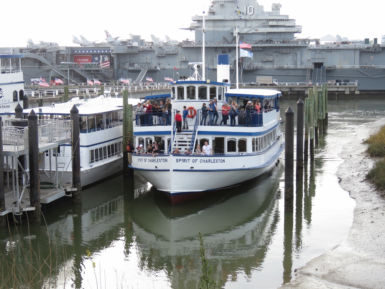 |
Spirit of Charleston
Position: -79 54.35, 32 47.44
The Spirit of Charleston mustn’t draw much—that’s pretty shallow water.
|
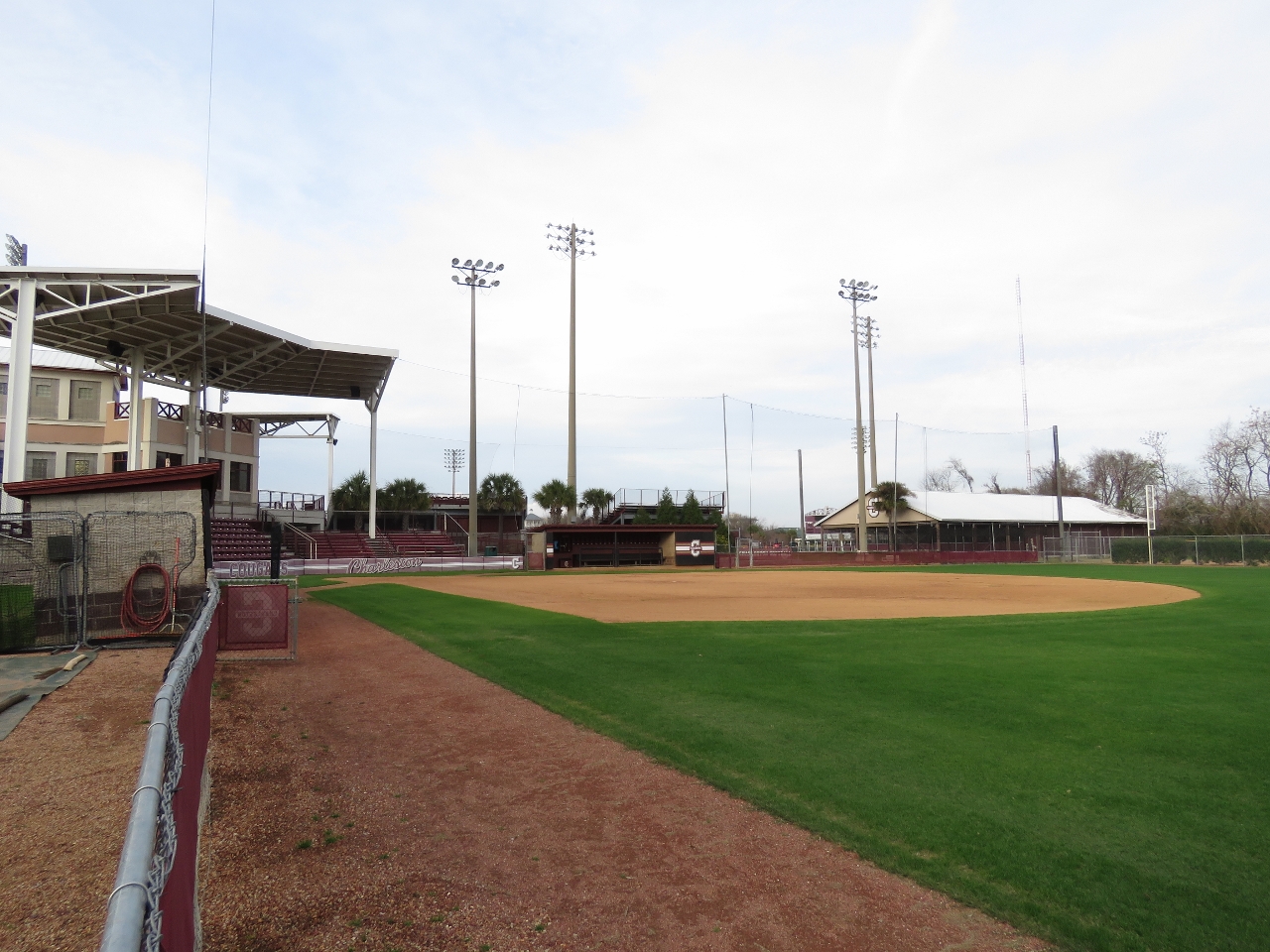 |
College of Charleston
Position: -79 54.14, 32 47.67
The College of Charleston has a large sports complex at Patriots Point, including a tennis center and stadiums for softball, soccer and baseball. This is the softball stadium.
|
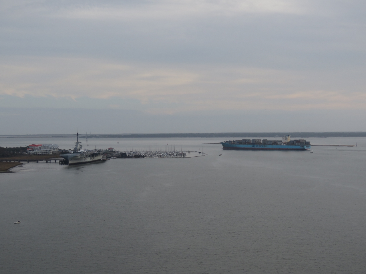 |
Maersk
Position: -79 54.70, 32 48.14
A Maersk container ship heading to sea between the Charleston Resort and Marina and the island Shutes Folly, viewed from the Arthur Ravenel Jr. Bridge. It sure looks tight. The name Shutes Folly derives from an early owner, Joseph Shute, using the Colonial custom of describing a Carolina sea island as a “folly.”
|
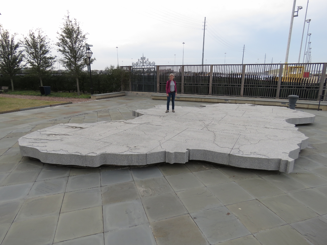 |
Irish Memorial
Position: -79 55.55, 32 47.53
Jennifer standing on a map of Ireland in the Charlotte Street Park. The memorial recognizes the contribution of the many Irish who contributed to Charleston’s early growth and development.
|
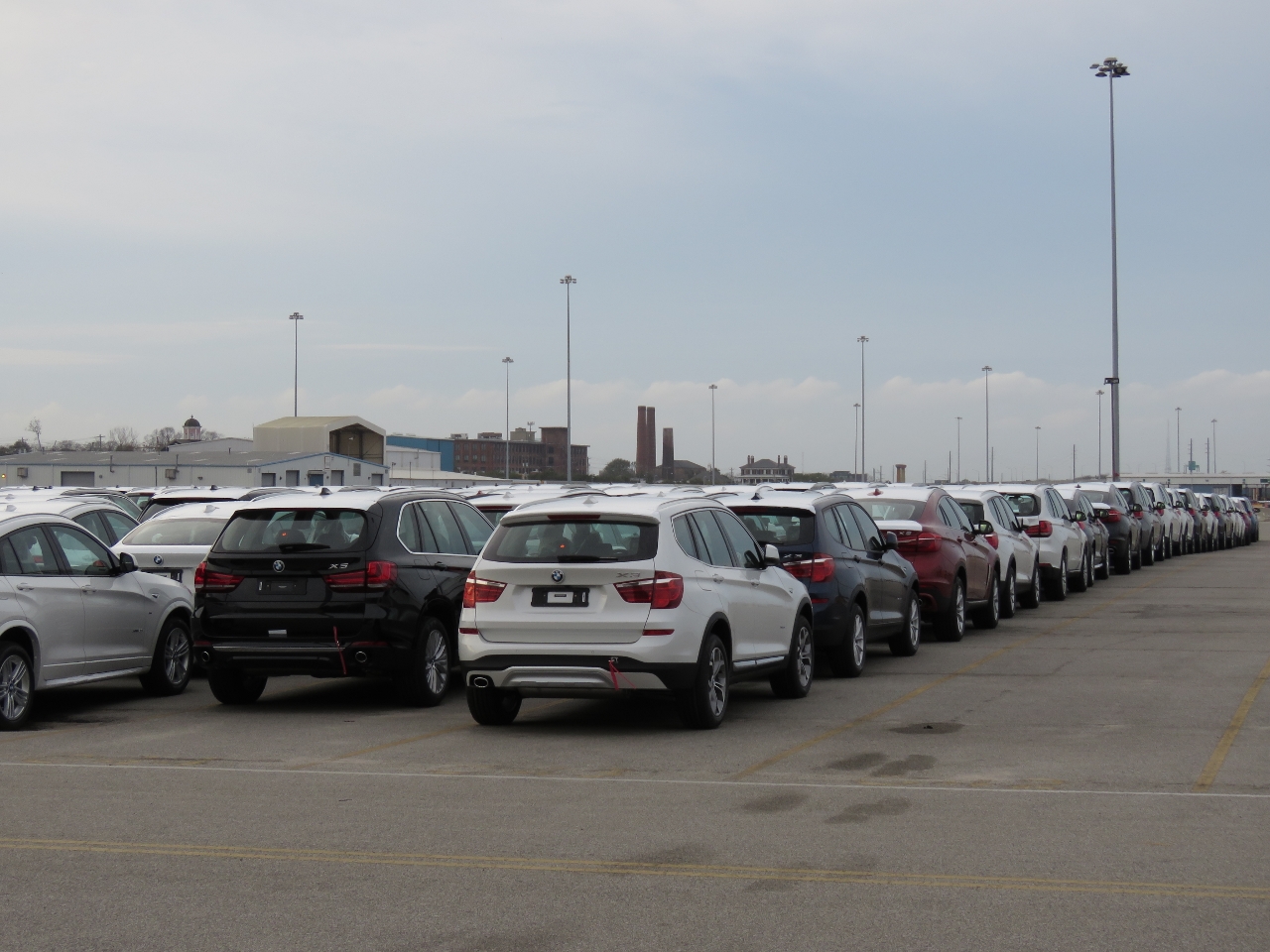 |
BMW
Position: -79 55.64, 32 47.50
A BMW plant is just outside Charleston and thousands of BMW vehicles were ready to load at the docks adjacent to the Charlotte Street Park.
|
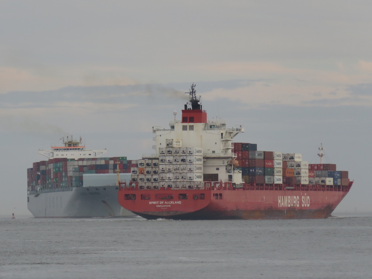 |
Passing
Position: -79 55.52, 32 47.51
While we were at the Charlotte Street Park, several large container ships arrived and departed, passing in the tight channel. It looked pretty risky.
|
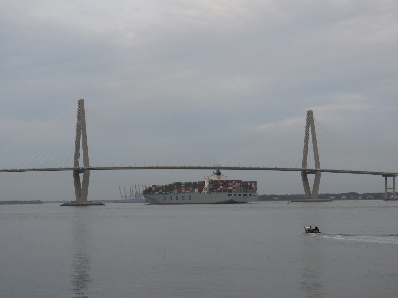 |
Ningbo
Position: -79 55.53, 32 47.51
Cosco Ningbo passing under the Arthur Ravenel Jr. Bridge. The clearance looks tight, but the bridge has a vertical clearance of 186ft and the ship has an air draft of 75ft, so there’s plenty of room.
|
 |
Charleston Maritime Center
Position: -79 55.51, 32 47.33
The marina at Charleston Maritime Center has shoaled in extensively and currently most of the docks are closed. We’ve read the docks also took some damage from Hurricane Mathew.
|
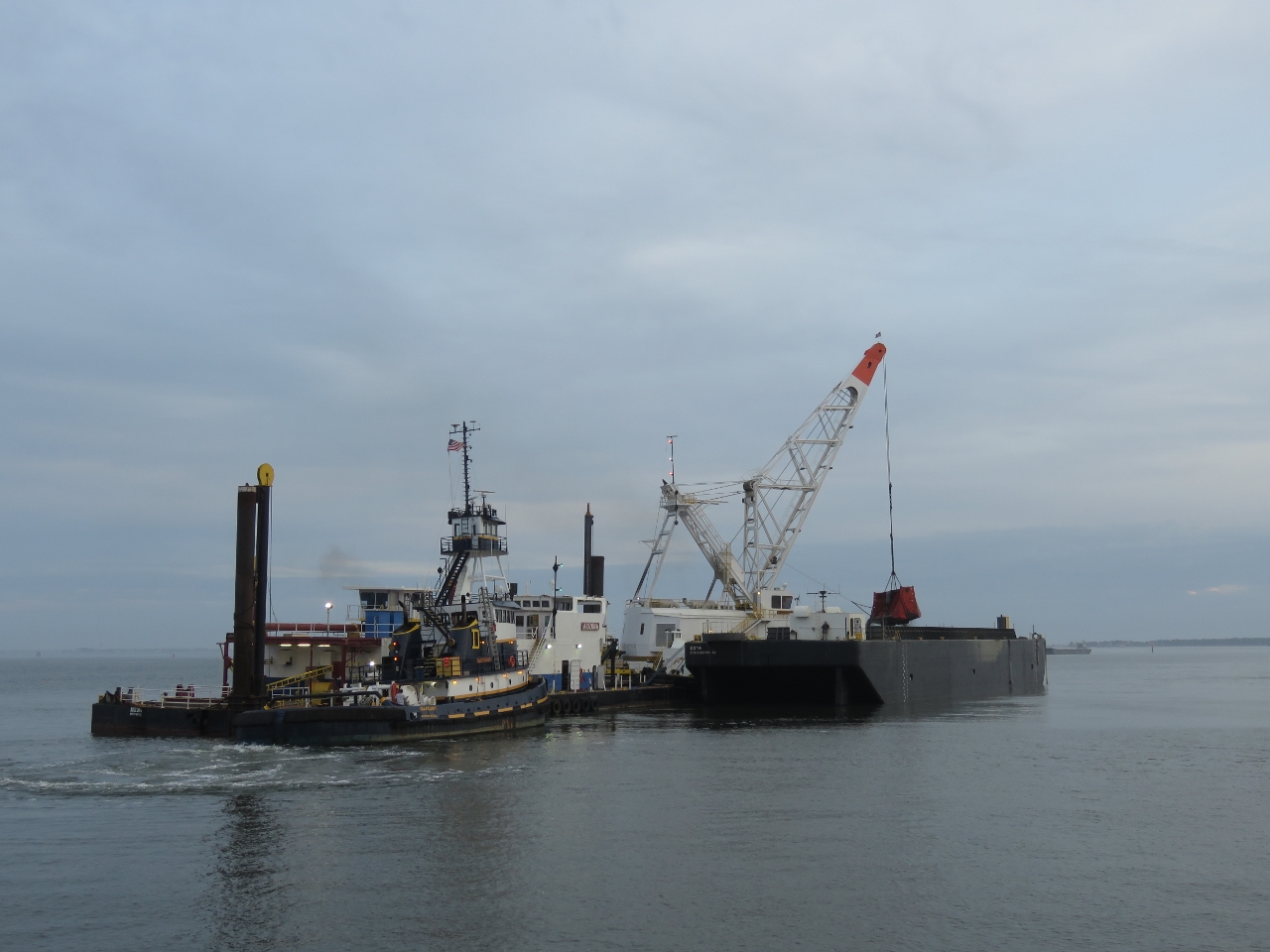 |
Dredging
Position: -79 55.43, 32 47.32
Dredging operations off Union Pier in downtown Charleston. We’ve heard the dredging is to allow larger cruise ships access the port.
|
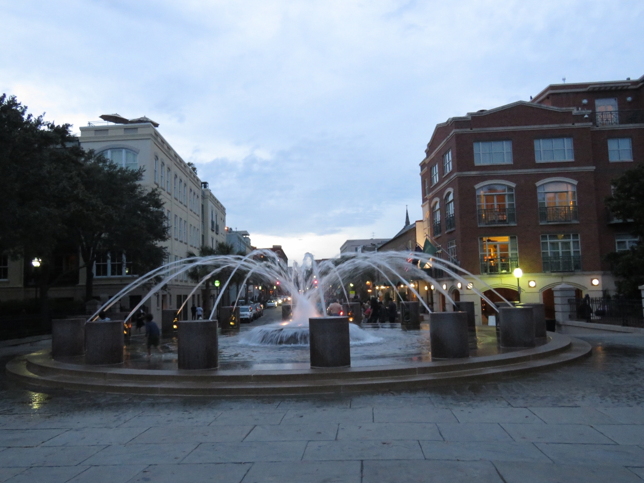 |
Waterfront Park
Position: -79 55.52, 32 46.74
Fountain in Charleston’s Waterfront Park.
|
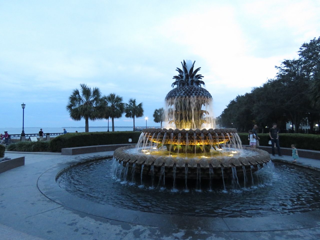 |
Pineapple Fountain
Position: -79 55.50, 32 46.68
A second fountain, the Pineapple Fountain, at the Waterfront Park. Pineapples are common motifs in Charleston, representing hospitality.
|
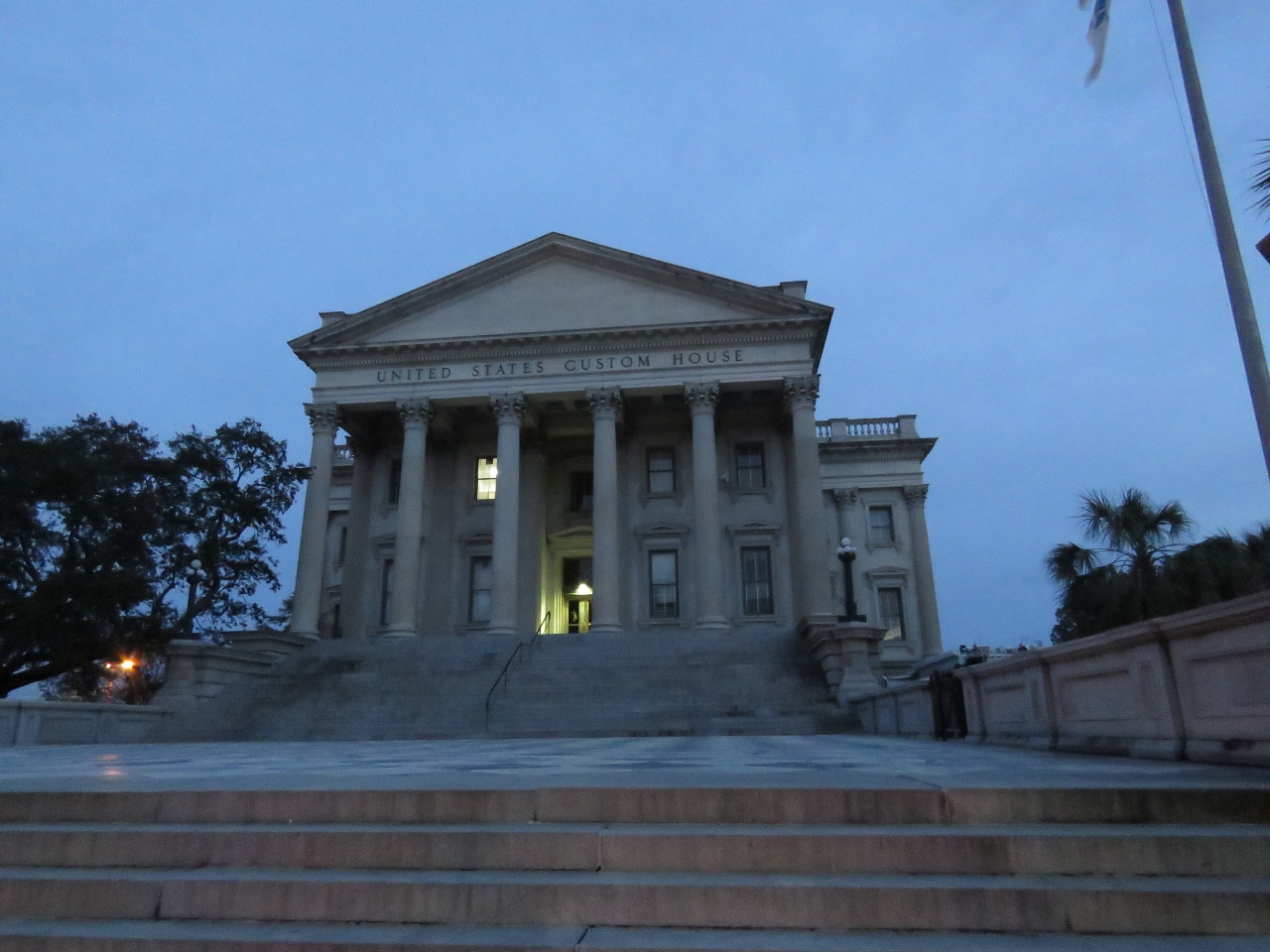 |
Customs House
Position: -79 55.63, 32 46.84
The majestic US Customs House building just off the waterfront was completed in 1879 and has been used ever since as a US Customs House.
|
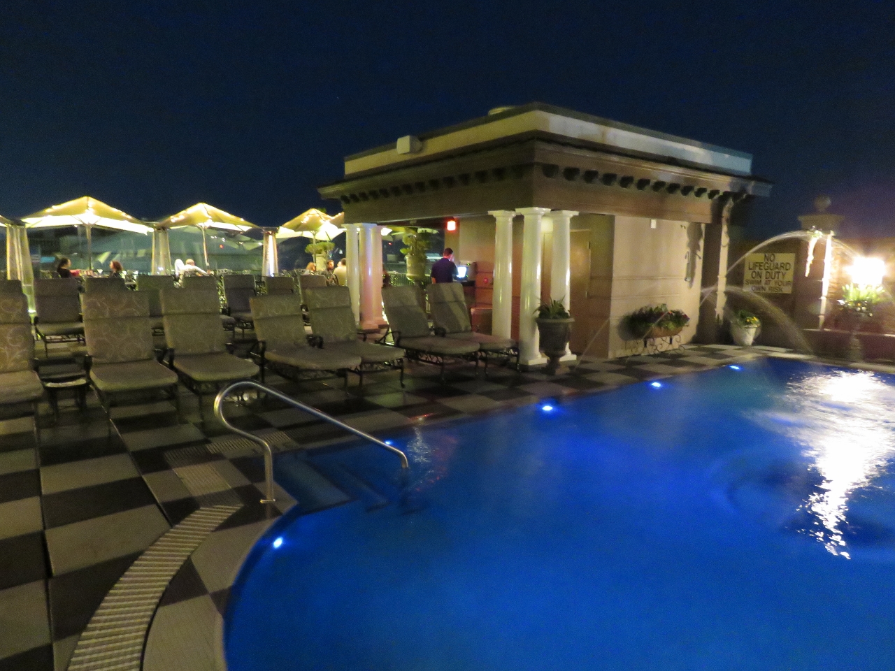 |
Pool
Position: -79 55.65, 32 46.86
From the street we could see a rooftop terrace above the Market Pavilion Hotel and went up to check it out. The first thing we saw getting off the elevator was this beautiful pool.
|
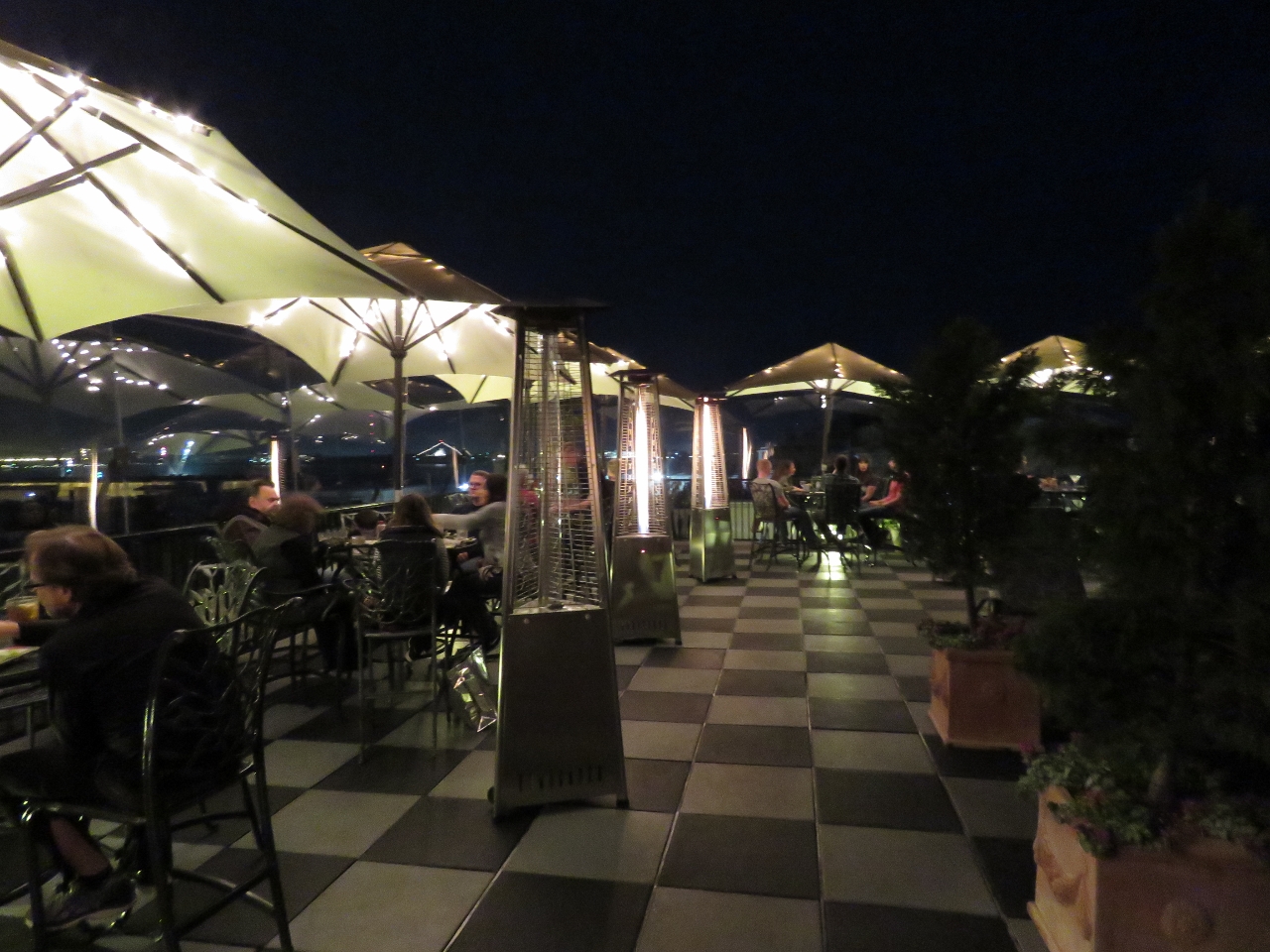 |
Pavilion Bar
Position: -79 55.65, 32 46.86
The Pavilion Bar at the top of the Market Pavilion Hotel was fabulous. Tables under lighted umbrellas lined the patio, with propane heaters to take off the chill.
|
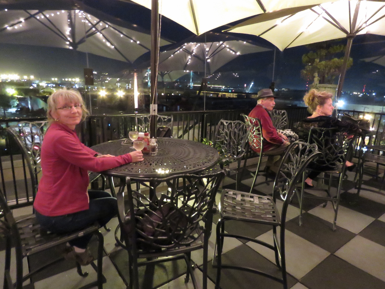 |
Table
Position: -79 55.65, 32 46.86
We were just early enough to snag a table along the edge with a view to the city, the harbor and the Arthur Ravenel Jr. Bridge. What a magical spot.
|
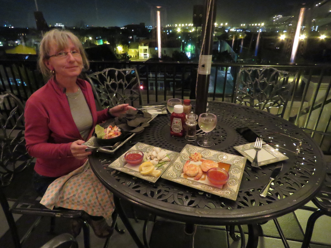 |
Dinner
Position: -79 55.65, 32 46.86
We shared several excellent seafood appetizers for dinner. You know we really like a place when we post four pictures of it. :)
|

|
Click the travel log icon on the left to see these locations on a map, with the complete log of our cruise.
On the map page, clicking on a camera or text icon will display a picture and/or log entry for that location, and clicking on the smaller icons along the route will display latitude, longitude and other navigation data for that location. And a live map of our current route and most recent log entries always is available at http://mvdirona.com/maps. |
If your comment doesn't show up right away, send us email and we'll dredge it out of the spam filter.