Bangor, Maine is the home of author Stephen King and the inspiration for the fictional town of Derry in several of his works. Bangor also is the location of the Eastern Maine Medical Center where Jennifer had an early-morning surgery scheduled to finally have the surgical pin removed from her shoulder. Rather than getting up crazy early in the morning to drive there in the dark from Belfast, we decided to spend the day exploring Bangor before surgery the following morning.
Trip highlights from October 12th and 13th in Bangor and Camden, Maine follow. Click any image for a larger view, or click the position to view the location on a map. And a live map of our current route and most recent log entries always is available at http://mvdirona.com/maps
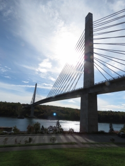 |
Penobscot Narrows Bridge
Position: -68 48.25, 44 33.67
On the way up to Bangor, we stopped off to visit the Penobscot Narrows Bridge opened in 2007. 420ft up at the top of the closest tower is the Penobscot Narrows Observatory, the first bridge observation tower in the United States and the tallest public bridge observatory in the world.
|
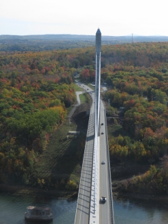 |
Waldo Hancock Bridge
Position: -68 48.22, 44 33.64
This is the view looking southeast across the river from the Penobscot Narrows Observatory. The footings from old the Waldo-Hancock Bridge are visible on the left. The Waldo-Hancock Bridge opened in 1931 with an 800ft span that was over twice as large as any other in Maine. In mid-2003 Maine Department of Transportation discovered severe corrosion in the supporting cables that required an emergency replacement of the bridge. The Penobscot Narrows Bridge was built in a record time of 42 months from conception to completion.
|
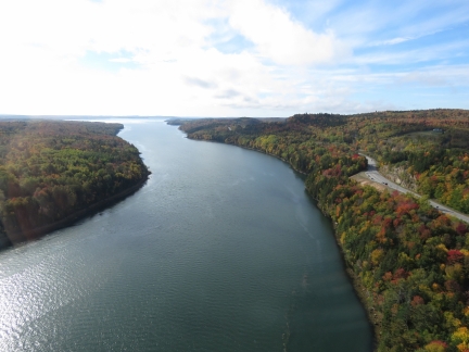 |
Penobscot River
Position: -68 48.22, 44 33.64
The view south down the Penobscot River from the Penobscot Narrows Observatory. In the distance are Sandy Point on the right and the junction with the Orland River on the left.
|
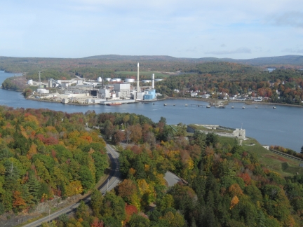 |
Fort from Bridge
Position: -68 48.22, 44 33.64
Looking north from the Penobscot Narrows Observatory. At the right of the picture on this side of the Penobscot River is Fort Knox, a 19th-century fortification and across the river is the Bucksport power plant and defunct paper mill.
|
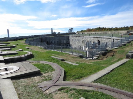 |
Fort Knox
Position: -68 48.14, 44 33.99
Fort Knox was built in the late 1800s to protect the area from further British attack. Maine and British Canada had repeated border disputes in the late 18th and early 19th century and the area between the mouth of the Penobscot River and the lumber-rich town of Bangor were occupied by British during the American Revolutionary War and the War of 1812. Fort Knox never saw battle and became a National Historic Landmark in 1970, as a virtually intact example of a mid-19th century granite coastal fortification.
|
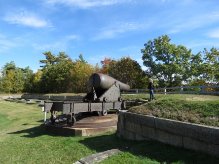 |
Cannon
Position: -68 48.09, 44 33.88
15-inch Rodman Cannon at “A” Battery at the south end of Fort Knox. “The gun was extremely powerful, but slow to maneuver. Twelve men were needed to load the cannon. They used a mechanical hoist to lift the 330 pound shell or 450 pound solid cannonball. Often, two men had to manage the rammer. The tube weight of the 15-inch Rodman is 50,000 pounds and the weight of the gunpowder charge was 60 pounds for a shell and 100 pounds for a solid cannonball. At a 20 degree elevation, the cannon could fire a solid cannonball 5,579 yards.” (Fort Knox State Historic Site).
|
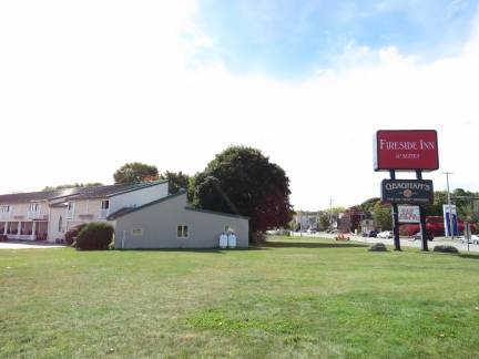 |
Fireside Inn
Position: -68 46.67, 44 47.31
We dropped the car off at our hotel, the Fireside Inn, to spend the afternoon exploring Bangor on foot.
|
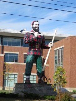 |
Paul Bunyan
Position: -68 46.66, 44 47.34
Bangor claims to be the birthplace of Paul Bunyan, a giant lumberjack in American folklore. Akeley, Minnesota also make this claim and both towns have large statues of the legend. This is the 31-ft high Paul Bunyan statue near our hotel, “reputed to be the largest statue of Paul Bunyan in the world,” according to its sign. Bangor native Stephen King brought the statue to life in his horror novel It.
|
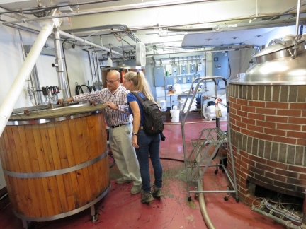 |
Sea Dog Brewery
Position: -68 46.19, 44 47.81
We’d arranged a tour of the Sea Dog Brewery along the Penobscot River. Here General Manager Bert Follero is showing us through.
|
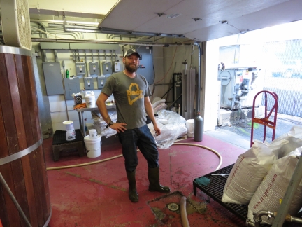 |
Head Brewer
Position: -68 46.19, 44 47.81
The Head Brewer at Sea Dog in Bangor.
|
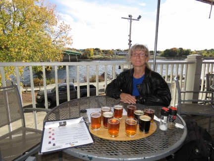 |
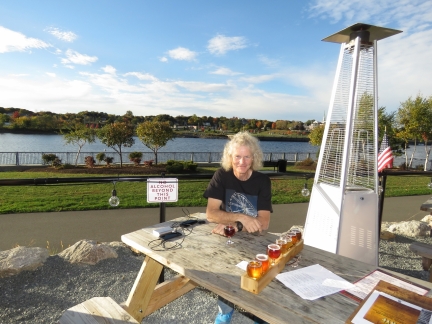
Tasting Flight
Position: -68 46.18, 44 47.81
We had a great lunch at the Sea Dog pub on the balcony above Penobscot River, with a tasting flight of their excellent beers.
|
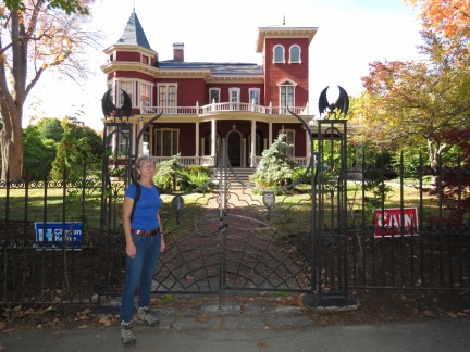 |
Stephen King
Position: -68 47.08, 44 48.13
Outside novelist Stephen King’s home in Bangor. Jennifer has been a huge Stephen King fan since first reading Salem’s Lot back in 1980 and has enjoyed many of his books over the years, including reading the entire The Dark Tower series during watches while crossing the South Pacific.
|
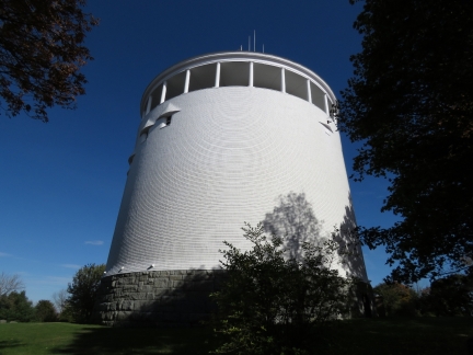 |
Standpipe
Position: -68 46.97, 44 48.46
Stephen King’s fictional town Derry in the the novel It and other stories is based on Bangor. The Thomas Hill Standpipe was the inspiration for the haunted and dangerous water tower in King’s novel It, and King is said to have written much of the book on park bench at the tower base.
|
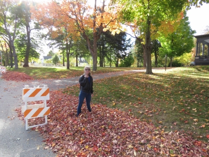 |
Leaves
Position: -68 46.95, 44 48.40
We’ve not seen a big pile of fall leaves for years. Jennifer couldn’t resist wading through.
|
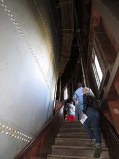 |
Standpipe Tour
Position: -68 46.97, 44 48.46
The Thomas Hill Standpipe is Bangor’s oldest standpipe and a National Historic Landmark, and has been in use since its construction in 1897. The standpipe is open usually only four times per year for public tours and we happened to be in town on one of those days for the “Fall Colors Tour”. A line-up of a nearly fifty people had formed before the doors opened at 3pm, along with a media van. Here we are climbing the stairs in the wooden building that encloses the standpipe, with the 1.75-million gallon riveted steel standpipe visible on the left.
|
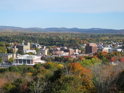 |
View
Position: -68 46.97, 44 48.45
The fabulous view from the standpipe’s promenade deck looking north. We believe the mountain range in the distance is the Longfellow Mountains, considered an extension of New Hampshire’s White Mountains. We were lucky to be in Bangor not only on the one day this season that the standpipe was open for tours, but in such clear and beautiful weather.
|
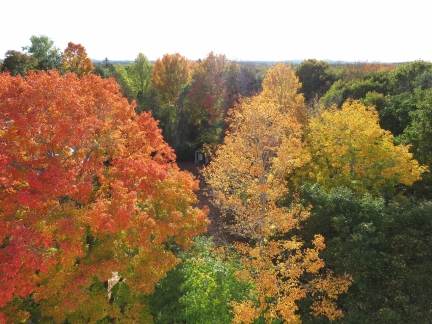 |
Fall Colors
Position: -68 46.98, 44 48.44
This is why they call it the “Fall Colors” standpipe tour. The fall leaves viewed from the standpipe promenade were spectacular.
|
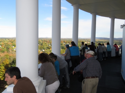 |
Crowds
Position: -68 46.98, 44 48.44
A continuous stream of people were arriving at the standpipe. Several hundred probably did the tour that day.
|
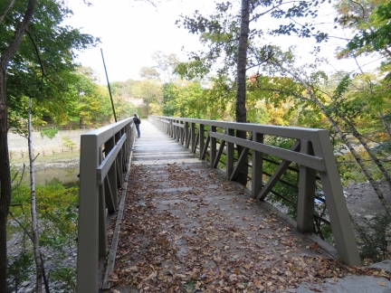 |
Kenduskeag Trail
Position: -68 46.61, 44 48.31
We walked a portion of the Kenduskeag Stream Trail to this footbridge, looking for a nice route back toward the Penobscot River, but the trail runs the other direction.The historic Morse Covered Bridge, built 1872, stood here until an arsonist destroyed it in 1983. The current footbridge across the Kenduskeag Stream stands on the footings of that original bridge. The Kenduskeag Stream is the one that the children dammed in Stephen King’s novel It, and the novel’s “Kissing Bridge” likely was based on the Morse Covered Bridge.
|
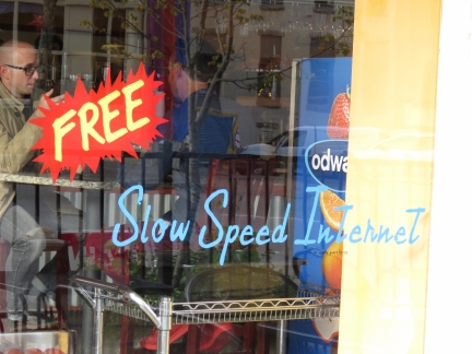 |
Free Internet
Position: -68 46.26, 44 48.07
We got a chuckle out of this “Free Slow Speed Internet” advertisement.
|
 |
Masons Brewery
Position: -68 46.18, 44 47.50
Back downtown, we crossed the Penobscot River and walked to Mason’s Brewery on opposite shore from Sea Dog Brewery.
|
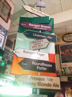 |
Geaghan’s
Position: -68 46.66, 44 47.20
Our final brewpub stop for the day at Geaghan’s Pub and Craft Brewery adjacent to our hotel. This is their craft beer list.
|
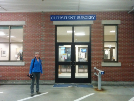 |
Eastern Maine Medical Center
Position: -69 0.23, 44 25.76
An early-morning surgery at Eastern Maine Medical Center to finally get that pin removed. Bangor may seem a bit off the beaten path for surgery, but Dr. Jessica Aronovitz came highly recommended and did an excellent job. And Bangor ended up being quite convenient in being about an hour’s drive from both Southwest Harbor and Belfast. So we could continue travelling south between the evaluation appointment and the surgery.
|
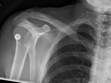 |
Pinless!
Position: -68 45.10, 44 48.46
Jennifer is finally pinless! The surgical pin that has been holding her shoulder together for the last six months finally was removed this morning in Bangor, Maine. The collar bone break has healed well and the good news, at least from our perspective, is we never had to stop and let things heal. Great medical attention allowed us to continue the trip largely without change, and to continue almost like nothing had happened. We got to enjoy Newfoundland and Nova Scotia this summer and hike and explore without really being slowed down at all.
Thanks to Dr. Gus Gialamas of Seaview Orthopaedics, Dr. Veronica Diaz of Jupiter Hand to Shoulder, and Dr. Jessica Aronovitz of Eastern Maine Medical Center. Without their care and skill, this year wouldn’t have been nearly as enjoyable as it was. Admittedly, it is very nice to have that pin gone :-) |
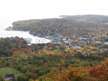 |
Mount Battie
Position: -69 4.08, 44 13.39
We weren’t expecting Jennifer to be up for much today after her surgery, but she recovered so well in just a couple of hours that we decided to try a little sightseeing. This is the view to Camden from Mount Battie. The fall colors are really out now.
|
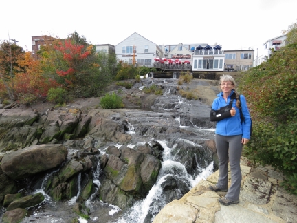 |
Megunticook River Falls
Position: -69 3.86, 44 12.64
Jennifer temporarily back in a sling in front of the Megunticook River Falls in Camden.
|
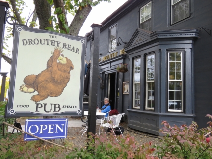 |
Drouthy Bear
Position: -69 4.00, 44 12.49
No beer for Jennifer today with the medication she is on after surgery, but she did get a lemonade on the patio at the Drouthy Bear pub in Camden.
|

|
Click the travel log icon on the left to see these locations on a map, with the complete log of our cruise.
On the map page, clicking on a camera or text icon will display a picture and/or log entry for that location, and clicking on the smaller icons along the route will display latitude, longitude and other navigation data for that location. And a live map of our current route and most recent log entries always is available at http://mvdirona.com/maps. |

If your comment doesn't show up right away, send us email and we'll dredge it out of the spam filter.