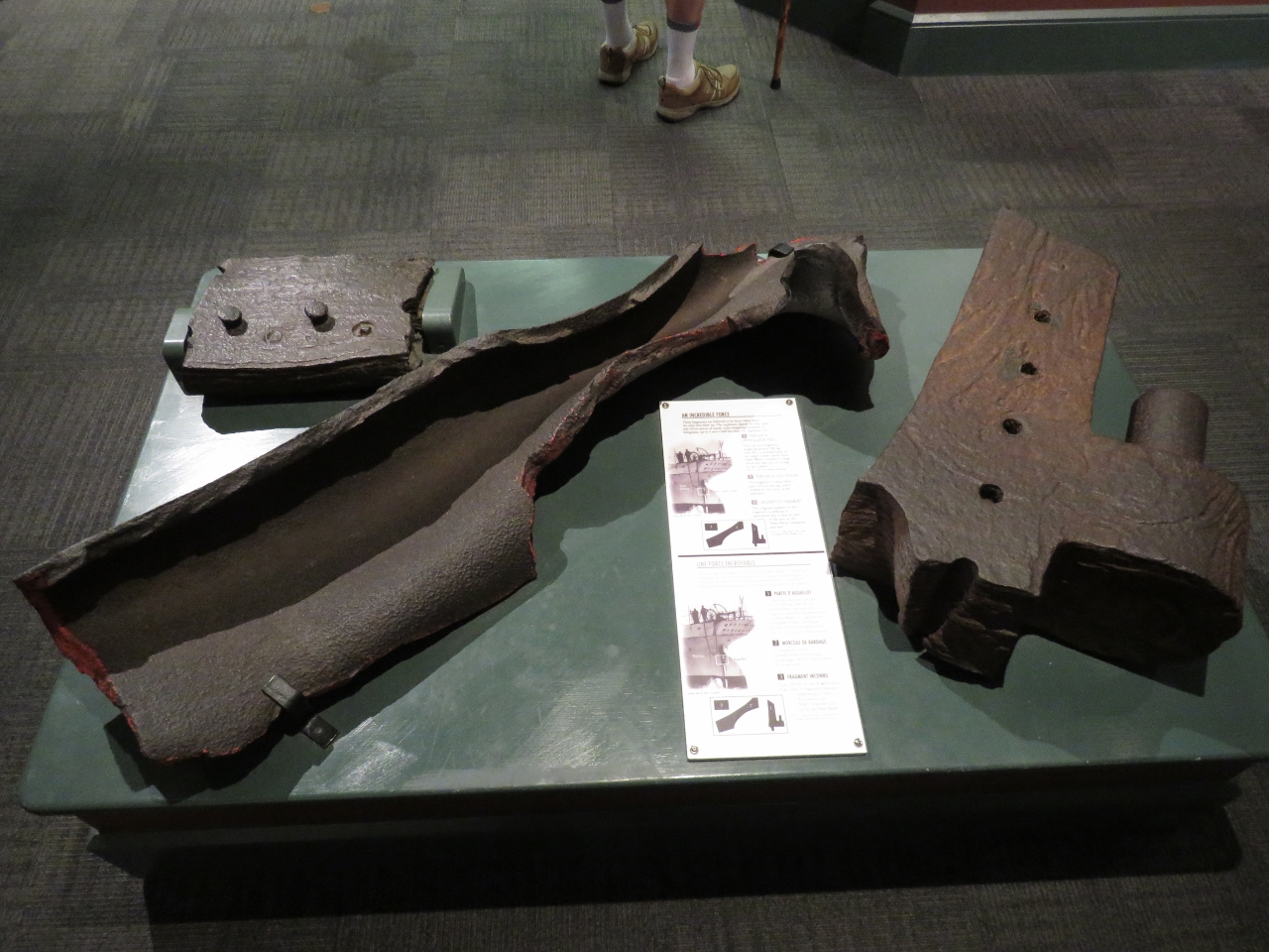
We loved our Halifax berth at the Maritime Museum, right downtown within walking distance of the city’s many attractions. One of the most memorable exhibits at the museum covers the 1917 Halifax Explosion, the largest man-made detonation prior to the development of nuclear weapons. On December 6th, 1917 the explosives-laden SS Mont-Blanc collided with the SS Imo in the Narrows that connect Halifax Harbour with Bedford Basin to the north. A fire started on board the Mont-Blanc and ignited the cargo. The ensuing explosion obliterated all buildings within a half-mile radius. 2,000 people were killed and another 9,000 were injured. Pictured above are fragments from the Mont-Blanc, which were scattered for miles.
Trip highlights from September 14th and 15th, 2016 in Halifax, Nova Scotia follow. Click any image for a larger view, or click the position to view the location on a map. And a live map of our current route and most recent log entries always is available at http://mvdirona.com/maps
 |
Welcome Package
Position: -63 34.18, 44 38.85
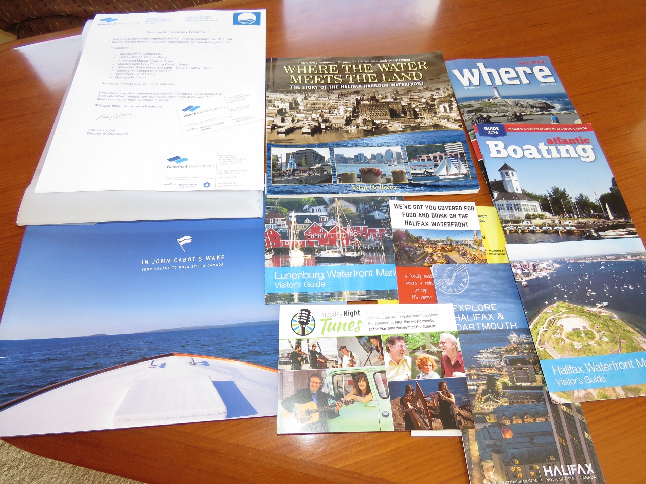
Waterfront Development, a Nova Scotia Crown Corporation, is responsible for rejuvenating Halifax’s beautiful waterfront. They also operate the Halifax Waterfront Marina, a collection of wharves and floating docks along the waterfront. They do an excellent job, including providing this extensive welcome package to visiting boaters. We’re quite impressed.
|
 |
Webcam
Position: -63 34.18, 44 38.85
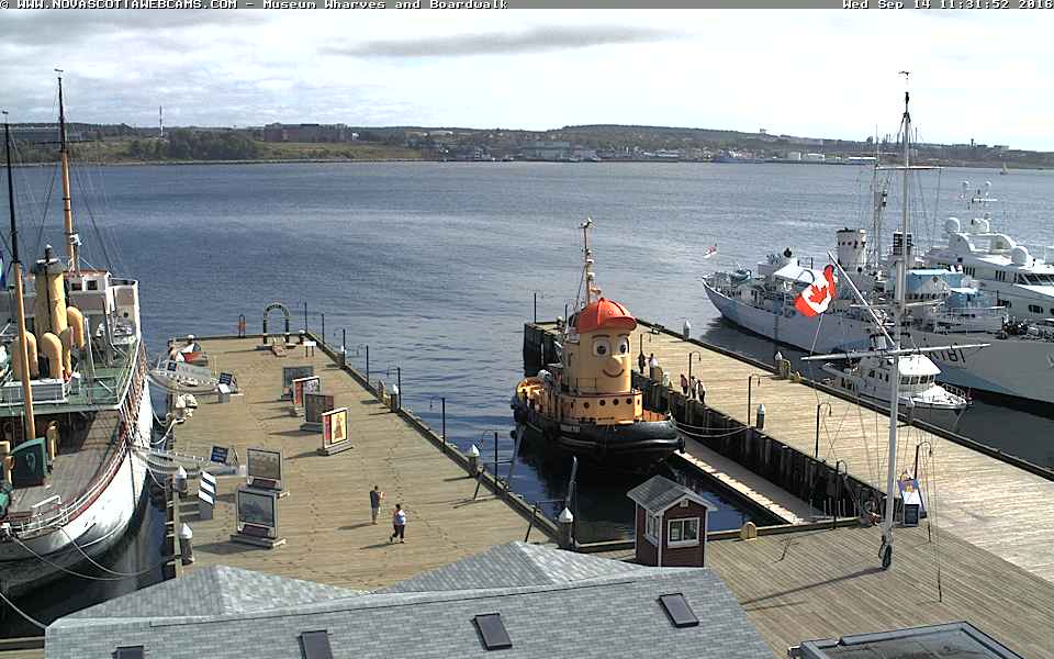
This photo is a screenshot taken from the museum webcam showing, from left to right, the CSS Acadia, Theodore Too, Dirona, and the HMCS Sackville. Our next stop will be Lunenberg, also with a waterfront webcam.
|
 |
Construction
Position: -63 34.47, 44 38.89
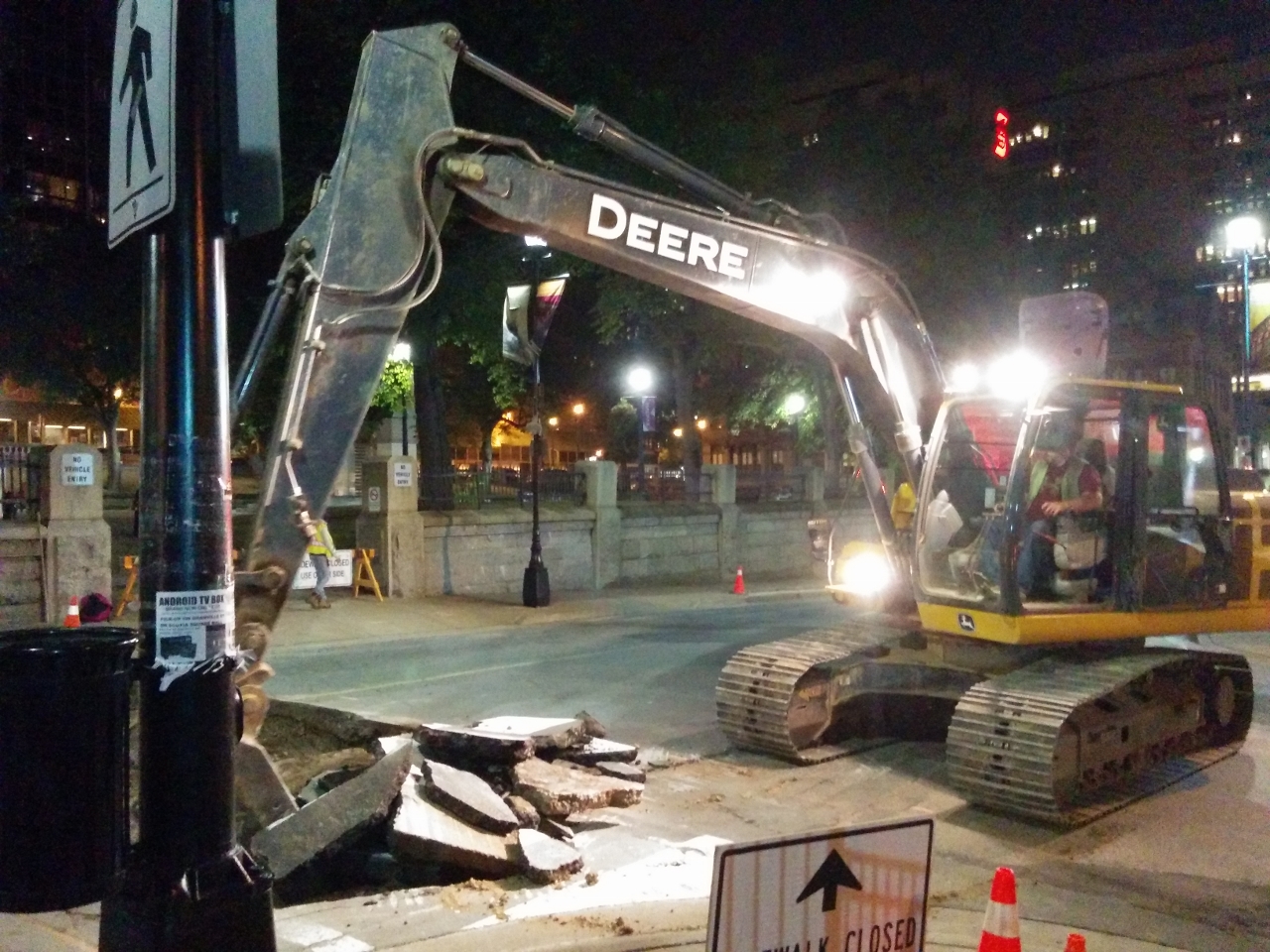
After dinner we walked around town a bit and spent a good half hour watching this power shovel digging up the road. We were amazed at how quickly the driver was able to tear out huge chunks of the pavement and with incredible accuracy. Within fifteen minutes he had removed a strip the width of the road.
|
 |
Garbage
Position: -63 34.18, 44 38.85
We’ve not disposed of any garbage since leaving Boston nearly eight weeks ago. The white bag on the ground next to Jennifer is one of the two trash compactor bags we filled in that time. We mainly put plastics and anything else not recyclable or biodegradable in the trash compacter, and don’t put anything in there that can smell. When the trash compacter is full, we stow the bag inside a plastic bin in one of the bow lockers. We put smelly, non-biodegradable foodstuff garbage in a small plastic container that we keep sealed under the galley sink. When we transfer the trash compacter bag forward, we also empty the smelly garbage into it. Using this system, we only produce one garbage cube every 3-4 weeks, allowing us to go multiple months without getting rid of any garbage.
|
 |
Prepare To Dive!
Position: -63 34.18, 44 38.85
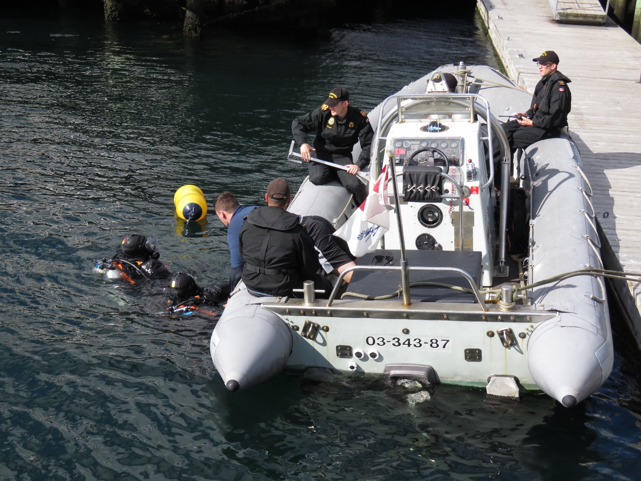
A crew from the HMCS Sackville came over this morning to warn us they’d be cleaning the bottom and request that we not move the boat or run the engine. An hour or so later, the divers were in the water from a tender off our bow. Each time the divers popped up to ask a question or get a tool, they had to stay above the water until the commanding officer yelled “Prepare to Dive!” then “Dive!”, at which point they were allowed to go down.
|
 |
Visit
Position: -63 34.18, 44 38.85
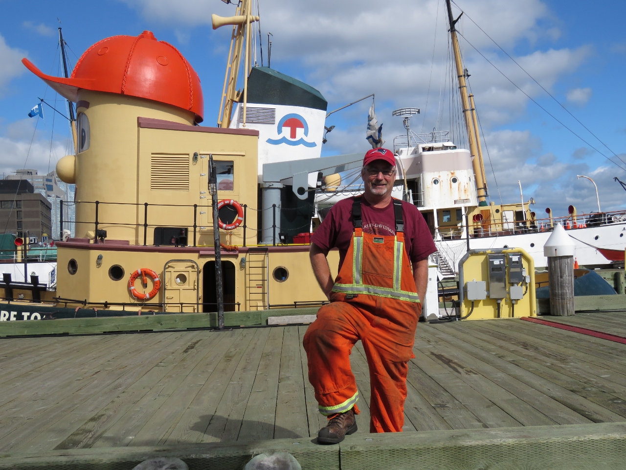
Nova Scotia resident Gary has been following our travels since Australia at least and stopped by to say hello during his work day.
|
 |
Merlin
Position: -63 34.26, 44 38.85
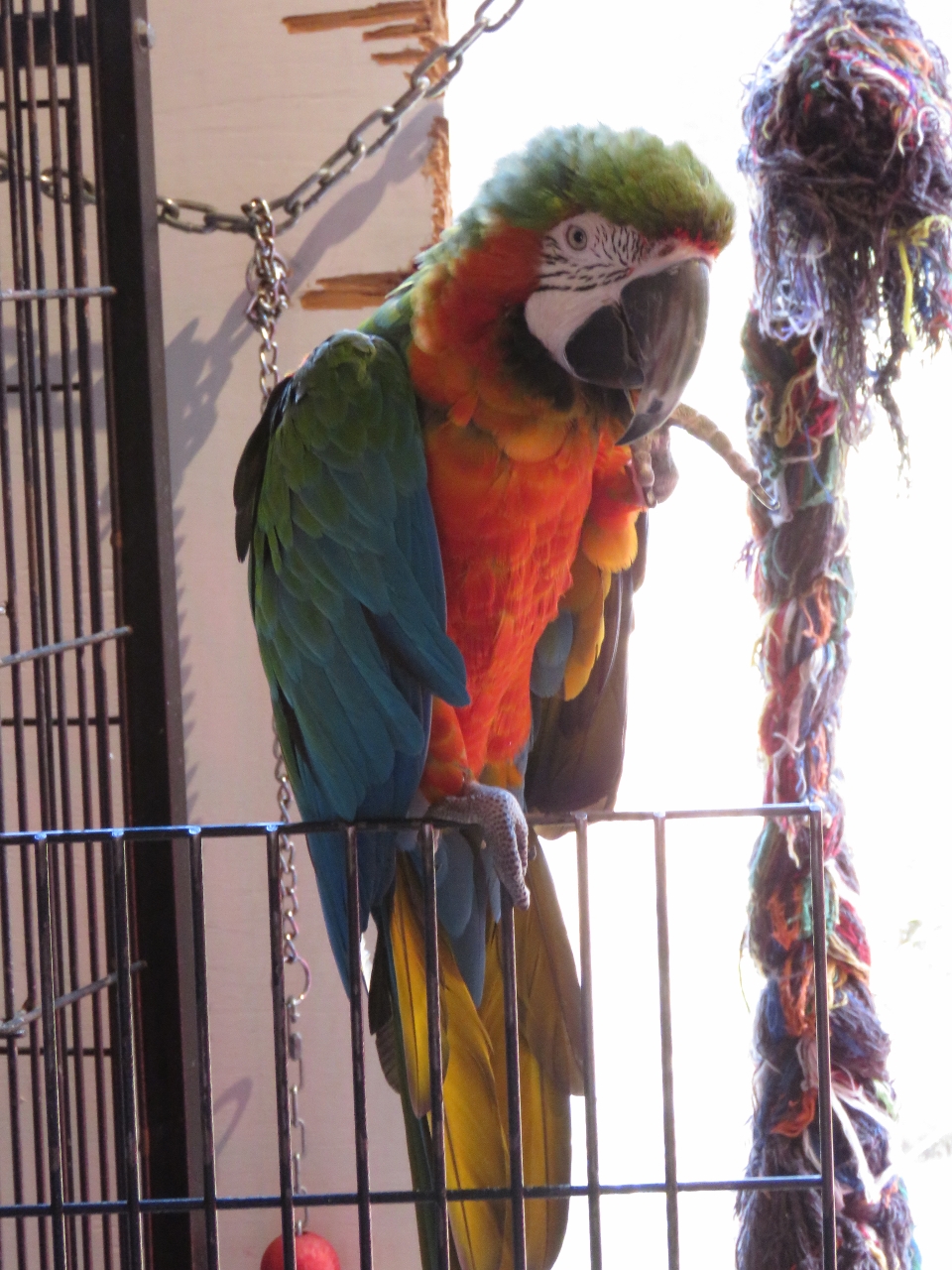
After lunch we visited the excellent Maritime Museum of the Atlantic. This is the museum greeter, Merlin the parrot.
|
 |
Fresnel Lens
Position: -63 34.26, 44 38.85
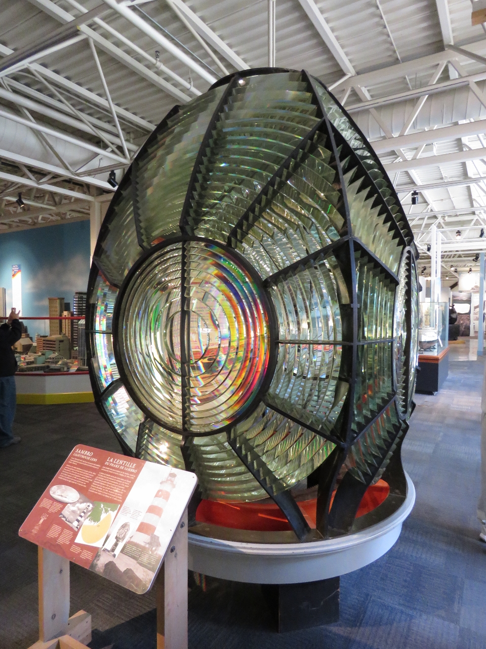
A giant first-order Fresnel lens from the Sambro light house southwest of Halifax Harbour.
|
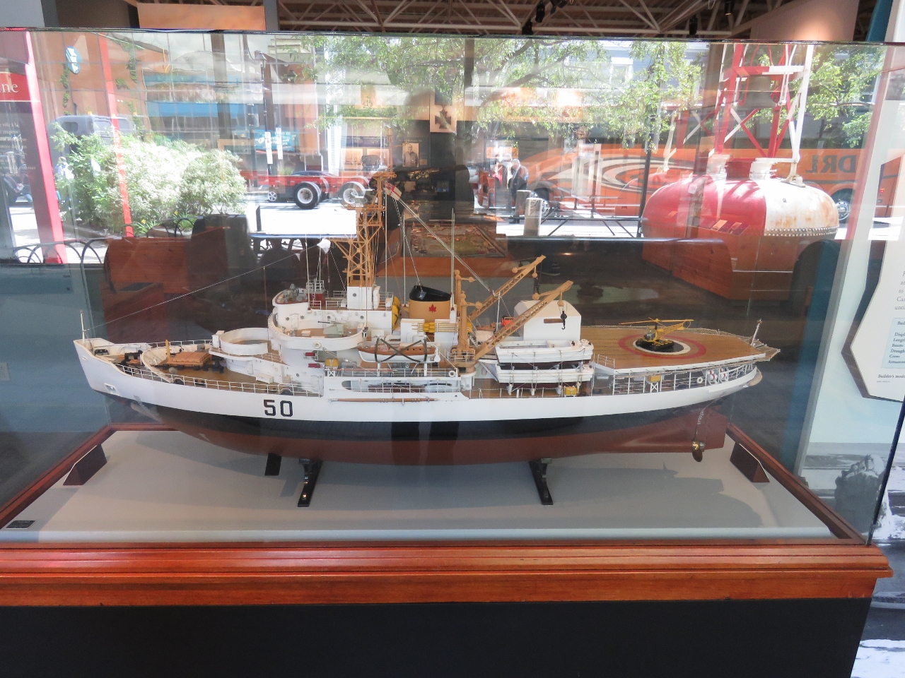 |
Model Ships
Position: -63 34.26, 44 38.85
The museum has a model ship workshop and an impressive collection of models on display. We found it interesting that this ship had both active stabilizers and what looked like a flopper-stopper pole.
|
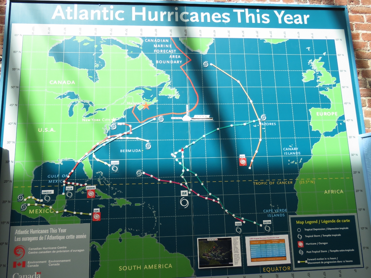 |
Hurricanes
Position: -63 34.26, 44 38.86
This placard in the museum tracks all the Atlantic hurricanes this year. Our approach to hurricane-avoidance has been to not be anywhere that has named storms during that area’s hurricane or cyclone season. But you pretty much can’t avoid it on the east coast of North America. The entire area sees hurricanes from the Caribbean up to at least Newfoundland. On September 29, 2003 Hurricane Juan hit Halifax with winds gusting to 110mph. The tidal surge sent large pieces of the boardwalk ashore and the HMCS Sackville broke loose and destroyed the vessel Lucina, moored where we are right now. Yikes! September 29th is only two weeks from when we were there.
|
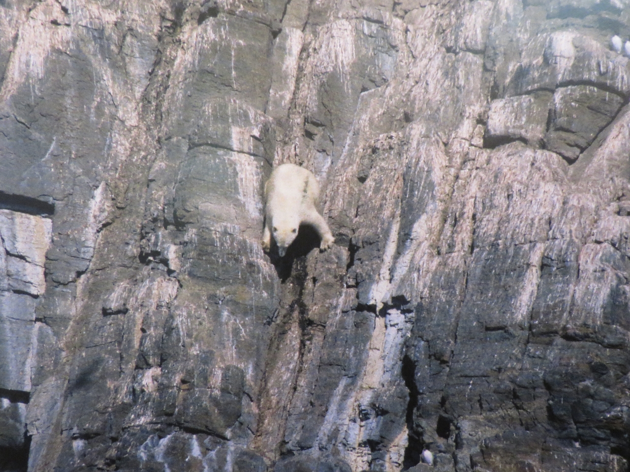 |
Polar Bear
Position: -63 34.25, 44 38.84
We loved this photo in the museum’s Arctic exhibit of a polar bear climbing down a sheer cliff to hunt for bird eggs.
|
|
|
Halifax Explosion
Position: -63 34.22, 44 38.85
On December 6th, 1917 the explosives-laden SS Mont-Blanc collided with the SS Imo in the Narrows that connect Halifax Harbour with Bedford Basin to the north. A fire started on board the Mont-Blanc and ignited the cargo, generating the largest man-made explosion prior to the development of nuclear weapons. All buildings within a half-mile radius were obliterated, 2,000 people were killed and another 9,000 were injured. Pictures are fragments from the Mont-Blanc, which were scattered for miles.
|
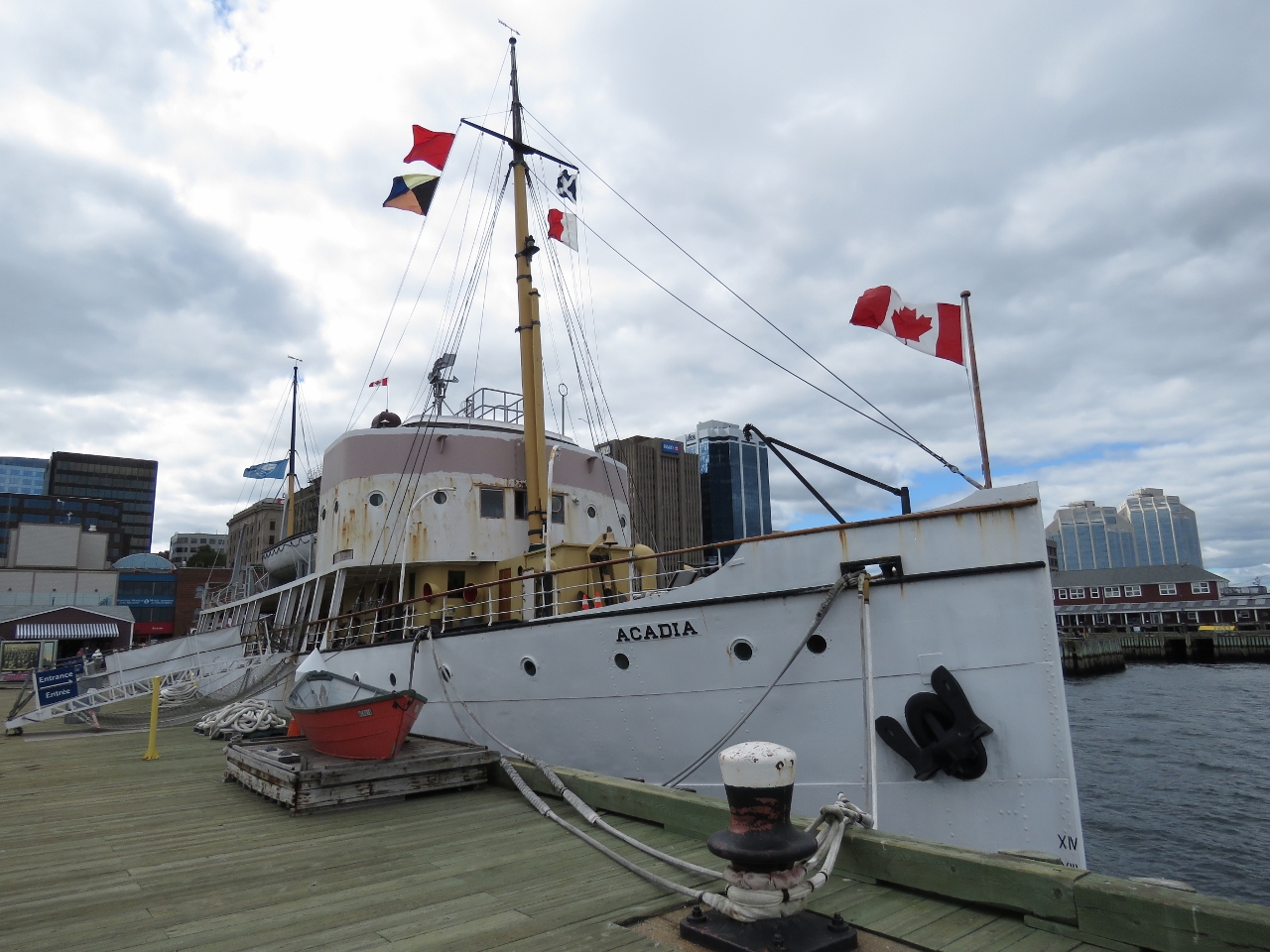 |
CSS Acadia
Position: -63 34.18, 44 38.87
The CSS Acadia is the first ship built specifically to survey Canada’s northern waters. She was launched in 1913 and is the only surviving ship to serve Canada during both World Wars. The ship was retired in 1969 and became part of the museum’s collection in 1982. the steel-hulled boat is beautifully built, with extensive woodwork throughout.
|
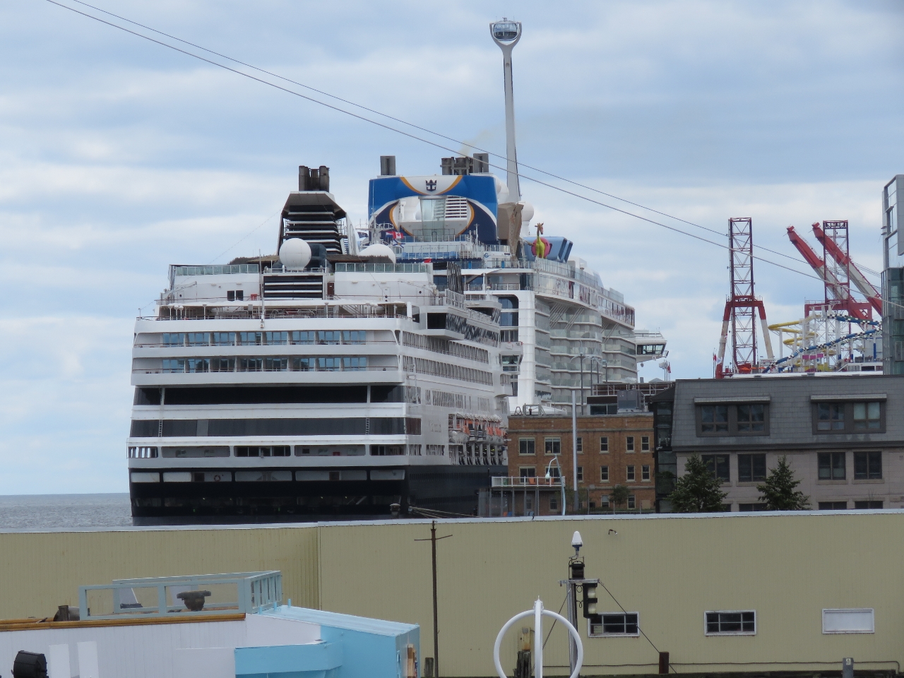 |
Cruise Ships
Position: -63 34.19, 44 38.88
Halifax is a major cruise ship port. Last year 141 cruise ships brought 22,309 passengers to the city. We could see two of the three in port today from the deck of the Acadia.
|
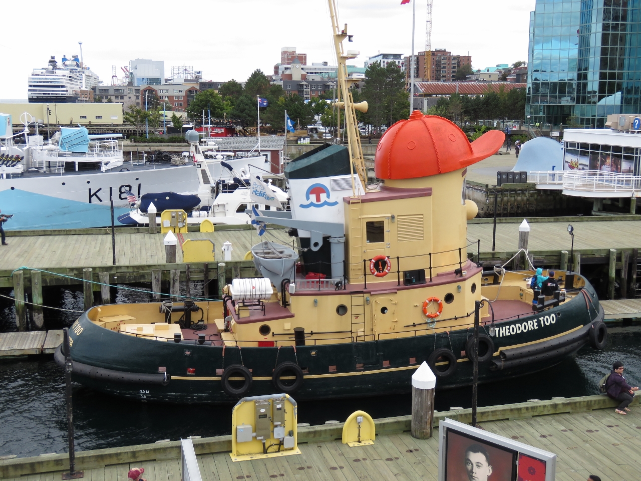 |
Neighbours
Position: -63 34.19, 44 38.88
Theodore Too, Dirona and the HMCS Sackville viewed from the deck of the Acadia.
|
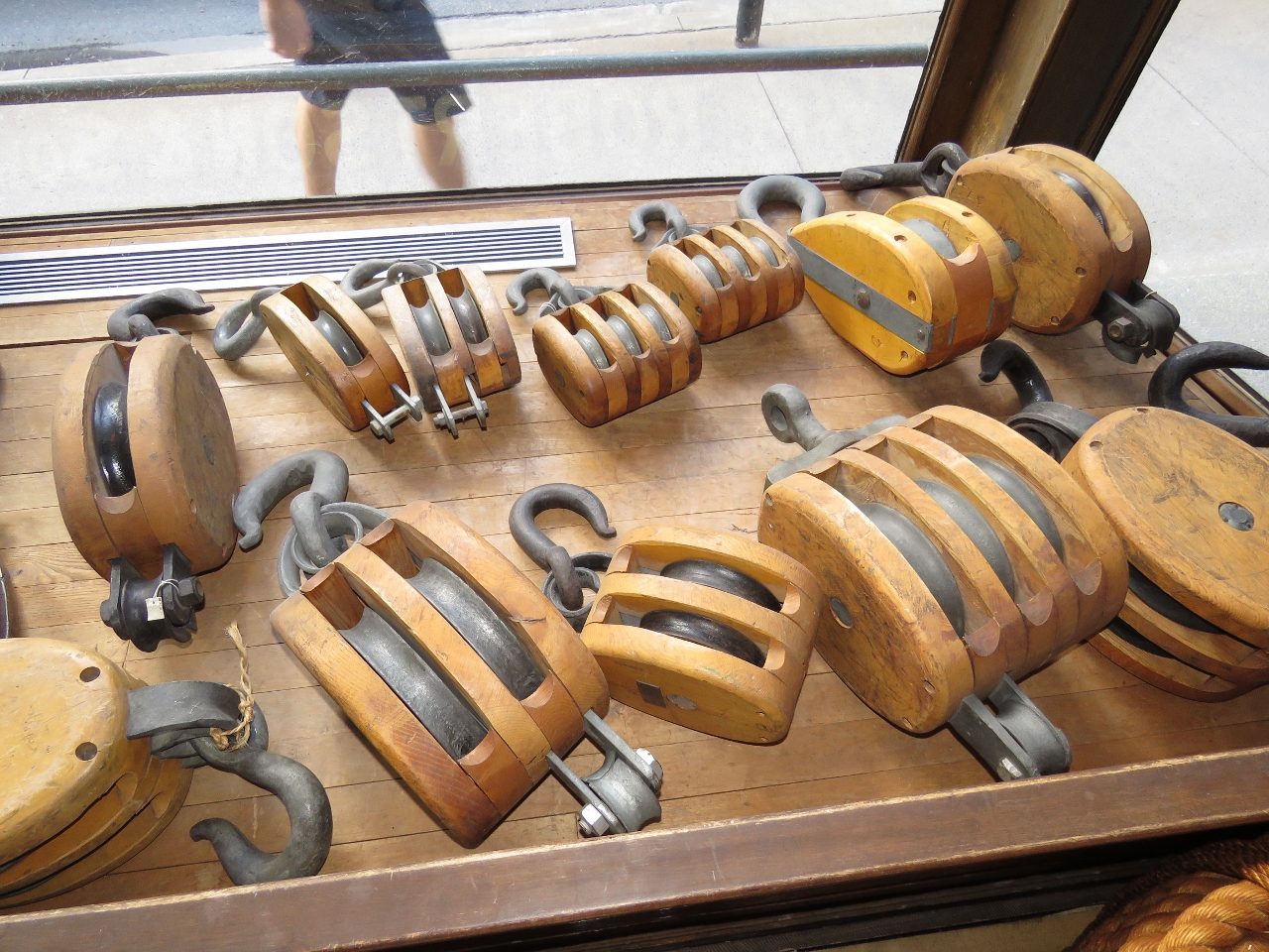 |
Blocks
Position: -63 34.28, 44 38.86
The museum display included the intact store W. M. Roberston and Sons in its original location with inventory it carried in the early 1900s. These beautiful blocks caught our attention on the street from outside the museum.
|
 |
Hammock
Position: -63 34.07, 44 38.72
From the museum we walked the harbor front boardwalk to the cruise ship terminal to see if we could get a good vantage for the ships leaving. Jennifer tried out the hammocks along the way.
|
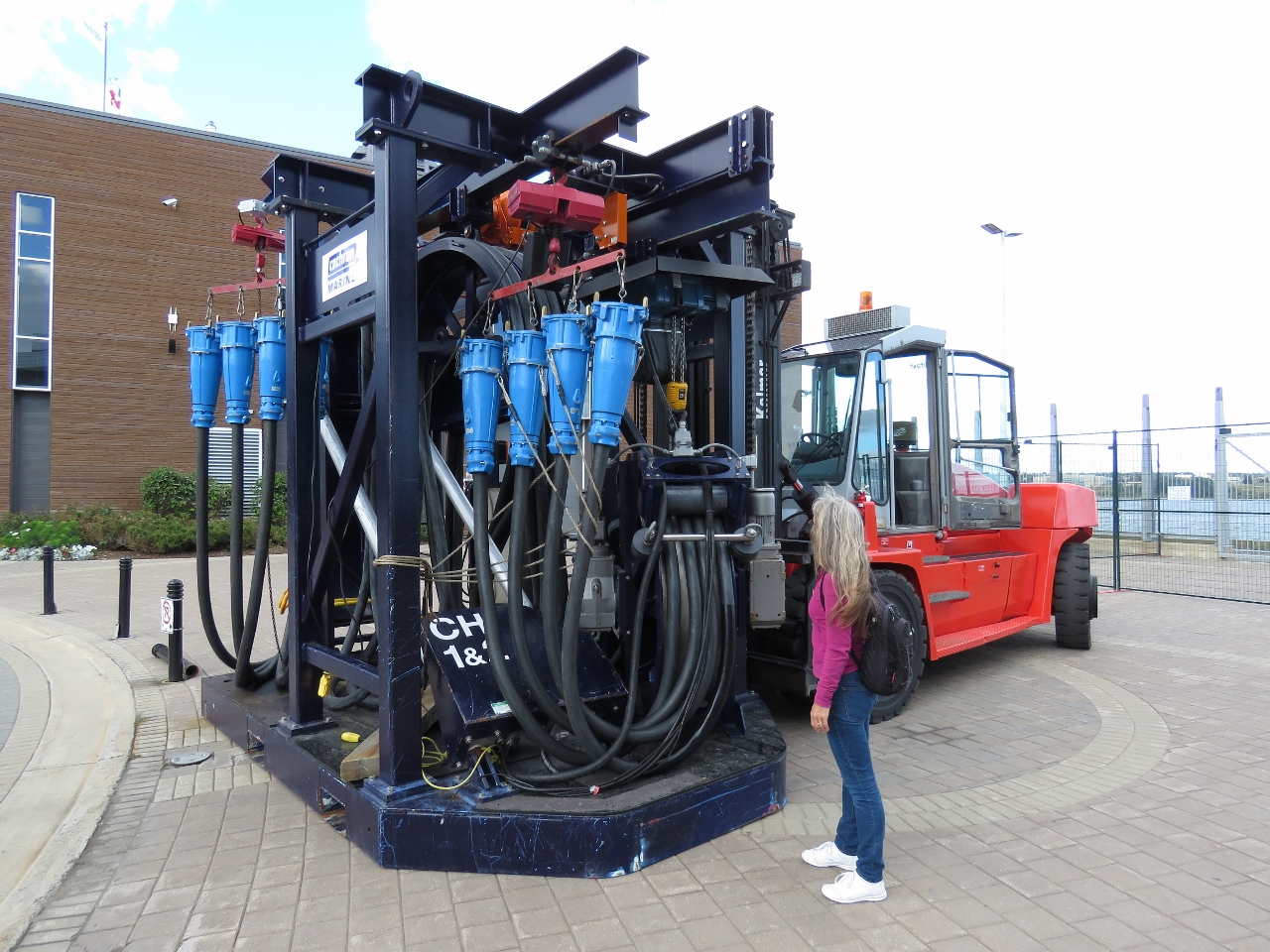 |
Power Connections
Position: -63 33.97, 44 38.47
Now that’s a shore power cord. One of the cruise ships had already left by the time we arrived and this is its shore power cord. We have a Glendinning to power our shore power cord in, whereas the cruise ships use a forklift.
|
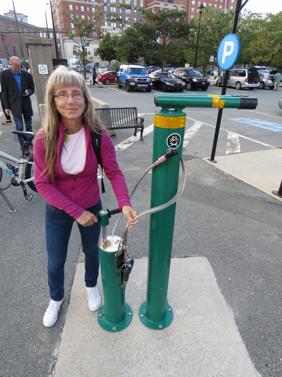 |
Bicycle Repair
Position: -63 33.98, 44 38.40
Halifax is very bicycle friendly. This is a bicycle repair station, complete with air, tools and a support for the bike while working on it.
|

|
Click the travel log icon on the left to see these locations on a map, with the complete log of our cruise.
On the map page, clicking on a camera or text icon will display a picture and/or log entry for that location, and clicking on the smaller icons along the route will display latitude, longitude and other navigation data for that location. And a live map of our current route and most recent log entries always is available at http://mvdirona.com/maps. |
Hello James,
Something’s are extremely hard to assess and while the Halifax explosion on December 6th, 1917 is probably the largest accidental explosion before the development of nuclear weapons, I really don’t think it’s the largest. one made by man.
When considering the destructive energy of an explosion various factors have to be considered as the weight of the material involved doesn’t tell the entire story. Proximity, chemical composition, tamping and purity or in the case of thermobaric weapons preheating and external oxygenation all play a role.
I still consider the Mines in the Battle of Messines detonated on June 7th 1917, to be the largest man made explosion. At any rate they killed more people and moved more mass than any non-nuclear explosion in history.
I’m not sure they didn’t move more mass than that multistage the Soviets set off in the 1960’s. And that was the largest explosion of any type made by man.
There are so many explosions “competing” for the crown that there is an entire Wikipedia page dedicated to the topic. Your arguments and the facts supporting them seem perfectly reasonable to me. The Museum claims the explosion to have been the largest but, as you said, there are many ways to size an explosion. It was deffinitely a big one.
Hi, James and Jennifer-
We have been following your incredible journey since the beginning. I wonder if you might share a little bit about your planning process? Wondering how far in advance you plan routes and destinations and how you approach the process? Seems like this could be a topic for a seminar/presentation at some point.
We do long-range planning of a year out or more between countries and for crossing oceans. It’s in our best interest to avoid hurricane and cyclone seasons and our insurance doesn’t cover us for named storms in season. So our plans avoid the affected regions during those times, such as the South Pacific between Dec 1 and March 31.
Another high-level constraint is major ocean crossings have a preferred time of the year to cross where the weather is statistically calmest. For example, the best time to cross the Tasman Sea from New Zealand to Australia is May-June. We aimed to cross in early May and ended up leaving May 15.
We do shorter-range planning within countries or regions of maybe a few weeks or a couple of months ahead. For places, such as the northeast coast of the US where there are lots of places to go and no specific weather restrictions our plans tend to be very open-ended. Right now our only plans are to keep running south and stay ahead of the frost line.
Next year we plan to cross the Atlantic and ultimately to cruise Norway and the Baltic Sea. That crossing is very dependent both on good weather and, for the more northern crossings, iceberg season. The farther north you cross (eg. Newfoundland to Ireland), the shorter the passage distance, but the more icebergs are a risk until about July. Going further south, eg. Bermuda to Azores and north is an option, but the statistically reasonably weather for the crossing doesn’t start until May. So it’s a long way out of the way for a gain of a few weeks. We’re still working on a plan.
We have an article coming out in Passage Maker likely early next year that covers this.
Jennifer
Thank you, that is helpful. I look forward to reading the article!
Larry