The Freedom Trail is a 2.5-mile route that leads past sixteen sites significant to Revolutionary Boston. The trail starts in downtown Boston at the Boston Commons and ends in Charlestown at the Charlestown Navy Yard or the Bunker Hill Monument. After our Boston Light trip, we took a self-guided walking tour of the Freedom Trail from Boston Commons to Bunker Hill. We had a great time visiting the historic sites, such as Old North Church where the “one if by land, and two if by sea” lantern signal was sent to warn patriots of a British attack. And we just made it to Bunker Hill before it closed for the day to climb to the top for a sweeping view of the city.
Trip highlights from our Freedom Trail tour follow. Click any image for a larger view, or click the position to view the location on a map. And a live map of our current route and most recent log entries always is available at http://mvdirona.com/maps
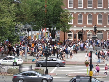 |
Crowd
Position: -71 3.47, 42 21.57
A huge crowd outside Faneuil Hall watching a street performer.
|
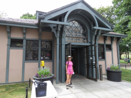 |
Freedom Trail
Position: -71 3.83, 42 21.32
At the start of the Freedom Trail, a 2.5-mile route that leads past sixteen sites that were significant to Revolutionary Boston.
|
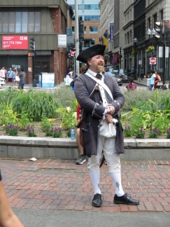 |
Tours
Position: -71 3.82, 42 21.33
Guides dressed in 18th century costumes play the role of Boston citizens at the forefront of the Revolutionary War and take visitors on a tour of the Freedom Trail.
|
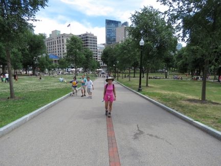 |
Boston Common
Position: -71 3.82, 42 21.44
The Freedom Trail starts at Boston Common, the nation’s oldest public park dating from the 1630s. The British Army camped here during the occupation of Boston that started in 1768, tensions from which led up to the Revolutionary War. The trail is marked with double-red bricks, so is easy to follow.
|
 |
State House
Position: -71 3.82, 42 21.45
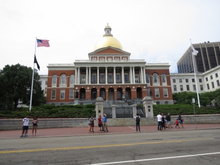
The Massachusetts State House was completed in 1798 and is one of the oldest buildings on the area. The dome was once made of wood and overlaid with copper by Paul Revere. In 1874, the dome was covered with 23-karat gold leaf. The land for the state house originally was John Hancock’s cow pasture.
|
 |
Park Street Church
Position: -71 3.72, 42 21.40
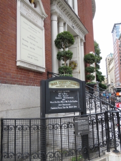
The Park Street Church was founded in 1809 and the 217-foot steeple once was the first landmark travelers saw when approaching Boston. The hymn “America” was first sung here on July 4, 1831 and William Lloyd Garrison gave his first antislavery speech here in 1829.
|
 |
Granary Burying Ground
Position: -71 3.72, 42 21.46
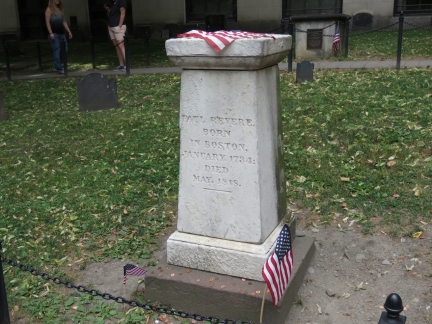
Some of the nation’s most notable citizens are buried at the Granary Burying Ground. This is Paul Revere’s grave.
|
 |
John Hancock
Position: -71 3.73, 42 21.45
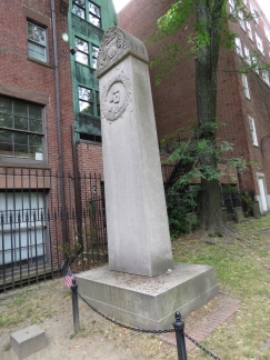
Obelisk marking John Hancock’s tomb at the Granary Burying Ground.
|
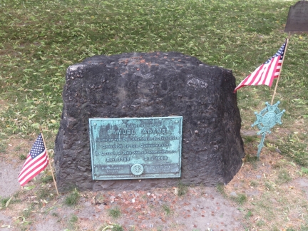 |
Samuel Adams
Position: -71 3.68, 42 21.44
Samuel Adams’ grave site at the Granary Burying Ground.
|
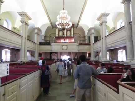 |
King’s Chapel
Position: -71 3.61, 42 21.47
King’s Chapel was founded in 1686 and houses the oldest American pulpit in continuous use. It’s bell was forged in England but cracked in 1814 and was recast and rehung by Paul Revere in 1816 and still rings today to summon people to worship.
|
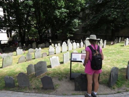 |
King’s Chapel Burying Ground
Position: -71 3.62, 42 21.51
King’s Chapel Burying Ground is the oldest in Boston proper. Massachusetts’s first governor, John Winthrop, is buried here, as is Mary Chilton, the first woman to step off the Mayflower.
|
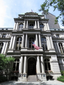 |
Old City Hall
Position: -71 3.58, 42 21.46
Boston’s Old City Hall was built in the French Empire Style and completed in 1865. It stands along the Freedom Trail route, but at only 150 years old is a little new to be an actual site on the trail.
|
 |
Benjamin Franklin
Position: -71 3.58, 42 21.46
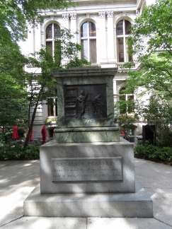
A statue of Benjamin Franklin (the statue is missing) sits at the site of America’s first public school where Benjamin Franklin once attended.
|
 |
Old Corner Bookstore
Position: -71 3.55, 42 21.44
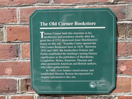
The Old Corner Bookstore was built as an apothecary shop and home in 1718 and became the center of American book publishing in the 1800s when Boston was the country’s literary mecca. Ticknor and Fields from here published the works of Henry David Thoreau, Louisa May Alcott, Ralph Waldo Emerson and Mark Twain, and the magazine Atlantic Monthly.
|
 |
Old South Meeting House
Position: -71 3.54, 42 21.41
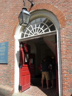
The Old South Meeting House was the largest building on colonial Boston and the meeting place where colonists gathered to challenge British rule, protesting the tea tax and the Boston Massacre. Samuel Adams launched the Boston Tea Party here in December of 1773 with the decree “No Tax on Tea!”
|
 |
Old State House
Position: -71 3.47, 42 21.49
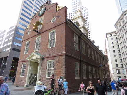
The Old State House was built in 1773 and was the seat of the colonial and state governments. In 1776, the Declaration of Independence was first read to the people of Boston from the Old State House balcony.
|
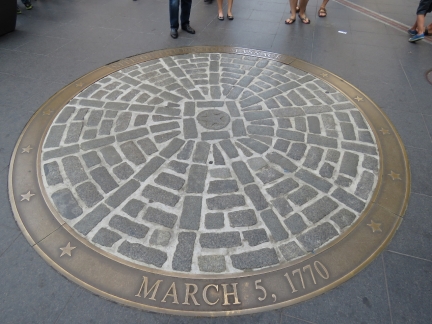 |
Boston Massacre
Position: -71 3.43, 42 21.55
In 1770, British forces opened fire on an angry mob of colonists who were upset over the British occupation. Five in the crowd were killed. Paul Revere’s widely distributed illustration of the event stirred up anti-British sentiment in the colonies.
|
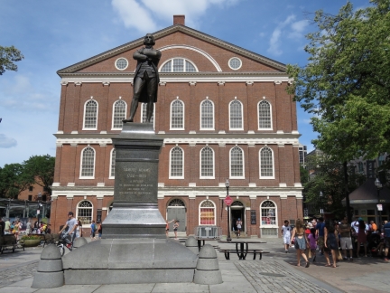 |
Faneuil Hall
Position: -71 3.39, 42 21.58
A statue of Samuel Adams outside Faneuil Hall, one of the nation’s first public meeting houses. In the Great Hall on the second floor Bostonians protested the taxation policies of the British Empire and set the doctrine of “no taxation without representation”.
|
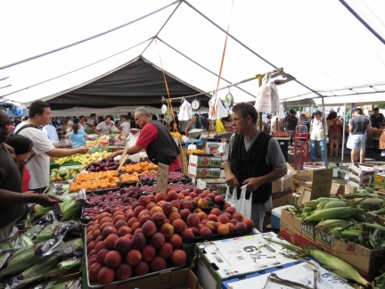 |
Haymarket
Position: -71 3.41, 42 21.71
Fresh-produce sellers have been bringing goods to the Haymarket outdoor market since the 1830s. It’s not an offical Freedom Trail site, but the brick walkway runs right through it.
|
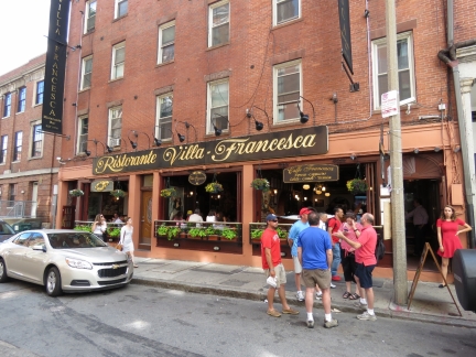 |
Villa Francesca
Position: -71 3.26, 42 21.80
The Freedom Trail led through North Boston, which is packed with excellent-looking restaurants such as Restorante Villa Francesca.
|
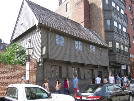 |
Paul Revere House
Position: -71 3.21, 42 21.82
Built in 1680, Paul Revere house is the oldest structure in downtown Boston. Paul Revere purchased the house in 1770 and lived here when he made his famous messenger ride on the night of April 18-19, 1775.
|
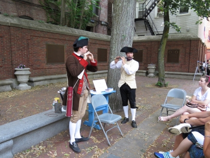 |
Fife
Position: -71 3.23, 42 21.95
Fife lessons outside Old North Church.
|
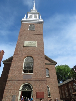 |
Old North Church
Position: -71 3.28, 42 21.99
On April 18, 1775 church sexton Robert Newman hung two lanterns in the steeple of Old North Church to warn Charlestown patriots that British soldiers were advancing by sea. Following Paul Revere’s plan, one lantern in the steeple meant the British were advancing and were coming by land, two meant they were coming by sea. This was a backup plan in case Paul Revere and another rider were not able to ride to warn the rebellion leaders, Sam Adams and John Hancock.
|
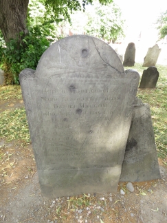 |
Copp’s Hill Burying Ground
Position: -71 3.38, 42 22.03
The British used Copp’s Hill Burying Ground as a vantage point to train their cannons on Charlestown during the battle of Bunker Hill. This gravestone of patriot Daniel Malcolm is riddled with bullet holes from vengeful British soldiers.
|
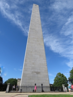 |
Bunker Hill Monument
Position: -71 3.66, 42 22.56
The 221-foot granite obelisk marks the site of the first major battle of the American Revolution at Bunker Hill.
|
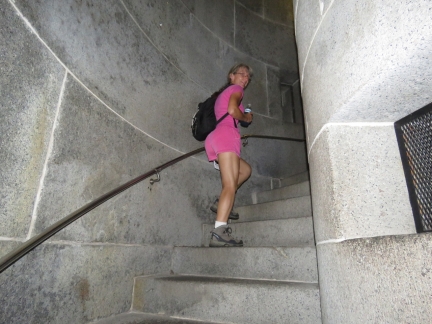 |
294 steps
Position: -71 3.65, 42 22.58
Climbing the 294 steps to the top of the Bunker Hill Monument.
|
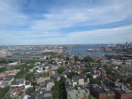 |
Boston Harbor
Position: -71 3.56, 42 22.56
The incredible view to Boston Harbor from the top of the 221-foot Bunker Hill Monument. The Charlestown Navy Yard is in the foreground and the Charlestown Marina where Dirona is moored is visible on the left.
|
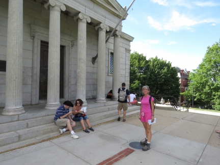 |
Trail’s End
Position: -71 3.63, 42 22.59
Standing at Bunker Hill at the end of the Freedom Trail.
|
 |
Warrens
Position: -71 3.78, 42 22.46
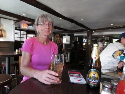
A refreshing cider at an appropriate venue after our Freedom Trail walk: historic Warrens tavern. Established in 1780, Warren Tavern is oldest tavern in Massachusetts. Notable patrons included national heroes Paul Revere, George Washington and Benjamin Franklin.
|

|
Click the travel log icon on the left to see these locations on a map, with the complete log of our cruise.
On the map page, clicking on a camera or text icon will display a picture and/or log entry for that location, and clicking on the smaller icons along the route will display latitude, longitude and other navigation data for that location. And a live map of our current route and most recent log entries always is available at http://mvdirona.com/maps. |

You are most definitely winners of the MOST THOROUGH BOSTON TOURISTS award. I congratulate you on taking advantage of your stay to really see what Boston has to offer. We’ve lived 70 miles south of Boston for 25 years and haven’t done all the interesting poking around Boston you have. I’ve enjoyed your observations very much.
We have really enjoyed our stay in Boston. It’s an amazing city but it’s starting to feel like it’s time to go back cruising. This weekend or next week, we plan to get underway for Labrador Canada.